SlideShare ist ein Scribd-Unternehmen logo
1 von 21
INDEX
1. The internal structure of the Earth.
1.1. The Geosphere.
1.2. Plate tectonics.
2. Relief formation.
2.1. Internal forces.
2.2. External agents.
3. Types of relief.
3.1. Continental relief.
3.2. Coastal relief.
3.3. Ocean relief.
4. The Earth´s continents.
1. THE INTERNAL STRUCTURE OF THE
EARTH
https://youtu.be/faXNNHcyXXk
1.1. THE GEOSPHERE
 According to their chemical composition, it
is divided into three layers:
 Crust: it is the outermost and thinnest
layer. It is made up of rock and it is
divided into oceanic and continental
crust.
 Mantle: it is the largest layer and
contains magma (mixture of molten and
semi-molten rock that is extremely hot).
When magma is ejected by a volcano, is
called lava. It is divided into upper and
lower mantle.
 Core: the innermost layer. It is believed it
is made up of heavy minerals, such as
iron and nickel in a solid or viscous state.
 According to the rigidity of the materials,
it is divided also into three layers:
 Lithosphere: composed of the crust and
upper mantle. Mainly solid and rigid.
 Mesosphere: lower mantle. Made up of
molten materials (magma).
 Endosphere: another name of the core.
Remember that Geosphere is the solid part of the Earth. It is made up of rocks
and other solid elements.
.
1.2. PLATE TECTONICS
 The lithosphere is fragmented into several blocks called tectonic
plates that float on the top of the molten materials in the
mantle.
 Consequently, Earth´s surface is in a state of constant motion
and evolution.
 There are plates under the ocean, called oceanic plates, and
plates under the continents, called continental plates.
 The movement of the tectonic plates is constant and pretty slow.
 There are two basic movements:
1. Collision : when two plates collide
2. Separation : when two plates separate
https://www.youtube.com/watch?v=7-MzoUR3R6E
Collision
When two plates collide, it can result in:
a) The formation of a very unstable area known as a
fault, which is a break in the crust where
earthquakes are common.
b) Mountain formation, when the edges of the plates
fold and rise. If the thinner edge is buried under the
thicker one, it causes part of the crust to disappear.
Separation
When two plates separate.
 This create a fissure where the magma from inside the
Earth comes up to the surface.
 When lava cools, it forms a new layer of crust, called
ridge or mountain range.
THEORY OF CONTINENTAL DRIFT
Wegener’s theory, the first step to theory of tectonic plates
 Alfred Wegener (1880 - 1930)
 Alfred Wegener proposed the theory of continental drift at
the beginning of the 20th century (1915). His idea was that
the Earth's continents were once joined together, but
gradually moved apart over millions of years. It offered an
explanation of the existence of similar fossils and rocks on
continents that are far apart from each other. But it took a
long time for the idea to become accepted by other
scientists.
 For more information:
http://kids.britannica.com/comptons/art-182286/Biological-and-geological-
similarities-between-continents-provide-evidence-of-continental
2. RELIEF FORMATION
The relief formation is the result of:
1. The internal forces of the Earth (orogenesis).
2. The action of external agents.
1. INTERNAL FORCES.
 Are the cause of the formation of elevated landforms (mountains).
 This process is called OROGENESIS. We can identify four process in
orogenesis:
 Volcanic mountain formation (orogenia volcánica).
 Fault-block mountain formation (orogenia por falla).
 Mountain formation by folding (orogenia por plegamiento).
 Mountain formation by folding and subduction (orogenia por
plegamiento y subducción).
Volcanic mountain formation
- Occurs when two tectonic plates
separate, creating a ridge.
- Magma erupts from the volcano.
- This lava cools and solidifies, forming
mountain ranges and volcanic cones.
Fault blocks
- Occur when forces act on blocks of
hard materials which cannot fold.
- These forces produce earthquakes,
which break up the blocks.
- This forms a relief made of raised and
lowered blocks.
Folding
- Occurs when two tectonic plates with edges
made of relatively soft materials collide.
- The edges of the plates fold and rise,
creating large mountains.
Folding and subduction
- Occur when a thinner oceanic plate and a
thicker continental plate collide, and the
oceanic plate sinks forming a trench.
- The edge of the continental plate folds and
rises, forming a mountain range.
 Elevated landforms are modified by the action of external agents:
water, wind and living beings.
 External agents shape the Earth’s relief through the interaction of three
geological processes:
 Erosion is the disintegration of landforms by the external agents
(fluvial erosion, coastal erosion, wind erosion…).
 Transportation is the movement of the eroded materials.
 Deposition is when the transported materials are deposited in areas of
low relief.
2. THE ACTION OF EXTERNAL AGENTS
3. TYPES OF RELIEF
There are three main types of relief: continental, coastal and ocean.
CONTINENTAL RELIEF
Plateaus (mesetas): these are flat or
gently undulating areas located at an average
altitude of about 650 m above sea level. On
its, erosion leaves the hardest rocks exposed.
Important: high plateaus (altiplanos) are
located between major mountain ranges at
altitudes above to 3.000 m.
Plains (llanuras): these are flat areas
located at altitudes below 150 m. The
materials they are made up of are the
result of transportation and deposition
processes.
CONTINENTAL RELIEF
Valleys: these are sunken areas
between mountains and plateaus.
They usually have a river running
through them. Important: when
river valleys are very large, they are
called depressions or basins.
Mountains: these are the highest
landforms. They have steep slopes and rugged
terrain. The average height of a mountain is
between 1.000 and 3.500 metres above sea
level. Depending on their height, structure
and size, mountains are classified as:
 Independent mountains
 Mountain range
COASTAL RELIEF
(Zonas costeras o litorales)
 It is located in areas where the emerging land is in contact with the sea.
 If the continental area is flat and has a low altitude : BEACHES.
 If the continental area is mountainous: high coast with slopes and cliffs .
 Coastal relief is made up of several landforms:
1. Peninsulas: area of land connected to the mainland and surrounded
by water on three sides, except of one called isthmus.
2. Capes: pieces of land which extend into the sea. If the cape is small, it
is called a point.
3. Gulfs: areas of the sea surrounded by land except on one side. If a golf
is small, it is called bay.
4. Inlets: areas where the sea floods into a deep and narrow valley. When
inlets are formed in glacial valleys, they are called fiords. For instance,
in Galician inlets are very typical: they are called rías.
5. Islands: are pieces of land surrounded by water on all sides. A group of
islands is an archipelago.
OCEAN RELIEF
 We can say there are five major types of landform:
1. Continental shelves: are large, flat areas which extend form
the coast and reach a depth of around 300 m.
2. Continental slopes: are steep slopes that connect continental
shelves with ocean basins.
3. Ocean basins: are large plains at a depth of between 3000 and
6000 metres that cover most of the bottom of the sea.
Sometimes, volcanic islands emerge form them. They are also
called abyssal plains.
4. Ocean ridges: are very high under water mountain ranges
located in the middle of the oceans. Their highest areas may
emerge from the water, creating islands or archipelagos.
5. Ocean trenches: are narrow crevices located along the edges
of ocean basins. They are some of the deepest areas of the
planet, in which the water pressure is enormous and sunlight
does not reach to the depths.
4. The Earth´s continents
From largest to smallest
1. Asia
2. America
3. Africa
4. Antarctica
5. Europe
6. Oceania
Look at these interesting links:
 http://www.pequetiempo.com/pequetiempos/encontrar-
por/aprender-sobre/%C2%BFcu%C3%A1ntos-continentes-hay-en-la-
tierra-1
 https://www.saberespractico.com/estudios/cultura-
general/%C2%BFcuantos-continentes-hay-y-cuales-son/

Weitere ähnliche Inhalte

Was ist angesagt?

Was ist angesagt? (20)

The Earth’s Relief
The Earth’s ReliefThe Earth’s Relief
The Earth’s Relief
 
Unit 1.
Unit 1.Unit 1.
Unit 1.
 
Geosphere
GeosphereGeosphere
Geosphere
 
Hydrosphere
HydrosphereHydrosphere
Hydrosphere
 
The Lithosphere/Geosphere
The Lithosphere/GeosphereThe Lithosphere/Geosphere
The Lithosphere/Geosphere
 
Unit 5
Unit 5Unit 5
Unit 5
 
Geosphere
GeosphereGeosphere
Geosphere
 
Physical oceanography
Physical oceanography Physical oceanography
Physical oceanography
 
Geosphere
GeosphereGeosphere
Geosphere
 
structure and composition of lithosphere
structure and composition of lithospherestructure and composition of lithosphere
structure and composition of lithosphere
 
Unit 2. Geosphere
Unit 2. GeosphereUnit 2. Geosphere
Unit 2. Geosphere
 
Lithosphere
LithosphereLithosphere
Lithosphere
 
Physical Oceanography
Physical Oceanography Physical Oceanography
Physical Oceanography
 
Unit 7, Earth internal energy and relief, 2ESO
Unit 7, Earth internal energy and relief, 2ESOUnit 7, Earth internal energy and relief, 2ESO
Unit 7, Earth internal energy and relief, 2ESO
 
Unit 1. Planet Earth
Unit 1. Planet EarthUnit 1. Planet Earth
Unit 1. Planet Earth
 
Lithosphere
LithosphereLithosphere
Lithosphere
 
Unit 2 relief
Unit 2 reliefUnit 2 relief
Unit 2 relief
 
Unit 1. Planet Earth
Unit 1. Planet EarthUnit 1. Planet Earth
Unit 1. Planet Earth
 
Unit 1. Planet Earth
Unit 1. Planet EarthUnit 1. Planet Earth
Unit 1. Planet Earth
 
Geological oceanography 301
Geological oceanography 301Geological oceanography 301
Geological oceanography 301
 

Andere mochten auch (10)

UNIT 4
UNIT 4UNIT 4
UNIT 4
 
Lapbook: Movements of the Earth
Lapbook: Movements of the Earth Lapbook: Movements of the Earth
Lapbook: Movements of the Earth
 
Unit 1. Planet Earth
Unit 1. Planet EarthUnit 1. Planet Earth
Unit 1. Planet Earth
 
Land relief and water distribution
Land relief and water distributionLand relief and water distribution
Land relief and water distribution
 
Unit 3. Medieval Europe
Unit 3. Medieval EuropeUnit 3. Medieval Europe
Unit 3. Medieval Europe
 
Tema 3
Tema 3 Tema 3
Tema 3
 
Feudalismo
FeudalismoFeudalismo
Feudalismo
 
UNIT 2. Feudalism
UNIT 2. FeudalismUNIT 2. Feudalism
UNIT 2. Feudalism
 
Unit 3. Medieval Europe
Unit 3. Medieval EuropeUnit 3. Medieval Europe
Unit 3. Medieval Europe
 
Unit 2. feudalism project
Unit 2. feudalism project   Unit 2. feudalism project
Unit 2. feudalism project
 

Ähnlich wie UNIT 2. Geosphere

plate-tectonics-ppppppppppower-point.ppt
plate-tectonics-ppppppppppower-point.pptplate-tectonics-ppppppppppower-point.ppt
plate-tectonics-ppppppppppower-point.ppt
LiezelVillaruz
 
Landforms thislandisourland-111022123136-phpapp01
Landforms thislandisourland-111022123136-phpapp01Landforms thislandisourland-111022123136-phpapp01
Landforms thislandisourland-111022123136-phpapp01
Erika Edgar
 

Ähnlich wie UNIT 2. Geosphere (20)

Unit 2. Geosphere
Unit 2. GeosphereUnit 2. Geosphere
Unit 2. Geosphere
 
UNIT 2. Geosphere
UNIT 2. GeosphereUNIT 2. Geosphere
UNIT 2. Geosphere
 
UNIT 2. Geosphere
UNIT 2. GeosphereUNIT 2. Geosphere
UNIT 2. Geosphere
 
Geosphere
GeosphereGeosphere
Geosphere
 
Geosphere
GeosphereGeosphere
Geosphere
 
plate-tectonics-ppppppppppower-point.ppt
plate-tectonics-ppppppppppower-point.pptplate-tectonics-ppppppppppower-point.ppt
plate-tectonics-ppppppppppower-point.ppt
 
Notes on living with tectonic hazards 0 levels
Notes on living with tectonic hazards 0 levelsNotes on living with tectonic hazards 0 levels
Notes on living with tectonic hazards 0 levels
 
UD3.- RELIEF AND LANDFORMS
UD3.- RELIEF AND LANDFORMSUD3.- RELIEF AND LANDFORMS
UD3.- RELIEF AND LANDFORMS
 
Notes on living with tectonic hazards n levels
Notes on living with tectonic hazards n levelsNotes on living with tectonic hazards n levels
Notes on living with tectonic hazards n levels
 
Landforms thislandisourland-111022123136-phpapp01
Landforms thislandisourland-111022123136-phpapp01Landforms thislandisourland-111022123136-phpapp01
Landforms thislandisourland-111022123136-phpapp01
 
CAMBRIDGE AS GEOGRAPHY REVISION: ROCKS AND WEATHERING - 3.1 PLATE TECTONICS
CAMBRIDGE AS GEOGRAPHY REVISION: ROCKS AND WEATHERING - 3.1 PLATE TECTONICSCAMBRIDGE AS GEOGRAPHY REVISION: ROCKS AND WEATHERING - 3.1 PLATE TECTONICS
CAMBRIDGE AS GEOGRAPHY REVISION: ROCKS AND WEATHERING - 3.1 PLATE TECTONICS
 
Plate margins
Plate marginsPlate margins
Plate margins
 
Major features of earth's surface
Major features of earth's surfaceMajor features of earth's surface
Major features of earth's surface
 
Restless Earth 2 PowerPoint Presentation
Restless Earth 2 PowerPoint PresentationRestless Earth 2 PowerPoint Presentation
Restless Earth 2 PowerPoint Presentation
 
AS GEOGRAPHY - ROCKS AND WEATHERING: ELEMENTARY PLATE TECTONICS
AS GEOGRAPHY - ROCKS AND WEATHERING: ELEMENTARY PLATE TECTONICS AS GEOGRAPHY - ROCKS AND WEATHERING: ELEMENTARY PLATE TECTONICS
AS GEOGRAPHY - ROCKS AND WEATHERING: ELEMENTARY PLATE TECTONICS
 
Unit2.theearth'srelief
Unit2.theearth'sreliefUnit2.theearth'srelief
Unit2.theearth'srelief
 
Tectonic Processes and Landscapes
Tectonic Processes and LandscapesTectonic Processes and Landscapes
Tectonic Processes and Landscapes
 
Plate tectonics
Plate tectonicsPlate tectonics
Plate tectonics
 
Volcanoes and plate tectonics
Volcanoes and plate tectonicsVolcanoes and plate tectonics
Volcanoes and plate tectonics
 
Landforms..this land is our land (Teach)
Landforms..this land is our land (Teach)Landforms..this land is our land (Teach)
Landforms..this land is our land (Teach)
 

Mehr von LUCÍA BLANCO FERNÁNDEZ (20)

Verbo (II)
Verbo (II)Verbo (II)
Verbo (II)
 
Planning de clases
Planning de clasesPlanning de clases
Planning de clases
 
El Paleolítico
El Paleolítico El Paleolítico
El Paleolítico
 
La Prehistoria
La PrehistoriaLa Prehistoria
La Prehistoria
 
Biomes project
Biomes projectBiomes project
Biomes project
 
Quinto tema 7. La narrativa
Quinto tema 7. La narrativa Quinto tema 7. La narrativa
Quinto tema 7. La narrativa
 
Tema 2. Dignidad
Tema 2. DignidadTema 2. Dignidad
Tema 2. Dignidad
 
Quinto tema 7. La narrativa (1)
Quinto tema 7. La narrativa (1)Quinto tema 7. La narrativa (1)
Quinto tema 7. La narrativa (1)
 
Unit 6
Unit 6 Unit 6
Unit 6
 
Unit 6
Unit 6Unit 6
Unit 6
 
Unit 5
Unit 5Unit 5
Unit 5
 
Project about cities
Project about citiesProject about cities
Project about cities
 
Recursos literarios
Recursos literariosRecursos literarios
Recursos literarios
 
Europe: rivers
Europe: riversEurope: rivers
Europe: rivers
 
Spain: rivers
Spain: riversSpain: rivers
Spain: rivers
 
Unit 4
Unit 4Unit 4
Unit 4
 
Unit 5.cities
Unit 5.citiesUnit 5.cities
Unit 5.cities
 
Relief Asia
Relief AsiaRelief Asia
Relief Asia
 
Relief oceania
Relief oceaniaRelief oceania
Relief oceania
 
Relief Africa
Relief AfricaRelief Africa
Relief Africa
 

Kürzlich hochgeladen

Kürzlich hochgeladen (20)

On_Translating_a_Tamil_Poem_by_A_K_Ramanujan.pptx
On_Translating_a_Tamil_Poem_by_A_K_Ramanujan.pptxOn_Translating_a_Tamil_Poem_by_A_K_Ramanujan.pptx
On_Translating_a_Tamil_Poem_by_A_K_Ramanujan.pptx
 
Jamworks pilot and AI at Jisc (20/03/2024)
Jamworks pilot and AI at Jisc (20/03/2024)Jamworks pilot and AI at Jisc (20/03/2024)
Jamworks pilot and AI at Jisc (20/03/2024)
 
General Principles of Intellectual Property: Concepts of Intellectual Proper...
General Principles of Intellectual Property: Concepts of Intellectual  Proper...General Principles of Intellectual Property: Concepts of Intellectual  Proper...
General Principles of Intellectual Property: Concepts of Intellectual Proper...
 
Google Gemini An AI Revolution in Education.pptx
Google Gemini An AI Revolution in Education.pptxGoogle Gemini An AI Revolution in Education.pptx
Google Gemini An AI Revolution in Education.pptx
 
Plant propagation: Sexual and Asexual propapagation.pptx
Plant propagation: Sexual and Asexual propapagation.pptxPlant propagation: Sexual and Asexual propapagation.pptx
Plant propagation: Sexual and Asexual propapagation.pptx
 
Single or Multiple melodic lines structure
Single or Multiple melodic lines structureSingle or Multiple melodic lines structure
Single or Multiple melodic lines structure
 
Exploring_the_Narrative_Style_of_Amitav_Ghoshs_Gun_Island.pptx
Exploring_the_Narrative_Style_of_Amitav_Ghoshs_Gun_Island.pptxExploring_the_Narrative_Style_of_Amitav_Ghoshs_Gun_Island.pptx
Exploring_the_Narrative_Style_of_Amitav_Ghoshs_Gun_Island.pptx
 
Holdier Curriculum Vitae (April 2024).pdf
Holdier Curriculum Vitae (April 2024).pdfHoldier Curriculum Vitae (April 2024).pdf
Holdier Curriculum Vitae (April 2024).pdf
 
Kodo Millet PPT made by Ghanshyam bairwa college of Agriculture kumher bhara...
Kodo Millet  PPT made by Ghanshyam bairwa college of Agriculture kumher bhara...Kodo Millet  PPT made by Ghanshyam bairwa college of Agriculture kumher bhara...
Kodo Millet PPT made by Ghanshyam bairwa college of Agriculture kumher bhara...
 
Micro-Scholarship, What it is, How can it help me.pdf
Micro-Scholarship, What it is, How can it help me.pdfMicro-Scholarship, What it is, How can it help me.pdf
Micro-Scholarship, What it is, How can it help me.pdf
 
Sensory_Experience_and_Emotional_Resonance_in_Gabriel_Okaras_The_Piano_and_Th...
Sensory_Experience_and_Emotional_Resonance_in_Gabriel_Okaras_The_Piano_and_Th...Sensory_Experience_and_Emotional_Resonance_in_Gabriel_Okaras_The_Piano_and_Th...
Sensory_Experience_and_Emotional_Resonance_in_Gabriel_Okaras_The_Piano_and_Th...
 
FSB Advising Checklist - Orientation 2024
FSB Advising Checklist - Orientation 2024FSB Advising Checklist - Orientation 2024
FSB Advising Checklist - Orientation 2024
 
How to Manage Global Discount in Odoo 17 POS
How to Manage Global Discount in Odoo 17 POSHow to Manage Global Discount in Odoo 17 POS
How to Manage Global Discount in Odoo 17 POS
 
How to setup Pycharm environment for Odoo 17.pptx
How to setup Pycharm environment for Odoo 17.pptxHow to setup Pycharm environment for Odoo 17.pptx
How to setup Pycharm environment for Odoo 17.pptx
 
Wellbeing inclusion and digital dystopias.pptx
Wellbeing inclusion and digital dystopias.pptxWellbeing inclusion and digital dystopias.pptx
Wellbeing inclusion and digital dystopias.pptx
 
Key note speaker Neum_Admir Softic_ENG.pdf
Key note speaker Neum_Admir Softic_ENG.pdfKey note speaker Neum_Admir Softic_ENG.pdf
Key note speaker Neum_Admir Softic_ENG.pdf
 
Basic Civil Engineering first year Notes- Chapter 4 Building.pptx
Basic Civil Engineering first year Notes- Chapter 4 Building.pptxBasic Civil Engineering first year Notes- Chapter 4 Building.pptx
Basic Civil Engineering first year Notes- Chapter 4 Building.pptx
 
UGC NET Paper 1 Mathematical Reasoning & Aptitude.pdf
UGC NET Paper 1 Mathematical Reasoning & Aptitude.pdfUGC NET Paper 1 Mathematical Reasoning & Aptitude.pdf
UGC NET Paper 1 Mathematical Reasoning & Aptitude.pdf
 
2024-NATIONAL-LEARNING-CAMP-AND-OTHER.pptx
2024-NATIONAL-LEARNING-CAMP-AND-OTHER.pptx2024-NATIONAL-LEARNING-CAMP-AND-OTHER.pptx
2024-NATIONAL-LEARNING-CAMP-AND-OTHER.pptx
 
How to Add New Custom Addons Path in Odoo 17
How to Add New Custom Addons Path in Odoo 17How to Add New Custom Addons Path in Odoo 17
How to Add New Custom Addons Path in Odoo 17
 

UNIT 2. Geosphere

  • 1.
  • 2. INDEX 1. The internal structure of the Earth. 1.1. The Geosphere. 1.2. Plate tectonics. 2. Relief formation. 2.1. Internal forces. 2.2. External agents. 3. Types of relief. 3.1. Continental relief. 3.2. Coastal relief. 3.3. Ocean relief. 4. The Earth´s continents.
  • 3. 1. THE INTERNAL STRUCTURE OF THE EARTH https://youtu.be/faXNNHcyXXk
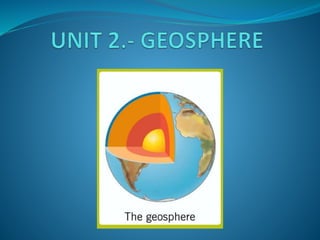
  • 4. 1.1. THE GEOSPHERE  According to their chemical composition, it is divided into three layers:  Crust: it is the outermost and thinnest layer. It is made up of rock and it is divided into oceanic and continental crust.  Mantle: it is the largest layer and contains magma (mixture of molten and semi-molten rock that is extremely hot). When magma is ejected by a volcano, is called lava. It is divided into upper and lower mantle.  Core: the innermost layer. It is believed it is made up of heavy minerals, such as iron and nickel in a solid or viscous state.  According to the rigidity of the materials, it is divided also into three layers:  Lithosphere: composed of the crust and upper mantle. Mainly solid and rigid.  Mesosphere: lower mantle. Made up of molten materials (magma).  Endosphere: another name of the core. Remember that Geosphere is the solid part of the Earth. It is made up of rocks and other solid elements.
  • 5. .
  • 6. 1.2. PLATE TECTONICS  The lithosphere is fragmented into several blocks called tectonic plates that float on the top of the molten materials in the mantle.  Consequently, Earth´s surface is in a state of constant motion and evolution.  There are plates under the ocean, called oceanic plates, and plates under the continents, called continental plates.  The movement of the tectonic plates is constant and pretty slow.  There are two basic movements: 1. Collision : when two plates collide 2. Separation : when two plates separate https://www.youtube.com/watch?v=7-MzoUR3R6E
  • 7. Collision When two plates collide, it can result in: a) The formation of a very unstable area known as a fault, which is a break in the crust where earthquakes are common. b) Mountain formation, when the edges of the plates fold and rise. If the thinner edge is buried under the thicker one, it causes part of the crust to disappear.
  • 8. Separation When two plates separate.  This create a fissure where the magma from inside the Earth comes up to the surface.  When lava cools, it forms a new layer of crust, called ridge or mountain range.
  • 9. THEORY OF CONTINENTAL DRIFT Wegener’s theory, the first step to theory of tectonic plates  Alfred Wegener (1880 - 1930)  Alfred Wegener proposed the theory of continental drift at the beginning of the 20th century (1915). His idea was that the Earth's continents were once joined together, but gradually moved apart over millions of years. It offered an explanation of the existence of similar fossils and rocks on continents that are far apart from each other. But it took a long time for the idea to become accepted by other scientists.  For more information: http://kids.britannica.com/comptons/art-182286/Biological-and-geological- similarities-between-continents-provide-evidence-of-continental
  • 10. 2. RELIEF FORMATION The relief formation is the result of: 1. The internal forces of the Earth (orogenesis). 2. The action of external agents. 1. INTERNAL FORCES.  Are the cause of the formation of elevated landforms (mountains).  This process is called OROGENESIS. We can identify four process in orogenesis:  Volcanic mountain formation (orogenia volcánica).  Fault-block mountain formation (orogenia por falla).  Mountain formation by folding (orogenia por plegamiento).  Mountain formation by folding and subduction (orogenia por plegamiento y subducción).
  • 11. Volcanic mountain formation - Occurs when two tectonic plates separate, creating a ridge. - Magma erupts from the volcano. - This lava cools and solidifies, forming mountain ranges and volcanic cones. Fault blocks - Occur when forces act on blocks of hard materials which cannot fold. - These forces produce earthquakes, which break up the blocks. - This forms a relief made of raised and lowered blocks.
  • 12. Folding - Occurs when two tectonic plates with edges made of relatively soft materials collide. - The edges of the plates fold and rise, creating large mountains. Folding and subduction - Occur when a thinner oceanic plate and a thicker continental plate collide, and the oceanic plate sinks forming a trench. - The edge of the continental plate folds and rises, forming a mountain range.
  • 13.  Elevated landforms are modified by the action of external agents: water, wind and living beings.  External agents shape the Earth’s relief through the interaction of three geological processes:  Erosion is the disintegration of landforms by the external agents (fluvial erosion, coastal erosion, wind erosion…).  Transportation is the movement of the eroded materials.  Deposition is when the transported materials are deposited in areas of low relief. 2. THE ACTION OF EXTERNAL AGENTS
  • 14. 3. TYPES OF RELIEF There are three main types of relief: continental, coastal and ocean. CONTINENTAL RELIEF Plateaus (mesetas): these are flat or gently undulating areas located at an average altitude of about 650 m above sea level. On its, erosion leaves the hardest rocks exposed. Important: high plateaus (altiplanos) are located between major mountain ranges at altitudes above to 3.000 m. Plains (llanuras): these are flat areas located at altitudes below 150 m. The materials they are made up of are the result of transportation and deposition processes.
  • 15. CONTINENTAL RELIEF Valleys: these are sunken areas between mountains and plateaus. They usually have a river running through them. Important: when river valleys are very large, they are called depressions or basins. Mountains: these are the highest landforms. They have steep slopes and rugged terrain. The average height of a mountain is between 1.000 and 3.500 metres above sea level. Depending on their height, structure and size, mountains are classified as:  Independent mountains  Mountain range
  • 16. COASTAL RELIEF (Zonas costeras o litorales)  It is located in areas where the emerging land is in contact with the sea.  If the continental area is flat and has a low altitude : BEACHES.  If the continental area is mountainous: high coast with slopes and cliffs .  Coastal relief is made up of several landforms: 1. Peninsulas: area of land connected to the mainland and surrounded by water on three sides, except of one called isthmus. 2. Capes: pieces of land which extend into the sea. If the cape is small, it is called a point. 3. Gulfs: areas of the sea surrounded by land except on one side. If a golf is small, it is called bay. 4. Inlets: areas where the sea floods into a deep and narrow valley. When inlets are formed in glacial valleys, they are called fiords. For instance, in Galician inlets are very typical: they are called rías. 5. Islands: are pieces of land surrounded by water on all sides. A group of islands is an archipelago.
  • 17.
  • 18. OCEAN RELIEF  We can say there are five major types of landform: 1. Continental shelves: are large, flat areas which extend form the coast and reach a depth of around 300 m. 2. Continental slopes: are steep slopes that connect continental shelves with ocean basins. 3. Ocean basins: are large plains at a depth of between 3000 and 6000 metres that cover most of the bottom of the sea. Sometimes, volcanic islands emerge form them. They are also called abyssal plains. 4. Ocean ridges: are very high under water mountain ranges located in the middle of the oceans. Their highest areas may emerge from the water, creating islands or archipelagos. 5. Ocean trenches: are narrow crevices located along the edges of ocean basins. They are some of the deepest areas of the planet, in which the water pressure is enormous and sunlight does not reach to the depths.
  • 19.
  • 20. 4. The Earth´s continents
  • 21. From largest to smallest 1. Asia 2. America 3. Africa 4. Antarctica 5. Europe 6. Oceania Look at these interesting links:  http://www.pequetiempo.com/pequetiempos/encontrar- por/aprender-sobre/%C2%BFcu%C3%A1ntos-continentes-hay-en-la- tierra-1  https://www.saberespractico.com/estudios/cultura- general/%C2%BFcuantos-continentes-hay-y-cuales-son/