SlideShare ist ein Scribd-Unternehmen logo
1 von 21
Downloaden Sie, um offline zu lesen
© KSRSAC – KGIS SOTM – Asia 2017
Discussion	on	Policies	/	Technologies	
&	use	of	Open	Data	
23-Sep-2017
M.JAYACHANDRAN
KGIS - Mission Management
Karnataka State Remote Sensing Applications Center, GoK
B
Y
Preview	of	Karnataka-GIS
© KSRSAC – KGIS SOTM – Asia 2017
Agenda	for	Panel	Discussion
● Mapping	policies	in	the	country
● Experience	using	GIS	technology	and	collecting	
data	
● How	can	OpenStreetMap	be	useful
© KSRSAC – KGIS SOTM – Asia 2017
Various	Policies	– related	to	Geospatial
• National	Map	Policy	(NMP)	in	2005		(Open	Series	and	defense	use)
• SoI	mandated	for	bringing	openness	to	data	– Datum	/	Projection
• The	Remote	Sensing	Data	Policy	2011
• NRSC	– authorised	single	point	of	sale	of	all	RS	data
• Data	Sharing	and	accessibility	Policy	(GSI)
• Specific	to	GSI’s	map	sharing	policy
• The	National	Data	Sharing	and	Accessibility	Policy,	2012	
• State	Govt	Policies	/	Act	
• Delhi,	Karntaka,…
● Digital	India
© KSRSAC – KGIS SOTM – Asia 2017
Use	of	Geospatial	Tech	in	Disaster		
● Technologies	&	Platform	- Solution
◦ GIS	/	GPS	/	LIDAR	/	Cameras	&	Sensors	(remote	/	monitoring)
◦ Satellite	/	Aerial	/	Drone	/	Mobile	Platforms
◦ Solution	- Processes	– Models	– Warning	Systems
● Disaster
◦ Flood	– Cyclone	– Landslides	– Earthquake	– Drought	– Act	of	Terror	
/	Violence	– FATAL	Events	- Tsunami
● Pre	disaster	Map	
● Rescue	and	Planning	operation	with	existing	maps
● Post	Disaster	Assessment
◦ Map	/	visualisation	using	Remote	Sensing	data
◦ Change	Detection	/	Analysis
◦ Mitigation	Plan	
Reason	– Research	– Prevent	/	Prepare
© KSRSAC – KGIS SOTM – Asia 2017
Suggestion	for	Governance
● Unified	Framework	– CORS	GPS	stations
◦ Seamless	HR	Satellite	mosaic	- Avoids	accuracy	issues
● Identify	Ownership	
◦ Avoid	duplication	and	redundancy
● Mandate	data	updation
● One	portal	for	all
● De-centralised	data	/	Distributed	Storage
● Single	Gateway
◦ For	all	Data	sources
◦ Tools	for	Mapping	/	Updation
◦ Customised	/	theme	Specific	Applications
◦ Generic	Queries	and	Tools
◦ Open	Platform	for	development	/	hosting
Karnataka	GIS
© KSRSAC – KGIS SOTM – Asia 2017
Current	Gaps	and	KGIS	Needs
● Lack	of	integrated	data	between	various	departments
● Lack	of	spatial	data	availability	in	various	dept
● Few	Dept	only	have	their	own	GIS	teams
● Lack	of	expertise	of	GIS	specialists	and	analysts
● DSS	based	on	spatial	data	and	trends	is	the	requirement		
● Existing	Spatial	Data	- not	in	common	coordinate	reference	frame	
● Lack	of	GIS	Applications	and	DSS	for	operational	needs
● Non	clarity	in	data	sharing	policy	between	dept	and	public
© KSRSAC – KGIS SOTM – Asia 2017
A flagship Project of GoK, to Institutionalize the use of Geospatial in the
Governance
Karnataka	GIS	(K-GIS)
Objectives
● To	establish	the	state	needs	for	robust	information	and	GIS	based	
decision	support	systems	and	also	focus	to	ensure	continued	
availability	of	GIS	ready	data	assets	and	applications.	
● To	bring	all	the	GIS	data	available	in	various	departments	under	one	
single	seamless	spatial	framework.
● To	help	the	departmental	users	with	GIS	data	and	advanced	tools	for	
GIS	analysis	through	simpler	web	and	mobile	interfaces	system	with	an	
executive	dashboard	and	other	business	workflows
KGIS	:	Integrated	-Departmental	Data
K-GIS
Tourism
Industries
Environment
Fisheries
Sericulture Land
Records
Forest &
Ecology
Planning
Rural
Development
e-governance
Water Supply
Horticulture
Health
AgricultureEducation
Urban
Power
© KSRSAC – KGIS SOTM – Asia 2017
K-GIS
Portal DSS
& Apps
E-Bhoomi,
Watershed
Dev
UID /
Aadhar
seeding
E- Health
Census &
EC,
E- Register
E-Aasthi
Law&
Order
(CCTNS)
Power
(RAPDRP)
KGIS :Integrated Applications
Expected outcome
Hardware / Software & NW Infrastructure Training and Capacity Building
KGIS	Elements
Asset
Portal &
DSS
Apps
Capacity
Building
Infra-
structure
• Common Spatial Framework
for registration, transformation
and visualization of spatial data
• Standardized New and Updated
GIS data to meet the application
needs
• Single gateway access to K-
GIS Asset and Dept. DSS
Applications.
• Suite of GIS applications for
decision and work processes
of different departments,
citizens
• Computing, Storage and
networking infrastructure for
hosting / serving the K-GIS data
and Applications.
• a sustained effort for training
and orientation in GIS &
applications for GoK
Departments
KGIS Standards and Design
Governed by Karnataka - Geospatial Policies
© KSRSAC – KGIS SOTM – Asia 2017
● Common	Coordinate	system
● Primary	and	Secondary	control	network
● Seamless	HR	Image	mosaic
● Digital	Terrain	(Elevation)	Model
● Layers	
◦ Base	layers	on	the	seamless	image	frame
◦ Other	layers	overlaid	on	each	other
◦ Continous	updated	base/thematic	layers
• KGIS	content	standards	circulated	through	GO
• Standards	/	protocol	for	data	exchange	
• DSS	Application	–SOA		- OGC	Standards	
• Single	Sign	On	- Role	based	access	for	
departmental	operation
• Karnataka	Geospatial	Policy
• Data	Sharing	Policy
Common	Framework	and	Standards,	Policies
1. Boundary
2. Infrastructures
3. Hydrology
4. Urban and Settlement
5. Industrial Content
6. Forest Environment & Ecology
7. Geological
8. Land Information
9. Land Ownership Information
10. Soil Information
11. Public Assets/ Amenities
12. Point of Interest
13. Grids and Graticules
14. Images
15. Topography
16. Weather Information
KGIS Spatial Datasets
244 Layers, expected to grow more
36 Ministries/Dept.
1	Million	Assets	– 30	TB	Database	- and Growing …
© KSRSAC – KGIS SOTM – Asia 2017
KGIS	:	Modular	Solution
SOA	architecture	for	Easy	Integration	and	GIS	Enabling
© KSRSAC – KGIS SOTM – Asia 2017
Portal		:	Sample	Functionalities
Flexible AoI Selection Multi Attribute Query Complex Buffer Analysis
Various Thematic mapview Online Heatmap Generation Overlay of desktop GIS data
© KSRSAC – KGIS SOTM – Asia 2017
Portal		:	Sample	Functionalities
Pre-defined query / Analysis
Satellite Data – availability
Spatial Editing of objects
Customised Dashboards for depts
Multilayer - Transparency
© KSRSAC – KGIS SOTM – Asia 2017
Portal	:	Other	components
Online Feedback / Requirement gathering
Apps: For locating various nearby
Services
Mobile Apps for field data Collection
Download - Apps & Docs
© KSRSAC – KGIS SOTM – Asia 2017
Operational	DSS	– Workflows	&	Dashboards
RDPR
Industry : KIADB
Urban: MUDA
Soil Health
Mission
© KSRSAC – KGIS SOTM – Asia 2017
Expected	Benefits
● Make GIS data available at all levels
● Geo-enabling e-governance and public services by
embedding GIS in all aspects of planning and development
at state/district/panchayat levels;
● Bringing transparency and geo-spatial information support
in decision-making;
● Citizen services by giving access to geospatial information;
● Enabling a “crowd-sourced” interactive process of citizen
involvement in providing feed-back/inputs/data
● Enable a sound process of monitoring and identifying “gaps
in development”;
● To make the state to be in the forefront of this field of
technology and applications that that are fast growing
globally.
● Also to make Karnataka GIS to be major contributor towards
establishment of National GIS
Government
Industries
Institutions
Researchers
Farmers
B
E
N
E
F
I
C
I
A
R
I
E
S
Entrepreneurs
Citizens &Public
Law
Enforcement
Legal / Judiciary
Disaster Mgmt
Summary	-Vision	2020
● KGIS	2020	:	Integrated	GIS	for	all	departments
● Planning	and	Decision	making	– efficient	and	transparent
● Improved	Service	Delivery
Karnataka
Geo
Spatial
Agency
Spatial Data
Managemen
t Mission
Virtual
Reference
Stations
Outreach,
Training
and
Consulting
Data Sales,
User
Projects
Technology
and
Research
KGIS
(Flagship
Mission)
Analytic
s
Process
Database
Web Apps
• New Requirements & feedback
improves
• CHANGES and Refinements
shall continue to happen.
© KSRSAC – KGIS http://kgis.Ksrsac.in/kgis kgissupport@ksrsac.in
© KSRSAC – KGIS SOTM – Asia 2017
Discussion	– Views	and	Thoughts
Policy Consideration
• Many data generation
agencies
• Different types of datas –
thematic, small / Large
Scale
• Ownership –of data
Duplication and authenticity
• Accuracy - CORS Network
• HR resolution data for whom
and why
• Public money – public data –
share it – Open data is not
necessary to be a free data
• Security concerns / Privacy
• Expose the availability of
data - metadata
• Correctness and validation
• Standards & interoperability
• Data Sharing Policy
• Data Updation Policy
Requirements for OSM to be
used
• OSM as institution should get
engaged with Govt – not as
freelance individuals.
• Create data in government
portals
• OSM data to be available and
updated in the government
portals
• The published data from
government portals can be
used in OSM portals
• Validate the data through
authoritative agencies
• Involve Departments to be part
of Mapping activity.
Way Forward
Should work towards developing open Map Solutions
Develop business models – free data – paid service for unique solution -
Collaboration with Agencies having copyright information
Let’s Discuss…..THANK YOU
How OSM can be useful
• As a Planning and Decision
support tool for governance
• Apart from mapping the
features and assets, themes
should be generated
• Citizen specific requirements
• Let OSM Community
develop solution and provide
services
• Crowd sourcing data within
govt depts is already being
valued.
• Govt can provide incentives
OSM volunteers / institution

Weitere ähnliche Inhalte

Was ist angesagt?

Building Spatial Data Infrastructures for Spatial Planning in Africa: Lagos e...
Building Spatial Data Infrastructures for Spatial Planning in Africa: Lagos e...Building Spatial Data Infrastructures for Spatial Planning in Africa: Lagos e...
Building Spatial Data Infrastructures for Spatial Planning in Africa: Lagos e...
Samuel Dekolo
 

Was ist angesagt? (20)

Gis Day Presentation 2010 - ACCC - Expanded Version
Gis Day Presentation 2010 - ACCC - Expanded VersionGis Day Presentation 2010 - ACCC - Expanded Version
Gis Day Presentation 2010 - ACCC - Expanded Version
 
Building Spatial Data Infrastructures for Spatial Planning in Africa: Lagos e...
Building Spatial Data Infrastructures for Spatial Planning in Africa: Lagos e...Building Spatial Data Infrastructures for Spatial Planning in Africa: Lagos e...
Building Spatial Data Infrastructures for Spatial Planning in Africa: Lagos e...
 
Leveraging ArcGIS Platform & CityEngine for GIS based Master Plans
Leveraging ArcGIS Platform & CityEngine for GIS based Master PlansLeveraging ArcGIS Platform & CityEngine for GIS based Master Plans
Leveraging ArcGIS Platform & CityEngine for GIS based Master Plans
 
Remote sensing GIS and public policy
Remote sensing GIS and public policyRemote sensing GIS and public policy
Remote sensing GIS and public policy
 
Land information system for efficient lands administration and revenue genera...
Land information system for efficient lands administration and revenue genera...Land information system for efficient lands administration and revenue genera...
Land information system for efficient lands administration and revenue genera...
 
Газрын мэдээллийн системийн төв
Газрын мэдээллийн системийн төвГазрын мэдээллийн системийн төв
Газрын мэдээллийн системийн төв
 
Scope of gis in pakistan
Scope of gis in pakistan Scope of gis in pakistan
Scope of gis in pakistan
 
GIS in property management
GIS in property management GIS in property management
GIS in property management
 
Land information system in Nepal
Land information system in NepalLand information system in Nepal
Land information system in Nepal
 
ENHANCEMENT OF PROPERTY TAX_shail
ENHANCEMENT OF PROPERTY TAX_shailENHANCEMENT OF PROPERTY TAX_shail
ENHANCEMENT OF PROPERTY TAX_shail
 
Commercial Sector Applications of GIS
Commercial Sector Applications of GISCommercial Sector Applications of GIS
Commercial Sector Applications of GIS
 
Spatial Data Infrastructure in Europe
Spatial Data Infrastructure in EuropeSpatial Data Infrastructure in Europe
Spatial Data Infrastructure in Europe
 
Esri user conference highlights v0.2 15072020_hah
Esri user conference highlights v0.2 15072020_hahEsri user conference highlights v0.2 15072020_hah
Esri user conference highlights v0.2 15072020_hah
 
MMA: Maine Integrated Land Records System
MMA: Maine Integrated Land Records System MMA: Maine Integrated Land Records System
MMA: Maine Integrated Land Records System
 
National Geospatial Resource Center (NGRC) A Capabilities Brief
National Geospatial Resource Center (NGRC) A Capabilities BriefNational Geospatial Resource Center (NGRC) A Capabilities Brief
National Geospatial Resource Center (NGRC) A Capabilities Brief
 
Land Information System
Land Information SystemLand Information System
Land Information System
 
Making MAGIC with Your Data: Interactive Maps, Mash-ups, and Data Visualizati...
Making MAGIC with Your Data: Interactive Maps, Mash-ups, and Data Visualizati...Making MAGIC with Your Data: Interactive Maps, Mash-ups, and Data Visualizati...
Making MAGIC with Your Data: Interactive Maps, Mash-ups, and Data Visualizati...
 
GIS BY NIKHIL PAKWANNE
GIS BY NIKHIL PAKWANNEGIS BY NIKHIL PAKWANNE
GIS BY NIKHIL PAKWANNE
 
FICCI Recommendations: Geospatial Information Regulation Bill
FICCI Recommendations: Geospatial Information Regulation BillFICCI Recommendations: Geospatial Information Regulation Bill
FICCI Recommendations: Geospatial Information Regulation Bill
 
Geographical information system : GIS and Social Media
Geographical information system : GIS and Social Media Geographical information system : GIS and Social Media
Geographical information system : GIS and Social Media
 

Ähnlich wie Jayachandran Mani, Technical Officer, Head, Mission management at Karnataka State Remote Sensing Agency, India | SotM Asia 2017

L N Dewangan_Resume
L  N  Dewangan_ResumeL  N  Dewangan_Resume
L N Dewangan_Resume
L N Dewangan
 
TechM GIS Competency
TechM GIS CompetencyTechM GIS Competency
TechM GIS Competency
TechM-GIS
 
Julian Watts - AGI Asset Management SIG (Sep 2013)
Julian Watts - AGI Asset Management SIG (Sep 2013)Julian Watts - AGI Asset Management SIG (Sep 2013)
Julian Watts - AGI Asset Management SIG (Sep 2013)
GeoEnable Limited
 

Ähnlich wie Jayachandran Mani, Technical Officer, Head, Mission management at Karnataka State Remote Sensing Agency, India | SotM Asia 2017 (20)

CK2017: Karnataka GIS - A GoK Initiative towards g-Governance
CK2017: Karnataka GIS - A GoK Initiative towards g-Governance CK2017: Karnataka GIS - A GoK Initiative towards g-Governance
CK2017: Karnataka GIS - A GoK Initiative towards g-Governance
 
Karnataka Geospatial Experience FME World Tour 2017 India
Karnataka Geospatial Experience FME World Tour 2017 IndiaKarnataka Geospatial Experience FME World Tour 2017 India
Karnataka Geospatial Experience FME World Tour 2017 India
 
A step towards e governance - Mr. Vivek Chitale
A step towards e governance - Mr. Vivek ChitaleA step towards e governance - Mr. Vivek Chitale
A step towards e governance - Mr. Vivek Chitale
 
URISA and the GIS Management Institute
URISA and  the GIS Management InstituteURISA and  the GIS Management Institute
URISA and the GIS Management Institute
 
Gis for Sustainable Development Goals (SDG)
Gis for Sustainable Development Goals (SDG)Gis for Sustainable Development Goals (SDG)
Gis for Sustainable Development Goals (SDG)
 
GEOGRAPHICAL INFORMATION SYSTEM (GIS)
GEOGRAPHICAL INFORMATION SYSTEM (GIS)GEOGRAPHICAL INFORMATION SYSTEM (GIS)
GEOGRAPHICAL INFORMATION SYSTEM (GIS)
 
Concept, approach, history, trend
Concept, approach, history, trendConcept, approach, history, trend
Concept, approach, history, trend
 
Singapore 3D Map for a Smart Nation
Singapore 3D Map for a Smart NationSingapore 3D Map for a Smart Nation
Singapore 3D Map for a Smart Nation
 
L N Dewangan_Resume
L  N  Dewangan_ResumeL  N  Dewangan_Resume
L N Dewangan_Resume
 
Application of GIS in Transportation Planning
Application of GIS in Transportation Planning Application of GIS in Transportation Planning
Application of GIS in Transportation Planning
 
roadmap GISv2
roadmap GISv2roadmap GISv2
roadmap GISv2
 
TechM GIS Competency
TechM GIS CompetencyTechM GIS Competency
TechM GIS Competency
 
Tariq
TariqTariq
Tariq
 
URISA, the Geospatial Revolution, and the GIS Management Institute
URISA, the Geospatial Revolution, and the GIS Management InstituteURISA, the Geospatial Revolution, and the GIS Management Institute
URISA, the Geospatial Revolution, and the GIS Management Institute
 
Julian Watts - AGI Asset Management SIG (Sep 2013)
Julian Watts - AGI Asset Management SIG (Sep 2013)Julian Watts - AGI Asset Management SIG (Sep 2013)
Julian Watts - AGI Asset Management SIG (Sep 2013)
 
Hardik_Final_CV
Hardik_Final_CVHardik_Final_CV
Hardik_Final_CV
 
Kristin Walker's resume
Kristin Walker's resumeKristin Walker's resume
Kristin Walker's resume
 
Adopting-smart_technology_for_enhancing_road_asset_performance_and_benchmarking
Adopting-smart_technology_for_enhancing_road_asset_performance_and_benchmarkingAdopting-smart_technology_for_enhancing_road_asset_performance_and_benchmarking
Adopting-smart_technology_for_enhancing_road_asset_performance_and_benchmarking
 
Geospatial Agenda in Indian Affairs
Geospatial Agenda in Indian AffairsGeospatial Agenda in Indian Affairs
Geospatial Agenda in Indian Affairs
 
Next generation data delivery for NSW geoscientific data
Next generation data delivery for NSW geoscientific data Next generation data delivery for NSW geoscientific data
Next generation data delivery for NSW geoscientific data
 

Mehr von Kathmandu Living Labs

Mehr von Kathmandu Living Labs (20)

Pradip Khatiwada, Kathmandu Living Labs | Mapping as Activism | SotM Asia 2017
Pradip Khatiwada, Kathmandu Living Labs | Mapping as Activism | SotM Asia 2017Pradip Khatiwada, Kathmandu Living Labs | Mapping as Activism | SotM Asia 2017
Pradip Khatiwada, Kathmandu Living Labs | Mapping as Activism | SotM Asia 2017
 
Maliha Binte Mohiuddin, University of Dhaka | YouthMappers Session | SotM Asi...
Maliha Binte Mohiuddin, University of Dhaka | YouthMappers Session | SotM Asi...Maliha Binte Mohiuddin, University of Dhaka | YouthMappers Session | SotM Asi...
Maliha Binte Mohiuddin, University of Dhaka | YouthMappers Session | SotM Asi...
 
Nikesh Balami, Open Knowledge Nepal | Nepal Session | SotM Asia 2017
Nikesh Balami, Open Knowledge Nepal | Nepal Session | SotM Asia 2017Nikesh Balami, Open Knowledge Nepal | Nepal Session | SotM Asia 2017
Nikesh Balami, Open Knowledge Nepal | Nepal Session | SotM Asia 2017
 
Shashish Maharjan, OSM Lalitpur | Nepal Session | SotM Asia 2017
Shashish Maharjan, OSM Lalitpur | Nepal Session | SotM Asia 2017Shashish Maharjan, OSM Lalitpur | Nepal Session | SotM Asia 2017
Shashish Maharjan, OSM Lalitpur | Nepal Session | SotM Asia 2017
 
Sumit Dugar, Practical Action Consulting | Nepal Session | SotM Asia 2017
Sumit Dugar, Practical Action Consulting | Nepal Session | SotM Asia 2017Sumit Dugar, Practical Action Consulting | Nepal Session | SotM Asia 2017
Sumit Dugar, Practical Action Consulting | Nepal Session | SotM Asia 2017
 
Yogesh Maharjan, OSM Kirtipur | Nepal Session | SotM Asia 2017
Yogesh Maharjan, OSM Kirtipur | Nepal Session | SotM Asia 2017Yogesh Maharjan, OSM Kirtipur | Nepal Session | SotM Asia 2017
Yogesh Maharjan, OSM Kirtipur | Nepal Session | SotM Asia 2017
 
Karan Suthakaran, OpenStreetMap Sri Lanka, OSM and the Sri Lankan Government ...
Karan Suthakaran, OpenStreetMap Sri Lanka, OSM and the Sri Lankan Government ...Karan Suthakaran, OpenStreetMap Sri Lanka, OSM and the Sri Lankan Government ...
Karan Suthakaran, OpenStreetMap Sri Lanka, OSM and the Sri Lankan Government ...
 
Uttam Paudel, Nursing Association of Nepal, EpiNurse: Local Nurses for Partic...
Uttam Paudel, Nursing Association of Nepal, EpiNurse: Local Nurses for Partic...Uttam Paudel, Nursing Association of Nepal, EpiNurse: Local Nurses for Partic...
Uttam Paudel, Nursing Association of Nepal, EpiNurse: Local Nurses for Partic...
 
Sazal Sthapit, Kathmandu Living Labs, QuakeMap | OSM as a Communication Tool ...
Sazal Sthapit, Kathmandu Living Labs, QuakeMap | OSM as a Communication Tool ...Sazal Sthapit, Kathmandu Living Labs, QuakeMap | OSM as a Communication Tool ...
Sazal Sthapit, Kathmandu Living Labs, QuakeMap | OSM as a Communication Tool ...
 
Harry Mahardhika, HOT Indonesia, OSM for Disaster Management, Harry Mahardhik...
Harry Mahardhika, HOT Indonesia, OSM for Disaster Management, Harry Mahardhik...Harry Mahardhika, HOT Indonesia, OSM for Disaster Management, Harry Mahardhik...
Harry Mahardhika, HOT Indonesia, OSM for Disaster Management, Harry Mahardhik...
 
Monal Bhattarai, Kaasthamandap Vidyalaya |Youth as Mappers | SotM Asia 2017
Monal Bhattarai, Kaasthamandap Vidyalaya |Youth as Mappers | SotM Asia 2017Monal Bhattarai, Kaasthamandap Vidyalaya |Youth as Mappers | SotM Asia 2017
Monal Bhattarai, Kaasthamandap Vidyalaya |Youth as Mappers | SotM Asia 2017
 
Pratichhya Sharma, Western Regional Campus |Youth as Mappers | SotM Asia 2017
Pratichhya Sharma, Western Regional Campus |Youth as Mappers | SotM Asia 2017Pratichhya Sharma, Western Regional Campus |Youth as Mappers | SotM Asia 2017
Pratichhya Sharma, Western Regional Campus |Youth as Mappers | SotM Asia 2017
 
Jasna Budhathoki, Rato Bangala School |Youth as Mappers | SotM Asia 2017
Jasna Budhathoki, Rato Bangala School |Youth as Mappers | SotM Asia 2017Jasna Budhathoki, Rato Bangala School |Youth as Mappers | SotM Asia 2017
Jasna Budhathoki, Rato Bangala School |Youth as Mappers | SotM Asia 2017
 
Rob Savoye, Freelance Developer, OSM Data Manipulation | Workshop | SotM Asia...
Rob Savoye, Freelance Developer, OSM Data Manipulation | Workshop | SotM Asia...Rob Savoye, Freelance Developer, OSM Data Manipulation | Workshop | SotM Asia...
Rob Savoye, Freelance Developer, OSM Data Manipulation | Workshop | SotM Asia...
 
Dewi Sulistiongrum, HOT Indonesia, The Mapping Strategy to Develop OSM Data |...
Dewi Sulistiongrum, HOT Indonesia, The Mapping Strategy to Develop OSM Data |...Dewi Sulistiongrum, HOT Indonesia, The Mapping Strategy to Develop OSM Data |...
Dewi Sulistiongrum, HOT Indonesia, The Mapping Strategy to Develop OSM Data |...
 
Bradley Wilson, University of Arkansas & Kathmandu Living Labs, From Disaster...
Bradley Wilson, University of Arkansas & Kathmandu Living Labs, From Disaster...Bradley Wilson, University of Arkansas & Kathmandu Living Labs, From Disaster...
Bradley Wilson, University of Arkansas & Kathmandu Living Labs, From Disaster...
 
Ramya Raghupathy, Mapbox, Basemap Completeness in Asian Cities | SotM Asia 2017
Ramya Raghupathy, Mapbox, Basemap Completeness in Asian Cities  | SotM Asia 2017Ramya Raghupathy, Mapbox, Basemap Completeness in Asian Cities  | SotM Asia 2017
Ramya Raghupathy, Mapbox, Basemap Completeness in Asian Cities | SotM Asia 2017
 
Poornima Badrinath, Mapbox, Past holds the mirror to the future | SotM Asia 2017
Poornima Badrinath, Mapbox, Past holds the mirror to the future | SotM Asia 2017Poornima Badrinath, Mapbox, Past holds the mirror to the future | SotM Asia 2017
Poornima Badrinath, Mapbox, Past holds the mirror to the future | SotM Asia 2017
 
Poornima Badrinath, Mapbox, OSM Validation: Workshop | SotM Asia 2017
Poornima Badrinath, Mapbox, OSM Validation: Workshop | SotM Asia 2017Poornima Badrinath, Mapbox, OSM Validation: Workshop | SotM Asia 2017
Poornima Badrinath, Mapbox, OSM Validation: Workshop | SotM Asia 2017
 
Dr. Rajib Subba, DIG, Nepal Police, Nepal Earthquake Session | SotM Asia 2017
Dr. Rajib Subba, DIG, Nepal Police, Nepal Earthquake Session | SotM Asia 2017Dr. Rajib Subba, DIG, Nepal Police, Nepal Earthquake Session | SotM Asia 2017
Dr. Rajib Subba, DIG, Nepal Police, Nepal Earthquake Session | SotM Asia 2017
 

Kürzlich hochgeladen

Finding Java's Hidden Performance Traps @ DevoxxUK 2024
Finding Java's Hidden Performance Traps @ DevoxxUK 2024Finding Java's Hidden Performance Traps @ DevoxxUK 2024
Finding Java's Hidden Performance Traps @ DevoxxUK 2024
Victor Rentea
 
Architecting Cloud Native Applications
Architecting Cloud Native ApplicationsArchitecting Cloud Native Applications
Architecting Cloud Native Applications
WSO2
 

Kürzlich hochgeladen (20)

Cyberprint. Dark Pink Apt Group [EN].pdf
Cyberprint. Dark Pink Apt Group [EN].pdfCyberprint. Dark Pink Apt Group [EN].pdf
Cyberprint. Dark Pink Apt Group [EN].pdf
 
AWS Community Day CPH - Three problems of Terraform
AWS Community Day CPH - Three problems of TerraformAWS Community Day CPH - Three problems of Terraform
AWS Community Day CPH - Three problems of Terraform
 
Boost Fertility New Invention Ups Success Rates.pdf
Boost Fertility New Invention Ups Success Rates.pdfBoost Fertility New Invention Ups Success Rates.pdf
Boost Fertility New Invention Ups Success Rates.pdf
 
Connector Corner: Accelerate revenue generation using UiPath API-centric busi...
Connector Corner: Accelerate revenue generation using UiPath API-centric busi...Connector Corner: Accelerate revenue generation using UiPath API-centric busi...
Connector Corner: Accelerate revenue generation using UiPath API-centric busi...
 
AXA XL - Insurer Innovation Award Americas 2024
AXA XL - Insurer Innovation Award Americas 2024AXA XL - Insurer Innovation Award Americas 2024
AXA XL - Insurer Innovation Award Americas 2024
 
Spring Boot vs Quarkus the ultimate battle - DevoxxUK
Spring Boot vs Quarkus the ultimate battle - DevoxxUKSpring Boot vs Quarkus the ultimate battle - DevoxxUK
Spring Boot vs Quarkus the ultimate battle - DevoxxUK
 
Finding Java's Hidden Performance Traps @ DevoxxUK 2024
Finding Java's Hidden Performance Traps @ DevoxxUK 2024Finding Java's Hidden Performance Traps @ DevoxxUK 2024
Finding Java's Hidden Performance Traps @ DevoxxUK 2024
 
EMPOWERMENT TECHNOLOGY GRADE 11 QUARTER 2 REVIEWER
EMPOWERMENT TECHNOLOGY GRADE 11 QUARTER 2 REVIEWEREMPOWERMENT TECHNOLOGY GRADE 11 QUARTER 2 REVIEWER
EMPOWERMENT TECHNOLOGY GRADE 11 QUARTER 2 REVIEWER
 
Exploring Multimodal Embeddings with Milvus
Exploring Multimodal Embeddings with MilvusExploring Multimodal Embeddings with Milvus
Exploring Multimodal Embeddings with Milvus
 
Exploring the Future Potential of AI-Enabled Smartphone Processors
Exploring the Future Potential of AI-Enabled Smartphone ProcessorsExploring the Future Potential of AI-Enabled Smartphone Processors
Exploring the Future Potential of AI-Enabled Smartphone Processors
 
Apidays New York 2024 - Accelerating FinTech Innovation by Vasa Krishnan, Fin...
Apidays New York 2024 - Accelerating FinTech Innovation by Vasa Krishnan, Fin...Apidays New York 2024 - Accelerating FinTech Innovation by Vasa Krishnan, Fin...
Apidays New York 2024 - Accelerating FinTech Innovation by Vasa Krishnan, Fin...
 
Biography Of Angeliki Cooney | Senior Vice President Life Sciences | Albany, ...
Biography Of Angeliki Cooney | Senior Vice President Life Sciences | Albany, ...Biography Of Angeliki Cooney | Senior Vice President Life Sciences | Albany, ...
Biography Of Angeliki Cooney | Senior Vice President Life Sciences | Albany, ...
 
Architecting Cloud Native Applications
Architecting Cloud Native ApplicationsArchitecting Cloud Native Applications
Architecting Cloud Native Applications
 
Apidays New York 2024 - Passkeys: Developing APIs to enable passwordless auth...
Apidays New York 2024 - Passkeys: Developing APIs to enable passwordless auth...Apidays New York 2024 - Passkeys: Developing APIs to enable passwordless auth...
Apidays New York 2024 - Passkeys: Developing APIs to enable passwordless auth...
 
Corporate and higher education May webinar.pptx
Corporate and higher education May webinar.pptxCorporate and higher education May webinar.pptx
Corporate and higher education May webinar.pptx
 
Web Form Automation for Bonterra Impact Management (fka Social Solutions Apri...
Web Form Automation for Bonterra Impact Management (fka Social Solutions Apri...Web Form Automation for Bonterra Impact Management (fka Social Solutions Apri...
Web Form Automation for Bonterra Impact Management (fka Social Solutions Apri...
 
MS Copilot expands with MS Graph connectors
MS Copilot expands with MS Graph connectorsMS Copilot expands with MS Graph connectors
MS Copilot expands with MS Graph connectors
 
ProductAnonymous-April2024-WinProductDiscovery-MelissaKlemke
ProductAnonymous-April2024-WinProductDiscovery-MelissaKlemkeProductAnonymous-April2024-WinProductDiscovery-MelissaKlemke
ProductAnonymous-April2024-WinProductDiscovery-MelissaKlemke
 
Polkadot JAM Slides - Token2049 - By Dr. Gavin Wood
Polkadot JAM Slides - Token2049 - By Dr. Gavin WoodPolkadot JAM Slides - Token2049 - By Dr. Gavin Wood
Polkadot JAM Slides - Token2049 - By Dr. Gavin Wood
 
DEV meet-up UiPath Document Understanding May 7 2024 Amsterdam
DEV meet-up UiPath Document Understanding May 7 2024 AmsterdamDEV meet-up UiPath Document Understanding May 7 2024 Amsterdam
DEV meet-up UiPath Document Understanding May 7 2024 Amsterdam
 

Jayachandran Mani, Technical Officer, Head, Mission management at Karnataka State Remote Sensing Agency, India | SotM Asia 2017

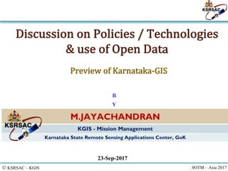
  • 1. © KSRSAC – KGIS SOTM – Asia 2017 Discussion on Policies / Technologies & use of Open Data 23-Sep-2017 M.JAYACHANDRAN KGIS - Mission Management Karnataka State Remote Sensing Applications Center, GoK B Y Preview of Karnataka-GIS
  • 2. © KSRSAC – KGIS SOTM – Asia 2017 Agenda for Panel Discussion ● Mapping policies in the country ● Experience using GIS technology and collecting data ● How can OpenStreetMap be useful
  • 3. © KSRSAC – KGIS SOTM – Asia 2017 Various Policies – related to Geospatial • National Map Policy (NMP) in 2005 (Open Series and defense use) • SoI mandated for bringing openness to data – Datum / Projection • The Remote Sensing Data Policy 2011 • NRSC – authorised single point of sale of all RS data • Data Sharing and accessibility Policy (GSI) • Specific to GSI’s map sharing policy • The National Data Sharing and Accessibility Policy, 2012 • State Govt Policies / Act • Delhi, Karntaka,… ● Digital India
  • 4. © KSRSAC – KGIS SOTM – Asia 2017 Use of Geospatial Tech in Disaster ● Technologies & Platform - Solution ◦ GIS / GPS / LIDAR / Cameras & Sensors (remote / monitoring) ◦ Satellite / Aerial / Drone / Mobile Platforms ◦ Solution - Processes – Models – Warning Systems ● Disaster ◦ Flood – Cyclone – Landslides – Earthquake – Drought – Act of Terror / Violence – FATAL Events - Tsunami ● Pre disaster Map ● Rescue and Planning operation with existing maps ● Post Disaster Assessment ◦ Map / visualisation using Remote Sensing data ◦ Change Detection / Analysis ◦ Mitigation Plan Reason – Research – Prevent / Prepare
  • 5. © KSRSAC – KGIS SOTM – Asia 2017 Suggestion for Governance ● Unified Framework – CORS GPS stations ◦ Seamless HR Satellite mosaic - Avoids accuracy issues ● Identify Ownership ◦ Avoid duplication and redundancy ● Mandate data updation ● One portal for all ● De-centralised data / Distributed Storage ● Single Gateway ◦ For all Data sources ◦ Tools for Mapping / Updation ◦ Customised / theme Specific Applications ◦ Generic Queries and Tools ◦ Open Platform for development / hosting
  • 7. © KSRSAC – KGIS SOTM – Asia 2017 Current Gaps and KGIS Needs ● Lack of integrated data between various departments ● Lack of spatial data availability in various dept ● Few Dept only have their own GIS teams ● Lack of expertise of GIS specialists and analysts ● DSS based on spatial data and trends is the requirement ● Existing Spatial Data - not in common coordinate reference frame ● Lack of GIS Applications and DSS for operational needs ● Non clarity in data sharing policy between dept and public
  • 8. © KSRSAC – KGIS SOTM – Asia 2017 A flagship Project of GoK, to Institutionalize the use of Geospatial in the Governance Karnataka GIS (K-GIS) Objectives ● To establish the state needs for robust information and GIS based decision support systems and also focus to ensure continued availability of GIS ready data assets and applications. ● To bring all the GIS data available in various departments under one single seamless spatial framework. ● To help the departmental users with GIS data and advanced tools for GIS analysis through simpler web and mobile interfaces system with an executive dashboard and other business workflows
  • 10. © KSRSAC – KGIS SOTM – Asia 2017 K-GIS Portal DSS & Apps E-Bhoomi, Watershed Dev UID / Aadhar seeding E- Health Census & EC, E- Register E-Aasthi Law& Order (CCTNS) Power (RAPDRP) KGIS :Integrated Applications Expected outcome Hardware / Software & NW Infrastructure Training and Capacity Building
  • 11. KGIS Elements Asset Portal & DSS Apps Capacity Building Infra- structure • Common Spatial Framework for registration, transformation and visualization of spatial data • Standardized New and Updated GIS data to meet the application needs • Single gateway access to K- GIS Asset and Dept. DSS Applications. • Suite of GIS applications for decision and work processes of different departments, citizens • Computing, Storage and networking infrastructure for hosting / serving the K-GIS data and Applications. • a sustained effort for training and orientation in GIS & applications for GoK Departments KGIS Standards and Design Governed by Karnataka - Geospatial Policies
  • 12. © KSRSAC – KGIS SOTM – Asia 2017 ● Common Coordinate system ● Primary and Secondary control network ● Seamless HR Image mosaic ● Digital Terrain (Elevation) Model ● Layers ◦ Base layers on the seamless image frame ◦ Other layers overlaid on each other ◦ Continous updated base/thematic layers • KGIS content standards circulated through GO • Standards / protocol for data exchange • DSS Application –SOA - OGC Standards • Single Sign On - Role based access for departmental operation • Karnataka Geospatial Policy • Data Sharing Policy Common Framework and Standards, Policies
  • 13. 1. Boundary 2. Infrastructures 3. Hydrology 4. Urban and Settlement 5. Industrial Content 6. Forest Environment & Ecology 7. Geological 8. Land Information 9. Land Ownership Information 10. Soil Information 11. Public Assets/ Amenities 12. Point of Interest 13. Grids and Graticules 14. Images 15. Topography 16. Weather Information KGIS Spatial Datasets 244 Layers, expected to grow more 36 Ministries/Dept. 1 Million Assets – 30 TB Database - and Growing …
  • 14. © KSRSAC – KGIS SOTM – Asia 2017 KGIS : Modular Solution SOA architecture for Easy Integration and GIS Enabling
  • 15. © KSRSAC – KGIS SOTM – Asia 2017 Portal : Sample Functionalities Flexible AoI Selection Multi Attribute Query Complex Buffer Analysis Various Thematic mapview Online Heatmap Generation Overlay of desktop GIS data
  • 16. © KSRSAC – KGIS SOTM – Asia 2017 Portal : Sample Functionalities Pre-defined query / Analysis Satellite Data – availability Spatial Editing of objects Customised Dashboards for depts Multilayer - Transparency
  • 17. © KSRSAC – KGIS SOTM – Asia 2017 Portal : Other components Online Feedback / Requirement gathering Apps: For locating various nearby Services Mobile Apps for field data Collection Download - Apps & Docs
  • 18. © KSRSAC – KGIS SOTM – Asia 2017 Operational DSS – Workflows & Dashboards RDPR Industry : KIADB Urban: MUDA Soil Health Mission
  • 19. © KSRSAC – KGIS SOTM – Asia 2017 Expected Benefits ● Make GIS data available at all levels ● Geo-enabling e-governance and public services by embedding GIS in all aspects of planning and development at state/district/panchayat levels; ● Bringing transparency and geo-spatial information support in decision-making; ● Citizen services by giving access to geospatial information; ● Enabling a “crowd-sourced” interactive process of citizen involvement in providing feed-back/inputs/data ● Enable a sound process of monitoring and identifying “gaps in development”; ● To make the state to be in the forefront of this field of technology and applications that that are fast growing globally. ● Also to make Karnataka GIS to be major contributor towards establishment of National GIS Government Industries Institutions Researchers Farmers B E N E F I C I A R I E S Entrepreneurs Citizens &Public Law Enforcement Legal / Judiciary Disaster Mgmt
  • 20. Summary -Vision 2020 ● KGIS 2020 : Integrated GIS for all departments ● Planning and Decision making – efficient and transparent ● Improved Service Delivery Karnataka Geo Spatial Agency Spatial Data Managemen t Mission Virtual Reference Stations Outreach, Training and Consulting Data Sales, User Projects Technology and Research KGIS (Flagship Mission) Analytic s Process Database Web Apps • New Requirements & feedback improves • CHANGES and Refinements shall continue to happen. © KSRSAC – KGIS http://kgis.Ksrsac.in/kgis kgissupport@ksrsac.in
  • 21. © KSRSAC – KGIS SOTM – Asia 2017 Discussion – Views and Thoughts Policy Consideration • Many data generation agencies • Different types of datas – thematic, small / Large Scale • Ownership –of data Duplication and authenticity • Accuracy - CORS Network • HR resolution data for whom and why • Public money – public data – share it – Open data is not necessary to be a free data • Security concerns / Privacy • Expose the availability of data - metadata • Correctness and validation • Standards & interoperability • Data Sharing Policy • Data Updation Policy Requirements for OSM to be used • OSM as institution should get engaged with Govt – not as freelance individuals. • Create data in government portals • OSM data to be available and updated in the government portals • The published data from government portals can be used in OSM portals • Validate the data through authoritative agencies • Involve Departments to be part of Mapping activity. Way Forward Should work towards developing open Map Solutions Develop business models – free data – paid service for unique solution - Collaboration with Agencies having copyright information Let’s Discuss…..THANK YOU How OSM can be useful • As a Planning and Decision support tool for governance • Apart from mapping the features and assets, themes should be generated • Citizen specific requirements • Let OSM Community develop solution and provide services • Crowd sourcing data within govt depts is already being valued. • Govt can provide incentives OSM volunteers / institution