2. The Armstrongs,
as they appeared
in Sunset Magazine,
and were chosen
“Best of the West.”
seanarbabi
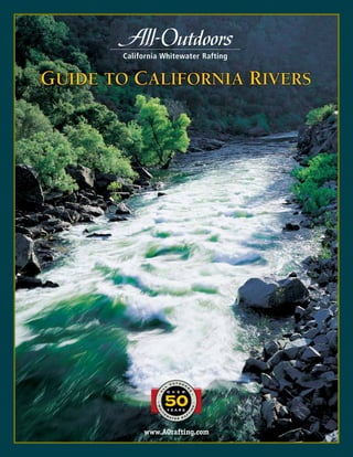
Welcome to the All-Outdoors
Guide to California Rivers
California Rivers Map page 3
Scale of River Difficulty page 4
Table of
Contents
Tom Sawyer Float page 6
South Fork American
Float trip with gentle, easy rapids.
Perfect for families with young children.
South Fork American page 9
California’s most popular
river trip. Great for first-timers,
Middle Fork American page 11
Scenic 2000-foot deep
wilderness canyon with a
taste of Class IV whitewater.
Merced page 12
Excellent introduction to
Class IV rafting located near
Yosemite National Park.
About All-Outdoors page 26
River Comparison Chart back cover
California Salmon page 22
Springtime run in a rock-walled
gorge with difficult whitewater.
Cherry Creek/Upper Tuolumne page 25
Considered the most
challenging commercial rafting
trip in the U.S.
Tuolumne page 14
Designated
“National Wild & Scenic River.”
One of California’s best multi-day trips.
North Fork Stanislaus page 16
Small, springtime stream
with lots of rapids in a
beautiful high-alpine setting.
Kaweah page 19
Non-stop action for
experienced rafters, in the spring.
Near Sequoia National Park.
North Fork American River page 21
Big, challenging drops
through a narrow rock gorge.
Runs in spring.
intermediate • class iii-iv
advanced • class v
intermediate-advanced • class iv-iv+
beginner-intermediate • class iii
intermediate • class iii-iv
intermediate-advanced • class iv-iv+
advanced • class v
beginner-intermediate • class iii
easy-beginner • class i-iieasy-beginner • class i-ii
2 |
TOur hope is that after reading about each river, you’ll have a clear notion
of the fun that awaits you on these wonderful runs.
As one of the first original outfitters in California, All-Outdoors has been
guiding people down rivers for more than 50 years. Our long history and
hard-earnedexperienceiswhatinspiresandqualifiesustowritethis“Guide
to California Rivers.” After leading more than 30,000 trips and more than
300,000 people down these runs, we have certainly come to know each
river intimately!
When you raft with All-Outdoors, you’ll be rafting with one of the
largest, oldest, and most experienced rafting companies in California.
Sunset Magazine recognized this and named us “Best of the West.”
Our staff of more than 100 professional guides, exceptional fleet of rafts,
and large and prestigious permits ensure you’ll have the best rafting ex-
perience available.
Sotakeafewminutestoreadthisguideandletyourimaginationsoar.We’ll
see you on a California river soon.
The Armstrong Family
hank you for your interest in rafting California rivers. Like
a menu at a fine restaurant, California has many great selections
from which to choose. We designed this guide to help you decide
which river trip is best suited to your unique needs and desires.
3. California, a Rafter’s Paradise
C
alifornia has one of the the highest concentrations
of navigable whitewater rivers in the world. It is hard to
find another place on earth with access to such a large
and varied number of waterways on which to raft. The
This All-Outdoors Guide to
California Rivers is also available
online in PDF format. Our website
includes trip options, details,
costs, discounts, virtual river tours,
real-time river flows, space avail-
ability, video, reservations, photo
galleries, and much more. This award-
winning, dynamic site is updated regu-
larly and is an easy way to get informed
and stay in touch with California rafting.
Go to www.AOrafting.com
high elevation of the state’s longest mountain range, the Sierra
Nevada, helps create a vast river system. Winter storms moving
east across the Pacific Ocean hit California first, leaving a
significant amount of rain and snow.
As the rivers drain west through scenic canyons, whitewater
runs are born. People from all walks of life come to be refreshed,
invigorated, and amazed by what many call a rafter’s paradise.
Whether you are planning a trip with family, friends or co-
workers, California has a river for you to discover and enjoy.
Connect to our website
by scanning this quick
response code with your
smart phone.
Look for All-Outdoors
on Facebook and Twitter.
4. How Rivers and
Rapids are Rated
Rivers and rapids are rated
on a scale of Class I (Easy) to
Class VI (Unrunnable). Rivers
receive a general rating based
on their most difficult rapid.
Several factors determine
the scale of difficulty for a
river or rapid: water flow and
temperature, obstacles such
as rocks and trees, vertical
drop in elevation per mile of
river (gradient), and the con-
sequences of a person falling
out of the raft unintention-
ally and “swimming” in the
rapids while wearing
a lifejacket.
Gradient is a fixed measure-
ment and is important to
take note of and to under-
stand. Steeper gradient
usually means faster current,
more rapids and a greater
level of difficulty.
Throughout this guide,
difficulty ratings assume
“normal” conditions. Age rec-
ommendations are also based
upon average flow conditions.
They are subject to change
with significant increases or
decreases in water level
For updated information
at the time of your trip,
please call (800) 247-2387
or visit www.AOrafting.com
It is important to understand the difficulty ratings of rivers prior to taking part in a rafting
trip. If difficulty ratings are ignored, individuals may end up on a river not suitable for their
abilities or expectations. Groups need to choose rivers that are appropriate for every person in
their party, not just the strongest member. All participants should be able to swim.
Class I - Mainly slow-moving flat water with some small waves. Passages
are clear and have few, if any, obstacles. Gradient is very mild (1-10 ft. per
mi.). “Swimming” Class I water is relatively easy.
Class II - Rapids may have waves from one- to two-feet high and passages
thataremostlyclearwithsomeobstacles.Gradientismild(10-20ft.permi).
Falling out of the raft can result in a “swim” that may be uncomfortable.
Class I-II rapids are appropriate for young children.
WHICH RIVER IS RIGHT FOR YOU?
easy-beginner • class i-ii
Scale of River Difficulty
easy-beginner • class i-ii
Rapidshavewavesthree-tofour-feethigh,passagescanbeclearandwideor
narrow with obstacles. Gradient is usually 20-30 ft. per mile. A knowledge-
able and capable guide is required for facilitating expert maneuvering.
Most people feel comfortable yet pleasantly challenged on Class III rivers,
and they serve as a great introduction to the sport of whitewater rafting.
beginner-intermediate • class iiibeginner-intermediate • class iii
Rapids can be long, contain waves and drops four- to five-feet high and
occasionally higher. Difficult maneuvering is often required between and
aroundobstacles.Currentisswiftandthegradientissomewhatsteep(30-40
ft.permile).Unintentionallyfallingintotherivermayresultinastrenuous
“swim” back to the raft or through the rapid to the next calm section.
Athletic,adventurousfirst-timerscanparticipateifconditionsareappropri-
ate, but previous experience is preferred and helpful.
Rapids are abrupt, long, and can be close together. They contain waves and
drops four- to six-feet high and occasionally higher. Difficult maneuvering
isrequiredbetweenandaroundobstacles.Currentisswiftandthegradient
is steep (40-70 ft. per mile). Unintentionally falling into the river will most
likely result in a strenuous “swim” back to the raft or through the rapid.
Previous experience is highly recommended.
intermediate • class iii-iv
intermediate-advanced • class iv-iv+
intermediate • class iii-iv
intermediate-advanced • class iv-iv+
Rapidsarepowerfulwithwavesanddropsfive-toeight-feethigh.Passages
are often narrow and complicated by twists and turns. Split- second ma-
neuvering around obstacles is required to avoid capsizing or “swimming.”
Current is strong and gradient is extremely steep (40-200 ft per mile).
“Swimming” can be very difficult and strenuous.
Individuals experiencing these rivers should have ample Class IV & IV+
experience, and need to be athletic, aggressive, and excellent swimmers.
Class VI - Unrunnable: Rapids are too difficult to navigate safely on a
regular basis. Chances of injury or death are significant. If attempted
with success, luck deserves the largest portion of credit.
advanced • class vadvanced • class v
4 |
5.
6. Nevada foothills. Tall oak trees line the banks, as do wild blackberry
bushesburstingwithjuicyfruitwaitingtobepickedinthelatesummer
months. Stopping to explore along the shoreline adds adventure to
this special family trip.
hE MIDDLE portION OF THE SOUTH FORK AMERICAN is perfect for
families with young children. This meandering section welcomes
all with its gentle Class II rapids and calm, relaxing pools. You’ll
have many opportunities to lounge on the boats and swim in
peaceful areas as you wind through the gold country of the Sierra
Weuseoar-raftssoyoumayrelaxandpaddleasmuchasyouwish.
Oar-rafts have a professional guide that controls the raft using
oars. Moreadventurouspaddlerswillalsohavetheopportunityto
navigate in your own one- or two-person inflatable kayak without
a guide. The kayaks are a fun way to explore the river canyon on a
more personal level. You’ll feel each rapid more intensely; you’ll
seeeachcurrentmoreintimately.Two-personkayaksallowparents
the unique opportunity to have a one-on-one rafting experience
withtheirkids.Thisisabeautiful,fun,andforgivingsectionofthe
river and is therefore the perfect place to attempt a self-guided
adventurelikekayaking.Theoar-raftsandguidesarenevertoofar
away to give any needed assistance to those in a kayak.
For more information about the South Fork American Class I-II
section and the surrounding area, go to: www.AOrafting.com.
A river is a wondrous thing to the eyes of a child.
6 |
S. F. AMERICAN - TOM SAWYER FLOAT TRIP
Season: JUNE through OCTOBER
Usual Minimum Age/WT: 5/35 lbs
TRIP Options: 1-DAY
MILES: 5
Location: 8 MILES NORTH OF PLACERVILLE,
40 MILES EAST OF SACRAMENTO
Gradient: 17 fEET PER mile
easy–beginner • class i–iieasy–beginner • class i–ii
F O R R E S E R V A TI O N S C A L L (800)24-RAFTS OR VISIT WWW.AORAFTING.COM
South Fork American
Tom Sawyer Float Trip
markreiner
7. The mild riffles of the Class II Section on the South Fork American are a great place to introduce young children to the joys of rafting and the natural world.
| 7Oar rafts and inflatable kayaks are used on the South Fork Class II Section.Owner Gregg Armstrong and family enjoying a float trip, early 90’s.
markreiner
8.
9. James Marshall discovered gold on the
South Fork American in 1848, sparking the
California Gold Rush.
The South Fork
has over 50 rapids
for both beginner
and veteran
rafters to enjoy.
South/MiddleFork2-DayCombotripsallowyouto
runtworiversintwodays.Thefirstdaywillbespent
enjoyingtheClassIIIrapidsontheUpper“ChiliBar”
section of the South Fork American River. At night
you have dinner and stay with us at our car-access
river camp on the South Fork with warm showers
andflushtoilets.Thenextdayyou’llwakeupearly
toaquick,healthybreakfastanddrivetotheMiddle
Fork of the American (50 minutes away) to chal-
lenge yourself with Class IV whitewater. You’ll crash
through intense rapids, testing your newfound
skills. At trip’s end, you’ll feel the exhilaration of
havingconqueredtworivers,traveledthroughtwo
canyons, and floated a total of 25 miles!
Express Trips
Express trips are for those watching their budget
and time. These faster trips last approximately
five to six hours, including shuttle. Lunch is not
included. Express trips on the Upper section take
place in the morning, and Express trips on the
Lower in the afternoon.
TolearnmoreabouttheSouthForkAmericanRiver
go to: www.AOrafting.com.
scenery, narrow rocky gorges, calm pools, and over 50 rapids! Whitewater
rafting on the South Fork draws people to the same Coloma Valley where
James Marshall discovered gold in 1848.
T
This river has the widest selection of trip options
inthisGuidebook,andisdividedintotwosections,
anUpperrunandaLowerrun.Bothareuniqueand
rewarding.TheSouthForkisadam-controlledriver
with reliable water flows all year.
One-Day Trips
One-DayUpper“ChiliBar”tripsstartinthedepths
of a steep, forested canyon. Rafters have just
enoughtimetowarm-upbeforefacingthelongest
rapid on the river, Meatgrinder! The whitewater
excitementkeepsyourattentionuntilthelastbig
challenge...awildS-turnridedownatwistedchute
knownasTroubleMakerRapid.Afterascrumptious
lunch,therivermellowstoapeacefulfloatthrough
the Coloma Valley where our trip ends.
One-Day Lower “Gorge” trips begin in the Lotus/
Colomaarea,withplentyofClassIandIIwarm-up
rapidsbeforetheriverdropsoutofthevalley.After
lunch,rockycanyonwallscloseinfrombothsides
asthemoredemandingClassIIIwhitewaterofthe
“Gorge” begins. Challenges such as Fowler’s Rock,
Satan’s Cesspool, Hospital Bar, and Recovery Room
rapids carry rafts swiftly toward Folsom Lake, the
trip’s end.
Two-Day Trips
South Fork 2-Day Car Access Camp trips typically
raft the Upper Section the first day, and the Lower
Section the second day. Guests enjoy a more lei-
surely pace, spending the evening at a beautiful,
convenientriversidecampwithhotshowers,flush
toilets,andcaraccess.Modernfacilitiesandhearty
camp meals provide a most comfortable stay.
he South Fork American River has something for everyone. It is
the most popular introductory whitewater river in California, yet it
alsosatisfiesexperiencedrafterswithitsnumerousClassIIIrapids.
TuckedawayintheSierrafoothills,theSouthForkAmericanislocated
just 40 miles east of Sacramento. This river offers diversity...classic
South Fork American
Season: ALL YEAR
Usual Minimum Age/WT: 8/50 lbs
TRIP Options: EXPRESS 1-Day, 2-Days
MILES: 9,12 9,12 21
Location: 8 MILES NORTH OF PLACERVILLE
AND 40 MILES EAST OF SACRAMENTO
Gradient: 25 fEEt PER mile
LEFT: Happy crew forward paddling through Satan’s Cesspool,
one of the exciting Class III rapids on the Lower Section of the
South Fork American.
F O R R E S E R V A TI O N S C A L L (800)24-RAFTS OR VISIT WWW.AORAFTING.COM
beginner–intermediate • class iiibeginner–intermediate • class iii
| 9
South Fork American
VIDEO
10. The Middle Fork of the American River. A beautiful wilderness area…an excellent place to go and get away from the daily grind.
The Middle Fork flows
through a runnable
90’ river tunnel!
Years ago, miners
blasted this passage
to divert and dry up
a mile of river bed for
prospecting.
A healthy population of Rainbow and German Brown Trout are
supported by the clean cool water of the Middle Fork.
F O R R E S E R V A TI O N S C A L L (800)24-RAFTS OR VISIT WWW.AORAFTING.COM10 |
11. T
he Middle Fork of the American is a true wilderness river. In the
solitudeofthisbeautiful2000-footdeepruggedcanyonarenumerous
Class III and some technical Class IV rapids. The Middle Fork is a good
follow-up trip to the less demanding South Fork, and is appropriate
for active, athletic individuals and adventurous first-timers.
The Middle Fork offers unique scenery and great whitewater. Early in
the trip, the entire river flows through a narrow, steep Class IV chasm
calledTunnelChuteandisfollowedbyarunnablerocktunnel90-feetin
length!Alongtherun,challengingrapidsareencounteredsuchasLast
Chance, Lettuce Hole and Kanaka. A calmer section toward the middle
of the day nicely compliments the whitewater excitement. Here, the
swiftly moving current allows passengers to relax and appreciate the
Middle Fork’s scenery. Remarkably clear water swirls above glistening
gravelbedsandhoveringtrout,whilethicklyforestedcanyonwallsrise
high overhead. Historic gravel tailings and fern-covered mine shafts
remind rafters of California’s Gold Rush. Tumbling sidecreeks create
cascading waterfalls and smoothly sculpted pools in which to swim.
Toward the end of the trip lies awe-inspiring Ruck-a-Chucky Falls. A
mandatory walk around this unrunnable 30-foot waterfall allows a
first-hand look at nature’s beauty and power. After re-boarding the
rafts, trips enter an impressive greenstone gorge filled with technical
Class IV rapids. This grand finale holds some of the most demanding
whitewater of the trip. Cleavage, Parallel Parking and Catapult are a few
of the steep, thrilling drops that end each adventure.
TripoptionsontheMiddleForkinclude16-mile,1-or2-Daypaddleraft
trips, and a 23-mile 3-Day trip. The 1-Day trip moves at a fast pace and
does not allow time to enjoy off-river attractions. Both 2- and 3-Day
trips afford an opportunity to venture into hidden side canyons, swim
in warm pools, kayak, and relax at beautiful wilderness beach camps
accessible only by raft.
The Middle Fork is dam-controlled, running April through October.
Anyone considering a Middle Fork trip must be aware that all partici-
pants should be in good physical condition.
For more information and images of the Middle Fork American and
the surrounding area, go to: www.AOrafting.com.
MIDDLE Fork American
Season: APRIL through OCTOBER
Usual Minimum Age/WT: 12/90 lbs
TRIP Options: 1-Day, 2 -Days, 3 -DAYS
MILES: 16, 16, 23
Location: 17 MILES NORTHEAST OF AUBURN
AND 50 MILES NORTHEAST OF SACRAMENTO
Gradient: 40 feet per mile
SF
Sacramento
intermediate • class iii–ivintermediate • class iii–iv
Tunnel Chute
is one of
California’s most
famous rapids.
Some guests may
choose to walk
around this one.
| 11
Middle Fork American
VIDEO
12. HE MERCED is an ideal “Intermediate” run for those ready to
graduate from a “Beginner” river. Adventurous, athletic first-timers
can also enjoy this run. The Merced tumbles over Yosemite’s Nevada
and Vernal Falls, meanders through the Valley, and builds into a river
of pure whitewater fun. The section we raft is below the Park, and is
characterized by a steep gradient, sweeping bends, and few obstacles to
hinderaraft’smomentum.Withlongstraightforwardrapidsandbigrolling
waves,“forwardpaddle!”isthepredominantcommand.Withitsfunrapids,
and proximity to Yosemite, this river brings rafters back annually.
Acorns provided the main food source for the
Native Americans who lived along the Merced before
the arrival of the settlers. Ancient grinding holes are
still visible in the rocks along its banks.
F O R R E S E R V A TI O N S C A L L (800)24-RAFTS OR VISIT WWW.AORAFTING.COM
The Merced’s clear waters wind through a grassy, mid-Sierra canyon
dotted with oak and Gray Pine. People on early spring trips are treated
to hillsides decorated in golden poppies, purple lupine, and wild iris.
Since there are no dams constructed above this stretch of river, trips
take place when the Sierra snowpack melts, normally April through
mid-July. For the biggest waves and longest rapids plan a trip during
AprilorMay,themonthsofpeakrunoff.Althoughtheflowlessensover
thecourseoftheseason,thesteepgradientofthisriverkeepsthepace
brisk.Youareabletocoveranimpressive16milesinoneaction-packed
day!Wavescrashoverthebowofraftsoverandoveragaininrapidslike
Percolator, Ned’s Gulch, Split Rock, and Corner Pocket.
Normally, 1-Day trips run the upper 16 miles. This lively section starts
off fast for the first six miles, slows down in the middle section, and
speeds up again during the final miles. It is a favorite run of many
whitewater enthusiasts.
Because of its exceptional qualities, a segment of the Merced was
awarded National Wild & Scenic status in 1987 by the US Congress and
will remain protected for future generations to enjoy.
For more information and images of the Merced and the surrounding
area, go to: www.AOrafting.com.
CHRISRUNNER
intermediate • class iii–ivintermediate • class iii–iv
12 |
MERCED
Season: APRIL through MID-JUly
Usual Minimum Age/WT: 12/90 lbs
TRIP Options: 1-Day
MILES: 16
Location: 10 MILES EAST OF MARIPOSA AND
4 MILES WEST OF YOSEMITE NATIONAL PARK
Gradient: 34 fEET PER MILE
Merced
VIDEO
13. An oar-paddle combination raft, used during periods of spring-time
high-water, blasting through the waves of Ned’s Gulch, Class IV.
Paddle crew finishes Split Rock rapid and prepares for Class IV Corner Pocket just 30 yards downstream! Below: The Class IV section of the Merced is only a few miles from Yosemite.
California Quail and other species of wildlife
find the Merced Canyon an attractive habitat.
markreiner
14. T
TUOLUMNE
Season: APRIL THROUGH SEPTEMBER
Usual Minimum Age/WT: 13/90 lbs
TRIP Options: 1-Day, 2- Days, 3-DAYS
MILES: 18, 18, 18
Location: 8 MI. EAST OF GROVELAND AND
20 MILES WEST OF YOSEMITE NATIONAL PARK
Gradient: 40 fEET PER mile
A paddle raft entering Clavey Falls - running this challenging rapid is optional.
The National Wild & Scenic Tuolumne hides some
of the best camping in all of California. Can you
find the happy rafters at the remote river camp
in the large photo on the next page?
Ocated just outside Yosemite National Park, the Tuolumne River
provides one of the finest all-around river experiences in the country.
Spectacular scenery, thrilling Class IV rapids, great side hikes leading
to deep swimming pools, and beautiful white-sand beaches are hidden
inside an 18-mile stretch of pristine canyon. Golden eagles, mountain
The Tuolumne is dam-controlled, running April through September.
1-, 2-, and 3-Day trips in all-paddle rafts and oar-paddle combination
raftsareavailable.Duetothelengthoftherun,1-Daytripshavenotime
foraddedadventuresonshore.Ontheotherhand,2-and3-Daytripsare
an excellent way to fully experience the canyon. You will visit historic
miningrelics,takeshorthikesalongtributarystreamstowater-slides
anddeeppools,andstillhavetimetorelaxintheTuolumne’sspacious
rivercamps.Whitesandbeachesshadedbygreenwillowsandtowering
oaksprovidethefinestriversidecamping.OvernighttripsareLewisand
Clark expedition-style, with gear rafts carrying all provisions.
Strict government regulations limit the size of trips to just 20 people
and the total number of commercial trips to two departures per day.
Suchregulationshelppreservethehighqualityofthispublicresource
and ensure solitude along this uncrowded wilderness run.
FormoreinformationandimagesoftheTuolumneandthesurround-
ing area, go to: www.AOrafting.com.
quail, rainbow trout and water ouzels provide a sampling of Sierra wildlife. No
signs of modern development interrupt the splendor of this remarkable place.
In recognition of the Tuolumne’s value, Congress has given the river National
Wild and Scenic protection. The Tuolumne is a perfect river for those wishing
to experience to Class IV rafting in a wilderness setting.
ThewhitewaterfunbeginsimmediatelywithRockGardenandNemesis.Long,technicalboulderslaloms,
tight chutes, and steep drops are characteristic of the entire run. Sunderland’s Chute, Ram’s Head, and
Evangelist provide a solid Class IV warm-up for the Tuolumne’s most famous rapid...Clavey Falls! Rapids
such as Gray’s Grindstone, Cabin, and Hell’s Kitchen continue to test the skills of each crew.
SpringtimeontheTuolumnebringslushgreenmountainsidesandwhitewateratitsverybest.Continuous
rapids and swift currents during high water make it important that each participant has ample rafting
experience. Summer and fall trips are ideal for lounging in warm swimming holes and experiencing the
Tuolumne’s renowned trout fishing. During these later months, the Tuolumne’s rapids become a less
vigorous Class IV challenge and can be attempted by athletic first-timers.
intermediate–advanced • class iv–iv+intermediate–advanced • class iv–iv+
Tuolumne
14 |
photosmarkleder-adams
mark reiner
VIDEO
15.
16. scenery — thick forests of pine and fir, mixed with old oak, maple,
dogwood, incense cedar, and wild azalea. It is one of the most beautiful
settingsofanyraftingtripinthisGuidebook.TheancientGiantSequoia
Redwoods nearby add spice to this already flavorful place.
Centrally located, the North Fork Stanislaus is
only a few hours from Sacramento and the
San Francisco Bay Area.
The North Stan flows through Calaveras Big Trees State
Park where Giant Sequoia Redwoods thrive and amaze.
chris hall
he North Stanislaus River is a well kept secret. Only a few
outfitters have been given government permission to operate river
trips on this high Sierra run. Trips start in Stanislaus National
Forest,at just over4,000feet,whichisanunusuallyhighelevation
for rivers rafted in California. This run has spectacular alpine
The steep gradient of the North Stanislaus (70’ per mile) and the
largenumberofrocksintherivercreatearaftingexperiencethat
is as intense and captivating as its scenery. Less than a minute
from put-in lies Beginners Luck, a stair-stepping, four-stage
15-foot Class IV drop that will jolt you awake and prepare you
for what awaits downstream. Rattlesnake, The Claw, Convulsion,
WalletSlot,andMachek’sMayhemaretwisting,turningrapidsthat
require deft maneuvering at high speeds. A day of back-to-back
whitewater ends with a series of big drops in Calaveras Big Trees
State Park called Upper and Lower Sequoia Sluice.
Althoughthisrunisshort(5miles),itisalwayssatisfyingbecause
oftheamazingscenery,largenumberofrapids,andtheintense,
technical paddling required for successful passage. The river
runs best in springtime, mid-April through May, and requires an
athletic and adventurous crew.
For more information and images of the North Fork Stanislaus,
go to: www.AOrafting.com.
North Fork Stanislaus
NORTH Fork STANISLAUS
Season: April through MAY
Usual Minimum Age: 15
TRIP Options: 1-Day
MILES: 5
Location: 4 MILES EAST OF ARNOLD AND
75 MiLES EAST OF STOCKTON
Gradient: 70 fEET PER mile
intermediate–advanced • class iv–iv+intermediate–advanced • class iv–iv+
16 |
markreiner
VIDEO
17. Polished granite, magnificent alpine scenery and continuous technical rapids on the North Stanislaus. Below: Paddle crew on the North Stan in the mid 80’s.
18.
19. is highly recommended, as there is no time to learn to paddle!
his Class IV+ river HAS its headwaters in the 13,000-foot peaks
of Kings Canyon and Sequoia National Parks. These majestic snow-
capped mountains form a scenic alpine backdrop to this continuous
Intermediate-Advancedriver.“Rapid-fireexcitement”bestdescribes
this thrilling and keenly satisfying run. Previous rafting experience
The river starts out like a runaway locomotive
and is relentless as it heads for Lake Kaweah,
nine miles downstream. In fast succession the
current immediately draws you into one rapid
after another, until you begin to ask, “How long
canthislast?”Bumper,PowerHouse,Cyanotic,and
Suicide Falls are only a few of the many Class IV+
rapids that make this run an intense high-speed
race to the finish. Simply staying in the raft while
paddling through the drops can be a challenge!
The Kaweah put-in is located only a few miles from
Sequoia National Park and very close to beautiful
Kings Canyon. Snowmelt determines the season,
whichusuallystartsinAprilandlaststhroughJune.
Years of heavy snowpack result in later flows and
excellent rafting conditions into summer.
For more information and images of the Kaweah
and the surrounding area, go to our web site:
www.AOrafting.com.
F O R R E S E R V A TI O N S C A L L (800)247-2387 OR VISIT WWW.AORAFTING.COM
A paddle boat powers through
exhilarating Kaweah whitewater.
KAWEAH
Season: April through JUNE
Usual Minimum Age: 15
TRIP Options: 1-Day
MILES: 9
Location: 2 MI. WEST OF SEQUOIA NATIONAL
PARK AND 70 MI. SOUTHEAST OF FRESNO
Gradient: 50 FEET PER mile
Kaweah
intermediate–advanced • class iv–iv+intermediate–advanced • class iv–iv+
| 19
Just outside Sequoia National Park, the Kaweah offers continuous whitewater and beautiful spring colors.
photos:markreiner
VIDEO
20. Paddlers love the challenge of this invigorating river. Wildflowers are often enjoyed on California springtime trips.
The North Fork is runnable for a limited time in the spring. Plan ahead to enjoy this unique canyon of sculpted rock walls and lush vegetation.
20 |
21. he North Fork American is the most difficult of the three
forks of the American River. Its proximity to the Interstate 80-Lake
Tahoe corridor makes for a convenient trip from Sacramento or the
San Francisco Bay Area. Every North Fork adventure gets off to a
quick start with four miles of intense Class IV rapids. Giant boulders
scatteredthroughoutasteep,narrowcanyoncreateatechnical,challenging
slalom. Previous experience on Class III rivers is advised.
The “heart-in-the-throat” excitement begins immediately as you
enter Chamberlain Falls Gorge. Slaughter’s Sluice, the first rapid,
is a long series of pinball maneuvers that culminates at the infa-
mous seven-foot Chamberlain Falls! Zig-Zag, Achilles Heel, Bogus
Thunder, and Staircase require intricate moves to negotiate. The
scenery of this gorge is amazing…lush foliage extends from high
ontheridgesdowntothewhitewashedriversidecliffswhilewater
splashes from tiny side canyons to join the incredibly clear North
Fork. The second half of the run mellows to Class II-III rapids,
allowing time to enjoy the canyon scenery.
TheNorthForkdependsonsnowmeltforitsflows,soAprilandMay
are the best months to run this river.
FormoreinformationandimagesoftheNorthForkAmericanand
the surrounding area, go to: www.AOrafting.com.
Raft pushes through and over 7’ Chamberlain Falls (Class IV+), one of the first rapids on the North Fork American.
NORTH Fork American
Season: April through MAY
Usual Minimum Age: 15
TRIP Options: 1-DAY
MILES: 9
Location: 20 mi. NORTHeast of AUBURN
Gradient: 34 fEET PER mile
intermediate-advanced • class iv–iv+intermediate-advanced • class iv–iv+
North Fork American
markreiner
VIDEO
22. he “Cal-Salmon” is ONe of CALIFORNIA’S best and most difficult
springruns.Experiencedrafterseagerlytraveltothenortherncorner
of the state for this river’s outstanding whitewater and temperate
rainforestscenery.Theriverplungesthroughanarrow,steep-walled
gorge with stunning cliffs, waterfalls, and unimaginable rapids.
The outstanding qualities of the California Salmon prompted Congress
to include this river in the National Wild and Scenic Rivers System.
CALIFORNIA SALMON
Season: April through MID-JUNE
Usual Minimum Age: 15
TRIP Options: 1-Day, 2-DayS
MILES: 12, 18
Location: 100 Miles NORTHeast of eureka
and 150 MILES NORTHWEST OF REDDING
Gradient: 40 fEET PER mile
The Cal-Salmon has great rapids and
incredible scenery featuring rock walls
and a temperate rainforest.
F O R R E S E R V A TI O N S C A L L (800)247-2387 OR VISIT WWW.AORAFTING.COM
TheNordheimerGorgerunontheuppersectionoftheriverbeginsim-
mediatelywithClassIV+rapidssuchasBloomerFalls,LewisCreekFalls,
andAirplaneTurn.TheactionincreasesatClassVCascadeRapid,which
is more waterfall than rapid, and continues its pace through the likes
ofAchillesHeel,WhirlingDervish,andLastChance.Theintensitypeaks
at Freight Train, a long rapid with massive holes and huge hydraulics.
There is never a shortage of rapids on the Cal-Salmon!
After the Nordheimer section the river mellows slightly at Butler
Creek, it flows through a magnificent canyon with small waterfalls
sheeting over sheer granite cliffs into the Cal-Salmon. The highlight
of this lower section is Gaping Maw, a long, powerful Class IV rapid
that ends in a river-wide hole of frothing whitewater!
On 1-Day trips we raft the entire river in one long day, beginning at
Nordheimer. On 2-Day trips we also raft the entire run the first day
and then camp along the river at a car-access camp. The next day we
do the invigorating Nordheimer section again before we take-out at
Butler Creek. Trips are conducted in paddle-rafts or oar-paddle rafts,
depending on water levels. The California Salmon is great for those
wanting to prepare for a trip on the even more challenging Cherry
Creek Class V adventure!
California Salmon
advanced • class iv+–vadvanced • class iv+–v
22 |
23. Raft crew running Class V Cascade on one of our first commercial trips on the Cal-Salmon in the early 80’s.
Native Americans who made their home on the Cal-Salmon and
Klamath rivers, built canoes of redwood logs. They hollowed the log
with fire, then scraped away the soft burned wood with a shell adz. | 23
markreiner
Both paddle rafts and oar-paddle combination rafts are used on Cal-Salmon trips.
24.
25. herry Creek IS the most CHALLENGING
commercial river trip in California, and perhaps the
entire United States. With a phenomenal twelve
Class V rapids and many unnamed Class IV drops,
this 9-mile run is incomparable.
Cherry Creek is more than superlative whitewater. The canyon’s rare beauty
creates a backdrop for both group unity and personal experience, while the
limited number of commercial outfitters fosters a unique level of privacy.
Guests on Cherry Creek are an integral part of each trip, helping navigate,
portage,andscoutrapids.ThislevelofparticipationrequirespreviousClass
IV-V whitewater or other water sport experience, adequate physical condi-
tion, and good swimming ability. Swimming practice and Class V education
are part of each trip.
The whitewater adventure starts immediately with Class IV “warm-up” rap-
ids. Then the Class V begins: rapids like Jawbone, Mushroom, Toadstool, and
UnknownSoldierkickoffanunforgettablemorning. Afterre-groupinginone
of the river’s many calm pools, trips enter the infamous Miracle Mile, which
drops 200 feet in a single mile and boasts back-to-back Class V whitewater:
Smokey’s Hole, Blind Faith, Gar’s Lunch, Eulogy, Coffin Rock and Lewis’s Leap.
Before the trip ends we portage Flat Rock and Lumsden Falls, finishing with
two miles of Class III-IV rapids. At take out, guests have experienced it all:
natural beauty, camaraderie, and exceptional whitewater.
FormoreinformationaboutourcombinationtripswiththeMainTuolumne
river and to view images of Cherry Creek and the surrounding area, go to:
www.AOrafting.com.
Cherry Creek
Season: MID-JULY through SEPTEMBER
Usual Minimum Age: 17
TRIP Options: 1 Day MILES: 9
Location: 15 MILES EAST OF GROVELAND
AND 15 MI. WEST OF YOSEMITE NATIONAL PARK
Gradient: 105 fEET PER mile
Left: Class V Lewis’ Leap; Raft crew runs the leap while another raft waits in the pool above. Cherry Creek, as a classic “pool/drop” river, offers technical whitewater
separated by calm pools.” Above: Dropping into Toadstool rapid (Class V) on Cherry Creek.
advanced • class vadvanced • class v
photos:markreiner
| 25
VIDEO
26. “Mae West” life jackets, common in the 1970’s
Trusting All-Outdoors
for Your Rafting Trip
• More than 50 Years Experience
• 10 of California’s Best Rivers
• Staff of 100 Professional Trained Guides
• Ultra-High Safety Standards
• Highest Quality Equipment
• Chosen “Best of the West”
by Sunset Magazine
• Inc Magazine Choice for
“Best Small Business Website in America”
• Guest Feedback
All-Outdoors
California Whitewater Rafting
1250 Pine Street Suite 103
Walnut Creek, CA 94596
(800)24-RAFTS (247-2387)
rivers@AOrafting.com
www.AOrafting.com
Extended Summer Office Hours
8am-7pm M-F & 9am-4pm S-S
Regular Hours 9am-5pm M-F
F O R R E S E R V A TI O N S C A L L (800)24-RAFTS OR VISIT WWW.AORAFTING.COM
tylerchildress
26 |
guiding people down california rivers
for more than fifty years
here is no substitute for experience;
We are one of the few original California outfitters.T
We helped pioneer the sport in the early ’60s, and have been
refining rafting techniques, training standards, safety procedures,
and equipment quality ever since. More than 50 years experience,
1o of California’s best rivers, more than 30,000 trips, more than
300,000 people...Experience makes a difference.
An historic “basket boat” negotiates “Razorback” rapid, Main Stanislaus, Camp Nine run, 1963.
More Experience.More Experience.
Look for Us on
Twitter and Facebook
27. Choosing a River Trip…
Choose a river that suits your experience level.
Most first-timers start with a ”Beginner“ river
(pg.6-9) before advancing to an “Intermediate”
river (pg.10-21). Call our office for helpful advice.
When planning a group trip, always consider the
abilities of the least experienced member.
Who Can Participate…
From a lazy day of summer on the Class I-II Easy
Section of the South Fork American, to the adrena-
line rush on Class V Cherry Creek, this Guidebook
offers a river trip to satisfy most everyone.
Participants should be able to swim and feel
comfortable in the water. Unfortunately, persons
with a chest or torso size over 52” (life jacket
maximum size) cannot take part in an All-Outdoors
trip. People with special health considerations
should call our office and consult their physician
for recommendations.
Making a Reservation
You can call our office at (800) 24-RAFTS or go
online at www.AOrafting.com to reserve space on
the rafting trip and date you desire. Usually, pay-
ment is due at the time of your reservation.
We Provide…
All-Outdoors provides professional instruction
preceding your trip, a Coast Guard approved life
jacket, professional rafting equipment, a profes-
sional guide in each raft, river shuttles, and
deluxe food from the first to last lunch.
You Bring…
You bring personal clothing for the trip. A sleep-
ing bag, tent (if desired), and toiletry items are
also needed for overnight trips. A detailed “What
To Bring” list will be sent to you, or may be ob-
tained online from our website. Transportation to
and from the meeting place is your responsibility.
Delicious All-Outdoors River Cuisine
Our meals are prepared with a variety of
wholesome, fresh ingredients, to provide a
healthful and appetizing menu for our guests.
Lunches on 1-Day trips consist of our spectacular
build-it-yourself gourmet sandwich bar, along
with fresh fruit, salsa and chips, beverage, and
dessert. A typical 2-Day trip dinner includes
hors d’oeuvres, fresh tossed salad, pasta with
vegetables, camp french bread, chicken, steak,
beverages, and a fresh baked dutch oven dessert.
Breakfast varies from custom omelets, camp hash
browns, and bacon, to fancy continental cuisine
when time is limited. Each meal is a delight,
served in a river setting with a natural ambience
a restaurant can never match.
AOrafting.com…
Find this Guidebook & More!
Our award winning, comprehensive website is an
invaluable tool for planning your first, second,
and hundredth rafting trip. At your finger tips
lies additional information including raft-
ing videos, real-time river flows, space
availability, reservations, trip options
and details, costs, discounts, and ex-
tensive photo galleries. This dynamic
site is updated regularly and is an
easy way to get informed and keep
in touch with California rafting.
Start your river trip by going to
www.AOrafting.com.
scott armstrong
River Trips and Reservations
Reserve Space Now
Call (800)247-2387
www.AOrafting.com
| 27
..More Rivers...More Fun!..More Rivers...More Fun!
28. All-Outdoors belongs to a number of organizations dedicated to river protection and conserva-
tion. We donate a portion of your trip fees to Friends of the River, one of the top river preservation
organizations in the U.S. To learn more about Friends of the River, go to friendsoftheriver.org.
Brochure design: daviddesign.com • Photos by picturethisimaginethat.biz unless noted.
All-Outdoors California Whitewater Rafting
1250 Pine St. Ste. 103 Walnut Creek, CA 94596
(800) 24-RAFTS • (925) 932-8993 • www.AOrafting.com
All-OutdoorsoperatesunderthepermitsandapprovalofU.S.ForestService,CalaverasBigTreesStatePark,Auburn
State Recreation Area, and the Bureau of Land Management. Notice: Water flows on the South Fork American
River result from releases from hydroelectric facilities located upstream. Such water releases are not subject to
the control of El Dorado County or commercial rafting companies operating under permits from the County of
El Dorado. All-Outdoors is an equal opportunity service provider. Please pass this guide on to a friend or recycle.
All-Outdoors California Whitewater Rafting • River Comparison Chart
★LEVEL OF NO. OF RIVER GRAD IENT ✚ USUAL ✜ RAFTING SEASON DRIVING MI FROM
RIVER DIFFICULT Y DAYS MILES VERTICAL DROP SCENER Y SOLITUDE MIN AG E WETSUITS DRY YEAR NORMAL WET YEAR SF SAC LA
EASY BEGINNER • Cl ass I–II
TOM SAW YER FLOAT TRIP* I-II 1 5 17’/ mi GOOD FAIR 5 TYPICALLY JUN–OCT JUN–OCT JUN–OCT 130 40 425
SOUTH FORK AMERICAN NOT REQUIRED
Great for families with young children
BEGINNER–INTERMEDIATE • CLASS III
SOUTH FORK Ameri can* III 1,2 9,12,21 25’/ mi good fair 8 A pr–MID. M ay ALL YEAR ALL YEAR ALL YEAR 130 40 425
Most popular whitewater
river in California
INTERMEDIATE • CLASS III–IV
MIDDLE FORK Ameri can* III-IV 1,2,3 16,16,23 40’/ mi EXCELLENT VERY GOOD 12 A pr–MID. M ay A pr–S ep A pr–OCT A pr–OCT 140 50 435
Remote, scenic 2000’ deep canyon with
a taste of Class IV whitewater
Me rced III-IV 1 16 34’/ mi good fair 12 A pr–MID. J un A pr–J un A pr–MID. J ul A pr–A ug 180 150 310
Excellent introduction to Class IV white-
water; only a few minutes from Yosemite
INTERMEDIATE– ADVANCED • CLASS IV–IV+
T uolU mne* IV-IV+ 1,2,3 18,18,18 40’/ mi EXCELLENT EXCELLENT 13 A pr–J un A pr–A ug A pr–S ep A pr–O ct 140 115 370
Designated “Wild & Scenic” by Congress
Considered California’s best multi-day trip
NoRTH FORK S tan i slaus IV-IV+ 1 5 70’/ mi EXCELLENT VERY good 15 A pr–MAY A pr–MID. MAY A pr–M ay A pr–O ct 160 125 410
Beautiful high-alpine setting
with lots of whitewater action
K aw eah IV-IV+ 1 9 50’/ mi good fair 15 A pr–MID. J un A pr–M ay A pr–J un A pr–J ul 260 240 210
One rapid after another,
near Sequoia National Park
NoRTH FORK Ameri can IV-IV+ 1 9 34’/ mi EXCELLENT VERY good 15 A pr-MID. M ay A pr A pr–M ay A pr–J un 150 55 420
Springtime run through a narrow rock
gorge with intense rapids
ADVANCED • CLASS V
C alIFORNIA S almon IV+-V 1,2 12,18 40’/ mi EXCELLENT VERY GOOD 15 always A pr–M ay A pr–MID. J un A pr–MID. J ul 395 320 680
Steep, rock-walled gorge in a temperate
rainforest with very challenging whitewater
C HErry Creek* V 1 9 105’/ mi EXCELLENT EXCELLENT 17 always J un–A ug J ul–S ep A ug–S ep 140 115 370
Considered the most challenging commercially
run whitewater river in the U.S.
Dam release from upstream man-made reservoirs/fairly predictable flows. The South Fork American has guaranteed weekend water for all season types from wet through dry years.
Based on the International Scale of Difficulty (see page 4 inside this Guidebook)
While rivers with “excellent” ratings have solitude 7 days a week, the level of solitude on other rivers improves during early and late season, as well as midweek during the summer.
Wetsuit requirements can vary so please call our office for details. Wetsuits may be rented directly from All-Outdoors at the meeting place the morning of your trip.
*
BLMUSFS
★
✚
✜
Printed on FSC certified,
elemental chlorine-free recycled
paper using vegetable based inks.