Geographical position of australia and its population
•Als PPTX, PDF herunterladen•
3 gefällt mir•1,341 views

Presented by: Glamour™media

Empfohlen
Weitere ähnliche Inhalte
Was ist angesagt?
Was ist angesagt? (20)
Andere mochten auch
Andere mochten auch (20)
Ähnlich wie Geographical position of australia and its population
Ähnlich wie Geographical position of australia and its population (20)
Kürzlich hochgeladen
Kürzlich hochgeladen (20)
Geographical position of australia and its population
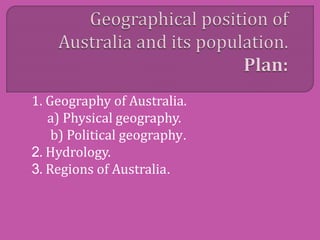
- 1. 1. Geography of Australia. a) Physical geography. b) Political geography. 2. Hydrology. 3. Regions of Australia.
- 3. The geography of Australia encompasses a wide variety of biogeographic regions being the world's smallest continent but the sixth- largest country in the world. The population of Australia is concentrated along the eastern and southeastern coasts. The geography of the country is extremely diverse, ranging from the snow-capped mountains of the Australian Alps and Tasmania to large deserts, tropical and temperate forests.
- 4. Neighbouring countries include Indonesia, East Timor and Papua New Guinea to the north, the Solomon Islands, Vanuatu and the French dependency of New Caledonia to the east, and New Zealand to the southeast.
- 5. Australia is a country, and an island. It is located in Oceania between the Indian Ocean and the South Pacific Ocean. It is the sixth largest country in the world with a total area of 7,686,850 square kilometers (2,967,909 sq. mi) (including Lord Howe Island and Macquarie Island), making it slightly smaller than the 48 states of the contiguous United States and 31.5 times larger than the United Kingdom.
- 7. Australia consists of six states, two major mainland territories, and other minor territories. The states are New South Wales, Queensland, South Australia, Tasmania, Victoria and Western Australia.
- 8. Because much of Australia's interior is arid, the low average annual rainfall means interior rivers are often dry and lakes empty. The headwaters of some waterways are located in tropical regions where summer rains create a high rate of discharge. Flood events drastically alter the dry environment in which the ecology of central Australia has had to adapt to the boom and bust cycle. The Great Artesian Basin is an important source of water, the world's largest and deepest fresh water basin.
- 10. The Australian continental landmass consists of 6 distinct landform divisions. These are: The Eastern Highlands—including the Great Dividing Range, the fertile Brigalow Belt strip of grassland behind the east coast, and the Eastern Uplands The Eastern alluvial Plains and Lowlands— Murray Darling basin covers southern part, also includes parts of the Lake Eyre Basin and extends to the Gulf of Carpentaria
- 11. The South Australian Highlands—including the Flinders Range, Eyre Peninsula and Yorke Peninsula. The Western Plateau—including the Nullarbor Plain. The Central Deserts. Northern Plateau and Basins—including the Top End.