Managing variability of water resources in river basins for enhanced food and livelihoods security
•Als PPTX, PDF herunterladen•
3 gefällt mir•2,969 views

Presented by Vladimir Smakhtin at the Global Water Systems Project Conference: Water in the Anthropocene, May 21-24 in Bonn Germany.

Empfohlen
Empfohlen
Weitere ähnliche Inhalte
Was ist angesagt?
Was ist angesagt? (20)
Ähnlich wie Managing variability of water resources in river basins for enhanced food and livelihoods security
Ähnlich wie Managing variability of water resources in river basins for enhanced food and livelihoods security (20)
Mehr von International Water Management Institute (IWMI)
Mehr von International Water Management Institute (IWMI) (20)
Kürzlich hochgeladen
Kürzlich hochgeladen (20)
Managing variability of water resources in river basins for enhanced food and livelihoods security
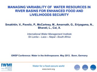
- 1. www.iwmi.org Water for a food-secure world MANAGING VARIABILITY OF WATER RESOURCES IN RIVER BASINS FOR ENHANCED FOOD AND LIVELIHOODS SECURITY Smakhtin, V., Pavelic, P., McCartney, M., Amarnath, G., Eriyagama, N., Bharati, L., Cai, X. International Water Management Institute Sri Lanka – Laos – Nepal –South Africa GWSP Conference: Water in the Anthropocene. May 2013. Bonn, Germany
- 2. www.iwmi.org Water for a food-secure world TOO MUCH…TOO LITTLE…
- 3. www.iwmi.org Water for a food-secure world Variability increases with climate change Source: Dartmouth Flood Observatory Variability increases water scarcity Variability has important positive implications Variability determines flood risk and damages FACETS OF WATER RESOURCES VARIABILITY
- 4. RRR IrrigationRainfed Basins RRR IrrigationRainfed Information Nile Volta, Niger Andes Zambezi, Limpopo Mekong Ganges Indus Amu Darya Syr Darya Tigris, Euphrates VARIABILITY MANAGEMENT AS A FOCAL RESEARCH AREA OF THE WLE PROGRAM Research Areas: • Variability Management • Resource Allocation and Benefit Sharing • Water-Energy-Food nexus in Basins • Water Accounting
- 5. www.iwmi.org Water for a food-secure world RESEARCH DIRECTIONS • Technical and economic design and appraisal of diverse water storage “portfolios” • Quantifying and considering ecosystem services of natural storage “infrastructure” in basin development • Detailed characterization and mapping of flood and drought risks and hot spots • Exploring underground solutions for conjunctive management of floods and droughts in a same basin
- 6. www.iwmi.org Water for a food-secure world WATER STORAGE CONTINUUM
- 7. www.iwmi.org Water for a food-secure world EVALUATING STORAGE OPTIONS Storage – Drought Deficit Index (how much of the long- term annual hydrological drought deficit is satisfied by the existing large storage capacity in a county) Livestock storage need (based on livestock density per cell, poverty levels, water availability, etc)
- 8. www.iwmi.org Water for a food-secure world EVALUATING REGULATING ROLE OF NATURAL STORAGE (example - wetlands in Zambezi basin)
- 9. www.iwmi.org Water for a food-secure world AGRICULTURE; PAGE (2005) POPULATION CIESIN - 2010 FLOOD EXPOSED GDP WB, 2010 • Globally - 90 grid cells of 100 km with catastrophic flood occurrence > 5, during 1900-2010 • Damage analysis ANALYSING FLOOD HOT SPOTS AND FLOOD MAPPING
- 10. www.iwmi.org Water for a food-secure world ANALYSING FLOODING HOT SPOTS AND FLOOD MAPPING Ganges Basin
- 11. ANALYSING FLOODING HOT SPOTS AND FLOOD MAPPING Flooded area (2000 – 2011) 2010 2010 8-days maps of inundation extent Annual maps of maximum inundation
- 12. www.iwmi.org Water for a food-secure world CONJUNCTIVE FLOOD AND DROUGHT MANAGEMENT Current Situation – Dry Season
- 13. www.iwmi.org Water for a food-secure world CONJUNCTIVE FLOOD AND DROUGHT MANAGEMENT Current Situation – Wet Season
- 14. www.iwmi.org Water for a food-secure world CONJUNCTIVE FLOOD AND DROUGHT MANAGEMENT Underground Taming of Floods for Irrigation (UTF-I); Wet season
- 15. www.iwmi.org Water for a food-secure world CONJUNCTIVE FLOOD AND DROUGHT MANAGEMENT Underground Taming of Floods for Irrigation (UTF-I); Dry season
- 16. www.iwmi.org Water for a food-secure world CONJUNCTIVE FLOOD AND DROUGHT MANAGEMENT UTF-I in plan view
- 17. CONJUNCTIVE FLOOD AND DROUGHT MANAGEMENT UTF-I desktop case study: Chao Phraya basin, Thailand Source: DFO Land Use Regular Flooding Alluvium aquifers
- 18. www.iwmi.org Water for a food-secure world CONJUNCTIVE FLOOD AND DROUGHT MANAGEMENT UTF-I desktop case study: Chao Phraya basin, Thailand • Harvest water only exceptionally wet years. 25% of the MAR is harvestable • 100 km2 dedicated land to flood harvesting needed (< 1% of the Basin area) • Additional 270,000 ha of irrigation possible • $150 mill / year - income to smallholder farmers • Cost < $ 1 Bill. Payback time – under 7 years • No analogs so far exist • Scaling up this solution to SA and SEA; needs: – Detailed design (should be as clear as the current design of surface reservoirs) – Identification of areas in a larger region that are suitable for piloting (flood hot spots, hydrogeology, etc) – Several pilot experiments
- 19. www.iwmi.org Water for a food-secure world CONCLUSIONS • Water resources Variability is a primary issue in basin water resources planning and management globally • Management of temporal Variability should consider a variety of storage options and their combinations, large and small, man-made and natural ones • Understanding and characterization of Variability hot spots may help target related research and investments • Subsurface solutions for water resources Variability management may have significant potential for flood and drought mitigation, increasing irrigation water availability and improving livelihoods. This potential is still to be realized
- 20. www.iwmi.org Water for a food-secure world 20 THANK YOU !
Hinweis der Redaktion
- Could be either too much or too little. This can be in the same place/ basin. Temporal and spatial variability. In water management – spatial variability was dealt with by interbasin transfers, and temporal – by surface storage reservoirs
- More arid areas also often have more variable rainfall And increases with CC ! Need to mention it or combine slides or both . Also- to “complicate things” – variability has positive aspects too.- mention This is why it was identified for intensive research under WLE program….
- Mentioned only 3 basins, but in principle the problem of uncoordinated modelling is more or less the same in all WLE basins
- Every time we build an artificial structure, it affects natural ecosystem services (e.g. regulating service). This needs to be factored into development
- Mention – Global economic damage from natural disasters 165 bill / a. The damage globally is more than current aid flow ,M ay rise to over $450 bill by 2030, floods take lion share of thisFlood hotspots are areas that are highly flood prone having frequent flood events; causing several damages both in livelihood and infrastructure / crop lossPAGE? - Pilot Analysis of Global Ecosystems (PAGE)Giriraj, Amarnath; Ameer, Mohamed; Aggarwal, Pramod; Smakhtin, Vladimir. 2012. Detecting spatio-temporal changes in the extent of seasonal and annual flooding in South Asia using multi-resolution satellite data. In Civco, D. L.; Ehlers, M.; Habib, S.; Maltese, A.; Messinger, D.; Michel, U.; Nikolakopoulos, K. G.; Schulz, K. (Eds.). Earth resources and environmental remote sensing/GIS applications III: proceedings of the International Society for Optics and Photonics (SPIE), Vol.8538, Amsterdam, Netherland, 1-6 July 2012. Bellingham, WA, USA: International Society for Optics and Photonics (SPIE). 11p.
- Example mapping products …The left map is for 2010 year example shows different classes of “water” “Mixed crops” class refer to areas that are inundated in cropland, meaning reflectance value has mixed values from vegetation and water content
- Need to mention Ganges Machine and other Machines somewhere