SlideShare ist ein Scribd-Unternehmen logo
1 von 27
Downloaden Sie, um offline zu lesen
LEISA Atmospheric Corrector (AC)
on EO1
George McCabe
NASA/Goddard Space Flight Center
Code 693
Greenbelt, MD 20771
LEISA Development History
• 1993 Selected for Pluto Express (PE) Mission under Advanced
Technology Insertion Program
• 1993 Baseline IR spectral imager for Highly Integrated Pluto Payload
System (HIPPS)
• 1994 Chosen for Small Satellite Technology Initiative (SSTI) Lewis
Mission
• 1996 Chosen for New Millennium Program Earth Observing-1 (EO-1)
Mission
• 1997 Space Act Agreement, participation in Field Studies with Boeing
Commercial Space Company, Resource21
• 2001 Phase B development New Horizons for NASA Pluto-Kuiper
Belt Mission
Instrument Characteristics
•

Correct Atmospheric Effects in High Spatial Resolution
Multispectral Imager Data
– Hyperspectral Imager
– Moderate Spectral Resolution (<10 nm)
– Moderate Spatial Resolution (<300 meter)
– Maximum Sampling Flexibility
– Minimum Impact on Spacecraft Resources
Wedged Filter Operation
LEISA Data Cube
Sample Image (Arid Lands Ecological Reserve)
Contribution to EO-1
•

Validation of Wedged Filter Approach for Spacecraft
Instrumentation

•

Atmospheric Correction for ALI Multispectral Images.

•

Atmospheric Correction for Landsat-7 Images (Formation Flying).

•

Direct Study of Spatial Resolution Degradation (CrossComparison with Hyperion).

•

Retrieved Atmospheric Parameters.

•

Cross-Comparisons with MODIS.
EO-1

Landsat-7
Less Than 1 Minute

Hyperspectral
Atmospheric Correction
(185 km @ 125 / 250 m)
Multispectral Images
(36 km @ 30 m)

TRWIS
Underflight
(Variable)

705 km
Altitude

AVIRIS Underflight
(10 km @ 20 m)

36 km
Landsat
Multispectral
Images
(185 km @ 30 m)

Grating-based
Hyperspectral
Images
(7.5 km @ 30 m)

7.7 km

185 km
AC Instrument Specifications
•
•

•
•
•
•
•
•
•

Spectral Coverage: 0.89 - 1.58 _m; 256 Bands Selected for
Optimal Correction of High Spatial Resolution Images
Spectral Resolution 2 Filter Sections:
Section 1 ~35 cm-1 (__: 5 nm @ 1.2 _m, 9 nm @ 1.6 _m)
Section 2 ~55 cm-1 (__ : 4 nm @ 0.9 _m, 8 nm @ 1.2 _m)
Swath Width: ~185 km; Matches Landsat
Spatial Resolution (pixel): 356 _radian (250 meter @ 705 km)
Three 256 x 256 Element InGaAs Arrays; TEC Stabilized (<285 K)
Three 15 Degree FOV 3 Element Lenses
Two Modules: “Bolt-on”Optics Module and Electronics Module
Mass: 10.5 kg (EM, 4.4 kg; OM 3.9 kg; Cable 2.2 kg)
Power: 48 W (Peak); <15 W (Orbit Average)
AC Linewidths
Optics Module Detail
In-Flight Calibration
•

•

•
•

Solar Calibration
– Radiometric Calibration (Relative and Absolute)
– Radiometric Stability
– Variable Light Level Response
– “Fixed Pattern” Noise Correction
Lunar Calibration
– Radiometric Calibration
– Image Quality
– Extended Duration Dark Current Stability
Surface Targets
– Radiometric/ Spectral Calibration (Ground Campaigns)
Dark Earth Looks
– Dark Current Stability
‘Fixed Pattern’ Signal
Extended Calibration
“Fixed Pattern” Signal Apparent After Launch
– Predominantly Additive Contribution
– Constant in Position and Time
– Reduced Accuracy in Low Illumination
Modified Radiometric Correction Procedure
– Requires Measurements Unaffected by Atmospheric
Absorption, Use Scanning Solar Data
– Scale Calculation Replaced by Calibration Lookup Table
Atmospheric Corrector Calibration System

ACCS
EO1
Level-0
Data

EXTRACT

REDUCE
VERIFY

Temporary
Storage

ARCHIVE
DELIVER

Permanent
Database

Level-1
Products
./rsi/idl_5.3
./ncsa/HDF4.1r3
./ncsa/4.1r3_irix64-64
./idldev/L0
./idldev/ACCS
./idldev/ACCS/bin
./idldev/ACCS/dev
./idldev/ACCS/doc
./idldev/ACCS/lib
./idldev/ACCS/data
./idldev/ACCS/install
./idldev/varosi
./idldev/astron
./idldev/freudenreich
./idldev/sterner_98apr
./gdaac/hdfeos

Calibration
System
Software
•150+ program modules
Processing Options
accs@fastie-bin-2 LAC_Option -l
to_level 1R
keepall_prod yes
eo1q_execute standard
null_calibration no
offset_source local_dark
scale_source default
replace_bad yes
force_cal no
cal_matchkey preset2
enhance_qlook yes
deliver_to lacsend
archive_file lacstor
post_cleanup yes
do_tapels both
mail_report yes
getsome_sleep yes
lookforward2_vacation yes

#
#
#
#
#
#
#
#
#
#
#
#
#
#
#
#
#

1R, 1G
no (highest only), yes
none, standard, extended
no, yes
default, local_dark
default, extended, local_cal
no, yes
no, yes
preset2, facist3, preset1, anarchist0
yes, no
lacsend, tarsend, tape, null
lacstor, tape, null
no, yes
both, tape, eo1tape, none
no, yes
yes, no
yes, no
Session Logs
• goACCS_EO1###.log
• LAC_Extract/Reduce0/Deliver/ArchiveYYYYMonDD@HHMMSS.log
• goClean.log
• dat3/dlt4_ACCS###.lst
• Scenes_Processed.lst
ACCS Performance
•
•
•

> 1500 scenes processed
8.5 Gb of data per session
1.5 hrs/Gb total processing time*
( Extract + Reduce + Archive )

* excepting extended calibration
HDF File Creation
Example
L0 = LACDATA+‘/lac/20013010839_AKS/EO11520372001301112K0/’+ $
‘AC2001301054952_AKS_01.L0’
GENICAL, L0, /VERBOSE, /OFFSET, $
MATCH={TYPE:1,TIME:1.0,ARRAY1T:10,ARRAY2T:10,ARRAY3T:10,STAT:'0111'}
GENHDF, L0, RUN_LABEL='2002Jan23@064222', /VERBOSE, /NON_INTERACTIVE
L1 = VERYGEN1R( L0 )
TIMEUPDT, L1
GEN1RSDS, L1
RDUPDT, L1, /NON_INTERACTIVE
Associated Files
• YYYY_DDD_lac/gps/acs.hdf
• 00indexEO1###
• ACYYYYDDDHHMMSS_RRR_##.L0_calcoef.b4
•
"
.L0_calpnotes.txt
•
•
•
•
•
•

"
"
"
"
"
"

.L0_stats
.L0_stats-M/S.bmp
.L0_trace0/C
.L0/1R_wint
.L0_update
.L1R_q-bands/frames.jpg

•

"

.L1R_geo
Level-1 HDF Products
Level-1R

Level-1G

Type

HDF v4 Grid

HDF-EOS v2.4 Swath

Processing Inputs

L0 Science, L0 Dark, scale
coefficients, lac / gps / acs metadata

L1R Science, lac / gps / acs
metadata, pointing map,
wavelength map, corrected frame
times

Key Attributes

Data Start Time, Level 1R: Dataset
Type, Response SD: Filenames,
Scale Factor

Spectra: Scale Factor

SD Structures

Offset, Response, Pixel_Map,
Wavelength_Map, Level 1R
(radiometrically calibrated, 768 x
Nframes x 256)

Latitude, Longitude, Wavelength,
Spectra (geo-located and band
rectified, NY x NX x 256)

Associated Products

Raw frame/pixel statistics, quicklook
images, ENVI header

Geo-location info

Usage

Modified ENVI input procedures
(BSQ)

ENVI Generic HDF (BIP)
Science Data Formats
• instrument clock, header data
• pixel pointing map, filter frequency map
• spacecraft meta data (YYYY_DDD_lac/gps/acs.hdf)

Ii,j,t ⇒ Ix,y,ν
ν
Level-1R

Level-1G
Band Alignment

Scan of Cuprite, NV 1200 frames
Color Composite
Image

Cuprite, NV

Mar. 1, 2001

red=1.32, green=1.03, blue=0.98 (µm)
Spectra
Cuprite, NV

March 1, 2001

3000
2500
2000
1500
1000
500
0
0.9

1

1.1

1.2

1.3

1.4

1.5

-500
[298,600]

[299,599]

[299,600]

[299,601]

[546,584]

[546,585]

[546,586]

[547,585]

1.6
Cuprite, NV
Scene-ID: EO10410342001060111PP

Lake Frome
Scene-ID: EO10970812001021111PP

Rochester, NY
Scene-ID: EO10160302001125111PP

Snake River
Scene-ID: EO10410302001140111PP

Suez Canal
Scene-ID: EO11760392001046111PP

Venice
Scene-ID: EO11920282001158112PP

Weitere ähnliche Inhalte

Was ist angesagt?

Senseapp13 keynote
Senseapp13 keynoteSenseapp13 keynote
Senseapp13 keynoteRaja Jurdak
 
ground penetration rader
ground  penetration raderground  penetration rader
ground penetration raderAmir Khan
 
Durham Ranch Seismic Acquisition
Durham Ranch Seismic AcquisitionDurham Ranch Seismic Acquisition
Durham Ranch Seismic AcquisitionHans Ecke
 
2020 10 geo meeting nyambayar
2020 10 geo meeting nyambayar2020 10 geo meeting nyambayar
2020 10 geo meeting nyambayarGeoMedeelel
 
Ground penetrating radar
Ground penetrating radarGround penetrating radar
Ground penetrating radarkasarlanaga
 
nisizawa_IGARSS_HSRL_FR2.T07.ppt
nisizawa_IGARSS_HSRL_FR2.T07.pptnisizawa_IGARSS_HSRL_FR2.T07.ppt
nisizawa_IGARSS_HSRL_FR2.T07.pptgrssieee
 
636908main paul presentation
636908main paul presentation636908main paul presentation
636908main paul presentationClifford Stone
 
Application of Ground Penetrating Radar (GPR) In Detecting Target of Interest
Application of Ground Penetrating Radar (GPR) In Detecting Target of InterestApplication of Ground Penetrating Radar (GPR) In Detecting Target of Interest
Application of Ground Penetrating Radar (GPR) In Detecting Target of InterestIRJET Journal
 
Ralph.basilio
Ralph.basilioRalph.basilio
Ralph.basilioNASAPMC
 
NEON Airborne Operations
NEON Airborne OperationsNEON Airborne Operations
NEON Airborne Operationsjjparnell
 
igarss11swot-vadon-callahan-psc-s3.110725.pptx
igarss11swot-vadon-callahan-psc-s3.110725.pptxigarss11swot-vadon-callahan-psc-s3.110725.pptx
igarss11swot-vadon-callahan-psc-s3.110725.pptxgrssieee
 
IGARSS 2011_Priestley.ppt
IGARSS 2011_Priestley.pptIGARSS 2011_Priestley.ppt
IGARSS 2011_Priestley.pptgrssieee
 
Current &amp; Future Spaceborne Sar Systems
Current &amp; Future Spaceborne Sar SystemsCurrent &amp; Future Spaceborne Sar Systems
Current &amp; Future Spaceborne Sar Systemsgpetrie
 
IGARSS_2016_SPC_OP_asSubmitted
IGARSS_2016_SPC_OP_asSubmittedIGARSS_2016_SPC_OP_asSubmitted
IGARSS_2016_SPC_OP_asSubmittedomkarpradhan
 
MSc Project Proposal: Comparing Terrestrial Laser Scanning and Photogrammetry
MSc Project Proposal: Comparing Terrestrial Laser Scanning and PhotogrammetryMSc Project Proposal: Comparing Terrestrial Laser Scanning and Photogrammetry
MSc Project Proposal: Comparing Terrestrial Laser Scanning and PhotogrammetryPeter McCready
 
LiDAR Introduction @ #DataWeekend
LiDAR Introduction @ #DataWeekendLiDAR Introduction @ #DataWeekend
LiDAR Introduction @ #DataWeekendcodefortomorrow
 
Pasolli_TU1_TO3.4.pptx
Pasolli_TU1_TO3.4.pptxPasolli_TU1_TO3.4.pptx
Pasolli_TU1_TO3.4.pptxgrssieee
 

Was ist angesagt? (19)

Senseapp13 keynote
Senseapp13 keynoteSenseapp13 keynote
Senseapp13 keynote
 
ground penetration rader
ground  penetration raderground  penetration rader
ground penetration rader
 
Durham Ranch Seismic Acquisition
Durham Ranch Seismic AcquisitionDurham Ranch Seismic Acquisition
Durham Ranch Seismic Acquisition
 
2020 10 geo meeting nyambayar
2020 10 geo meeting nyambayar2020 10 geo meeting nyambayar
2020 10 geo meeting nyambayar
 
Ground penetrating radar
Ground penetrating radarGround penetrating radar
Ground penetrating radar
 
nisizawa_IGARSS_HSRL_FR2.T07.ppt
nisizawa_IGARSS_HSRL_FR2.T07.pptnisizawa_IGARSS_HSRL_FR2.T07.ppt
nisizawa_IGARSS_HSRL_FR2.T07.ppt
 
636908main paul presentation
636908main paul presentation636908main paul presentation
636908main paul presentation
 
Application of Ground Penetrating Radar (GPR) In Detecting Target of Interest
Application of Ground Penetrating Radar (GPR) In Detecting Target of InterestApplication of Ground Penetrating Radar (GPR) In Detecting Target of Interest
Application of Ground Penetrating Radar (GPR) In Detecting Target of Interest
 
Ralph.basilio
Ralph.basilioRalph.basilio
Ralph.basilio
 
NEON Airborne Operations
NEON Airborne OperationsNEON Airborne Operations
NEON Airborne Operations
 
igarss11swot-vadon-callahan-psc-s3.110725.pptx
igarss11swot-vadon-callahan-psc-s3.110725.pptxigarss11swot-vadon-callahan-psc-s3.110725.pptx
igarss11swot-vadon-callahan-psc-s3.110725.pptx
 
GAIA @SpaceUpParis
GAIA @SpaceUpParisGAIA @SpaceUpParis
GAIA @SpaceUpParis
 
IGARSS 2011_Priestley.ppt
IGARSS 2011_Priestley.pptIGARSS 2011_Priestley.ppt
IGARSS 2011_Priestley.ppt
 
Deconvolution
DeconvolutionDeconvolution
Deconvolution
 
Current &amp; Future Spaceborne Sar Systems
Current &amp; Future Spaceborne Sar SystemsCurrent &amp; Future Spaceborne Sar Systems
Current &amp; Future Spaceborne Sar Systems
 
IGARSS_2016_SPC_OP_asSubmitted
IGARSS_2016_SPC_OP_asSubmittedIGARSS_2016_SPC_OP_asSubmitted
IGARSS_2016_SPC_OP_asSubmitted
 
MSc Project Proposal: Comparing Terrestrial Laser Scanning and Photogrammetry
MSc Project Proposal: Comparing Terrestrial Laser Scanning and PhotogrammetryMSc Project Proposal: Comparing Terrestrial Laser Scanning and Photogrammetry
MSc Project Proposal: Comparing Terrestrial Laser Scanning and Photogrammetry
 
LiDAR Introduction @ #DataWeekend
LiDAR Introduction @ #DataWeekendLiDAR Introduction @ #DataWeekend
LiDAR Introduction @ #DataWeekend
 
Pasolli_TU1_TO3.4.pptx
Pasolli_TU1_TO3.4.pptxPasolli_TU1_TO3.4.pptx
Pasolli_TU1_TO3.4.pptx
 

Andere mochten auch (7)

Workshop Discussion: HDF & HDF-EOS Future Direction
Workshop Discussion: HDF & HDF-EOS Future DirectionWorkshop Discussion: HDF & HDF-EOS Future Direction
Workshop Discussion: HDF & HDF-EOS Future Direction
 
HDF and HDF-EOS Experiences and Applications
HDF and HDF-EOS Experiences and ApplicationsHDF and HDF-EOS Experiences and Applications
HDF and HDF-EOS Experiences and Applications
 
HDF-EOS Aura File Format Guidelines
HDF-EOS Aura File Format GuidelinesHDF-EOS Aura File Format Guidelines
HDF-EOS Aura File Format Guidelines
 
Subsetting
SubsettingSubsetting
Subsetting
 
Transitioning from HDF4 to HDF5
Transitioning from HDF4 to HDF5Transitioning from HDF4 to HDF5
Transitioning from HDF4 to HDF5
 
Welcome to HDF Workshop V
Welcome to HDF Workshop VWelcome to HDF Workshop V
Welcome to HDF Workshop V
 
HDF Update
HDF UpdateHDF Update
HDF Update
 

Ähnlich wie Correct Atmospheric Effects in High Spatial Resolution Imagery

A coupled Electromagnetic-Mechanical analysis of next generation Radio Telesc...
A coupled Electromagnetic-Mechanical analysis of next generation Radio Telesc...A coupled Electromagnetic-Mechanical analysis of next generation Radio Telesc...
A coupled Electromagnetic-Mechanical analysis of next generation Radio Telesc...Altair
 
TEMPEST AEM FORM 2000
TEMPEST AEM FORM 2000TEMPEST AEM FORM 2000
TEMPEST AEM FORM 2000Brett Johnson
 
fr2.t03.5.2-micron IPDA Presentation at IGARSS-2011-Final-Revised-1.pptx
fr2.t03.5.2-micron IPDA Presentation at IGARSS-2011-Final-Revised-1.pptxfr2.t03.5.2-micron IPDA Presentation at IGARSS-2011-Final-Revised-1.pptx
fr2.t03.5.2-micron IPDA Presentation at IGARSS-2011-Final-Revised-1.pptxgrssieee
 
637124main staehle presentation
637124main staehle presentation637124main staehle presentation
637124main staehle presentationClifford Stone
 
Space Situational Awareness Forum - GERMAN AEROSPACE CENTRE Presentation
Space Situational Awareness Forum - GERMAN AEROSPACE CENTRE PresentationSpace Situational Awareness Forum - GERMAN AEROSPACE CENTRE Presentation
Space Situational Awareness Forum - GERMAN AEROSPACE CENTRE PresentationSpace_Situational_Awareness
 
AI models for Ice Classification - ExtremeEarth Open Workshop
AI models for Ice Classification - ExtremeEarth Open WorkshopAI models for Ice Classification - ExtremeEarth Open Workshop
AI models for Ice Classification - ExtremeEarth Open WorkshopExtremeEarth
 
Environmental Remote Sensing
 Environmental Remote Sensing  Environmental Remote Sensing
Environmental Remote Sensing Ghassan Hadi
 
WaPOR version 3 - H Pelgrum - eLeaf - 05 May 2023.pdf
WaPOR version 3 - H Pelgrum - eLeaf - 05 May 2023.pdfWaPOR version 3 - H Pelgrum - eLeaf - 05 May 2023.pdf
WaPOR version 3 - H Pelgrum - eLeaf - 05 May 2023.pdfWaPOR
 
Network-based UE mobility estimation in mobile networks
Network-based UE mobility estimation in mobile networksNetwork-based UE mobility estimation in mobile networks
Network-based UE mobility estimation in mobile networksPopescu Dalia
 
Training and hands-on SNAP Sentinel-1 IW SLC Interferogram and Displacement
Training and hands-on SNAP Sentinel-1 IW SLC Interferogram and DisplacementTraining and hands-on SNAP Sentinel-1 IW SLC Interferogram and Displacement
Training and hands-on SNAP Sentinel-1 IW SLC Interferogram and DisplacementEmmanuel Mathot
 
Interstellar explorermay02
Interstellar explorermay02Interstellar explorermay02
Interstellar explorermay02Clifford Stone
 
2017 ASPRS-RMR Big Data Track: Using NASA's AppEEARS to Slice and Dice Big Ea...
2017 ASPRS-RMR Big Data Track: Using NASA's AppEEARS to Slice and Dice Big Ea...2017 ASPRS-RMR Big Data Track: Using NASA's AppEEARS to Slice and Dice Big Ea...
2017 ASPRS-RMR Big Data Track: Using NASA's AppEEARS to Slice and Dice Big Ea...GIS in the Rockies
 
Interstellar explorerjun01
Interstellar explorerjun01Interstellar explorerjun01
Interstellar explorerjun01Clifford Stone
 
THE THERMAL INFRARED SENSOR ON THE LANDSAT DATA CONTINUITY MISSION.pdf
THE THERMAL INFRARED SENSOR ON THE LANDSAT DATA CONTINUITY MISSION.pdfTHE THERMAL INFRARED SENSOR ON THE LANDSAT DATA CONTINUITY MISSION.pdf
THE THERMAL INFRARED SENSOR ON THE LANDSAT DATA CONTINUITY MISSION.pdfMuhammadMuhaimin54
 
The Matsu Project - Open Source Software for Processing Satellite Imagery Data
The Matsu Project - Open Source Software for Processing Satellite Imagery DataThe Matsu Project - Open Source Software for Processing Satellite Imagery Data
The Matsu Project - Open Source Software for Processing Satellite Imagery DataRobert Grossman
 

Ähnlich wie Correct Atmospheric Effects in High Spatial Resolution Imagery (20)

GeoCAPE Strategies
GeoCAPE StrategiesGeoCAPE Strategies
GeoCAPE Strategies
 
A coupled Electromagnetic-Mechanical analysis of next generation Radio Telesc...
A coupled Electromagnetic-Mechanical analysis of next generation Radio Telesc...A coupled Electromagnetic-Mechanical analysis of next generation Radio Telesc...
A coupled Electromagnetic-Mechanical analysis of next generation Radio Telesc...
 
TEMPEST AEM FORM 2000
TEMPEST AEM FORM 2000TEMPEST AEM FORM 2000
TEMPEST AEM FORM 2000
 
fr2.t03.5.2-micron IPDA Presentation at IGARSS-2011-Final-Revised-1.pptx
fr2.t03.5.2-micron IPDA Presentation at IGARSS-2011-Final-Revised-1.pptxfr2.t03.5.2-micron IPDA Presentation at IGARSS-2011-Final-Revised-1.pptx
fr2.t03.5.2-micron IPDA Presentation at IGARSS-2011-Final-Revised-1.pptx
 
NPOESS Program Overview
NPOESS Program OverviewNPOESS Program Overview
NPOESS Program Overview
 
637124main staehle presentation
637124main staehle presentation637124main staehle presentation
637124main staehle presentation
 
Space Situational Awareness Forum - GERMAN AEROSPACE CENTRE Presentation
Space Situational Awareness Forum - GERMAN AEROSPACE CENTRE PresentationSpace Situational Awareness Forum - GERMAN AEROSPACE CENTRE Presentation
Space Situational Awareness Forum - GERMAN AEROSPACE CENTRE Presentation
 
Dr Stuart Eves
Dr Stuart Eves   Dr Stuart Eves
Dr Stuart Eves
 
AI models for Ice Classification - ExtremeEarth Open Workshop
AI models for Ice Classification - ExtremeEarth Open WorkshopAI models for Ice Classification - ExtremeEarth Open Workshop
AI models for Ice Classification - ExtremeEarth Open Workshop
 
Environmental Remote Sensing
 Environmental Remote Sensing  Environmental Remote Sensing
Environmental Remote Sensing
 
WaPOR version 3 - H Pelgrum - eLeaf - 05 May 2023.pdf
WaPOR version 3 - H Pelgrum - eLeaf - 05 May 2023.pdfWaPOR version 3 - H Pelgrum - eLeaf - 05 May 2023.pdf
WaPOR version 3 - H Pelgrum - eLeaf - 05 May 2023.pdf
 
CLIM: Transition Workshop - Optimization Methods in Remote Sensing - Jessica...
CLIM: Transition Workshop - Optimization Methods in Remote Sensing  - Jessica...CLIM: Transition Workshop - Optimization Methods in Remote Sensing  - Jessica...
CLIM: Transition Workshop - Optimization Methods in Remote Sensing - Jessica...
 
Network-based UE mobility estimation in mobile networks
Network-based UE mobility estimation in mobile networksNetwork-based UE mobility estimation in mobile networks
Network-based UE mobility estimation in mobile networks
 
2011 06 17
2011 06 172011 06 17
2011 06 17
 
Training and hands-on SNAP Sentinel-1 IW SLC Interferogram and Displacement
Training and hands-on SNAP Sentinel-1 IW SLC Interferogram and DisplacementTraining and hands-on SNAP Sentinel-1 IW SLC Interferogram and Displacement
Training and hands-on SNAP Sentinel-1 IW SLC Interferogram and Displacement
 
Interstellar explorermay02
Interstellar explorermay02Interstellar explorermay02
Interstellar explorermay02
 
2017 ASPRS-RMR Big Data Track: Using NASA's AppEEARS to Slice and Dice Big Ea...
2017 ASPRS-RMR Big Data Track: Using NASA's AppEEARS to Slice and Dice Big Ea...2017 ASPRS-RMR Big Data Track: Using NASA's AppEEARS to Slice and Dice Big Ea...
2017 ASPRS-RMR Big Data Track: Using NASA's AppEEARS to Slice and Dice Big Ea...
 
Interstellar explorerjun01
Interstellar explorerjun01Interstellar explorerjun01
Interstellar explorerjun01
 
THE THERMAL INFRARED SENSOR ON THE LANDSAT DATA CONTINUITY MISSION.pdf
THE THERMAL INFRARED SENSOR ON THE LANDSAT DATA CONTINUITY MISSION.pdfTHE THERMAL INFRARED SENSOR ON THE LANDSAT DATA CONTINUITY MISSION.pdf
THE THERMAL INFRARED SENSOR ON THE LANDSAT DATA CONTINUITY MISSION.pdf
 
The Matsu Project - Open Source Software for Processing Satellite Imagery Data
The Matsu Project - Open Source Software for Processing Satellite Imagery DataThe Matsu Project - Open Source Software for Processing Satellite Imagery Data
The Matsu Project - Open Source Software for Processing Satellite Imagery Data
 

Mehr von The HDF-EOS Tools and Information Center

STARE-PODS: A Versatile Data Store Leveraging the HDF Virtual Object Layer fo...
STARE-PODS: A Versatile Data Store Leveraging the HDF Virtual Object Layer fo...STARE-PODS: A Versatile Data Store Leveraging the HDF Virtual Object Layer fo...
STARE-PODS: A Versatile Data Store Leveraging the HDF Virtual Object Layer fo...The HDF-EOS Tools and Information Center
 

Mehr von The HDF-EOS Tools and Information Center (20)

Cloud-Optimized HDF5 Files
Cloud-Optimized HDF5 FilesCloud-Optimized HDF5 Files
Cloud-Optimized HDF5 Files
 
Accessing HDF5 data in the cloud with HSDS
Accessing HDF5 data in the cloud with HSDSAccessing HDF5 data in the cloud with HSDS
Accessing HDF5 data in the cloud with HSDS
 
The State of HDF
The State of HDFThe State of HDF
The State of HDF
 
Highly Scalable Data Service (HSDS) Performance Features
Highly Scalable Data Service (HSDS) Performance FeaturesHighly Scalable Data Service (HSDS) Performance Features
Highly Scalable Data Service (HSDS) Performance Features
 
Creating Cloud-Optimized HDF5 Files
Creating Cloud-Optimized HDF5 FilesCreating Cloud-Optimized HDF5 Files
Creating Cloud-Optimized HDF5 Files
 
HDF5 OPeNDAP Handler Updates, and Performance Discussion
HDF5 OPeNDAP Handler Updates, and Performance DiscussionHDF5 OPeNDAP Handler Updates, and Performance Discussion
HDF5 OPeNDAP Handler Updates, and Performance Discussion
 
Hyrax: Serving Data from S3
Hyrax: Serving Data from S3Hyrax: Serving Data from S3
Hyrax: Serving Data from S3
 
Accessing Cloud Data and Services Using EDL, Pydap, MATLAB
Accessing Cloud Data and Services Using EDL, Pydap, MATLABAccessing Cloud Data and Services Using EDL, Pydap, MATLAB
Accessing Cloud Data and Services Using EDL, Pydap, MATLAB
 
HDF - Current status and Future Directions
HDF - Current status and Future DirectionsHDF - Current status and Future Directions
HDF - Current status and Future Directions
 
HDFEOS.org User Analsys, Updates, and Future
HDFEOS.org User Analsys, Updates, and FutureHDFEOS.org User Analsys, Updates, and Future
HDFEOS.org User Analsys, Updates, and Future
 
HDF - Current status and Future Directions
HDF - Current status and Future Directions HDF - Current status and Future Directions
HDF - Current status and Future Directions
 
H5Coro: The Cloud-Optimized Read-Only Library
H5Coro: The Cloud-Optimized Read-Only LibraryH5Coro: The Cloud-Optimized Read-Only Library
H5Coro: The Cloud-Optimized Read-Only Library
 
MATLAB Modernization on HDF5 1.10
MATLAB Modernization on HDF5 1.10MATLAB Modernization on HDF5 1.10
MATLAB Modernization on HDF5 1.10
 
HDF for the Cloud - Serverless HDF
HDF for the Cloud - Serverless HDFHDF for the Cloud - Serverless HDF
HDF for the Cloud - Serverless HDF
 
HDF5 <-> Zarr
HDF5 <-> ZarrHDF5 <-> Zarr
HDF5 <-> Zarr
 
HDF for the Cloud - New HDF Server Features
HDF for the Cloud - New HDF Server FeaturesHDF for the Cloud - New HDF Server Features
HDF for the Cloud - New HDF Server Features
 
Apache Drill and Unidata THREDDS Data Server for NASA HDF-EOS on S3
Apache Drill and Unidata THREDDS Data Server for NASA HDF-EOS on S3Apache Drill and Unidata THREDDS Data Server for NASA HDF-EOS on S3
Apache Drill and Unidata THREDDS Data Server for NASA HDF-EOS on S3
 
STARE-PODS: A Versatile Data Store Leveraging the HDF Virtual Object Layer fo...
STARE-PODS: A Versatile Data Store Leveraging the HDF Virtual Object Layer fo...STARE-PODS: A Versatile Data Store Leveraging the HDF Virtual Object Layer fo...
STARE-PODS: A Versatile Data Store Leveraging the HDF Virtual Object Layer fo...
 
HDF5 and Ecosystem: What Is New?
HDF5 and Ecosystem: What Is New?HDF5 and Ecosystem: What Is New?
HDF5 and Ecosystem: What Is New?
 
HDF5 Roadmap 2019-2020
HDF5 Roadmap 2019-2020HDF5 Roadmap 2019-2020
HDF5 Roadmap 2019-2020
 

Kürzlich hochgeladen

Enhancing Worker Digital Experience: A Hands-on Workshop for Partners
Enhancing Worker Digital Experience: A Hands-on Workshop for PartnersEnhancing Worker Digital Experience: A Hands-on Workshop for Partners
Enhancing Worker Digital Experience: A Hands-on Workshop for PartnersThousandEyes
 
Swan(sea) Song – personal research during my six years at Swansea ... and bey...
Swan(sea) Song – personal research during my six years at Swansea ... and bey...Swan(sea) Song – personal research during my six years at Swansea ... and bey...
Swan(sea) Song – personal research during my six years at Swansea ... and bey...Alan Dix
 
Scaling API-first – The story of a global engineering organization
Scaling API-first – The story of a global engineering organizationScaling API-first – The story of a global engineering organization
Scaling API-first – The story of a global engineering organizationRadu Cotescu
 
Kotlin Multiplatform & Compose Multiplatform - Starter kit for pragmatics
Kotlin Multiplatform & Compose Multiplatform - Starter kit for pragmaticsKotlin Multiplatform & Compose Multiplatform - Starter kit for pragmatics
Kotlin Multiplatform & Compose Multiplatform - Starter kit for pragmaticscarlostorres15106
 
Salesforce Community Group Quito, Salesforce 101
Salesforce Community Group Quito, Salesforce 101Salesforce Community Group Quito, Salesforce 101
Salesforce Community Group Quito, Salesforce 101Paola De la Torre
 
08448380779 Call Girls In Greater Kailash - I Women Seeking Men
08448380779 Call Girls In Greater Kailash - I Women Seeking Men08448380779 Call Girls In Greater Kailash - I Women Seeking Men
08448380779 Call Girls In Greater Kailash - I Women Seeking MenDelhi Call girls
 
Key Features Of Token Development (1).pptx
Key  Features Of Token  Development (1).pptxKey  Features Of Token  Development (1).pptx
Key Features Of Token Development (1).pptxLBM Solutions
 
Slack Application Development 101 Slides
Slack Application Development 101 SlidesSlack Application Development 101 Slides
Slack Application Development 101 Slidespraypatel2
 
Beyond Boundaries: Leveraging No-Code Solutions for Industry Innovation
Beyond Boundaries: Leveraging No-Code Solutions for Industry InnovationBeyond Boundaries: Leveraging No-Code Solutions for Industry Innovation
Beyond Boundaries: Leveraging No-Code Solutions for Industry InnovationSafe Software
 
08448380779 Call Girls In Friends Colony Women Seeking Men
08448380779 Call Girls In Friends Colony Women Seeking Men08448380779 Call Girls In Friends Colony Women Seeking Men
08448380779 Call Girls In Friends Colony Women Seeking MenDelhi Call girls
 
SQL Database Design For Developers at php[tek] 2024
SQL Database Design For Developers at php[tek] 2024SQL Database Design For Developers at php[tek] 2024
SQL Database Design For Developers at php[tek] 2024Scott Keck-Warren
 
Breaking the Kubernetes Kill Chain: Host Path Mount
Breaking the Kubernetes Kill Chain: Host Path MountBreaking the Kubernetes Kill Chain: Host Path Mount
Breaking the Kubernetes Kill Chain: Host Path MountPuma Security, LLC
 
How to Remove Document Management Hurdles with X-Docs?
How to Remove Document Management Hurdles with X-Docs?How to Remove Document Management Hurdles with X-Docs?
How to Remove Document Management Hurdles with X-Docs?XfilesPro
 
Integration and Automation in Practice: CI/CD in Mule Integration and Automat...
Integration and Automation in Practice: CI/CD in Mule Integration and Automat...Integration and Automation in Practice: CI/CD in Mule Integration and Automat...
Integration and Automation in Practice: CI/CD in Mule Integration and Automat...Patryk Bandurski
 
08448380779 Call Girls In Civil Lines Women Seeking Men
08448380779 Call Girls In Civil Lines Women Seeking Men08448380779 Call Girls In Civil Lines Women Seeking Men
08448380779 Call Girls In Civil Lines Women Seeking MenDelhi Call girls
 
Presentation on how to chat with PDF using ChatGPT code interpreter
Presentation on how to chat with PDF using ChatGPT code interpreterPresentation on how to chat with PDF using ChatGPT code interpreter
Presentation on how to chat with PDF using ChatGPT code interpreternaman860154
 
Injustice - Developers Among Us (SciFiDevCon 2024)
Injustice - Developers Among Us (SciFiDevCon 2024)Injustice - Developers Among Us (SciFiDevCon 2024)
Injustice - Developers Among Us (SciFiDevCon 2024)Allon Mureinik
 
08448380779 Call Girls In Diplomatic Enclave Women Seeking Men
08448380779 Call Girls In Diplomatic Enclave Women Seeking Men08448380779 Call Girls In Diplomatic Enclave Women Seeking Men
08448380779 Call Girls In Diplomatic Enclave Women Seeking MenDelhi Call girls
 
Transcript: #StandardsGoals for 2024: What’s new for BISAC - Tech Forum 2024
Transcript: #StandardsGoals for 2024: What’s new for BISAC - Tech Forum 2024Transcript: #StandardsGoals for 2024: What’s new for BISAC - Tech Forum 2024
Transcript: #StandardsGoals for 2024: What’s new for BISAC - Tech Forum 2024BookNet Canada
 
FULL ENJOY 🔝 8264348440 🔝 Call Girls in Diplomatic Enclave | Delhi
FULL ENJOY 🔝 8264348440 🔝 Call Girls in Diplomatic Enclave | DelhiFULL ENJOY 🔝 8264348440 🔝 Call Girls in Diplomatic Enclave | Delhi
FULL ENJOY 🔝 8264348440 🔝 Call Girls in Diplomatic Enclave | Delhisoniya singh
 

Kürzlich hochgeladen (20)

Enhancing Worker Digital Experience: A Hands-on Workshop for Partners
Enhancing Worker Digital Experience: A Hands-on Workshop for PartnersEnhancing Worker Digital Experience: A Hands-on Workshop for Partners
Enhancing Worker Digital Experience: A Hands-on Workshop for Partners
 
Swan(sea) Song – personal research during my six years at Swansea ... and bey...
Swan(sea) Song – personal research during my six years at Swansea ... and bey...Swan(sea) Song – personal research during my six years at Swansea ... and bey...
Swan(sea) Song – personal research during my six years at Swansea ... and bey...
 
Scaling API-first – The story of a global engineering organization
Scaling API-first – The story of a global engineering organizationScaling API-first – The story of a global engineering organization
Scaling API-first – The story of a global engineering organization
 
Kotlin Multiplatform & Compose Multiplatform - Starter kit for pragmatics
Kotlin Multiplatform & Compose Multiplatform - Starter kit for pragmaticsKotlin Multiplatform & Compose Multiplatform - Starter kit for pragmatics
Kotlin Multiplatform & Compose Multiplatform - Starter kit for pragmatics
 
Salesforce Community Group Quito, Salesforce 101
Salesforce Community Group Quito, Salesforce 101Salesforce Community Group Quito, Salesforce 101
Salesforce Community Group Quito, Salesforce 101
 
08448380779 Call Girls In Greater Kailash - I Women Seeking Men
08448380779 Call Girls In Greater Kailash - I Women Seeking Men08448380779 Call Girls In Greater Kailash - I Women Seeking Men
08448380779 Call Girls In Greater Kailash - I Women Seeking Men
 
Key Features Of Token Development (1).pptx
Key  Features Of Token  Development (1).pptxKey  Features Of Token  Development (1).pptx
Key Features Of Token Development (1).pptx
 
Slack Application Development 101 Slides
Slack Application Development 101 SlidesSlack Application Development 101 Slides
Slack Application Development 101 Slides
 
Beyond Boundaries: Leveraging No-Code Solutions for Industry Innovation
Beyond Boundaries: Leveraging No-Code Solutions for Industry InnovationBeyond Boundaries: Leveraging No-Code Solutions for Industry Innovation
Beyond Boundaries: Leveraging No-Code Solutions for Industry Innovation
 
08448380779 Call Girls In Friends Colony Women Seeking Men
08448380779 Call Girls In Friends Colony Women Seeking Men08448380779 Call Girls In Friends Colony Women Seeking Men
08448380779 Call Girls In Friends Colony Women Seeking Men
 
SQL Database Design For Developers at php[tek] 2024
SQL Database Design For Developers at php[tek] 2024SQL Database Design For Developers at php[tek] 2024
SQL Database Design For Developers at php[tek] 2024
 
Breaking the Kubernetes Kill Chain: Host Path Mount
Breaking the Kubernetes Kill Chain: Host Path MountBreaking the Kubernetes Kill Chain: Host Path Mount
Breaking the Kubernetes Kill Chain: Host Path Mount
 
How to Remove Document Management Hurdles with X-Docs?
How to Remove Document Management Hurdles with X-Docs?How to Remove Document Management Hurdles with X-Docs?
How to Remove Document Management Hurdles with X-Docs?
 
Integration and Automation in Practice: CI/CD in Mule Integration and Automat...
Integration and Automation in Practice: CI/CD in Mule Integration and Automat...Integration and Automation in Practice: CI/CD in Mule Integration and Automat...
Integration and Automation in Practice: CI/CD in Mule Integration and Automat...
 
08448380779 Call Girls In Civil Lines Women Seeking Men
08448380779 Call Girls In Civil Lines Women Seeking Men08448380779 Call Girls In Civil Lines Women Seeking Men
08448380779 Call Girls In Civil Lines Women Seeking Men
 
Presentation on how to chat with PDF using ChatGPT code interpreter
Presentation on how to chat with PDF using ChatGPT code interpreterPresentation on how to chat with PDF using ChatGPT code interpreter
Presentation on how to chat with PDF using ChatGPT code interpreter
 
Injustice - Developers Among Us (SciFiDevCon 2024)
Injustice - Developers Among Us (SciFiDevCon 2024)Injustice - Developers Among Us (SciFiDevCon 2024)
Injustice - Developers Among Us (SciFiDevCon 2024)
 
08448380779 Call Girls In Diplomatic Enclave Women Seeking Men
08448380779 Call Girls In Diplomatic Enclave Women Seeking Men08448380779 Call Girls In Diplomatic Enclave Women Seeking Men
08448380779 Call Girls In Diplomatic Enclave Women Seeking Men
 
Transcript: #StandardsGoals for 2024: What’s new for BISAC - Tech Forum 2024
Transcript: #StandardsGoals for 2024: What’s new for BISAC - Tech Forum 2024Transcript: #StandardsGoals for 2024: What’s new for BISAC - Tech Forum 2024
Transcript: #StandardsGoals for 2024: What’s new for BISAC - Tech Forum 2024
 
FULL ENJOY 🔝 8264348440 🔝 Call Girls in Diplomatic Enclave | Delhi
FULL ENJOY 🔝 8264348440 🔝 Call Girls in Diplomatic Enclave | DelhiFULL ENJOY 🔝 8264348440 🔝 Call Girls in Diplomatic Enclave | Delhi
FULL ENJOY 🔝 8264348440 🔝 Call Girls in Diplomatic Enclave | Delhi
 

Correct Atmospheric Effects in High Spatial Resolution Imagery

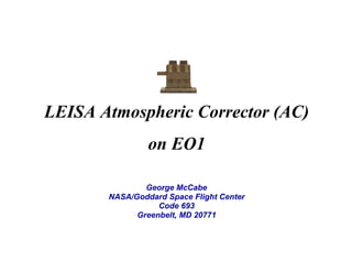
  • 1. LEISA Atmospheric Corrector (AC) on EO1 George McCabe NASA/Goddard Space Flight Center Code 693 Greenbelt, MD 20771
  • 2. LEISA Development History • 1993 Selected for Pluto Express (PE) Mission under Advanced Technology Insertion Program • 1993 Baseline IR spectral imager for Highly Integrated Pluto Payload System (HIPPS) • 1994 Chosen for Small Satellite Technology Initiative (SSTI) Lewis Mission • 1996 Chosen for New Millennium Program Earth Observing-1 (EO-1) Mission • 1997 Space Act Agreement, participation in Field Studies with Boeing Commercial Space Company, Resource21 • 2001 Phase B development New Horizons for NASA Pluto-Kuiper Belt Mission
  • 3. Instrument Characteristics • Correct Atmospheric Effects in High Spatial Resolution Multispectral Imager Data – Hyperspectral Imager – Moderate Spectral Resolution (<10 nm) – Moderate Spatial Resolution (<300 meter) – Maximum Sampling Flexibility – Minimum Impact on Spacecraft Resources
  • 6. Sample Image (Arid Lands Ecological Reserve)
  • 7. Contribution to EO-1 • Validation of Wedged Filter Approach for Spacecraft Instrumentation • Atmospheric Correction for ALI Multispectral Images. • Atmospheric Correction for Landsat-7 Images (Formation Flying). • Direct Study of Spatial Resolution Degradation (CrossComparison with Hyperion). • Retrieved Atmospheric Parameters. • Cross-Comparisons with MODIS.
  • 8. EO-1 Landsat-7 Less Than 1 Minute Hyperspectral Atmospheric Correction (185 km @ 125 / 250 m) Multispectral Images (36 km @ 30 m) TRWIS Underflight (Variable) 705 km Altitude AVIRIS Underflight (10 km @ 20 m) 36 km Landsat Multispectral Images (185 km @ 30 m) Grating-based Hyperspectral Images (7.5 km @ 30 m) 7.7 km 185 km
  • 9. AC Instrument Specifications • • • • • • • • • Spectral Coverage: 0.89 - 1.58 _m; 256 Bands Selected for Optimal Correction of High Spatial Resolution Images Spectral Resolution 2 Filter Sections: Section 1 ~35 cm-1 (__: 5 nm @ 1.2 _m, 9 nm @ 1.6 _m) Section 2 ~55 cm-1 (__ : 4 nm @ 0.9 _m, 8 nm @ 1.2 _m) Swath Width: ~185 km; Matches Landsat Spatial Resolution (pixel): 356 _radian (250 meter @ 705 km) Three 256 x 256 Element InGaAs Arrays; TEC Stabilized (<285 K) Three 15 Degree FOV 3 Element Lenses Two Modules: “Bolt-on”Optics Module and Electronics Module Mass: 10.5 kg (EM, 4.4 kg; OM 3.9 kg; Cable 2.2 kg) Power: 48 W (Peak); <15 W (Orbit Average)
  • 12. In-Flight Calibration • • • • Solar Calibration – Radiometric Calibration (Relative and Absolute) – Radiometric Stability – Variable Light Level Response – “Fixed Pattern” Noise Correction Lunar Calibration – Radiometric Calibration – Image Quality – Extended Duration Dark Current Stability Surface Targets – Radiometric/ Spectral Calibration (Ground Campaigns) Dark Earth Looks – Dark Current Stability
  • 14. Extended Calibration “Fixed Pattern” Signal Apparent After Launch – Predominantly Additive Contribution – Constant in Position and Time – Reduced Accuracy in Low Illumination Modified Radiometric Correction Procedure – Requires Measurements Unaffected by Atmospheric Absorption, Use Scanning Solar Data – Scale Calculation Replaced by Calibration Lookup Table
  • 15. Atmospheric Corrector Calibration System ACCS EO1 Level-0 Data EXTRACT REDUCE VERIFY Temporary Storage ARCHIVE DELIVER Permanent Database Level-1 Products
  • 17. Processing Options accs@fastie-bin-2 LAC_Option -l to_level 1R keepall_prod yes eo1q_execute standard null_calibration no offset_source local_dark scale_source default replace_bad yes force_cal no cal_matchkey preset2 enhance_qlook yes deliver_to lacsend archive_file lacstor post_cleanup yes do_tapels both mail_report yes getsome_sleep yes lookforward2_vacation yes # # # # # # # # # # # # # # # # # 1R, 1G no (highest only), yes none, standard, extended no, yes default, local_dark default, extended, local_cal no, yes no, yes preset2, facist3, preset1, anarchist0 yes, no lacsend, tarsend, tape, null lacstor, tape, null no, yes both, tape, eo1tape, none no, yes yes, no yes, no
  • 18. Session Logs • goACCS_EO1###.log • LAC_Extract/Reduce0/Deliver/ArchiveYYYYMonDD@HHMMSS.log • goClean.log • dat3/dlt4_ACCS###.lst • Scenes_Processed.lst
  • 19. ACCS Performance • • • > 1500 scenes processed 8.5 Gb of data per session 1.5 hrs/Gb total processing time* ( Extract + Reduce + Archive ) * excepting extended calibration
  • 20. HDF File Creation Example L0 = LACDATA+‘/lac/20013010839_AKS/EO11520372001301112K0/’+ $ ‘AC2001301054952_AKS_01.L0’ GENICAL, L0, /VERBOSE, /OFFSET, $ MATCH={TYPE:1,TIME:1.0,ARRAY1T:10,ARRAY2T:10,ARRAY3T:10,STAT:'0111'} GENHDF, L0, RUN_LABEL='2002Jan23@064222', /VERBOSE, /NON_INTERACTIVE L1 = VERYGEN1R( L0 ) TIMEUPDT, L1 GEN1RSDS, L1 RDUPDT, L1, /NON_INTERACTIVE
  • 21. Associated Files • YYYY_DDD_lac/gps/acs.hdf • 00indexEO1### • ACYYYYDDDHHMMSS_RRR_##.L0_calcoef.b4 • " .L0_calpnotes.txt • • • • • • " " " " " " .L0_stats .L0_stats-M/S.bmp .L0_trace0/C .L0/1R_wint .L0_update .L1R_q-bands/frames.jpg • " .L1R_geo
  • 22. Level-1 HDF Products Level-1R Level-1G Type HDF v4 Grid HDF-EOS v2.4 Swath Processing Inputs L0 Science, L0 Dark, scale coefficients, lac / gps / acs metadata L1R Science, lac / gps / acs metadata, pointing map, wavelength map, corrected frame times Key Attributes Data Start Time, Level 1R: Dataset Type, Response SD: Filenames, Scale Factor Spectra: Scale Factor SD Structures Offset, Response, Pixel_Map, Wavelength_Map, Level 1R (radiometrically calibrated, 768 x Nframes x 256) Latitude, Longitude, Wavelength, Spectra (geo-located and band rectified, NY x NX x 256) Associated Products Raw frame/pixel statistics, quicklook images, ENVI header Geo-location info Usage Modified ENVI input procedures (BSQ) ENVI Generic HDF (BIP)
  • 23. Science Data Formats • instrument clock, header data • pixel pointing map, filter frequency map • spacecraft meta data (YYYY_DDD_lac/gps/acs.hdf) Ii,j,t ⇒ Ix,y,ν ν Level-1R Level-1G
  • 24. Band Alignment Scan of Cuprite, NV 1200 frames
  • 25. Color Composite Image Cuprite, NV Mar. 1, 2001 red=1.32, green=1.03, blue=0.98 (µm)
  • 26. Spectra Cuprite, NV March 1, 2001 3000 2500 2000 1500 1000 500 0 0.9 1 1.1 1.2 1.3 1.4 1.5 -500 [298,600] [299,599] [299,600] [299,601] [546,584] [546,585] [546,586] [547,585] 1.6
  • 27. Cuprite, NV Scene-ID: EO10410342001060111PP Lake Frome Scene-ID: EO10970812001021111PP Rochester, NY Scene-ID: EO10160302001125111PP Snake River Scene-ID: EO10410302001140111PP Suez Canal Scene-ID: EO11760392001046111PP Venice Scene-ID: EO11920282001158112PP