SlideShare ist ein Scribd-Unternehmen logo
1 von 22
Downloaden Sie, um offline zu lesen
GIS Solutions for Petroleum Companies
Stian Heid
Solution sales specialist


                            Photo Øyvind Hagen - Statoil


Stavanger, 18.04.2013
Agenda
• Introduction
• Where can GIS be applied?
• GIS solutions
   – Integration
   – Visualization
   – Analyses
   – Monitoring
• Wrap up and questions
Introduction – Our vision for
               GIS in Petroleum
  • Aurora petroleum
  • ArcGIS Online


 “A fully integrated spatial datawarehouse solution for the oil and gas
industry to manage, combine and distribute all spatial information, in order
to support decision-making throughout the chain of value”.
Integration
•   Petrel                  •   Bathymetry data
•   Kingdom                 •   Hand-drawn maps
•   NPD                     •   MS Office
•   Diskos                  •   FMB
•   GeoX                    •   Millennium Atlas
•   SAP                     •   ODM
•   CAD                     •   More…
•   Full motion video
•   Real time sensor data
Spatial warehouse solutions for NCS


                              Online
                              services
Benefits of the Spatial Warehouse


   •   One central hub for access to all spatial data across
       business processes.
   •   One IT-infrastructure to manage, integrate and distribute
       spatial data.
   •   Efficient management and gathering of vital data
   •   Ensure the spatial integrity
   •   Ensure quality in all processes that includes spatial data
   •   One spatial data warehouse
   •   Break down silos between isolated applications
   •   Information enrichment through analyses of existing
       data
Where can GIS be applied?
•   Localization of office
•   G&G
•   License applications
•   Trading
•   Bathymetric surveys
•   Development and planning
•   Sub-sea operations
•   Infrastructure
•   Production and monitoring
Where can GIS be applied?

             • HSE

             • R&D

             • Sales and resale

             • Localization of resale

             • Public relations

             • Investor relations
Solution areas

•   Integration
•   Visualization
•   Analyses
•   Monitoring
Petrel


ASCII points, lines, polygons and grids goes both ways
Petrel
GeoX
GeoX + Petrel
NPD
NPD change detection
Full motion video

•   Play video files
•   Play live streams of video
•   Extract frames as georeferenced images
•   Fully time-enabled
Bathymetry data
• ArcGIS for Maritime
  – Bathymetry
  – Charting
ArcGIS for Maritime: Bathymetry
Register    Explore          Compose         Share

                  Gridded         Surfaces
                   Data
                  (BAGs)     52
                                  Features
               Collections

                                  Rules
   BIS
           Metadata
MS Office

• Esri maps for Office
  – Included in ArcGIS Online and Portal for ArcGIS
  – Insert maps in PowerPoint and Excel
  – Use own Excel data in maps
  – Share your map with colleagues
  – And more
Monitoring

• ArcGIS GeoEvent Processor
• Input connectors:
   – Built-in GPS connectors for Sierra Wireless and Trimble
   – Common transport protocols, such as UDP, TCP, and
     XMPP
   – Vehicle telematics by CompassCom, networkfleet, and
     many others.
• Operations Dashboard for ArcGIS
• Demo
Summary
Thank you!

Weitere ähnliche Inhalte

Was ist angesagt?

Was ist angesagt? (20)

Introduction to GIS
Introduction to GISIntroduction to GIS
Introduction to GIS
 
Introduction to geomatics
Introduction to geomaticsIntroduction to geomatics
Introduction to geomatics
 
History of GIS
History of GISHistory of GIS
History of GIS
 
Introduction of GIS & Remote Sensing (RS)
Introduction of GIS & Remote Sensing (RS)Introduction of GIS & Remote Sensing (RS)
Introduction of GIS & Remote Sensing (RS)
 
Geocoding for beginners
Geocoding for beginnersGeocoding for beginners
Geocoding for beginners
 
Digitization in ArcGIS
Digitization in ArcGISDigitization in ArcGIS
Digitization in ArcGIS
 
spatial data infrastructure : issues and concepts
spatial data infrastructure : issues and conceptsspatial data infrastructure : issues and concepts
spatial data infrastructure : issues and concepts
 
OpenStreetMap
OpenStreetMapOpenStreetMap
OpenStreetMap
 
Digital Elevation Models
Digital Elevation ModelsDigital Elevation Models
Digital Elevation Models
 
Change detection using remote sensing and GIS
Change detection using remote sensing and GISChange detection using remote sensing and GIS
Change detection using remote sensing and GIS
 
Gis functions
Gis functionsGis functions
Gis functions
 
GEOGRAPHICAL INFORMATION SYSTEM (GIS)
GEOGRAPHICAL INFORMATION SYSTEM (GIS)GEOGRAPHICAL INFORMATION SYSTEM (GIS)
GEOGRAPHICAL INFORMATION SYSTEM (GIS)
 
Introduction to ArcGIS
Introduction to ArcGISIntroduction to ArcGIS
Introduction to ArcGIS
 
Spatial data analysis 1
Spatial data analysis 1Spatial data analysis 1
Spatial data analysis 1
 
History of GIS.pptx
History of GIS.pptxHistory of GIS.pptx
History of GIS.pptx
 
Web Mapping
Web MappingWeb Mapping
Web Mapping
 
GIS data analysis
GIS data analysisGIS data analysis
GIS data analysis
 
Web GIS
Web GISWeb GIS
Web GIS
 
NSDI_ Concepts and Components
NSDI_ Concepts and ComponentsNSDI_ Concepts and Components
NSDI_ Concepts and Components
 
GIS application in Defense
GIS application in DefenseGIS application in Defense
GIS application in Defense
 

Andere mochten auch

Highs and Lows: A Resel-based Approach to the Analysis of Data from Geophysic...
Highs and Lows: A Resel-based Approach to the Analysis of Data from Geophysic...Highs and Lows: A Resel-based Approach to the Analysis of Data from Geophysic...
Highs and Lows: A Resel-based Approach to the Analysis of Data from Geophysic...Jessica Ogden
 
Danish groundwater mapping – geological information building and disseminatio...
Danish groundwater mapping – geological information building and disseminatio...Danish groundwater mapping – geological information building and disseminatio...
Danish groundwater mapping – geological information building and disseminatio...Geological Survey of Sweden
 
Jeofizik Tarımsal Toprak İncelemesi
Jeofizik Tarımsal Toprak İncelemesiJeofizik Tarımsal Toprak İncelemesi
Jeofizik Tarımsal Toprak İncelemesiAli Osman Öncel
 
Fast modelling of Airborne EM data using "Smart Interpretation"
Fast modelling of Airborne EM data using "Smart Interpretation"Fast modelling of Airborne EM data using "Smart Interpretation"
Fast modelling of Airborne EM data using "Smart Interpretation"Torben Bach
 
Geographic Information Systems in the Oil & Gas Industry
Geographic Information Systems in the Oil & Gas IndustryGeographic Information Systems in the Oil & Gas Industry
Geographic Information Systems in the Oil & Gas IndustryFrancois Viljoen
 
GEBCO 09 - DELPH
GEBCO 09 - DELPHGEBCO 09 - DELPH
GEBCO 09 - DELPHIXSEA-DELPH
 
Delph v29 0 - General Presentation
Delph v29   0 - General PresentationDelph v29   0 - General Presentation
Delph v29 0 - General PresentationIXSEA-DELPH
 
Assessing Geophysical Risk and Social Vulnerability to Natural Disasters
Assessing Geophysical Risk and Social Vulnerability to Natural DisastersAssessing Geophysical Risk and Social Vulnerability to Natural Disasters
Assessing Geophysical Risk and Social Vulnerability to Natural DisastersMaureen1523
 
Exploration and 3D GIS Software - MapInfo Professional Discover3D 2015
Exploration and 3D GIS Software - MapInfo Professional Discover3D 2015Exploration and 3D GIS Software - MapInfo Professional Discover3D 2015
Exploration and 3D GIS Software - MapInfo Professional Discover3D 2015Prakher Hajela Saxena
 
Ground Geophysical Survey
Ground Geophysical SurveyGround Geophysical Survey
Ground Geophysical SurveyOmary Issa
 
GIS and Decision Making, Literature Review
GIS and Decision Making, Literature ReviewGIS and Decision Making, Literature Review
GIS and Decision Making, Literature Reviewagungwah
 
Archaeological Applications of Geographic Information Systems (GIS)
Archaeological Applications of Geographic Information Systems (GIS)Archaeological Applications of Geographic Information Systems (GIS)
Archaeological Applications of Geographic Information Systems (GIS)Joshua Campbell
 
MINERAL EXPLORATION USING ASTER IMAGE
MINERAL EXPLORATION USING ASTER IMAGE MINERAL EXPLORATION USING ASTER IMAGE
MINERAL EXPLORATION USING ASTER IMAGE Abhiram Kanigolla
 
Remote Sensing And GIS Application In Mineral , Oil , Ground Water MappingMin...
Remote Sensing And GIS Application In Mineral , Oil , Ground Water MappingMin...Remote Sensing And GIS Application In Mineral , Oil , Ground Water MappingMin...
Remote Sensing And GIS Application In Mineral , Oil , Ground Water MappingMin...Swetha A
 
Geophysics
GeophysicsGeophysics
Geophysicsfulay
 
Geology & geophysics in oil exploration
Geology & geophysics in oil explorationGeology & geophysics in oil exploration
Geology & geophysics in oil explorationFelipe Andrés
 

Andere mochten auch (20)

Highs and Lows: A Resel-based Approach to the Analysis of Data from Geophysic...
Highs and Lows: A Resel-based Approach to the Analysis of Data from Geophysic...Highs and Lows: A Resel-based Approach to the Analysis of Data from Geophysic...
Highs and Lows: A Resel-based Approach to the Analysis of Data from Geophysic...
 
Danish groundwater mapping – geological information building and disseminatio...
Danish groundwater mapping – geological information building and disseminatio...Danish groundwater mapping – geological information building and disseminatio...
Danish groundwater mapping – geological information building and disseminatio...
 
Hawaii Pacific GIS Conference 2012: Participatory and Place-Based GIS - Using...
Hawaii Pacific GIS Conference 2012: Participatory and Place-Based GIS - Using...Hawaii Pacific GIS Conference 2012: Participatory and Place-Based GIS - Using...
Hawaii Pacific GIS Conference 2012: Participatory and Place-Based GIS - Using...
 
Jeofizik Tarımsal Toprak İncelemesi
Jeofizik Tarımsal Toprak İncelemesiJeofizik Tarımsal Toprak İncelemesi
Jeofizik Tarımsal Toprak İncelemesi
 
Fast modelling of Airborne EM data using "Smart Interpretation"
Fast modelling of Airborne EM data using "Smart Interpretation"Fast modelling of Airborne EM data using "Smart Interpretation"
Fast modelling of Airborne EM data using "Smart Interpretation"
 
Geographic Information Systems in the Oil & Gas Industry
Geographic Information Systems in the Oil & Gas IndustryGeographic Information Systems in the Oil & Gas Industry
Geographic Information Systems in the Oil & Gas Industry
 
GEBCO 09 - DELPH
GEBCO 09 - DELPHGEBCO 09 - DELPH
GEBCO 09 - DELPH
 
Delph v29 0 - General Presentation
Delph v29   0 - General PresentationDelph v29   0 - General Presentation
Delph v29 0 - General Presentation
 
Assessing Geophysical Risk and Social Vulnerability to Natural Disasters
Assessing Geophysical Risk and Social Vulnerability to Natural DisastersAssessing Geophysical Risk and Social Vulnerability to Natural Disasters
Assessing Geophysical Risk and Social Vulnerability to Natural Disasters
 
Exploration and 3D GIS Software - MapInfo Professional Discover3D 2015
Exploration and 3D GIS Software - MapInfo Professional Discover3D 2015Exploration and 3D GIS Software - MapInfo Professional Discover3D 2015
Exploration and 3D GIS Software - MapInfo Professional Discover3D 2015
 
Anisotropy Effects in Geophysical Data
Anisotropy Effects in Geophysical DataAnisotropy Effects in Geophysical Data
Anisotropy Effects in Geophysical Data
 
Ground Geophysical Survey
Ground Geophysical SurveyGround Geophysical Survey
Ground Geophysical Survey
 
GIS and Decision Making, Literature Review
GIS and Decision Making, Literature ReviewGIS and Decision Making, Literature Review
GIS and Decision Making, Literature Review
 
Geophysical exploration
Geophysical exploration Geophysical exploration
Geophysical exploration
 
Archaeological Applications of Geographic Information Systems (GIS)
Archaeological Applications of Geographic Information Systems (GIS)Archaeological Applications of Geographic Information Systems (GIS)
Archaeological Applications of Geographic Information Systems (GIS)
 
MINERAL EXPLORATION USING ASTER IMAGE
MINERAL EXPLORATION USING ASTER IMAGE MINERAL EXPLORATION USING ASTER IMAGE
MINERAL EXPLORATION USING ASTER IMAGE
 
Geophysical data analysis
Geophysical data analysis Geophysical data analysis
Geophysical data analysis
 
Remote Sensing And GIS Application In Mineral , Oil , Ground Water MappingMin...
Remote Sensing And GIS Application In Mineral , Oil , Ground Water MappingMin...Remote Sensing And GIS Application In Mineral , Oil , Ground Water MappingMin...
Remote Sensing And GIS Application In Mineral , Oil , Ground Water MappingMin...
 
Geophysics
GeophysicsGeophysics
Geophysics
 
Geology & geophysics in oil exploration
Geology & geophysics in oil explorationGeology & geophysics in oil exploration
Geology & geophysics in oil exploration
 

Ähnlich wie GIS solutions for petroleum companies

Arc gis desktop_and_geoprocessing
Arc gis desktop_and_geoprocessingArc gis desktop_and_geoprocessing
Arc gis desktop_and_geoprocessingEsri
 
Esri South Africa GIS In The Cloud
Esri South Africa GIS In The CloudEsri South Africa GIS In The Cloud
Esri South Africa GIS In The CloudEsri South Africa
 
Building good web_maps, Esri, Joris Bak
Building good web_maps, Esri, Joris BakBuilding good web_maps, Esri, Joris Bak
Building good web_maps, Esri, Joris BakEsri Nederland
 
Operationalizing Machine Learning Using GPU-accelerated, In-database Analytics
Operationalizing Machine Learning Using GPU-accelerated, In-database AnalyticsOperationalizing Machine Learning Using GPU-accelerated, In-database Analytics
Operationalizing Machine Learning Using GPU-accelerated, In-database AnalyticsKinetica
 
IMGS GeoDATA 2014 Presentation: Property and Cadastre Management using a Web GIS
IMGS GeoDATA 2014 Presentation: Property and Cadastre Management using a Web GISIMGS GeoDATA 2014 Presentation: Property and Cadastre Management using a Web GIS
IMGS GeoDATA 2014 Presentation: Property and Cadastre Management using a Web GISIMGS
 
Evolution of Esri Data Formats Seminar
Evolution of Esri Data Formats SeminarEvolution of Esri Data Formats Seminar
Evolution of Esri Data Formats SeminarEsri South Africa
 
NDGeospatialSummit2019 - ArcGIS Pro – Next-Generation Desktop GIS
NDGeospatialSummit2019 - ArcGIS Pro – Next-Generation Desktop GISNDGeospatialSummit2019 - ArcGIS Pro – Next-Generation Desktop GIS
NDGeospatialSummit2019 - ArcGIS Pro – Next-Generation Desktop GISNorth Dakota GIS Hub
 
Publishing on ArcGIS Mobile
Publishing on ArcGIS MobilePublishing on ArcGIS Mobile
Publishing on ArcGIS MobileEsri
 
Architecting the ArcGIS Platform
Architecting the ArcGIS PlatformArchitecting the ArcGIS Platform
Architecting the ArcGIS PlatformEsri UK
 
Managing Assets in Your GIS
Managing Assets in Your GISManaging Assets in Your GIS
Managing Assets in Your GISSSP Innovations
 
Paradigm IT - Outsourcing advantages for you
Paradigm IT - Outsourcing advantages for youParadigm IT - Outsourcing advantages for you
Paradigm IT - Outsourcing advantages for yousantoshkr
 
Welsh Conference 2023 Opening Plenary
Welsh Conference 2023 Opening PlenaryWelsh Conference 2023 Opening Plenary
Welsh Conference 2023 Opening PlenaryEsri UK
 
SDI: A prespective from a UK archaeological unit
SDI: A prespective from a UK archaeological unitSDI: A prespective from a UK archaeological unit
SDI: A prespective from a UK archaeological unitPaul Cripps
 
Big data analytics and machine intelligence v5.0
Big data analytics and machine intelligence   v5.0Big data analytics and machine intelligence   v5.0
Big data analytics and machine intelligence v5.0Amr Kamel Deklel
 
GIS Application in Water Resource Management by Engr. Ehtisham Habib
GIS Application in Water Resource Management by Engr. Ehtisham HabibGIS Application in Water Resource Management by Engr. Ehtisham Habib
GIS Application in Water Resource Management by Engr. Ehtisham HabibEhtisham Habib
 
TELUS Case Study: iVAULT implementation improved corporate intelligence
TELUS Case Study: iVAULT implementation improved corporate intelligence TELUS Case Study: iVAULT implementation improved corporate intelligence
TELUS Case Study: iVAULT implementation improved corporate intelligence eventspat
 
GIS at Sain Associates
GIS at Sain AssociatesGIS at Sain Associates
GIS at Sain AssociatesSainAssociates
 
Enhance Location-Based Insights with Additional Geocoding Capabilities
Enhance Location-Based Insights with Additional Geocoding CapabilitiesEnhance Location-Based Insights with Additional Geocoding Capabilities
Enhance Location-Based Insights with Additional Geocoding CapabilitiesPrecisely
 
Case Studies On Gis Fm Integration
Case Studies On Gis Fm IntegrationCase Studies On Gis Fm Integration
Case Studies On Gis Fm IntegrationJohn Przybyla
 

Ähnlich wie GIS solutions for petroleum companies (20)

Arc gis desktop_and_geoprocessing
Arc gis desktop_and_geoprocessingArc gis desktop_and_geoprocessing
Arc gis desktop_and_geoprocessing
 
Esri South Africa GIS In The Cloud
Esri South Africa GIS In The CloudEsri South Africa GIS In The Cloud
Esri South Africa GIS In The Cloud
 
Building good web_maps, Esri, Joris Bak
Building good web_maps, Esri, Joris BakBuilding good web_maps, Esri, Joris Bak
Building good web_maps, Esri, Joris Bak
 
Operationalizing Machine Learning Using GPU-accelerated, In-database Analytics
Operationalizing Machine Learning Using GPU-accelerated, In-database AnalyticsOperationalizing Machine Learning Using GPU-accelerated, In-database Analytics
Operationalizing Machine Learning Using GPU-accelerated, In-database Analytics
 
IMGS GeoDATA 2014 Presentation: Property and Cadastre Management using a Web GIS
IMGS GeoDATA 2014 Presentation: Property and Cadastre Management using a Web GISIMGS GeoDATA 2014 Presentation: Property and Cadastre Management using a Web GIS
IMGS GeoDATA 2014 Presentation: Property and Cadastre Management using a Web GIS
 
Evolution of Esri Data Formats Seminar
Evolution of Esri Data Formats SeminarEvolution of Esri Data Formats Seminar
Evolution of Esri Data Formats Seminar
 
NDGeospatialSummit2019 - ArcGIS Pro – Next-Generation Desktop GIS
NDGeospatialSummit2019 - ArcGIS Pro – Next-Generation Desktop GISNDGeospatialSummit2019 - ArcGIS Pro – Next-Generation Desktop GIS
NDGeospatialSummit2019 - ArcGIS Pro – Next-Generation Desktop GIS
 
Publishing on ArcGIS Mobile
Publishing on ArcGIS MobilePublishing on ArcGIS Mobile
Publishing on ArcGIS Mobile
 
Architecting the ArcGIS Platform
Architecting the ArcGIS PlatformArchitecting the ArcGIS Platform
Architecting the ArcGIS Platform
 
ArcGIS10 Land Records Mgmt (EPAN 2010)
ArcGIS10 Land Records Mgmt (EPAN 2010)ArcGIS10 Land Records Mgmt (EPAN 2010)
ArcGIS10 Land Records Mgmt (EPAN 2010)
 
Managing Assets in Your GIS
Managing Assets in Your GISManaging Assets in Your GIS
Managing Assets in Your GIS
 
Paradigm IT - Outsourcing advantages for you
Paradigm IT - Outsourcing advantages for youParadigm IT - Outsourcing advantages for you
Paradigm IT - Outsourcing advantages for you
 
Welsh Conference 2023 Opening Plenary
Welsh Conference 2023 Opening PlenaryWelsh Conference 2023 Opening Plenary
Welsh Conference 2023 Opening Plenary
 
SDI: A prespective from a UK archaeological unit
SDI: A prespective from a UK archaeological unitSDI: A prespective from a UK archaeological unit
SDI: A prespective from a UK archaeological unit
 
Big data analytics and machine intelligence v5.0
Big data analytics and machine intelligence   v5.0Big data analytics and machine intelligence   v5.0
Big data analytics and machine intelligence v5.0
 
GIS Application in Water Resource Management by Engr. Ehtisham Habib
GIS Application in Water Resource Management by Engr. Ehtisham HabibGIS Application in Water Resource Management by Engr. Ehtisham Habib
GIS Application in Water Resource Management by Engr. Ehtisham Habib
 
TELUS Case Study: iVAULT implementation improved corporate intelligence
TELUS Case Study: iVAULT implementation improved corporate intelligence TELUS Case Study: iVAULT implementation improved corporate intelligence
TELUS Case Study: iVAULT implementation improved corporate intelligence
 
GIS at Sain Associates
GIS at Sain AssociatesGIS at Sain Associates
GIS at Sain Associates
 
Enhance Location-Based Insights with Additional Geocoding Capabilities
Enhance Location-Based Insights with Additional Geocoding CapabilitiesEnhance Location-Based Insights with Additional Geocoding Capabilities
Enhance Location-Based Insights with Additional Geocoding Capabilities
 
Case Studies On Gis Fm Integration
Case Studies On Gis Fm IntegrationCase Studies On Gis Fm Integration
Case Studies On Gis Fm Integration
 

Mehr von Geodata AS

Øvelse Oslofjord - BK2016
Øvelse Oslofjord  - BK2016Øvelse Oslofjord  - BK2016
Øvelse Oslofjord - BK2016Geodata AS
 
Kartlegging av flomveier i Oslo - BK2015
Kartlegging av flomveier i Oslo - BK2015Kartlegging av flomveier i Oslo - BK2015
Kartlegging av flomveier i Oslo - BK2015Geodata AS
 
Imagery and beyond - BK 2016
Imagery and beyond - BK 2016Imagery and beyond - BK 2016
Imagery and beyond - BK 2016Geodata AS
 
ArcGIS i samferdselsplanlegging - BK2016
ArcGIS i samferdselsplanlegging - BK2016ArcGIS i samferdselsplanlegging - BK2016
ArcGIS i samferdselsplanlegging - BK2016Geodata AS
 
Disrupt or be disrupted - BK 2016
Disrupt or be disrupted - BK 2016Disrupt or be disrupted - BK 2016
Disrupt or be disrupted - BK 2016Geodata AS
 
ArcGIS Server og FME som duo i dokumentproduksjon - BK2016
ArcGIS Server og FME som duo i dokumentproduksjon - BK2016ArcGIS Server og FME som duo i dokumentproduksjon - BK2016
ArcGIS Server og FME som duo i dokumentproduksjon - BK2016Geodata AS
 
Workflow manager - Kystverkets bruk og erfaringer - BK2016
Workflow manager - Kystverkets bruk og erfaringer - BK2016Workflow manager - Kystverkets bruk og erfaringer - BK2016
Workflow manager - Kystverkets bruk og erfaringer - BK2016Geodata AS
 
Workflow manager – hva er det og hva kan det brukes til - BK2016
Workflow manager – hva er det og hva kan det brukes til - BK2016Workflow manager – hva er det og hva kan det brukes til - BK2016
Workflow manager – hva er det og hva kan det brukes til - BK2016Geodata AS
 
ArcGIS Portal og sharepoint - en fleksibel kombinasjon - BK2016
ArcGIS Portal og sharepoint - en fleksibel kombinasjon - BK2016ArcGIS Portal og sharepoint - en fleksibel kombinasjon - BK2016
ArcGIS Portal og sharepoint - en fleksibel kombinasjon - BK2016Geodata AS
 
Enkel tilgang på live trafikkinformasjon - BK2016
Enkel tilgang på live trafikkinformasjon - BK2016Enkel tilgang på live trafikkinformasjon - BK2016
Enkel tilgang på live trafikkinformasjon - BK2016Geodata AS
 
Anvendelse av ArcGIS-plattformen for planlegging gjennomføring - BK2016
Anvendelse av ArcGIS-plattformen for planlegging gjennomføring - BK2016Anvendelse av ArcGIS-plattformen for planlegging gjennomføring - BK2016
Anvendelse av ArcGIS-plattformen for planlegging gjennomføring - BK2016Geodata AS
 
Dynamisk ressurs modellering - miljørisikoanalyse for arktiske olje og gass a...
Dynamisk ressurs modellering - miljørisikoanalyse for arktiske olje og gass a...Dynamisk ressurs modellering - miljørisikoanalyse for arktiske olje og gass a...
Dynamisk ressurs modellering - miljørisikoanalyse for arktiske olje og gass a...Geodata AS
 
Arctic Risk Map - kommuniserer regionens sikkerhet og miljø risiko - BK2016
Arctic Risk Map -  kommuniserer regionens sikkerhet og miljø risiko - BK2016Arctic Risk Map -  kommuniserer regionens sikkerhet og miljø risiko - BK2016
Arctic Risk Map - kommuniserer regionens sikkerhet og miljø risiko - BK2016Geodata AS
 
Tilstandsregistrering av landbruksveger i Hedmark ved hjelp av collector for ...
Tilstandsregistrering av landbruksveger i Hedmark ved hjelp av collector for ...Tilstandsregistrering av landbruksveger i Hedmark ved hjelp av collector for ...
Tilstandsregistrering av landbruksveger i Hedmark ved hjelp av collector for ...Geodata AS
 
Bruks av ArcGIS Online som samhandlingsplattform i beredskap og krise - BK2016
Bruks av ArcGIS Online som samhandlingsplattform i beredskap og krise - BK2016Bruks av ArcGIS Online som samhandlingsplattform i beredskap og krise - BK2016
Bruks av ArcGIS Online som samhandlingsplattform i beredskap og krise - BK2016Geodata AS
 
Kom i gang med ArcGIS Pro
Kom i gang med ArcGIS ProKom i gang med ArcGIS Pro
Kom i gang med ArcGIS ProGeodata AS
 
ArcGIS en plattform for hele virksomheten - BK2016
ArcGIS  en plattform for hele virksomheten - BK2016ArcGIS  en plattform for hele virksomheten - BK2016
ArcGIS en plattform for hele virksomheten - BK2016Geodata AS
 
Geografiske analyser i ArcGIS - BK 2016
Geografiske analyser i ArcGIS - BK 2016Geografiske analyser i ArcGIS - BK 2016
Geografiske analyser i ArcGIS - BK 2016Geodata AS
 
Skredregistrering.no og norsk skreddatabase - BK2016
Skredregistrering.no og norsk skreddatabase - BK2016Skredregistrering.no og norsk skreddatabase - BK2016
Skredregistrering.no og norsk skreddatabase - BK2016Geodata AS
 
Laserskanning av skog fra drone gir nye muligheter - BK2016
Laserskanning av skog fra drone gir nye muligheter - BK2016Laserskanning av skog fra drone gir nye muligheter - BK2016
Laserskanning av skog fra drone gir nye muligheter - BK2016Geodata AS
 

Mehr von Geodata AS (20)

Øvelse Oslofjord - BK2016
Øvelse Oslofjord  - BK2016Øvelse Oslofjord  - BK2016
Øvelse Oslofjord - BK2016
 
Kartlegging av flomveier i Oslo - BK2015
Kartlegging av flomveier i Oslo - BK2015Kartlegging av flomveier i Oslo - BK2015
Kartlegging av flomveier i Oslo - BK2015
 
Imagery and beyond - BK 2016
Imagery and beyond - BK 2016Imagery and beyond - BK 2016
Imagery and beyond - BK 2016
 
ArcGIS i samferdselsplanlegging - BK2016
ArcGIS i samferdselsplanlegging - BK2016ArcGIS i samferdselsplanlegging - BK2016
ArcGIS i samferdselsplanlegging - BK2016
 
Disrupt or be disrupted - BK 2016
Disrupt or be disrupted - BK 2016Disrupt or be disrupted - BK 2016
Disrupt or be disrupted - BK 2016
 
ArcGIS Server og FME som duo i dokumentproduksjon - BK2016
ArcGIS Server og FME som duo i dokumentproduksjon - BK2016ArcGIS Server og FME som duo i dokumentproduksjon - BK2016
ArcGIS Server og FME som duo i dokumentproduksjon - BK2016
 
Workflow manager - Kystverkets bruk og erfaringer - BK2016
Workflow manager - Kystverkets bruk og erfaringer - BK2016Workflow manager - Kystverkets bruk og erfaringer - BK2016
Workflow manager - Kystverkets bruk og erfaringer - BK2016
 
Workflow manager – hva er det og hva kan det brukes til - BK2016
Workflow manager – hva er det og hva kan det brukes til - BK2016Workflow manager – hva er det og hva kan det brukes til - BK2016
Workflow manager – hva er det og hva kan det brukes til - BK2016
 
ArcGIS Portal og sharepoint - en fleksibel kombinasjon - BK2016
ArcGIS Portal og sharepoint - en fleksibel kombinasjon - BK2016ArcGIS Portal og sharepoint - en fleksibel kombinasjon - BK2016
ArcGIS Portal og sharepoint - en fleksibel kombinasjon - BK2016
 
Enkel tilgang på live trafikkinformasjon - BK2016
Enkel tilgang på live trafikkinformasjon - BK2016Enkel tilgang på live trafikkinformasjon - BK2016
Enkel tilgang på live trafikkinformasjon - BK2016
 
Anvendelse av ArcGIS-plattformen for planlegging gjennomføring - BK2016
Anvendelse av ArcGIS-plattformen for planlegging gjennomføring - BK2016Anvendelse av ArcGIS-plattformen for planlegging gjennomføring - BK2016
Anvendelse av ArcGIS-plattformen for planlegging gjennomføring - BK2016
 
Dynamisk ressurs modellering - miljørisikoanalyse for arktiske olje og gass a...
Dynamisk ressurs modellering - miljørisikoanalyse for arktiske olje og gass a...Dynamisk ressurs modellering - miljørisikoanalyse for arktiske olje og gass a...
Dynamisk ressurs modellering - miljørisikoanalyse for arktiske olje og gass a...
 
Arctic Risk Map - kommuniserer regionens sikkerhet og miljø risiko - BK2016
Arctic Risk Map -  kommuniserer regionens sikkerhet og miljø risiko - BK2016Arctic Risk Map -  kommuniserer regionens sikkerhet og miljø risiko - BK2016
Arctic Risk Map - kommuniserer regionens sikkerhet og miljø risiko - BK2016
 
Tilstandsregistrering av landbruksveger i Hedmark ved hjelp av collector for ...
Tilstandsregistrering av landbruksveger i Hedmark ved hjelp av collector for ...Tilstandsregistrering av landbruksveger i Hedmark ved hjelp av collector for ...
Tilstandsregistrering av landbruksveger i Hedmark ved hjelp av collector for ...
 
Bruks av ArcGIS Online som samhandlingsplattform i beredskap og krise - BK2016
Bruks av ArcGIS Online som samhandlingsplattform i beredskap og krise - BK2016Bruks av ArcGIS Online som samhandlingsplattform i beredskap og krise - BK2016
Bruks av ArcGIS Online som samhandlingsplattform i beredskap og krise - BK2016
 
Kom i gang med ArcGIS Pro
Kom i gang med ArcGIS ProKom i gang med ArcGIS Pro
Kom i gang med ArcGIS Pro
 
ArcGIS en plattform for hele virksomheten - BK2016
ArcGIS  en plattform for hele virksomheten - BK2016ArcGIS  en plattform for hele virksomheten - BK2016
ArcGIS en plattform for hele virksomheten - BK2016
 
Geografiske analyser i ArcGIS - BK 2016
Geografiske analyser i ArcGIS - BK 2016Geografiske analyser i ArcGIS - BK 2016
Geografiske analyser i ArcGIS - BK 2016
 
Skredregistrering.no og norsk skreddatabase - BK2016
Skredregistrering.no og norsk skreddatabase - BK2016Skredregistrering.no og norsk skreddatabase - BK2016
Skredregistrering.no og norsk skreddatabase - BK2016
 
Laserskanning av skog fra drone gir nye muligheter - BK2016
Laserskanning av skog fra drone gir nye muligheter - BK2016Laserskanning av skog fra drone gir nye muligheter - BK2016
Laserskanning av skog fra drone gir nye muligheter - BK2016
 

Kürzlich hochgeladen

Exploring Multimodal Embeddings with Milvus
Exploring Multimodal Embeddings with MilvusExploring Multimodal Embeddings with Milvus
Exploring Multimodal Embeddings with MilvusZilliz
 
Six Myths about Ontologies: The Basics of Formal Ontology
Six Myths about Ontologies: The Basics of Formal OntologySix Myths about Ontologies: The Basics of Formal Ontology
Six Myths about Ontologies: The Basics of Formal Ontologyjohnbeverley2021
 
Why Teams call analytics are critical to your entire business
Why Teams call analytics are critical to your entire businessWhy Teams call analytics are critical to your entire business
Why Teams call analytics are critical to your entire businesspanagenda
 
[BuildWithAI] Introduction to Gemini.pdf
[BuildWithAI] Introduction to Gemini.pdf[BuildWithAI] Introduction to Gemini.pdf
[BuildWithAI] Introduction to Gemini.pdfSandro Moreira
 
ProductAnonymous-April2024-WinProductDiscovery-MelissaKlemke
ProductAnonymous-April2024-WinProductDiscovery-MelissaKlemkeProductAnonymous-April2024-WinProductDiscovery-MelissaKlemke
ProductAnonymous-April2024-WinProductDiscovery-MelissaKlemkeProduct Anonymous
 
Apidays New York 2024 - Accelerating FinTech Innovation by Vasa Krishnan, Fin...
Apidays New York 2024 - Accelerating FinTech Innovation by Vasa Krishnan, Fin...Apidays New York 2024 - Accelerating FinTech Innovation by Vasa Krishnan, Fin...
Apidays New York 2024 - Accelerating FinTech Innovation by Vasa Krishnan, Fin...apidays
 
AWS Community Day CPH - Three problems of Terraform
AWS Community Day CPH - Three problems of TerraformAWS Community Day CPH - Three problems of Terraform
AWS Community Day CPH - Three problems of TerraformAndrey Devyatkin
 
Platformless Horizons for Digital Adaptability
Platformless Horizons for Digital AdaptabilityPlatformless Horizons for Digital Adaptability
Platformless Horizons for Digital AdaptabilityWSO2
 
Finding Java's Hidden Performance Traps @ DevoxxUK 2024
Finding Java's Hidden Performance Traps @ DevoxxUK 2024Finding Java's Hidden Performance Traps @ DevoxxUK 2024
Finding Java's Hidden Performance Traps @ DevoxxUK 2024Victor Rentea
 
EMPOWERMENT TECHNOLOGY GRADE 11 QUARTER 2 REVIEWER
EMPOWERMENT TECHNOLOGY GRADE 11 QUARTER 2 REVIEWEREMPOWERMENT TECHNOLOGY GRADE 11 QUARTER 2 REVIEWER
EMPOWERMENT TECHNOLOGY GRADE 11 QUARTER 2 REVIEWERMadyBayot
 
Mcleodganj Call Girls 🥰 8617370543 Service Offer VIP Hot Model
Mcleodganj Call Girls 🥰 8617370543 Service Offer VIP Hot ModelMcleodganj Call Girls 🥰 8617370543 Service Offer VIP Hot Model
Mcleodganj Call Girls 🥰 8617370543 Service Offer VIP Hot ModelDeepika Singh
 
Boost Fertility New Invention Ups Success Rates.pdf
Boost Fertility New Invention Ups Success Rates.pdfBoost Fertility New Invention Ups Success Rates.pdf
Boost Fertility New Invention Ups Success Rates.pdfsudhanshuwaghmare1
 
MINDCTI Revenue Release Quarter One 2024
MINDCTI Revenue Release Quarter One 2024MINDCTI Revenue Release Quarter One 2024
MINDCTI Revenue Release Quarter One 2024MIND CTI
 
FWD Group - Insurer Innovation Award 2024
FWD Group - Insurer Innovation Award 2024FWD Group - Insurer Innovation Award 2024
FWD Group - Insurer Innovation Award 2024The Digital Insurer
 
"I see eyes in my soup": How Delivery Hero implemented the safety system for ...
"I see eyes in my soup": How Delivery Hero implemented the safety system for ..."I see eyes in my soup": How Delivery Hero implemented the safety system for ...
"I see eyes in my soup": How Delivery Hero implemented the safety system for ...Zilliz
 
Cloud Frontiers: A Deep Dive into Serverless Spatial Data and FME
Cloud Frontiers:  A Deep Dive into Serverless Spatial Data and FMECloud Frontiers:  A Deep Dive into Serverless Spatial Data and FME
Cloud Frontiers: A Deep Dive into Serverless Spatial Data and FMESafe Software
 
TrustArc Webinar - Unlock the Power of AI-Driven Data Discovery
TrustArc Webinar - Unlock the Power of AI-Driven Data DiscoveryTrustArc Webinar - Unlock the Power of AI-Driven Data Discovery
TrustArc Webinar - Unlock the Power of AI-Driven Data DiscoveryTrustArc
 
Artificial Intelligence Chap.5 : Uncertainty
Artificial Intelligence Chap.5 : UncertaintyArtificial Intelligence Chap.5 : Uncertainty
Artificial Intelligence Chap.5 : UncertaintyKhushali Kathiriya
 
How to Troubleshoot Apps for the Modern Connected Worker
How to Troubleshoot Apps for the Modern Connected WorkerHow to Troubleshoot Apps for the Modern Connected Worker
How to Troubleshoot Apps for the Modern Connected WorkerThousandEyes
 

Kürzlich hochgeladen (20)

Exploring Multimodal Embeddings with Milvus
Exploring Multimodal Embeddings with MilvusExploring Multimodal Embeddings with Milvus
Exploring Multimodal Embeddings with Milvus
 
Six Myths about Ontologies: The Basics of Formal Ontology
Six Myths about Ontologies: The Basics of Formal OntologySix Myths about Ontologies: The Basics of Formal Ontology
Six Myths about Ontologies: The Basics of Formal Ontology
 
Why Teams call analytics are critical to your entire business
Why Teams call analytics are critical to your entire businessWhy Teams call analytics are critical to your entire business
Why Teams call analytics are critical to your entire business
 
[BuildWithAI] Introduction to Gemini.pdf
[BuildWithAI] Introduction to Gemini.pdf[BuildWithAI] Introduction to Gemini.pdf
[BuildWithAI] Introduction to Gemini.pdf
 
ProductAnonymous-April2024-WinProductDiscovery-MelissaKlemke
ProductAnonymous-April2024-WinProductDiscovery-MelissaKlemkeProductAnonymous-April2024-WinProductDiscovery-MelissaKlemke
ProductAnonymous-April2024-WinProductDiscovery-MelissaKlemke
 
Apidays New York 2024 - Accelerating FinTech Innovation by Vasa Krishnan, Fin...
Apidays New York 2024 - Accelerating FinTech Innovation by Vasa Krishnan, Fin...Apidays New York 2024 - Accelerating FinTech Innovation by Vasa Krishnan, Fin...
Apidays New York 2024 - Accelerating FinTech Innovation by Vasa Krishnan, Fin...
 
AWS Community Day CPH - Three problems of Terraform
AWS Community Day CPH - Three problems of TerraformAWS Community Day CPH - Three problems of Terraform
AWS Community Day CPH - Three problems of Terraform
 
Platformless Horizons for Digital Adaptability
Platformless Horizons for Digital AdaptabilityPlatformless Horizons for Digital Adaptability
Platformless Horizons for Digital Adaptability
 
Finding Java's Hidden Performance Traps @ DevoxxUK 2024
Finding Java's Hidden Performance Traps @ DevoxxUK 2024Finding Java's Hidden Performance Traps @ DevoxxUK 2024
Finding Java's Hidden Performance Traps @ DevoxxUK 2024
 
EMPOWERMENT TECHNOLOGY GRADE 11 QUARTER 2 REVIEWER
EMPOWERMENT TECHNOLOGY GRADE 11 QUARTER 2 REVIEWEREMPOWERMENT TECHNOLOGY GRADE 11 QUARTER 2 REVIEWER
EMPOWERMENT TECHNOLOGY GRADE 11 QUARTER 2 REVIEWER
 
Mcleodganj Call Girls 🥰 8617370543 Service Offer VIP Hot Model
Mcleodganj Call Girls 🥰 8617370543 Service Offer VIP Hot ModelMcleodganj Call Girls 🥰 8617370543 Service Offer VIP Hot Model
Mcleodganj Call Girls 🥰 8617370543 Service Offer VIP Hot Model
 
Boost Fertility New Invention Ups Success Rates.pdf
Boost Fertility New Invention Ups Success Rates.pdfBoost Fertility New Invention Ups Success Rates.pdf
Boost Fertility New Invention Ups Success Rates.pdf
 
MINDCTI Revenue Release Quarter One 2024
MINDCTI Revenue Release Quarter One 2024MINDCTI Revenue Release Quarter One 2024
MINDCTI Revenue Release Quarter One 2024
 
FWD Group - Insurer Innovation Award 2024
FWD Group - Insurer Innovation Award 2024FWD Group - Insurer Innovation Award 2024
FWD Group - Insurer Innovation Award 2024
 
"I see eyes in my soup": How Delivery Hero implemented the safety system for ...
"I see eyes in my soup": How Delivery Hero implemented the safety system for ..."I see eyes in my soup": How Delivery Hero implemented the safety system for ...
"I see eyes in my soup": How Delivery Hero implemented the safety system for ...
 
+971581248768>> SAFE AND ORIGINAL ABORTION PILLS FOR SALE IN DUBAI AND ABUDHA...
+971581248768>> SAFE AND ORIGINAL ABORTION PILLS FOR SALE IN DUBAI AND ABUDHA...+971581248768>> SAFE AND ORIGINAL ABORTION PILLS FOR SALE IN DUBAI AND ABUDHA...
+971581248768>> SAFE AND ORIGINAL ABORTION PILLS FOR SALE IN DUBAI AND ABUDHA...
 
Cloud Frontiers: A Deep Dive into Serverless Spatial Data and FME
Cloud Frontiers:  A Deep Dive into Serverless Spatial Data and FMECloud Frontiers:  A Deep Dive into Serverless Spatial Data and FME
Cloud Frontiers: A Deep Dive into Serverless Spatial Data and FME
 
TrustArc Webinar - Unlock the Power of AI-Driven Data Discovery
TrustArc Webinar - Unlock the Power of AI-Driven Data DiscoveryTrustArc Webinar - Unlock the Power of AI-Driven Data Discovery
TrustArc Webinar - Unlock the Power of AI-Driven Data Discovery
 
Artificial Intelligence Chap.5 : Uncertainty
Artificial Intelligence Chap.5 : UncertaintyArtificial Intelligence Chap.5 : Uncertainty
Artificial Intelligence Chap.5 : Uncertainty
 
How to Troubleshoot Apps for the Modern Connected Worker
How to Troubleshoot Apps for the Modern Connected WorkerHow to Troubleshoot Apps for the Modern Connected Worker
How to Troubleshoot Apps for the Modern Connected Worker
 

GIS solutions for petroleum companies

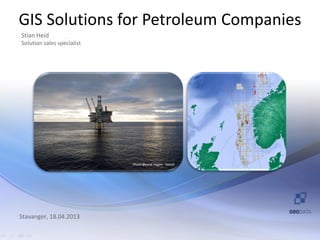
  • 1. GIS Solutions for Petroleum Companies Stian Heid Solution sales specialist Photo Øyvind Hagen - Statoil Stavanger, 18.04.2013
  • 2. Agenda • Introduction • Where can GIS be applied? • GIS solutions – Integration – Visualization – Analyses – Monitoring • Wrap up and questions
  • 3. Introduction – Our vision for GIS in Petroleum • Aurora petroleum • ArcGIS Online “A fully integrated spatial datawarehouse solution for the oil and gas industry to manage, combine and distribute all spatial information, in order to support decision-making throughout the chain of value”.
  • 4. Integration • Petrel • Bathymetry data • Kingdom • Hand-drawn maps • NPD • MS Office • Diskos • FMB • GeoX • Millennium Atlas • SAP • ODM • CAD • More… • Full motion video • Real time sensor data
  • 5. Spatial warehouse solutions for NCS Online services
  • 6. Benefits of the Spatial Warehouse • One central hub for access to all spatial data across business processes. • One IT-infrastructure to manage, integrate and distribute spatial data. • Efficient management and gathering of vital data • Ensure the spatial integrity • Ensure quality in all processes that includes spatial data • One spatial data warehouse • Break down silos between isolated applications • Information enrichment through analyses of existing data
  • 7. Where can GIS be applied? • Localization of office • G&G • License applications • Trading • Bathymetric surveys • Development and planning • Sub-sea operations • Infrastructure • Production and monitoring
  • 8. Where can GIS be applied? • HSE • R&D • Sales and resale • Localization of resale • Public relations • Investor relations
  • 9. Solution areas • Integration • Visualization • Analyses • Monitoring
  • 10. Petrel ASCII points, lines, polygons and grids goes both ways
  • 12. GeoX
  • 14. NPD
  • 16. Full motion video • Play video files • Play live streams of video • Extract frames as georeferenced images • Fully time-enabled
  • 17. Bathymetry data • ArcGIS for Maritime – Bathymetry – Charting
  • 18. ArcGIS for Maritime: Bathymetry Register Explore Compose Share Gridded Surfaces Data (BAGs) 52 Features Collections Rules BIS Metadata
  • 19. MS Office • Esri maps for Office – Included in ArcGIS Online and Portal for ArcGIS – Insert maps in PowerPoint and Excel – Use own Excel data in maps – Share your map with colleagues – And more
  • 20. Monitoring • ArcGIS GeoEvent Processor • Input connectors: – Built-in GPS connectors for Sierra Wireless and Trimble – Common transport protocols, such as UDP, TCP, and XMPP – Vehicle telematics by CompassCom, networkfleet, and many others. • Operations Dashboard for ArcGIS • Demo