Weather2020 Forecast School Chapter 1
•Als PPTX, PDF herunterladen•
1 gefällt mir•4,696 views

An introduction into meteorology begins with the Atmosphere. And we concentrate on the lowest layer, the Troposphere.

Empfohlen
Weitere ähnliche Inhalte
Was ist angesagt?
Was ist angesagt? (20)
Andere mochten auch
Andere mochten auch (12)
Ähnlich wie Weather2020 Forecast School Chapter 1
Ähnlich wie Weather2020 Forecast School Chapter 1 (20)
Kürzlich hochgeladen
Kürzlich hochgeladen (20)
Weather2020 Forecast School Chapter 1
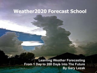
- 1. Weather2020 Forecast School Learning Weather Forecasting From 1 Day to 200 Days Into The Future By Gary Lezak
- 2. Introduction Meteorologist Gary Lezak will introduce us to meteorology. Gary received his Bachelor of Science Meteorology degree in 1985 from the University of Oklahoma. He has been rated one of the most accurate weather forecasters in the nation and he is going to be providing some insight into weather forecasting both short and long range using the Lezak Recurring Cycle (LRC). This is breakthrough technology that is now being used around the world in the 1Weather app and on Weather2020.com. This introduction into weather forecasting will begin with an understanding of the troposphere. We will then take you through one of the most important and visual parts of weather forecasting, the clouds, storm systems, and surface analysis. By the end of this educational series you should have enough knowledge to strengthen your weather forecasting skills.
- 3. Chapter 1: The Atmosphere Most of the weight of the atmosphere is within the troposphere, which is 78% Nitrogen, and 21% Oxygen. The troposphere begins at the surface of the earth and extends up to around 5 to 13 miles depending on the location and season. During the winter the troposphere is lower and it is more expansive during the warm months. For the same reason it is much higher at the equator than it is at the poles. The temperature in the troposphere decreases with height due to lower density of the gasses with height. The air becomes thinner and the temperature drops. The top of the troposphere is called the tropopause. Did you know that you have visually experienced the top of troposphere many times in your life?
- 4. The cumulonimbus cloud, you can see here, showcases the entire troposphere. In the troposphere the temperatures cool with height. When a cumulus cloud is growing, water vapor is condensing into cloud droplets and heat is released in this condensation process. The heat allows the air within the rising cloud to be warmer than the surrounding environment and the air will continue to rise and the cloud grows. There is an upper limit, however, to how high the cloud can grow. Once the cloud hits the stratosphere, where the air begins warming again, the cloud is forced to stop growing and this can be seen in every thunderstorm that forms. The anvil spreads out, the top of the thunderstorm, and this shows that where the top of the troposphere is located. So, when it is raining, we are literally seeing the effects of the cumulonimbus cloud from the ground all the way up to the bottom of the stratosphere.
- 5. All of the weather we experience here on earth forms within the troposphere. The other layers of the atmosphere likely have very little influence on the turbulent layer that lies near the surface. What’s incredible is how thin this layer really is. Remember the troposphere goes up to around 12 to 14 miles at the most. The largest cumulonimbus clouds have been known to reach close to 70,000 feet up. So, let’s say the upper limits of the troposphere is 14 miles. And now, let’s imagine you driving from Shawnee, KS across the Kansas/Missouri border to Raytown, MO, both suburbs of Kansas City. If you were to draw a straight line that distance would be 14 miles. Now, look at the second map below. Look how tiny of a distance that is when you think of the bigger global picture. 99% of the atmosphere’s water vapor is contained in this area near the earth’s surface, within the troposphere. And 75% of the weight of the atmosphere is in this layer. The next time you look up at the sky, try to think of the troposphere, and what is happening in this layer. This is just one of the basic topics that we need to learn to become a great weather forecaster.
- 6. This diagram comes from http://scied.ucar.edu/shortcontent/troposphere-overview. This shows what is happening within the troposphere and what happens above the tropopause. The Ozone layer is up in the stratosphere, and the amount of solar radiation that reaches the surface of the earth is affected, but the weather we experience on earth is driven by what happens within the lowest layer, the troposphere. The process of developing clouds and precipitation can be quite violent and we will be discussing this turbulence in the cloud series.