
Empfohlen
Weitere ähnliche Inhalte
Was ist angesagt?
Was ist angesagt? (20)
Andere mochten auch
Ähnlich wie Improve kpmb+big booklet
Ähnlich wie Improve kpmb+big booklet (20)
Kürzlich hochgeladen
Kürzlich hochgeladen (20)
Improve kpmb+big booklet
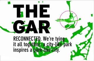
- 1. 1 RECONNECTED. We’re tying it all together; a city-like park inspires a park-like city. THE GAR
- 2. 2 We are not throwing it away anymore. Every bit of our city is a vital piece of stored energy poised to be reused. Our Gardiner has the potential to activate an enlightened city building initiative. The Constraint becomes an Opportunity.
- 3. 3
- 4. 4 We will use our city differently. We will build on a paradigm shift that is already underway. Transit, bicycles and pedestrians are reorganizing the flows of movement and the circulation of city blocks. Public space will surround, integrate & incorporate the traffic.
- 5. 5
- 6. 6 As the city becomes more park-like, the park becomes more city-like. Betsy Barlow Rogers, founder central Park Conservancy We are converting THE GAR. Its a highway; a GO station; a new community & neighbourhood. New parts of the city are forming... inhabited landforms are rising. It is Park City.
- 7. 7
- 8. 8
- 9. 9 Reconnected. THE GAR provides a New Sectional Relationship between city, motorway and waterfront.
- 10. 10 Hybrid forms of cross-sections create hybrid structures with multiple programs (civic, commercial, retail, &
- 11. 11 recreational) running between the new mezzanine level, the top of the infrastructure, and the waterfront.
- 12. 12
- 13. 13
- 14. 14 the gar_project overview The greatest constraints often lead to the most interesting solutions. Think of the Gardiner as a resource for building Toronto’s future urban space and reuse this copious structure. We are using design to make a radical revision of the Gardiner, using it to generate a new kind of neighbourhood, a new kind of city, THE GAR. We are capturing the best qualities and opportunities of the Gardiner’s form, and reducing it’s ill effects. Rather than entombing it, we are reconfiguring and reusing the existing landscape around it, to make it part of a dynamic connector of clusters of public space augmented by existing earth berms and strategic north- south arterials. It’s time we stop looking at the Gardiner as wasteland. Why not let the public space surround the traffic?
- 15. 15 Site = keystone at the epicenter of a massive reinvestment in Toronto’s future. It will serve 42,000 new residents, 20,500 employees and millions of annual visitors and be anchored by a new transit hubs. Greatest barrier = not the Gardiner but the Rail Corridor. The Rail Corridor is skirted by Isolated Neighbourhoods. Creating the Clustered Islands of Distillery District, Olympic Park, West Don Lands, and the Lower Donlands. The eccentricity of the site demands a special response. The land is surrounded and traversed by major regional transportation corridors. Removing this section of the elevated Gardiner is extremely difficult and costly in the short and medium term. But by moving Lakeshore Boulevard out from under the Gardiner and reshaping it, the elevated Gardiner has a potential to become a monumental pedestrian Colonnade to the lake and along 20 acres of new public space lining both sides of the Keating Channel. 480 Lakeshore property can be transformed into a new public ground at the level of a man-made Mountain with an intense urban life at multi-levels. Departing from the conventional logic of streets and blocks this new ground is penetrated by courtyards, passages, terraces, & bridges.
- 16. 16 the gar_project overview THE GAR has the capacity to accommodate a whole new neighbourhood! Max Non-Residential + Residential GFA = 300,000 m2 Max Residential GFA = 198,200 m2 Max Parking Capacity = 3000 cars We propose a landscape platform, a single seamless topography tying all the elements together. Within and atop the mountain an intense program of new uses will serve the need for retail, cultural and civic uses and create a new residential and employment community which will animate the intricate multi-level network of interconnected public spaces. The coming shift in our use of the city is reflected in a phased reduction of the Gardiner and its conversion into a Sustainable Hybrid Link. The Pedestrian Infrastructure ties all the pieces together through a network of pedestrian routes and ramps forming a seamless landscape topography. We are suggesting an inversion: why not let the public space surround the traffic? Providing easy access for the pedestrians and bikers, it is possible to regain the waterfront. We are moving the public program towards the most attractive place and integrating the heavy traffic under the cover of a public level.
- 17. 17 Inhabited land forms: topographic manipulations, alternating plateaus and terraces. Programmed landforms: apartments, plaza, skating. Atop the undulating high level public landscape of the mountain shaped by the surrounding topography of embankments and the dynamic form of the elevated structures, strategically placed towers contain a mix of uses including residential units with remarkable views. Provide the city with views never before experienced. Buildings are treated as landscape concepts. There will be a transit plaza, green roofscapes/landscapes. The gardiner becomes an elevated park and the underpass a public space The site completes the Missing Link in the regional greenspace connecting Distillery District, Don Lands, Lower Don Lands, New GO Station, District Energy Centre. It is an ecology unto itself, and celebrates an exhilarating way of entering Toronto.
- 18. 18
- 19. 19
- 20. 20
- 21. 21
- 22. 22 Phasing THE GAR is a process of evolution and acceleration. We’re not untying a knot, we’re tying it all together. the gar_project phasing We feel that the real creative opportunity lies in looking at THE GAR as a phenomenon of evolution. Incremental transformation of the space between the City and the Lake from a barrier to a fertile ground for connectivity. The transformation weans us away from our reliance on a six-lane, controlled access highway that carries roughly 200,000 cars per day from the west and 120,000 cars per day from the east. We propose highly visible, affordable and useful transformations at early stages that incorporate public transit and pedestrian routes that accelerate this process decreasing the reliance on single occupancy vehicles. PHASE 1 PHASE 2 PHASE 3
- 23. 23 The key idea for tying the 3km stretch of study area together is the management of flows through the landscape and the topographic manipulations that support this new enhanced circulation. The 480 site becomes the confluence point of all the infrastructure systems. A path system ties the site together. Bike path infrastructure literally connects and merges into the mountain’s path sinuously at the top level podium. The Gardiner grid system is multiplied and extended into the mountain site, both as the structural grid for the new forms and as the landscape planting grid for the linear park under the Gardiner. One organizing proportional system applies to both the new and existing pieces.
- 24. 24 existing district islands Clusters of disconnected neighbourhood islands.
- 25. 25 ! RECONNECTED. A new urban topography, a sinuous landscape solving accessibility, but also tying all the disjointed clusters back together. A new eco-infrastructure.
- 26. 26 Biggest obstacle for accessibility = rail corridor + Gardiner Disconnected neighbourhoods.
- 27. 27 Proposed PanAm Games Olympic Park + District Energy Centre + 480 Lakeshore Site Can the existing topography of the rail corridor berms inform a congruent connection?
- 28. 28 re-tying the knot. Strategic passages across minimal interventions.
- 29. 29
- 30. 30
- 31. 31
- 32. 32
- 33. 33
- 34. 34
- 35. 35 Design Elements Aligned with it and forming its northern edge the 480 Lakeshore property offers a new development site calling for a unique (and phase-able) treatment. This departs from the conventional logic of streets and blocks and develops new public ground at the level of a man-made ‘bluff’ with an intense urban life at multi-levels penetrated by courtyards and passages at street level. This site is the keystone at the epicenter of a massive reinvestment in the creation of the East Bayfront, the Distillery District, the West Donlands, and the Lower Donlands which will serve 1000s of new residents and employees and millions of annual visitors.
- 36. 36 NS Connections the gar_project design elements A powerful design driven program of perpendicular moves directed toward the water can alleviate the barrier of the rail corridor and better connect neighbourhoods all along the waterfront.
- 37. 1
- 38. 2
- 39. 37 CONCERT STAGE SHOPFRONTS HANGING GARDEN ARBORETUM SECTION- BETWEEN JARVIS AND SHERBOURNE SECTION- JARVIS INTERSECTION DON’T USE THIS CONCERT STAGE SHOPFRONTS HANGING GARDEN ARBORETUM SECTION- BETWEEN JARVIS AND SHERBOURNE SECTION- JARVIS INTERSECTION
- 40. 38 ART PARK NOISE CATHEDRAL CINEMA SECTION- BETWEEN JARVIS AND SHERBOURNE SECTION- BETWEEN SHERBOURNE AND PARLIAMENT
- 41. 39 ART PARK NOISE CATHEDRAL CINEMA SECTION- BETWEEN JARVIS AND SHERBOURNE SECTION- BETWEEN SHERBOURNE AND PARLIAMENT BIKE PATH SECTION- BETWEEN PARLIAMENT AND CHERRY
- 42. 40 RAILYARD PARK URBAN BOULEVARD SECTION- BETWEEN BOOTH AND LESLIE SECTION- BETWEEN DON RIVER AND BOOTH RAILYARD PARK URBAN BOULEVARD SECTION- BETWEEN BOOTH AND LESLIE SECTION- BETWEEN DON RIVER AND BOOTH
- 43. 41 RAILYARD PARK TOBOGGAN HILL SECTION- BETWEEN DON RIVER AND BOOTH SECTION- JUST EAST OF CHERRY
- 44. 42 ART WALL WIDENED SIDEWALK NEW STREET PAVING BERMED ART PARK SHERBOURNE PARK STREET LOWERED UNDER BERM SHOPFRONT DENSE TREE PLANTING NOISE CATHEDRAL BIKE PATH
- 45. 43 DISTILLERY DISTRICT CONTINUOUS BRICK PAVING TO WATERFRONT BIKE PATH PEDESTRIAN UNDERPASS SHOPFRONT
- 46. 44 Rail Berms the gar_project design elements A new public space offers an interconnected network of public park space at the grade level.
- 47. 45
- 48. 46
- 49. 47
- 50. 48 the gar_project design elements Bridges The scheme’s primary new spatial elements become inhabited bridges. Four new structures augment the existing system of bridges and intensify the density of spatial relationships and uses. Along the Don Valley’s north-south axis, inhabited bridge- cities use the program to link two parts of the City that conflict in both scale and character. The inhabited bridges are both horizontal and vertical connectors, with ramps, escalators, and elevators that link the lower levels of the Valley to the upper levels of the historical city. Each bridge accommodates two categories of use: in the core element, public or commercial use, and at the deck level, pedestrian traffic and related uses. MUNITION STREET PEDESTRIAN BRIDGE OVER THE RAIL CORRIDOR
- 51. 49
- 52. 50
- 53. 51 Go Station At the heart of this new district the temporary GO Station for the Pan Am Games should become a permanent fixture serving this major new pole of investment which parallels and exceeds that which is happening to the west in Liberty Village. This integrated whole has the potential to achieve a new level of sustainability in forming a pattern of transit oriented development served by GO and Light Rail on Queens Quay and Cherry Street.
- 54. 52 Mountain Podium the gar_project design elements The design proposes a continuous, constructed landscape forming an uninterrupted Z-shaped “green” platform/ mountain, that rises over the existing Gardiner and Lake Ontario. The mountain capitalizes on views of the skyline and the Lake reconnects the urban core to the revitalized waterfront. Within and atop the podium, an intense program of new uses will serve the need for retail, cultural and civic uses and new residential and employment uses which will animate the intricate multi-level network of interconnected public spaces.
- 55. 53 This man-made ‘bluff’ provides a remarkable new vantage point overlooking the harbour and new public landscape similar in size to Trinity Bellwoods Park integrated with new links to the West Donlands and Don River Park. On top of this undulating high level public landscape (shaped by the surrounding topography of embankments and the dynamic form of the elevated structures) strategically placed towers contain a mix of uses including residential units with remarkable views.
- 56. 54 Circulation diagram for the 480 Lakeshore Site.
- 57. 55
- 58. 56 the gar_project design elements The landscape design abstracts two of Toronto’s iconic geographic typologies, the bluff and the ravine. The landscape subtypes- savannah (moist and dry), meadow, bluff, and ravine (moist slope and riparian slope) are all part of the larger Carolinian matrix. The two elevational extremes of bluff and ravine inspire an abutment of the topographic experiences of the man- made podium to the familiar experience of Toronto’s most iconic landscapes, the Scarborough Bluffs and the Ravine System. Gathering spaces along the ‘bluff’ zone connect the buildings, and are made lush with orchards, community gardens and play areas throughout. The ravine landscape strategy under the Gardiner colonnade and along the Keating Channel is activated with recreational programming such as a swimming pool and restaurant pavilions. In spirit, it creates a covered boardwalk feel. Park System THE GAR as Gathering Space.
- 59. 57
- 60. 58 BLUFF SAVANNAH DRY SAVANNAH MOIST MEADOW RAVINE SLOPE RAVINE RIPARIAN
- 61. 59 Pinusbanksii JackPine BLUFF SAVANNAHDRY SAVANNAHMOISTMEADOW RAVINESLOPE RAVINERIPARIAN Pinusbanksii JackPine Rhustyphina StaghornSumac Rhusaromatica FragrantSumac Betula alleghaniensis YellowBirch Amelenchier arborea Serviceberry Acersaccharum SugarMaple Acersaccharum SugarMaple Calmagrostis canadensis Canadabluejoint Scirpuscyperinus Wool-grass Asclepiastuberosa Asterericoides Heathaster Wildbergamot Helianthus divaricatus Elymuscanadensis CanadianWildRye Quercusvelutina BlackOak Quercusalba WhiteOak Juglanscinerea Butternut Salixpetiolaris Slenderwillow QuercusPalustris PinOak Quercus macrocarpa Buroak Quercus bicolor SwmpWhiteOak Coylusamericana AmericanHazel Prunusvirginiana ChokeCherry Cornusamomum ssp.obliqua SilkyDogwood Andropogongerardii BigBluestem Sorghastrum nutans IndianGrass Rhustyphina StasghornSumac Sambucus canadensis CommonElderberry Populus grandidentata Large-toothAspen Populustremuloides TremblingAspen Landscape plantng strategy for 480 Lakeshore site.
- 63. 61
- 64. 62
- 65. 63
- 66. 64
- 67. 65 OVERALL CHANNEL EDGE IN CONTEXT
- 68. 66 Towers the gar_project design elements CONCEPT DIAGRAMS PROGRAM DISTRIBUTED PROGRAM MASSING & SITE BARRIERS SITE ACCESS GREEN CONTINUITY CULTURAL / RECREATION RETAIL COMMERCIAL RESIDENTIAL PARKING
- 69. 67 BLOCKED VIEWS PULL UP TO HIGHWAY LEVEL PERFECT VIEWS! EAST-WEST CONNECTION FOR LAKESHORE BLVD E PEDESTRIAN PATH
- 70. 68 TERRACESCOULDCLIMBUPTHISSIDE,CONTINUINGTHEGREENSTRIPS PUBLIC ACCESS AREAS DRAMATIC VIEWS! RESIDENTIAL PODIUM COMMUNITY FUNCTION SPACES SECTION A-A SECTION B-B AA BB RESIDENTIAL TOWER PROGRAM AND CIRCULATION
- 71. 69 EASTWEST SOUTH NORTH MEP RISERS RESIDENTIAL TOWER TYPICAL PLANS AND UNIT MIX EASTWEST SOUTH NORTH MEP RISERS STUDIO STUDIO W/DEN 1 BEDROOM 1 BEDROOM W/DEN 2 BEDROOM 2 BEDROOM W/DEN COMMUNITY AMENITIES PUBLIC AMENITIES TOTAL GFA = 30,000m2 UNIT TYPE QTY AVG AREA STUDIO 31 <45m2 STUDIO W/DEN 27 45m2 1 BEDROOM 87 50m2 1 BEDROOM W/DEN 112 62m2 2 BEDROOM 39 70m2 2 BEDROOM W/DEN 26 >100m2
- 72. 70 F10 F9 F8 F7 F6 F5 F4 F3 F2 GF F20 F19 F18 F17 F16 F15 F14 F13 F12 F11 F30 F29 F28 F27 F26 F25 F24 F23 F22 F21 F40 F39 F38 F37 F36 F35 F34 F33 F32 F31 RESIDENTIAL TOWER TYPICAL PLANS AND UNIT MIX
- 73. 71 VOID BALCONY TRIANGLE BALCONY PIXEL BALCONY WAVE BALCONY FACADE STRATEGIES PROVIDE VARIATION IN VIEWS & PRIVACY
- 74. 72 SITE SECTION A-A A SITE SECTION B-B B SITE SECTION C-C C SITE SECTION D-D D
- 75. 73 COMMERCIAL TOWER TYPICAL PLANS AND ELEVATIONS NORTH EAST SOUTH WEST
- 76. 74 the gar_project sustainability strategy Sustainable design provides solutions that are more than green. The first priority is the human experience – social sustainability.
- 77. 75 Sustainable Innovations for THE GAR will promote environmental and urban stewardship through leveraging current and proposed infrastructure with the site’s inherent energies, ecologies and communities. The key to providing sustainable solutions for modern urban development is to take an integrated systems approach where components of the design compliment each other and function more effectively as a whole. Sustainability measures can be integrated into each of the major infrastructures by considering the natural elements, such as soil, water, and wind, and how they can be incorporated in both the summer and winter seasons. A direct heat exchange system between the Gardiner and the Keating channel could reduce thermal stress and maintenance for the pavement and provide a recreational public water space. This would involve a closed-loop, in-slab hydronic system where embedded pipes beneath the surface help regulate the temperature of the pavement. The pipes would be filled with a water-glycol solution, and the improved heat capacity of the pavement would prevent freezing in the wintertime. In the summer the Gardiner would act as a solar collector to heat the water of a public swimming area within the Keating channel. Selected zones of the Keating channel will be transformed into a solar heated public spa where minimized maintenance is provided by well balanced cleansing systems, developed for large scale
- 78. 76 outdoor applications. The channel could also have areas designated for canoeing and kayaking. A passive lighting system using a highly reflective ceiling, skylights, and reflective facades on adjacent buildings could brighten the space beneath the Gardiner, creating a more welcoming atmosphere, and reducing energy needs. Lining the Gardiner with sound barriers and green walls will help absorb noise and air pollution. The sound barriers could be covered with Photovoltaics to generate electricity which could be fed back to the grid. New structures, vegetation and trees will provide windbreaks, reduce wind-chill, and create a more inviting environment for pedestrians and drivers. A sloping, vegetated Mountain will cover two levels of underground parking and provide roughly 74,000 square metres of green space for trees, meadows, and community gardens. Large skylights will allow beams of light to shine through the structure, illuminating the landscape beneath. An integrated irrigation system using rainwater collection and cisterns would keep the space green throughout the growing season. A community compost collection system could help build soil and fertilize community gardens. The Mountain will also contribute to urban heat island reduction by providing shade trees, green space, reflective surfaces and limiting the areas of exposed asphalt. The UV treated stormwater from the stormwater management system outlined in
- 79. 77 the West Don Lands Precinct Plan/Keating North Lands Plan could be pumped up to the Mountain surface for utilization as a water source for a water feature such as a stream and waterfall. The UV treatment system has to be pumped in its current configuration up to the Mountain surface allowing the added benefit of creating a water feature. The UV treated water would continue to discharge to the Keating Channel to facilitate an inflow at the east end of the channel. The design offers improved aesthetics, air quality, and living environment for the area under and around the Gardiner expressway. Adjacent buildings will benefit from the improved visual quality, public transportation and traffic circulation. Local food production, reduced energy needs, and small scale renewable energy will contribute to Toronto’s plan to become a greener city, a PARK city.
- 80. 78 Noise absorbing walls cladded with Photovoltaics reduce noise emissions and provide maximum yield for green power Daylight redirection below Gardiner Public solar heated spa Keating Channel Direct heat exchange Gardiner acts as solar collector for heating of the keating channel Green noise absorber improve air quality Facade pattern enhance outdoor lighting / quality of public realm Embeded piping in new Gardiner pavement reduces theremal stress and maintenance summer
- 81. 79 Daylight redirection below Gardiner Direct heat exchange with water from Keating Channel as heat source in winter Embeded piping in new Gardiner pavement prevents frost and reduces maintenance and thermal stress to enhance daylight condition to brighten space WINTER
- 82. 80 the gar_project transportation and circulation We foresee a solution that produces highly visible, affordable and useful change at early stages anticipating and incorporating transit and pedestrian routes that accelerate this process and decrease the reliance on single occupancy vehicles. There is an extraordinary opportunity to forge a new integrated urban landscape that will tie these existing and emerging neighbourhoods together with big shaping moves and a rich palette of textures, lighting, furnishings, vegetation and improved connections through the railway and Gardiner corridors, the water’s edge promenades, and an expansive park and trail network.
- 83. 81
- 84. 82 N Regional Through Routes Major Arterials Key Neighborhood Streets Networks
- 86. 84 the gar_project economics We do not see a singular solution but rather a set of affordable interventions. Not one gateway but multiple strategies that facilitate and encourage movement. Great density and mix is anticipated along this corridor and the new neighbourhoods formed in this interstitial territory will not exist in isolation but in a very real sense will be an extension of bordering neighbourhoods. We do not see a singular solution but rather a set of affordable interventions. Multiple strategies that facilitate and encourage movement. APPENDIX
- 87. 85 Innovative Design Competition Master Plan Summary Table TEAM: B SUMMARY A B C D E F G H I J K L M N O P Q R Block Number Block Description Block Type Site Area (Hectares) Maximum Block Height (m) Average Block Height (m) Maximum Building Storeys Total (GFA m2 ) Office % Office (GFA m2 ) Retail % Retail (GFA m2 ) Residential % Residential (GFA m2 ) Other % Other (GFA m2 ) Phase # Notes 1 Ds 10 10 2 7,796 0% 0 100% 7,796 0% 0 0% 0 3 Retail, Service 2 Ds 127 127 40 143,974 30% 43,192 10% 14,397 40% 57,590 20% 25,000 1 Mix Use w integrated parking str 3 Ds 5 5 1 4,176 0% 0 100% 4,176 0% 0 0% 0 3 Big Box Retail 4 Ds 127 127 40 57,398 28% 16,071 20% 11,480 52% 29,847 0% 0 1 Mix Use 5 Ds 127 127 40 65,165 32% 20,853 22% 14,336 46% 29,976 0% 0 1 Mix use 6 Ds 5 5 1 6,704 0% 0 100% 6,704 0% 0 0% 0 2 Big Box Retail 7 Ds 60 60 20 37,000 100% 37,000 0% 0 0% 0 0% 0 1 Commercial 0 0 0 0 8 Park Podium Level Pa 0 37,100 0% 0 0% 0 0% 0 0% 0 1,2,3 Public Amenity 9 Park at Grade Level Pa 0 12,216 0% 0 0% 0 0% 0 0% 0 3 Public Amenity 10 Arcade Park Pa 0 17,986 0% 0 0% 0 0% 0 0% 0 2 Public Amenity 0 0 0 0 11 Jarvis to Sherbourne Pa 0 0 0 7,191 0% 0 15% 1,064 0% 0 0% 0 Public Amenity 12 Sherbourne to Parliament Pa 0 0 0 12,554 0% 0 6% 753 0% 0 0% 0 Public Amenity 13 Parliament to Cherry Pa 0 0 0 3,377 0% 0 32% 1,087 0% 0 0% 0 Public Amenity 14 Don Valley to Booth Pa 0 0 0 32,557 0% 0 0% 0 0% 0 0% 0 Public Amenity 15 Booth to Logan Pa 0 0 0 2,406 0% 0 0% 0 0% 0 0% 0 Public Amenity 16 Logan to Morse Pa 0 0 0 2,062 0% 0 0% 0 0% 0 0% 0 Public Amenity 17 Morse to Carlaw Pa 0 0 0 1,899 0% 0 0% 0 0% 0 0% 0 Public Amenity 18 Carlaw to Winnifred Pa 0 0 0 7,992 0% 0 0% 0 0% 0 0% 0 Public Amenity 19 Winnifred to Larchmount Pa 0 0 0 3,042 0% 0 0% 0 0% 0 0% 0 Public Amenity 20 Larchmount to Rushbrooke Pa 0 0 0 3,651 0% 0 0% 0 0% 0 0% 0 Public Amenity 21 Rushbrooke to Leslie Pa 0 0 0 3,687 0% 0 0% 0 0% 0 0% 0 Public Amenity 0 0 0 0 Site Area: 15 Acres including roads 0 0 0 0 0 0 0 0 0 0 0 0 0 0 0 0 0.00 469,932 117,116 61,794 117,412 25,000 PHASES B Auto-Calculation Phase Number A Description We are proposing a form of intensive development, highly beneficial to intensive transit-oriented development which has great revenue potential for strategic city-owned lands.
- 90. 88 Gardiner Competition Strategic Approach This scheme creates a proposal for the Toronto waterfront that keeps the Gardiner Expressway up and operational. Through strategic public infrastructure projects, this proposal will improve the economic development of the waterfront and Toronto overall in an incremental and cost-effective manner. Toronto has been experiencing a rejuvenated central city where proximity to the Financial District, cultural and retail amenities, and high regional accessibility have all provided a basis for new economic development. Just north of the waterfront, new neighborhoods have been established with highly desirable residential, office, and retail spaces. However, the physical and psychological barriers of the Gardiner and Lakeshore Boulevard in conjunction with deteriorated economic conditions have slowed the transition of development towards the waterfront. Keeping the Gardiner Expressway up and operational allows for the continuous function of the region, while the relatively low-cost strategic improvements recommended by this scheme take hold. Development already slated for the waterfront, such as Parkside Development in East Bayfront and the Keating Channel Precinct in the Lower Don Lands, can take place without construction or vehicular constraints that demolition or tunneling would create. The scheme calls for a series of improved north-south connections in addition to a signature economic development project, 480 Lakeshore. The first physical connections, streetscape and underpass renovations to key roadways, will provide significantly improved pedestrian and vehicular accessibility from the city core to the waterfront. Already in the planning stage, the proposal calls for more vibrant connections with gallery and retail space on both sides of the underpass corridors. These connections, beginning in the west towards the east, will provide more seamless connectivity from the central city to the Central Waterfront and East Bayfront. As economic development takes hold in those areas, simultaneous strategic construction projects to the east will set the next phase of waterfront development into motion. As streetscape and underpass improvements take place towards the west, major public construction projects to the east can begin. It should be noted that throughout this time, the Gardiner remains operational and will allow the central city and waterfront to continue to operate without significant traffic burden. Key public construction projects include the realignment of Lakeshore Boulevard through the 480 Lakeshore site, a pedestrian bridge that traverses the rail yard from Munition Street onto the green roof of 480 Lakeshore, and an array of landscaping elements along the Gardiner. With these improvements, 480 Lakeshore, with a new GO Station, can begin initial development. A green roof atop its podium structure will connect pedestrians between the new neighborhoods (River City, Athletes Village) in the West Don Lands and the waterfront, via 480 Lakeshore. The result is a seamless, highly accessible waterfront neighborhood for pedestrians, transit, and vehicles. Over time, neighborhoods in the West Don Lands, 480 Lakeshore, and the Lower Don Lands (Keating Channel Precinct) take shape all the while, the Gardiner remains up and operational. Incrementally, this strategy provides catalytic public realm infrastructure to support development already in the pipeline and stimulate new waterfront neighborhoods. Toronto Waterfront Economic Development Projects Several real estate developments are slated for the Toronto waterfront. Some projects remain in the planning stage, while others are under construction or occupied. The strategy presented by this scheme incrementally connects waterfront neighborhoods from the west to the east. New connections from the central city to the waterfront, will support these existing developments and improve the prospects for future neighborhoods in the planning stage. East Bayfront •Parkside Development, north of Queens Quay and east of the Sherbourne Park, will be the first private sector development in East Bayfront. The $200 million project includes 540,000 total square feet with a 240,000 square foot podium and 300,000 square foot tower. Uses include residential, retail, office, and institutional. •George Brown College is currently developing a new lakeside campus that will be a central home to George Brown’s Centre for Health Sciences and a new 500-student residence hall. •Corus Quay, recently completed directly on the water’s edge, will be the new corporate headquarters for Corus entertainment. The eight-story, $160 million project has 450,000 square feet of space for 1,200 employees. The project received public funding to be developed. Lower Don Lands •Keating Channel Precinct, in planning stages, will be a 25-block new neighborhood with the Keating Channel bisecting the area. The current draft plan envisions 4,000 residential units. West Don Lands •River City Development, a $250 to $350 million project that is currently in sales, will include five buildings with 900 for-sale residential units complemented by retail. The project is sited in the northeastern section of the West Don Lands.
- 91. 89 •Toronto Community Housing is developing a three-building project with 243 affordable rental units geared for families and seniors. The project will include ground-floor retail and resident amenities. •Athletes Village for the 2015 Pan American Games will accommodate 8,500 athletes and officials in a new neighborhood with sports facilities, retail space, and medical offices. The project is anticipated to turnover as a residential neighborhood with 2,100 housing units. 480 Lakeshore Residual Land Value Analysis Results KPMB Architects, supported by Greenberg Consultants and AECOM, has developed a scheme to respond to the strategy of keeping the Gardiner Expressway up and operational. The vision includes a series of interventions that create rich, multimodal connections between the waterfront and the remainder of Toronto: •Underpass Rehabilitations and Streetscape Enhancements for Jarvis, Sherbourne, Parliament, Cherry, and Trinity •Munition Street Pedestrian Bridge •Realignment of Lakeshore Boulevard In addition to the public realm interventions, a key catalyst project in the proposed scheme is the mixed-use development of 480 Lakeshore located between the Don & Wilson Rail Yards to the north, the Gardiner Expressway to the south and west, and the Don River and Don Valley Parkway to the east. 480 Lakeshore will have a retail and office podium base along with five residential and office towers. Atop 480 Lakeshore is another key public realm infrastructure project, an expansive green roof public space that connects the Munition Street pedestrian bridge to 480 Lakeshore and points south on the waterfront. AECOM Economics has prepared a preliminary residual land value analysis of the proposed 480 Lakeshore development. In the analysis, AECOM first estimates the residual land value of the 480 Lakeshore site and then compares that to cost of the entirety of the public realm projects. 480 Lakeshore Proposed Design The proposed design for 480 Lakeshore calls for a large podium base structure (office, retail) punctuated by five towers (four residential, one commercial) on the 15-acre wedge of land. A pedestrian bridge on Munition Street will provide the connection to the Don West Lands to the north to the site. Atop the podium will be a public green roof open space that links pedestrians throughout the site. Additionally, a proposed new GO Station at 480 Lakeshore will provide transit accessibility to the region. Program The program, outlined in Fig. 2, indicates a total gross floor area of 296,000 square meters or 3.2 million square feet. Of the total floor area, office and residential are the primary components, representing 40 percent each. The remaining is planned for retail. In addition, underground parking will require 103,000 square meters or 1.1 million square feet of space. When completed, the program will support approximately 4,500 office employees, 1,000 retail employees, 1,400 residential units, and 2,100 parking spaces on site. In order to make the project successful, the project requires a mix of residential, office, and retail uses. However, as the project will not developed for some time, the proportion remains flexible and can be rearranged to reflect market conditions at any given time period. Residual Land Value Analysis_Methodology To compute the residual land value of 480 Lakeshore, AECOM took the following steps to evaluate the market value of the office, retail, residential, and parking uses: Figure 2: 480 Lakeshore Proposed Program Use Metric Imperial Office 117,116 sq m 1,260,626 sf Retail 61,794 sq m 665,145 sf Residential 117,412 sq m 1,263,812 sf Grand Total SF 296,322 sq m 3,189,583 sf Parking 103,000 sq m 1,108,683 sf Total Acreage 6.1 hectares 15 acres Source: KPMB Architects; AECOM Gross Floor Area In order to make the project successful, the project requires a mix of residential, office, and retail uses. However, as the project will not developed for some time, the proportion remains flexible and can be rearranged to reflect market conditions at any given time period. Residual Land Value Analysis Methodology To compute the residual land value of 480 Lakeshore, AECOM took the following steps to evaluate the market value of the office, retail, residential, and parking uses: Determine Market Value: o Office and Retail – The analysis relies on the income-capitalization approach. The approach estimates the stabilized-year net operating income for each use and divides it by prevailing capitalization rates, yielding an estimate for total market value. o Residential and Parking – The analysis estimates sale values of residential units and parking spaces. Determine Construction Costs: AECOM developed order-of-magnitude vertical construction costs and site infrastructure cost estimates at 480 Lakeshore as well as the costs to develop the public realm infrastructure interventions.
- 92. 90 Determine Market Value: •Office and Retail – The analysis relies on the income-capitalization approach. The approach estimates the stabilized-year net operating income for each use and divides it by prevailing capitalization rates, yielding an estimate for total market value. •Residential and Parking – The analysis estimates sale values of residential units and parking spaces. Determine Construction Costs: AECOM developed order-of-magnitude vertical construction costs and site infrastructure cost estimates at 480 Lakeshore as well as the costs to develop the public realm infrastructure interventions. •Estimate Residual Land Value: Subtracting construction costs from market value provides a residual land value estimate for the site. This analysis, referred to as a stabilized-year pro forma, is simplistic and does not consider the intricacies of absorption and multiple phases. The analysis does not consider the period to fully lease the office and retail spaces and the multiyear sales period for the residential and parking units. Additionally, tenant inducement packages for office and retail tenants in the first year of the lease and locked-in lease rates are not considered. Assumptions The analysis relies on assumptions regarding the real estate market in Toronto. AECOM spoke to market research analysts at Avison & Young, Devencore Newmark Knight Frank, and a local real estate developer to provide input on assumptions. AECOM provided order-of-magnitude construction costs for both 480 Lakeshore and the public realm projects. Office: •Average Lease Rate – $30 per square foot, triple-net •Vacancy Allowance – 5% •Capitalization Rate – 7.25% •Sales Cost – 4% Retail: •Average Lease Rate – $32 per square foot, triple-net. This assumes the retail will consist of one-third big box retailers at $15 per square foot and remaining two-thirds will consist of traditional retailers at $35 per square foot. •Vacancy Allowance – 8% •Capitalization Rate – 7.5% •Sales Cost – 4% Residential / Parking •Residential Sale Price – $500 per square foot •Parking Space Sale Price – $22,000 •Sales Cost – 4% Construction Costs •Retail and Office – $250 vertical hard costs per square foot, primarily located in the podium structure •Residential – $220 vertical hard costs per square foot located in towers •Garage Parking – $125 per square foot •Soft Costs – 20% of hard costs •Site Infrastructure Costs – $59 million •Public Realm Projects – Please see AECOM cost estimates. The analysis results, shown in Figure 3, indicate 480 Lakeshore has a total market value of $1.2 billion with vertical construction costs (hard and soft) of $1.1 billion. After accounting for site infrastructure costs of $59 million, the remaining residual land value is $52 million, or $3.4 million per acre. Results The analysis results, shown in Figure 3, indicate 480 Lakeshore has a total market value of $1.2 billion with vertical construction costs (hard and soft) of $1.1 billion. After accounting for site infrastructure costs of $59 million, the remaining residual land value is $52 million, or $3.4 million per acre. Figure 3: 480 Lakeshore Residual Land Value Analysis Program Description Total Market Value Vertical Hard Costs Vertical Soft Costs Residual Development Value 480 Lakeshore Program Residential 515,635,000$ (278,039,000)$ (55,608,000)$ 181,989,000$ Retail 199,712,000$ (166,286,000)$ (33,257,000)$ 168,000$ Office 428,161,000$ (315,157,000)$ (63,031,000)$ 49,973,000$ Garage 45,030,000$ (138,585,000)$ (27,717,000)$ (121,273,000)$ Total 1,188,537,000$ (898,067,000)$ (179,613,000)$ 110,857,000$ 480 Lakeshore Site Work (59,263,000)$ 480 Lakeshore Residual Value 51,595,000$ 480 Lakeshore Acres 15 480 Lakeshore Residual Value per Acre 3,440,000$ Source: AECOM 1 Figures may not add due to rounding.
- 93. 91 Appendix: Development Values by Use Figure 5: Residential Units, For-Sale Development Value Gross Square Footage 1,263,812 Gross to Net Factor 85% Rentable Building Area (15% of Gross) 1,074,240 Revenue from For-Sale Units Average Price per Square Foot 500$ Potential Cash Flow 537,120,205$ Net Cash Flow 537,120,205$ Less Sales Costs at 4.00% (21,484,808)$ Market Value 515,635,397$ Source: AECOM Figure 6: Stabilized-Year Retail Income Statement & Development Value Gross Square Feet 665,145 Loss Factor 10% Rentable Building Area (90% of Gross) 598,631 Retail Lease Revenue Average Lease Rate (NNN PSF) 28.33$ Potential Cash Flow 16,959,204$ Less Vacancy Allowance (8% of Lease Revenue) (1,356,736)$ Less Operating Costs Incl. Tax, Insurance, Etc. (0% of Lease Revenue) -$ Net Cash Flow 15,602,468$ Stabilized Year NOI 15,602,468$ Capitalized Value at 7.50% 208,032,903$ Less Sales Costs at 4.00% (8,321,316)$ Market Value 199,711,587$ Source: AECOM Public Realm Funding Strategies The land sale proceeds of $52 million could be used to offset the necessary public realm infrastructure costs of $148 million, leaving a $97 million funding gap. In addition to immediate land sale proceeds, the City and Waterfront Toronto can expect significant property tax revenues from 480 Lakeshore. Newer, Class A office and retail properties in Toronto, conservatively pay approximately $16 per square foot. Based on this, at full occupancy, the commercial uses of 480 Lakeshore can yield $31 million in property tax revenues each year. Residential taxes at roughly 1.25 percent of the purchase price can yield $6.7 million in property taxes each year. The annual property tax revenues of $37 million, at full occupancy, can be considered a future revenue stream to offset the initial funding gap. Figure 7: Stabilized-Year Office Income Statement & Development Value Gross Square Feet 1,260,626 Loss Factor 10% Rentable Building Area (90% of Gross) 1,134,564 Office Lease Revenue Average Lease Rate (NNN PSF) $30 Potential Cash Flow 34,036,906$ Less Vacancy Allowance (5% of Lease Revenue) (1,701,845)$ Less Operating Costs Incl. Tax, Insurance, Etc. (0% of Lease Revenue) -$ Net Cash Flow 32,335,060$ Stabilized Year NOI 32,335,060$ Capitalized Value at 7.25% 446,000,831$ Less Sales Costs at 4.00% (17,840,033)$ Market Value 428,160,798$ Source: AECOM Figure 8: Parking Spaces, For-Sale Development Value Gross Square Footage 1,108,683 Square Feet per Space 520 Total Spaces 2,132 Revenue from Parking Space Sales Revenue per Space 22,000$ Potential Cash Flow 46,905,810$ Net Cash Flow 46,905,810$ Less Sales Costs at 4.00% (1,876,232)$ Market Value 45,029,577$ Source: AECOM infrastructure costs of $148 million, leaving a $97 million funding gap. Figure 4 presents a summary of the public realm costs and the funding gap. Figure 4: Public Realm Funding Public Realm Costs Underpasses (Jarvis, Sherbourne, Parliament, Cherry, Trinity) (11,835,000)$ Munition Street Pedestrian Bridge over Rail (19,500,000)$ Realignment of Lakeshore (19,308,000)$ Sustainability Elements (10,640,000)$ Podium Green Roof / Public Space (26,708,000)$ Streetscape Enhancements (38,624,000)$ Additional Landscaping along Rail Berm & Gardiner (21,671,000)$ Total (148,286,000)$ 480 Lakeshore Residual Land Value 51,595,000$ Funding Gap (480 Lakeshore Residual Value - Public Realm Costs) (96,691,000)$ Source: AECOM 1 Figures may not add due to rounding. In addition to immediate land sale proceeds, the City and Waterfront Toronto can expect significant property tax revenues from 480 Lakeshore. Newer, Class A office and retail properties in Toronto, conservatively pay approximately $16 per square foot. Based on this, at full occupancy, the commercial uses of 480 Lakeshore can yield $31 million in property tax revenues each year. Residential taxes at roughly 1.25 percent of the purchase price can yield $6.7 million in property taxes each year. The annual property tax revenues of $37 million, at full occupancy, can be considered a future revenue stream to offset the initial funding gap.
- 94. 92
- 95. 93 siteplan1:750
- 97. 95 Gardiner Expressway + Lakeshore Redevelopment Competition Consultant List 2010 KPMB, Architecture Bruce Kuwabara Marianne McKenna Bo Yoon Joseph Kan Danielle Whitley Ali Yarbakhti Sharaneh Farahani Lindsay Keir Amanda Sebris BIG, Architecture Bjarke Ingels Jakob Lange Cat Huang Stanley Lung Brian Yang Brian Muthaliff ARUP, Transportation Jonathan Wright Trent Lethco AECOM, Civil and Municipal Engineering Marko Prgin Mike Shallhorn Anita Karvonen Kate Coburn Kumar Kintala PHILLIPS FAREVAAG SMALLENBERG, Landscape Kelty McKinnon Greg Smallenberg DAOUST LESTAGE, Urban Design Renee Daoust Rachel Stecker GREENBERG CONSULTING, Urban Design Ken Greenberg TRANSSOLAR, Sustainability Thomas Auer Matthias Rudolph WONDER Incorporated, Graphic Communication Anita Matusevics
- 98. 96