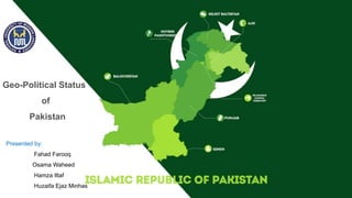
This document discusses the geo-political significance of Pakistan. It outlines how Pakistan's location between South Asia, Central Asia, the Middle East and China gives it strategic importance. Pakistan shares borders with India, Afghanistan, Iran and China, and its location provides access between these regions. The document also notes Pakistan's natural resources like water, fuel, agriculture and minerals. It argues that Pakistan's geostrategic position will continue impacting international relations in the region.
2. CONTENTS:
Geo-Politics
Geo-political value of Asia
Geo-political Realities of South Asia
Geo-political Value of Pakistan in South Asia
Pakistan as a FRONT-LINE STATE
Containment of china Via Pakistan
Borders of Pakistan
Natural Resources in Pakistan
Conclusion
5. GEO-POLITICS:
• Analysis of the geographic influences on power relationships in international
relations.
• The word geopolitics was originally coined by the Swedish political scientist Rudolf
Kjellén.
• In contemporary discourse, geopolitics has been widely employed as a loose
synonym for international politics.
• At the level of international relations, geopolitics is a method of studying foreign
policy.
• Geopolitics focuses on political power linked to geographic space.
6.
7. GEO-POLITICAL VALUE OF ASIA:
• Covers an area of 17,256,000 square miles. 1/3 of Earth’s land mass.
• World’s Largest continent with the population of 4.561 Billion.
• It is consist of 48 Countries.
• Asia is home to the world’s earliest civilizations.
• It is surrounded by 38 countries on the coast.
• sea-lanes in the Indian Ocean regulate roughly 80 to 90 percent of total world
trade.
• The social and political geography of the continent continues to inform and
influence the rest of the world.
8.
9. GEO-POLITICAL REALITIES OF SOUTH ASIA:
• Region's history is shaped by its terrain. Foreign policy and national interests are
also impacted.
• South Asia is considered as the "Fulcrum" of Asia because of its location.
• The countries of Central Asia, China, the Gulf States, and Southeast Asia all meet
in South Asia.
• Inter-regional conflicts based on ideological differences, conflicting national
objectives.
• territorial disagreements, and political rivalry characterize the politics of this region.
10.
11. GEO-POLITICAL VALUE OF PAKISTAN IN SOUTH
ASIA:
• Pakistan is a bridge connecting South Asia, South West Asia, and Central Asia.
• Iran and CARS have abundant energy resources, whereas India and China are energy
deficient.
• Through Afghanistan, Pakistan provides a direct land access to Iran and the CARs.
• Pakistan also offers a more cost-effective path to India for the IPI line project.
• During the Cold War, the Soviets conquered Afghanistan in order to gain access to
warm water via Pakistan's strategic location.
12.
13. PAKISTAN AS A FRONT-LINE STATE:
• In her surrogate war against the Soviet Union, the United States exploited
Pakistan as a front-line state.
• Pakistan had payed high price in the war of terror (GWOT) because of its border
with Afghanistan.
• Pakistan is once again being used as a front-line state in the global war on terror.
• Now USA wants to use Pakistan to restrict china’s Economic Activities.
• USA is also interested for bases in Pakistan to keep an eye on whole region after
the exit from Afghanistan in Aug, 2021.
14.
15. CONTAINMENT OF CHINA VIA PAKISTAN:
• The United States' objectives in the region are to restrict China's emerging influence.
• USA wants to stop Iran's nuclear ambitions, fight terrorism through Afghanistan, and
expand India as a balance to China.
• The United States is aiming to gain economic dominance in the Rest of Asia, which are
rich in petroleum resources.
• USA is not happy with CPEC Project in Pakistan.
• United States is achieving its security goals of maintaining its standing as the sole
superpower by restricting China's rise.
16.
17. IMPORTANCE OF PAKISTAN FOR CENTRAL ASIAN
STATES
• With the disintegration of the Soviet Union, five important landlocked countries called Central
Asian Republics (CARs), emerged in Asia.
• They need Pakistan to conduct its transit trade towards South Asia and beyond.
• Pakistan and the Central Asian Republics are linked by several trade agreements.
• The $8 billion Turkmenistan, Afghanistan, Pakistan, and India (TAPI) gas pipeline project.
• CASA 1000 is another project under construction that would fill the energy sector gap
between the two regions.
• will provide a gateway to Indian Ocean waters to China and the Central Asian states.
18.
19.
20. BORDERS OF PAKISTAN:
• Pakistan is bordered by India to the east, Afghanistan to the northwest and Iran to
the west while China borders the country in the northeast.
• The nation is geopolitically situated within some of the most controversial regional
boundaries.
• share disputes and have many-a-times escalated military tensions between the
nations.
• Dispute of Kashmir with India and the Durand Line with Afghanistan.
• Its western borders include the Khyber Pass and Bolan Pass.
21.
22. AFGHANISTAN–PAKISTAN BORDER:
• The border with Afghanistan which is known as the Durand Line, 2,670 km.
• Runs from the Hindu Kush and the Pamir Mountains.
• Southwestern Chaman border – one of the two main crossings between the two
neighbors.
• Pakistan and landlocked Afghanistan share 18 crossing points.
• most frequently used are northwestern Torkham and Chaman. Torkham border
was reopened on Sep,14, 2020.
• According to Pakistan Customs authorities, the border will remain open 24 hours
for trade activities.
23.
24. CHINA–PAKISTAN BORDER:
• The eastern tip of the Wakhan Corridor starts the Sino-Pak border between the
People's Republic of China and Pakistan.
• The border length between both countries is 559 Km.
• It carries on south-eastward and ends near the Karakoram Pass.
• This line was determined from 1961 to 1965 in a series of agreements between
China and Pakistan.
• It is understood that if the dispute over Kashmir is resolved, the border would need
to be discussed again.
25.
26. INDIA–PAKISTAN BORDER:
• The India–Pakistan border continues irregularly southward for about 1,280
kilometers, following the Radcliffe line.
• The international border-line has been a matter of pivotal dispute between
Pakistan and India ever since 1947.
• The Pakistan-India ceasefire line runs from the Karakoram Pass to northwest of
Lahore.
• This line, about 770 kilometers long, was arranged with United Nations.
• the Shimla Agreement was signed on 2 July 1972 between Indira Gandhi and
Zulfikar Ali Bhutto.
• Since then, it has been generally known as the Line of Control or the (LoC).
27.
28. INDIA–PAKISTAN BORDER CONT…..
• The southern borders are far less contentious than those in northern Pakistan
(Kashmir).
• Wagha border connects Pakistan’s Lahore with India’s Amritsar.
• Independent and free Pakistan contested the southern boundary of Sindh, and a
succession of border incidents resulted.
• They were less dangerous and less widespread, however, than the conflict that
erupted in Kashmir in the Indo-Pakistani War of August 1965.
• Final stretch of Pakistan's border with India is about 80 kilometers long, running
east and southeast of Sindh to an inlet of the Arabian Sea.
29.
30. IRAN–PAKISTAN BORDER:
• The boundary with Iran, 959 km (595.9 mi).
• first delimited by a British commission in the same year as the Durand Line was
demarcated.
• Separating Iran from what was then British India's Baluchistan province.
• Modern Iran has a province named Sistan va Baluchistan that borders Pakistan
and has Balochis in an ethnic majority.
• In 1957 Pakistan signed a frontier agreement with Iran in Rawalpindi according to
which the border was officially declared.
• Two countries haven't had this border as a subject of serious dispute at all.
31.
32. NATURAL RESOURCES IN PAKISTAN:
Water Resources:
• Hydrological power is a renewable resource which benefits Pakistan a lot.
• After the Indus Water Treaty in 1960 World Bank decided that River Sutlej, Ravi
and Beas water will be used by India.
• River Indus, Jhelum and Chenab water will be used by Pakistan.
• Pakistan was told to build two dams, one tarbela and second Mangla, 5 barrages,
8 link canals, and 1 gated siphon.
• Pakistan largest river is known as the Indus River which flows from Tibet/China
and enters Pakistan through Gilgit Baltistan.
33.
34. Fuel Resources:
• Pakistan has extensive energy resources in fairly sizable amount.
• Natural gas reserves, petroleum oil reserves, coal fields and large hydropower
potential.
Agriculture:
• About 26% of Pakistan's total land area is under cultivation and is watered by one
of the largest irrigation systems in the world.
• cotton, wheat, rice, sugarcane, maize, sorghum, millets, pulses, oil
seeds, barley, fruits and vegetables.
35.
36. Fishery:
• Fishery and fishing industry plays an important role in the national economy of
Pakistan.
• With a coastline of about 1046 km, Pakistan has enough fishery resources that
remain to be fully developed.
Forestry:
• About only 4.1% of land in Pakistan is covered with forests.
• The forests of Pakistan are a main source of food, lumber, paper, fuel
wood, latex, medicine.
• as well as used for purposes of wildlife conservation and Eco tourism.
37.
38. Mining:
• Salt Range in the Potwar Plateau has large deposits of rock salt.
• Pakistan has extensive mineral resources.
• reserves of gypsum, limestone, chromite, iron ore, rock salt, silver, gold.
• precious stones, gems, marbles, tiles, copper, sulfur, fire clay and silica sand.
Climate:
• All four seasons exist in Pakistan.
• Some Area are pleasant, some are hot and some are humid.
39.
40. CONCLUSION:
• Pakistan's geostrategic, ideological, and political concerns are numerous, diverse,
nuanced, and compelling.
• encouraging self-reliance and austerity, which may be the foundation of our
national strategy in the future.
• Besides geopolitical and historical facts, maps, charts and data proving and
confirming this oneness were used.
• As has been often said, the unity is under risk from outsiders because of its
geographical location.