SlideShare ist ein Scribd-Unternehmen logo
1 von 29
Downloaden Sie, um offline zu lesen
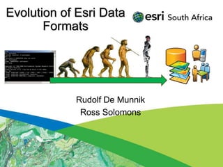
Evolution of Esri Data
       Formats


            Rudolf De Munnik
             Ross Solomons
Seminar Outline
 • Introduction

 • Legacy Formats
 • Demonstration

 • Current Formats
 • BREAK (15min)
 • Demonstration

 • Future Formats
 • Demonstration

 • Questions / Discussions
Introduction
• Purpose of the seminar:
 − History of formats.
 − Awareness to the optimal usage of the
   software and data formats.
 − Purpose, advantages and disadvantages of
   formats
 − What the future holds…
History Timeline


 1982(ArcInfo)          1986(PC ArcInfo)   1991(ArcInfo)    1991(ArcCAD)
  Coverages                Coverages          GRID              CAD


1991(ArcView 1)   1994(ArcInfo) 1995(ArcSDE)    1996        1999(ArcView 3.2)
  Shapefiles        ArcStorm       RDBMS     (MapObjects)   Models, Extensions


1997(ArcView IMS) 1999(ArcIMS)     2001(ArcGIS 8.1)     2006      ArcGIS 10.1
  Map Services    Map Services      Geodatabase (ArcGIS Server 9.2)  2012
                                                    Map Services     Cloud
Legacy Formats
• Organizational use:
 − Projects and Departments
• Users:
 − Data capturing and storage


 Project   Department
Legacy Formats
• ArcInfo Coverages:


                       Topology:
                       - Build command
                       - Clean command

                       Model for the
                       Geodatabase
                       Feature Dataset
ArcInfo Workstation
Legacy Formats
• ArcStorm:
 −   Central storage and checkout editing
 −   Coverage based
 −   Tile structure
 −   Pessimistic locking of Tiles
 −   Checked out Tiles not available to other users
 −   Mapped network drives
 −   No Relational database
 −   Initial concepts for SDE
Legacy Formats
• ArcSDE:
 −   Store Spatial data in a Relational Database
 −   Oracle, Informix, DB2
 −   Utilise Spatial Types (OGC)
 −   No Geodatabase functions
 −   No Feature Datasets
 −   Allow raster storage
 −   Rasters fast, but large.
 −   Raster duplication.
Legacy Formats
• Shapefile legacy:
 − Simple geographic data
   format
 − Big Demand for simple
   storage
 − Open Exchange format
 − Adopted as standard
 − Interoperability buzzword
 − Point, Line and Polygon only
Demonstration
• ArcInfo Workstation
• ArcView 3.2
Current Formats Overview
• Organization:
    − Projects, Departments, Enterprise
• User:
    − Analysis and Consume

•   Shapefile limitations
•   Geodatabase advantages
•   Services
•   Mobile
•   Cloud
Organizational Use
• Projects
 − Shapefiles and File Geodatabase
• Departments
 − Geodatabase (Oracle, SQL…)
• Enterprise
 − Geodatabase (Oracle, SQL…)
 − Services  (ArcGIS Server)


 Project     Department
                          Enterprise
Shape file Limitations
•   No Topology
•   No Attribute validation
•   Size limitation (2GB)
•   No complex geometry
•   No multiuser editing
                                  To Geodatabase
•   No Annotation


                                     Shapefile
•   DBF Limitations
    − Data types e.g. date/time
    − Field names 10 chars                       Shapefile

    − Blobs
Not using full potential of ArcGIS
Geodatabase Advantages
• What is a Geodatabase?
 − Central storage and management location for
   rich collection of spatial data,
 − Sophisticated rules and relationships.
 − Geoprocessing and symbology.
Geodatabase Advantages
• Why use a Geodatabase?
 −   Integration with RDBMS (Oracle, SQL..)
 −   Multi-user editing (versions)
 −   Topology rules and behavior
 −   Attribute validation (domains)
 −   Greater storage capacity
 −   Lower storage requirements
 −   Optimized performance
 −   Scalable (File GDB, SQL Express, Enterprise)

 Leverage full potential of ArcGIS!!
Geodatabase elements
Geodatabase                        Tables
Feature dataset
                                   Raster datasets
   Spatial reference

                                   Raster mosaic
 Feature classes
    Polygon            Route       Additional geodatabase elements
    Line               Dimension   Survey datasets   Terrain datasets
    Point
                                   GPS Datasets      Schematics
    Annotation
                                   Network datasets Representations
 Relationship classes
                                   Toolboxes
 Geometric networks                      Tool           Model           Script
 Topology                          Behavior
                                   Attribute defaults       Connectivity rules
 Network datasets                  Attribute domains        Relationship rules
                                   Split/Merge policy       Topology rules
Geodatabase Design
• Domains, Attachments and Aliases
 −   Utilize on multiple platforms
 −   Design for editing in Desktop
 −   Design for Server applications
 −   Design for Mobile
                                     Validation in Attributes dialog box
     Validation in attribute table
Feature Dataset defined
• Logical grouping of Feature Classes that
  participate in a behavioral function e.g.
  Topology.
• Common coordinate system for all contained
  Feature Classes.
• User permission set on Feature Dataset level.
• Feature Class name unique in Geodatabase,
  not in Feature Dataset.
• Not to be used to organize data – not a
  directory!
Services
• Dynamic Services
  − Live content from Geodatabase
  − View updates
  − Interrogate data

• Cached Services
  − Predefined Tile schema at
    various scales
  − Stored as images in Tile
    structure

• Image Services
  − Single or mosaic images served
Mobile
• Mobile (GPS)
  −   High accuracy devices
  −   Data capture
  −   Ruggedized
  −   Purpose driven
  −   Workflow
  −   Geodatabase design

• Mobile (Smartphone)
  −   Windows, Apple, Android
  −   Executive monitoring
  −   Planning
  −   Geodatabase design
Online (Cloud) content
• Online content
  − Image and Street
  − Desktop, Server, Mobile
  − Online access control

• Subscription
  −   Personal
  −   Organization
  −   Upload data/proc
  −   Applications and
      Dashboards
BREAK
• 15 Minute Break
Demonstration
• Geodatabase:
 −   Elements
 −   Topology
 −   Network analysis
 −   Domains
 −   Representations
 −   Annotation

 − Attachments
 − Geometric Networks
Demonstration
• Services
• Mobile
• Online content
Future Formats
• Organizational use:
 − Projects, Departments, Enterprise
 − Societal
• Users
 − Everyone


 Project   Department                  Societal
                         Enterprise
Demonstration
• Social Media
• 3D Web Viewer (Braamfontein)
• 3D Web Viewer (Airport )
Questions & Discussions

Thank You !

Weitere ähnliche Inhalte

Was ist angesagt?

GEOGRAPHICAL INFORMATION SYSTEM (GIS)
GEOGRAPHICAL INFORMATION SYSTEM (GIS)GEOGRAPHICAL INFORMATION SYSTEM (GIS)
GEOGRAPHICAL INFORMATION SYSTEM (GIS)Siva Mbbs
 
Application of GIS (Geographical information system)
Application of GIS (Geographical information system)Application of GIS (Geographical information system)
Application of GIS (Geographical information system)Fayaz Ahamed A P
 
Spatial Analysis Using GIS
Spatial Analysis Using GISSpatial Analysis Using GIS
Spatial Analysis Using GISPrachi Mehta
 
DATA in GIS and DATA Query
DATA in GIS and DATA QueryDATA in GIS and DATA Query
DATA in GIS and DATA QueryKU Leuven
 
Gis powerpoint
Gis powerpointGis powerpoint
Gis powerpointkaushdave
 
Digital image processing 1
Digital  image processing 1Digital  image processing 1
Digital image processing 1Dhaval Jalalpara
 
Vector data model
Vector data model Vector data model
Vector data model Pramoda Raj
 
Theoretical framework for gis
Theoretical framework for gisTheoretical framework for gis
Theoretical framework for gissrinivas2036
 
Data input and transformation
Data input and transformationData input and transformation
Data input and transformationMohsin Siddique
 
Introduction To Geographical Information System (GIS)
Introduction To Geographical Information System (GIS) Introduction To Geographical Information System (GIS)
Introduction To Geographical Information System (GIS) Ajay Singh Lodhi
 
Intro to GIS and Remote Sensing
Intro to GIS and Remote SensingIntro to GIS and Remote Sensing
Intro to GIS and Remote SensingJohn Reiser
 
A Journey to the World of GIS
A Journey to the World of GISA Journey to the World of GIS
A Journey to the World of GISNishant Sinha
 
Terminology and Basic Questions About GIS
Terminology and Basic Questions About GISTerminology and Basic Questions About GIS
Terminology and Basic Questions About GISMrinmoy Majumder
 

Was ist angesagt? (20)

GIS - Topology
GIS - Topology GIS - Topology
GIS - Topology
 
GEOGRAPHICAL INFORMATION SYSTEM (GIS)
GEOGRAPHICAL INFORMATION SYSTEM (GIS)GEOGRAPHICAL INFORMATION SYSTEM (GIS)
GEOGRAPHICAL INFORMATION SYSTEM (GIS)
 
Application of GIS (Geographical information system)
Application of GIS (Geographical information system)Application of GIS (Geographical information system)
Application of GIS (Geographical information system)
 
Types of GIS Data
Types of GIS DataTypes of GIS Data
Types of GIS Data
 
Spatial Analysis Using GIS
Spatial Analysis Using GISSpatial Analysis Using GIS
Spatial Analysis Using GIS
 
DATA in GIS and DATA Query
DATA in GIS and DATA QueryDATA in GIS and DATA Query
DATA in GIS and DATA Query
 
Components of GIS
Components of GISComponents of GIS
Components of GIS
 
GIS data analysis
GIS data analysisGIS data analysis
GIS data analysis
 
Gis powerpoint
Gis powerpointGis powerpoint
Gis powerpoint
 
Digital image processing 1
Digital  image processing 1Digital  image processing 1
Digital image processing 1
 
Vector data model
Vector data model Vector data model
Vector data model
 
Theoretical framework for gis
Theoretical framework for gisTheoretical framework for gis
Theoretical framework for gis
 
Data input and transformation
Data input and transformationData input and transformation
Data input and transformation
 
Introduction To Geographical Information System (GIS)
Introduction To Geographical Information System (GIS) Introduction To Geographical Information System (GIS)
Introduction To Geographical Information System (GIS)
 
GIS & Raster
GIS & RasterGIS & Raster
GIS & Raster
 
Functions of GIS
Functions of GISFunctions of GIS
Functions of GIS
 
Intro to GIS and Remote Sensing
Intro to GIS and Remote SensingIntro to GIS and Remote Sensing
Intro to GIS and Remote Sensing
 
A Journey to the World of GIS
A Journey to the World of GISA Journey to the World of GIS
A Journey to the World of GIS
 
GIS Map Projection
GIS Map ProjectionGIS Map Projection
GIS Map Projection
 
Terminology and Basic Questions About GIS
Terminology and Basic Questions About GISTerminology and Basic Questions About GIS
Terminology and Basic Questions About GIS
 

Ähnlich wie Evolution of Esri Data Formats Seminar

Data managing and Exchange GDB
Data managing and Exchange GDB Data managing and Exchange GDB
Data managing and Exchange GDB Esri
 
Arc gis desktop_and_geoprocessing
Arc gis desktop_and_geoprocessingArc gis desktop_and_geoprocessing
Arc gis desktop_and_geoprocessingEsri
 
Materi Geodatabase Management - Fellowship 2022.pdf
Materi Geodatabase Management - Fellowship 2022.pdfMateri Geodatabase Management - Fellowship 2022.pdf
Materi Geodatabase Management - Fellowship 2022.pdfsakinatunnajmi
 
Ozri 2013 Brisbane, Australia - Geodatabase Efficiencies
Ozri 2013 Brisbane, Australia - Geodatabase EfficienciesOzri 2013 Brisbane, Australia - Geodatabase Efficiencies
Ozri 2013 Brisbane, Australia - Geodatabase EfficienciesWalter Simonazzi
 
Architecting the ArcGIS Platform
Architecting the ArcGIS PlatformArchitecting the ArcGIS Platform
Architecting the ArcGIS PlatformEsri UK
 
Enterprise geodatabase sql access and administration
Enterprise geodatabase sql access and administrationEnterprise geodatabase sql access and administration
Enterprise geodatabase sql access and administrationbrentpierce
 
NDGeospatialSummit2019 - ArcGIS Pro – Next-Generation Desktop GIS
NDGeospatialSummit2019 - ArcGIS Pro – Next-Generation Desktop GISNDGeospatialSummit2019 - ArcGIS Pro – Next-Generation Desktop GIS
NDGeospatialSummit2019 - ArcGIS Pro – Next-Generation Desktop GISNorth Dakota GIS Hub
 
GWT 2014: Emergency Conference - 02 le soluzioni geospaziali per la gestione ...
GWT 2014: Emergency Conference - 02 le soluzioni geospaziali per la gestione ...GWT 2014: Emergency Conference - 02 le soluzioni geospaziali per la gestione ...
GWT 2014: Emergency Conference - 02 le soluzioni geospaziali per la gestione ...Planetek Italia Srl
 
NAPSG 2010 Fire/EMS Conference - Data Sharing Basics
NAPSG 2010 Fire/EMS Conference - Data Sharing BasicsNAPSG 2010 Fire/EMS Conference - Data Sharing Basics
NAPSG 2010 Fire/EMS Conference - Data Sharing Basicspdituri
 
Arc gis introduction-ppt
Arc gis introduction-pptArc gis introduction-ppt
Arc gis introduction-pptAshok Peddi
 
GWT 2014: Energy Conference - 02 Le soluzioni Geospaziali per il mondo energy
GWT 2014: Energy Conference - 02 Le soluzioni Geospaziali per il mondo energyGWT 2014: Energy Conference - 02 Le soluzioni Geospaziali per il mondo energy
GWT 2014: Energy Conference - 02 Le soluzioni Geospaziali per il mondo energyPlanetek Italia Srl
 
Presentation MIG-T GeoPackage.pdf
Presentation MIG-T GeoPackage.pdfPresentation MIG-T GeoPackage.pdf
Presentation MIG-T GeoPackage.pdfssusera932351
 
Building good web_maps, Esri, Joris Bak
Building good web_maps, Esri, Joris BakBuilding good web_maps, Esri, Joris Bak
Building good web_maps, Esri, Joris BakEsri Nederland
 
2016 workshops: understanding the language of gis and cad by warren geissler
2016 workshops:  understanding  the language  of gis and cad by warren geissler2016 workshops:  understanding  the language  of gis and cad by warren geissler
2016 workshops: understanding the language of gis and cad by warren geisslerGIS in the Rockies
 
Apdm 101 Arc Gis Pipeline Data Model (1)
Apdm 101 Arc Gis Pipeline Data Model  (1)Apdm 101 Arc Gis Pipeline Data Model  (1)
Apdm 101 Arc Gis Pipeline Data Model (1)David Nichter, GISP
 
Development of a Prototype Web GIS Server for HDF-EOS Data based on OGC Web M...
Development of a Prototype Web GIS Server for HDF-EOS Data based on OGC Web M...Development of a Prototype Web GIS Server for HDF-EOS Data based on OGC Web M...
Development of a Prototype Web GIS Server for HDF-EOS Data based on OGC Web M...The HDF-EOS Tools and Information Center
 
Lecture 1b introduction to arc gis
Lecture 1b  introduction to arc gisLecture 1b  introduction to arc gis
Lecture 1b introduction to arc gisAbir Mohammad
 

Ähnlich wie Evolution of Esri Data Formats Seminar (20)

Data managing and Exchange GDB
Data managing and Exchange GDB Data managing and Exchange GDB
Data managing and Exchange GDB
 
Arc gis desktop_and_geoprocessing
Arc gis desktop_and_geoprocessingArc gis desktop_and_geoprocessing
Arc gis desktop_and_geoprocessing
 
Materi Geodatabase Management - Fellowship 2022.pdf
Materi Geodatabase Management - Fellowship 2022.pdfMateri Geodatabase Management - Fellowship 2022.pdf
Materi Geodatabase Management - Fellowship 2022.pdf
 
Ozri 2013 Brisbane, Australia - Geodatabase Efficiencies
Ozri 2013 Brisbane, Australia - Geodatabase EfficienciesOzri 2013 Brisbane, Australia - Geodatabase Efficiencies
Ozri 2013 Brisbane, Australia - Geodatabase Efficiencies
 
Architecting the ArcGIS Platform
Architecting the ArcGIS PlatformArchitecting the ArcGIS Platform
Architecting the ArcGIS Platform
 
Enterprise geodatabase sql access and administration
Enterprise geodatabase sql access and administrationEnterprise geodatabase sql access and administration
Enterprise geodatabase sql access and administration
 
NDGeospatialSummit2019 - ArcGIS Pro – Next-Generation Desktop GIS
NDGeospatialSummit2019 - ArcGIS Pro – Next-Generation Desktop GISNDGeospatialSummit2019 - ArcGIS Pro – Next-Generation Desktop GIS
NDGeospatialSummit2019 - ArcGIS Pro – Next-Generation Desktop GIS
 
GWT 2014: Emergency Conference - 02 le soluzioni geospaziali per la gestione ...
GWT 2014: Emergency Conference - 02 le soluzioni geospaziali per la gestione ...GWT 2014: Emergency Conference - 02 le soluzioni geospaziali per la gestione ...
GWT 2014: Emergency Conference - 02 le soluzioni geospaziali per la gestione ...
 
Geoservices Activities at EDINA
Geoservices Activities at EDINAGeoservices Activities at EDINA
Geoservices Activities at EDINA
 
ArcGIS10 Land Records Mgmt (EPAN 2010)
ArcGIS10 Land Records Mgmt (EPAN 2010)ArcGIS10 Land Records Mgmt (EPAN 2010)
ArcGIS10 Land Records Mgmt (EPAN 2010)
 
NAPSG 2010 Fire/EMS Conference - Data Sharing Basics
NAPSG 2010 Fire/EMS Conference - Data Sharing BasicsNAPSG 2010 Fire/EMS Conference - Data Sharing Basics
NAPSG 2010 Fire/EMS Conference - Data Sharing Basics
 
Arc gis introduction-ppt
Arc gis introduction-pptArc gis introduction-ppt
Arc gis introduction-ppt
 
GWT 2014: Energy Conference - 02 Le soluzioni Geospaziali per il mondo energy
GWT 2014: Energy Conference - 02 Le soluzioni Geospaziali per il mondo energyGWT 2014: Energy Conference - 02 Le soluzioni Geospaziali per il mondo energy
GWT 2014: Energy Conference - 02 Le soluzioni Geospaziali per il mondo energy
 
Presentation MIG-T GeoPackage.pdf
Presentation MIG-T GeoPackage.pdfPresentation MIG-T GeoPackage.pdf
Presentation MIG-T GeoPackage.pdf
 
Bb geodatabase
Bb geodatabaseBb geodatabase
Bb geodatabase
 
Building good web_maps, Esri, Joris Bak
Building good web_maps, Esri, Joris BakBuilding good web_maps, Esri, Joris Bak
Building good web_maps, Esri, Joris Bak
 
2016 workshops: understanding the language of gis and cad by warren geissler
2016 workshops:  understanding  the language  of gis and cad by warren geissler2016 workshops:  understanding  the language  of gis and cad by warren geissler
2016 workshops: understanding the language of gis and cad by warren geissler
 
Apdm 101 Arc Gis Pipeline Data Model (1)
Apdm 101 Arc Gis Pipeline Data Model  (1)Apdm 101 Arc Gis Pipeline Data Model  (1)
Apdm 101 Arc Gis Pipeline Data Model (1)
 
Development of a Prototype Web GIS Server for HDF-EOS Data based on OGC Web M...
Development of a Prototype Web GIS Server for HDF-EOS Data based on OGC Web M...Development of a Prototype Web GIS Server for HDF-EOS Data based on OGC Web M...
Development of a Prototype Web GIS Server for HDF-EOS Data based on OGC Web M...
 
Lecture 1b introduction to arc gis
Lecture 1b  introduction to arc gisLecture 1b  introduction to arc gis
Lecture 1b introduction to arc gis
 

Mehr von Esri South Africa

Esri South Africa ArcGIS 10.2 Rollout
Esri South Africa ArcGIS 10.2 Rollout Esri South Africa ArcGIS 10.2 Rollout
Esri South Africa ArcGIS 10.2 Rollout Esri South Africa
 
Esri Africa User Conference 2014
Esri Africa User Conference 2014Esri Africa User Conference 2014
Esri Africa User Conference 2014Esri South Africa
 
The Gauteng City Region keynote address
The Gauteng City Region keynote addressThe Gauteng City Region keynote address
The Gauteng City Region keynote addressEsri South Africa
 
GIS as a Platform by Sam Viana (Esri Inc)
GIS as a Platform by Sam Viana (Esri Inc)GIS as a Platform by Sam Viana (Esri Inc)
GIS as a Platform by Sam Viana (Esri Inc)Esri South Africa
 
Data Interoperabilty Extension
Data Interoperabilty Extension Data Interoperabilty Extension
Data Interoperabilty Extension Esri South Africa
 
Esri South Africa Python for Everyone
Esri South Africa Python for EveryoneEsri South Africa Python for Everyone
Esri South Africa Python for EveryoneEsri South Africa
 
Esri South Africa GIS In The Cloud
Esri South Africa GIS In The CloudEsri South Africa GIS In The Cloud
Esri South Africa GIS In The CloudEsri South Africa
 
Licensing in ArcGIS 10.0 and 10.1
Licensing in ArcGIS 10.0 and 10.1Licensing in ArcGIS 10.0 and 10.1
Licensing in ArcGIS 10.0 and 10.1Esri South Africa
 
Geodatabase: The ArcGIS Mechanism for Data Management
Geodatabase: The ArcGIS Mechanism for Data ManagementGeodatabase: The ArcGIS Mechanism for Data Management
Geodatabase: The ArcGIS Mechanism for Data ManagementEsri South Africa
 

Mehr von Esri South Africa (13)

Esri South Africa ArcGIS 10.2 Rollout
Esri South Africa ArcGIS 10.2 Rollout Esri South Africa ArcGIS 10.2 Rollout
Esri South Africa ArcGIS 10.2 Rollout
 
Esri Africa User Conference 2014
Esri Africa User Conference 2014Esri Africa User Conference 2014
Esri Africa User Conference 2014
 
The Gauteng City Region keynote address
The Gauteng City Region keynote addressThe Gauteng City Region keynote address
The Gauteng City Region keynote address
 
Esri Mobility Basics 2013
Esri Mobility Basics 2013Esri Mobility Basics 2013
Esri Mobility Basics 2013
 
GIS as a Platform by Sam Viana (Esri Inc)
GIS as a Platform by Sam Viana (Esri Inc)GIS as a Platform by Sam Viana (Esri Inc)
GIS as a Platform by Sam Viana (Esri Inc)
 
Data Interoperabilty Extension
Data Interoperabilty Extension Data Interoperabilty Extension
Data Interoperabilty Extension
 
Esri South Africa Python for Everyone
Esri South Africa Python for EveryoneEsri South Africa Python for Everyone
Esri South Africa Python for Everyone
 
Whats New in ArcGIS 10.1
Whats New in ArcGIS 10.1Whats New in ArcGIS 10.1
Whats New in ArcGIS 10.1
 
Esri South Africa GIS In The Cloud
Esri South Africa GIS In The CloudEsri South Africa GIS In The Cloud
Esri South Africa GIS In The Cloud
 
Licensing in ArcGIS 10.0 and 10.1
Licensing in ArcGIS 10.0 and 10.1Licensing in ArcGIS 10.0 and 10.1
Licensing in ArcGIS 10.0 and 10.1
 
Aligning data
Aligning dataAligning data
Aligning data
 
Geodatabase: The ArcGIS Mechanism for Data Management
Geodatabase: The ArcGIS Mechanism for Data ManagementGeodatabase: The ArcGIS Mechanism for Data Management
Geodatabase: The ArcGIS Mechanism for Data Management
 
Gis without the_box_may2012
Gis without the_box_may2012Gis without the_box_may2012
Gis without the_box_may2012
 

Kürzlich hochgeladen

Understanding Discord NSFW Servers A Guide for Responsible Users.pdf
Understanding Discord NSFW Servers A Guide for Responsible Users.pdfUnderstanding Discord NSFW Servers A Guide for Responsible Users.pdf
Understanding Discord NSFW Servers A Guide for Responsible Users.pdfUK Journal
 
GenCyber Cyber Security Day Presentation
GenCyber Cyber Security Day PresentationGenCyber Cyber Security Day Presentation
GenCyber Cyber Security Day PresentationMichael W. Hawkins
 
Connector Corner: Accelerate revenue generation using UiPath API-centric busi...
Connector Corner: Accelerate revenue generation using UiPath API-centric busi...Connector Corner: Accelerate revenue generation using UiPath API-centric busi...
Connector Corner: Accelerate revenue generation using UiPath API-centric busi...DianaGray10
 
Handwritten Text Recognition for manuscripts and early printed texts
Handwritten Text Recognition for manuscripts and early printed textsHandwritten Text Recognition for manuscripts and early printed texts
Handwritten Text Recognition for manuscripts and early printed textsMaria Levchenko
 
Exploring the Future Potential of AI-Enabled Smartphone Processors
Exploring the Future Potential of AI-Enabled Smartphone ProcessorsExploring the Future Potential of AI-Enabled Smartphone Processors
Exploring the Future Potential of AI-Enabled Smartphone Processorsdebabhi2
 
From Event to Action: Accelerate Your Decision Making with Real-Time Automation
From Event to Action: Accelerate Your Decision Making with Real-Time AutomationFrom Event to Action: Accelerate Your Decision Making with Real-Time Automation
From Event to Action: Accelerate Your Decision Making with Real-Time AutomationSafe Software
 
Artificial Intelligence: Facts and Myths
Artificial Intelligence: Facts and MythsArtificial Intelligence: Facts and Myths
Artificial Intelligence: Facts and MythsJoaquim Jorge
 
Apidays New York 2024 - Scaling API-first by Ian Reasor and Radu Cotescu, Adobe
Apidays New York 2024 - Scaling API-first by Ian Reasor and Radu Cotescu, AdobeApidays New York 2024 - Scaling API-first by Ian Reasor and Radu Cotescu, Adobe
Apidays New York 2024 - Scaling API-first by Ian Reasor and Radu Cotescu, Adobeapidays
 
Strategies for Landing an Oracle DBA Job as a Fresher
Strategies for Landing an Oracle DBA Job as a FresherStrategies for Landing an Oracle DBA Job as a Fresher
Strategies for Landing an Oracle DBA Job as a FresherRemote DBA Services
 
Tech Trends Report 2024 Future Today Institute.pdf
Tech Trends Report 2024 Future Today Institute.pdfTech Trends Report 2024 Future Today Institute.pdf
Tech Trends Report 2024 Future Today Institute.pdfhans926745
 
TrustArc Webinar - Unlock the Power of AI-Driven Data Discovery
TrustArc Webinar - Unlock the Power of AI-Driven Data DiscoveryTrustArc Webinar - Unlock the Power of AI-Driven Data Discovery
TrustArc Webinar - Unlock the Power of AI-Driven Data DiscoveryTrustArc
 
HTML Injection Attacks: Impact and Mitigation Strategies
HTML Injection Attacks: Impact and Mitigation StrategiesHTML Injection Attacks: Impact and Mitigation Strategies
HTML Injection Attacks: Impact and Mitigation StrategiesBoston Institute of Analytics
 
🐬 The future of MySQL is Postgres 🐘
🐬  The future of MySQL is Postgres   🐘🐬  The future of MySQL is Postgres   🐘
🐬 The future of MySQL is Postgres 🐘RTylerCroy
 
Tata AIG General Insurance Company - Insurer Innovation Award 2024
Tata AIG General Insurance Company - Insurer Innovation Award 2024Tata AIG General Insurance Company - Insurer Innovation Award 2024
Tata AIG General Insurance Company - Insurer Innovation Award 2024The Digital Insurer
 
2024: Domino Containers - The Next Step. News from the Domino Container commu...
2024: Domino Containers - The Next Step. News from the Domino Container commu...2024: Domino Containers - The Next Step. News from the Domino Container commu...
2024: Domino Containers - The Next Step. News from the Domino Container commu...Martijn de Jong
 
ProductAnonymous-April2024-WinProductDiscovery-MelissaKlemke
ProductAnonymous-April2024-WinProductDiscovery-MelissaKlemkeProductAnonymous-April2024-WinProductDiscovery-MelissaKlemke
ProductAnonymous-April2024-WinProductDiscovery-MelissaKlemkeProduct Anonymous
 
Developing An App To Navigate The Roads of Brazil
Developing An App To Navigate The Roads of BrazilDeveloping An App To Navigate The Roads of Brazil
Developing An App To Navigate The Roads of BrazilV3cube
 
Scaling API-first – The story of a global engineering organization
Scaling API-first – The story of a global engineering organizationScaling API-first – The story of a global engineering organization
Scaling API-first – The story of a global engineering organizationRadu Cotescu
 
Partners Life - Insurer Innovation Award 2024
Partners Life - Insurer Innovation Award 2024Partners Life - Insurer Innovation Award 2024
Partners Life - Insurer Innovation Award 2024The Digital Insurer
 
Strategize a Smooth Tenant-to-tenant Migration and Copilot Takeoff
Strategize a Smooth Tenant-to-tenant Migration and Copilot TakeoffStrategize a Smooth Tenant-to-tenant Migration and Copilot Takeoff
Strategize a Smooth Tenant-to-tenant Migration and Copilot Takeoffsammart93
 

Kürzlich hochgeladen (20)

Understanding Discord NSFW Servers A Guide for Responsible Users.pdf
Understanding Discord NSFW Servers A Guide for Responsible Users.pdfUnderstanding Discord NSFW Servers A Guide for Responsible Users.pdf
Understanding Discord NSFW Servers A Guide for Responsible Users.pdf
 
GenCyber Cyber Security Day Presentation
GenCyber Cyber Security Day PresentationGenCyber Cyber Security Day Presentation
GenCyber Cyber Security Day Presentation
 
Connector Corner: Accelerate revenue generation using UiPath API-centric busi...
Connector Corner: Accelerate revenue generation using UiPath API-centric busi...Connector Corner: Accelerate revenue generation using UiPath API-centric busi...
Connector Corner: Accelerate revenue generation using UiPath API-centric busi...
 
Handwritten Text Recognition for manuscripts and early printed texts
Handwritten Text Recognition for manuscripts and early printed textsHandwritten Text Recognition for manuscripts and early printed texts
Handwritten Text Recognition for manuscripts and early printed texts
 
Exploring the Future Potential of AI-Enabled Smartphone Processors
Exploring the Future Potential of AI-Enabled Smartphone ProcessorsExploring the Future Potential of AI-Enabled Smartphone Processors
Exploring the Future Potential of AI-Enabled Smartphone Processors
 
From Event to Action: Accelerate Your Decision Making with Real-Time Automation
From Event to Action: Accelerate Your Decision Making with Real-Time AutomationFrom Event to Action: Accelerate Your Decision Making with Real-Time Automation
From Event to Action: Accelerate Your Decision Making with Real-Time Automation
 
Artificial Intelligence: Facts and Myths
Artificial Intelligence: Facts and MythsArtificial Intelligence: Facts and Myths
Artificial Intelligence: Facts and Myths
 
Apidays New York 2024 - Scaling API-first by Ian Reasor and Radu Cotescu, Adobe
Apidays New York 2024 - Scaling API-first by Ian Reasor and Radu Cotescu, AdobeApidays New York 2024 - Scaling API-first by Ian Reasor and Radu Cotescu, Adobe
Apidays New York 2024 - Scaling API-first by Ian Reasor and Radu Cotescu, Adobe
 
Strategies for Landing an Oracle DBA Job as a Fresher
Strategies for Landing an Oracle DBA Job as a FresherStrategies for Landing an Oracle DBA Job as a Fresher
Strategies for Landing an Oracle DBA Job as a Fresher
 
Tech Trends Report 2024 Future Today Institute.pdf
Tech Trends Report 2024 Future Today Institute.pdfTech Trends Report 2024 Future Today Institute.pdf
Tech Trends Report 2024 Future Today Institute.pdf
 
TrustArc Webinar - Unlock the Power of AI-Driven Data Discovery
TrustArc Webinar - Unlock the Power of AI-Driven Data DiscoveryTrustArc Webinar - Unlock the Power of AI-Driven Data Discovery
TrustArc Webinar - Unlock the Power of AI-Driven Data Discovery
 
HTML Injection Attacks: Impact and Mitigation Strategies
HTML Injection Attacks: Impact and Mitigation StrategiesHTML Injection Attacks: Impact and Mitigation Strategies
HTML Injection Attacks: Impact and Mitigation Strategies
 
🐬 The future of MySQL is Postgres 🐘
🐬  The future of MySQL is Postgres   🐘🐬  The future of MySQL is Postgres   🐘
🐬 The future of MySQL is Postgres 🐘
 
Tata AIG General Insurance Company - Insurer Innovation Award 2024
Tata AIG General Insurance Company - Insurer Innovation Award 2024Tata AIG General Insurance Company - Insurer Innovation Award 2024
Tata AIG General Insurance Company - Insurer Innovation Award 2024
 
2024: Domino Containers - The Next Step. News from the Domino Container commu...
2024: Domino Containers - The Next Step. News from the Domino Container commu...2024: Domino Containers - The Next Step. News from the Domino Container commu...
2024: Domino Containers - The Next Step. News from the Domino Container commu...
 
ProductAnonymous-April2024-WinProductDiscovery-MelissaKlemke
ProductAnonymous-April2024-WinProductDiscovery-MelissaKlemkeProductAnonymous-April2024-WinProductDiscovery-MelissaKlemke
ProductAnonymous-April2024-WinProductDiscovery-MelissaKlemke
 
Developing An App To Navigate The Roads of Brazil
Developing An App To Navigate The Roads of BrazilDeveloping An App To Navigate The Roads of Brazil
Developing An App To Navigate The Roads of Brazil
 
Scaling API-first – The story of a global engineering organization
Scaling API-first – The story of a global engineering organizationScaling API-first – The story of a global engineering organization
Scaling API-first – The story of a global engineering organization
 
Partners Life - Insurer Innovation Award 2024
Partners Life - Insurer Innovation Award 2024Partners Life - Insurer Innovation Award 2024
Partners Life - Insurer Innovation Award 2024
 
Strategize a Smooth Tenant-to-tenant Migration and Copilot Takeoff
Strategize a Smooth Tenant-to-tenant Migration and Copilot TakeoffStrategize a Smooth Tenant-to-tenant Migration and Copilot Takeoff
Strategize a Smooth Tenant-to-tenant Migration and Copilot Takeoff
 

Evolution of Esri Data Formats Seminar

  • 1. Evolution of Esri Data Formats Rudolf De Munnik Ross Solomons
  • 2. Seminar Outline • Introduction • Legacy Formats • Demonstration • Current Formats • BREAK (15min) • Demonstration • Future Formats • Demonstration • Questions / Discussions
  • 3. Introduction • Purpose of the seminar: − History of formats. − Awareness to the optimal usage of the software and data formats. − Purpose, advantages and disadvantages of formats − What the future holds…
  • 4. History Timeline 1982(ArcInfo) 1986(PC ArcInfo) 1991(ArcInfo) 1991(ArcCAD) Coverages Coverages GRID CAD 1991(ArcView 1) 1994(ArcInfo) 1995(ArcSDE) 1996 1999(ArcView 3.2) Shapefiles ArcStorm RDBMS (MapObjects) Models, Extensions 1997(ArcView IMS) 1999(ArcIMS) 2001(ArcGIS 8.1) 2006 ArcGIS 10.1 Map Services Map Services Geodatabase (ArcGIS Server 9.2) 2012 Map Services Cloud
  • 5. Legacy Formats • Organizational use: − Projects and Departments • Users: − Data capturing and storage Project Department
  • 6. Legacy Formats • ArcInfo Coverages: Topology: - Build command - Clean command Model for the Geodatabase Feature Dataset
  • 8.
  • 9. Legacy Formats • ArcStorm: − Central storage and checkout editing − Coverage based − Tile structure − Pessimistic locking of Tiles − Checked out Tiles not available to other users − Mapped network drives − No Relational database − Initial concepts for SDE
  • 10. Legacy Formats • ArcSDE: − Store Spatial data in a Relational Database − Oracle, Informix, DB2 − Utilise Spatial Types (OGC) − No Geodatabase functions − No Feature Datasets − Allow raster storage − Rasters fast, but large. − Raster duplication.
  • 11. Legacy Formats • Shapefile legacy: − Simple geographic data format − Big Demand for simple storage − Open Exchange format − Adopted as standard − Interoperability buzzword − Point, Line and Polygon only
  • 13. Current Formats Overview • Organization: − Projects, Departments, Enterprise • User: − Analysis and Consume • Shapefile limitations • Geodatabase advantages • Services • Mobile • Cloud
  • 14. Organizational Use • Projects − Shapefiles and File Geodatabase • Departments − Geodatabase (Oracle, SQL…) • Enterprise − Geodatabase (Oracle, SQL…) − Services (ArcGIS Server) Project Department Enterprise
  • 15. Shape file Limitations • No Topology • No Attribute validation • Size limitation (2GB) • No complex geometry • No multiuser editing To Geodatabase • No Annotation Shapefile • DBF Limitations − Data types e.g. date/time − Field names 10 chars Shapefile − Blobs Not using full potential of ArcGIS
  • 16. Geodatabase Advantages • What is a Geodatabase? − Central storage and management location for rich collection of spatial data, − Sophisticated rules and relationships. − Geoprocessing and symbology.
  • 17. Geodatabase Advantages • Why use a Geodatabase? − Integration with RDBMS (Oracle, SQL..) − Multi-user editing (versions) − Topology rules and behavior − Attribute validation (domains) − Greater storage capacity − Lower storage requirements − Optimized performance − Scalable (File GDB, SQL Express, Enterprise) Leverage full potential of ArcGIS!!
  • 18. Geodatabase elements Geodatabase Tables Feature dataset Raster datasets Spatial reference Raster mosaic Feature classes Polygon Route Additional geodatabase elements Line Dimension Survey datasets Terrain datasets Point GPS Datasets Schematics Annotation Network datasets Representations Relationship classes Toolboxes Geometric networks Tool Model Script Topology Behavior Attribute defaults Connectivity rules Network datasets Attribute domains Relationship rules Split/Merge policy Topology rules
  • 19. Geodatabase Design • Domains, Attachments and Aliases − Utilize on multiple platforms − Design for editing in Desktop − Design for Server applications − Design for Mobile Validation in Attributes dialog box Validation in attribute table
  • 20. Feature Dataset defined • Logical grouping of Feature Classes that participate in a behavioral function e.g. Topology. • Common coordinate system for all contained Feature Classes. • User permission set on Feature Dataset level. • Feature Class name unique in Geodatabase, not in Feature Dataset. • Not to be used to organize data – not a directory!
  • 21. Services • Dynamic Services − Live content from Geodatabase − View updates − Interrogate data • Cached Services − Predefined Tile schema at various scales − Stored as images in Tile structure • Image Services − Single or mosaic images served
  • 22. Mobile • Mobile (GPS) − High accuracy devices − Data capture − Ruggedized − Purpose driven − Workflow − Geodatabase design • Mobile (Smartphone) − Windows, Apple, Android − Executive monitoring − Planning − Geodatabase design
  • 23. Online (Cloud) content • Online content − Image and Street − Desktop, Server, Mobile − Online access control • Subscription − Personal − Organization − Upload data/proc − Applications and Dashboards
  • 25. Demonstration • Geodatabase: − Elements − Topology − Network analysis − Domains − Representations − Annotation − Attachments − Geometric Networks
  • 27. Future Formats • Organizational use: − Projects, Departments, Enterprise − Societal • Users − Everyone Project Department Societal Enterprise
  • 28. Demonstration • Social Media • 3D Web Viewer (Braamfontein) • 3D Web Viewer (Airport )