SlideShare ist ein Scribd-Unternehmen logo
1 von 4
Downloaden Sie, um offline zu lesen
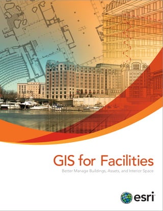
GIS for Facilities
Better Manage Buildings, Assets, and Interior Space
Modernize the Management of Your Buildings
The spatial analysis capabilities of a GIS make it a technology uniquely qualified to help you
better design and operate your facilities from a single authoritative database. And with basic
templates and applications freely available, you can get started quickly.

Why ArcGIS for Facilities
The ArcGIS ® platform can be used to build or enhance
your facilities technology systems. The ability of GIS to
do analysis and apply models based on different scenarios
allows facility managers to create an efficient building from
the start that provides the best space usage and energy
efficiency possible. As the building matures, staff can
model asset usage and depreciation over time and
manage security and environmental costs. Most
importantly, GIS opens up facilities-specific software
and data for use across the enterprise.

ArcGIS improves all areas of
facilities-focused business
functions including:
Planning
Move management
Real estate/Portfolio management
Asset management
Safety and security
Environmental health
Work order management
Transportation planning
Emergency planning and response
Wayfinding (routing across campus and through buildings)
IT infrastructure management
Energy management

Pomona College and Esri partner Critigen used
ArcGIS as a central data repository and analysis
platform for auditing on-site renewable energy
potential via landscape water usage.
Esri ArcGIS for Facilities
®

Esri makes designing and managing facilities
fast and easy.
Esri partner R&K helps clients assess building conditions and understand
maintenance costs easily through a dashboard app.

Manage Data Better

Create Healthier Facilities

Easily Exchange Data with CAD

Visualize Anywhere

The ArcGIS platform supports data exchange between
CAD technology with interoperability tools that allow the
interchange of most CAD data, as well as BIM formats.
ArcGIS also supports Open Geospatial Consortium, Inc. (OGC),
web services, including WFS, WMS, and WCS, for sharing
data. Expanding support for GML and CAD applications,
including the ability to consume GIS web services inside CAD,
means it is easier than ever to use facilities data in ArcGIS.

ArcGIS platform-based templates, downloadable for free,
can be used to create, view, and use intelligent campus and
room-level maps. These maps and analyses can be shared on
the Internet and via any mobile device, including smartphones,
and embedded into web-based applications.

Create Consistent, Standard Models
Esri has created data models and standardized templates
to help you get started and provide consistent standards to
make it easier to share and integrate data. All the features
critical to support space, asset, and move management
applications are supported.

Find Solutions Fast
Creating geographically aware facilities means managers
are better equipped for everything from maintenance to
emergency response. Find locations, route between points,
and even ask questions that include information on multiple
floors and buildings. Viewing facilities in 2D, 3D, and even 4D
means facilities are more functional, and so are you.

Continue to Leverage Your IT Investments
Esri supports a complete GIS facilities IT solution by using
open, flexible, standards-based technology for integrated
query, analysis, and reporting capabilities. This ensures that
GIS applications work with your standard facilities technology.
Geospatial data investments can be leveraged, and you can
provide a platform for geospatial integration.

Find out more at
esri.com/fm.

Esri partner Manhattan provides the ability to view facilities usage
across campus and discover vacant or underutilized space.
Esri inspires and enables people to positively impact their
future through a deeper, geographic understanding of the
changing world around them.
Governments, business leaders, academics, and nongovernmental
organizations trust us to connect them with the analytic knowledge
they need to make the critical decisions that shape the planet. For
more than 40 years, Esri has cultivated collaborative relationships
with partners who share our commitment to solving earth’s most
pressing challenges with geographic expertise and rational resolve.
Today, we believe that geography is at the heart of a more resilient
and sustainable future. Creating responsible products and solutions
drives our passion for improving quality of life everywhere.

Contact Esri
380 New York Street
Redlands, California 92373-8100

USA

1 800 447 9778
T 909 793 2853
F 909 793 5953
info@esri.com
esri.com
Offices worldwide
esri.com/locations

Copyright © 2013 Esri. All rights reserved. Esri, the Esri globe logo, ArcGIS, @esri.com, and esri.com are
trademarks, service marks, or registered marks of Esri in the United States, the European Community, or certain
other jurisdictions. Other companies and products or services mentioned herein may be trademarks, service
marks, or registered marks of their respective mark owners.

Printed in USA

137745
5C11/13dl

Weitere ähnliche Inhalte

Was ist angesagt?

Esri News for Petroleum Winter 2012/2013 newsletter
Esri News for Petroleum Winter 2012/2013 newsletterEsri News for Petroleum Winter 2012/2013 newsletter
Esri News for Petroleum Winter 2012/2013 newsletterEsri
 
Esri Technology for National Intelligence
Esri Technology for National IntelligenceEsri Technology for National Intelligence
Esri Technology for National IntelligenceEsri
 
Esri News for Facilities Winter 2012/2013 newsletter
Esri News for Facilities Winter 2012/2013 newsletterEsri News for Facilities Winter 2012/2013 newsletter
Esri News for Facilities Winter 2012/2013 newsletterEsri
 
GIS Platform for National Security
GIS Platform for National SecurityGIS Platform for National Security
GIS Platform for National SecurityEsri
 
Location analytics-put-the-where
Location analytics-put-the-whereLocation analytics-put-the-where
Location analytics-put-the-whereEsri
 
Esri Technology for Defense
Esri Technology for DefenseEsri Technology for Defense
Esri Technology for DefenseEsri
 
Spring 2013
Spring 2013Spring 2013
Spring 2013Esri
 
ArcGIS
ArcGISArcGIS
ArcGISEsri
 
Improving Citizen Engagement: Gov 2.0
Improving Citizen Engagement: Gov 2.0Improving Citizen Engagement: Gov 2.0
Improving Citizen Engagement: Gov 2.0Esri
 
ArcGIS: Better Aeronautical Data Management
ArcGIS: Better Aeronautical Data ManagementArcGIS: Better Aeronautical Data Management
ArcGIS: Better Aeronautical Data ManagementEsri
 
Esri Technology for Homeland Security
Esri Technology for Homeland SecurityEsri Technology for Homeland Security
Esri Technology for Homeland SecurityEsri
 
ArcGIS: A Platform for Intelligent 3D Imagery
ArcGIS: A Platform for Intelligent 3D ImageryArcGIS: A Platform for Intelligent 3D Imagery
ArcGIS: A Platform for Intelligent 3D ImageryEsri
 
Esri News for State & Local Government Fall 2013 newsletter
Esri News for State & Local Government Fall 2013 newsletterEsri News for State & Local Government Fall 2013 newsletter
Esri News for State & Local Government Fall 2013 newsletterEsri
 
Complete water system management with Esri
Complete water system management with EsriComplete water system management with Esri
Complete water system management with EsriEsri
 
Summer 2013
Summer 2013Summer 2013
Summer 2013Esri
 
Esri News for State & Local Government newsletter
Esri News for State & Local Government newsletterEsri News for State & Local Government newsletter
Esri News for State & Local Government newsletterEsri
 
Open Data
Open Data Open Data
Open Data Esri
 
GIS for Electric Transmission
GIS for Electric TransmissionGIS for Electric Transmission
GIS for Electric TransmissionEsri
 
Implementing ArcGIS for Water Utilities
Implementing ArcGIS for Water UtilitiesImplementing ArcGIS for Water Utilities
Implementing ArcGIS for Water UtilitiesEsri
 

Was ist angesagt? (20)

Esri News for Petroleum Winter 2012/2013 newsletter
Esri News for Petroleum Winter 2012/2013 newsletterEsri News for Petroleum Winter 2012/2013 newsletter
Esri News for Petroleum Winter 2012/2013 newsletter
 
Esri Technology for National Intelligence
Esri Technology for National IntelligenceEsri Technology for National Intelligence
Esri Technology for National Intelligence
 
Esri News for Facilities Winter 2012/2013 newsletter
Esri News for Facilities Winter 2012/2013 newsletterEsri News for Facilities Winter 2012/2013 newsletter
Esri News for Facilities Winter 2012/2013 newsletter
 
GIS Platform for National Security
GIS Platform for National SecurityGIS Platform for National Security
GIS Platform for National Security
 
Location analytics-put-the-where
Location analytics-put-the-whereLocation analytics-put-the-where
Location analytics-put-the-where
 
Esri Technology for Defense
Esri Technology for DefenseEsri Technology for Defense
Esri Technology for Defense
 
Spring 2013
Spring 2013Spring 2013
Spring 2013
 
ArcGIS
ArcGISArcGIS
ArcGIS
 
Improving Citizen Engagement: Gov 2.0
Improving Citizen Engagement: Gov 2.0Improving Citizen Engagement: Gov 2.0
Improving Citizen Engagement: Gov 2.0
 
ArcGIS: Better Aeronautical Data Management
ArcGIS: Better Aeronautical Data ManagementArcGIS: Better Aeronautical Data Management
ArcGIS: Better Aeronautical Data Management
 
Esri Technology for Homeland Security
Esri Technology for Homeland SecurityEsri Technology for Homeland Security
Esri Technology for Homeland Security
 
ArcGIS: A Platform for Intelligent 3D Imagery
ArcGIS: A Platform for Intelligent 3D ImageryArcGIS: A Platform for Intelligent 3D Imagery
ArcGIS: A Platform for Intelligent 3D Imagery
 
Esri News for State & Local Government Fall 2013 newsletter
Esri News for State & Local Government Fall 2013 newsletterEsri News for State & Local Government Fall 2013 newsletter
Esri News for State & Local Government Fall 2013 newsletter
 
Complete water system management with Esri
Complete water system management with EsriComplete water system management with Esri
Complete water system management with Esri
 
ODOT PR
ODOT PRODOT PR
ODOT PR
 
Summer 2013
Summer 2013Summer 2013
Summer 2013
 
Esri News for State & Local Government newsletter
Esri News for State & Local Government newsletterEsri News for State & Local Government newsletter
Esri News for State & Local Government newsletter
 
Open Data
Open Data Open Data
Open Data
 
GIS for Electric Transmission
GIS for Electric TransmissionGIS for Electric Transmission
GIS for Electric Transmission
 
Implementing ArcGIS for Water Utilities
Implementing ArcGIS for Water UtilitiesImplementing ArcGIS for Water Utilities
Implementing ArcGIS for Water Utilities
 

Andere mochten auch

Spatial data analysis 1
Spatial data analysis 1Spatial data analysis 1
Spatial data analysis 1Johan Blomme
 
Spatial decision support and analytics on a campus scale: bringing GIS, CAD, ...
Spatial decision support and analytics on a campus scale: bringing GIS, CAD, ...Spatial decision support and analytics on a campus scale: bringing GIS, CAD, ...
Spatial decision support and analytics on a campus scale: bringing GIS, CAD, ...Safe Software
 
Design and Development of BIM on GIS Interoperability Open Platform
Design and Development of BIM on GIS Interoperability Open PlatformDesign and Development of BIM on GIS Interoperability Open Platform
Design and Development of BIM on GIS Interoperability Open Platformslhead1
 
Understanding Complex Buildings.
Understanding Complex Buildings.Understanding Complex Buildings.
Understanding Complex Buildings.UCL
 
Site Planning and Design Principles - اساسيات تخطيط وتصميم المواقع
Site Planning and Design Principles - اساسيات تخطيط وتصميم المواقعSite Planning and Design Principles - اساسيات تخطيط وتصميم المواقع
Site Planning and Design Principles - اساسيات تخطيط وتصميم المواقعGalala University
 
1. 10 site analysis
1. 10 site analysis1. 10 site analysis
1. 10 site analysisQWILL_ONE
 
Site planning kevin lynch
Site planning kevin lynchSite planning kevin lynch
Site planning kevin lynchXtian Escala
 
17 Ways to Design a Presentation People Want to View
17 Ways to Design a Presentation People Want to View17 Ways to Design a Presentation People Want to View
17 Ways to Design a Presentation People Want to ViewJim MacLeod
 

Andere mochten auch (13)

Spatial data analysis 1
Spatial data analysis 1Spatial data analysis 1
Spatial data analysis 1
 
Spatial decision support and analytics on a campus scale: bringing GIS, CAD, ...
Spatial decision support and analytics on a campus scale: bringing GIS, CAD, ...Spatial decision support and analytics on a campus scale: bringing GIS, CAD, ...
Spatial decision support and analytics on a campus scale: bringing GIS, CAD, ...
 
Design and Development of BIM on GIS Interoperability Open Platform
Design and Development of BIM on GIS Interoperability Open PlatformDesign and Development of BIM on GIS Interoperability Open Platform
Design and Development of BIM on GIS Interoperability Open Platform
 
Understanding Complex Buildings.
Understanding Complex Buildings.Understanding Complex Buildings.
Understanding Complex Buildings.
 
Space syntax
Space syntaxSpace syntax
Space syntax
 
Site Planning and Design Principles - اساسيات تخطيط وتصميم المواقع
Site Planning and Design Principles - اساسيات تخطيط وتصميم المواقعSite Planning and Design Principles - اساسيات تخطيط وتصميم المواقع
Site Planning and Design Principles - اساسيات تخطيط وتصميم المواقع
 
1. 10 site analysis
1. 10 site analysis1. 10 site analysis
1. 10 site analysis
 
Site analysis
Site analysis Site analysis
Site analysis
 
Site planning
Site planningSite planning
Site planning
 
Site planning
Site planningSite planning
Site planning
 
Site planning kevin lynch
Site planning kevin lynchSite planning kevin lynch
Site planning kevin lynch
 
Site Analysis
Site AnalysisSite Analysis
Site Analysis
 
17 Ways to Design a Presentation People Want to View
17 Ways to Design a Presentation People Want to View17 Ways to Design a Presentation People Want to View
17 Ways to Design a Presentation People Want to View
 

Ähnlich wie GIS for Facilities Overview

ArcGIS
ArcGISArcGIS
ArcGISEsri
 
ArcGIS as a Platform
ArcGIS as a PlatformArcGIS as a Platform
ArcGIS as a PlatformGovLoop
 
Boost Mining Profits with Esri
Boost Mining Profits with EsriBoost Mining Profits with Esri
Boost Mining Profits with EsriEsri
 
ArcGIS for Desktop
ArcGIS for DesktopArcGIS for Desktop
ArcGIS for DesktopEsri
 
Esri News for Petroleum Winter 2013/2014 newsletter
Esri News for Petroleum Winter 2013/2014 newsletterEsri News for Petroleum Winter 2013/2014 newsletter
Esri News for Petroleum Winter 2013/2014 newsletterEsri
 
ArcGIS Online
ArcGIS OnlineArcGIS Online
ArcGIS OnlineEsri
 
Esri Maps for MicroStrategy
Esri Maps for MicroStrategyEsri Maps for MicroStrategy
Esri Maps for MicroStrategyEsri
 
ArcGIS Online
ArcGIS OnlineArcGIS Online
ArcGIS OnlineEsri
 
GIS for Smart Grid
GIS for Smart GridGIS for Smart Grid
GIS for Smart GridEsri
 
FlightlineGeo_ESRI_Newsletter_winter2014
FlightlineGeo_ESRI_Newsletter_winter2014FlightlineGeo_ESRI_Newsletter_winter2014
FlightlineGeo_ESRI_Newsletter_winter2014Devon Humphrey
 
Turning Geography into Geographic Understanding - Texas GIS Forum 2013
Turning Geography into Geographic Understanding - Texas GIS Forum 2013Turning Geography into Geographic Understanding - Texas GIS Forum 2013
Turning Geography into Geographic Understanding - Texas GIS Forum 2013Bern Szukalski
 
GIS for Everyone
GIS for EveryoneGIS for Everyone
GIS for EveryoneEsri
 
Gis application in civil engineering
Gis application in civil engineeringGis application in civil engineering
Gis application in civil engineeringAmal C Varghese
 
Richard Leadbeater - Technology Solutions for Improved Service Delivery - GCS16
Richard Leadbeater - Technology Solutions for Improved Service Delivery - GCS16Richard Leadbeater - Technology Solutions for Improved Service Delivery - GCS16
Richard Leadbeater - Technology Solutions for Improved Service Delivery - GCS16KC Digital Drive
 
Oil & gas
Oil & gasOil & gas
Oil & gasyoki78
 
Oil & gas
Oil & gasOil & gas
Oil & gasyoki78
 
Gis for Electric Distribution
Gis for Electric DistributionGis for Electric Distribution
Gis for Electric DistributionEsri
 
GeoPlanner for ArcGIS
GeoPlanner for ArcGISGeoPlanner for ArcGIS
GeoPlanner for ArcGISEsri
 
Gisapplicationincivilengineering 140227110022-phpapp02
Gisapplicationincivilengineering 140227110022-phpapp02Gisapplicationincivilengineering 140227110022-phpapp02
Gisapplicationincivilengineering 140227110022-phpapp02Antriksh Vatsyayana
 
GIS in property management
GIS in property management GIS in property management
GIS in property management Samuel Dekolo
 

Ähnlich wie GIS for Facilities Overview (20)

ArcGIS
ArcGISArcGIS
ArcGIS
 
ArcGIS as a Platform
ArcGIS as a PlatformArcGIS as a Platform
ArcGIS as a Platform
 
Boost Mining Profits with Esri
Boost Mining Profits with EsriBoost Mining Profits with Esri
Boost Mining Profits with Esri
 
ArcGIS for Desktop
ArcGIS for DesktopArcGIS for Desktop
ArcGIS for Desktop
 
Esri News for Petroleum Winter 2013/2014 newsletter
Esri News for Petroleum Winter 2013/2014 newsletterEsri News for Petroleum Winter 2013/2014 newsletter
Esri News for Petroleum Winter 2013/2014 newsletter
 
ArcGIS Online
ArcGIS OnlineArcGIS Online
ArcGIS Online
 
Esri Maps for MicroStrategy
Esri Maps for MicroStrategyEsri Maps for MicroStrategy
Esri Maps for MicroStrategy
 
ArcGIS Online
ArcGIS OnlineArcGIS Online
ArcGIS Online
 
GIS for Smart Grid
GIS for Smart GridGIS for Smart Grid
GIS for Smart Grid
 
FlightlineGeo_ESRI_Newsletter_winter2014
FlightlineGeo_ESRI_Newsletter_winter2014FlightlineGeo_ESRI_Newsletter_winter2014
FlightlineGeo_ESRI_Newsletter_winter2014
 
Turning Geography into Geographic Understanding - Texas GIS Forum 2013
Turning Geography into Geographic Understanding - Texas GIS Forum 2013Turning Geography into Geographic Understanding - Texas GIS Forum 2013
Turning Geography into Geographic Understanding - Texas GIS Forum 2013
 
GIS for Everyone
GIS for EveryoneGIS for Everyone
GIS for Everyone
 
Gis application in civil engineering
Gis application in civil engineeringGis application in civil engineering
Gis application in civil engineering
 
Richard Leadbeater - Technology Solutions for Improved Service Delivery - GCS16
Richard Leadbeater - Technology Solutions for Improved Service Delivery - GCS16Richard Leadbeater - Technology Solutions for Improved Service Delivery - GCS16
Richard Leadbeater - Technology Solutions for Improved Service Delivery - GCS16
 
Oil & gas
Oil & gasOil & gas
Oil & gas
 
Oil & gas
Oil & gasOil & gas
Oil & gas
 
Gis for Electric Distribution
Gis for Electric DistributionGis for Electric Distribution
Gis for Electric Distribution
 
GeoPlanner for ArcGIS
GeoPlanner for ArcGISGeoPlanner for ArcGIS
GeoPlanner for ArcGIS
 
Gisapplicationincivilengineering 140227110022-phpapp02
Gisapplicationincivilengineering 140227110022-phpapp02Gisapplicationincivilengineering 140227110022-phpapp02
Gisapplicationincivilengineering 140227110022-phpapp02
 
GIS in property management
GIS in property management GIS in property management
GIS in property management
 

Mehr von Esri

INIA- CISA: Análisis de las amenazas en la fauna silvestre
INIA- CISA: Análisis de las amenazas en la fauna silvestreINIA- CISA: Análisis de las amenazas en la fauna silvestre
INIA- CISA: Análisis de las amenazas en la fauna silvestreEsri
 
Aena Aeropuerto Adolfo Suárez-Barajas crea potentes aplicaciones para sus cli...
Aena Aeropuerto Adolfo Suárez-Barajas crea potentes aplicaciones para sus cli...Aena Aeropuerto Adolfo Suárez-Barajas crea potentes aplicaciones para sus cli...
Aena Aeropuerto Adolfo Suárez-Barajas crea potentes aplicaciones para sus cli...Esri
 
Plataforma Smart City de Móstoles
Plataforma Smart City de MóstolesPlataforma Smart City de Móstoles
Plataforma Smart City de MóstolesEsri
 
ArcGIS Online para Organizaciones
ArcGIS Online para OrganizacionesArcGIS Online para Organizaciones
ArcGIS Online para OrganizacionesEsri
 
Molina de Segura se convierte en una smart city
Molina de Segura se convierte en una smart cityMolina de Segura se convierte en una smart city
Molina de Segura se convierte en una smart cityEsri
 
Portal for ArcGIS
Portal for ArcGISPortal for ArcGIS
Portal for ArcGISEsri
 
GIS-Based Web Services Provide Rapid Analysis and Dissemination of Maritime Data
GIS-Based Web Services Provide Rapid Analysis and Dissemination of Maritime DataGIS-Based Web Services Provide Rapid Analysis and Dissemination of Maritime Data
GIS-Based Web Services Provide Rapid Analysis and Dissemination of Maritime DataEsri
 
An Effective Tool for Drinking Water Protection
An Effective Tool for Drinking Water ProtectionAn Effective Tool for Drinking Water Protection
An Effective Tool for Drinking Water ProtectionEsri
 
GeoCollector for ArcPad
GeoCollector for ArcPadGeoCollector for ArcPad
GeoCollector for ArcPadEsri
 
GeoCollector for ArcGIS for Windows Mobile
GeoCollector for ArcGIS for Windows MobileGeoCollector for ArcGIS for Windows Mobile
GeoCollector for ArcGIS for Windows MobileEsri
 
Data Appliance for ArcGIS
Data Appliance for ArcGISData Appliance for ArcGIS
Data Appliance for ArcGISEsri
 
Esri and BlackBridge
Esri and BlackBridgeEsri and BlackBridge
Esri and BlackBridgeEsri
 
Esri and AccuWeather
Esri and AccuWeatherEsri and AccuWeather
Esri and AccuWeatherEsri
 
Esri and Airbus Defense & Space
Esri and Airbus Defense & SpaceEsri and Airbus Defense & Space
Esri and Airbus Defense & SpaceEsri
 
Esri US Data Fact Sheet
Esri US Data Fact SheetEsri US Data Fact Sheet
Esri US Data Fact SheetEsri
 
ArcGIS for Server on Microsoft Azure Jumpstart
ArcGIS for Server on Microsoft Azure JumpstartArcGIS for Server on Microsoft Azure Jumpstart
ArcGIS for Server on Microsoft Azure JumpstartEsri
 
ArcGIS for the Military--Maritime Operations
ArcGIS for the Military--Maritime OperationsArcGIS for the Military--Maritime Operations
ArcGIS for the Military--Maritime OperationsEsri
 
Esri Geoportal Server
Esri Geoportal ServerEsri Geoportal Server
Esri Geoportal ServerEsri
 
ArcGIS GeoEvent Extension for Server
ArcGIS GeoEvent Extension for ServerArcGIS GeoEvent Extension for Server
ArcGIS GeoEvent Extension for ServerEsri
 
The NATO Core Geographic Services System
The NATO Core Geographic Services SystemThe NATO Core Geographic Services System
The NATO Core Geographic Services SystemEsri
 

Mehr von Esri (20)

INIA- CISA: Análisis de las amenazas en la fauna silvestre
INIA- CISA: Análisis de las amenazas en la fauna silvestreINIA- CISA: Análisis de las amenazas en la fauna silvestre
INIA- CISA: Análisis de las amenazas en la fauna silvestre
 
Aena Aeropuerto Adolfo Suárez-Barajas crea potentes aplicaciones para sus cli...
Aena Aeropuerto Adolfo Suárez-Barajas crea potentes aplicaciones para sus cli...Aena Aeropuerto Adolfo Suárez-Barajas crea potentes aplicaciones para sus cli...
Aena Aeropuerto Adolfo Suárez-Barajas crea potentes aplicaciones para sus cli...
 
Plataforma Smart City de Móstoles
Plataforma Smart City de MóstolesPlataforma Smart City de Móstoles
Plataforma Smart City de Móstoles
 
ArcGIS Online para Organizaciones
ArcGIS Online para OrganizacionesArcGIS Online para Organizaciones
ArcGIS Online para Organizaciones
 
Molina de Segura se convierte en una smart city
Molina de Segura se convierte en una smart cityMolina de Segura se convierte en una smart city
Molina de Segura se convierte en una smart city
 
Portal for ArcGIS
Portal for ArcGISPortal for ArcGIS
Portal for ArcGIS
 
GIS-Based Web Services Provide Rapid Analysis and Dissemination of Maritime Data
GIS-Based Web Services Provide Rapid Analysis and Dissemination of Maritime DataGIS-Based Web Services Provide Rapid Analysis and Dissemination of Maritime Data
GIS-Based Web Services Provide Rapid Analysis and Dissemination of Maritime Data
 
An Effective Tool for Drinking Water Protection
An Effective Tool for Drinking Water ProtectionAn Effective Tool for Drinking Water Protection
An Effective Tool for Drinking Water Protection
 
GeoCollector for ArcPad
GeoCollector for ArcPadGeoCollector for ArcPad
GeoCollector for ArcPad
 
GeoCollector for ArcGIS for Windows Mobile
GeoCollector for ArcGIS for Windows MobileGeoCollector for ArcGIS for Windows Mobile
GeoCollector for ArcGIS for Windows Mobile
 
Data Appliance for ArcGIS
Data Appliance for ArcGISData Appliance for ArcGIS
Data Appliance for ArcGIS
 
Esri and BlackBridge
Esri and BlackBridgeEsri and BlackBridge
Esri and BlackBridge
 
Esri and AccuWeather
Esri and AccuWeatherEsri and AccuWeather
Esri and AccuWeather
 
Esri and Airbus Defense & Space
Esri and Airbus Defense & SpaceEsri and Airbus Defense & Space
Esri and Airbus Defense & Space
 
Esri US Data Fact Sheet
Esri US Data Fact SheetEsri US Data Fact Sheet
Esri US Data Fact Sheet
 
ArcGIS for Server on Microsoft Azure Jumpstart
ArcGIS for Server on Microsoft Azure JumpstartArcGIS for Server on Microsoft Azure Jumpstart
ArcGIS for Server on Microsoft Azure Jumpstart
 
ArcGIS for the Military--Maritime Operations
ArcGIS for the Military--Maritime OperationsArcGIS for the Military--Maritime Operations
ArcGIS for the Military--Maritime Operations
 
Esri Geoportal Server
Esri Geoportal ServerEsri Geoportal Server
Esri Geoportal Server
 
ArcGIS GeoEvent Extension for Server
ArcGIS GeoEvent Extension for ServerArcGIS GeoEvent Extension for Server
ArcGIS GeoEvent Extension for Server
 
The NATO Core Geographic Services System
The NATO Core Geographic Services SystemThe NATO Core Geographic Services System
The NATO Core Geographic Services System
 

Kürzlich hochgeladen

Vector Search -An Introduction in Oracle Database 23ai.pptx
Vector Search -An Introduction in Oracle Database 23ai.pptxVector Search -An Introduction in Oracle Database 23ai.pptx
Vector Search -An Introduction in Oracle Database 23ai.pptxRemote DBA Services
 
[BuildWithAI] Introduction to Gemini.pdf
[BuildWithAI] Introduction to Gemini.pdf[BuildWithAI] Introduction to Gemini.pdf
[BuildWithAI] Introduction to Gemini.pdfSandro Moreira
 
CNIC Information System with Pakdata Cf In Pakistan
CNIC Information System with Pakdata Cf In PakistanCNIC Information System with Pakdata Cf In Pakistan
CNIC Information System with Pakdata Cf In Pakistandanishmna97
 
ICT role in 21st century education and its challenges
ICT role in 21st century education and its challengesICT role in 21st century education and its challenges
ICT role in 21st century education and its challengesrafiqahmad00786416
 
Apidays New York 2024 - APIs in 2030: The Risk of Technological Sleepwalk by ...
Apidays New York 2024 - APIs in 2030: The Risk of Technological Sleepwalk by ...Apidays New York 2024 - APIs in 2030: The Risk of Technological Sleepwalk by ...
Apidays New York 2024 - APIs in 2030: The Risk of Technological Sleepwalk by ...apidays
 
Why Teams call analytics are critical to your entire business
Why Teams call analytics are critical to your entire businessWhy Teams call analytics are critical to your entire business
Why Teams call analytics are critical to your entire businesspanagenda
 
Navigating the Deluge_ Dubai Floods and the Resilience of Dubai International...
Navigating the Deluge_ Dubai Floods and the Resilience of Dubai International...Navigating the Deluge_ Dubai Floods and the Resilience of Dubai International...
Navigating the Deluge_ Dubai Floods and the Resilience of Dubai International...Orbitshub
 
Cloud Frontiers: A Deep Dive into Serverless Spatial Data and FME
Cloud Frontiers:  A Deep Dive into Serverless Spatial Data and FMECloud Frontiers:  A Deep Dive into Serverless Spatial Data and FME
Cloud Frontiers: A Deep Dive into Serverless Spatial Data and FMESafe Software
 
MS Copilot expands with MS Graph connectors
MS Copilot expands with MS Graph connectorsMS Copilot expands with MS Graph connectors
MS Copilot expands with MS Graph connectorsNanddeep Nachan
 
Finding Java's Hidden Performance Traps @ DevoxxUK 2024
Finding Java's Hidden Performance Traps @ DevoxxUK 2024Finding Java's Hidden Performance Traps @ DevoxxUK 2024
Finding Java's Hidden Performance Traps @ DevoxxUK 2024Victor Rentea
 
Biography Of Angeliki Cooney | Senior Vice President Life Sciences | Albany, ...
Biography Of Angeliki Cooney | Senior Vice President Life Sciences | Albany, ...Biography Of Angeliki Cooney | Senior Vice President Life Sciences | Albany, ...
Biography Of Angeliki Cooney | Senior Vice President Life Sciences | Albany, ...Angeliki Cooney
 
WSO2's API Vision: Unifying Control, Empowering Developers
WSO2's API Vision: Unifying Control, Empowering DevelopersWSO2's API Vision: Unifying Control, Empowering Developers
WSO2's API Vision: Unifying Control, Empowering DevelopersWSO2
 
Connector Corner: Accelerate revenue generation using UiPath API-centric busi...
Connector Corner: Accelerate revenue generation using UiPath API-centric busi...Connector Corner: Accelerate revenue generation using UiPath API-centric busi...
Connector Corner: Accelerate revenue generation using UiPath API-centric busi...DianaGray10
 
DEV meet-up UiPath Document Understanding May 7 2024 Amsterdam
DEV meet-up UiPath Document Understanding May 7 2024 AmsterdamDEV meet-up UiPath Document Understanding May 7 2024 Amsterdam
DEV meet-up UiPath Document Understanding May 7 2024 AmsterdamUiPathCommunity
 
"I see eyes in my soup": How Delivery Hero implemented the safety system for ...
"I see eyes in my soup": How Delivery Hero implemented the safety system for ..."I see eyes in my soup": How Delivery Hero implemented the safety system for ...
"I see eyes in my soup": How Delivery Hero implemented the safety system for ...Zilliz
 
How to Troubleshoot Apps for the Modern Connected Worker
How to Troubleshoot Apps for the Modern Connected WorkerHow to Troubleshoot Apps for the Modern Connected Worker
How to Troubleshoot Apps for the Modern Connected WorkerThousandEyes
 
Strategize a Smooth Tenant-to-tenant Migration and Copilot Takeoff
Strategize a Smooth Tenant-to-tenant Migration and Copilot TakeoffStrategize a Smooth Tenant-to-tenant Migration and Copilot Takeoff
Strategize a Smooth Tenant-to-tenant Migration and Copilot Takeoffsammart93
 
Artificial Intelligence Chap.5 : Uncertainty
Artificial Intelligence Chap.5 : UncertaintyArtificial Intelligence Chap.5 : Uncertainty
Artificial Intelligence Chap.5 : UncertaintyKhushali Kathiriya
 

Kürzlich hochgeladen (20)

Vector Search -An Introduction in Oracle Database 23ai.pptx
Vector Search -An Introduction in Oracle Database 23ai.pptxVector Search -An Introduction in Oracle Database 23ai.pptx
Vector Search -An Introduction in Oracle Database 23ai.pptx
 
[BuildWithAI] Introduction to Gemini.pdf
[BuildWithAI] Introduction to Gemini.pdf[BuildWithAI] Introduction to Gemini.pdf
[BuildWithAI] Introduction to Gemini.pdf
 
CNIC Information System with Pakdata Cf In Pakistan
CNIC Information System with Pakdata Cf In PakistanCNIC Information System with Pakdata Cf In Pakistan
CNIC Information System with Pakdata Cf In Pakistan
 
ICT role in 21st century education and its challenges
ICT role in 21st century education and its challengesICT role in 21st century education and its challenges
ICT role in 21st century education and its challenges
 
Apidays New York 2024 - APIs in 2030: The Risk of Technological Sleepwalk by ...
Apidays New York 2024 - APIs in 2030: The Risk of Technological Sleepwalk by ...Apidays New York 2024 - APIs in 2030: The Risk of Technological Sleepwalk by ...
Apidays New York 2024 - APIs in 2030: The Risk of Technological Sleepwalk by ...
 
Why Teams call analytics are critical to your entire business
Why Teams call analytics are critical to your entire businessWhy Teams call analytics are critical to your entire business
Why Teams call analytics are critical to your entire business
 
Navigating the Deluge_ Dubai Floods and the Resilience of Dubai International...
Navigating the Deluge_ Dubai Floods and the Resilience of Dubai International...Navigating the Deluge_ Dubai Floods and the Resilience of Dubai International...
Navigating the Deluge_ Dubai Floods and the Resilience of Dubai International...
 
Cloud Frontiers: A Deep Dive into Serverless Spatial Data and FME
Cloud Frontiers:  A Deep Dive into Serverless Spatial Data and FMECloud Frontiers:  A Deep Dive into Serverless Spatial Data and FME
Cloud Frontiers: A Deep Dive into Serverless Spatial Data and FME
 
MS Copilot expands with MS Graph connectors
MS Copilot expands with MS Graph connectorsMS Copilot expands with MS Graph connectors
MS Copilot expands with MS Graph connectors
 
Finding Java's Hidden Performance Traps @ DevoxxUK 2024
Finding Java's Hidden Performance Traps @ DevoxxUK 2024Finding Java's Hidden Performance Traps @ DevoxxUK 2024
Finding Java's Hidden Performance Traps @ DevoxxUK 2024
 
Biography Of Angeliki Cooney | Senior Vice President Life Sciences | Albany, ...
Biography Of Angeliki Cooney | Senior Vice President Life Sciences | Albany, ...Biography Of Angeliki Cooney | Senior Vice President Life Sciences | Albany, ...
Biography Of Angeliki Cooney | Senior Vice President Life Sciences | Albany, ...
 
WSO2's API Vision: Unifying Control, Empowering Developers
WSO2's API Vision: Unifying Control, Empowering DevelopersWSO2's API Vision: Unifying Control, Empowering Developers
WSO2's API Vision: Unifying Control, Empowering Developers
 
Connector Corner: Accelerate revenue generation using UiPath API-centric busi...
Connector Corner: Accelerate revenue generation using UiPath API-centric busi...Connector Corner: Accelerate revenue generation using UiPath API-centric busi...
Connector Corner: Accelerate revenue generation using UiPath API-centric busi...
 
DEV meet-up UiPath Document Understanding May 7 2024 Amsterdam
DEV meet-up UiPath Document Understanding May 7 2024 AmsterdamDEV meet-up UiPath Document Understanding May 7 2024 Amsterdam
DEV meet-up UiPath Document Understanding May 7 2024 Amsterdam
 
"I see eyes in my soup": How Delivery Hero implemented the safety system for ...
"I see eyes in my soup": How Delivery Hero implemented the safety system for ..."I see eyes in my soup": How Delivery Hero implemented the safety system for ...
"I see eyes in my soup": How Delivery Hero implemented the safety system for ...
 
How to Troubleshoot Apps for the Modern Connected Worker
How to Troubleshoot Apps for the Modern Connected WorkerHow to Troubleshoot Apps for the Modern Connected Worker
How to Troubleshoot Apps for the Modern Connected Worker
 
Understanding the FAA Part 107 License ..
Understanding the FAA Part 107 License ..Understanding the FAA Part 107 License ..
Understanding the FAA Part 107 License ..
 
Strategize a Smooth Tenant-to-tenant Migration and Copilot Takeoff
Strategize a Smooth Tenant-to-tenant Migration and Copilot TakeoffStrategize a Smooth Tenant-to-tenant Migration and Copilot Takeoff
Strategize a Smooth Tenant-to-tenant Migration and Copilot Takeoff
 
+971581248768>> SAFE AND ORIGINAL ABORTION PILLS FOR SALE IN DUBAI AND ABUDHA...
+971581248768>> SAFE AND ORIGINAL ABORTION PILLS FOR SALE IN DUBAI AND ABUDHA...+971581248768>> SAFE AND ORIGINAL ABORTION PILLS FOR SALE IN DUBAI AND ABUDHA...
+971581248768>> SAFE AND ORIGINAL ABORTION PILLS FOR SALE IN DUBAI AND ABUDHA...
 
Artificial Intelligence Chap.5 : Uncertainty
Artificial Intelligence Chap.5 : UncertaintyArtificial Intelligence Chap.5 : Uncertainty
Artificial Intelligence Chap.5 : Uncertainty
 

GIS for Facilities Overview

  • 1. GIS for Facilities Better Manage Buildings, Assets, and Interior Space
  • 2. Modernize the Management of Your Buildings The spatial analysis capabilities of a GIS make it a technology uniquely qualified to help you better design and operate your facilities from a single authoritative database. And with basic templates and applications freely available, you can get started quickly. Why ArcGIS for Facilities The ArcGIS ® platform can be used to build or enhance your facilities technology systems. The ability of GIS to do analysis and apply models based on different scenarios allows facility managers to create an efficient building from the start that provides the best space usage and energy efficiency possible. As the building matures, staff can model asset usage and depreciation over time and manage security and environmental costs. Most importantly, GIS opens up facilities-specific software and data for use across the enterprise. ArcGIS improves all areas of facilities-focused business functions including: Planning Move management Real estate/Portfolio management Asset management Safety and security Environmental health Work order management Transportation planning Emergency planning and response Wayfinding (routing across campus and through buildings) IT infrastructure management Energy management Pomona College and Esri partner Critigen used ArcGIS as a central data repository and analysis platform for auditing on-site renewable energy potential via landscape water usage.
  • 3. Esri ArcGIS for Facilities ® Esri makes designing and managing facilities fast and easy. Esri partner R&K helps clients assess building conditions and understand maintenance costs easily through a dashboard app. Manage Data Better Create Healthier Facilities Easily Exchange Data with CAD Visualize Anywhere The ArcGIS platform supports data exchange between CAD technology with interoperability tools that allow the interchange of most CAD data, as well as BIM formats. ArcGIS also supports Open Geospatial Consortium, Inc. (OGC), web services, including WFS, WMS, and WCS, for sharing data. Expanding support for GML and CAD applications, including the ability to consume GIS web services inside CAD, means it is easier than ever to use facilities data in ArcGIS. ArcGIS platform-based templates, downloadable for free, can be used to create, view, and use intelligent campus and room-level maps. These maps and analyses can be shared on the Internet and via any mobile device, including smartphones, and embedded into web-based applications. Create Consistent, Standard Models Esri has created data models and standardized templates to help you get started and provide consistent standards to make it easier to share and integrate data. All the features critical to support space, asset, and move management applications are supported. Find Solutions Fast Creating geographically aware facilities means managers are better equipped for everything from maintenance to emergency response. Find locations, route between points, and even ask questions that include information on multiple floors and buildings. Viewing facilities in 2D, 3D, and even 4D means facilities are more functional, and so are you. Continue to Leverage Your IT Investments Esri supports a complete GIS facilities IT solution by using open, flexible, standards-based technology for integrated query, analysis, and reporting capabilities. This ensures that GIS applications work with your standard facilities technology. Geospatial data investments can be leveraged, and you can provide a platform for geospatial integration. Find out more at esri.com/fm. Esri partner Manhattan provides the ability to view facilities usage across campus and discover vacant or underutilized space.
  • 4. Esri inspires and enables people to positively impact their future through a deeper, geographic understanding of the changing world around them. Governments, business leaders, academics, and nongovernmental organizations trust us to connect them with the analytic knowledge they need to make the critical decisions that shape the planet. For more than 40 years, Esri has cultivated collaborative relationships with partners who share our commitment to solving earth’s most pressing challenges with geographic expertise and rational resolve. Today, we believe that geography is at the heart of a more resilient and sustainable future. Creating responsible products and solutions drives our passion for improving quality of life everywhere. Contact Esri 380 New York Street Redlands, California 92373-8100 USA 1 800 447 9778 T 909 793 2853 F 909 793 5953 info@esri.com esri.com Offices worldwide esri.com/locations Copyright © 2013 Esri. All rights reserved. Esri, the Esri globe logo, ArcGIS, @esri.com, and esri.com are trademarks, service marks, or registered marks of Esri in the United States, the European Community, or certain other jurisdictions. Other companies and products or services mentioned herein may be trademarks, service marks, or registered marks of their respective mark owners. Printed in USA 137745 5C11/13dl