Strategies for Landing an Oracle DBA Job as a Fresher
Esri Roads and Highways
1. Esri Roads and Highways
®
Esri Roads and Highways is a new extension for ArcGIS for Desktop and ArcGIS for Server. Agencies responsible for road
and highway maintenance, and operations can use this solution to get a unified view of the roadways and related assets
they manage. With Esri Roads and Highways, you can easily overlay data from multiple linear referencing system (LRS)
networks—even when that data is stored in many separate systems across the enterprise. This single, integrated view gives
you the information you need to make better decisions and generate reports.
®
®
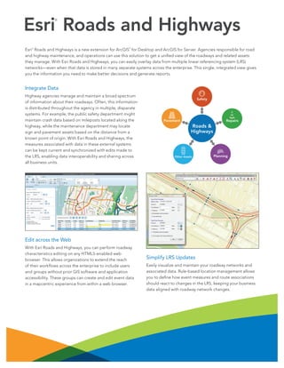
Integrate Data
Highway agencies manage and maintain a broad spectrum
of information about their roadways. Often, this information
is distributed throughout the agency in multiple, disparate
systems. For example, the public safety department might
maintain crash data based on mileposts located along the
highway, while the maintenance department may locate
sign and pavement assets based on the distance from a
known point of origin. With Esri Roads and Highways, the
measures associated with data in these external systems
can be kept current and synchronized with edits made to
the LRS, enabling data interoperability and sharing across
all business units.
Safety
Repairs
Pavement
Roads &
Highways
Other Assets
Planning
Edit across the Web
With Esri Roads and Highways, you can perform roadway
characteristics editing on any HTML5-enabled web
browser. This allows organizations to extend the reach
of their workflows across the enterprise to include users
and groups without prior GIS software and application
accessibility. These groups can create and edit event data
in a mapcentric experience from within a web browser.
Simplify LRS Updates
Easily visualize and maintain your roadway networks and
associated data. Rule-based location management allows
you to define how event measures and route associations
should react to changes in the LRS, keeping your business
data aligned with roadway network changes.