SlideShare ist ein Scribd-Unternehmen logo
1 von 1
Downloaden Sie, um offline zu lesen
Esri®
Maps for IBM Cognos
Copyright © 2013 Esri. All rights reserved. Esri, the Esri globe logo, and esri.com are trademarks, service marks, or registered marks of Esri in
the United States, the European Community, or certain other jurisdictions. Other companies and products or services mentioned herein may
be trademarks, service marks, or registered marks of their respective mark owners.
133890
Esri__3/13dm
esri.com/cognosmaps
Dynamic Basemaps
Put interactive, data-driven maps in your
reports, not just static images.
Map to Report-Object Broadcasts
Filter all or part of a report using simple mouse
gestures on regions, points, or both.
Zoom and Pan
Use simple tools to navigate the map and
explore data.
Built for IBM Cognos Report Authors
No coding or customizing skills are required.
The Bridge Between Business Metrics
and Location
Esri®
Maps for IBM Cognos is web-based software that brings
location analytics to your business intelligence (BI) reports and
dashboards.
This nondisruptive solution plugs directly into the IBM®
Cognos
report authoring and deployment workflow, enabling you to
analyze BI data in a geographic context.
Create, integrate, customize, and distribute interactive Esri
maps within your BI and see key business data in new ways.
The Power of Location Analytics
Every BI application has a spatial context. By linking business
results with maps, BI users have a new perspective to identify
patterns and correlations based on geography.
• What regions sold the most based on last quarter’s
marketing campaigns?
• How does revenue compare in the eastern versus
western territories?
• Where do deliveries cost the most (or least), and why?
Designed for IBM Cognos Report Authors
Esri Maps for IBM Cognos is designed for the IBM Cognos
report author and does not require previous geographic
information system (GIS) experience.
This zero-coding solution lets you use simple mouse gestures to
build and explore map-enabled reports and dashboards.
Built for the Enterprise
Esri Maps for IBM Cognos integrates Esri’s enterprise GIS
platform into the IBM Cognos BI architecture, leveraging
in-place security, deployment capabilities, and scalability.
The result is a truly enterprise location analytics solution.

Weitere ähnliche Inhalte

Was ist angesagt?

StevesDWESlide_exported
StevesDWESlide_exportedStevesDWESlide_exported
StevesDWESlide_exported
Steve Snow
 
AvisMap GIS Products Overview
AvisMap GIS Products OverviewAvisMap GIS Products Overview
AvisMap GIS Products Overview
avismapsoftware
 
"Using Satellites to Extract Insights on the Ground," a Presentation from Orb...
"Using Satellites to Extract Insights on the Ground," a Presentation from Orb..."Using Satellites to Extract Insights on the Ground," a Presentation from Orb...
"Using Satellites to Extract Insights on the Ground," a Presentation from Orb...
Edge AI and Vision Alliance
 
James Shorten - Spatial Economic Analysis Tool South West
James Shorten - Spatial Economic Analysis Tool South WestJames Shorten - Spatial Economic Analysis Tool South West
James Shorten - Spatial Economic Analysis Tool South West
South West Observatory
 

Was ist angesagt? (20)

GIS and BI with NovaView GIS
GIS and BI with NovaView GISGIS and BI with NovaView GIS
GIS and BI with NovaView GIS
 
The future of GIS as we know it
The future of GIS as we know itThe future of GIS as we know it
The future of GIS as we know it
 
StevesDWESlide_exported
StevesDWESlide_exportedStevesDWESlide_exported
StevesDWESlide_exported
 
Getting to Know ArcGIS Pro
Getting to Know ArcGIS ProGetting to Know ArcGIS Pro
Getting to Know ArcGIS Pro
 
ArcGIS for Desktop
ArcGIS for DesktopArcGIS for Desktop
ArcGIS for Desktop
 
Mechsoft Mapper
Mechsoft MapperMechsoft Mapper
Mechsoft Mapper
 
HighAccuracyDataCollection
HighAccuracyDataCollectionHighAccuracyDataCollection
HighAccuracyDataCollection
 
( G . i . s )
( G . i . s )( G . i . s )
( G . i . s )
 
Offline maps for mobile developers (Android/iOS)
Offline maps for mobile developers (Android/iOS)Offline maps for mobile developers (Android/iOS)
Offline maps for mobile developers (Android/iOS)
 
When GIS has no value
When GIS has no valueWhen GIS has no value
When GIS has no value
 
Geo Earth Mapping presentation
Geo Earth Mapping presentationGeo Earth Mapping presentation
Geo Earth Mapping presentation
 
Esri CityEngine
Esri CityEngineEsri CityEngine
Esri CityEngine
 
AvisMap GIS Products Overview
AvisMap GIS Products OverviewAvisMap GIS Products Overview
AvisMap GIS Products Overview
 
"Using Satellites to Extract Insights on the Ground," a Presentation from Orb...
"Using Satellites to Extract Insights on the Ground," a Presentation from Orb..."Using Satellites to Extract Insights on the Ground," a Presentation from Orb...
"Using Satellites to Extract Insights on the Ground," a Presentation from Orb...
 
What is Roomtag?
What is Roomtag?What is Roomtag?
What is Roomtag?
 
James Shorten - Spatial Economic Analysis Tool South West
James Shorten - Spatial Economic Analysis Tool South WestJames Shorten - Spatial Economic Analysis Tool South West
James Shorten - Spatial Economic Analysis Tool South West
 
Crush The Quo
Crush The QuoCrush The Quo
Crush The Quo
 
10 Benefits of Purpose-Built CAFM Tools
10 Benefits of Purpose-Built CAFM Tools10 Benefits of Purpose-Built CAFM Tools
10 Benefits of Purpose-Built CAFM Tools
 
Infographics
InfographicsInfographics
Infographics
 
Mapping the news 2012
Mapping the news 2012Mapping the news 2012
Mapping the news 2012
 

Ähnlich wie Esri Maps for IBM Cognos

Using OGC Standards To Link BI and Spatial
Using OGC Standards To Link BI and SpatialUsing OGC Standards To Link BI and Spatial
Using OGC Standards To Link BI and Spatial
MISNet - Integeo SE Asia
 
What is GIS?
What is GIS?What is GIS?
What is GIS?
deirdre
 

Ähnlich wie Esri Maps for IBM Cognos (20)

Esri Maps for IBM Cognos
Esri Maps for IBM CognosEsri Maps for IBM Cognos
Esri Maps for IBM Cognos
 
Mapping for Advanced Business Analytics - ArcGIS Business Analyst
Mapping for Advanced Business Analytics - ArcGIS Business AnalystMapping for Advanced Business Analytics - ArcGIS Business Analyst
Mapping for Advanced Business Analytics - ArcGIS Business Analyst
 
Esri Maps for SAP BusinessObjects
Esri Maps for SAP BusinessObjectsEsri Maps for SAP BusinessObjects
Esri Maps for SAP BusinessObjects
 
Esri Maps for MicroStrategy
Esri Maps for MicroStrategyEsri Maps for MicroStrategy
Esri Maps for MicroStrategy
 
Esri Maps for Dynamics CRM
Esri Maps for Dynamics CRMEsri Maps for Dynamics CRM
Esri Maps for Dynamics CRM
 
Esri Maps for Office
Esri Maps for OfficeEsri Maps for Office
Esri Maps for Office
 
Leverage Location Intelligence with PMSquare
Leverage Location Intelligence with PMSquareLeverage Location Intelligence with PMSquare
Leverage Location Intelligence with PMSquare
 
Zubed Geospatial
Zubed GeospatialZubed Geospatial
Zubed Geospatial
 
GeoPlanner for ArcGIS
GeoPlanner for ArcGISGeoPlanner for ArcGIS
GeoPlanner for ArcGIS
 
Esri cityengine
Esri cityengineEsri cityengine
Esri cityengine
 
Esri CityEngine
Esri CityEngineEsri CityEngine
Esri CityEngine
 
Faster is the New Fast - with Mi Express You can Analyze Location Data Faster
Faster is the New Fast - with Mi Express You can Analyze Location Data FasterFaster is the New Fast - with Mi Express You can Analyze Location Data Faster
Faster is the New Fast - with Mi Express You can Analyze Location Data Faster
 
Location Intelligence - The where factor
Location Intelligence - The where factorLocation Intelligence - The where factor
Location Intelligence - The where factor
 
ArcGIS Online
ArcGIS OnlineArcGIS Online
ArcGIS Online
 
Using OGC Standards To Link BI and Spatial
Using OGC Standards To Link BI and SpatialUsing OGC Standards To Link BI and Spatial
Using OGC Standards To Link BI and Spatial
 
ArcGIS Online
ArcGIS OnlineArcGIS Online
ArcGIS Online
 
Extensible Intelligent iOS app for crisis management
Extensible Intelligent iOS app for crisis managementExtensible Intelligent iOS app for crisis management
Extensible Intelligent iOS app for crisis management
 
Big Data BizViz Analytics Platform Introduction
Big Data BizViz Analytics Platform IntroductionBig Data BizViz Analytics Platform Introduction
Big Data BizViz Analytics Platform Introduction
 
What is GIS?
What is GIS?What is GIS?
What is GIS?
 
0 supermapproductsintroduction
0 supermapproductsintroduction0 supermapproductsintroduction
0 supermapproductsintroduction
 

Mehr von Esri

Aena Aeropuerto Adolfo Suárez-Barajas crea potentes aplicaciones para sus cli...
Aena Aeropuerto Adolfo Suárez-Barajas crea potentes aplicaciones para sus cli...Aena Aeropuerto Adolfo Suárez-Barajas crea potentes aplicaciones para sus cli...
Aena Aeropuerto Adolfo Suárez-Barajas crea potentes aplicaciones para sus cli...
Esri
 

Mehr von Esri (20)

INIA- CISA: Análisis de las amenazas en la fauna silvestre
INIA- CISA: Análisis de las amenazas en la fauna silvestreINIA- CISA: Análisis de las amenazas en la fauna silvestre
INIA- CISA: Análisis de las amenazas en la fauna silvestre
 
Aena Aeropuerto Adolfo Suárez-Barajas crea potentes aplicaciones para sus cli...
Aena Aeropuerto Adolfo Suárez-Barajas crea potentes aplicaciones para sus cli...Aena Aeropuerto Adolfo Suárez-Barajas crea potentes aplicaciones para sus cli...
Aena Aeropuerto Adolfo Suárez-Barajas crea potentes aplicaciones para sus cli...
 
Plataforma Smart City de Móstoles
Plataforma Smart City de MóstolesPlataforma Smart City de Móstoles
Plataforma Smart City de Móstoles
 
ArcGIS Online para Organizaciones
ArcGIS Online para OrganizacionesArcGIS Online para Organizaciones
ArcGIS Online para Organizaciones
 
Molina de Segura se convierte en una smart city
Molina de Segura se convierte en una smart cityMolina de Segura se convierte en una smart city
Molina de Segura se convierte en una smart city
 
Portal for ArcGIS
Portal for ArcGISPortal for ArcGIS
Portal for ArcGIS
 
GIS-Based Web Services Provide Rapid Analysis and Dissemination of Maritime Data
GIS-Based Web Services Provide Rapid Analysis and Dissemination of Maritime DataGIS-Based Web Services Provide Rapid Analysis and Dissemination of Maritime Data
GIS-Based Web Services Provide Rapid Analysis and Dissemination of Maritime Data
 
An Effective Tool for Drinking Water Protection
An Effective Tool for Drinking Water ProtectionAn Effective Tool for Drinking Water Protection
An Effective Tool for Drinking Water Protection
 
GeoCollector for ArcPad
GeoCollector for ArcPadGeoCollector for ArcPad
GeoCollector for ArcPad
 
GeoCollector for ArcGIS for Windows Mobile
GeoCollector for ArcGIS for Windows MobileGeoCollector for ArcGIS for Windows Mobile
GeoCollector for ArcGIS for Windows Mobile
 
Data Appliance for ArcGIS
Data Appliance for ArcGISData Appliance for ArcGIS
Data Appliance for ArcGIS
 
Esri and BlackBridge
Esri and BlackBridgeEsri and BlackBridge
Esri and BlackBridge
 
Esri and AccuWeather
Esri and AccuWeatherEsri and AccuWeather
Esri and AccuWeather
 
Esri and Airbus Defense & Space
Esri and Airbus Defense & SpaceEsri and Airbus Defense & Space
Esri and Airbus Defense & Space
 
Esri US Data Fact Sheet
Esri US Data Fact SheetEsri US Data Fact Sheet
Esri US Data Fact Sheet
 
ArcGIS for Server on Microsoft Azure Jumpstart
ArcGIS for Server on Microsoft Azure JumpstartArcGIS for Server on Microsoft Azure Jumpstart
ArcGIS for Server on Microsoft Azure Jumpstart
 
ArcGIS for the Military--Maritime Operations
ArcGIS for the Military--Maritime OperationsArcGIS for the Military--Maritime Operations
ArcGIS for the Military--Maritime Operations
 
Esri Geoportal Server
Esri Geoportal ServerEsri Geoportal Server
Esri Geoportal Server
 
ArcGIS GeoEvent Extension for Server
ArcGIS GeoEvent Extension for ServerArcGIS GeoEvent Extension for Server
ArcGIS GeoEvent Extension for Server
 
The NATO Core Geographic Services System
The NATO Core Geographic Services SystemThe NATO Core Geographic Services System
The NATO Core Geographic Services System
 

Kürzlich hochgeladen

Cloud Frontiers: A Deep Dive into Serverless Spatial Data and FME
Cloud Frontiers:  A Deep Dive into Serverless Spatial Data and FMECloud Frontiers:  A Deep Dive into Serverless Spatial Data and FME
Cloud Frontiers: A Deep Dive into Serverless Spatial Data and FME
Safe Software
 
Architecting Cloud Native Applications
Architecting Cloud Native ApplicationsArchitecting Cloud Native Applications
Architecting Cloud Native Applications
WSO2
 

Kürzlich hochgeladen (20)

Ransomware_Q4_2023. The report. [EN].pdf
Ransomware_Q4_2023. The report. [EN].pdfRansomware_Q4_2023. The report. [EN].pdf
Ransomware_Q4_2023. The report. [EN].pdf
 
TrustArc Webinar - Stay Ahead of US State Data Privacy Law Developments
TrustArc Webinar - Stay Ahead of US State Data Privacy Law DevelopmentsTrustArc Webinar - Stay Ahead of US State Data Privacy Law Developments
TrustArc Webinar - Stay Ahead of US State Data Privacy Law Developments
 
"I see eyes in my soup": How Delivery Hero implemented the safety system for ...
"I see eyes in my soup": How Delivery Hero implemented the safety system for ..."I see eyes in my soup": How Delivery Hero implemented the safety system for ...
"I see eyes in my soup": How Delivery Hero implemented the safety system for ...
 
GenAI Risks & Security Meetup 01052024.pdf
GenAI Risks & Security Meetup 01052024.pdfGenAI Risks & Security Meetup 01052024.pdf
GenAI Risks & Security Meetup 01052024.pdf
 
EMPOWERMENT TECHNOLOGY GRADE 11 QUARTER 2 REVIEWER
EMPOWERMENT TECHNOLOGY GRADE 11 QUARTER 2 REVIEWEREMPOWERMENT TECHNOLOGY GRADE 11 QUARTER 2 REVIEWER
EMPOWERMENT TECHNOLOGY GRADE 11 QUARTER 2 REVIEWER
 
Powerful Google developer tools for immediate impact! (2023-24 C)
Powerful Google developer tools for immediate impact! (2023-24 C)Powerful Google developer tools for immediate impact! (2023-24 C)
Powerful Google developer tools for immediate impact! (2023-24 C)
 
Emergent Methods: Multi-lingual narrative tracking in the news - real-time ex...
Emergent Methods: Multi-lingual narrative tracking in the news - real-time ex...Emergent Methods: Multi-lingual narrative tracking in the news - real-time ex...
Emergent Methods: Multi-lingual narrative tracking in the news - real-time ex...
 
Cloud Frontiers: A Deep Dive into Serverless Spatial Data and FME
Cloud Frontiers:  A Deep Dive into Serverless Spatial Data and FMECloud Frontiers:  A Deep Dive into Serverless Spatial Data and FME
Cloud Frontiers: A Deep Dive into Serverless Spatial Data and FME
 
Web Form Automation for Bonterra Impact Management (fka Social Solutions Apri...
Web Form Automation for Bonterra Impact Management (fka Social Solutions Apri...Web Form Automation for Bonterra Impact Management (fka Social Solutions Apri...
Web Form Automation for Bonterra Impact Management (fka Social Solutions Apri...
 
FWD Group - Insurer Innovation Award 2024
FWD Group - Insurer Innovation Award 2024FWD Group - Insurer Innovation Award 2024
FWD Group - Insurer Innovation Award 2024
 
Exploring the Future Potential of AI-Enabled Smartphone Processors
Exploring the Future Potential of AI-Enabled Smartphone ProcessorsExploring the Future Potential of AI-Enabled Smartphone Processors
Exploring the Future Potential of AI-Enabled Smartphone Processors
 
Boost Fertility New Invention Ups Success Rates.pdf
Boost Fertility New Invention Ups Success Rates.pdfBoost Fertility New Invention Ups Success Rates.pdf
Boost Fertility New Invention Ups Success Rates.pdf
 
Automating Google Workspace (GWS) & more with Apps Script
Automating Google Workspace (GWS) & more with Apps ScriptAutomating Google Workspace (GWS) & more with Apps Script
Automating Google Workspace (GWS) & more with Apps Script
 
Real Time Object Detection Using Open CV
Real Time Object Detection Using Open CVReal Time Object Detection Using Open CV
Real Time Object Detection Using Open CV
 
Apidays New York 2024 - The value of a flexible API Management solution for O...
Apidays New York 2024 - The value of a flexible API Management solution for O...Apidays New York 2024 - The value of a flexible API Management solution for O...
Apidays New York 2024 - The value of a flexible API Management solution for O...
 
Mastering MySQL Database Architecture: Deep Dive into MySQL Shell and MySQL R...
Mastering MySQL Database Architecture: Deep Dive into MySQL Shell and MySQL R...Mastering MySQL Database Architecture: Deep Dive into MySQL Shell and MySQL R...
Mastering MySQL Database Architecture: Deep Dive into MySQL Shell and MySQL R...
 
A Year of the Servo Reboot: Where Are We Now?
A Year of the Servo Reboot: Where Are We Now?A Year of the Servo Reboot: Where Are We Now?
A Year of the Servo Reboot: Where Are We Now?
 
Repurposing LNG terminals for Hydrogen Ammonia: Feasibility and Cost Saving
Repurposing LNG terminals for Hydrogen Ammonia: Feasibility and Cost SavingRepurposing LNG terminals for Hydrogen Ammonia: Feasibility and Cost Saving
Repurposing LNG terminals for Hydrogen Ammonia: Feasibility and Cost Saving
 
ProductAnonymous-April2024-WinProductDiscovery-MelissaKlemke
ProductAnonymous-April2024-WinProductDiscovery-MelissaKlemkeProductAnonymous-April2024-WinProductDiscovery-MelissaKlemke
ProductAnonymous-April2024-WinProductDiscovery-MelissaKlemke
 
Architecting Cloud Native Applications
Architecting Cloud Native ApplicationsArchitecting Cloud Native Applications
Architecting Cloud Native Applications
 

Esri Maps for IBM Cognos

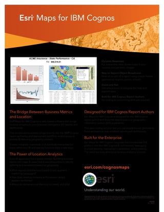
  • 1. Esri® Maps for IBM Cognos Copyright © 2013 Esri. All rights reserved. Esri, the Esri globe logo, and esri.com are trademarks, service marks, or registered marks of Esri in the United States, the European Community, or certain other jurisdictions. Other companies and products or services mentioned herein may be trademarks, service marks, or registered marks of their respective mark owners. 133890 Esri__3/13dm esri.com/cognosmaps Dynamic Basemaps Put interactive, data-driven maps in your reports, not just static images. Map to Report-Object Broadcasts Filter all or part of a report using simple mouse gestures on regions, points, or both. Zoom and Pan Use simple tools to navigate the map and explore data. Built for IBM Cognos Report Authors No coding or customizing skills are required. The Bridge Between Business Metrics and Location Esri® Maps for IBM Cognos is web-based software that brings location analytics to your business intelligence (BI) reports and dashboards. This nondisruptive solution plugs directly into the IBM® Cognos report authoring and deployment workflow, enabling you to analyze BI data in a geographic context. Create, integrate, customize, and distribute interactive Esri maps within your BI and see key business data in new ways. The Power of Location Analytics Every BI application has a spatial context. By linking business results with maps, BI users have a new perspective to identify patterns and correlations based on geography. • What regions sold the most based on last quarter’s marketing campaigns? • How does revenue compare in the eastern versus western territories? • Where do deliveries cost the most (or least), and why? Designed for IBM Cognos Report Authors Esri Maps for IBM Cognos is designed for the IBM Cognos report author and does not require previous geographic information system (GIS) experience. This zero-coding solution lets you use simple mouse gestures to build and explore map-enabled reports and dashboards. Built for the Enterprise Esri Maps for IBM Cognos integrates Esri’s enterprise GIS platform into the IBM Cognos BI architecture, leveraging in-place security, deployment capabilities, and scalability. The result is a truly enterprise location analytics solution.