
Empfohlen
Weitere ähnliche Inhalte
Was ist angesagt?
Was ist angesagt? (19)
Ähnlich wie Eops 2017 10_31
Ähnlich wie Eops 2017 10_31 (20)
Mehr von EOPS EOPS
Kürzlich hochgeladen
Kürzlich hochgeladen (20)
Eops 2017 10_31
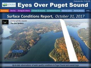
- 1. Surface Conditions Report, October 31, 2017 Eyes Over Puget Sound Publication No. 17-03-073 Up-to-date observations of water quality conditions in Puget Sound and coastal bays Start here Critter of the month: The Sea Spiders Summary Stories Diving & Critters Climate & streams Combinedfactors Marine water Aerial photos Info
- 2. Personalstories p. 3 Meet our new WashingtonConservationCorps intern,Juhi LaFuente Climate& Streams p. 6 During October air temperatures are cooler andprecipitation higher thannormal,while sunshine remainedabundant. As a result tributaries throughout Puget Sound and the Olympic Mountains are generally flowingnormal after below normal flows over the late summer particularly in the north Sound region. Marine waters p. 10 Puget Sound is fresher thanit’s ever been the past 17 years. Warmer temperatures remaininSouth Sound in September. In October surface water temperature inthe Straits begin to cool and rivers discolor surface waters. Aerialphotography p. 12 Blooms are small andconfinedto inlets. Jellyfishpatches are practically absent. Leaves beginto drift onthe water withsome orange debris lookinglike a dying bloomof Noctiluca. LONG-TERMMARINEMONITORINGUNIT Editorial assistanceprovided by: Julianne Ruffner, Suzan Pool, CarolMaloy Summary conditions at a glance Dr. Christopher Krembs (Editor) Skip Albertson Suzan Pool Julia Bos Tyler Burks Jim Shedd Juhi LaFuente Summary Stories Diving & Critters Climate & streams Combinedfactors Marine water Aerial photos Info
- 3. Meet our new Washington Conservation Corps intern Personal Field ImpressionPersonal stories and field impressions Summary Stories Diving & Critters Climate & streams Combinedfactors Marine water Aerial photos Info Juhi joined our marine team to conductwater and sediment surveys, work in our laboratory, and supportboth the Toxic Studies and BEACH program. We are really happy to have her in the program for the next year! Juhi Brings Experience Juhi graduated fromWestern Washington University with a BS in EnvironmentalScience. She studied Tropical Marine Biology and Ecology in La Paz, Mexico, followed by an AmeriCorps position at the PortTownsend Marine Science Center. There she worked on aquaria, husbandry for the invertebrates and fish, and public communication and outreach. It is getting cold out there! Juhi’s first marine survey on our research vessel Skookum. Juhi LaFuente
- 4. This isa newfeature,andwearesolicitingfeedback (salb461@ecy.wa.gov). Eventuallywewill featurethemostrecentdata. Visibility What was the visibility in the water for divers? Find number Find depths with high and low visibility • Best visibility was nearly 50 feet south of Three Tree Point toward Browns Pointand Commencement Bay. • Poor vibility occurred in many places in South PugetSound, but also in Bellingham Bay and near Bremerton/Silverdale. • We usetransmissometer readings fromour CTD packageand convertthem into horizontalvisibility. See our recent publication for details: Underwater visibility Maps – a Tool for Scuba Divers. September Best Divingibility in survey Visibility (ft)/depth(ft) good poor How well can you see underwater? Read poster Summary Stories Diving & Critters Climate & streams Combinedfactors Marine water Aerial photos Info Best/Depth,Least/Depth
- 5. Critter of the Month – The Sea Spiders Dany Burgess & Angela Eagleston Marine Sediment Monitoring Team Personal Field ImpressionWhat can you find under water? Fun Sea SpiderFacts • Species frompolar oceans can grow to the sizeof a dinner plate. • Their blood is pumped by the gut, not the heart. • The male sea spider cares for the eggs, holding them with a special pair of legs. Learn moreabout Sea Spiders and other critters on Ecology’s EcoConnectblog here The Pycnogonids BOO!If you’rescared of spiders, this month’s creepy Critter might give you a fright. Find out why the Sea Spider is not actually a spider at all, and why its amazing legs do many spooktacular things! Photo courtesy of Dave Cowles,wallawalla.edu Photo courtesy of Dave Cowles,wallawalla.edu Summary Stories Diving & Critters Climate & streams Combinedfactors Marine water Aerial photos Info
- 6. How much water flows into coastal marine waters? Tyler Burks,Jim Shedd After warmand very dry summer conditions in the Puget Sound, conditions returned to mostly normal in October. Temperatures and precipitation wereclose to averagethroughout the region. As a result, tributaries throughoutPugetSound and the Olympic Mountains are generally flowing normally after below normalflows over the late summer, particularly in the north Sound region. Summary Stories Diving & Critters Climate & streams Combinedfactors Marine water Aerial photos Info Streamflows returned to normal in October after much of the basin experienced below and much below normalflows in the month of September. October saw the return of much needed precipitation after below average and even record breaking dry periods in parts of the Olympics and north Cascades. LastOctober (2016) saw record breaking precipitation in much of the Puget Sound region. Interestingly, Olympia had 28 rainy days in October 2016 in contrastto only 11 days this year. Yet October 2017 still saw normal to abovenormal precipitation. Washington Streamflows October,2017 Washington - Precipitation July – September 2017Percentile WestWide Drought Tracker, U Idaho/WRCC Data Source: PRISM (Prelim), created 16 OCT 2017 Percent ofAveragePrecipitation (%) Oct,6, 2017 –Nov,4,2017 Generated 11/5/2017 at WRCC using proDivingional data. NOAA Regional Climate Centers
- 7. How much water flows into coastal marine waters? Summary Stories Diving & Critters Climate & streams Combinedfactors Marine water Aerial photos Info Climatologists predict wetter and cooler conditions this winter and early spring due to an expected La Niña. Could this mean a good supply of cool water flowing to Puget Sound in the spring and summer? Very early snow water equivalence (SWE) in the mountains is off to a good start. The past two years SWEwas generally higher than normal. Will we see the same in 2018? The graphics on the left shows currentsnow accumulation. Dec-Jan-Feb 2017 Jan-Feb-Mar 2018 Feb-Mar-Apr 2018 Dec-Jan-Feb 2017 Jan-Feb-Mar 2018 Feb-Mar-Apr 2018 The map on the upper left shows higher than usual probability of above normalprecipitation. The map on the right show a higher chance of cooler temperatures. Click here
- 8. Climateinfluences:HowwellisPugetSoundexchangingitswater? The Fraser River is the major driver of estuarine circulationandwater exchange withthe ocean. Fraser River flows werehigher than normal in July. Then flows gotweaker. Lower Fraser River and weaker upwelling along the coastfavored a reduced inflow of low-oxygen water fromthe coastand positively influence oxygen conditions. Historically, peaks of coastal upwelling and the freshet are in sync. Higher than normal Lower than normal Expected Fraser River NPGO(x10) PDO/UpwellingIndex How do ocean boundary conditions affect the quality of water we exchange withthe ocean. Pastyears warmwater is fading (PDO), upwelling of low oxygen and high nutrient ocean water are low (Upwelling Indexanomaly), and surfaceproductivity along the coastis near normal (NPGO). Pacific DecadalOscillation Index(PDO, temperature, explanation). Upwelling Index(anomalies) (Upwelling, low oxygen, explanation). North Pacific Gyre Oscillation Index(NPGO, productivity, explanation). Three-year running averageof PDO, Upwelling, and NPGO indices -25 -15 -5 5 15 25 -1.5 -1 -0.5 0 0.5 1 1.5 1945 1950 1955 1960 1965 1970 1975 1980 1985 1990 1995 2000 2005 2010 2015 Summary Stories Diving & Critters Climate & streams Combinedfactors Marine water Aerial photos Info
- 9. What’s the story of influences affecting water quality? higher No datalowerexpected *UpwellingAnomalies (PFEL) PDO = PacificDecadal Oscillation NPGO = North Pacific GyreOscillation ENSO = El Niño Southern Oscillation Climate and naturalinfluences include weather,river flows,andthe adjacent oceanconditions that affect our marine waters. This graphic provides context for interpretingPuget Soundmarine conditions. All data frompublic sources: weather fromUWGrayskies;river flows fromUSGS and Environment Canada; indices fromNOAA,UW (PDO),and E. Di Lorenzo (NPGO). Summary: Air temperatures fell below normal during October after being mostly above normalsince May. Precipitationlevels had been low, but are now above normal. Sunshine levels havebeen consistently abovenormal since May. River flows areincreasing back to normal after low flows through the summer. We expect downwelling in fall, but it’s currently weaker. ENSO is trending cooler, towards La Niña. Summary Stories Diving & Critters Climate & streams Combinedfactors Marine water Aerial photos Info 2017201615Anomalies
- 10. How did water quality respond to recent conditions? As of Sept 2017, warmer temperaturepersists in South Sound. Very low salinity persists inHood Canal, Central and SouthSound. Significantly fresher conditions in Puget Sound occurred since November, 2016. In September higher dissolved oxygen values continue in Hood Canal while dissolved oxygen is lower in Central Sound. = higher than expected (>*IQR) = expected (=*IQR) = lower than expected (<*IQR) = higher than previous measurements = no data = lower than previous measurements * IQR = Interquartile Range (25th – 75th percentiles); n = 17 Ecology’s monthlysamples monitoring stationnetwork.Surface to full depth Summary Stories Diving & Critters Climate & streams Combinedfactors Marine water Aerial photos Info Ecology’s monthlymonitoringstation network.Surface to full depth. Year Month 9 10 11 12 1 2 3 4 5 6 7 8 9 10 11 12 1 2 3 4 5 6 7 8 9 9 10 11 12 1 2 3 4 5 6 7 8 9 10 11 12 1 2 3 4 5 6 7 8 9 9 10 11 12 1 2 3 4 5 6 7 8 9 10 11 12 1 2 3 4 5 6 7 8 9 Ecology's long-term marine monitoring station network 2017Temperature Salinity 2015 20152016 Whidbey Basin Hood Canal Central Sound South Sound 20172017 DissolvedOxygen 2015 Grays Harbor Willapa Bay North Sound San Juan 20162016 Temperature Salinity Dissolved Oxygen
- 11. Summary of Victoria Clipper IVferry data: Surface water temperature cooledinthe Strait of Juande Fuca. Moderate chlorophyll concentrations inPuget Sound occurredinearly October followedby clearinginmid- month. Turbidity andCDOMwere noisy until late October whenriver outflows contributedto anincrease near the Triple Junction. Gaps in the data are explainedby the vessel remaining in port. What are conditions at the surface? Summary Stories Diving & Critters Climate & streams Combinedfactors Marine water Aerial photos Info The Victoria Clipper IV carries sensorsin its sea chest. The sensorsallow us to plot overtime transects of: A. Temperature B. Chlorophyll C. Turbidity D. CDOM Over time,we see the dynamic of these variablesin surface water betweenSeattle and Victoria,BC.
- 12. What are conditions at the surface? Start here BloomDebrisFrontPlume Narrow HammersleyInletconnectingOakland Bay Seattle enjoyingthe lastsunny daysof fall Mixing and Fronts: Fronts along Deschutes River plume. Otherwise uneventful. Debris: Leaves drifting at the surfacein Inlets of South Sound. Ribbons of orangein Case Inlet accumulating along fronts. Potentially being Noctiluca? Visible blooms: Red-brown: Dyes, Sinclair, Eld, Budd and Henderson Inlets. Jellyfish: Jellyfish patches rare, seen only in Budd Inlet. Suspendedsediment: Uneventful The productive seasonis comingto anend, blooms are gettingsmaller, mainly in the color of red- brown. Jellyfishpatches are practically absent.Leaves beginto drift onthe water withsome orange debris in Case Inlet lookinglike a fadingbloomof the dinoflagellate Noctiluca. Summary Stories Diving & Critters Climate & streams Combinedfactors Marine water Aerial photos Info
- 13. Strait of Juan de Fuca San Juan Islands Padilla Bay Main Basin Hood Canal Whidbey Basin Sunny,Divingibilityslightlyhazy. Flight Information: Aerial photography and navigation guide Flight route 6 Observation Maps: Central Sound South Sound 12 7 14 3 9 8 10 13 15 4 5 11 South Sound Tide data(Seattle): Time Height (ft) High/Low 02:31 AM 8.35 H 08:22 AM 2.77 L 2:57 PM 11.18 H 9:32 PM 2.92 L 2 Summary Stories Diving & Critters Climate & streams Combinedfactors Marine water Aerial photos Info 1
- 14. Lower altitude.Red-brown bloom. Front of the Deschutes River with organic material debris. Location: Budd Inlet (South Sound),2:47 PM. 1 Aerial photography 10-31-2017 Navigate Priest Point Summary Stories Diving & Critters Climate & streams Combinedfactors Marine water Aerial photos Info Bloom Debris Debris
- 15. Higher altitude.Red-brown bloom. Front of the Deschutes River with organic material debris. Location: Budd Inlet (South Sound),2:49 PM. 2 Navigate Debris Summary Stories Diving & Critters Climate & streams Combinedfactors Marine water Aerial photos Info Aerial photography 10-31-2017 boat wood Bloom boat Debris
- 16. 3 Navigate Red-brown bloom and orange surface debris. Location: Eld Inlet (South Sound),2:52 PM. Bloom boat Debris Flapjack Point Summary Stories Diving & Critters Climate & streams Combinedfactors Marine water Aerial photos Info Aerial photography 10-31-2017 Debris Debris
- 17. 4 Navigate Intense red-brown bloom confined to westernside of the bay. Location: Eld Inlet (South Sound),2:52 PM. White Point Bloom boat Debris Summary Stories Diving & Critters Climate & streams Combinedfactors Marine water Aerial photos Info Aerial photography 10-31-2017
- 18. 5 Navigate Tidal eddy. Location: Totten Inlet (South Sound),2:54 PM. rafts Summary Stories Diving & Critters Climate & streams Combinedfactors Marine water Aerial photos Info Aerial photography 10-31-2017 eddy Cougar Point
- 19. Orange surface debris. Location: Big Cove,Totten Inlet (South Sound),2:55 PM. 6 Navigate boat Summary Stories Diving & Critters Climate & streams Combinedfactors Marine water Aerial photos Info Aerial photography 10-31-2017 Debris Debris Debris Cougar Point
- 20. Orange surface debris along front. Location: Herron Island,Case Inlet (South Sound),3:00 PM. 7 Navigate Debris Summary Stories Diving & Critters Climate & streams Combinedfactors Marine water Aerial photos Info Aerial photography 10-31-2017 Herron Island
- 21. Orange surface debris along front. Location: Across Stretch Island,Case Inlet (South Sound),3:02 PM. 8 Navigate Stretch Island Summary Stories Diving & Critters Climate & streams Combinedfactors Marine water Aerial photos Info Aerial photography 10-31-2017 Debris Debris
- 22. Some surface debris. Location: BurleyLagoon,Carr Inlet (South Sound),3:06 PM. 9 Navigate boat Summary Stories Diving & Critters Climate & streams Combinedfactors Marine water Aerial photos Info Aerial photography 10-31-2017 Debris raft
- 23. 10 Navigate Red-brown bloom. Location: Sinclair Inlet (Central Sound),3:11PM. Bloom Bloom barge Summary Stories Diving & Critters Climate & streams Combinedfactors Marine water Aerial photos Info Aerial photography 10-31-2017 Ross Point
- 24. Navigate Red-brown bloom and some surface debris. Location: Ostrich Bay,Dyes Inlet (Central Sound),3:13 PM. 11 Debris Debris boat Summary Stories Diving & Critters Climate & streams Combinedfactors Marine water Aerial photos Info Aerial photography 10-31-2017 Bloom Rocky Point Madrona Point
- 25. Navigate Organic material accumulating at tidal front next to red-brown bloom. Location: Entrance to Ostrich Bay,Dyes Inlet (Central Sound),3:13 PM. 12 Debris Debris Summary Stories Diving & Critters Climate & streams Combinedfactors Marine water Aerial photos Info Aerial photography 10-31-2017 boat Rocky Point Madrona Point
- 26. Navigate Organic material accumulating at tidal front next to red-brown bloom. Location: LibertyBay (Central Sound),3:17 PM. 13 Debris Debris Bloom boat Summary Stories Diving & Critters Climate & streams Combinedfactors Marine water Aerial photos Info Aerial photography 10-31-2017 Keyport
- 27. Navigate Red-brown bloom. Location: LibertyBay (Central Sound),3:17 PM. 14 Bloom Summary Stories Diving & Critters Climate & streams Combinedfactors Marine water Aerial photos Info Aerial photography 10-31-2017 boat boat boatBloom
- 28. Navigate Jay, our new pilot at the helm of the Kenmore Beaver floatplane. Location: Gettingreadyfor the approach to Kenmore Base (Seattle),3:22 PM. 15 Summary Stories Diving & Critters Climate & streams Combinedfactors Marine water Aerial photos Info Aerial photography 10-31-2017
- 29. Hood Canal Central Sound Numbers on map refer to picture numbers for spatial reference Date: 10-31-2017 Qualitative aerial observer map Navigate Numbers on map refer to picture numbers for spatial reference n.a. Summary Stories Diving & Critters Climate & streams Combinedfactors Marine water Aerial photos Info 15 14 12 11 13 10
- 30. Date: 10-31-2017 Numbers on map refer to picture numbers for spatial reference South Sound 8 7 6 9 Summary Stories Diving & Critters Climate & streams Combinedfactors Marine water Aerial photos Info Qualitative aerial observer map Navigate 1 2 3 5 4
- 31. Discontinued mooring network http://www.ecy.wa.gov/pr ograms/eap/mar_wat/dat a.html - : Suzan.Pool@ecy.wa.gov Get data from Ecology’s Marine MonitoringPrograms Long–Term MonitoringNetwork Accesscore monitoringdata: https://fortress.wa.gov/ec y/eap/marinewq/mwdata set.asp Christopher.Krembs@ecy.w a.gov Ecology’s long-termmarine monitoring stations Continuous track Riverand Stream WaterQuality Monitoring http://www.ecy.wa.gov/programs/eap/fw _riv/index.html Discontinued (fundingcuts) Summary Stories Diving & Critters Climate & streams Combinedfactors Marine water Aerial photos Info En route ferry monitoring
- 32. You may subscribe or unsubscribe to the Eyes Over Puget Sound email listservby going to: http://listserv.wa.gov/cgi-bin/wa?A0=ECOLOGY-EYES-OVER-PUGET-SOUND Many thanks to our business partners: Clipper Navigation,SwantownMarina,andKenmore Air. Contact: Dr. ChristopherKrembs, ckre461@ecy.wa.gov Marine Monitoring Unit Environmental AssessmentProgram WA Departmentof Ecology Recommended Citation: Washington State Department of Ecology. 2017. EyesOver PugetSound, Surface ConditionsReport, August28, 2017. Ecology PublicationNo. 17-03-072. https://fortress.wa.gov/ecy/publications/documents/1703072.pdf Summary Stories Diving & Critters Climate & streams Combinedfactors Marine water Aerial photos Info