Weather Hazard Mobile Application
•Als PPTX, PDF herunterladen•
1 gefällt mir•1,312 views

Description of the development of Weather Hazard, motivations and what follows

Empfohlen
Empfohlen
Weitere ähnliche Inhalte
Was ist angesagt?
Was ist angesagt? (20)
Andere mochten auch
Andere mochten auch (20)
Ähnlich wie Weather Hazard Mobile Application
Ähnlich wie Weather Hazard Mobile Application (20)
Mehr von David Eliseo Martinez Castellanos
Mehr von David Eliseo Martinez Castellanos (9)
Kürzlich hochgeladen
Kürzlich hochgeladen (8)
Weather Hazard Mobile Application
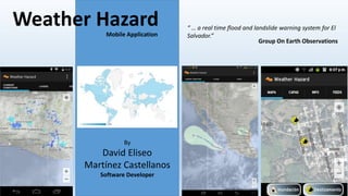
- 1. Weather Hazard “ … a real time flood and landslide warning system for El Mobile Application Salvador.” By David Eliseo Martínez Castellanos Software Developer Group On Earth Observations
- 2. Weather Hazard App is an Android Application Created to: 1. Participate in the GEO Appathon 2014. 2. To be useful for Salvadoran People. There were some rules: • The App must stem from use of the GEOSS Portal’s suite of tools. • The App’s purpose must connect with one or more ‘GEO theme’; Agriculture, Biodiversity, Climate, Disasters, Ecosystems, Energy, Health, Water or Weather. • The App should be designed to work on an App oriented operating systems, such as Android (including V4.4), iOS (including v7), Windows 8.1 (Apps only), and Windows 8 Phone. • The App can be designed for any popular portable device form factor, including smart phone, tablet, and laptop. • Participants must be non-commercial individuals or teams. • Apps must use English as a primary language. www.geoappathon.org
- 4. The GEOSS Portal “The GEOSS Portal is your main entry point to Earth Observation data from all over the world. Search our data or Contribute to our resources and data discovery tools. We also link world-wide community of practice in nine SOCIETAL BENEFIT AREA” http://geoportal.org/web/guest/geo_home_stp
- 5. Theme Selection The GEOSS Portal represents an overwhelmingly large metadata database of services and resources about agricultura, biodiversity, climate, disasters, ecosystems, energy, health, water and weather. All themes are of interest of salvadoran people even if they don’t know it. Some difficulties found during the selection of theme for the App: • Large database, takes time to check and pick data sets. • Data produced outside El Salvador, presented in an scale or resolution not adequate for El Salvador. • Dataset update periodicity not so frequent to be use in an App (Most datasets good for research and paper publication) • Some datasets metadata were incomplete or where missing the information on how to consume the data. Not all datasets where GIS datasets. So I decided to combine GEOSS datasets with datasets produced in El Salvador by The Ministry of Environment en Natural Resources (Ministerio de Medio Ambiente y Recursos Naturales, MARN) + The generation of new datasets with the collaboration of App users (citizen report).
- 6. The Layers & Datasets From GEOSS partners: Layers consumed from nowcoast.noaa.gov • Visible Satellite Cloud Imagery • Infrared Satellite Cloud Imagery • Tropical Storm Watches, Warnings and Advisories "nowCOAST presently provides public access to its observations, forecasts, imagery and geo-referenced hyperlink layers in three ways.“ This layers are consumed in the form of WMS services in real time. Feeds (rss) • National Hurricane Center Atlantic and Pacific Outlook. • Global Disaster Alerts feeds
- 7. The Layers & Datasets From MARN El Salvador • Radar animation (The last 5 images available on MARN). • Rain data stations closest to the viewer device. • Hydrographic basin flood susceptibility, based on hydrographic forecast from MARN. • Landslide susceptibility estimation, daily evaluation from MARN. • WRF Forecast, requested by MARN, [ but MARN made changes in its georeference after the App was submitted. The georeference will be corrected in next version of the App ]. Citizen reports [ Created to add a “+” to the App ] • Flood reports • Landslide reports
- 8. Implementation App backend: Google App Engine: Google App Engine is a Platform as a Service (PaaS) offering that lets you build and run applications on Google’s infrastructure. Weather Hazard uses App Engine to store citizen reports and to process WMS tiles to add transparency to tiles [ functionality that can be programmatically added on the Android devices but is not optimal for low end devices ] Frontend: The App was developed using Eclipse ADT and Standar Android APIs + Google Maps API for Android V2. Main UI composed of a Tabbed Activity.
- 9. The Result App available on Google Play: https://play.google.com/store/apps/details?id=sv.eliseo.weatherhazard And got Second Price on the GEO Appathon 2014 Winners Announced
- 10. What is next? Work to be done on: • UI [ After research on mobile map app design and patterns ] • Layer rendering [ load indicators, exception management ] • Include pictures on the citizen report and proper validation of reports [ With the help of MARN ] • Port to other platforms THANKS David Eliseo Martínez Castellanos Developer eliseo.Martinez@gmail.com sv.linkedin.com/pub/david-eliseo-martinez-castellanos/35/71b/7b5/