
Empfohlen
Empfohlen
Weitere ähnliche Inhalte
Was ist angesagt?
Was ist angesagt? (20)
Ähnlich wie Smart Planning Smart Cities_danachermesh_eng
Ähnlich wie Smart Planning Smart Cities_danachermesh_eng (20)
Mehr von Dana Chermesh Reshef
Mehr von Dana Chermesh Reshef (6)
Kürzlich hochgeladen
Kürzlich hochgeladen (20)
Smart Planning Smart Cities_danachermesh_eng
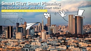
- 1. Smart City? Smart Planning Big Data for better and truly smart cities * A data-driven analysis of Tel-Aviv city’s rezoning feasibility Dana Chermesh, Jan 2019 danachermesh@gmail.com github.com/danachermesh
- 2. * Why worry about cities? Urban areas only occupy ~1% of the Earth’s land, yet they generate 80% of global GDP, emit 70% of greenhouse gasses, and hold 54% of the world’s population. Cities are the world
- 3. Cities are the world Urban areas only occupy ~1% of the Earth’s land, yet they generate 80% of global GDP, emit 70% of greenhouse gasses, and hold 54% of the world’s population. * Why worry about cities? By the year 2050, 75% of humanity is expected to dwell in cities. How smart will those cities be? How will life look like in them and who will shape them?
- 4. 21st century cities’ challenges cities Already deal with the current and future challenges of the 21st century and the largest and most rapid urbanization process ‣ Overpopulation ‣ Housing ‣ Mobility ‣ Infrastructure ‣ Health ‣ Safety + Security ‣ Energy ‣ Water ‣ Waste ‣ Resilience ‣ Pollution ‣ Poverty
- 5. Cities are the future Cities are the solutions to their own challenges Richard Florida, CityLab, Oct 2018 Richard Florida, CityLab, July 2018
- 6. Cities are the future Richard Florida, CityLab, Sep 2018 Ian Klaus, CityLab, Dec 2018 Cities are the solutions to their own challenges
- 7. Cities are the future ClimateMayors.org, June 2017 Richard Florida, CityLab, Mar 2017 Cities are the solutions to their own challenges
- 8. Cities are the future Ian Chipman, Stanford Engineering, Jan 2017 Josh Kron, The Atlantic, Nov 2012 ClimateChangeFork, Dec 2016 Cities are the solutions to their own challenges
- 9. Cities are the future World Economic Forum, July 2017 International Water Association, Apr 2015 Cities are the solutions to their own challenges
- 10. Big Data
- 11. Big Data‣ Data mining and storage ‣ Data science ‣ Artificial intelligence & machine learning ‣ Technology & IOT (Internet of Things)
- 12. Who shapes today’s cities?
- 13. Who shapes today’s cities?
- 14. Derek Thompson, The Atlantic, Oct 2018 Who shapes today’s cities?
- 15. Who shapes today’s cities?
- 16. Eddie Small, The Real-Deal New York, Mar 2018 Who shapes today’s cities?
- 17. Aarian Marshal, CitiLab, Sep 2018 Ben Fried, StreetsBlogNYC, July 2018 Who shapes today’s cities?
- 18. Who shapes today’s cities?
- 19. Lisa W. Foderaro, The New York Times, Dec 2017 Lisa W. Foderaro, The Boston Globe, Dec 2017 Who shapes today’s cities?
- 20. Who shape today’s cities?
- 21. Look how smart our cities are!
- 22. Look how smart our cities are!
- 23. Smart city for whom?
- 24. the case of LinkNYC // Sidewalk Labs Smart city for whom?
- 25. the case of LinkNYC // Sidewalk Labs Smart city for whom?
- 26. Kyle Wiggers, VentureBeat, Sep 2018 the case of LinkNYC // Sidewalk Labs Smart city for whom?
- 27. ** Dana Chermesh; Principles of Urban Informatics (PUI) class, NYU CUSP, Fall 2017 Figure: linkNYC locations on top of a choropleth of broadband access from total households. The linkNYC stations are shown on top of % of broadband access from total households.. The linkNYC stations are colored by the date they were installed on; darker red is older station. % of households with WiFi from total households the case of LinkNYC // Sidewalk Labs Smart city for whom?
- 28. ** Dana Chermesh; Principles of Urban Informatics (PUI) class, NYU CUSP, Fall 2017 MIDTOWN MANHATTAN Figure: linkNYC locations on top of a choropleth of broadband access from total households. The linkNYC stations are shown on top of % of broadband access from total households.. The linkNYC stations are colored by the date they were installed on; darker red is older station. % of households with WiFi from total households the case of LinkNYC // Sidewalk Labs Smart city for whom?
- 29. Ava Kofman, The Intercept, Sep 2018 the case of LinkNYC // Sidewalk Labs Smart city for whom?
- 30. Ava Kofman, The Intercept, Nov 2018 Smart city for whom?
- 31. Richard Florida, CityLab, May 2018 Richard Florida, CityLab, Dec 2018 Smart city for whom?
- 32. Laura Bliss, CityLab, Dec 2018 Smart city for whom?
- 33. What makes a city Smart ?
- 34. Operations Planning What makes a city Smart ?
- 35. Planning InfrastructureMaintenanceOnline services Transparency Accessibility Democracy Planning Research & Analysis What makes a city Smart ? Operations
- 36. Planning InfrastructureMaintenanceOnline services Transparency Accessibility Democracy Planning Research & Analysis What makes a city Smart ? Operations
- 42. Sponsor: Local Initiatives Support Corporation (LISC NYC) CUSP Mentor: Prof. Neil Kleiman; UCB Mentor: Prof. Karen Chapple Team: Ruben Hambardzumyan, Hao Xi, Gerardo Rodriguez, Dana Chermesh Urban Displacement Project for the Greater New York
- 43. Income Built Environment Race Education Housing Market Transit Migration Census Data: 1990, 2000, 2016
- 45. CHECK OUT our UDPNY Website + Mapping tools @ udpny.org
- 46. CHECK OUT our UDPNY Website + Mapping tools @ udpny.org
- 47. CHECK OUT our UDPNY Website + Mapping tools @ udpny.org Mobility Opportunities Explorer Where can the displaced move to?
- 48. Where can they go? Stamford, CT Bushwick, BK Chelsea, MN East Bronx, BX Ongoing Gentrification Advanced Gentrification UDPNY Website + Mapping tools @ udpny.org
- 49. Do the classic planning processes succeed to benefit from the use and applications of big data? Smarter City Planning? * What makes a city Smart ? PlanningOperations
- 50. Complexed Scale Time What makes a city Smart ? PlanningOperations Smarter City Planning?
- 51. 1 DeliriousTel-Aviv. 1 TAU, 2013
- 56. The White City of Tel Aviv – The Modern Movement has been inscribed upon the World Heritage List of the convention for the protection of the World Cultural and Natural Heritage. Inscription on this List confirms its outstanding universal value, which deserves protection for the sake of humanity. Tel Aviv was founded in 1909 and developed under the British Mandate (1920-1948). The White City was constructed from the early 1930 till 1948, based on the urban plan by Sir Patrick Geddes’ reflecting modern organic planning principles. The buildings were designed by Jewish architects who were trained in Europe where they practiced their profession before emigrating to Palestine-Eretz Yisrael. They created an outstanding architectural ensemble of the modern movement in a new cultural context. أﳊﺮﻛﺔ – اﻟﺒﻴﻀﺎء أﺑﻴﺐ -ﺗﻞ ﻣﺪﻳﻨﺔ .اﳊﺪﻳﺜﺔ اﻟﻌﺎﳌﻲ اﻟﺘﺮاث ﻗﺎﺋﻤﺔ ﻓﻲ ﻋﻨﻬﺎ اﻹﻋﻼن ﰎ ﻟﻠﺜﻘﺎﻓﺔ اﻟﻌﺎﳌﻲ اﻟﺘﺮاث ﺣﻤﺎﻳﺔ ﻣﻌﺎﻫﺪة ﺑﺤﺴﺐ .ﻟﻠﻌﺎم واﻟﻄﺒﻴﻌﺔ ﻋﻦ ﻳﻌﺒﺮ اﻟﻘﺎﺋﻤﺔ ﻫﺬه ﻓﻲ ﺗﻞ-أﺑﻴﺐ ﺷﻤﻞ إن ﻟﻠﻤﺪﻳﻨﺔ ةﺪﻳﺮﻔﻟا ﻦﻣ ﺎﻬﻋﻮﻧ اﻟﻌﺎﳌﻴﺔ اﻟﻘﻴﻤﺔ ﻟﺼﺎﻟﺢ ﻋﻠﻴﻬﺎ اﳊﻔﺎظ ﺗﻠﺰم اﻟﺘﻲ اﻟﺒﻴﻀﺎء .اﻟﻘﺎدﻣﺔ اﻷﺟﻴﺎل ﻓﻲ اﻹﻧﺴﺎﻧﻴﺔ ازدﻫﺮت ﺣﻴﺚ ، ١٩٠٩ اﻟﻌﺎم ﻓﻲ ﺗﻞ-أﺑﻴﺐ أﻗﻴﻤﺖ ﺑﲔ اﻟﺒﺮﻳﻄﺎﻧﻲ اﻻﻧﺘﺪاب ﺣﻘﺒﺔ ﻓﻲ وﺗﻄﻮرت ﻓﻲ اﻟﺒﺪء ﰎ وﻗﺪ ، (١٩٢٠-١٩٤٨) اﻷﻋﻮام وﺣﺘﻰ اﻟﺜﻼﺛﻴﻨﺎت ﻓﻲ اﻟﺒﻴﻀﺎء اﳌﺪﻳﻨﺔ ﺑﻨﺎء ﺣﺴﺐ وذﻟﻚ ، ﻣﺪﻧﻲ أﺳﺎس ﻋﻠﻰ ١٩٤٨ اﻟﻌﺎم رواد ﻣﻦ وﻫﻮ ﻏﺪس ﺑﺘﺮﻳﻚ اﻟﺴﻴﺮ ﺗﺨﻄﻴﻂ اﻟﻘﺮن ﻓﻲ اﳊﺪﻳﺚ اﳌﺪﻧﻲ اﻟﺘﺨﻄﻴﻂ ﻣﺒﺎدئ اﳌﺪﻳﻨﺔ ﺑﻴﻮت ﺗﺨﻄﻴﻂ ﺑﺈﻋﺪاد ﻗﺎم .اﻟﻌﺸﺮﻳﻦ ﻳﻬﻮد ﻣﻌﻤﺎرﻳﲔ ﻣﻬﻨﺪﺳﲔ ﻣﻦ ﻣﺠﻤﻮﻋﺔ ﻣﻬﻨﺘﻬﻢ ﻓﻲ واﺧﺘﺼﻮا وﺗﺮﺑﻮا ﻧﺸﺆوا ﻗﺪ ﻛﺎﻧﻮا أرض – ﻓﻠﺴﻄﲔ إﻟﻰ ﻫﺠﺮﺗﻬﻢ ﻗﺒﻞ أوروﺑﺎ ﻓﻲ ﳑﻴﺰا ﻣﻌﻤﺎرﻳﺎ ﺗﻜﺎﻣﻼ أوﺟﺪوا ﺣﻴﺚ ،إﺳﺮاﺋﻴﻞ ﺟﻮ ﻓﻲ اﳊﺪﻳﺜﺔ اﻟﻌﺼﺮ وﻟﻐﺔ ﻳﺘﻼءم وﻣﺤﻠﻴﺎ .ﺟﺪﻳﺪ ﺣﻀﺎري – . . - . . TAU, 20131 #delirious_tlv Tel-Aviv’s Preservation Plan (2008) Preservation level A Preservation level B
- 59. TAU, 20131 #delirious_tlv x*waytoomuch* = x 1’ג 38 תמ”א םילבקמ םישרגמ םוחת לובג
- 63. TLV, 2011-172
- 64. TLV, 2011-172
- 65. TLV, 2011-172 The City Center of Tel-Aviv, Israel
- 66. TLV, 2011-172 Borough no.3 “The Old North” neighborhood Borough no.4 “The New North” neighborhood The City Center of Tel-Aviv, Israel
- 67. 3 NYU CUSP, 2017-18
- 68. Will Tel-Aviv be renewed?
- 69. Who wants Borough 3 to be renewed? ויינברג גבריאל :צילום
- 70. Borough 3 Borough 4 The New NorthThe Old North Jaffa (Borough 7) Borough 5 1. HISTORY Boroughs 1+2 < Borough 6 Tel-Aviv City Center Mediterranean Sea
- 71. 1. HISTORY Geddes Plan, 1925
- 72. 1. HISTORY Geddes Plan, 1925 Typical Residential Block, “Garden City”
- 73. c “The White City” zone Borough 31. HISTORY
- 74. “The White City” zone c 1. HISTORY “The White City of Tel Aviv is a synthesis of outstanding significance of the various trends of the Modern Movement in architecture and town planning in the early part of the 20th century. Such influences were adapted to the cultural and climatic conditions of the place, as well as being integrated with local traditions” 2003
- 75. 60% Of Borough’s 3 area 1. HISTORY “The White City” zone Borough 3
- 76. ‣ Approved: December 2017 ‣ One out of four renewal plans being prepared for Tel-Aviv city center boroughs (3,4,5,6) and the first one to be approved ‣ Plan TA/3616/A Instructions, Israeli Planning Administrations 2. Plan TA/3616/A
- 77. ‣ Act as a lever for urban renewal, by upgrading non-historical buildings and increasing the housing stock of the city center ‣ Make buildings more resilient to earthquakes according to national masterplan no.38 ‣ Preserving the spatial qualities of the unique city center’s urban scape, including following UNESCO’s requirements Not eligible for: ‣ Historical Buildings ‣ New Buildings (>1980) ‣ Non-residential Buildings * Plan’s Objectives 2. Plan TA/3616/A Plan TA/3616/A Instructions, Israeli Planning Administrations
- 78. The plan is Incentive-based * $ (The developer burdens all the costs of a project, including giving back to homeowners their existing floor area) > HOW? 2. Plan TA/3616/A Plan TA/3616/A Instructions, Israeli Planning Administrations
- 79. == M2 2. Plan TA/3616/A > HOW? Plan TA/3616/A Instructions, Israeli Planning Administrations The plan is Incentive-based * $The Incentive is Floor-Area
- 80. 2. Plan TA/3616/A > HOW? Plan TA/3616/A Instructions, Israeli Planning Administrations == M2 The plan is Incentive-based * $The Incentive is Floor-Area Parameters for calculating “development rights” ‣ Setbacks (Meters) ‣ Floors (#) ‣ Density coefficient (housing units) *
- 81. Building Footprint 2. Plan TA/3616/A > HOW? Plan TA/3616/A Instructions, Israeli Planning Administrations Parameters for calculating “development rights” ‣ Setbacks (Meters) ‣ Floors (#) ‣ Density coefficient (housing units) * == M2 The plan is Incentive-based * $The Incentive is Floor-Area
- 82. Floor Area 2. Plan TA/3616/A > HOW? Plan TA/3616/A Instructions, Israeli Planning Administrations == M2 The plan is Incentive-based * $The Incentive is Floor-Area Parameters for calculating “development rights” ‣ Setbacks (Meters) ‣ Floors (#) ‣ Density coefficient (housing units) *M2
- 83. 2. Plan TA/3616/A > HOW? Plan TA/3616/A Instructions, Israeli Planning Administrations M2 Floor Area Ratio (FAR) * M2
- 84. 1 Building Footprint M2 Floor Area % 23 2. Plan TA/3616/A > HOW? Plan TA/3616/A Instructions, Israeli Planning Administrations Floor Area Ratio (FAR) (lot coverage)(lot coverage X floors)
- 85. The plan differs between: ‣ New Construction / Building Extensions ‣ within / outside White City zone ‣ Parcel’s area <> 500 m2 (UNESCO) ‣ Residential / Commercial street <** ** This research analyzes new construction possibility only 2. Plan TA/3616/A Plan TA/3616/A Instructions, Israeli Planning Administrations Parameters: ‣ Setbacks ‣ no. of floors ‣ Density coefficient * Principles:
- 86. The plan differs between: ‣ New Construction / Building Extensions ‣ within / outside White City zone ‣ Parcel’s area <> 500 m2 (UNESCO) ‣ Residential / Commercial street < 2. Plan TA/3616/A Plan TA/3616/A Instructions, Israeli Planning Administrations Parameters: ‣ Setbacks ‣ no. of floors ‣ Density coefficient * Principles:
- 87. The plan differs between: ‣ New Construction / Building Extensions ‣ within / outside White City zone ‣ Parcel’s area <> 500 m2 (UNESCO) ‣ Residential / Commercial street < 2. Plan TA/3616/A Plan TA/3616/A Instructions, Israeli Planning Administrations Parameters: ‣ Setbacks ‣ no. of floors ‣ Density coefficient * Principles:
- 88. 1+ Parameters: ‣ Setbacks ‣ no. of floors ‣ Density coefficient * 2. Plan TA/3616/A Plan TA/3616/A Instructions, Israeli Planning Administrations The plan differs between: ‣ New Construction / Building Extensions ‣ within / outside White City zone ‣ Parcel’s area <> 500 m2 (UNESCO) ‣ Residential / Commercial street Principles:
- 89. total addition of 8,000 housing units is expected According to the city, the plan can create 16,000 new housing units, with an assumption of 50% utilization >> * Today there are 34,000 housing units in borough 3 2. Plan TA/3616/A Plan TA/3616/A Instructions, Israeli Planning Administrations Housing Units ^ Additional^ Existing
- 90. 1’ג 38 תמ”א S?$? +++ 2. Plan TA/3616/A Plan TA/3616/A Instructions, Israeli Planning Administrations
- 91. 3. DATA & METHODOLOGY *Analysis assumption: Equal and high demand for land For all of Borough 3 area Borough 3 The Old North
- 92. 3. DATA & METHODOLOGY Writing a python code that reads real gis data of every building and parcel in the borough, calculates it according to the rezoning’s instructions to assess the allowed floor area to be built. This to determine whether the incentive per building is big enough to assume it will be utilized
- 93. 3. DATA & METHODOLOGY gis data ‣ Address ‣ Parcel Size (m2) ‣ Footprint (m2) ‣ Building Type ‣ no. of Floors ‣ Historical Buildings ‣ Boundaries: Borough 3, White City Zone >> INPUT < Python code > << Writing a python code that reads real gis data of every building and parcel in the borough, calculates it according to the rezoning’s instructions to assess the allowed floor area to be built. This to determine whether the incentive per building is big enough to assume it will be utilized
- 94. 3.1 SPATIAL DATA // GIS TLV [search zoning]
- 95. 3.1 SPATIAL DATA // GIS TLV [choose boundaries]
- 96. 3.1 SPATIAL DATA // GIS TLV [download .shp: addresses]
- 97. 3.1 SPATIAL DATA // GIS TLV [download .shp: buildings]
- 98. 3.1 SPATIAL DATA // GIS TLV [download .shp: parcels]
- 99. 3.1 SPATIAL DATA // GIS TLV [download .shp: historic]
- 100. 3.2 reading, cleaning, munging data Jupyter notebookCode cell
- 101. 3.2 reading, cleaning, munging data Jupyter notebook Output
- 102. 3.2 reading, cleaning, munging data Jupyter notebook Markdown cells
- 103. 3.2 reading, cleaning, munging data 80% of your time
- 104. 3.2 reading, cleaning, munging data
- 105. My final input dataset 3.2 reading, cleaning, munging data < 2,161 Parcels > (out of 4,560 parcels in borough 3)
- 106. gis data 1 M2 Floor Area 2 Floor Area Ratio (FAR) >> INPUT CALcULATED (EXISTING) (EXISTING) < Python code > <<<< 3. DATA & METHODOLOGY ‣ Address ‣ Parcel Size (m2) ‣ Footprint (m2) ‣ Building Type ‣ no. of Floors ‣ Historical Buildings ‣ Boundaries: Borough 3, White City Zone
- 107. gis data 1 M2 Floor Area 2 >> INPUT CALcULATED (EXISTING) (EXISTING) < Python code > <<<< 3. DATA & METHODOLOGY Floor Area Ratio (FAR) ‣ Address ‣ Parcel Size (m2) ‣ Footprint (m2) ‣ Building Type ‣ no. of Floors ‣ Historical Buildings ‣ Boundaries: Borough 3, White City Zone
- 108. 4.1 Exploratory Analysis: Current built environment Floor Area Ratio (FAR) (EXISTING FAR)
- 109. 4.1 Exploratory Analysis: Current built environment The coherence of the TLV urban space derives from a similar FAR
- 110. Histogram == frequency distribution 4.1 Exploratory Analysis: Current built environment
- 111. 4.1 Exploratory Analysis: Current built environment Histogram == frequency distribution
- 112. 4.1 Exploratory Analysis: Current built environment
- 113. 4.1 Exploratory Analysis: Current built environment
- 114. gis data < Python code > Plan instructions << << 4.2 Predictive Analysis: FUTURE built environment Methodology Writing a python code that reads real gis data of every building and parcel in the borough, calculates it according to the rezoning’s instructions to assess the allowed floor area to be built. This to determine whether the incentive per building is big enough to assume it will be utilized
- 115. gis data < Python code ><< << 4.2 Predictive Analysis: FUTURE built environment Plan instructions Methodology Writing a python code that reads real gis data of every building and parcel in the borough, calculates it according to the rezoning’s instructions to assess the allowed floor area to be built. This to determine whether the incentive per building is big enough to assume it will be utilized
- 116. gis data < Python code > Anticipated floor area << << << m2 ** According to plan principles 4.2 Predictive Analysis: FUTURE built environment Plan instructions Methodology Writing a python code that reads real gis data of every building and parcel in the borough, calculates it according to the rezoning’s instructions to assess the allowed floor area to be built. This to determine whether the incentive per building is big enough to assume it will be utilized
- 117. 1 44%-56% 4.2 Predictive Analysis: FUTURE built environment Building Footprint
- 118. >750m2 : 55% 4.2 Predictive Analysis: FUTURE built environment 1Building Footprint
- 119. gis data < Python code > Anticipated floor area << << << m2 ** footprint (44%-56%) X allowed # of floors M2 2 4.2 Predictive Analysis: FUTURE built environment Plan instructions Methodology Writing a python code that reads real gis data of every building and parcel in the borough, calculates it according to the rezoning’s instructions to assess the allowed floor area to be built. This to determine whether the incentive per building is big enough to assume it will be utilized
- 120. 4.2 Predictive Analysis: FUTURE built environment (Allowed FAR) 3 Floor Area Ratio (FAR)
- 121. 4.2 Predictive Analysis: FUTURE built environment The far values within the white city zone are lower than outside of it, though the histograms are similar, meaning, the built environment will be higher outside of the white city but the overall coherence of the urban scape will be preserved.
- 122. 4.2 Predictive Analysis: FUTURE built environment <
- 123. 1’ג 38 תמ”א S?$? gis data < Python code > Anticipated floor area feasible? << << <<Existing floor area<< +++ 4.3 Predictive Analysis: ECONOMIC FEASIBILITY Considering the give backs to the dwellers of their existing floor area (+more), the allowed FA needs to be a large enough incentive in order to assume the deal is economically feasible Methodology Writing a python code that reads real gis data of every building and parcel in the borough, calculates it according to the rezoning’s instructions to assess the allowed floor area to be built. This to determine whether the incentive per building is big enough to assume it will be utilized Plan instructions
- 124. 1’ג 38 תמ”א S?$? gis data < Python code > feasible? << << <<<< +++ 4.3 Predictive Analysis: ECONOMIC FEASIBILITY <= 0.5Anticipated floor area Existing floor area <500m2 : 0.45 >750m2 : 0.55 Economic feasibility threshold: Methodology Writing a python code that reads real gis data of every building and parcel in the borough, calculates it according to the rezoning’s instructions to assess the allowed floor area to be built. This to determine whether the incentive per building is big enough to assume it will be utilized Plan instructions
- 125. 4.3 Predictive Analysis: ECONOMIC FEASIBILITY 1640 521
- 126. 1640 4.3 Predictive Analysis: ECONOMIC FEASIBILITY 521
- 127. Will Tel-Aviv be renewed? 4.3 Predictive Analysis: ECONOMIC FEASIBILITY Only 521 buildings (24% of all the buildings that are eligible for the rezoning) were found profitable enough to assume their renewal.
- 128. Will Tel-Aviv be renewed? 4.3 Predictive Analysis: ECONOMIC FEASIBILITY
- 129. Will Tel-Aviv be renewed? 4.3 Predictive Analysis: ECONOMIC FEASIBILITY 3,390 housing units == 60% less than the city’s formal prediction of 8,000 units ?Housing Units
- 130. 4.3 Predictive Analysis: ECONOMIC FEASIBILITY Will Tel-Aviv be renewed? Feasible >> new (allowed) far Not feasible >> current far
- 131. Plan’s Objectives: 5 implications ? ‣ Act as a lever for urban renewal, by upgrading non-historical buildings and increasing the housing stock of the city ‣ Make buildings more resilient to earthquakes according to national masterplan no.38 ‣ Preserving the spatial qualities of the unique city center’s urban scape, including following UNESCO’s requirements
- 132. 5 implications TIME 2 TIME 1 2 Or 75% 25% Meirav Moran, Haaretz, July 2018
- 133. 5 implicationsויינברג גבריאל :צילום
- 134. 6 future research ‣ Boroughs 4,5,6 > How will the future TLV city center’s urban scape look and function? ‣ Economic, Social, Spatial consequences ‣ Random forest, ML techniques > Which are the factors that affect the feasibility of an incentive-based upzoning and how? ויינברג גבריאל :צילום
- 136. < Thank you > All examples + code are available in my GitHub github.com/danachermesh