D Mac P Indoor Navigation
•
1 gefällt mir•802 views

The document discusses the development of an open standard format for exchanging open floor plans and building information. It proposes identifying relevant stakeholders and existing standards that could be leveraged. Key steps include examining OGC and other standards, identifying missing pieces, signing agreements with standards bodies, and developing a standard hierarchy and information delivery manual. The goal is to consolidate accomplishments and partner with owners, vendors and developers to submit a proposal and testbed for an open exchange format.

Empfohlen
Weitere ähnliche Inhalte
Ähnlich wie D Mac P Indoor Navigation
Ähnlich wie D Mac P Indoor Navigation (20)
Kürzlich hochgeladen
Kürzlich hochgeladen (20)
D Mac P Indoor Navigation
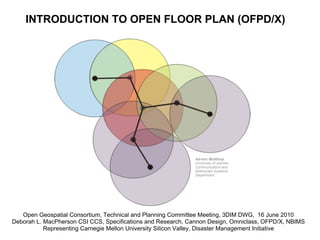
- 1. INTRODUCTION TO OPEN FLOOR PLAN (OFPD/X) Ad-hoc Multihop University of Aachen Communication and Distributed Systems Department Open Geospatial Consortium, Technical and Planning Committee Meeting, 3DIM DWG, 16 June 2010 Deborah L. MacPherson CSI CCS, Specifications and Research, Cannon Design, Omniclass, OFPD/X, NBIMS Representing Carnegie Mellon University Silicon Valley, Disaster Management Initiative
- 2. Overview of Building Classification Systems VA BIM Guide and Omniclass Facility Types
- 3. Simple Geometry with Basic Semantic Support OSHA Evacuation Diagram and HazMat Symbols Creative Commons SVG Fire Symbol Sample Screen Shot
- 4. Different Architecture, Different Specifications, Similar Data, Similar Communication Needs
- 5. Standards Landscape Advance a standard open floor plan format for EM within OASIS Create and NBIMS IDM (National Building Information Standard, Information Delivery Manual) Work towards OGC testing Standards Harmonization Contact: Steve Ray @ CMU SV bSi OGC OASIS
- 6. Relevant OGC Standards CityGML, SensorML, IndoorML Geographic Objects Interface Standard (GOS), Filter Encoding Standard (FES), Styled Layer Descriptor, Planning Service Interface Standard (SPS), OpenLS Tracking Services See Handout
- 7. Using BIM for Indoor Navigation and Routing 3D circulation rules are implemented as a route graph that defines all paths within the building going through space that can be used for through circulation. Distances traversed, the types and security of spaces in the traversal path, and other conditions can be used to define allowable and illegal circulation paths. On a 6-story courthouse, approximately 27,000 routes were tested using 312 circulation rules in approximately 15 seconds. Chuck Eastman Yeon-Suk Jeong Jae min Lee Jin Kook Lee Sherif Abdelmohsen, Hugo Sheward Paola Sanguinetti Georgia Tech
- 8. Examples showing how Solibri calculates egress routes from a building. Provided by Jonathan Widney All egress routes for a building, and the occupancies of each space Control panel where the user defines how the egress and occupancy displays
- 9. Spatial Congnition: Automomous Wheelchair Provided by John Bateman, OntoSpace
- 10. Rules to Make BIMs, for CityGML, for use by Fire Departments © IKG, Universität Bonn Provided by Greg Jakubowski Identifying Common XML Entities and Relationships
- 11. Typical Symbol and Sign Information - could be in a BIM? © IKG, Universität Bonn
- 12. Standardizing Colors in Buildings, On Site Plans © IKG, Universität Bonn
- 13. Connecting Attributes and Properties
- 15. OGC Specification versus Interoperability Process Healthcare Interoperability Standards, CyrusXP
- 16. 7 Challenges 1. Although the work is justified, clear articulation is missing. 2. Relationship to other research and development efforts needs more explanation - particularly tracking and locator studies. 3. Differentiation from other work is missing. What unique contribution will the project add to the existing body of knowledge? 4. The study design is too open ended, not tied to specific deliverables yet. 5. More definition is needed on the technical approach. How will goals be accomplished? What methods and strategies will be used for data collection, analysis, etc.? 6. Institutional commitment from stakeholders needs to be more obvious both vertically and horizontally. 7. The means for collaboration needs to be explained to research and development communities, hardware/software vendors, and end users.
- 17. 10 Steps 1. Identify Owners who could benefit from the use of an open format to exchange open floor plans and all the semantic information that can be packed into their XML schemas. 2. Identify which OGC standards can be used, focusing on CityGML and others in the handout. 3. Closely examine these OGC standards with contract documents and maintenance agreements about sensors and certain properties of building materials using the new Omniclass Table 49 Properties and 11-14 Facility and Space types to add structure. 4. Look at OASIS, W3, ISO standards and functional open data models to identify what can be used already versus the missing pieces that need to be worked on by bSa (standard colors, basic wall types, essential property sets). 5. Sign project specific MOUs with bSa, OASIS EM TC, IFD, NIEM and associated international efforts, Insurance Associations, NEMA, CSI, AIA, NIBS, and A/Es in the Large Firm Round Table like Cannon Design.
- 18. 10 Steps (Continued) 6. Work with the bSa Open Floor Plan project committee on a standard hierarchy for buildings and Information Delivery Manual (IDM) using cross references in the Veterans Administration (VA) BIM Guide. Look at the Spatial Program Validation and other Model View Definitions (MVDs). Collaborate with original IDM and MVD authors to ensure the components and relationships will work backwards and forewards. 7. Consolidate what has been accomplished so far and write out again more clearly - what Owners needs are, what is in place already versus bridges that need to be built, and a strategy to partner with vendors and developers. 8. Talk with US National Institute of Standards and Technology (NIST) about what needs to be certified; and Google regarding Scalable Vector Graphics (SVG) and Building Maker in 3D Warehouse. 9. Submit a proposal to OGC members that can benefit from a unified effort. 10. Hold an OGC testbed with the range of vendors and services that need to be involved. Work the results into proper form for open exchange models.