ICT Role in 21st Century Education & its Challenges.pptx
CM10 Improving Health Daniel Serda
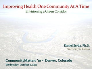
1. CommunityMatters ’10 Denver, Colorado▪CommunityMatters ’10 Denver, Colorado▪
Wednesday, October 6, 2010Wednesday, October 6, 2010
Daniel Serda, Ph.D.Daniel Serda, Ph.D.
University of KansasUniversity of Kansas
2.
3.
4.
5. The vision of the Healthy KidsThe vision of the Healthy Kids
Initiative is that RosedaleInitiative is that Rosedale
will be a healthy andwill be a healthy and
sustainable community thatsustainable community that
enables physical activity,enables physical activity,
encourages healthy eating,encourages healthy eating,
and promotes healthy livingand promotes healthy living
for residents of all ages.for residents of all ages.
International
Safe Walk to
School Day
October 6, 2010October 6, 2010
6.
7. Watershed PlanningWatershed Planning
COE Flood Study 1987COE Flood Study 1987
• Environmental degradationEnvironmental degradation
• Natural resource inventoryNatural resource inventory
COE Watershed Plan 2007COE Watershed Plan 2007
• Urban ecosystem restorationUrban ecosystem restoration
• Habitat conservationHabitat conservation
• Recreation and trailsRecreation and trails
15. SOURCE: Scott Campbell, “Green Cities, Growing Cities, Just Cities.”
Jnl of the American Planning Assn., Summer 1996.
16. Kansas City, KS – Industrial ParkKansas City, KS – Industrial Park
17.
18. A Question of FairnessA Question of Fairness
Median Household Income inMedian Household Income in
Rosedale = $28,573Rosedale = $28,573
(KC Metro = $40,824)(KC Metro = $40,824)
20% of Rosedale population lives20% of Rosedale population lives
below the poverty linebelow the poverty line
KCK has second lowest median homeKCK has second lowest median home
value ($52,000) in U.S. for cities >value ($52,000) in U.S. for cities >
100,000 pop.100,000 pop.
85% of students in Rosedale students85% of students in Rosedale students
are economically disadvantagedare economically disadvantaged
51% of children in Rosedale are51% of children in Rosedale are
overweight or obese (U.S.=20%)overweight or obese (U.S.=20%)
To be active and grow up healthy,To be active and grow up healthy,
children need safe places to play, andchildren need safe places to play, and
access to recreational amenities thataccess to recreational amenities that
encourage exploration andencourage exploration and
independenceindependence
19.
20.
21. The increasing role of media technology in the lives of childrenThe increasing role of media technology in the lives of children
explains, in part, the imbalance between physical activity and foodexplains, in part, the imbalance between physical activity and food
consumption (Hillierconsumption (Hillier Annals, AAPSSAnnals, AAPSS 2008; 615)2008; 615)
Neighborhoods with increased proximity between homes and higherNeighborhoods with increased proximity between homes and higher
proportions of park area are associated with higher physical activity inproportions of park area are associated with higher physical activity in
young children (Roemmich et al.,young children (Roemmich et al., Prev MedPrev Med 2006;43)2006;43)
Lower levels of physical activity in low-income communities of colorLower levels of physical activity in low-income communities of color
are attributable both to disparities in access to parks and recreationare attributable both to disparities in access to parks and recreation
environments, as well perceptions of safety among residents (Floyd etenvironments, as well perceptions of safety among residents (Floyd et
al.al. Am J Prev MedAm J Prev Med 2009;36)2009;36)
Playground renovations increase frequency of use and overallPlayground renovations increase frequency of use and overall
childhood physical activity (Tester & Baker,childhood physical activity (Tester & Baker, Prev MedPrev Med 2009;48)2009;48)
Routine, organized activities at parks are the strongest factorRoutine, organized activities at parks are the strongest factor
facilitating park use and community physical activity (Cohen et al.facilitating park use and community physical activity (Cohen et al. PrevPrev
MedMed 2009;50)2009;50)
Richard Louv, in his book The Last Child in the Wood: Saving Our Children from Nature-Deficit Disorder highlights research done to explain negative impacts on the disconnection from nature. He also coins the term nature-deficit disorder, which is not a medical condition but his way of describing a set of ill-effects associated with decreased outdoor play. The argument is compelling for the fact that our physical environment and perceptions about children play and safety have gone through radical changes since the baby-boom generation. Many children have an almost inherent desire to explore the woods or climb a tree but these forms of play are inaccessible.
Environmental Impacts: Floodplain filling; Channel straightening; Concrete lining; Channel enclosures; On-stream lake filling; Road/utility crossings
Army COE Watershed Project : Watershed Project; Upper Turkey Creek; Watershed planning; Ecosystem restoration; Include trails in urban stream corridors
Studies of Turkey Creek were initiated following the 1983 flood. In 1987, the U.S. Army Corps of Engineers produced the Reconnaissance Study of Turkey Creek. This study commenced the series of studies that make up the “Turkey Creek Flood Protection Feasibility Study”. The Flood Damage Reduction Project was authorized for construction in the Water Resources Development Act (WRDA) of 1999.
The corridor is located within the Turkey Creek drainage basin, which is 23 square miles located adjacent to Interstate 35 for much of its length. Most of the 15 miles of stream channel lies within Johnson County. Approximately 9.22 miles of tributary streams flow into Turkey Creek. Much of the creek’s original floodplain has been developed for industrial, commercial, and residential urban uses.
Channel modification of the primary channel begins just upstream (west) of the Mission Road/I-35 area and extends to just downstream (west) of the 7th Street overpass. To date the channel work has been completed including the bioengineering components. Construction of the levee is expected to begin in August 2009 and be completed in August 2010.
Several major flood events have occurred over the last 50 years with extreme events in 1993 and 1998. The creek passes through the ¼ mile long Turkey Creek tunnel to the Kansas River at river mile 3.17. Much of the creek’s original floodplain has been developed for industrial, commercial, and residential urban uses.
Although the COE has been conducting studies on Turkey Creek for over 20 years the main focus was flood control. It wasn’t until the mid-1990’s when they began to examine the entire watershed from a wetland preservation perspective. In 2006 the COE held the first public workshop with the Turkey Creek Basin Stakeholders to discuss development of a concept plan that would take into consideration watershed protection as well as flood control.
The Turkey Creek Corridor is a 10 mile long segment of the MetroGreen regional greenway plan.
Turkey Creek flows west to east from Johnson County, Kansas through Wyandotte County and into the Kansas River. The Turkey Creek corridor intersects several different local governments. Those are Overland Park, Merriam, Mission, Roeland Park, Kansas City, Kansas and Kansas City, Missouri. This corridor follows the creek through suburbs, commercial areas and industrial zones finally terminating at the Missouri River. It also transects several heavily traveled local roadways and interstate highways including: I-35, I-635, I-70, Antioch, Merriam Lane, Lamar Avenue and Southwest Boulevard.
Trail development along this corridor will not only provide a recreation amenity for the community, but encourage conservation along Turkey Creek, provide alternative transportation to downtown and spur economic development.
Sustainability is often couched as a finding BALANCE in the TENSION between PROTECTING THE ENVIRONMENT and PROMOTING ECONOMIC DEVELOPMENT. Such a perspective overlooks the ROLE OF LOCAL COMMUNITIES – SUSTAINABILITY IS ALSO ABOUT ENGAGING COMMUNITIES IN DEFINING THEIR OWN FUTURES.
The infrastructure and environmental challenges in Rosedale loom large compared to other parts of the corridor….
The Turkey Creek corridor has been developed heavily and contains commercial, industrial and residential areas. The COE economic study on the area determined a total of 58,280 employees work in the corridor with an annual payroll of $1,851,000. As mentioned in section 3.0 there are over 38,000 people that live within the corridor and over 16,000 households. Although much of the area has been developed, there is wooded land that has been left undeveloped which can become part of the MetroGreen system.
And this is happening in a context in which the diversity of the population in Rosedale is increasing ….
Poverty is a real issue, and it creates strains that adversely impact not only the economic livelihood, but also the PHYSICAL WELL-BEING of children in Rosedale.
Kids are incredibly perceptive about what is important. We asked kids at a local elementary school to describe the environments in which they play. Invariably, most drew pictures of organized recess time on the school playground.
When we asked about whether they play near their homes, the answer was invariably “I’d like to – but it’s not safe.” The primary reason for this perception of lack of safety is not crime, but TRAFFIC.
These are challenges that have to be set against what we are learning about the critical role that neighborhood environments serve in shaping access to physical activity.
Here is the broader corridor plan being developed by the Mid-America Regional Council, our metropolitan planning organization. Not that other than the streamway enhancement area, the corridor through Rosedale is a dashed line on the map. Here was an OPPORTUNITY.
We set ought to create an asset-based plan that leverages existing institutional anchors, such as local elementary and parochial schools, and creates a pedestrian pathway and trail system to connect these anchors. We also set ought to re-imagine what have often been perceived as LIABILITIES into CORE ASSETS that will help make this vision a reality.
The most common problem we heard about from schoolkids was the lack of sidewalks and safe places to play. This is a dramatic challenge; based on our analysis, over 60% of existing residential streets either LACK sidewalks or have sidewalks that are SERIOUSLY DETERIORATED.
Given this INFRASTRUCTURE DEFICIT, we proposed a capital investment process that not only will ADD TO or REPAIR existing sidewalks, but place a premium on their UTILITY for walking and regular activity. We also proposed that sidewalks incorporate GREEN FEATURES, such as planter boxes and swales that will aid in stormwater retention.
We also encouraged the community to contemplate shared-easement PEDESTRIAN PATHWAYS, which could replace existing alleyways and provide alternative access for residents throughout the community.
Given Rosedale’s precarious geography in the Turkey Creek valley, FLASH FLOODING is a regular problem, as is the need for on-site STORMWATER RETENTION, particularly near LIGHT INDUSTRIAL SITES. The lack of viable infrastructure in Rosedale has meant that many local roads lack storm sewers, but this opens up the opportunity to introduce GREEN INFRASTRUCTURE, such as swales and raingardens for these purposes.
Again, these can also be incorporated into pedestrian enhancements, as shown in the example above.
Given its RUGGED TOPOGRAPHY, Rosedale has hundreds of acres of heavily forested land, a not insignificant portion of which is held in public ownership. These areas have dramatic slopes (grades usually in the 20-30% range), and many abut the highway, railroad, and creek. Some, such as the relatively flat area shown above, are also subject to flash flooding during heavy rains.
We proposed the creation of a NATURAL TRAIL system to make these areas ACCESSIBLE FOR EXPLORATION. Rosedale seeks to use its own URBAN WILD LANDS and make natural play accessible to the children of the community.
One of the most exciting assets that we discovered was a 14-acre parcel owned by the city (originally designated a park by the CITY OF ROSEDALE, it has never been maintained as such by KCK). This parcel is immediately adjacent to the local middle school, the grounds of which include an additional THREE ACRES of forested, inaccessible land, and abuts approximately ¾ of a mile of DEDICATED, but UNIMPROVED, local STREETS. These are logical settings for the introduction of NATURAL TRAILS and the creation of a large URBAN WILDLAND.
A local, all-volunteer example of the effort required to make such a landscape accessible already exists in Kansas City, Mo.’s Swope Park, where mountain bike aficianados have created a network of SWITCHBACK TRAILS constructed entirely with volunteer labor.
The proximity of these natural areas to the local middle school led to a proposal, now being vetted with the local school board, to repurpose the former industrial arts classrooms (8,000 GROSS SQ FT on TWO LEVELS) as an ENVIRONMENTAL EDUCATIONAL CENTER. One of the possibilities being explored is tying the ROSEDALE ENVIRONMENTAL ACTIONAL LABORATORY into a prototype STEM education facility for use by students from throughout the region.
Finally, we came back to the mandate handed to us by staff from MARC – the creation of a COMPLETE STREETS STRATEGY for SOUTHWEST BOULEVARD and MERRIAM LANE, the arterial roadway that runs parallel to INTERSTATE 35.
We determined that it is eminently feasible, within the existing RIGHT OF WAY, to add on-street bicycle lanes – particularly because the local government was already planned to resurface and re-signal approximately three miles of this critical local roadway. The Rosedale Development Association is in discussions to ensure that this project expands to include traffic calming measures – which led to one final though.
Wouldn’t it be a mistake not to leverage millions of dollars in CAPITAL INVESTMENTS in roadway infrastructure into a more walkable DOWNTOWN DISTRICT?
IN CONCLUSION, here’s a brief animation to suggest the sequence of what might be possible . . .
Adding a transit stop . . ..
Striping bicycle lanes
Adding streetscape features, such as street trees and new pedestrian lighting
These investments will attract bicycle commuters, but…
It will also encourage reinvestment in near-abandoned properties….
And holds the potential to create interest in new RESIDENTIAL DEVELOPMENT along the corridor.