SlideShare ist ein Scribd-Unternehmen logo
1 von 19
(Nova Scotia Environment, 2011)
Proposed Plan for
Road Construction
in Nichols Lake:
Assessing and Avoiding
Alterations
Prepared for:
Elizabeth Kennedy M.Sc, PGeo.
PWS.
Prepared by:
Cindy Quigley, Jordan Gardiner,
Mikasa Quaife, and Tanya Prystay
March 26, 2015
March 26, 2015
Page 2 of 19
TABLE OF CONTENTS
Section Page Number
1.0 Project Description......................................................................................................... 4
2.0 Wetland Description....................................................................................................... 5
2.1 Methods................................................................................................................. 5
2.2 Classification.......................................................................................................... 5
Table 1 Wetland Areas and Classification................................................ 5
2.3.1 Character..................................................................................................... 6
2.3.2 Wetland Functions....................................................................................... 6
2.3.3 Wetland Sensitivities.................................................................................... 7
3.0 Interactions..................................................................................................................... 7
3.1 Hydrology............................................................................................................... 7
Table 2 Hydraulic Interactions................................................................... 7
3.2 Soil......................................................................................................................... 8
Table 3 Soil Interactions............................................................................ 8
3.3 Ecology.................................................................................................................. 8
Table 4 Ecological Interactions................................................................. 8
4.0 Recommended Mitigations............................................................................................. 9
Table 5 Avoidance Measures Taken Before Construction Begins........... 9
Table 6 Actions Taken to Minimize Effects of Construction...................... 9
Table 7 Compensation for Effects that can Neither be Avoided nor
Minimized.................................................................................................. 10
5.0 Effects to Wetlands......................................................................................................... 11
5.1.1 Loss of Wetland and Wetland Fragmentation............................................... 11
5.1.2 Sedimentation............................................................................................... 11
5.1.3 Water Quality...................................................................................................... 11
5.1.4 Other Impacts..................................................................................................... 11
Table 8 Mitigations to Help Counteract Effects to Wetlands..................... 12
6.0 Recommendations for Follow-Up Monitoring................................................................. 13
6.1 Objectives.............................................................................................................. 13
6.2 Methods................................................................................................................. 13
6.3 Locations............................................................................................................... 13
6.4 Frequency and Duration........................................................................................ 13
7.0 Closing Statement.......................................................................................................... 13
8.0 References 14
March 26, 2015
Page 3 of 19
LIST OF APPENDICES
Appendix Page Number
Appendix 1: Delineated Wetlands by Air Photo Interpretation............................................... 17
Appendix 2: Prospect River Watershed................................................................................. 18
Appendix 3: Wetland Construction Permits and Legislations................................................ 19
Appendix 4: Specifications for a standard cross section Minor F.......................................... 20
March 26, 2015
Page 4 of 19
1.0 PROJECT DESCRIPTION
Nichol’s Lake is a popular recreational area for local residents of the Halifax Regional
Municipality (HRM) who use it for fishing, hiking, paddling, hunting, and swimming. The project
will provide lake access via a paved, two-lane, minor F-collector highway extending from
highway 333 to the northeast corner of Nichol’s Lake (Appendix 1). The lake is directly fed by
Little Indian Lake via Stillwater Run and is part of the Prospect River Watershed, beginning at
Otter Lake and emptying into Prospect Bay (Appendix 2). Upstream, Otter Lake and Big Indian
Lake are part of the provincial fish-stocking program for sport fishing and are currently being
stocked by the Nova Scotia Department of Fisheries and Aquaculture (EDM, 2010). Important
fish species found in the watershed include Brook trout, Sea trout, Atlantic salmon, and
Gaspereau. There are no rare or endangered species of concern; however, the area has an
established population of snapping turtles. There are a number of wetlands along the east side
of Nichol’s Lake that provide important ecosystem services.
Road construction through these wetlands will cause direct loss that must be compensated for
at a 2:1 ratio (Nova Scotia Environment, 2014). Minimization of wetland loss through careful
planning and design will reduce the compensable wetland area. Project concerns include loss of
ecosystem services from wetland loss and loss of fish and fish habitat from watercourse
alterations. Permits will be required from the Department of Fisheries and Oceans (DFO), Nova
Scotia Environment (NSE), and Halifax Regional Municipality. It is assumed that all legislative
and permitting requirements will be complete prior to project commencement (Appendix 3).
The timing window for project activities should fall between June 1 and September 30 to
accommodate migrating fish species and comply with DFO to reduce harm to fish and fish
habitat (DFO, 2014). Specifications for the collector include a total length of 1.80 Km and width
of 30.4m, which includes an additional 10m of treed cutback on both sides of the paved edge
(Appendix 3). The preferred route connected Nichol’s Lake to Highway 333 just north of the
Sandstone Drive turnoff and would have avoided wetlands; however, this route is outside
property boundaries and is unavailable for development. The alternate route was chosen to
minimize highway length and wetland alteration; however, there will be approximately 0.70-0.80
hectares of wetland destruction that is unavoidable unless adjacent properties can be utilized
(Appendix 1).
Even though wetland alteration has been avoided and mitigated where possible, highway
design requires infilling of the fen, which must be compensated for at a 2:1 ratio, requiring at
least 2 hectares of new wetland to be created in the area (NSE, 2014). The indirect effects may
require further compensation due to hydrological, chemical, and physical alterations to the
wetlands that will occur over time after project completion. The total project footprint will be no
more than one hectare, which includes highway construction, vegetative cutbacks, flow
diversions, and stockpiling areas for sand and gravel.
The new road will not impede the flow of Stillwater Run; however, there will be a temporary
diversion of flow to accommodate in stream works during installation of the boxed culvert.
Project activities will include clearing and grubbing the site, and infilling with clean fill material
from approved quarries. Temporary diversion of Stillwater Run and possible drainage of the site
will be required to facilitate boxed culvert installation, which will be done in consultation with
DFO and NSE as per approval permits. Paving will include gravel and asphalt placement,
installation of road signs and pavement markings, and filling and grading the site using clean
materials that are not prone to acid rock drainage. Maintenance activities will include snow
March 26, 2015
Page 5 of 19
clearing, salting and/or sanding, tree and vegetation management along shoulders and cut
backs, pothole repairs, asphalt patching, culvert maintenance and repair, shoulder and washout
repairs, and maintenance of signage.
2.0 WETLAND DESCRIPTION
2.1 Methods
Air Photo Interpretation
Likely wetlands were delineated by examining air photos of the project site with a stereoscope,
looking for depressions, evidence of saturated soil, and surface water inputs to wetland.
Delineated wetlands were classified according to visual cues identified on the air photos, which
were then compared with the Nova Scotia Department of Natural Resources Wetland Inventory
database (2004). Resulting wetlands were further confirmed using nearby watercourses
identified on topographic maps of the area. Surface water inputs to each wetland were also
identified.
Field Delineation
Wetland boundaries were delineated in situ by identifying the boundary of upland, facultative,
and wetland plants. Soil samples were taken to identify histosol boundaries and pH was
measured. Saturated soils were identified as sapric or fibric to identify the wetland type. Water
levels were measured for two years prior to construction using piezometers. The piezometers
were placed throughout each wetland to obtain baseline values of depth, duration, and timing of
saturation, with which to compare post-construction water levels. The piezometers also allowed
characterization of groundwater flow.
2.2 Classification
Wetlands were classified into class and form based on Canadian Wetlands Classification
System (Table 1).
Table 1 Wetland Areas and Classification
Wetland Class Form Reasoning
1 Swamp Riverine  Water table is below surface for at least part of the year.
 More than 30% covered by wooded vegetation (Nova Scotia
Environment, 2011).
 Fed by groundwater, runoff, and surface water
 Adjacent to a river.
2 Swamp Flat  Water table is below surface for at least part of the year.
 More than 30% covered by wooded vegetation (Nova Scotia
Environment, 2011).
 Fed by groundwater, runoff, and surface water.
3 Fen Stream  Water table is below surface for at least part of the year.
 Located on the edge of a stream (Warner & Rubec, 1997).
 Graminoids and mosses dominate in wetter areas, while low
shrubs are present in drier areas (Nova Scotia Environment,
2011, EDM 2009).
March 26, 2015
Page 6 of 19
Table 1 Wetland Areas and Classification (Cont’d)
4 Fen Stream  Water table is below surface at least part of the year.
 Located on the edge of a stream (Warner & Rubec, 1997).
 Graminoids and mosses dominate (Nova Scotia Environment, 2011,
EDM, 2009).
5 Fen Stream  Water table is below surface at least part of the year
 Located on the edge of a stream (Warner & Rubec, 1997)
 Graminoids and mosses dominate in wetter areas, low shrubs in drier
areas (Nova Scotia Environment, 2011, EDM 2009).
6 Fen Stream  Water table is below surface at least part of the year
 Located on the edge of a stream (Warner & Rubec, 1997)
 Graminoids and mosses dominate in wetter areas, low shrubs
in drier areas (Nova Scotia Environment, 2011, EDM 2009).
7 Fen Stream  Water table is below surface at least part of the year
 Located on the edge of a stream (Warner & Rubec, 1997)
 Graminoids and mosses dominate in wetter areas, low shrubs in drier
areas (Nova Scotia Environment, 2011, EDM 2009).
8 Swamp Flat  Water table is below surface at least part of the year
 More than 30% covered by wooded vegetation (Nova Scotia
Environment, 2011).
 Fed by groundwater and runoff.
2.3.1 Character
Appendix 1 illustrates the delineated wetlands in the project region. Woody vegetation,
particularly coniferous bushes and trees dominate swamps 1, 2, and 8. Fens 3, 4, 5, 6, and 7
are mostly dominated by graminoids; although fens 3, 5, 6, and 7 also have some low shrubs in
drier areas. Swamps 1, 2, and 8 have variable pH (Nova Scotia Environment, 2011) but soils
tend to be acidic due to the historic use of the land for agriculture, stripping the land of nutrients
(EDM, 2009). These swamps are fed by runoff, groundwater, and precipitation. Swamps 1 and 2
are also fed by surface streams (Warner & Rubec, 1997). There is an accumulation of peat in
the surface soils of these wetlands. Fens 3, 4, 5, 6, and 7 are characterized by mucky peat and
are fed by groundwater and surface water (Nova Scotia Environment, 2011).
2.3.2 Wetland Functions
Since both fens and swamps can be peatlands, they provide an opportunity for carbon
sequestration. With a water table below ground level, swamps and fens provide protection from
storm surges (Nova Scotia Environment, 2011). All wetlands identified in the area are tied to the
groundwater system and therefore likely play a role in filtering and recharging groundwater.
Fens and swamps around Nichol’s lake also provide habitat for local snapping turtles and other
hydrophytic flora and fauna. Stream fens provide the additional service of slowing the input of
groundwater into the river, preventing flooding following large precipitation events (Nova Scotia
Environment, 2011).
March 26, 2015
Page 7 of 19
2.3.3 Wetland Sensitivities
Both fens and swamps could be sensitive to pollutants since they are fed by surface water.
Additionally a change in the pH could severely impact the vegetation in these wetlands.
Increased inputs due to the addition of an impermeable surface could permanently change the
water table level. Since swamps and fens are also partially groundwater fed changes in
groundwater flow could result in desiccation or flooding. Flooding would have a particularly
strong effect on swamps, as the trees growing in the swamp cannot adapt to constant high
water level conditions.
3.0 INTERACTIONS
3.1 Hydrology
The fen is fed by precipitation, surface water from Stillwater Run, and groundwater. The
groundwater source may be a deep aquifer and/or localized recharge from the stream. Infilling
the fen will cause hydraulic isolation that will permanently alter the upstream and downstream
hydraulic characteristics. Increased storm water runoff, decreased groundwater recharge, and
flow constrictions are the three main hydraulic characteristics that would be most affected
(Table 2).
Table 2 Hydraulic Interactions
Flow constrictions In stream changes in flow patterns caused by culvert
installation may cause stormwater to back up and flood low-
lying areas.
Flooding Infilling will cause changes in the hydropattern that will
reduce the wetland’s storage capacity, resulting in increased
runoff and an increase in the magnitude and frequency of
flood events.
Loss of hydraulic connectivity Culvert installation may drain the upstream portion of the
wetland or may routinely restrict flow due to sedimentation.
Changes in stream stage and
hydropattern
Stream stage and hydropattern changes may cause
scouring of the riverbanks and bottom, bringing sediment
downstream, further altering stream hydraulic
characteristics, both downstream and upstream.
Increased runoff An increase in impervious surfaces from paving and
vegetation removal reduces soil infiltration capacity causing
increased runoff, flooding, erosion, and sedimentation
downstream
Reduced groundwater
recharge
Stormwater drainage control structures prevent groundwater
recharge due to the lack of retention time in the wetland.
This may affect wetland type and function.
Hydraulic isolation The downstream portion of the fen will not receive surface
water inflows from the stream and will only be fed by
groundwater and precipitation. As the fen dries out,
hydrophytic vegetation will be replaced by upland vegetative
species that are more tolerant to drier conditions.
March 26, 2015
Page 8 of 19
3.2 Soil
Disturbances to soil affect the physical and chemical properties of the soil, which can further
alter wetland function (Table 3). Important redox reactions occur in anoxic soils that reduce
decomposition rates and recycle nutrients.
Table 3 Soil Interactions
Disturbed and exposed soil Project activities will disturb and expose soil, making it
vulnerable to erosion and sedimentation.
Erosion and scouring of
stream banks
Increases in runoff volume and velocity will remove protective
riparian vegetation, further increasing stream bank scouring and
erosion.
Sedimentation Soil disturbances, scouring of stream banks, and the removal of
bottom sediments will carry sediments downstream to be
deposited.
Eutrophication Nutrient laden sediment entering the lake can cause algae
blooms, poor water quality, and anoxia resulting in fish kills in
late summer.
Water quality Sand and gravel used for road building can alter the pH and
chemistry of runoff water entering the stream, affecting fish and
fish habitat and changing wetland vegetative species
composition.
3.3 Ecology
Wetland plant communities will be affected by nutrient availability caused by changes in hydro-
pattern and hydraulic isolation (Table 4). Changes from hydrophytic vegetation to more upland
species may cause permanent changes in the insect, amphibian, and higher animal
communities. Changes to wetland plant communities may change the wetland class, form, and
type, depending on the hydraulic regime of groundwater sources.
Table 4 Ecological Interactions
Fish and fish habitat Road construction across Stillwater Run may cause alterations,
to fish and fish habitat, which must be mitigated against and/or
compensated for.
Invasive species Increased accessibility may cause the introduction of invasive
species, which outcompete native species and contribute to
reductions in wetland function and species diversity.
Removal of alluvial
sediments and deposits
Reduced nutrient availability for vegetative species may cause a
reduction in wetland primary productivity, loss of potential
carbon storage, and a reduction in wetland function.
Water level fluctuations Drier conditions caused by stable water levels may reduce
species richness and diversity by increasing unfavourable
conditions for species that thrive in a wet environment.
Herbicides and pesticides Runoff containing contaminants used for vegetation
management may enter surface water and groundwater
systems and have adverse effects on the wetland ecosystem.
Salt Highway runoff containing salt may cause stress to plants that
are not salt tolerant and suppress their growth rates.
March 26, 2015
Page 9 of 19
4.0 RECOMMENDEDMITIGATIONS
The proposed road will remove wetland area and have residual long term effects (Section 3).
This will result in fragmentation and likely alter these local wetlands. Tables 5 and 6 list different
mitigation tactics that will be taken before, during and after the construction process to help
avoid, minimize, and compensate for any damage.
Table 5 Avoidance measures taken before construction begins
Mitigation Rationale
Avoid fragmenting
wetlands
By constructing the road between wetlands 4 and 6, wetland
fragmentation of can be avoided and damage to these wetlands can be
minimized. This allows the local biota to move through the wetlands
without finding alternative ways around obstructions. By avoiding wetland
fragmentation, the hydrology within these areas can also remain
unaffected. The road will also be built through part of wetland 7. This
interrupts one end of the wetland and thus minimizes the amount
fragmented (Government of British Columbia, 2009a).
Table 6 Actions taken to minimize effects of construction
Mitigation Rationale
Shoulder slope
and material
Maintaining the shoulder slope of the road to a 10% grade will minimize
the erosion of the nearby soil. The shoulder will be made with a
permeable substance to reduce runoff from the road during storm events
(Environment Canada, 2000: Grand Lake Meadows case study).
Buffer Zones Buffer zones will be added between the road and adjacent wetlands. This
buffer zone is suggested to be approximately 10 m in size to help
minimize the effect on water quality, sediment control, and nutrient load
from activities on the road. The buffer zone should consist of native
plants and follow the natural curve of the wetlands.
During construction, a raised berm of heavy clay will be built to prevent
runoff of construction activities from entering the wetlands (North
American Waterfront Management Plan, n.d.).
Open boxed
culvert
An open box culvert will be designed and installed according to Best
Management Practices for wetland crossings. This type of culvert avoids
impeding water and facilitates animal crossing in wetland regions. Water
will be diverted around the construction site during installation
(Environment Canada, 2000: Grand Lake Meadows case study).
Night lighting It is recommended there be minimal change to the amount of night light
in these areas. This will help to minimize the effect on daily cycles of
biota in the wetlands (Environment Canada, 2000: Road through a
wetland case study).
Emergency action
plan
An emergency action plan should be implemented during construction to
ensure a quick and efficient clean-up for any potential accidents. This will
help to minimize effects on surrounding wetlands (Environment Canada,
2000: Grand Lake Meadows case study).
March 26, 2015
Page 10 of 19
Table 6 Actions taken to minimize effects of construction (Cont’d)
No Service
Stations
No service stations (i.e. Gas stations, restaurants, shops, etc.) will be
placed around wetlands on the road to help avoid detrimental spills and
accidents from further affecting surrounding wetlands (Government of
British Columbia, 2009, Environment Canada, 2000: Road through a
wetland case study).
Waste disposal Chemical waste will be collected in bins and disposed of according to Best
Management Practices (TransCanada, 2012). Other waste will be
collected and disposed of offsite according to Best Management
Practices. Construction will include drains to redirect runoff into trees
forest region where it can be filtered before reaching the wetland.
Minimize amount
of land cleared at
one time
Land cleared at one time should be kept to a minimum while construction
occurs. This will permit better management of the area and rapid changes
if necessary (Environment Canada, 2000: Drain Lake Wetland case
study).
Invasive species
management
A washing station will be implemented. All construction vehicles and
materials must be washed prior to entering the project site to avoid
spreading invasive species.
Vehicle regulation Movement of construction vehicles will be restricted to project boundaries
(TransCanada, 2012). Locked barriers at road entrances will be
implemented to prevent recreationalists from entering the wetland.
Monitoring during
construction
Monitoring during construction will detect early negative environmental
effects. This will permit proposed modifications to the construction plan to
be implemented during the construction period and maintain ecological
integrity. Monitoring will include water quality parameters, and biota
diversity (Environment Canada, 2000).
Table 7 Compensation for effects that can neither be avoided nor minimized
Mitigation Rationale
2:1
compensation
ratio
Affected wetlands will be compensated in a 2:1 ratio. This will mainly affect
part of a fen (wetland 7), and alter approximately 0.8 ha. This 0.8 ha land
damaged will be compensated for by extending the bottom of wetland 6 by
approximately 2 ha. The functions of wetland 7 should be maintained in
this new created wetland. Both, wetlands 6 and 7 are fens located
downstream so the ecology and functions should be similar (Environment
Canada, 2000).
Public education The surrounding wetlands will be affected by an increase in human traffic
and activities facilitated by the new road. To compensate and minimize
these effects, the wetlands close to human activities could be created into
public education sites with raised boardwalks that keep pedestrians off of
vegetation and vulnerable land. Educational signs can also help increase
care and empathy towards the land (Environment Canada, 2000:
Vancouver International Airport Runway Expansion case study).
March 26, 2015
Page 11 of 19
5.0 EFFECTS TO WETLANDS
5.1 Post mitigation and unavoidable effects
The protection and management of wetlands aims to optimise preservation and
maintenance of water quantities, qualities, habitats, and species (Government of British
Columbia, 2009). Direct impacts are the long term effects on wetlands that occur when
dredging, filling, draining, or other alterations take place inside the wetland and often yield
loss of wetland territory (Wright, et. al. 2006). Indirect impacts are caused by an increase in
storm water and pollution due to increased activity in the wetland drainage region. Such
impacts alter the hydrology and impose stress on the vegetation and animals living in the
wetlands. The four main categories of impacts the road construction may have on wetlands
are loss and of wetland and wetland fragmentation, sedimentation, water quality, and other
impacts.
5.1.1 Loss of wetland and wetland fragmentation
Filling and fragmenting the wetland can alter the hydrology, such as the lateral flow in fens
(Government of British Columbia, 2009b). This could result in the entire wetland flooding,
changes in wetland class, desiccation, or partial desiccation while other sections flood. Loss
of wetland could create barriers to wildlife movement and alter breeding and feeding
behaviours. Flooded regions tend to cause tree mortality, and tree species replacement with
better adapted species to the wet environment (Gillies, C. 2011). The dead trees would also
increase the volume of hummock micro-habitats in the wetland. These alterations could
substantially alter the treed swamps and fens in the construction region.
5.1.2 Sedimentation
Site preparation for construction and the road construction processes increase the
wetland’s vulnerability to erosion as the procedures disturb the land and expose the soil
(Government of British Columbia, 2009b). Sediment erosion can reduce biological activity in
the wetland, impose stress on the wildlife by altering breeding and feeding behaviours of
animals the wildlife inhabiting the region, and may affect downstream habitats as well by
either continuing erosion or dumping sediment, creating a buildup.
5.1.3 Water quality
Contaminants, such pesticides and fertilizers, used on surrounding vegetation, de-icers,
metal, petroleum products, and nutrients build up on roads and runoff during a precipitation
event (Government of British Columbia, 2009b). These contaminants in the runoff into the
wetlands promote wetland eutrophication.
5.1.4 Other impacts
The road increases the distribution of invasive species into the ecosystem (Government of
British Columbia, 2009b). Vehicles and construction equipment pick up non-native species
and deposits them along the road where they ultimately flow into the wetland. The road also
March 26, 2015
Page 12 of 19
provides more opportunity for recreationalists to boat, use their all-terrain vehicle (ATV), etc.
in the region and alter the ecosystem.
Mitigations to counteract these effects are listed in table 8.
Table 8 Mitigations to help counteract effects to wetlands
Impacts Type of Effect Mitigation
Weed management Indirect A weed management plan will be implemented to
prevent the spread of invasive species, or species
thriving due to increase in fertilization introduced by
the construction process. Weed management will
occur as part of the monitoring program
(TransCanada, 2012).
Sedimentation and
erosion management
Direct Seed native species along the road to reduce water
velocity and decrease erosion. This would also
prevent native plants from being outcompeted
(TransCanada, 2012).
Maintenance of
buffer zone
Direct Seeding native plant species and weeding will be
focused around the road perimeter to prevent
contaminants from flowing into the wetland. Effective
buffer zones can reduce sediment runoff by up to
90% and filter pesticides and fertilizers that cause
eutrophication (North American Waterfront
Management Plan, n.d.).
Maintenance of
ditches
Direct Maintain ditches to ensure they remain unplugged
and continue to direct the runoff to a culvert crossing
(Government of British Columbia, 2009b).
Waste Disposal Indirect To avoid recreationalists deposing garbage into the
wetland, wildlife-safe garbage, compost, and
recycling bins will be included in the entrance, at boat
ramp sites, and ATV trails. Waste pick-up will be
included in the local waste pick-up schedule
(TransCanada, 2012).
Signage for animal
crossings
Indirect Caution signs for turtle crossings will be placed along
the road to warn drivers about potential turtle
crossings (Biolinx Environmental Research LTD,
2004).
Signage for
preventing spread of
invasive species
Indirect Signs advising recreationalists to wash their
equipment between sites will be placed at the
entrance of the road, at the entrance of ATV tails,
and at the boat ramps in Nichols Lake, in order to
prevent invasive species distribution.
March 26, 2015
Page 13 of 19
6.0 RECOMMENDATIONS FOR FOLLOW-UP MONITORING
6.1 Objectives
Post-construction monitoring should be completed to meet the following objectives:
 To confirm that the effects of the construction and maintenance on the project area were
accurately predicted.
 To optimize mitigation success and to minimize natural wetland loss of function.
 To diagnose any unpredicted changes as early as possible and to minimize the potential
negative effects of these changes.
 To publish the results from the monitoring program in order to increase public understanding
of the impacts of road construction on wetlands and to reduce the impact of future projects
on wetlands.
6.2 Methods
The following processes should be followed to ensure the monitoring objectives are met:
 Water levels in wetlands 4, 5, 6, and 7 should be monitored with piezometers placed
throughout each wetland.
 Wetland area should be monitored to identify whether wetlands are shrinking or growing.
 Changes in vegetation, including percent cover and type, should be recorded.
 Changes in pH should be monitored.
 Culvert depth should be measured.
6.3 Locations
Wetlands 4, 5, 6, and 7, should be monitored both during and after construction as these are the
wetlands most likely to be affected by the project. Wetlands 2 and 3 should also be monitored
as indicators for natural variations between years.
6.4 Frequencyand duration
All monitoring should occur weekly during the construction period and for the first month after
construction is completed. Monitoring should then become monthly for one year after
construction is completed, and yearly in subsequent years.
7.0 CLOSING STATEMENT
The proposed plan for the construction of a road joining Highway 333 to Nichol’s lake addresses
the requirements according to the understanding and conditions of the project. If unforeseen
adverse impacts are detected, construction will cease and appropriate authorities will be notified
immediately (Nova Scotia Department of Energy and Marine Renewables, n.d.). Construction
will only resume once mitigations agreeable to all parties have been established, and the
monitoring framework will be modified accordingly. Similar protocols will be followed if
unforeseen impacts are detected during post-monitoring.
March 26, 2015
Page 14 of 19
8.0 REFERENCES
Biolinx Environmental Research LTD. 2004. Best management practices for amphibians and
reptiles in urban and rural environments in British Columbia. BC Ministry of Water, Land
and Air Protection. Retrieved 03 20, 2015, http://www.env.gov.bc.ca/wld/BMP/
herptile/HerptileBMP_final.pdf
DFO. 2014. Timing windows to conduct projects in or around water. Retrieved 03 07, 2015, from
http://www.dfo-mpo.gc.ca/pnw-ppe/timing-periodes/index-eng.html
EDM. 2010. Western Common Wilderness Common Master Plan Final Report. Retrieved 03 13,
2015 from https://www.halifax.ca/proprty/WCWA/document/FinalReport-
WesternCommonMasterPlans.pdf
EDM. 2009. Western Common Wilderness Common Master Plan. Retrieved 03 13, 2015 from
https://www.halifax.ca/property/WCWA/documents/SAR_Chapter3.pdf
Environment Canada. 2000. Wetland mitigation in Canada: A framework for application.
Sustaining wetlands issues paper. Secretariat: Ottawa, On. Retrieved 03 23, 2015, from
http://nawcc.wetlandnetwork.ca/Wetland%20Mitigation%202000-1.pdf
Gillies, C. 2011. Contract report CR-652: Water management techniques for resource roads in
wetlands. Retrieved 03 13, 2015 from https://fpinnovations.ca/ResearchProgram/
Pages/research-program-forest-operations-resourceroads-wetlands.aspx
Government of British Columbia. 2009a. Chapter 2: General Guidelines. Wetland ways: Interim
guidelines for wetland protection and conservation in British Columbia. Retrieved 03 23,
2015, from http://www.env.gov.bc.ca/wld/documents/bmp/wetlandways2009/Wetland%
20Ways%20Ch%202%20General.pdf
Government of British Columbia. 2009b. Chapter nine: Road and utility corridors. In Wetland
Stewardship Partnership, Wetland ways (pp. 9-1 – 9-11). Retrieved 03 04, 2015, from
http://www.env.gov.bc.ca/wld/documents/bmp/wetlandways2009/
Wetland%20Ways%20Ch%209%20Corridors.pdf
Government of Canada. 2014. Acts. Retrieved 03 13, 2015, from http://www.ec.gc.ca/
default.asp?lang=En&n=E826924C-1.
Government of Canda. 2015. Canada wildlife act. Retrieved 03 04, 2015, from
http://www.ec.gc.ca/alef-ewe/default.asp?lang=En&n=E8EA5606-1
Government of Nova Scotia. 2010. Forest Act. Retrieved 03 20, 2015, from
http://nslegislature.ca/legc/statutes/forests.htm
Government of Nova Scotia. 2014a. Woodlands and wetlands: what you should know before
you harvest. Retrieved 03 20, 2015, from http://www.novascotia.ca/
nse/wetland/docs/Woodlands_and_Wetlands.pdf.
Government of Nova Scotia. 2014b. Municipal Government Act – Resource Binder. Retrieved
03 21, 2015, from http://novascotia.ca/dma/publications/mga.asp.
March 26, 2015
Page 15 of 19
Lahey, W.,and Doelle, M. 2012. Environmental goals and sustainable prosperity act: Negotiating
the interface of environmental and economic governance: Nova Scotia’s environmental
goals and sustainable prosperity act. Dalhousie L. J. 35 (1): [Excerpt]. Retrieved 03 21,
2015, from http://papers.ssrn.com/sol3/papers.cfm?abstract
_id=2164282
North American Waterfront Management Plan. (n.d). PEI wetland notes: Eastern habitat joint
venture. Retrieved 03 23, 2015, from http://www.gov.pe.ca/photos/original/eef_
wildlife_p8.pdf
Nova Scotia department of energy and marine renewables. (n.d.). Statement of best practices
for in-stream tidal energy development and operation. Retrieved 03 21, 2015, from
http://energy.novascotia.ca/sites/default/files/files/Statement
%20of%20Best%20Practices%20Booklet.pdf
Nova Scotia Department of Natural Resources. 2004. Natural resources: Significant habitats of
Nova Scotia. Retrieved 03 15, 2015 from
http://gis4.natr.gov.ns.ca/website/nssighabnew/viewer.htm
Nova Scotia Environment. 2011. Retrieved 03 20, 2015, from http://www.novascotia.ca/nse/
wetland/docs/Nova.Scotia.Wetland.Conservation.Policy.pdf
Nova Scotia Environment. 2014. Compensation for Wetland Alterations. Retrieved 03 20, 2015,
from http://www.novascotia.ca/nse/wetland/compensation.asp
NSTIR. 2009. Nova Scotia Transportation and Infrastructure Renewal. Retrieved 03 13, 2015
from http://novascotia.ca/tran/highways/standarplanspdfs/Highway%20Design
/Design%20Guidelines/S-2009008_Standard%20Cross%20Section%20Minor%20
Collector.pdf
SWCS. 2013. Prospect River Watershed. Retrieved 03 13, 2015, from
www.chebucto.ns.ca/ccn/info/Science/SWCS//TPMODELS/PIC/prospecr.jpg
TransCanada. 2012. Keystone XL project construction, mitigation, and reclamation plan.
Retrieved 03 23, 2015, from http://keystonepipelinexl.state.gov/documents/
organization/205587.pdf
Warner, B. G., & Rubec, C. D. A. (Eds.). 1997. The Canadian wetland classification system.
Waterloo: Wetlands Research Centre
Wright T., Tomlinson J., Schueler, T., Cappiella, K., Kitchell, A., and Hirschman, D. (2006).
Direct and indirect impacts of urbanization on wetland quality. Retrieved 03 19, 2015,
from http://www.northinlet.sc.edu/training/media/resources/article1impact%20
urbanization%20wetland%20quality.pdf
March 26, 2015
Page 16 of 19
Appendix 1: Delineated Wetlands by Air Photo Interpretation
March 26, 2015
Page 17 of 19
Appendix 2: Prospect River Watershed (SWCS, 2013).
Source: www.chebucto.ns.ca/ccn/info/Science/SWCS//TPMODELS/PIC/prospecr.jpg
March 26, 2015
Page 18 of 19
Appendix 3: Wetland Construction Permits and Legislations
Wetland alterations are only permitted provided all the required legal permit applications have
been approved by the appropriate government divisions. Only roads built through wooded
swamps and less than 10 meters wide and 600m square in total area do not require an
approval; all other permanent road construction through a wetland require an approval
(Government of Nova Scotia, 2014a). Projects altering 2 or more hectares of wetland require an
approval. The following table lists the legislations and permits applicable to this project.
Legislation Jurisdiction
Authority
Description Approval
Required
(Yes/No)
Wildlife Act Federal
Government
Environment Canada has developed the Act to preserve
habitats and to protect all native and some non-native
wildlife species from harmful human activity
(Government of Canada 2015). Projects can only
proceed once wildlife have left the site or by
implementing effective mitigations.
Y
Environment
Act
Provincial
Government
The Department of the Environment Act developed the
Act to preserve and enhance the natural environment
from harmful anthropogenic activity (Government of
Canada, 2014). The Act includes regulations such as
the On-site Sewage Disposal Systems Regulations and
Watercourse Alteration Regulation.
Y
Environmental
Goals and
Sustainable
Prosperity Act
(EGSPA)
Provincial
Government
The Act was developed in order to achieve two goals by
the year 2020: 1) serve as an international role model by
having one of the top cleanest and sustainable
environments in the world 2) obtaining an economic
performance equal to or greater than the average
Canadian economic performance (Lahey and Doelle,
2012).
N
Water
Resource
Protection Act
Provincial
Government
The Act prohibits the bulk removal of water from a
watercourse in Nova Scotia (Water for Life: Nova
Scotia’s water resource management strategy, 2010)
N
Forest Act Provincial
Government
The Act is set to protect and promote healthy, more
productive forests (Government of Nova Scotia, 2010).
This includes regulations such as Wildlife Habitat and
Watercourses Protection Regulations.
N
Municipal
Government
Act
Municipal
Government
The Act gives authority to the Municipal Government to
develop and implement by-laws, such as the Waste
Water Discharge Bylaw (Government of Nova Scotia,
2014b).
Y
The listed requirements only include wetland legislations. Other legislations and bylaws apply to
the broader project. Examples include the Fisheries Act and the Migratory Bird Convention Act
under the Federal Government. Professionals in these domains should be consulted prior to
development construction. Further Municipal Bylaws regarding the project construction, such as
the Noise Bylaw, should also be considered prior to construction.
March 26, 2015
Page 19 of 19
Appendix 4: Specifications for a standard cross section Minor F Collector (NSTIR, 2009).

Weitere ähnliche Inhalte

Was ist angesagt?

Oyster castle addition at bennett's point
Oyster castle addition at bennett's pointOyster castle addition at bennett's point
Oyster castle addition at bennett's pointMadisonSocha
 
Med partnership bouareg_rev
Med partnership bouareg_revMed partnership bouareg_rev
Med partnership bouareg_revgroundwatercop
 
Santee experimental forest wetland restoration
Santee experimental forest wetland restorationSantee experimental forest wetland restoration
Santee experimental forest wetland restorationMadisonSocha
 
ARMF 2014 Employment of Proactive Mitigation Strategies in Combination with R...
ARMF 2014 Employment of Proactive Mitigation Strategies in Combination with R...ARMF 2014 Employment of Proactive Mitigation Strategies in Combination with R...
ARMF 2014 Employment of Proactive Mitigation Strategies in Combination with R...Janna Ellis Kepley
 
Water Conservation and salmon issues for lower Fraser River
Water Conservation and salmon issues for lower Fraser RiverWater Conservation and salmon issues for lower Fraser River
Water Conservation and salmon issues for lower Fraser RiverEric832w
 
Strategies for effective stormwater management
Strategies for effective stormwater managementStrategies for effective stormwater management
Strategies for effective stormwater managementBuzzards Bay Coalition
 
Stone Mill Court Project Completion
Stone Mill Court Project CompletionStone Mill Court Project Completion
Stone Mill Court Project CompletionFairfax County
 
Swim sm lourmas-6-5-2014
Swim sm lourmas-6-5-2014Swim sm lourmas-6-5-2014
Swim sm lourmas-6-5-2014groundwatercop
 
2008 restoration conference article
2008 restoration conference article2008 restoration conference article
2008 restoration conference articlesvandegrift
 
SLIPP All-Committee Meeting: Shoreline Update 12-April-2012
SLIPP All-Committee Meeting: Shoreline Update 12-April-2012SLIPP All-Committee Meeting: Shoreline Update 12-April-2012
SLIPP All-Committee Meeting: Shoreline Update 12-April-2012Erin Vieira
 
4210 final presentation
4210 final presentation4210 final presentation
4210 final presentationCeciliaEargle
 
Rccas presentation gm 11_14_13sm
Rccas presentation gm 11_14_13smRccas presentation gm 11_14_13sm
Rccas presentation gm 11_14_13smgreenbelt82
 
Woodglen Lake Dredging and Restoration
Woodglen Lake Dredging and RestorationWoodglen Lake Dredging and Restoration
Woodglen Lake Dredging and RestorationFairfax County
 

Was ist angesagt? (20)

HURRICANE TOMAS DAMAGE ASSESSMENT REPORT SAINT LUCIA
HURRICANE TOMAS DAMAGE ASSESSMENT REPORT SAINT LUCIAHURRICANE TOMAS DAMAGE ASSESSMENT REPORT SAINT LUCIA
HURRICANE TOMAS DAMAGE ASSESSMENT REPORT SAINT LUCIA
 
Oyster castle addition at bennett's point
Oyster castle addition at bennett's pointOyster castle addition at bennett's point
Oyster castle addition at bennett's point
 
Med partnership bouareg_rev
Med partnership bouareg_revMed partnership bouareg_rev
Med partnership bouareg_rev
 
Santee experimental forest wetland restoration
Santee experimental forest wetland restorationSantee experimental forest wetland restoration
Santee experimental forest wetland restoration
 
Evolution of Strategic Environmental Assessment (SEA) to inform hydropower de...
Evolution of Strategic Environmental Assessment (SEA) to inform hydropower de...Evolution of Strategic Environmental Assessment (SEA) to inform hydropower de...
Evolution of Strategic Environmental Assessment (SEA) to inform hydropower de...
 
ARMF 2014 Employment of Proactive Mitigation Strategies in Combination with R...
ARMF 2014 Employment of Proactive Mitigation Strategies in Combination with R...ARMF 2014 Employment of Proactive Mitigation Strategies in Combination with R...
ARMF 2014 Employment of Proactive Mitigation Strategies in Combination with R...
 
Water Conservation and salmon issues for lower Fraser River
Water Conservation and salmon issues for lower Fraser RiverWater Conservation and salmon issues for lower Fraser River
Water Conservation and salmon issues for lower Fraser River
 
Strategies for effective stormwater management
Strategies for effective stormwater managementStrategies for effective stormwater management
Strategies for effective stormwater management
 
Stone Mill Court Project Completion
Stone Mill Court Project CompletionStone Mill Court Project Completion
Stone Mill Court Project Completion
 
Master plan final 2002
Master plan final 2002Master plan final 2002
Master plan final 2002
 
Diktas athens 2014
Diktas athens 2014Diktas athens 2014
Diktas athens 2014
 
Swim sm lourmas-6-5-2014
Swim sm lourmas-6-5-2014Swim sm lourmas-6-5-2014
Swim sm lourmas-6-5-2014
 
2008 restoration conference article
2008 restoration conference article2008 restoration conference article
2008 restoration conference article
 
SLIPP All-Committee Meeting: Shoreline Update 12-April-2012
SLIPP All-Committee Meeting: Shoreline Update 12-April-2012SLIPP All-Committee Meeting: Shoreline Update 12-April-2012
SLIPP All-Committee Meeting: Shoreline Update 12-April-2012
 
Mississippi
MississippiMississippi
Mississippi
 
Kentucky
KentuckyKentucky
Kentucky
 
4210 final presentation
4210 final presentation4210 final presentation
4210 final presentation
 
Rccas presentation gm 11_14_13sm
Rccas presentation gm 11_14_13smRccas presentation gm 11_14_13sm
Rccas presentation gm 11_14_13sm
 
LAMP Nutrient Status Report 2010
LAMP Nutrient Status Report 2010LAMP Nutrient Status Report 2010
LAMP Nutrient Status Report 2010
 
Woodglen Lake Dredging and Restoration
Woodglen Lake Dredging and RestorationWoodglen Lake Dredging and Restoration
Woodglen Lake Dredging and Restoration
 

Andere mochten auch

Fisiocracia: puntos importantes.
Fisiocracia: puntos importantes.Fisiocracia: puntos importantes.
Fisiocracia: puntos importantes.Sofiiavioleta
 
Qué es la economía
Qué es la economíaQué es la economía
Qué es la economíaSofiiavioleta
 
power point de economia politica
power point de economia politicapower point de economia politica
power point de economia politicaSofiiavioleta
 
El mercantilismo: puntos importantes
El mercantilismo: puntos importantes El mercantilismo: puntos importantes
El mercantilismo: puntos importantes Sofiiavioleta
 
Critique: Multiple Routes of Pesticide Exposure for Honey Bees Living Near Ag...
Critique: Multiple Routes of Pesticide Exposure for Honey Bees Living Near Ag...Critique: Multiple Routes of Pesticide Exposure for Honey Bees Living Near Ag...
Critique: Multiple Routes of Pesticide Exposure for Honey Bees Living Near Ag...Cindy Quigley, BSc
 
SAEvents-Presenter-2015-1c
SAEvents-Presenter-2015-1cSAEvents-Presenter-2015-1c
SAEvents-Presenter-2015-1cPieter Rossouw
 
CV of Nanda Aung update
CV of Nanda Aung updateCV of Nanda Aung update
CV of Nanda Aung updateNanda Aung
 
Nuestro cerebro y el dinero
Nuestro cerebro y el dineroNuestro cerebro y el dinero
Nuestro cerebro y el dineroSofiiavioleta
 
CV - Azhar-Shaikh-n
CV - Azhar-Shaikh-nCV - Azhar-Shaikh-n
CV - Azhar-Shaikh-nAzhar Uddin
 
El amanecer del hombre
El amanecer del hombreEl amanecer del hombre
El amanecer del hombreSofiiavioleta
 
Preguntas para el examen de economía
Preguntas para el examen de economía Preguntas para el examen de economía
Preguntas para el examen de economía Sofiiavioleta
 
MILITARY NETWORK CERT TRNG AND PLACEMENT
MILITARY NETWORK  CERT TRNG AND  PLACEMENTMILITARY NETWORK  CERT TRNG AND  PLACEMENT
MILITARY NETWORK CERT TRNG AND PLACEMENTRob Wilson
 
Veteran Resources
Veteran Resources Veteran Resources
Veteran Resources Rob Wilson
 
Occupational Roles - WHAT IT TAKES - OPTIONS
Occupational Roles - WHAT IT TAKES - OPTIONSOccupational Roles - WHAT IT TAKES - OPTIONS
Occupational Roles - WHAT IT TAKES - OPTIONSRob Wilson
 
Veteran OPPORTUNITY
Veteran OPPORTUNITY Veteran OPPORTUNITY
Veteran OPPORTUNITY Rob Wilson
 

Andere mochten auch (18)

Fisiocracia: puntos importantes.
Fisiocracia: puntos importantes.Fisiocracia: puntos importantes.
Fisiocracia: puntos importantes.
 
Qué es la economía
Qué es la economíaQué es la economía
Qué es la economía
 
power point de economia politica
power point de economia politicapower point de economia politica
power point de economia politica
 
El mercantilismo: puntos importantes
El mercantilismo: puntos importantes El mercantilismo: puntos importantes
El mercantilismo: puntos importantes
 
Critique: Multiple Routes of Pesticide Exposure for Honey Bees Living Near Ag...
Critique: Multiple Routes of Pesticide Exposure for Honey Bees Living Near Ag...Critique: Multiple Routes of Pesticide Exposure for Honey Bees Living Near Ag...
Critique: Multiple Routes of Pesticide Exposure for Honey Bees Living Near Ag...
 
SAEvents-Presenter-2015-1c
SAEvents-Presenter-2015-1cSAEvents-Presenter-2015-1c
SAEvents-Presenter-2015-1c
 
CV of Nanda Aung update
CV of Nanda Aung updateCV of Nanda Aung update
CV of Nanda Aung update
 
Major Project copy
Major Project copyMajor Project copy
Major Project copy
 
Nuestro cerebro y el dinero
Nuestro cerebro y el dineroNuestro cerebro y el dinero
Nuestro cerebro y el dinero
 
CV - Azhar-Shaikh-n
CV - Azhar-Shaikh-nCV - Azhar-Shaikh-n
CV - Azhar-Shaikh-n
 
El amanecer del hombre
El amanecer del hombreEl amanecer del hombre
El amanecer del hombre
 
Preguntas para el examen de economía
Preguntas para el examen de economía Preguntas para el examen de economía
Preguntas para el examen de economía
 
Critique Assignment
Critique AssignmentCritique Assignment
Critique Assignment
 
MILITARY NETWORK CERT TRNG AND PLACEMENT
MILITARY NETWORK  CERT TRNG AND  PLACEMENTMILITARY NETWORK  CERT TRNG AND  PLACEMENT
MILITARY NETWORK CERT TRNG AND PLACEMENT
 
Veteran Resources
Veteran Resources Veteran Resources
Veteran Resources
 
Perspective
PerspectivePerspective
Perspective
 
Occupational Roles - WHAT IT TAKES - OPTIONS
Occupational Roles - WHAT IT TAKES - OPTIONSOccupational Roles - WHAT IT TAKES - OPTIONS
Occupational Roles - WHAT IT TAKES - OPTIONS
 
Veteran OPPORTUNITY
Veteran OPPORTUNITY Veteran OPPORTUNITY
Veteran OPPORTUNITY
 

Ähnlich wie Wetlands_term_paper_2015

ENVIRONMENTAL IMPACT ASSESSMENT ON DAL LAKE SRINAGAR KASHMIR
ENVIRONMENTAL IMPACT ASSESSMENT ON DAL LAKE SRINAGAR KASHMIRENVIRONMENTAL IMPACT ASSESSMENT ON DAL LAKE SRINAGAR KASHMIR
ENVIRONMENTAL IMPACT ASSESSMENT ON DAL LAKE SRINAGAR KASHMIRIRJET Journal
 
Com'è cambiato il Delta del Po
Com'è cambiato il Delta del PoCom'è cambiato il Delta del Po
Com'è cambiato il Delta del PoAlessiaDeMarchi2
 
Delta del Po e cambiamento climatico, lo studio della Regione
Delta del Po e cambiamento climatico, lo studio della RegioneDelta del Po e cambiamento climatico, lo studio della Regione
Delta del Po e cambiamento climatico, lo studio della RegioneAlessiaDeMarchi2
 
Assessment, analysis and study of encroachments and change in natural water f...
Assessment, analysis and study of encroachments and change in natural water f...Assessment, analysis and study of encroachments and change in natural water f...
Assessment, analysis and study of encroachments and change in natural water f...eSAT Journals
 
Sand, rarer than one thinks
Sand, rarer than one thinksSand, rarer than one thinks
Sand, rarer than one thinksberat celik
 
Kerwin Abinoja - ENVE341 Research Poster November 2015 (Assessing River Recov...
Kerwin Abinoja - ENVE341 Research Poster November 2015 (Assessing River Recov...Kerwin Abinoja - ENVE341 Research Poster November 2015 (Assessing River Recov...
Kerwin Abinoja - ENVE341 Research Poster November 2015 (Assessing River Recov...Kerwin Abinoja
 
brower woods_report_part_a_2014_03_06
brower woods_report_part_a_2014_03_06brower woods_report_part_a_2014_03_06
brower woods_report_part_a_2014_03_06zubeditufail
 
WaterServices&projectsExperienceADJllr
WaterServices&projectsExperienceADJllrWaterServices&projectsExperienceADJllr
WaterServices&projectsExperienceADJllrAlejandro DUSSAILLANT
 
Identification Of Soil Erosion Prone Zones Using Geomatics Technology In Part...
Identification Of Soil Erosion Prone Zones Using Geomatics Technology In Part...Identification Of Soil Erosion Prone Zones Using Geomatics Technology In Part...
Identification Of Soil Erosion Prone Zones Using Geomatics Technology In Part...IJERA Editor
 
IRJET- Variation of Hydraulic Conductivity of Montmorillonite Rich Clay upon ...
IRJET- Variation of Hydraulic Conductivity of Montmorillonite Rich Clay upon ...IRJET- Variation of Hydraulic Conductivity of Montmorillonite Rich Clay upon ...
IRJET- Variation of Hydraulic Conductivity of Montmorillonite Rich Clay upon ...IRJET Journal
 
IRJET-Investigation of Landslides and its Effects on Kothagiri
IRJET-Investigation of Landslides and its Effects on KothagiriIRJET-Investigation of Landslides and its Effects on Kothagiri
IRJET-Investigation of Landslides and its Effects on KothagiriIRJET Journal
 
EIA PRESENTATION ON NARMDA RIVER
EIA PRESENTATION ON NARMDA RIVEREIA PRESENTATION ON NARMDA RIVER
EIA PRESENTATION ON NARMDA RIVERvikas rahangdale
 
Week 4_2: Drainage of Agricultural Land
Week 4_2: Drainage of Agricultural LandWeek 4_2: Drainage of Agricultural Land
Week 4_2: Drainage of Agricultural LandSuyog Khose
 
The International Journal of Engineering and Science (The IJES)
The International Journal of Engineering and Science (The IJES)The International Journal of Engineering and Science (The IJES)
The International Journal of Engineering and Science (The IJES)theijes
 
The International Journal of Engineering and Science (The IJES)
 The International Journal of Engineering and Science (The IJES) The International Journal of Engineering and Science (The IJES)
The International Journal of Engineering and Science (The IJES)theijes
 

Ähnlich wie Wetlands_term_paper_2015 (20)

ENVIRONMENTAL IMPACT ASSESSMENT ON DAL LAKE SRINAGAR KASHMIR
ENVIRONMENTAL IMPACT ASSESSMENT ON DAL LAKE SRINAGAR KASHMIRENVIRONMENTAL IMPACT ASSESSMENT ON DAL LAKE SRINAGAR KASHMIR
ENVIRONMENTAL IMPACT ASSESSMENT ON DAL LAKE SRINAGAR KASHMIR
 
Com'è cambiato il Delta del Po
Com'è cambiato il Delta del PoCom'è cambiato il Delta del Po
Com'è cambiato il Delta del Po
 
Delta del Po e cambiamento climatico, lo studio della Regione
Delta del Po e cambiamento climatico, lo studio della RegioneDelta del Po e cambiamento climatico, lo studio della Regione
Delta del Po e cambiamento climatico, lo studio della Regione
 
Assessment, analysis and study of encroachments and change in natural water f...
Assessment, analysis and study of encroachments and change in natural water f...Assessment, analysis and study of encroachments and change in natural water f...
Assessment, analysis and study of encroachments and change in natural water f...
 
Sand, rarer than one thinks
Sand, rarer than one thinksSand, rarer than one thinks
Sand, rarer than one thinks
 
Pnacp687
Pnacp687Pnacp687
Pnacp687
 
Kerwin Abinoja - ENVE341 Research Poster November 2015 (Assessing River Recov...
Kerwin Abinoja - ENVE341 Research Poster November 2015 (Assessing River Recov...Kerwin Abinoja - ENVE341 Research Poster November 2015 (Assessing River Recov...
Kerwin Abinoja - ENVE341 Research Poster November 2015 (Assessing River Recov...
 
brower woods_report_part_a_2014_03_06
brower woods_report_part_a_2014_03_06brower woods_report_part_a_2014_03_06
brower woods_report_part_a_2014_03_06
 
WaterServices&projectsExperienceADJllr
WaterServices&projectsExperienceADJllrWaterServices&projectsExperienceADJllr
WaterServices&projectsExperienceADJllr
 
EdgeW
EdgeWEdgeW
EdgeW
 
Bacton NTS Table 6.2
Bacton NTS Table 6.2Bacton NTS Table 6.2
Bacton NTS Table 6.2
 
Identification Of Soil Erosion Prone Zones Using Geomatics Technology In Part...
Identification Of Soil Erosion Prone Zones Using Geomatics Technology In Part...Identification Of Soil Erosion Prone Zones Using Geomatics Technology In Part...
Identification Of Soil Erosion Prone Zones Using Geomatics Technology In Part...
 
IRJET- Variation of Hydraulic Conductivity of Montmorillonite Rich Clay upon ...
IRJET- Variation of Hydraulic Conductivity of Montmorillonite Rich Clay upon ...IRJET- Variation of Hydraulic Conductivity of Montmorillonite Rich Clay upon ...
IRJET- Variation of Hydraulic Conductivity of Montmorillonite Rich Clay upon ...
 
13-018 from OFR6313
13-018 from OFR631313-018 from OFR6313
13-018 from OFR6313
 
IRJET-Investigation of Landslides and its Effects on Kothagiri
IRJET-Investigation of Landslides and its Effects on KothagiriIRJET-Investigation of Landslides and its Effects on Kothagiri
IRJET-Investigation of Landslides and its Effects on Kothagiri
 
EIA PRESENTATION ON NARMDA RIVER
EIA PRESENTATION ON NARMDA RIVEREIA PRESENTATION ON NARMDA RIVER
EIA PRESENTATION ON NARMDA RIVER
 
Week 4_2: Drainage of Agricultural Land
Week 4_2: Drainage of Agricultural LandWeek 4_2: Drainage of Agricultural Land
Week 4_2: Drainage of Agricultural Land
 
EIA Project
EIA ProjectEIA Project
EIA Project
 
The International Journal of Engineering and Science (The IJES)
The International Journal of Engineering and Science (The IJES)The International Journal of Engineering and Science (The IJES)
The International Journal of Engineering and Science (The IJES)
 
The International Journal of Engineering and Science (The IJES)
 The International Journal of Engineering and Science (The IJES) The International Journal of Engineering and Science (The IJES)
The International Journal of Engineering and Science (The IJES)
 

Wetlands_term_paper_2015

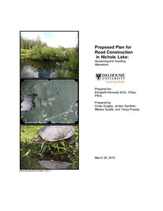
  • 1. (Nova Scotia Environment, 2011) Proposed Plan for Road Construction in Nichols Lake: Assessing and Avoiding Alterations Prepared for: Elizabeth Kennedy M.Sc, PGeo. PWS. Prepared by: Cindy Quigley, Jordan Gardiner, Mikasa Quaife, and Tanya Prystay March 26, 2015
  • 2. March 26, 2015 Page 2 of 19 TABLE OF CONTENTS Section Page Number 1.0 Project Description......................................................................................................... 4 2.0 Wetland Description....................................................................................................... 5 2.1 Methods................................................................................................................. 5 2.2 Classification.......................................................................................................... 5 Table 1 Wetland Areas and Classification................................................ 5 2.3.1 Character..................................................................................................... 6 2.3.2 Wetland Functions....................................................................................... 6 2.3.3 Wetland Sensitivities.................................................................................... 7 3.0 Interactions..................................................................................................................... 7 3.1 Hydrology............................................................................................................... 7 Table 2 Hydraulic Interactions................................................................... 7 3.2 Soil......................................................................................................................... 8 Table 3 Soil Interactions............................................................................ 8 3.3 Ecology.................................................................................................................. 8 Table 4 Ecological Interactions................................................................. 8 4.0 Recommended Mitigations............................................................................................. 9 Table 5 Avoidance Measures Taken Before Construction Begins........... 9 Table 6 Actions Taken to Minimize Effects of Construction...................... 9 Table 7 Compensation for Effects that can Neither be Avoided nor Minimized.................................................................................................. 10 5.0 Effects to Wetlands......................................................................................................... 11 5.1.1 Loss of Wetland and Wetland Fragmentation............................................... 11 5.1.2 Sedimentation............................................................................................... 11 5.1.3 Water Quality...................................................................................................... 11 5.1.4 Other Impacts..................................................................................................... 11 Table 8 Mitigations to Help Counteract Effects to Wetlands..................... 12 6.0 Recommendations for Follow-Up Monitoring................................................................. 13 6.1 Objectives.............................................................................................................. 13 6.2 Methods................................................................................................................. 13 6.3 Locations............................................................................................................... 13 6.4 Frequency and Duration........................................................................................ 13 7.0 Closing Statement.......................................................................................................... 13 8.0 References 14
  • 3. March 26, 2015 Page 3 of 19 LIST OF APPENDICES Appendix Page Number Appendix 1: Delineated Wetlands by Air Photo Interpretation............................................... 17 Appendix 2: Prospect River Watershed................................................................................. 18 Appendix 3: Wetland Construction Permits and Legislations................................................ 19 Appendix 4: Specifications for a standard cross section Minor F.......................................... 20
  • 4. March 26, 2015 Page 4 of 19 1.0 PROJECT DESCRIPTION Nichol’s Lake is a popular recreational area for local residents of the Halifax Regional Municipality (HRM) who use it for fishing, hiking, paddling, hunting, and swimming. The project will provide lake access via a paved, two-lane, minor F-collector highway extending from highway 333 to the northeast corner of Nichol’s Lake (Appendix 1). The lake is directly fed by Little Indian Lake via Stillwater Run and is part of the Prospect River Watershed, beginning at Otter Lake and emptying into Prospect Bay (Appendix 2). Upstream, Otter Lake and Big Indian Lake are part of the provincial fish-stocking program for sport fishing and are currently being stocked by the Nova Scotia Department of Fisheries and Aquaculture (EDM, 2010). Important fish species found in the watershed include Brook trout, Sea trout, Atlantic salmon, and Gaspereau. There are no rare or endangered species of concern; however, the area has an established population of snapping turtles. There are a number of wetlands along the east side of Nichol’s Lake that provide important ecosystem services. Road construction through these wetlands will cause direct loss that must be compensated for at a 2:1 ratio (Nova Scotia Environment, 2014). Minimization of wetland loss through careful planning and design will reduce the compensable wetland area. Project concerns include loss of ecosystem services from wetland loss and loss of fish and fish habitat from watercourse alterations. Permits will be required from the Department of Fisheries and Oceans (DFO), Nova Scotia Environment (NSE), and Halifax Regional Municipality. It is assumed that all legislative and permitting requirements will be complete prior to project commencement (Appendix 3). The timing window for project activities should fall between June 1 and September 30 to accommodate migrating fish species and comply with DFO to reduce harm to fish and fish habitat (DFO, 2014). Specifications for the collector include a total length of 1.80 Km and width of 30.4m, which includes an additional 10m of treed cutback on both sides of the paved edge (Appendix 3). The preferred route connected Nichol’s Lake to Highway 333 just north of the Sandstone Drive turnoff and would have avoided wetlands; however, this route is outside property boundaries and is unavailable for development. The alternate route was chosen to minimize highway length and wetland alteration; however, there will be approximately 0.70-0.80 hectares of wetland destruction that is unavoidable unless adjacent properties can be utilized (Appendix 1). Even though wetland alteration has been avoided and mitigated where possible, highway design requires infilling of the fen, which must be compensated for at a 2:1 ratio, requiring at least 2 hectares of new wetland to be created in the area (NSE, 2014). The indirect effects may require further compensation due to hydrological, chemical, and physical alterations to the wetlands that will occur over time after project completion. The total project footprint will be no more than one hectare, which includes highway construction, vegetative cutbacks, flow diversions, and stockpiling areas for sand and gravel. The new road will not impede the flow of Stillwater Run; however, there will be a temporary diversion of flow to accommodate in stream works during installation of the boxed culvert. Project activities will include clearing and grubbing the site, and infilling with clean fill material from approved quarries. Temporary diversion of Stillwater Run and possible drainage of the site will be required to facilitate boxed culvert installation, which will be done in consultation with DFO and NSE as per approval permits. Paving will include gravel and asphalt placement, installation of road signs and pavement markings, and filling and grading the site using clean materials that are not prone to acid rock drainage. Maintenance activities will include snow
  • 5. March 26, 2015 Page 5 of 19 clearing, salting and/or sanding, tree and vegetation management along shoulders and cut backs, pothole repairs, asphalt patching, culvert maintenance and repair, shoulder and washout repairs, and maintenance of signage. 2.0 WETLAND DESCRIPTION 2.1 Methods Air Photo Interpretation Likely wetlands were delineated by examining air photos of the project site with a stereoscope, looking for depressions, evidence of saturated soil, and surface water inputs to wetland. Delineated wetlands were classified according to visual cues identified on the air photos, which were then compared with the Nova Scotia Department of Natural Resources Wetland Inventory database (2004). Resulting wetlands were further confirmed using nearby watercourses identified on topographic maps of the area. Surface water inputs to each wetland were also identified. Field Delineation Wetland boundaries were delineated in situ by identifying the boundary of upland, facultative, and wetland plants. Soil samples were taken to identify histosol boundaries and pH was measured. Saturated soils were identified as sapric or fibric to identify the wetland type. Water levels were measured for two years prior to construction using piezometers. The piezometers were placed throughout each wetland to obtain baseline values of depth, duration, and timing of saturation, with which to compare post-construction water levels. The piezometers also allowed characterization of groundwater flow. 2.2 Classification Wetlands were classified into class and form based on Canadian Wetlands Classification System (Table 1). Table 1 Wetland Areas and Classification Wetland Class Form Reasoning 1 Swamp Riverine  Water table is below surface for at least part of the year.  More than 30% covered by wooded vegetation (Nova Scotia Environment, 2011).  Fed by groundwater, runoff, and surface water  Adjacent to a river. 2 Swamp Flat  Water table is below surface for at least part of the year.  More than 30% covered by wooded vegetation (Nova Scotia Environment, 2011).  Fed by groundwater, runoff, and surface water. 3 Fen Stream  Water table is below surface for at least part of the year.  Located on the edge of a stream (Warner & Rubec, 1997).  Graminoids and mosses dominate in wetter areas, while low shrubs are present in drier areas (Nova Scotia Environment, 2011, EDM 2009).
  • 6. March 26, 2015 Page 6 of 19 Table 1 Wetland Areas and Classification (Cont’d) 4 Fen Stream  Water table is below surface at least part of the year.  Located on the edge of a stream (Warner & Rubec, 1997).  Graminoids and mosses dominate (Nova Scotia Environment, 2011, EDM, 2009). 5 Fen Stream  Water table is below surface at least part of the year  Located on the edge of a stream (Warner & Rubec, 1997)  Graminoids and mosses dominate in wetter areas, low shrubs in drier areas (Nova Scotia Environment, 2011, EDM 2009). 6 Fen Stream  Water table is below surface at least part of the year  Located on the edge of a stream (Warner & Rubec, 1997)  Graminoids and mosses dominate in wetter areas, low shrubs in drier areas (Nova Scotia Environment, 2011, EDM 2009). 7 Fen Stream  Water table is below surface at least part of the year  Located on the edge of a stream (Warner & Rubec, 1997)  Graminoids and mosses dominate in wetter areas, low shrubs in drier areas (Nova Scotia Environment, 2011, EDM 2009). 8 Swamp Flat  Water table is below surface at least part of the year  More than 30% covered by wooded vegetation (Nova Scotia Environment, 2011).  Fed by groundwater and runoff. 2.3.1 Character Appendix 1 illustrates the delineated wetlands in the project region. Woody vegetation, particularly coniferous bushes and trees dominate swamps 1, 2, and 8. Fens 3, 4, 5, 6, and 7 are mostly dominated by graminoids; although fens 3, 5, 6, and 7 also have some low shrubs in drier areas. Swamps 1, 2, and 8 have variable pH (Nova Scotia Environment, 2011) but soils tend to be acidic due to the historic use of the land for agriculture, stripping the land of nutrients (EDM, 2009). These swamps are fed by runoff, groundwater, and precipitation. Swamps 1 and 2 are also fed by surface streams (Warner & Rubec, 1997). There is an accumulation of peat in the surface soils of these wetlands. Fens 3, 4, 5, 6, and 7 are characterized by mucky peat and are fed by groundwater and surface water (Nova Scotia Environment, 2011). 2.3.2 Wetland Functions Since both fens and swamps can be peatlands, they provide an opportunity for carbon sequestration. With a water table below ground level, swamps and fens provide protection from storm surges (Nova Scotia Environment, 2011). All wetlands identified in the area are tied to the groundwater system and therefore likely play a role in filtering and recharging groundwater. Fens and swamps around Nichol’s lake also provide habitat for local snapping turtles and other hydrophytic flora and fauna. Stream fens provide the additional service of slowing the input of groundwater into the river, preventing flooding following large precipitation events (Nova Scotia Environment, 2011).
  • 7. March 26, 2015 Page 7 of 19 2.3.3 Wetland Sensitivities Both fens and swamps could be sensitive to pollutants since they are fed by surface water. Additionally a change in the pH could severely impact the vegetation in these wetlands. Increased inputs due to the addition of an impermeable surface could permanently change the water table level. Since swamps and fens are also partially groundwater fed changes in groundwater flow could result in desiccation or flooding. Flooding would have a particularly strong effect on swamps, as the trees growing in the swamp cannot adapt to constant high water level conditions. 3.0 INTERACTIONS 3.1 Hydrology The fen is fed by precipitation, surface water from Stillwater Run, and groundwater. The groundwater source may be a deep aquifer and/or localized recharge from the stream. Infilling the fen will cause hydraulic isolation that will permanently alter the upstream and downstream hydraulic characteristics. Increased storm water runoff, decreased groundwater recharge, and flow constrictions are the three main hydraulic characteristics that would be most affected (Table 2). Table 2 Hydraulic Interactions Flow constrictions In stream changes in flow patterns caused by culvert installation may cause stormwater to back up and flood low- lying areas. Flooding Infilling will cause changes in the hydropattern that will reduce the wetland’s storage capacity, resulting in increased runoff and an increase in the magnitude and frequency of flood events. Loss of hydraulic connectivity Culvert installation may drain the upstream portion of the wetland or may routinely restrict flow due to sedimentation. Changes in stream stage and hydropattern Stream stage and hydropattern changes may cause scouring of the riverbanks and bottom, bringing sediment downstream, further altering stream hydraulic characteristics, both downstream and upstream. Increased runoff An increase in impervious surfaces from paving and vegetation removal reduces soil infiltration capacity causing increased runoff, flooding, erosion, and sedimentation downstream Reduced groundwater recharge Stormwater drainage control structures prevent groundwater recharge due to the lack of retention time in the wetland. This may affect wetland type and function. Hydraulic isolation The downstream portion of the fen will not receive surface water inflows from the stream and will only be fed by groundwater and precipitation. As the fen dries out, hydrophytic vegetation will be replaced by upland vegetative species that are more tolerant to drier conditions.
  • 8. March 26, 2015 Page 8 of 19 3.2 Soil Disturbances to soil affect the physical and chemical properties of the soil, which can further alter wetland function (Table 3). Important redox reactions occur in anoxic soils that reduce decomposition rates and recycle nutrients. Table 3 Soil Interactions Disturbed and exposed soil Project activities will disturb and expose soil, making it vulnerable to erosion and sedimentation. Erosion and scouring of stream banks Increases in runoff volume and velocity will remove protective riparian vegetation, further increasing stream bank scouring and erosion. Sedimentation Soil disturbances, scouring of stream banks, and the removal of bottom sediments will carry sediments downstream to be deposited. Eutrophication Nutrient laden sediment entering the lake can cause algae blooms, poor water quality, and anoxia resulting in fish kills in late summer. Water quality Sand and gravel used for road building can alter the pH and chemistry of runoff water entering the stream, affecting fish and fish habitat and changing wetland vegetative species composition. 3.3 Ecology Wetland plant communities will be affected by nutrient availability caused by changes in hydro- pattern and hydraulic isolation (Table 4). Changes from hydrophytic vegetation to more upland species may cause permanent changes in the insect, amphibian, and higher animal communities. Changes to wetland plant communities may change the wetland class, form, and type, depending on the hydraulic regime of groundwater sources. Table 4 Ecological Interactions Fish and fish habitat Road construction across Stillwater Run may cause alterations, to fish and fish habitat, which must be mitigated against and/or compensated for. Invasive species Increased accessibility may cause the introduction of invasive species, which outcompete native species and contribute to reductions in wetland function and species diversity. Removal of alluvial sediments and deposits Reduced nutrient availability for vegetative species may cause a reduction in wetland primary productivity, loss of potential carbon storage, and a reduction in wetland function. Water level fluctuations Drier conditions caused by stable water levels may reduce species richness and diversity by increasing unfavourable conditions for species that thrive in a wet environment. Herbicides and pesticides Runoff containing contaminants used for vegetation management may enter surface water and groundwater systems and have adverse effects on the wetland ecosystem. Salt Highway runoff containing salt may cause stress to plants that are not salt tolerant and suppress their growth rates.
  • 9. March 26, 2015 Page 9 of 19 4.0 RECOMMENDEDMITIGATIONS The proposed road will remove wetland area and have residual long term effects (Section 3). This will result in fragmentation and likely alter these local wetlands. Tables 5 and 6 list different mitigation tactics that will be taken before, during and after the construction process to help avoid, minimize, and compensate for any damage. Table 5 Avoidance measures taken before construction begins Mitigation Rationale Avoid fragmenting wetlands By constructing the road between wetlands 4 and 6, wetland fragmentation of can be avoided and damage to these wetlands can be minimized. This allows the local biota to move through the wetlands without finding alternative ways around obstructions. By avoiding wetland fragmentation, the hydrology within these areas can also remain unaffected. The road will also be built through part of wetland 7. This interrupts one end of the wetland and thus minimizes the amount fragmented (Government of British Columbia, 2009a). Table 6 Actions taken to minimize effects of construction Mitigation Rationale Shoulder slope and material Maintaining the shoulder slope of the road to a 10% grade will minimize the erosion of the nearby soil. The shoulder will be made with a permeable substance to reduce runoff from the road during storm events (Environment Canada, 2000: Grand Lake Meadows case study). Buffer Zones Buffer zones will be added between the road and adjacent wetlands. This buffer zone is suggested to be approximately 10 m in size to help minimize the effect on water quality, sediment control, and nutrient load from activities on the road. The buffer zone should consist of native plants and follow the natural curve of the wetlands. During construction, a raised berm of heavy clay will be built to prevent runoff of construction activities from entering the wetlands (North American Waterfront Management Plan, n.d.). Open boxed culvert An open box culvert will be designed and installed according to Best Management Practices for wetland crossings. This type of culvert avoids impeding water and facilitates animal crossing in wetland regions. Water will be diverted around the construction site during installation (Environment Canada, 2000: Grand Lake Meadows case study). Night lighting It is recommended there be minimal change to the amount of night light in these areas. This will help to minimize the effect on daily cycles of biota in the wetlands (Environment Canada, 2000: Road through a wetland case study). Emergency action plan An emergency action plan should be implemented during construction to ensure a quick and efficient clean-up for any potential accidents. This will help to minimize effects on surrounding wetlands (Environment Canada, 2000: Grand Lake Meadows case study).
  • 10. March 26, 2015 Page 10 of 19 Table 6 Actions taken to minimize effects of construction (Cont’d) No Service Stations No service stations (i.e. Gas stations, restaurants, shops, etc.) will be placed around wetlands on the road to help avoid detrimental spills and accidents from further affecting surrounding wetlands (Government of British Columbia, 2009, Environment Canada, 2000: Road through a wetland case study). Waste disposal Chemical waste will be collected in bins and disposed of according to Best Management Practices (TransCanada, 2012). Other waste will be collected and disposed of offsite according to Best Management Practices. Construction will include drains to redirect runoff into trees forest region where it can be filtered before reaching the wetland. Minimize amount of land cleared at one time Land cleared at one time should be kept to a minimum while construction occurs. This will permit better management of the area and rapid changes if necessary (Environment Canada, 2000: Drain Lake Wetland case study). Invasive species management A washing station will be implemented. All construction vehicles and materials must be washed prior to entering the project site to avoid spreading invasive species. Vehicle regulation Movement of construction vehicles will be restricted to project boundaries (TransCanada, 2012). Locked barriers at road entrances will be implemented to prevent recreationalists from entering the wetland. Monitoring during construction Monitoring during construction will detect early negative environmental effects. This will permit proposed modifications to the construction plan to be implemented during the construction period and maintain ecological integrity. Monitoring will include water quality parameters, and biota diversity (Environment Canada, 2000). Table 7 Compensation for effects that can neither be avoided nor minimized Mitigation Rationale 2:1 compensation ratio Affected wetlands will be compensated in a 2:1 ratio. This will mainly affect part of a fen (wetland 7), and alter approximately 0.8 ha. This 0.8 ha land damaged will be compensated for by extending the bottom of wetland 6 by approximately 2 ha. The functions of wetland 7 should be maintained in this new created wetland. Both, wetlands 6 and 7 are fens located downstream so the ecology and functions should be similar (Environment Canada, 2000). Public education The surrounding wetlands will be affected by an increase in human traffic and activities facilitated by the new road. To compensate and minimize these effects, the wetlands close to human activities could be created into public education sites with raised boardwalks that keep pedestrians off of vegetation and vulnerable land. Educational signs can also help increase care and empathy towards the land (Environment Canada, 2000: Vancouver International Airport Runway Expansion case study).
  • 11. March 26, 2015 Page 11 of 19 5.0 EFFECTS TO WETLANDS 5.1 Post mitigation and unavoidable effects The protection and management of wetlands aims to optimise preservation and maintenance of water quantities, qualities, habitats, and species (Government of British Columbia, 2009). Direct impacts are the long term effects on wetlands that occur when dredging, filling, draining, or other alterations take place inside the wetland and often yield loss of wetland territory (Wright, et. al. 2006). Indirect impacts are caused by an increase in storm water and pollution due to increased activity in the wetland drainage region. Such impacts alter the hydrology and impose stress on the vegetation and animals living in the wetlands. The four main categories of impacts the road construction may have on wetlands are loss and of wetland and wetland fragmentation, sedimentation, water quality, and other impacts. 5.1.1 Loss of wetland and wetland fragmentation Filling and fragmenting the wetland can alter the hydrology, such as the lateral flow in fens (Government of British Columbia, 2009b). This could result in the entire wetland flooding, changes in wetland class, desiccation, or partial desiccation while other sections flood. Loss of wetland could create barriers to wildlife movement and alter breeding and feeding behaviours. Flooded regions tend to cause tree mortality, and tree species replacement with better adapted species to the wet environment (Gillies, C. 2011). The dead trees would also increase the volume of hummock micro-habitats in the wetland. These alterations could substantially alter the treed swamps and fens in the construction region. 5.1.2 Sedimentation Site preparation for construction and the road construction processes increase the wetland’s vulnerability to erosion as the procedures disturb the land and expose the soil (Government of British Columbia, 2009b). Sediment erosion can reduce biological activity in the wetland, impose stress on the wildlife by altering breeding and feeding behaviours of animals the wildlife inhabiting the region, and may affect downstream habitats as well by either continuing erosion or dumping sediment, creating a buildup. 5.1.3 Water quality Contaminants, such pesticides and fertilizers, used on surrounding vegetation, de-icers, metal, petroleum products, and nutrients build up on roads and runoff during a precipitation event (Government of British Columbia, 2009b). These contaminants in the runoff into the wetlands promote wetland eutrophication. 5.1.4 Other impacts The road increases the distribution of invasive species into the ecosystem (Government of British Columbia, 2009b). Vehicles and construction equipment pick up non-native species and deposits them along the road where they ultimately flow into the wetland. The road also
  • 12. March 26, 2015 Page 12 of 19 provides more opportunity for recreationalists to boat, use their all-terrain vehicle (ATV), etc. in the region and alter the ecosystem. Mitigations to counteract these effects are listed in table 8. Table 8 Mitigations to help counteract effects to wetlands Impacts Type of Effect Mitigation Weed management Indirect A weed management plan will be implemented to prevent the spread of invasive species, or species thriving due to increase in fertilization introduced by the construction process. Weed management will occur as part of the monitoring program (TransCanada, 2012). Sedimentation and erosion management Direct Seed native species along the road to reduce water velocity and decrease erosion. This would also prevent native plants from being outcompeted (TransCanada, 2012). Maintenance of buffer zone Direct Seeding native plant species and weeding will be focused around the road perimeter to prevent contaminants from flowing into the wetland. Effective buffer zones can reduce sediment runoff by up to 90% and filter pesticides and fertilizers that cause eutrophication (North American Waterfront Management Plan, n.d.). Maintenance of ditches Direct Maintain ditches to ensure they remain unplugged and continue to direct the runoff to a culvert crossing (Government of British Columbia, 2009b). Waste Disposal Indirect To avoid recreationalists deposing garbage into the wetland, wildlife-safe garbage, compost, and recycling bins will be included in the entrance, at boat ramp sites, and ATV trails. Waste pick-up will be included in the local waste pick-up schedule (TransCanada, 2012). Signage for animal crossings Indirect Caution signs for turtle crossings will be placed along the road to warn drivers about potential turtle crossings (Biolinx Environmental Research LTD, 2004). Signage for preventing spread of invasive species Indirect Signs advising recreationalists to wash their equipment between sites will be placed at the entrance of the road, at the entrance of ATV tails, and at the boat ramps in Nichols Lake, in order to prevent invasive species distribution.
  • 13. March 26, 2015 Page 13 of 19 6.0 RECOMMENDATIONS FOR FOLLOW-UP MONITORING 6.1 Objectives Post-construction monitoring should be completed to meet the following objectives:  To confirm that the effects of the construction and maintenance on the project area were accurately predicted.  To optimize mitigation success and to minimize natural wetland loss of function.  To diagnose any unpredicted changes as early as possible and to minimize the potential negative effects of these changes.  To publish the results from the monitoring program in order to increase public understanding of the impacts of road construction on wetlands and to reduce the impact of future projects on wetlands. 6.2 Methods The following processes should be followed to ensure the monitoring objectives are met:  Water levels in wetlands 4, 5, 6, and 7 should be monitored with piezometers placed throughout each wetland.  Wetland area should be monitored to identify whether wetlands are shrinking or growing.  Changes in vegetation, including percent cover and type, should be recorded.  Changes in pH should be monitored.  Culvert depth should be measured. 6.3 Locations Wetlands 4, 5, 6, and 7, should be monitored both during and after construction as these are the wetlands most likely to be affected by the project. Wetlands 2 and 3 should also be monitored as indicators for natural variations between years. 6.4 Frequencyand duration All monitoring should occur weekly during the construction period and for the first month after construction is completed. Monitoring should then become monthly for one year after construction is completed, and yearly in subsequent years. 7.0 CLOSING STATEMENT The proposed plan for the construction of a road joining Highway 333 to Nichol’s lake addresses the requirements according to the understanding and conditions of the project. If unforeseen adverse impacts are detected, construction will cease and appropriate authorities will be notified immediately (Nova Scotia Department of Energy and Marine Renewables, n.d.). Construction will only resume once mitigations agreeable to all parties have been established, and the monitoring framework will be modified accordingly. Similar protocols will be followed if unforeseen impacts are detected during post-monitoring.
  • 14. March 26, 2015 Page 14 of 19 8.0 REFERENCES Biolinx Environmental Research LTD. 2004. Best management practices for amphibians and reptiles in urban and rural environments in British Columbia. BC Ministry of Water, Land and Air Protection. Retrieved 03 20, 2015, http://www.env.gov.bc.ca/wld/BMP/ herptile/HerptileBMP_final.pdf DFO. 2014. Timing windows to conduct projects in or around water. Retrieved 03 07, 2015, from http://www.dfo-mpo.gc.ca/pnw-ppe/timing-periodes/index-eng.html EDM. 2010. Western Common Wilderness Common Master Plan Final Report. Retrieved 03 13, 2015 from https://www.halifax.ca/proprty/WCWA/document/FinalReport- WesternCommonMasterPlans.pdf EDM. 2009. Western Common Wilderness Common Master Plan. Retrieved 03 13, 2015 from https://www.halifax.ca/property/WCWA/documents/SAR_Chapter3.pdf Environment Canada. 2000. Wetland mitigation in Canada: A framework for application. Sustaining wetlands issues paper. Secretariat: Ottawa, On. Retrieved 03 23, 2015, from http://nawcc.wetlandnetwork.ca/Wetland%20Mitigation%202000-1.pdf Gillies, C. 2011. Contract report CR-652: Water management techniques for resource roads in wetlands. Retrieved 03 13, 2015 from https://fpinnovations.ca/ResearchProgram/ Pages/research-program-forest-operations-resourceroads-wetlands.aspx Government of British Columbia. 2009a. Chapter 2: General Guidelines. Wetland ways: Interim guidelines for wetland protection and conservation in British Columbia. Retrieved 03 23, 2015, from http://www.env.gov.bc.ca/wld/documents/bmp/wetlandways2009/Wetland% 20Ways%20Ch%202%20General.pdf Government of British Columbia. 2009b. Chapter nine: Road and utility corridors. In Wetland Stewardship Partnership, Wetland ways (pp. 9-1 – 9-11). Retrieved 03 04, 2015, from http://www.env.gov.bc.ca/wld/documents/bmp/wetlandways2009/ Wetland%20Ways%20Ch%209%20Corridors.pdf Government of Canada. 2014. Acts. Retrieved 03 13, 2015, from http://www.ec.gc.ca/ default.asp?lang=En&n=E826924C-1. Government of Canda. 2015. Canada wildlife act. Retrieved 03 04, 2015, from http://www.ec.gc.ca/alef-ewe/default.asp?lang=En&n=E8EA5606-1 Government of Nova Scotia. 2010. Forest Act. Retrieved 03 20, 2015, from http://nslegislature.ca/legc/statutes/forests.htm Government of Nova Scotia. 2014a. Woodlands and wetlands: what you should know before you harvest. Retrieved 03 20, 2015, from http://www.novascotia.ca/ nse/wetland/docs/Woodlands_and_Wetlands.pdf. Government of Nova Scotia. 2014b. Municipal Government Act – Resource Binder. Retrieved 03 21, 2015, from http://novascotia.ca/dma/publications/mga.asp.
  • 15. March 26, 2015 Page 15 of 19 Lahey, W.,and Doelle, M. 2012. Environmental goals and sustainable prosperity act: Negotiating the interface of environmental and economic governance: Nova Scotia’s environmental goals and sustainable prosperity act. Dalhousie L. J. 35 (1): [Excerpt]. Retrieved 03 21, 2015, from http://papers.ssrn.com/sol3/papers.cfm?abstract _id=2164282 North American Waterfront Management Plan. (n.d). PEI wetland notes: Eastern habitat joint venture. Retrieved 03 23, 2015, from http://www.gov.pe.ca/photos/original/eef_ wildlife_p8.pdf Nova Scotia department of energy and marine renewables. (n.d.). Statement of best practices for in-stream tidal energy development and operation. Retrieved 03 21, 2015, from http://energy.novascotia.ca/sites/default/files/files/Statement %20of%20Best%20Practices%20Booklet.pdf Nova Scotia Department of Natural Resources. 2004. Natural resources: Significant habitats of Nova Scotia. Retrieved 03 15, 2015 from http://gis4.natr.gov.ns.ca/website/nssighabnew/viewer.htm Nova Scotia Environment. 2011. Retrieved 03 20, 2015, from http://www.novascotia.ca/nse/ wetland/docs/Nova.Scotia.Wetland.Conservation.Policy.pdf Nova Scotia Environment. 2014. Compensation for Wetland Alterations. Retrieved 03 20, 2015, from http://www.novascotia.ca/nse/wetland/compensation.asp NSTIR. 2009. Nova Scotia Transportation and Infrastructure Renewal. Retrieved 03 13, 2015 from http://novascotia.ca/tran/highways/standarplanspdfs/Highway%20Design /Design%20Guidelines/S-2009008_Standard%20Cross%20Section%20Minor%20 Collector.pdf SWCS. 2013. Prospect River Watershed. Retrieved 03 13, 2015, from www.chebucto.ns.ca/ccn/info/Science/SWCS//TPMODELS/PIC/prospecr.jpg TransCanada. 2012. Keystone XL project construction, mitigation, and reclamation plan. Retrieved 03 23, 2015, from http://keystonepipelinexl.state.gov/documents/ organization/205587.pdf Warner, B. G., & Rubec, C. D. A. (Eds.). 1997. The Canadian wetland classification system. Waterloo: Wetlands Research Centre Wright T., Tomlinson J., Schueler, T., Cappiella, K., Kitchell, A., and Hirschman, D. (2006). Direct and indirect impacts of urbanization on wetland quality. Retrieved 03 19, 2015, from http://www.northinlet.sc.edu/training/media/resources/article1impact%20 urbanization%20wetland%20quality.pdf
  • 16. March 26, 2015 Page 16 of 19 Appendix 1: Delineated Wetlands by Air Photo Interpretation
  • 17. March 26, 2015 Page 17 of 19 Appendix 2: Prospect River Watershed (SWCS, 2013). Source: www.chebucto.ns.ca/ccn/info/Science/SWCS//TPMODELS/PIC/prospecr.jpg
  • 18. March 26, 2015 Page 18 of 19 Appendix 3: Wetland Construction Permits and Legislations Wetland alterations are only permitted provided all the required legal permit applications have been approved by the appropriate government divisions. Only roads built through wooded swamps and less than 10 meters wide and 600m square in total area do not require an approval; all other permanent road construction through a wetland require an approval (Government of Nova Scotia, 2014a). Projects altering 2 or more hectares of wetland require an approval. The following table lists the legislations and permits applicable to this project. Legislation Jurisdiction Authority Description Approval Required (Yes/No) Wildlife Act Federal Government Environment Canada has developed the Act to preserve habitats and to protect all native and some non-native wildlife species from harmful human activity (Government of Canada 2015). Projects can only proceed once wildlife have left the site or by implementing effective mitigations. Y Environment Act Provincial Government The Department of the Environment Act developed the Act to preserve and enhance the natural environment from harmful anthropogenic activity (Government of Canada, 2014). The Act includes regulations such as the On-site Sewage Disposal Systems Regulations and Watercourse Alteration Regulation. Y Environmental Goals and Sustainable Prosperity Act (EGSPA) Provincial Government The Act was developed in order to achieve two goals by the year 2020: 1) serve as an international role model by having one of the top cleanest and sustainable environments in the world 2) obtaining an economic performance equal to or greater than the average Canadian economic performance (Lahey and Doelle, 2012). N Water Resource Protection Act Provincial Government The Act prohibits the bulk removal of water from a watercourse in Nova Scotia (Water for Life: Nova Scotia’s water resource management strategy, 2010) N Forest Act Provincial Government The Act is set to protect and promote healthy, more productive forests (Government of Nova Scotia, 2010). This includes regulations such as Wildlife Habitat and Watercourses Protection Regulations. N Municipal Government Act Municipal Government The Act gives authority to the Municipal Government to develop and implement by-laws, such as the Waste Water Discharge Bylaw (Government of Nova Scotia, 2014b). Y The listed requirements only include wetland legislations. Other legislations and bylaws apply to the broader project. Examples include the Fisheries Act and the Migratory Bird Convention Act under the Federal Government. Professionals in these domains should be consulted prior to development construction. Further Municipal Bylaws regarding the project construction, such as the Noise Bylaw, should also be considered prior to construction.
  • 19. March 26, 2015 Page 19 of 19 Appendix 4: Specifications for a standard cross section Minor F Collector (NSTIR, 2009).