HỌC TỐT TIẾNG ANH 11 THEO CHƯƠNG TRÌNH GLOBAL SUCCESS ĐÁP ÁN CHI TIẾT - CẢ NĂ...
Eops 2014 09_16
1. September 16, 2014
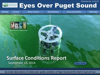
Surface Conditions Report
Eyes Over Puget Sound
Fieldlog Climate Water column Aerial photos Ferry andSatellite Moorings
Publication No. 14-03-077
Start here
Up-to-date observations of visiblewater quality conditions in Puget Sound and the Strait of Juan de Fuca
MarineWater Condition Index
2. Personalfieldlog p.4
What is a phytoplanktonbloom,really?
Climateconditions p.6
Sunshine and warmtemperatures continue. The Fraser River
flow is below normal,PDO andupwelling are above normal.
Watercolumn p.7
As summer ends, temperatures are high in SouthSound. Low
dissolvedoxygenlevels are widespreadinPuget Sound, yet
remainhigh in HoodCanal.
Moorings p.38
At Mukilteo,continuous water temperature fluctuatedand
salinity declined. Upper mooringmeasuredstrongtidal effects.
Aerialphotography p.11
Numerous andlarge patches of jellyfishseeninfinger inlets of
SouthSoundand East Sound(Orcas Island). Red-brownblooms
remainstronginsmaller bays inside Puget Sound. Suspended
sediment fromNooksack andSkagit rivers are very visible.
Ferryand satellite p.40
Bloomincentral Puget Sound begins to fade as temperatures
cool. MODIS reveals extensivebloomat entrance to Strait of
Juande Fuca. Thermal imagery fromLandsat 8 shows relatively
warmwater inStrait of Georgia,Whidbey Basin,and finger inlets
of SouthPuget Sound.
LONG-TERMMARINEMONITORINGUNIT
Mya Keyzers
Laura Hermanson
Joe Leatherman
Skip Albertson
Dr. Christopher
Krembs
Guest:
Dr. Brandon
Sackmann,
Integral
Julia Bos
Suzan Pool
www.ecy.wa.gov/programs/eap/mar_wat/eops/Previous Eyes Over Puget Sound reports:
Marine conditionsfrom 9-16-2014 at a glance
Fieldlog Climate Water column Aerial photos Ferry andSatellite Moorings
3. http://www.eopugetsound.org/Read about 2013 conditions in Puget Sound in the latest report from PSEMP
ThePuget Sound Marine Waters: 2013 Overview
• Informson the marine water conditions and
associated biota in Puget Sound. Itcompiles the
physical, chemical, and biological information
obtained fromdiverse marine monitoring and
observing programs.
• Represents a collaboration among agencies and
scientists forming a collective view of marine
water conditions to enhance the ecological
understanding of Puget Sound.
• Includes manyobservations from bacteria to
birds presented in context ofclimaticand
physical conditions affectingour water ways.
http://www.psp.wa.gov/downloads/psemp/PSm
arinewaters_2013_overview.pdf
FrontCoverPhoto Credit:JimDevereaux
Fieldlog Climate Water column Aerial photos Ferry andSatellite Moorings
4. All About Phytoplankton: Part 1
Haveyou ever looked at water fromPuget Sound under a
microscope? You may be surprised at whatyou see! Microscopic
single-celled algae called phytoplankton area crucial part of the
marineecosystem and are the foundation of the Puget Sound food
web. Two main types of phytoplankton arediatoms and
dinoflagellates.
Dinoflagellates are alsodiverse andcan
be brown,red, orange,or green.
Diatoms come inmany shapes andsizes,
andare usually green or brownin color. Diatomshavea rigid cell wall made of silica, can formchains, and
contain chloroplasts which make them purely photosynthetic. They
maketheir own food using sunlight.
Dinoflagellates have1-2 flagella that help them migrate vertically in
the water column and can formchains. Dinoflagellates havethe
ability to be photosynthetic, heterotrophic (consume other cells), or
even mixotrophic (able to photosynthesizeand consume other cells).
When it comes to the lower food web, dinoflagellates rule because
they are able to break all the rules!
Personal flight impression 9-16-2014
Fieldlog Climate Water column Aerial photos Ferry andSatellite Moorings
5. Personal flight impression 9-16-2014
Fieldlog Climate Water column Aerial photos Ferry andSatellite Moorings
What is a Bloom?
Blooms occur when planktonic cells divide at such high rates that their large biomass is
visible to the eye. This typically happens in the spring and fall when nutrient and
sunlight conditions are optimal.
While not alwaysvisible fromthe water, we can easily see the color and expanse of
bloomsfrom the air. The color is caused by chlorophylland other light-harvesting
pigments.
Themajority of blooms are not harmfuland are in fact naturally occurring. However,
excess nutrients (mainly nitrogen) can fuel blooms and have negative effects on water
quality. Over time, the location of blooms could indicate persistent nutrient sources.
Red bloom (dinoflagellatesand diatoms).
Green algal mats.
OrangeNoctiluca (dinoflagellate) bloom. Green diatom bloom.
Stay tuned for “All About Phytoplankton: Part2” next month!
6. Fieldlog Climate Water column Aerial photos Ferry andSatellite Moorings
Climateand natural influencesbefore 9-16-2014
Summary:
Air temperatures have generally
been above normal continuing the
trend of the past six months.
Precipitation has not occurred for
several days. The summer has been
dry, yet a few large rain events have
made it average normal.
Sunshine levels have been above
normal.
River flows are below normal for the
Fraser River, but near expected
elsewhere.
PDO remains in the warm phase and
upwelling is above normal for the first
time this summer, yet ocean intrusions
(using a new Intrusion index) of low
DO water have been sparse.
lowerhigher expected No data
New section! Climate and natural influences are conditions that influence our marine waters,
including weather, rivers, and the adjacent ocean (previously called Weather). For an explanation of
the figure, see: http://www.ecy.wa.gov/programs/eap/mar_wat/weather.html, page 26.
7. We use a chartered float
plane to access our
monthly monitoring
stations most cost
effectively.
We communicate data and
environmentalmarine
conditions using:
1. MarineWater
ConditionIndex
(MWCI)
2. EyesOverPuget
Sound (EOPS)
3. Anomaliesand
sourcedata
Fieldlog Weather Water column Aerial photos Ferry andSatellite Moorings
Ourlong-termmarinemonitoringstationsinWashington
Starthere
Isl.
.
8. Salinity Variable Oxygen Stays LowerAugust2014: Temperature variable
Region
6 7 8 9 10 11 12 1 2 3 4 5 6 7 8 9 10 11 12 1 2 3 4 5 6 7 8
Grays Harbor
Willapa Bay
North Sound
San Juan
Whidbey Basin
Hood Canal
Central Sound
South Sound
20142012 2013
6 7 8 9 10 11 12 1 2 3 4 5 6 7 8 9 10 11 12 1 2 3 4 5 6 7 8
20142012 2013
6 7 8 9 10 11 12 1 2 3 4 5 6 7 8 9 10 11 12 1 2 3 4 5 6 7 8
20132012 2014
Physical conditionstracked in statistically historic context
In 2013, PugetSound waswarmer. Early 2014 started colder, and saltier with lower oxygen, then became fresher
dueto rain. At the end of summer, temperatures are high in South Sound and salinities and dissolved oxygen are
low in Central Sound. Hood Canal remains unusually cold and high in DO.
Fieldlog Weather Water column Aerial photos Ferry andSatellite Moorings
9. -25
-20
-15
-10
-5
0
5
10
15
20
25
-1.5
-1
-0.5
0
0.5
1
1.5
1945 1950 1955 1960 1965 1970 1975 1980 1985 1990 1995 2000 2005 2010 2015
a) PacificDecadalOscillationIndex(PDO,temperature) (explanation)
b) UpwellingIndex(anomalies)(Upwelling,lowoxygen) (explanation)
c) NorthPacificGyreOscillationIndex(NPGO,productivity) (explanation)
NPGO(x10)
PDO/UpwellingIndex
Three-year running average of PDO, Upwelling, and NPGO indices scores
Ocean boundaryconditions have been favorable for water qualityin Puget Sound: (a)colder water (PDO),
(b)less upwelled lowoxygen and high nutrient ocean water reachingPuget Sound (UpwellingIndex),and
(c) higher surface productivityalongthe coast (NPGO). Where are we headingnext?
Fieldlog Weather Water column Aerial photos Ferry andSatellite Moorings
.
Theoceanaffectswaterquality: OceanClimateIndices
10. Explore the data
Is the food web changing in Puget Sound?
The story in5 min
Follow the experts
Hypothesis!
Should wepay
greater attention to
nutrientratios,
energy transfer,
and material cycling
in Puget Sound?
Noctiluca blooms are
a visible harbinger of
a changing microbial
food web in Puget
Sound waters.
11. Summary: Aerial photography9-16-2014
Numerousand largepatches of jellyfish seen in finger inlets of South Sound and East Sound
(OrcasIsland). Red-brown bloomsremain strong in smaller baysinside Puget Sound.
Suspended sediment fromNooksack and SkagitRivers are very visible.
Fieldlog Weather Water column Aerial photos Ferry andSatellite Moorings
Start here
Mixing andFronts:
Developed frontsand mixing visible by colored surface water.
Debris:
Localized organic debris north and south of Lummi Island and
along tidal fronts.
Visible blooms:
Green-brown: Fidalgo Bay, SkagitBay, Saratoga Passage,
and PortSusan.
Red-brown: Budd, Eld, Henderson, Carr, and Sinclair
Inletsand Eagle Harbor.
Jellyfish:
Jellyfish patches large and numerous in southern inlets of
South Sound and East Sound (OrcasIsland).
BloomDebrisFront
Suspendedsediment:
Sediments in glacier-fed Skagit and Nooksack riversinfluence a
widearea.
Plume
Green: What is golf course,what is water?
Nothingat the surface inPort Gamble
Boat
Internal waves
Bloom
5 7
1 2 8 18
7 9 13 14
1 2 3 4 6 10 11 13 15 16 17
20
19
18
1 10 11 13 17 1918
12. Straitof
Juan de Fuca
San Juan Islands
Padilla Bay
Main Basin
Hood Canal
South Sound
Fieldlog Climate Water column Aerial photos Ferry andSatellite Moorings
Observation Maps:
Afternoonflight,photos 9-20:
Overcast,hazy,calm
Flight Information:
Morningflight,photos 1-8
Overcast low visibility,calm
8
19
11
10
13 14
15
Aerial photography
and navigation guide
20
6
Centraland NorthSound
SouthSound
SeattleTides:H.tide:12:53PM11:25PM,,L.tide:5:08AM,6:36PM
7
12
Whidbey Basin
5
Flight route and fuelingstop
17
16
9
18
3
2
1
4
13. A. B.
Debris
Red-brown bloom and many patches of jellyfish.
Location: A.Cooper Point. B.Gull Harbor, Budd Inlet (South Sound),9:29 AM.
1 Aerial photography 9-16-2014 Navigate
Fieldlog Climate Water column Aerial photos Ferry andSatellite Moorings
Boat
jellyfish
jellyfish
jellyfish
jellyfish
jellyfish
jellyfish
jellyfish
jellyfish
Bloom
Debris
14. A. B.
2 NavigateAerial photography 9-16-2014
Fieldlog Climate Water column Aerial photos Ferry andSatellite Moorings
Red-brown bloom and many jellyfishpatches.
Location: A.Off Frye Cove. B. Near YoungCove Eld Inlet (South Sound),9:35 AM.
jellyfish
Bloom
jellyfish
jellyfish
jellyfish
jellyfish
jellyfish
Bloom
jellyfish
Debris
16. A. B.
4 Navigate
Fieldlog Climate Water column Aerial photos Ferry andSatellite Moorings
Aerial photography 9-16-2014
Red-brown bloom inside the inlet.
Location: ScowBay, Marrowstone Island (CentralSound),10:14AM.
Bloom
boat
Bloom
17. 5 NavigateAerial photography 9-16-2014
Fieldlog Climate Water column Aerial photos Ferry andSatellite Moorings
Two distinguishable water masses outline surface water movements.
Location: Fort Ebey, AdmiraltyReach (Central Sound),10:21AM.
Ship
Front
Boat
18. Red-brown bloom traces patterns of water circulation in bay.
Location: Mud Bay,Lopez Sound (San Juan Islands),10:30 AM.
6 NavigateAerial photography 9-16-2014
Fieldlog Climate Water column Aerial photos Ferry andSatellite Moorings
Boat
Bloom
Bloom
Boat
19. Suspended sediment highlights mixing patterns of water entering from East Sound.
Location: Deer Point,Obstruction Pass (San Juan Islands),10:25 AM.
7 NavigateAerial photography 9-16-2014
Fieldlog Climate Water column Aerial photos Ferry andSatellite Moorings
mixing
Plume
mixing
20. Numerous patches of jellyfish.
Location: Cascade Bay,East Sound (San Juan Islands),11:14 AM.
8 NavigateAerial photography 9-16-2014
Fieldlog Climate Water column Aerial photos Ferry andSatellite Moorings
Boat
jellyfish
jellyfishjellyfish
jellyfish
21. Two distinguishable water masses with sediment-richwater from the Nooksack River .
Location:Off Point Migley,Lummi Bay (North Sound),12:05 PM.
9 NavigateAerial photography 9-16-2014
Fieldlog Climate Water column Aerial photos Ferry andSatellite Moorings
Boat
Boat
Plume
Boat
Boat
22. 10 NavigateAerial photography 9-16-2014
Small red-brown phytoplankton bloom following local pattern of advection.
Location: Fishermans Cove,Whatcom ChiefFerry(North Sound),12:07 PM.
Fieldlog Climate Water column Aerial photos Ferry andSatellite Moorings
Bloom
boat
Debris
boat
boat
23. 11 NavigateAerial photography 9-16-2014
Large patches of organic surface debris and phytoplankton-rich water leaving bay.
Location: OffSamish Island,Samish Bay(North Sound),12:50 PM.
Fieldlog Climate Water column Aerial photos Ferry andSatellite Moorings
Boat
Bloom
ship
ship
24. Glacial-fedwater from the Skagit River drives estuarine circulation in Whidbey Basin in the summer.
Location: Swinomish Channel,Skagit Bay(WhidbeyBasin),1:22PM.
12 Navigate
Fieldlog Climate Water column Aerial photos Ferry andSatellite Moorings
Aerial photography 9-16-2014
boat
SwinomishChannel
Skagit River
jetty
25. Skagit River plume flowing northwest next to near-shore phytoplankton bloom.
Location: Goat Island,Skagit River estuary(WhidbeyBasin),1:22 PM.
13 NavigateAerial photography 9-16-2014
Bloom
Fieldlog Climate Water column Aerial photos Ferry andSatellite Moorings
Plume
Debris
26. Sediment-richwater entering from Davis Slough by flowing over flooded mudflats.
Location: Livingston Bay,Port Susan (WhidbeyBasin),1:51 PM.
14 Navigate
Fieldlog Climate Water column Aerial photos Ferry andSatellite Moorings
Aerial photography 9-16-2014
submergedgully
Plume
27. 15 Navigate
Fieldlog Climate Water column Aerial photos Ferry andSatellite Moorings
A mix of sediment-and phytoplankton-rich water drifting southward over shallow water.
Location: Off Triangle Cove,Port Susan (WhidbeyBasin),1:53 PM.
Aerial photography 9-16-2014
Bloom
Davis Slough
StillaguamishRiver
29. Fishpen
A. B.
17 Navigate
Fieldlog Climate Water column Aerial photos Ferry andSatellite Moorings
Red-brown and golden-brown blooms along with small amounts of organic surface debris.
Location: A.Allen Point,B. Henderson Bay,Carr Inlet (South Sound),4:10 PM.
Aerial photography 9-16-2014
Bloom
Bloom
BloomDebris
30. Debris
18 Navigate
Fieldlog Climate Water column Aerial photos Ferry andSatellite Moorings
Red-brown bloom and patches of jellyfish.
Location: Over Woodland BayConservationArea,Henderson Inlet (South Sound),4:20PM.
Aerial photography 9-16-2014
boat
pilings Bloom
jellyfish
jellyfish
31. 19 Navigate
Fieldlog Climate Water column Aerial photos Ferry andSatellite Moorings
Red-brown bloom and patches of organic debris outlining pattern of circulation in inner bay.
Location: Southern Henderson Inlet (South Sound),4:20PM.
Aerial photography 9-16-2014
Boat
Debris
Bloom
Boat
32. 20 Navigate
Red-brown bloom outlining pattern of circulation in inner bay.
Location:Southern Henderson Inlet (South Sound),4:21PM.
Aerial photography 9-16-2014
Bloom
Fieldlog Climate Water column Aerial photos Ferry andSatellite Moorings
33. NorthSound/SanJuan Islands
Numbers on map refer to picture numbers for spatial reference
Date: 9-16-2014
CentralSound
Aerial photography observations in Central SoundObservations in Central and North Sound Navigate
Fieldlog Climate Water column Aerial photos Ferry andSatellite Moorings
5
6
10
9
13 14
11
12
15
16
4
3
7
8
34. Date: 9-16-2014
Observations in Hood Canal and South Sound
Numbers on map refer to picture numbers for spatial reference
Navigate
Fieldlog Climate Water column Aerial photos Ferry andSatellite Moorings
SouthSound
17
18
19
201
2
35. Legendto map annotations
Comments:
Maps are producedby observers during and
after flights. They are intendedto give an
approximate reconstructionofthe surface
conditions onscales that connect to and
overlapwithsatellite images inthe sectionthat
follows.
Debris:
Debris canbe distinguished into natural and
anthropogenic debris floatingat the surface
sensu Moore andAllen(2000). The majority of
organic debris inPuget Sound is natural and
mixedwithdiscardedman-made pieces of
plastic,wood,etc. Fromthe plane,we cannot
differentiatethe quality of debris at the surface
andtherefore,call it for reasons of practicality
just “debris”.
S.L. Moore,M. J. Allen. 2000. Distribution of
Anthropogenic and Natural Debris on the
Mainland Shelf of the Southern California Bight.
Marine Pollution Bulletin,40(1): 83–88.
Navigate
Fieldlog Climate Water column Aerial photos Ferry andSatellite Moorings
36. Current Conditions:
Bloomin central Puget Sound begins to fade as
temperatures cool; max temperatures generally
<15 °C. MODIS revealsextensive bloom at entrance to
Straitof Juan de Fuca. Thermal imagery from Landsat
8 shows warmer water in Strait of Georgia, Whidbey
Basin, and finger inlets of South Puget Sound.
Brandon Sackmann
Contact: bsackmann@integral-corp.com
26 July2014
Hardware upgrades onthe Victoria Clipper IV
successfully restorednear real-time data collection
as of July 23, 2014; we are back online!
Fieldlog Climate Water column Aerial photos Ferry andSatellite Moorings
Ferry and satelliteobservations9-16-2014
Starthere
16 September 2014
37. C. Weak tides in August and September associated with
warmer temperaturesin Strait of Juan de Fuca.
A. Strong algae bloom in central Puget Sound during
firstweek of September.
B. Stratification shows signs of weakening (temperature
is declining indicating mixing) and bloom is dissipating.
C. C.
B.
B.A.
Fieldlog Climate Water column Aerial photos Ferry andSatellite Moorings
Ferry and satellite observations9-16-2014
3:47PM
Victoria Clipper rendezvous near Kingston
38. Fieldlog Climate Water column Aerial photos Ferry andSatellite Moorings
Ferry and satellite observations9-16-2014
MODIS-Terra (top) and MODIS-
Aqua (bottom) revealintense
offshorebloomnear entrance
to Strait of Juan de Fuca!
True Color Turbidity
Chlorophyll
Imagery obtained fromNASA’sOceanColor WEB
http://oceancolor.gsfc.nasa.gov/
39. Fieldlog Climate Water column Aerial photos Ferry andSatellite Moorings
Ferry and satellite observations9-16-2014
Thermalimagery fromthe Landsat 8
satellite show warmwatersthroughout
Straitof Georgia and Whidbey Basin (left).
Warmer temperatures werein finger inlets
throughoutSouth PugetSound; cooler
temperatureshighlight areas experiencing
increased mixing (top).
15 September2014
40. Mooring observationsand trends
9-4-2014 to 9-16-2014
Fieldlog Climate Water column Aerial photos Ferry andSatellite Moorings
2-6 m depth
Dissolvedoxygennot
measured
12-16 m depth
These plots show the
probability of
observationsover the
pasttwo-week period.
High probability shown in
warmcolors.
Left Panels: Density is
defined by salinity and
temperature.
Right Panel: Dissolved
oxygen concentration in
relation to salinity.
AtMukilteo, we observed strong tidal effects fromour upper mooring. On the lower mooring,
temperaturefluctuated, with a temporal pattern somewhat reverse of the daily tidal range. Technical
issues may haveaffected the near-bottomsalinity measurements. Variable winds and reduced river
flowslessen the export of freshwater leaving Puget Sound.
Dissolvedoxygensensor
issues; not presented
41. Mooring observationsand trends
8-17-2014to 9-16-2014
Click on icon to view real-
time data of the moorings
Fieldlog Climate Water column Aerial photos Ferry andSatellite Moorings
Our mooringstation in Mukilteo is located
in WhidbeyBasin near Everett. It is also
located at the transition between
Possession and CentralSounds at a depth
that is influenced bythe Skagit and
Snohomish river discharges,prevailing
winds,and tidal mixing.
As the largest regional contributor of
freshwater to Puget Sound,understanding
the timingand magnitude ofthe Skagit
river flow is important.
We present data ofdailymeans for the
past 31 days. Data are plotted in Pacific
Standard Time. Wind dataare from Paine
Field in Everett. River flow data are from
USGS.
42. Mooring observationsand trends
Mukilteo2010 to 2014
Fieldlog Climate Water column Aerial photos Ferry andSatellite Moorings
Pleasenote that data are provisional. Data are in GMT.
At the Mukilteo mooring,we use the near-bottom
sensor (12-16 m deep) to measure significant
inter-annualvariabilityin temperature,salinity
and dissolved oxygen.
Inter-annual variabilityis shown over a 4.5-year
period. All three variables showstrong
seasonality.
In 2014, trends in salinityand dissolved oxygen
appear to decline whereas trends in temperature
are similar to 2013. Our bath verifications
indicated the dissolved oxygen sensor failedin
earlyJuly and thus,dissolved oxygen data for July
2014 is from latter halfof the month.
44. You maysubscribe or unsubscribe to the Eyes Over Puget Sound email listservby going to:
http://listserv.wa.gov/cgi-bin/wa?A0=ECOLOGY-EYES-OVER-PUGET-SOUND
Many thanks to our business partners: Clipper Navigations,SwantownMarina,andKenmore Air.
We are looking forfeedbackto improve ourproducts.
Dr. ChristopherKrembs
christopher.krembs@ecy.wa.gov
Marine Monitoring Unit
EnvironmentalAssessment Program
WA Department of Ecology
Fieldlog Climate Water column Aerial photos Ferry andSatellite Moorings