Suche senden
Hochladen
Pydata taipei-20200921
•
Als PPT, PDF herunterladen
•
0 gefällt mir
•
121 views
Dennis Raylin Chen
Folgen
Introduction of OpenStreetMap in PyData Taipei
Weniger lesen
Mehr lesen
Daten & Analysen
Melden
Teilen
Melden
Teilen
1 von 80
Jetzt herunterladen
Empfohlen
Facebook的人跑到OpenStreetMap論壇發文http://forum.openstreetmap.org/viewtopic.php?id=55220 提及他們用AI分析衛星圖,找出還沒畫出來的道路。
Facebook用AI改進OpenStreetMap圖資
瑞霖 陳
Google map 介紹
Google map 介紹
proly1015
2013-12-26 高雄大學
OpenStreetMap 的公益應用
OpenStreetMap 的公益應用
Sin-di Lee
自製簡易實景調查(街景)車
自製簡易實景調查(街景)車
俊宏 劉
App 如何跨越虛擬與現實的鴻溝
App 如何跨越虛擬與現實的鴻溝
Mikimoto Chuang
談 OpenStreetMap @ HP42
Sin-di Lee
OpenStreetMap 介紹 @ 朝陽科技大學
Sin-di Lee
2020/12/8(二) 09:00 ~ 12:00 真理大學資工系 自造應用開發─人工智慧與邊緣運算 手把手教你建置自己的智慧影像分類系統 http://omnixri.blogspot.com
20201208 au smart_image_classification_omni_xri
OmniXRI Studio
活動 http://bnext.com.tw/edm/taipeidesign2013/agenda.html 說明 http://blog.schee.info/2013/02/03/digicity/
數位、連結、城市
數位、連結、城市
TH Schee
MOPCON 2013 http://mopcon.org/2013 2013/10/26 14:20~15:00 高雄國際會議中心 二廳 講者簡介: 陳坤助 KNY 中華民國 App 跨界交流協會理事長,於 2010 年 11 月獲得 Google Play Top Developer 徽章。長期關注與推動台灣 App 產業的發展,並積極倡議台灣 OpenData 的發展。希望透過科技與開放的力量,建構更美好的未來。 議題介紹: 如何透過微小的 App ,獲得巨大的力量,進而改變世界。
App與改變世界的力量
App與改變世界的力量
KNY. KUN CHU. 坤助 陳. CHEN
2013.2.25 在新北市政府的一場演講。題目是對方給的,本簡報並非最後完整版。又,比較關鍵的幾頁將著重在系統化處理這些知識,但目前尚未製作。暫時沒時間,放不開來大想大作,先因襲就簡。
科技、設計、人本、城市
科技、設計、人本、城市
TH Schee
台灣地理資訊學會年會論文發表:自願性地理資訊:以OSM為例
Sin-di Lee
地圖物件的使用
再接再勵學 Swift 程式設計
再接再勵學 Swift 程式設計
政斌 楊
如何活用公部門開放資料創造百萬App下載量 kny高速公路案例分享
KNY. KUN CHU. 坤助 陳. CHEN
g0v summit 2020的演講投影片
Wikidata introduction-20201205 Final
Dennis Raylin Chen
g0v summit 上回顧過往台灣 Wikidata 的發展狀況
Wikidata introduction on g0v Summit 2020 V2
Dennis Raylin Chen
g0v summit 上回顧過往台灣 Wikidata 的發展狀況
Wikidata introduction on g0v Summit 2020
Dennis Raylin Chen
Open Data Day 2020 Taiwan場,介紹OpenStreetMap以及水路資料
Open streetmap open data day 2020
Dennis Raylin Chen
在COSCUP Taigi大會上,談OpenStreetMap的多語言名稱機制,能增加台語、客家話地名,資料夠多的話,終有一日能夠建立客製化的本土語言地圖,記載本土的資料
Taigu coscup-open streetmap-multilanguage
Dennis Raylin Chen
在藝術人文開放社群分享Wikidata, Wiki Commons 等維基專案
Wikidata、 Wiki Commons的藝術人文應用簡介
Dennis Raylin Chen
Story about the impact of Niantic Pokemon Go App in game map Switch to OpenStreetMap from Google Maps, the community is hugely effect. The OpenStreetMap Community has to deal with some mappers with bad intent. For the player who is mapping correctly, it seems Pokemon Go attract a new wave of mappers to the OpenStreetMap community.
Pokemon go use of open streetmap state of the map asia 2018
Dennis Raylin Chen
GeoDesign Taipei介紹OpenStreetMap。尤其最近Pokemon Go與OpenStreetMap的關係越來越多人知道,不少人因Pokemon Go而來編輯OSM,社群也面臨衝擊。
群眾參與開源地圖到底行不行?我的OSM台灣社群經驗談
Dennis Raylin Chen
Wikidata簡介,台灣維基媒體協會十週年研討會Lighting Talking
Wikidata query
Wikidata query
Dennis Raylin Chen
I talk in Hong Kong Open Source Conference 2017, a brief introduction of OpenStreetMap, and the Challenge of localization, especially in East Asia. 我在香港開源年會簡介開放街圖,以及在地化的挑戰,特別是在東亞這一帶。
The progress and challenge of OpenStreetMap in East Asia
Dennis Raylin Chen
I talk about my experience of OpenStreetMap, how I contribute, and how I help build the community on Hong Kong Open Source Conference 2017. 我在香港開源年會談個人在開放街圖的貢獻經驗,以及社群經營的方法和狀況。
My Experience of OpenStreetMap Taiwan
Dennis Raylin Chen
東華大學談OpenStreetMap和GIS混搭應用。什麼是OpenStreetMap,如何運用Overpass Turbo找出想要的特定資料。QGIS裡跟OpenStreetMap相關的plugin:OpenLayer, QuickOSM
Osm繪圖技巧與圖資整合應用
Osm繪圖技巧與圖資整合應用
Dennis Raylin Chen
知了新聞工作坊-資料新聞學。簡介什麼是OpenStreetMap計畫。如何用OpenStreetMap的資料截取服務Overpass Turbo,來找出特定的資料,能夠GIS軟體進行後續分析或其他應用。QGIS裡用到OpenStreetMap的plugin簡介
知了新聞 GIS X OpenStreetMap
Dennis Raylin Chen
In this slide I'll talk about how things going on Taiwan. What progress and big news is coming, and the difficulties that the community in Taiwan has to face and solve. OpenStreetMap is already used heavily in the bus and rail community. Now the hiking community in Taiwan is not only using the map for offline navigation when there's no network available, they also even add the trail missing.
Progress and Challenges of OpenStreetMap Taiwan
Dennis Raylin Chen
臺北市公務人員訓練中心演講,介紹開放街圖以及災害應變與預防的相關應用
2016 公訓演講開放街圖-開放街圖與災害應用
Dennis Raylin Chen
飲水地圖的聚會飲水松上介紹開放街圖的歷史,以及重要特色
飲水松-開放街圖簡介 drinking water map and openstreetmap
Dennis Raylin Chen
Weitere ähnliche Inhalte
Ähnlich wie Pydata taipei-20200921
活動 http://bnext.com.tw/edm/taipeidesign2013/agenda.html 說明 http://blog.schee.info/2013/02/03/digicity/
數位、連結、城市
數位、連結、城市
TH Schee
MOPCON 2013 http://mopcon.org/2013 2013/10/26 14:20~15:00 高雄國際會議中心 二廳 講者簡介: 陳坤助 KNY 中華民國 App 跨界交流協會理事長,於 2010 年 11 月獲得 Google Play Top Developer 徽章。長期關注與推動台灣 App 產業的發展,並積極倡議台灣 OpenData 的發展。希望透過科技與開放的力量,建構更美好的未來。 議題介紹: 如何透過微小的 App ,獲得巨大的力量,進而改變世界。
App與改變世界的力量
App與改變世界的力量
KNY. KUN CHU. 坤助 陳. CHEN
2013.2.25 在新北市政府的一場演講。題目是對方給的,本簡報並非最後完整版。又,比較關鍵的幾頁將著重在系統化處理這些知識,但目前尚未製作。暫時沒時間,放不開來大想大作,先因襲就簡。
科技、設計、人本、城市
科技、設計、人本、城市
TH Schee
台灣地理資訊學會年會論文發表:自願性地理資訊:以OSM為例
Sin-di Lee
地圖物件的使用
再接再勵學 Swift 程式設計
再接再勵學 Swift 程式設計
政斌 楊
如何活用公部門開放資料創造百萬App下載量 kny高速公路案例分享
KNY. KUN CHU. 坤助 陳. CHEN
Ähnlich wie Pydata taipei-20200921
(6)
數位、連結、城市
數位、連結、城市
App與改變世界的力量
App與改變世界的力量
科技、設計、人本、城市
科技、設計、人本、城市
台灣地理資訊學會年會論文發表:自願性地理資訊:以OSM為例
再接再勵學 Swift 程式設計
再接再勵學 Swift 程式設計
如何活用公部門開放資料創造百萬App下載量 kny高速公路案例分享
Mehr von Dennis Raylin Chen
g0v summit 2020的演講投影片
Wikidata introduction-20201205 Final
Dennis Raylin Chen
g0v summit 上回顧過往台灣 Wikidata 的發展狀況
Wikidata introduction on g0v Summit 2020 V2
Dennis Raylin Chen
g0v summit 上回顧過往台灣 Wikidata 的發展狀況
Wikidata introduction on g0v Summit 2020
Dennis Raylin Chen
Open Data Day 2020 Taiwan場,介紹OpenStreetMap以及水路資料
Open streetmap open data day 2020
Dennis Raylin Chen
在COSCUP Taigi大會上,談OpenStreetMap的多語言名稱機制,能增加台語、客家話地名,資料夠多的話,終有一日能夠建立客製化的本土語言地圖,記載本土的資料
Taigu coscup-open streetmap-multilanguage
Dennis Raylin Chen
在藝術人文開放社群分享Wikidata, Wiki Commons 等維基專案
Wikidata、 Wiki Commons的藝術人文應用簡介
Dennis Raylin Chen
Story about the impact of Niantic Pokemon Go App in game map Switch to OpenStreetMap from Google Maps, the community is hugely effect. The OpenStreetMap Community has to deal with some mappers with bad intent. For the player who is mapping correctly, it seems Pokemon Go attract a new wave of mappers to the OpenStreetMap community.
Pokemon go use of open streetmap state of the map asia 2018
Dennis Raylin Chen
GeoDesign Taipei介紹OpenStreetMap。尤其最近Pokemon Go與OpenStreetMap的關係越來越多人知道,不少人因Pokemon Go而來編輯OSM,社群也面臨衝擊。
群眾參與開源地圖到底行不行?我的OSM台灣社群經驗談
Dennis Raylin Chen
Wikidata簡介,台灣維基媒體協會十週年研討會Lighting Talking
Wikidata query
Wikidata query
Dennis Raylin Chen
I talk in Hong Kong Open Source Conference 2017, a brief introduction of OpenStreetMap, and the Challenge of localization, especially in East Asia. 我在香港開源年會簡介開放街圖,以及在地化的挑戰,特別是在東亞這一帶。
The progress and challenge of OpenStreetMap in East Asia
Dennis Raylin Chen
I talk about my experience of OpenStreetMap, how I contribute, and how I help build the community on Hong Kong Open Source Conference 2017. 我在香港開源年會談個人在開放街圖的貢獻經驗,以及社群經營的方法和狀況。
My Experience of OpenStreetMap Taiwan
Dennis Raylin Chen
東華大學談OpenStreetMap和GIS混搭應用。什麼是OpenStreetMap,如何運用Overpass Turbo找出想要的特定資料。QGIS裡跟OpenStreetMap相關的plugin:OpenLayer, QuickOSM
Osm繪圖技巧與圖資整合應用
Osm繪圖技巧與圖資整合應用
Dennis Raylin Chen
知了新聞工作坊-資料新聞學。簡介什麼是OpenStreetMap計畫。如何用OpenStreetMap的資料截取服務Overpass Turbo,來找出特定的資料,能夠GIS軟體進行後續分析或其他應用。QGIS裡用到OpenStreetMap的plugin簡介
知了新聞 GIS X OpenStreetMap
Dennis Raylin Chen
In this slide I'll talk about how things going on Taiwan. What progress and big news is coming, and the difficulties that the community in Taiwan has to face and solve. OpenStreetMap is already used heavily in the bus and rail community. Now the hiking community in Taiwan is not only using the map for offline navigation when there's no network available, they also even add the trail missing.
Progress and Challenges of OpenStreetMap Taiwan
Dennis Raylin Chen
臺北市公務人員訓練中心演講,介紹開放街圖以及災害應變與預防的相關應用
2016 公訓演講開放街圖-開放街圖與災害應用
Dennis Raylin Chen
飲水地圖的聚會飲水松上介紹開放街圖的歷史,以及重要特色
飲水松-開放街圖簡介 drinking water map and openstreetmap
Dennis Raylin Chen
在SotM Taiwan 2015臺灣開放街圖會的Workshop,簡介開放街圖
想要怎麼用就怎麼用Openstreetmaps
Dennis Raylin Chen
SoTM Taiwan 2015,介紹QA工具,還有變動監控
如何確保圖資即時且正確
如何確保圖資即時且正確
Dennis Raylin Chen
2015年5月20日大坪林消防署演講開放街圖在防災應用
開放街圖與災害應用
開放街圖與災害應用
Dennis Raylin Chen
在g0v Summit談要資料的困難,也許crowd-sourcing的選項維基百科和開放街圖是另個選擇
G0v summit-open-content-and-open-government
Dennis Raylin Chen
Mehr von Dennis Raylin Chen
(20)
Wikidata introduction-20201205 Final
Wikidata introduction on g0v Summit 2020 V2
Wikidata introduction on g0v Summit 2020
Open streetmap open data day 2020
Taigu coscup-open streetmap-multilanguage
Wikidata、 Wiki Commons的藝術人文應用簡介
Pokemon go use of open streetmap state of the map asia 2018
群眾參與開源地圖到底行不行?我的OSM台灣社群經驗談
Wikidata query
Wikidata query
The progress and challenge of OpenStreetMap in East Asia
My Experience of OpenStreetMap Taiwan
Osm繪圖技巧與圖資整合應用
Osm繪圖技巧與圖資整合應用
知了新聞 GIS X OpenStreetMap
Progress and Challenges of OpenStreetMap Taiwan
2016 公訓演講開放街圖-開放街圖與災害應用
飲水松-開放街圖簡介 drinking water map and openstreetmap
想要怎麼用就怎麼用Openstreetmaps
如何確保圖資即時且正確
如何確保圖資即時且正確
開放街圖與災害應用
開放街圖與災害應用
G0v summit-open-content-and-open-government
Pydata taipei-20200921
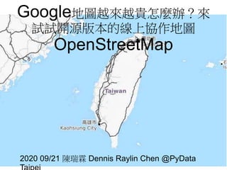
1.
Google地圖越來越貴怎麼辦?來 試試開源版本的線上協作地圖 OpenStreetMap 2020 09/21 陳瑞霖
Dennis Raylin Chen @PyData
2.
檔案 COSCUP 時JupterNotebook檔案
https://github.com/Supaplextw/COS CUP-2020 https://github.com/Supaplextw/PyD ata-20200921
3.
自我介紹 OSM ID:
Supaplex 維基人,台灣維基協會理事 OSM社群活動組織者 臺北聚會主持人,翻譯計畫譯者
4.
http://hdyc.neis-one.org/?Supaplex
5.
Goolge地圖功能齊全與強大
6.
很好用,只是…
7.
$$$
8.
9.
Google地圖漲價 Google Maps
Platform 不論是否達收費標準,都需要留信用卡號 每千次API呼叫2~30美元 每月有200美元免費額度 網站擁有者初估收費漲1400%
10.
11.
https://technews.tw/2017/12/01/why-the-road-is-gone-pokemon-go-
12.
13.
2015年臉書開始用OSM
14.
另一選擇-OpenSteetMap
15.
Google Vs OpenSteetMap
一家整合多項服務 vs 眾多廠商組合的服務 Google包導航、街景、geocoding 老字號 vs 跟風維基概念的鄉民計劃 街景:Google街景 vs Mapillary, OpenStreetCam Geocoding: Google API vs Nominatim
16.
什麼是OpenStreetMap OSM, osm.org
開放街圖 2004成立,英國NGO 社群共編的網路地圖 維基百科版本的地圖 使用OSM的網站:Foursquare、Wikimedia、 Apple Photo、Facebook、實價登錄網站、台北 市土壤潛勢地圖
17.
OpenStreetMap 創辦人 英國人
Steve Coast GIS 領域學生 當年政府的OS Geodata 太貴了 受到維基百科影響,決 定創辦類似的地圖計 畫,讓所有人都能貢獻
18.
一份資料,可以多種地圖樣式呈現
19.
高壓電線與電塔
20.
3D建築
21.
交通運輸
22.
鐵路和捷運路網
23.
24.
印度多語言顯示的例子
25.
整體架構 https://wiki.openstreetmap.org/wiki/Component_overvie
26.
全球各地快取 國網中心龍馬伺服器 https://wiki.openstreetmap.org/wiki/Servers
27.
資料格式 Node:實際帶有經緯度資訊的部分 Way:可能是線段或構成封閉區域
Relation:多個線段或點的集合,可構成 公車路線、行政邊界
28.
資料格式-XML https://www.openstreetmap.org/api/0.6/relation/5233670
29.
HOT Humaniatarin OpenStreetMap Team
美國的NGO 專注在防災與救災畫OpenStreetMap 運用OpenStreetMap快速繪製地圖的特 性,來繪製災後反映現地的地圖
30.
非洲最大貧民窟 肯亞 Kibera http://www.openstreetmap.org/#map=16/- 1.3115/36.7876
31.
2018大阪地震
32.
救災大顯身手-尼伯爾、海燕颱風
33.
https://twitter.com/billgates/status/59546171989753856 1
34.
三鶯部落 https://www.openstreetmap.org/#map=18/24.94334/121.3550 9
35.
編輯畫面、背景影像 https://www.openstreetmap.org/#map=18/25.03966/121.53962
36.
GPS軌跡
37.
編輯歷史記錄
38.
錯誤偵測工具-OSMInspector https://tools.geofabrik.de/osmi/
39.
6,889,320累積註冊帳號
40.
全球資料總數
41.
全球88GB
42.
台灣78MB
43.
AI 與影像辨識 以往
OSM 靠人眼工人智慧辨識空照圖的道路 與建築 現在有越來越多的AI影像辨識的應用 Mapillary辨識街景中的號誌與設施 Facebook辨識出空照圖中的道路
44.
Facebook收購Mapillary https://blog.mapillary.com/news/2020/06/18/Mapillary-joins- Facebook.html
45.
Mapillary街景 https://www.mapillary.com/app/?lat=25.043516100000005&lng=121.55766679999999&z=17.9283 5074163003&pKey=YIB24qR8tnC1YASOJHjbBA&focus=photo&x=NaN&y=NaN&zoom=0
46.
Facebook使用OSM情形
47.
48.
改版之前有標位置的粉絲頁
49.
https://twitter.com/mappingmashups/status/756996185437511681
50.
Credit: Facebook
51.
Mark Zuckerburg -
AI畫地圖影片 https://www.facebook.com/zuck/posts/10102695816334251
52.
MapwithAI https://mapwith.ai/#14/24.02269/- 104.68274
53.
AI+鄉民審核
54.
AI 描繪
55.
Mapbox: API+圖磚
56.
App
57.
魯地圖 Taiwan Topo
58.
登山圖資-魯地圖 https://www.facebook.com/photo.php?fbid=10154544537337138&set= gm.676811479141135&type=3&theaterhttp://sea.tokyo.idv.tw/?p=3004 OpenStreetM ap+內政部DEM 資料 活躍的登山社群編 輯登山步道
59.
ODbL 與維基百科類似 地圖資料授權:ODbL開放資料庫授權
OSM-carto圖磚授權:CC-BY-SA 3.0
60.
OpenStreetMap API OpenStreetMap
API: 可讀可寫 Overpass API:只有讀取 商業API: Mapbox API
61.
Overpass API http://overpass- api.de/
62.
Overpass Turbo https://overpass- turbo.eu/s/Y8f
63.
範例 https://overpass- turbo.eu/s/Y8k
64.
全台往太平洋或台灣海峽流的河川 https://overpass- turbo.eu/s/Rn3
65.
複雜例子http://overpass- turbo.eu/s/kpv
66.
全臺中正路http://overpass- turbo.eu/s/jby
67.
臺北市各區藥局統計
68.
臺北市的臺鐵車站
69.
Python函式庫 直接用常用的網路套件:requests、json Overpass
API 專用基礎套件:OSMPythonTools 進階套件:OSMnx 地圖呈現套件:Folium
70.
requests、json 簡單,只要有網路相關套件就能取用 OpenStreetMap 難處,需要熟悉接
API 串資料方式
71.
72.
73.
74.
GeoPandas
75.
osmnx
76.
Folium
77.
78.
OSM x Wikidata月聚
10/5 19:30 @摩茲工寮
79.
80.
參考資料 https://hackmd.io/@pham/coscup2 020#/ Overpass
API https://towardsdatascience.com/loa ding-data-from-openstreetmap- with-python-and-the-overpass-api-
Jetzt herunterladen