On-demand cartography for trekkers: different trekkers, different maps. C. Domingues, C. Hoarau, ICC 2011

In this paper, we introduce a method for identifying the specific needs of a community from a user survey, and adapting maps accordingly. This method was applied to four different groups of trekkers: walkers, road cyclists, cross-country bikers, and recreational trekkers. Relevant concepts, criticisms and expectations for each group were identified using natural language processing and lexicometry methods and tools. Suggestions for adapting maps focus on data selection and graphic representation. Pedestrian trails were emphasized using trail-marking signs as graphical symbols and adding numbers which refer to additional information. Specific trails were added to the cross-country biking map using the difficulty level indication of ski maps. Moreover, contour lines were highlighted for cross-country bikers to help them to understand relief. The road cyclist map was designed at a 1/50 000 scale with generalized data. The slope of cycling paths was indicated by a diverging color scheme to convey the difficulty of different sections of road. This paper describes part of an on-demand map making process and illustrates it for a specific community, trekkers. It has been shown that it is possible to select data and define radical graphic choices as long as the community is targeted enough to have the same needs and wishes.

Empfohlen
Empfohlen
Weitere ähnliche Inhalte
Kürzlich hochgeladen
Kürzlich hochgeladen (20)
Empfohlen
Empfohlen (20)
On-demand cartography for trekkers: different trekkers, different maps. C. Domingues, C. Hoarau, ICC 2011
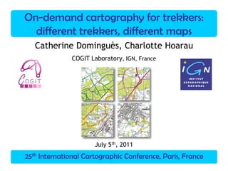
- 1. 25th International Cartographic Conference, Paris, France On-demand cartography for trekkers: different trekkers, different maps Catherine Dominguès, Charlotte Hoarau COGIT Laboratory, IGN, France July 5th, 2011
- 2. Trekker survey Survey analysis (NLP tools) Cartographic proposals 25th ICC, Paris, FranceCartography for trekkers 2C.Dominguès, C.Hoarau Some trekker maps
- 3. Trekker survey Survey analysis (NLP tools) Cartographic proposals 25th ICC, Paris, FranceCartography for trekkers 3C.Dominguès, C.Hoarau Some trekker maps
- 4. Trekker survey Survey analysis (NLP tools) Cartographic proposals 25th ICC, Paris, FranceCartography for trekkers 4C.Dominguès, C.Hoarau Some trekker maps
- 5. Trekker survey Survey analysis (NLP tools) Cartographic proposals 25th ICC, Paris, FranceCartography for trekkers 5C.Dominguès, C.Hoarau Context Trekking maps might be very different Local initiatives In IGN, neither specific data nor specific symbolization for trekking A survey conducted for trekkers
- 6. Trekker survey Survey analysis (NLP tools) Cartographic proposals 25th ICC, Paris, FranceCartography for trekkers 6C.Dominguès, C.Hoarau Objectives Map making method based on user survey : – Improving our process of on-demand map making – Testing natural language processing (NLP) methods and tools Special case: cartography for trekkers
- 7. Trekker survey Survey analysis (NLP tools) Cartographic proposals 25th ICC, Paris, FranceCartography for trekkers 7C.Dominguès, C.Hoarau Outline trekker survey relevant items criticisms & expectations transcription written corpus lexicometry patterns maps cartographic proposals survey analysis
- 8. Trekker survey Survey analysis (NLP tools) Cartographic proposals 25th ICC, Paris, FranceCartography for trekkers 8C.Dominguès, C.Hoarau Outline trekker survey relevant items criticisms & expectations transcription written corpus lexicometry patterns maps survey analysis cartographic proposals
- 9. Trekker survey Survey analysis (NLP tools) Cartographic proposals 25th ICC, Paris, FranceCartography for trekkers 9C.Dominguès, C.Hoarau Trekker survey 4 groups according to their activity: – walking – road cycling – cross-country biking – those who occasionally practice these activities
- 10. Trekker survey Survey analysis (NLP tools) Cartographic proposals 25th ICC, Paris, FranceCartography for trekkers 10C.Dominguès, C.Hoarau Trekker survey 4 groups according to their activity: – walking – road cycling – cross-country biking – those who occasionally practice these activities 4 interviews conducted by coordinator
- 11. Trekker survey Survey analysis (NLP tools) Cartographic proposals 25th ICC, Paris, FranceCartography for trekkers 11C.Dominguès, C.Hoarau Trekker survey 4 groups according to their activity: – walking – road cycling – cross-country biking – those who occasionally practice these activities 4 interviews conducted by coordinator Open-ended questions
- 12. Trekker survey Survey analysis (NLP tools) Cartographic proposals 25th ICC, Paris, FranceCartography for trekkers 12C.Dominguès, C.Hoarau Outline trekker survey relevant items criticisms & expectations transcription written corpus lexicometry patterns maps survey analysis cartographic proposals
- 13. Trekker survey Survey analysis (NLP tools) Cartographic proposals 25th ICC, Paris, FranceCartography for trekkers 13C.Dominguès, C.Hoarau Written corpus 1 group = 1 activity = 1 practice of trekking Transcription of questions and replies = written (sub-)corpus 4 written sub-corpora for 4 practices of trekking
- 14. Trekker survey Survey analysis (NLP tools) Cartographic proposals 25th ICC, Paris, FranceCartography for trekkers 14C.Dominguès, C.Hoarau Written corpus Transcription of interview = 1 written (sub-)corpus: - If contour lines are dim, you can't see them very well. - If you highlight them, it’s going to be heavy. Graticule and Lambert coordinates are not useful. They are only for specialist. Yes, they are useful for specialists. They prevent you from reading the map or they don't. The map is too crowded by all these numbers. - I like color. It's lively. It's clear. I have a quick overall reading of relief; I can see valleys well. - The map shows the distance you can cover by bike : 25 by 30 kms. - I am fond of vivid colors.
- 15. Trekker survey Survey analysis (NLP tools) Cartographic proposals 25th ICC, Paris, FranceCartography for trekkers 15C.Dominguès, C.Hoarau Outline trekker survey relevant items criticisms & expectations transcription written corpus lexicometry patterns maps survey analysis cartographic proposals
- 16. Trekker survey Survey analysis (NLP tools) Cartographic proposals 25th ICC, Paris, FranceCartography for trekkers 16C.Dominguès, C.Hoarau Relevant concepts Relevant concepts for each activity
- 17. Trekker survey Survey analysis (NLP tools) Cartographic proposals 25th ICC, Paris, FranceCartography for trekkers 17C.Dominguès, C.Hoarau Relevant concepts Relevant concepts for each activity Used tool: lexicometry – Based on corpus – To make out significantly frequent words in a corpus
- 18. Trekker survey Survey analysis (NLP tools) Cartographic proposals 25th ICC, Paris, FranceCartography for trekkers 18C.Dominguès, C.Hoarau Relevant concepts Relevant concepts for each activity Used tool: lexicometry – Based on corpus – To make out significantly frequent words in a corpus Contrastive study between each sub-corpus and a reference corpus
- 19. Trekker survey Survey analysis (NLP tools) Cartographic proposals 25th ICC, Paris, FranceCartography for trekkers 19C.Dominguès, C.Hoarau Relevant concepts road cycling sub-corpus cross-country biking sub-corpus walking sub-corpus recreational trekking sub-corpus Reference corpus=concatenation of sub-corpora road cycling sub-corpus cross-country biking sub-corpus walking sub-corpus recreational trekking sub-corpus reference corpus
- 20. Trekker survey Survey analysis (NLP tools) Cartographic proposals 25th ICC, Paris, FranceCartography for trekkers 20C.Dominguès, C.Hoarau Transcription of interview = 1 written (sub-)corpus: - If contour lines are dim, you can't see them very well. - If you highlight them, it’s going to be heavy. Graticule and Lambert coordinates are not useful. They are only for specialist. Yes, they are useful for specialists. They prevent you from reading the map or they don't. The map is too crowded by all these numbers. - I like color. It's lively. It's clear. I have a quick overall reading of relief; I can see valleys well. - The map shows the distance you can cover by bike : 25 by 30 kms. - I am fond of vivid colors. Written corpus
- 21. Trekker survey Survey analysis (NLP tools) Cartographic proposals 25th ICC, Paris, FranceCartography for trekkers 21C.Dominguès, C.Hoarau Written corpus Transcription of interview = 1 written (sub-)corpus: - If contour lines are dim, you can't see them very well. - If you highlight them, it’s going to be heavy. Graticule and Lambert coordinates are not useful. They are only for specialist. Yes, they are useful for specialists. They prevent you from reading the map or they don't. The map is too crowded by all these numbers. - I like color. It's lively. It's clear. I have a quick overall reading of relief; I can see valleys well. - The map shows the distance you can cover by bike : 25 by 30 kms. - I am fond of vivid colors.
- 22. Trekker survey Survey analysis (NLP tools) Cartographic proposals 25th ICC, Paris, FranceCartography for trekkers 22C.Dominguès, C.Hoarau Relevant items 1:25 000 1:50 000 1:25 000 1:50 000 1:100 000 1:25 0001:25 000 1:50 000 scale used herringbone pattern contour line relief slope contour linedifference in altitude slope gradient landmarkroad circuit forest town signposted footpath path vegetation self-orientation trackroad lane path signposted footpath track track path facility used stroll ride marked path marked pathmarked pathitineraryactivity recreational trekkingroad cyclingcross-country biking walking Sub-corpus Topics
- 23. Trekker survey Survey analysis (NLP tools) Cartographic proposals 25th ICC, Paris, FranceCartography for trekkers 23C.Dominguès, C.Hoarau Outline trekker survey relevant items criticisms & expectations transcription written corpus lexicometry patterns maps survey analysis cartographic proposals
- 24. Trekker survey Survey analysis (NLP tools) Cartographic proposals 25th ICC, Paris, FranceCartography for trekkers 24C.Dominguès, C.Hoarau Use of morpho-syntactic patterns to identify criticisms and expectations: – opinion: I think that – preference: I prefer – wish: I would like – criticism: <to be> too much – assessment: I like, <NOUN> <to miss> User criticisms and expectations
- 25. Trekker survey Survey analysis (NLP tools) Cartographic proposals 25th ICC, Paris, FranceCartography for trekkers 25C.Dominguès, C.Hoarau for example : a preference User criticisms and expectations with Unitex : http://www-igm.univ-mlv.fr/~unitex/
- 26. Trekker survey Survey analysis (NLP tools) Cartographic proposals 25th ICC, Paris, FranceCartography for trekkers 26C.Dominguès, C.Hoarau 337 cases : - If contour lines are dim, you can't see them very well. - If you highlight them, it’s going to be heavy. Graticule and Lambert coordinates are not useful. They are only for specialist. Yes, they are useful for specialists. They prevent you from reading the map or they don't. The map is too crowded by all these numbers. - I like color. It's lively. It's clear. I have a quick overall reading of relief; I can see valleys well. - The map shows the distance you can cover by bike : 25 by 30 kms. - I am fond of vivid colors. User criticisms and expectations
- 27. Trekker survey Survey analysis (NLP tools) Cartographic proposals 25th ICC, Paris, FranceCartography for trekkers 27C.Dominguès, C.Hoarau 337 cases : - If contour lines are dim, you can't see them very well. - If you highlight them, it’s going to be heavy. Graticule and Lambert coordinates are not useful. They are only for specialist. Yes, they are useful for specialists. They prevent you from reading the map or they don't. The map is too crowded by all these numbers. - I like color. It's lively. It's clear. I have a quick overall reading of relief; I can see valleys well. - The map shows the distance you can cover by bike : 25 by 30 kms. - I am fond of vivid colors. User criticisms and expectations
- 28. Trekker survey Survey analysis (NLP tools) Cartographic proposals 25th ICC, Paris, FranceCartography for trekkers 28C.Dominguès, C.Hoarau Written corpus Transcription of interview = 1 written (sub-)corpus: - If contour lines are dim, you can't see them very well. - If you highlight them, it’s going to be heavy. Graticule and Lambert coordinates are not useful. They are only for specialist. Yes, they are useful for specialists. They prevent you from reading the map or they don't. The map is too crowded by all these numbers. - I like color. It's lively. It's clear. I have a quick overall reading of relief; I can see valleys well. - The map shows the distance you can cover by bike : 25 by 30 kms. - I am fond of vivid colors.
- 29. Trekker survey Survey analysis (NLP tools) Cartographic proposals 25th ICC, Paris, FranceCartography for trekkers 29C.Dominguès, C.Hoarau Transcription of interview = 1 written (sub-)corpus: - If contour lines are dim, you can't see them very well. - If you highlight them, it’s going to be heavy. Graticule and Lambert coordinates are not useful. They are only for specialist. Yes, they are useful for specialists. They prevent you from reading the map or they don't. The map is too crowded by all these numbers. - I like color. It's lively. It's clear. I have a quick overall reading of relief; I can see valleys well. - The map shows the distance you can cover by bike : 25 by 30 kms. - I am fond of vivid colors. Written corpus
- 30. Trekker survey Survey analysis (NLP tools) Cartographic proposals 25th ICC, Paris, FranceCartography for trekkers 30C.Dominguès, C.Hoarau Transcription of interview = 1 written (sub-)corpus: - If contour lines are dim, you can't see them very well. - If you highlight them, it’s going to be heavy. Graticule and Lambert coordinates are not useful. They are only for specialist. Yes, they are useful for specialists. They prevent you from reading the map or they don't. The map is too crowded by all these numbers. - I like color. It's lively. It's clear. I have a quick overall reading of relief; I can see valleys well. - The map shows the distance you can cover by bike : 25 by 30 kms. - I am fond of vivid colors. Written corpus
- 31. Trekker survey Survey analysis (NLP tools) Cartographic proposals 25th ICC, Paris, FranceCartography for trekkers 31C.Dominguès, C.Hoarau User criticisms and expectations walking cross-country biking road cycling recreational trekking 1:25 000 scale 1:50 000 scale 1:100 000 scale 1:25 000 scale on-demand map much information tourist information relief information distance information number of vehicles on the road tourist information relief information distance information level of difficulty simple map well spaced out map simple legend technical vocabu- lary bright colours contrasting colours conventional colours contrasting colours dense map scale 1:50 000 hard-to-read legend 1:50 000 map too dense legend complicated map confusing map Lambert graticule Lambert graticule Lambert graticule local boundaries Lambert graticule not enough contras- ting colours irrelevant information pastel colour too similar icons
- 32. Trekker survey Survey analysis (NLP tools) Cartographic proposals 25th ICC, Paris, FranceCartography for trekkers 32C.Dominguès, C.Hoarau Outline trekker survey relevant items criticisms & expectations transcription written corpus lexicometry patterns maps survey analysis cartographic proposals
- 33. Trekker survey Survey analysis (NLP tools) Cartographic proposals 25th ICC, Paris, FranceCartography for trekkers 33C.Dominguès, C.Hoarau Initial map
- 34. Trekker survey Survey analysis (NLP tools) Cartographic proposals 25th ICC, Paris, FranceCartography for trekkers 34C.Dominguès, C.Hoarau Road graphical representation Removing the administrative classification Preservation of road relevance information
- 35. Trekker survey Survey analysis (NLP tools) Cartographic proposals 25th ICC, Paris, FranceCartography for trekkers 35C.Dominguès, C.Hoarau Association with landmarks Including roads in the background layer Road graphical representation
- 36. Trekker survey Survey analysis (NLP tools) Cartographic proposals 25th ICC, Paris, FranceCartography for trekkers 36C.Dominguès, C.Hoarau Road graphical representation Road accessibility for cyclists – Footpaths, tracks… not accessible – Highways forbidden
- 37. Trekker survey Survey analysis (NLP tools) Cartographic proposals 25th ICC, Paris, FranceCartography for trekkers 37C.Dominguès, C.Hoarau Road graphical representation Road accessibility for cyclists – Footpaths, tracks… not accessible – Highways forbidden Discontinuity of road network ➙ Dashed symbolization
- 38. Trekker survey Survey analysis (NLP tools) Cartographic proposals 25th ICC, Paris, FranceCartography for trekkers 38C.Dominguès, C.Hoarau Road graphical representation Inaccessible roads
- 39. Trekker survey Survey analysis (NLP tools) Cartographic proposals 25th ICC, Paris, FranceCartography for trekkers 39C.Dominguès, C.Hoarau Trail graphical representation 1:25 000 1:50 000 1:25 000 1:50 000 1:100 000 1:25 0001:25 000 1:50 000 scale used herringbone pattern contour line relief slope contour linedifference in altitude slope gradient landmarkroad circuit forest town signposted footpath path vegetation self-orientation trackroad lane path signposted footpath track track path facility used stroll ride marked path marked pathmarked pathitineraryactivity recreational trekkingroad cyclingcross-country biking walking Sub-corpus Topics
- 40. Trekker survey Survey analysis (NLP tools) Cartographic proposals 25th ICC, Paris, FranceCartography for trekkers 40C.Dominguès, C.Hoarau Trail graphical representation 1:25 000 1:50 000 1:25 000 1:50 000 1:100 000 1:25 0001:25 000 1:50 000 scale used herringbone pattern contour line relief slope contour linedifference in altitude slope gradient landmarkroad circuit forest town signposted footpath path vegetation self-orientation trackroad lane path signposted footpath track track path facility used stroll ride marked path marked pathmarked pathitineraryactivity recreational trekkingroad cyclingcross-country biking walking Sub-corpus Topics
- 41. Trekker survey Survey analysis (NLP tools) Cartographic proposals 25th ICC, Paris, FranceCartography for trekkers 41C.Dominguès, C.Hoarau Trail graphical representation For pedestrian trekkers – Need of self orientation information and facility highlighting
- 42. Trekker survey Survey analysis (NLP tools) Cartographic proposals 25th ICC, Paris, FranceCartography for trekkers 42C.Dominguès, C.Hoarau Trail graphical representation For pedestrian trekkers – Need of self orientation information and facility highlighting Source : French Trekking Federation Terrain Symbols
- 43. Trekker survey Survey analysis (NLP tools) Cartographic proposals 25th ICC, Paris, FranceCartography for trekkers 43C.Dominguès, C.Hoarau Trail graphical representation For pedestrian trekkers – Need of self orientation information and facility highlighting Source : French Trekking Federation Our Legend SuggestionTerrain Symbols
- 44. Trekker survey Survey analysis (NLP tools) Cartographic proposals 25th ICC, Paris, FranceCartography for trekkers 44C.Dominguès, C.Hoarau Pedestrian trekker map Pedestrian trails
- 45. Trekker survey Survey analysis (NLP tools) Cartographic proposals 25th ICC, Paris, FranceCartography for trekkers 45C.Dominguès, C.Hoarau Trail graphical representation 1:25 000 1:50 000 1:25 000 1:50 000 1:100 000 1:25 0001:25 000 1:50 000 scale used herringbone pattern contour line relief slope contour linedifference in altitude slope gradient landmarkroad circuit forest town signposted footpath path vegetation self-orientation trackroad lane path signposted footpath track track path facility used stroll ride marked path marked pathmarked pathitineraryactivity recreational trekkingroad cyclingcross-country biking walking Sub-corpus Topics
- 46. Trekker survey Survey analysis (NLP tools) Cartographic proposals 25th ICC, Paris, FranceCartography for trekkers 46C.Dominguès, C.Hoarau Trail graphical representation 1:25 000 1:50 000 1:25 000 1:50 000 1:100 000 1:25 0001:25 000 1:50 000 scale used herringbone pattern contour line relief slope contour linedifference in altitude slope gradient landmarkroad circuit forest town signposted footpath path vegetation self-orientation trackroad lane path signposted footpath track track path facility used stroll ride marked path marked pathmarked pathitineraryactivity recreational trekkingroad cyclingcross-country biking walking Sub-corpus Topics
- 47. Trekker survey Survey analysis (NLP tools) Cartographic proposals 25th ICC, Paris, FranceCartography for trekkers 47C.Dominguès, C.Hoarau Road cyclist map Cyclist trails
- 48. Trekker survey Survey analysis (NLP tools) Cartographic proposals 25th ICC, Paris, FranceCartography for trekkers 48C.Dominguès, C.Hoarau Road cyclist map Cyclist trails
- 49. Trekker survey Survey analysis (NLP tools) Cartographic proposals 25th ICC, Paris, FranceCartography for trekkers 49C.Dominguès, C.Hoarau Trail graphical representation For cross-country bikers – Need of difficulty level information – Using the skimap color schema
- 50. Trekker survey Survey analysis (NLP tools) Cartographic proposals 25th ICC, Paris, FranceCartography for trekkers 50C.Dominguès, C.Hoarau Cross-country biker map Cross-Country trails Pedestrian trails
- 51. Trekker survey Survey analysis (NLP tools) Cartographic proposals 25th ICC, Paris, FranceCartography for trekkers 51C.Dominguès, C.Hoarau Trail highlighting Cross-country biker and pedestrian trails Road cyclist trails
- 52. Trekker survey Survey analysis (NLP tools) Cartographic proposals 25th ICC, Paris, FranceCartography for trekkers 52C.Dominguès, C.Hoarau walking cross-country biking road cycling recreational trekking 1:25 000 scale 1:50 000 scale 1:100 000 scale 1:25 000 scale on-demand map much information tourist information relief information distance information number of vehicles on the road tourist information relief information distance information level of difficulty simple map well spaced out map simple legend technical vocabu- lary bright colours contrasting colours conventional colours contrasting colours dense map scale 1:50 000 hard-to-read legend 1:50 000 map too dense legend complicated map confusing map Lambert graticule Lambert graticule Lambert graticule local boundaries Lambert graticule not enough contras- ting colours irrelevant information pastel colour too similar icons Points of interest
- 53. Trekker survey Survey analysis (NLP tools) Cartographic proposals 25th ICC, Paris, FranceCartography for trekkers 53C.Dominguès, C.Hoarau Points of interest walking cross-country biking road cycling recreational trekking 1:25 000 scale 1:50 000 scale 1:100 000 scale 1:25 000 scale on-demand map much information tourist information relief information distance information number of vehicles on the road tourist information relief information distance information level of difficulty simple map well spaced out map simple legend technical vocabu- lary bright colours contrasting colours conventional colours contrasting colours dense map scale 1:50 000 hard-to-read legend 1:50 000 map too dense legend complicated map confusing map Lambert graticule Lambert graticule Lambert graticule local boundaries Lambert graticule not enough contras- ting colours irrelevant information pastel colour too similar icons
- 54. Trekker survey Survey analysis (NLP tools) Cartographic proposals 25th ICC, Paris, FranceCartography for trekkers 54C.Dominguès, C.Hoarau Points of interest walking cross-country biking road cycling recreational trekking 1:25 000 scale 1:50 000 scale 1:100 000 scale 1:25 000 scale on-demand map much information tourist information relief information distance information number of vehicles on the road tourist information relief information distance information level of difficulty simple map well spaced out map simple legend technical vocabu- lary bright colours contrasting colours conventional colours contrasting colours dense map scale 1:50 000 hard-to-read legend 1:50 000 map too dense legend complicated map confusing map Lambert graticule Lambert graticule Lambert graticule local boundaries Lambert graticule not enough contras- ting colours irrelevant information pastel colour too similar icons
- 55. Trekker survey Survey analysis (NLP tools) Cartographic proposals 25th ICC, Paris, FranceCartography for trekkers 55C.Dominguès, C.Hoarau Points of interest walking cross-country biking road cycling recreational trekking 1:25 000 scale 1:50 000 scale 1:100 000 scale 1:25 000 scale on-demand map much information tourist information relief information distance information number of vehicles on the road tourist information relief information distance information level of difficulty simple map well spaced out map simple legend technical vocabu- lary bright colours contrasting colours conventional colours contrasting colours dense map scale 1:50 000 hard-to-read legend 1:50 000 map too dense legend complicated map confusing map Lambert graticule Lambert graticule Lambert graticule local boundaries Lambert graticule not enough contras- ting colours irrelevant information pastel colour too similar icons
- 56. Trekker survey Survey analysis (NLP tools) Cartographic proposals 25th ICC, Paris, FranceCartography for trekkers 56C.Dominguès, C.Hoarau Points of interest Removing irrelevant information (golf courses, …) Adding specific information (bike repairer’s…) Picnic Area Campsite Monument Bike Repairer Points of Interest
- 57. Trekker survey Survey analysis (NLP tools) Cartographic proposals 25th ICC, Paris, FranceCartography for trekkers 57C.Dominguès, C.Hoarau Recreational trekker map Pedestrian trails Touristic information Adding touristic information for recreational trekkers
- 58. Trekker survey Survey analysis (NLP tools) Cartographic proposals 25th ICC, Paris, FranceCartography for trekkers 58C.Dominguès, C.Hoarau Conclusion Specific maps for trekkers: – Incompatible requests were prioritized – Relevant choices regarding the targeted audience Trekkers' criticisms and expectations identified without any preconceived idea
- 59. Trekker survey Survey analysis (NLP tools) Cartographic proposals 25th ICC, Paris, FranceCartography for trekkers 59C.Dominguès, C.Hoarau Plans for future work To test resulting maps by trekkers To apply natural language processing methods to another targeted audience
- 60. 25th International Cartographic Conference, Paris, France On-demand cartography for trekkers Catherine Dominguès, Charlotte Hoarau For further information: catherine.domingues@ign.fr charlotte.hoarau@ign.fr http://recherche.ign.fr/labos/cogit Thank you for your attention