Lesson 6.3 Activity: Human Migration Patterns
•
2 gefällt mir•6,039 views

Where did early humans start and where did they end up? Explore the migration patterns of humans throughout the world. Register to explore the whole course here: https://school.bighistoryproject.com/bhplive?WT.mc_id=Slideshare12202017

Empfohlen
Weitere ähnliche Inhalte
Was ist angesagt?
Was ist angesagt? (20)
Andere mochten auch
Andere mochten auch (20)
Ähnlich wie Lesson 6.3 Activity: Human Migration Patterns
Ähnlich wie Lesson 6.3 Activity: Human Migration Patterns (20)
Mehr von Big History Project
Mehr von Big History Project (20)
Kürzlich hochgeladen
Kürzlich hochgeladen (20)
Lesson 6.3 Activity: Human Migration Patterns
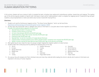
- 1. TEACHER MATERIALS HUMAN MIGRATION PATTERNS In this activity, students will use a variety of skills to complete the tasks, including close reading and comprehension abilities, researching, and mapping. The reading part of this activity requires students to read for both information (clues) and for understanding in order to complete the mapping section. Creating the map will give students a visual representation of when and where early humans moved after leaving Africa. Directions: 1. Students will read the Smithsonian magazine article, “The Great Human Migration,” which can be found here: http://www.smithsonianmag.com/history/the-great-human-migration-13561/ 2. As they read, they should take notes or highlight every piece of information or clue given about human migration out of Africa. Possible information/evidence gleaned from the article: • Neanderthals prevalent in Europe and Asia • Pockets of Homo erectus in Far East • Arrival in Asia between 80,000 and 60,000 years ago • Settled Indonesia, Papua New Guinea, Australia 45,000 years ago • Entered Europe 40,000 years ago • Neanderthals forced into mountains of Croatia, Iberian Peninsula • Original exodus involved anywhere from 1,000 to 50,000 people—sometime more recently than 80,000 years ago • Modern humans reached the New World at least 15,000 years ago via the Bering Land Bridge 3. After gathering all clues, break the class into groups to begin mapping the migration patterns of early humans. 4. Students begin their small group work by labeling the following parts of the map: BIG HISTORY PROJECT / LESSON 6.3 ACTIVITY • Africa • Europe • Iberian Peninsula • Middle East • Israel • Turkey • Arabian Peninsula • Croatia • India • Asia • Indonesia • Papua New Guinea • Australia • North America • South America • Mediterranean Sea • Red Sea • Indian Ocean 5. As a group, they will compare all of their individual notes and clues they collected while reading the article to decide which pieces of information are important to the story of human migration.
- 2. TEACHER MATERIALS HUMAN MIGRATION PATTERNS 6. They will use the symbols provided in the map legend to draw the course of human migration as told in the article. On their map, they should note evidence of: • Migration routes • Water crossings • Mountains • Evidence of human habitation, including Homo sapiens and Neanderthal areas of settlement 7. Last, students will label the migration routes with the approximate date ranges for when humans moved into these areas. Links for the images used in the map legend: • Canoe http://www.clker.com/clipart-canoe-acsess-black.html • Mountains http://9pixs.com/popular-items-for-mountain-clip-art-on-etsy-2014/ • Human http://www.clker.com/clipart-gray-stick-figure-1.html BIG HISTORY PROJECT / LESSON 6.3 ACTIVITY
- 3. TEACHER MATERIALS HUMAN MIGRATION PATTERNS (ANSWER KEY) BIG HISTORY PROJECT / LESSON 6.3 ACTIVITY NORTH AMERICA SOUTH AMERICA AFRICA ASIA Mediterranean Sea EUROPE AUSTRALIA Papua New Guinea Iberian Peninsula (Neanderthal stronghold) Blombos Cave Red Sea Indian Ocean Indonesia Croatia Turkey Israel INDIA MIDDLE EAST Arabian Peninsula (15,000 yrs ago) (40,000 yrs ago) (45,000 yrs ago) (80-60,000 yrs ago) (Neanderthals) Legend Migration routes Human Habitation Mountain Ranges Water Crossing
- 4. STUDENT MATERIALS HUMAN MIGRATION PATTERNS Directions: 1. Read the Smithsonian magazine article, “The Great Human Migration,” which can be found here: http://www.smithsonianmag.com/history/the-great-human-migration-13561/ 2. As you read, take notes or highlight every piece of information or clue given about human migration out of Africa. 3. After gathering all clues, break into groups to begin mapping the migration patterns of early humans. 4. Begin by labeling the following parts of the map: BIG HISTORY PROJECT / LESSON 6.3 ACTIVITY • Africa • Europe • Iberian Peninsula • Middle East • Israel • Turkey • Arabian Peninsula • Croatia • India • Asia • Indonesia • Papua New Guinea • Australia • North America • South America • Mediterranean Sea • Red Sea • Indian Ocean 5. As a group, compare all of your individual notes and clues you collected while reading the article to decide which pieces of information are important to the story of human migration. 6. Use the symbols provided in the map legend to draw the course of human migration as told in the article. On your map note evidence of: • Migration routes • Water crossings • Mountains • Evidence of human habitation, including Homo sapiens and Neanderthal areas of settlement 7. Lastly, label the migration routes with the approximate date ranges for when humans moved into these areas.
- 5. Name: Date: STUDENT MATERIALS HUMAN MIGRATION PATTERNS BIG HISTORY PROJECT / LESSON 6.3 ACTIVITY