SC7 Workshop 2: Space Data for Secure Societies
•
1 gefällt mir•642 views

The document provides information about the Copernicus program, which is the European Union's Earth observation program. It summarizes the six Copernicus services that use Earth observation data to deliver information. It then describes some of the Copernicus satellites, including Sentinel-1, Sentinel-2, and Sentinel-3, and discusses how Sentinel data is accessed. Finally, it addresses some of the challenges around big data and moving towards the Copernicus Data and Information Access Service (DIAS) to improve access to Copernicus data and information.

Empfohlen
Empfohlen
Weitere ähnliche Inhalte
Was ist angesagt?
Was ist angesagt? (20)
Ähnlich wie SC7 Workshop 2: Space Data for Secure Societies
Ähnlich wie SC7 Workshop 2: Space Data for Secure Societies (20)
Mehr von BigData_Europe
Mehr von BigData_Europe (20)
Kürzlich hochgeladen
Kürzlich hochgeladen (20)
SC7 Workshop 2: Space Data for Secure Societies
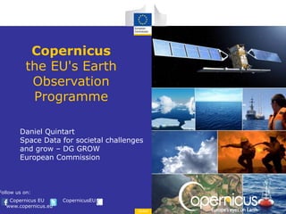
- 1. Copernicus EU CopernicusEU www.copernicus.eu Follow us on: Space Copernicus the EU's Earth Observation Programme Daniel Quintart Space Data for societal challenges and grow – DG GROW European Commission
- 3. Space 6 services use Earth Observation data to deliver … Sentinels Contributing missions In situ observations Contributing Missions In-situ …added-value information Copernicus architecture
- 4. Space S1: Radar Mission S2: High Resolution Optical Mission S3: Medium Resolution Imaging and Altimetry Mission S4: Geostationary Atmospheric Chemistry Mission S5P: Low Earth Orbit Atmospheric Chemistry Precursor Mission S5: Low Earth Orbit Atmospheric Chemistry Mission S6 (Jason-CS): Altimetry Mission Space Component Dedicated Missions
- 5. Space Sentinel 1 Feature Description Spacecrafts 2 operating in twin config. Instrument 4 SAR modes with different resolution and coverage Bands C-band SAR imaging mission in continuation of ERS and Envisat Resolution IW 5x20m / EW 25x100m Swath IW 250 km / EW 400 km Orbit Sun-synchronous at 693 km with LTDN 6:00 AM Revisit Periodicity 12 days with 1 satellite 6 days with 2 satellites Lifetime 7 years, consumables for 12 years Launch April 2014 and April 2016
- 6. Space Sentinel 2 Feature Description Spacecrafts 2 operating in twin config. Instrument MSI (Multi-Spectral Instrument) Spectral bands 13 (VIS–NIR–SWIR) Resolution 10m / 20m / 60m Swath 290 km Orbit Sun-synchronous at 786 km with LTDN 10:30 AM Revisit Periodicity 10 days with 1 satellite 5 days with 2 satellites Lifetime 7.25 years, extendable to 12 years Launch June 2015
- 7. Space Sentinel 3 Feature Description Spacecrafts 2 operating in twin config. Instrument Ocean and Land Colour Instrument (OLCI), Sea and Land Surface Temperature Radiometer (SLSTR), SAR Altimeter (SRAL), Microwave Radiometer (MWR) Spectral bands 21 (OLCI), 9 (SLSTR), Ku band and C band (SRAL) and 23.8 & 36.5 GHz (MWR) Resolution 300m OLCI / 500m and 1km SLSTR Swath 1270 km OLCI, 1420 km SLSTR Orbit Sun-synchronous at 815 km with LTDN 10:30 AM Revisit Periodicity With 2 satellites : SLSTR one day, OLCI two days Lifetime 7.00 years, extendable to 12 years Launch February 2016
- 8. December 2015 Sentinels data access Current Configuration Statistics: 30 June 2016 Scientific Data Hub Collaborative Data Hub > 38,885 Users 11 Collaborative Users 4 Data Hub Relay Users Max 2 Concurrent Downloads International Access Hub Copernicus Services Data Hub 4 Users 108 Users No Rolling Policy Applied No specific threshold Self Registration Sentinel-1A NRT & NTC Sentinel-2A L1C Sentinel-1A NRT & NTC Sentinel-2A L1C Sentinel-1A NTC Sentinel-2A L1C Sentinel-1A NTC Sentinel-2A L1C 03-Oct-2014 16-Nov-2015 Node 1: 30 days Node 2: 9 days 30 Days Node 1: Max 10 downloads Node 2: No specific threshold 01-Dec-2015 Max 10 concurrent downloads No Rolling Policy Applied
- 9. Space ESA Data Hub Software (DHuS) provides an open source Web Interface Users can set scripts to automatically download data Online data access at: scihub.copernicus.eu Sentinel Data – Online Access
- 10. December 2015 Copernicus Contributing Missions Atmospheric missions PROBA-V SPOT (VGT) MetOp Meteosat 2nd Generation Cryosat Jason DMC Deimos-2 Pléiades RapidEye SPOT (HRS) COSMO-Skymed Radarsat TerraSAR–X Tandem-X Copernicus Contributing Missions
- 11. Space Operational Services Monitoring the State of the Earth System Environment … … cross-cutting Thematic Services
- 13. From global… …to pan-European… …to local e.g. Vegetation dynamics, Bio- physical parameters, energy balance e.g. bio-diversity, water bodies, land-use, land change e.g. urban land-use Land Monitoring
- 15. Marine Environment Monitoring Service Global and Regional Real time and with Reanalyses Satellite & In Situ observations and Models Ice Temperature Salinity Sea Level A 3D and consistent estimation of the ocean Currents Biogeochemistry
- 17. pace 17 The Copernicus Atmosphere Monitoring Service (CAMS) Detects emissions and estimate surface fluxes Quantifies transport, removal and transformations of atmospheric constituents Forecasts and informs on impacts Air quality Climate forcing Ozone layer Radiation Emissions CAMS in three figures 280 million observations processed every 12 hours Data from 70 satellite instruments are received and used delivers everyday 14,000 maps online
- 19. Space 19 Copernicus Climate Change (C3) service What is the rate of change? Forecasts & Projections What are the societal impacts? Climate indicators & Sectoral information to be an authoritative source of climate information for Europe How is the climate changing? Observations & Re-analysis http://climate.copernicus.eu/
- 20. Space Copernicus Emergency Management Service Mapping Component Early Warning Component
- 21. Space 21 The Emergency Management Service EMS service covers the 3 phases of emergencies: preparedness, emergency and recovery
- 22. Space Emergency Management service Providing support to emergency response services Situation maps, reference information Flood and forest fire risk forecasts
- 23. Space Tropical Cyclone, Vanuatu Refugee Camp, Al Mafraq Jordan Ebola epidemic, Guinea Earthquake, San Felice sul Panaro Italy Floods, Ostlandet Norway Earthquake, Nepal Mapping service
- 24. Space Copernicus Security Service (CSS) As an exception to the free, full and open data policy of Copernicus, information produced by CSS is distributed to authorised users only
- 25. Space Implementation Industrial Base (DA) November 2015 Border Surveillance (DA) October 2016 Support to EU External Actions (DA) December 2015 Maritime Surveillance Inter-Agency cooperation CSS Moving to Operations
- 26. Space Border Surveillance satellite COOPERATIVE COOPERATIVE COOPERATIVE COOPERATIVE COOPERATIVECOOPERATIVE COOPERATIVECOOPERATIVE NON COOPERATIVE NON COOPERATIVE NON COOPERATIVE NON COOPERATIVE NON COOPERATIVE + reporting + in-situ sensor Pre-frontier Monitoring Maritime areas Land areas Validation of the Concept and user up-taking: SAGRES and LOBOS projects (2013-14); Maritime Domain Awareness
- 27. Space • Aims at providing: Support to EU External Actions Geo-spatial intelligence and information for situational awareness Rapid on-demand geo-spatial information For crisis prevention, preparedness and response capacities, particularly in conflict situations Specific support to CFSP-CSDP and other security user needs Complementary to the Emergency Management Service Shares common processing capabilities Support to EU External Actions
- 28. Space Support to EU External Actions New tools & services Engaging users in new application domains Bringing products to an operational maturity level – humanitarian crisis – natural resources – land conflicts situation awareness – border surveillance (outside EU borders) – illicit crops SEA - Service Portfolio Validation of the concept and user up-taking: G-NEXT and G-MOSAIC projects (2013-14); Operations : SatCen
- 29. Space An Integrated approach Underpinning principle: Share data for economy of scale in surveillance costs Need to take into consideration data policy and sensitivity aspects –Border Control –Maritime Safety and Security –Defence –Customs Authorities –Law enforcement –Marine Environment –Fisheries Control Maritime Surveillance Support to Maritime Surveillance May 2014 : • Implementation Recommendations • Service Portfolio WG on Maritime Surveillance Validation of the concept and user up-taking: Several R&D projects; Operations : EMSA
- 30. Space Combination of Technology / Data Fusion Satellite data (radar, optical) Vessel reporting systems (AIS, VMS, LRIT) UAV surveillance Novel sensor concepts Maritime Surveillance Support to Maritime Surveillance
- 31. Space 31 © Copernicus Sentinel data (2015) Copernicus Big Data Challenges
- 32. Space EASY ACCESS TO COPERNICUS Improving the current data access Bringing the users to the data User uptake initiatives 32 Objectives © Copernicus Sentinel data
- 33. Space 33 Copernicus Data and Information Catalogue, Search and View User management Download Data Broadcast Long-Term Archive Access to QRT Data User support Restricted Access Copernicus Distribution System(s)
- 34. Space 34 DIAS Concept CopernicusDomainUserDomain Commission Member States Regional/Loc al Administratio n Private sector Citizen Scientific users S6 User Data Land Marine Atmosph ere Emergenc y Security Climate Sentinel Data Service Information Data Distribution service Data and Information Access Service Copernicus Core Services Sentinel Data ESA Sentinel Data EUMETSAT Contributin g Missions In-Situ Data for Download Information Access & Download Data/Information Access Service Information Processing & Other Value Added Services & Data S5S4S3S2S1 Sentinels National, International & Commercial Data Processing & Other Value Added Services & Data ESA / EUMETSAT Data/Information co-located with IT exploitation environment and tools
- 35. Space 35 Copernicus DIAS Functional scope Access Discovery Visualisation Integration layer to support user initiatives Additional offerings – free or paid for (open business models) Processing Access to other data Tools Market places …. Open & non-discriminatory Competitive, open to industrial initiatives User Data Sentinel Data Service Information Data and Information Access Service Data/Information Access on Cloud Processing & Other Value Added Services & Data Data/Information co-located with IT exploitation environment and tools
- 36. Space Copernicus Data and Information Access Service (DIAS) Back office Front Office Copernicus Data Data Exploration Tools 3rd party Data Environment Third Party Services & Environment CopernicusfundedServices ThirdPartyfundedServices Downstream Use Data & Information Exploration Computing Environment DIAS Concept
- 37. Space 37 Complementarity The Copernicus DIAS initiative builds on and enriches other efforts within and outside the Commission. We are stepping up our coordination effort to target alignment of objectives and mutual support amongst actors. European Big Data Initiative Copernicus Market Place Contribution to GEO EO Innovation Europe Collaborative Ground Segment
- 38. Space Challenges Critical mass of data, applications, users is a shared and strong objective essential for the success of the operation Beyond Copernicus, national mission data, non-EO data … Security vs usability, which security level is required ? Separate platforms 38
- 39. Space Moving ahead Finalisation of Functional Requirements, then translation into technical specifications Foreseen to start operation in 2018 39
- 40. Copernicus EU CopernicusEU www.copernicus.eu Follow us on: Space Thank you for your attention! http://www.copernicus.eu/