
Empfohlen
Empfohlen
Weitere ähnliche Inhalte
Was ist angesagt?
Was ist angesagt? (7)
Mehr von Ayala Solzi Tertman
Kürzlich hochgeladen
Kürzlich hochgeladen (20)
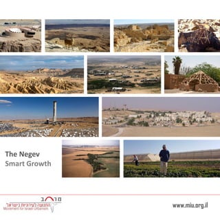
Smart Growth of the Negev
- 2. Jerusalem Amman Be’er Sheva Gaza Tel Aviv - Jaffa Haifa Eilat Aaqaba JordanEgypt Syria Lebanon Palestine Negev The Negev covers more than half of Israel, over some 13,000 km² (4,700 sq mi) or at least 55% of the country's land area. The Negev region is arid, Eilat receives on average only 24 mm of rainfall a year and very little rain due to its location to the east of the Sahara . The temperature raises from 28-45. The usual rainfall total from June through October is zero. Snow and frost are rare in the northern Negev, and snow and frost are unknown in the vicinity of Eilat in the southern Negev. The Negev – the region of southern Israel
- 3. Arad Sderot Netivot Ofaqim Be’er Sheva Hura Rahat Yeruham Dimona Mizpe Ramon Eilat The Negev contains several smallmedium towns, as well as 7 small bedouin cities. populationtown 23,090Sderot 31,314Netivot 25,638ofaqim 62,415Rahat 203,604Be’erSheva 24,436Arad 10,064Yeruham 33,258Dimona 5,000Mizpe Ramon 49,734Eilat 2030 Existing demographic 908,950518,490 Total number of Jewish residents 540,000270,000 Total number of Bedouins residents Towns in the Negev
- 4. Arava Tichona Tamar Eilot Region Sdot Negev Shaar Hanegev Ramat Negev Eshkol Merhavim Bnei Shimon The Negev contains 9 Jewish regional councils with 69,000 people . The Bedouin population is 80,000 people living in 9 recognize villages and 36 unrecognized villages. Number of settlements populationcouncil 127,718 Shaar Hanegev 179,400 Sdot Negev 139,277 Bnei Shimon 1712,606Merhavim 3214,587Eshkol 166,000 Ramat Negev 73,300 Arava Tichona 61,350Tamar 104,700Eilot Region Regional Council in the Negev
- 5. Nature reserve Eilat Mountains Ramon Crater Anemone blossoming The Negev landscape
- 6. Sderot Netivot Ofaqim Be’er Sheva Rahat Dimona Arad Mizpe Ramon Eilat Kibutz Ketura Sapir Academic College located near Sderot. Ben-Gurion University of the Negev located in Be’er Sheva. Ben-Gurion faculties include the Jacob Blaustein Institutes for Desert Research and the Albert Katz International School for Desert Studies, both located at the Midreshet Ben-Gurion campus adjacent to Kibbutz Sde Boker. Arava Institute for Environmental Studies Ben-Gurion University in Eilat. Midreshet Ben- Gurion Educational Institutes
- 7. Ovda Airport Eilat Airport Sapir Airport Sderot Netivot Ofaqim Lehavim Rahat Qiryat Gat Mizpe Ramon Eilat Dimona Be’er Sheva Sderot Arad Train station Existing line Planned line Tel - Aviv Eilat 344KM 4 HOURS Mizpe Ramon 140KM 1.45 HOURS Be’er Sheva 235KM 2.50 HOURS Be’er Sheva (2 stations) Regional road network Eilat Dimona
- 8. Arava Tichona Tamar Eilot Region Ramat Negev Eshkol Merhavim Gaza Strip Rahat Ashkelon Sderot Be’er Sheva Qiryat Gat Industrial Area Commercial Area Noam Industrial Park Mall 7 Commercial Area Sapirim Industrial Park Bnei Shimon Shaar Hanegev Sdot Negev Idan HaNegev Industrial Park Ofakim Netivot Local Economic Opportunities
- 10. Mizpe Ramon Sderot Netivot Eilat
- 11. Netivot City center Old City Center
- 12. Dimona City center Old City Center New Shopping Center
- 13. Yeruham City center Main Street City Center
- 14. Ofaqim City center City Center
- 15. Mizpe Ramon City center Old City center City Market
- 16. Arad City center City center
- 17. Sderot City center Old City Center New Shopping Center
- 18. Eilat City center City center
- 20. 20 Density and efficient land use A continuous and dense streets network Strengthening the city center Variety of transportation options A variety of economic opportunities Criteria for examining the quality of life in the Negev’s cities
- 21. Total city area :4.1 km2 Total build area : 0.8 km2 Urban density ---------------------------------- city population 23,090(2015) / Total city area 4.1 5,631 capita per km2 ---------------------------------- BUILT / VACANT 12% of the city is built New planned neighborhood Sderot The city’s Boundary line Density and efficient land use
- 22. Industrial area Neighborhood border Statistical areaNew statistical area City center Statistical area number population area (km2) Density 239000.84875 331000.310333 438000.57600 529001.252320 5-new29000.754142 643000.94777 6-new43000.656,651 726001.61625 7-new26000.279626 (6) 4777 Capita per km2 (5) 4142 Capita per km2 (2) 4875 Capita per km2 (4) 7600 Capita per km2(3) 10,333 Capita per km2 (7) 9626 Capita per km2 Sderot Density and efficient land use
- 23. “Business as usual” new residents only at the new neighborhood Possible : new residents at the new east neighborhood and Densification the city center Ideal : Densification the city center Urban Development Strategy “Business as usual” What reality allows Ideal 12,000 Capita per km2 Planning as usual Without any intervention 5000-7000 person Adding to the city center 3000-5000 person Adding at the new east neighborhood near the train station City center 1.85 km2 9,900 existing + 10,200 adding = 20,100 ה ה ה ה ה
- 24. The grid is built on a hierarchy Of main streets that link neighborhoods. The network of main streets is not dens . The secondary streets are often dead-end. Sderot A continuous and dense streets network
- 25. Ben Gurion neighborhood Nodes per km2 20 9 Neot HaNavieim neighborhood Nodes per km2 54 25 City center neighborhood Nodes per km2 39 10 Sderot A continuous and dense streets network
- 26. Line 1 Frequency 15-20 min Line 3 Frequency 60 min Line 4 Frequency 30 min Morning only Line 11 Frequency 15-45 min Line 12 Frequency 20-40 min City center Train station Sderot Variety of transportation options
- 27. City market Train station Commercial Street City center 5000-4000 people are connected by foot to city center. No housing near the train station. 400 meter radios Sderot walkability
- 28. Font facing the street Continues front Varied trade Connectivity Institutions Quality of space Strengthening the city center
- 29. ; City market post municipality clinic Bank Social security Cinema Youth centerclinic police Students dormitories Main road Commercial streets Student dormitories Commercial front facing the St. Indoor trade Deserted trade building Sderot Current Situation Strengthening the city center
- 31. Thank you
- 32. w w w .m iu .org.il Movement for Israeli Urbanism