SlideShare ist ein Scribd-Unternehmen logo
1 von 14
Duration: 95 min High School Grade: 9 -12 CCSS, NGSS
Plate tectonics
Geology
Click on the model to interact
The topic of plate tectonics is largely based on Alfred Wegner's theory of continental drift, which became accepted with the discovery of seafloor spreading in the Atlantic Ocean, and
after fossil, flora, and geological studies in Africa and South America. In this lesson, students will learn about Earth’s structure, differences between various types of tectonic plate
boundaries, their outcomes, and their connection to locations of volcanoes and earthquake activity.
.
• Describe the general distribution of fold mountains, volcanoes, and earthquakes, and explain how this distribution is related to movements at plate boundaries.
• Show a basic understanding of plate tectonics, describe the global pattern of plates and their structure, and be aware of plate movements and their effects – constructive (plates
moving away from each other), destructive (plates moving towards each other), and conservative (plates sliding past each other).
• Demonstrate an understanding of the main features of volcanoes (and their eruptions) and earthquakes.
Plate Tectonics, Lithospheric Plates, Boundary, Divergent Boundary, Convergent Boundary, Sea-floor Spreading, Continental Crust, Oceanic Crust, Continental Drift, Pangea, Volcano.
Learning objectives
Keywords
Lesson overview
Standards
Common Core
CCSS.ELA-Literacy SL.9-
10.1
Initiate and participate effectively in a range of collaborative discussions (one-on-one,
in groups, and teacher-led) with diverse partners on grade 9-10 topics, texts, and issues,
building on others' ideas and expressing their own clearly and persuasively.
CCSS.ELA-Literacy
SL.11-12.5
Make strategic use of digital media (e.g., textual, graphical, audio, visual, and interactive
elements) in presentations to enhance understanding of findings, reasoning, and evidence,
and to add interest.
NGSS
HS-ESS1-5. Evaluate evidence of the past and current movements of continental and oceanic crust
and the theory of plate tectonics to explain the ages of crustal rocks.
HS-ESS2-1. Develop a model to illustrate how Earth’s internal and surface processes operate
at different spatial and temporal scales to form continental and ocean-floor features.
MS-ESS2-3. Analyze and interpret data on the distribution of fossils and rocks, continental shapes,
and seafloor structures to provide evidence of the past plate motions.
10
min
1. Introduction to Earth Structure
Explain to your students the structure of the Earth by highlighting and speaking about
different layers on the Lifeliqe model.
Open the Lifeliqe app and enter “Earth” or “Structure of the Earth” into the search box.
Open the model and highlight the “Earth - V cut” part and its components, including
measure, and read the Introduction section:
Atmosphere - the layer of gases, commonly known as air, that surrounds the planet Earth
and is retained by Earth's gravity. The atmosphere protects life on Earth by absorbing
ultraviolet solar radiation, warming the surface through heat retention (the greenhouse
effect), and reducing temperature extremes between day and night.
Crust - the outermost layer of the earth, 3–44 miles (5–70 km) thick and
representing less than 1% of the earth's total volume.
Upper Mantle - The upper mantle begins just beneath the crust and ends at the lower
mantle. The thickness of the upper mantle is between 200 and 250 miles (320-400 km).
The temperature of the mantle near the crust ranges from 900 to 1600 degrees Fahrenheit
(480-870 °C).
Lower Mantle - The entire mantle is about 1,800 miles (2900 km) thick, which means that
the lower mantle makes up the bulk of this part of the Earth. It gets hotter at greater depths.
The lower mantle near the core is as hot as 7000 degrees Fahrenheit (3870°C).
Fluid Core - The outer core of the Earth is a fluid layer about 1,400 miles (2300 km)
thick and composed of iron and nickel.
Solid Core - The inner core is Earth's innermost part and according to seismological
studies, it has been believed to be primarily a solid ball with a radius of about 1220
kilometers, or 760 miles. It is composed of an iron–nickel alloy and some light elements.
The temperature at the inner core boundary is approximately 9800 degrees Fahrenheit
(5400 °C).
Click on the model to interact
15
min
2. Lithospheric plates
Lithospheric plates are regions of Earth's crust and upper mantle that are fractured into plates that move across a deeper plasticine mantle. Earth's crust is fractured into 13 major and
approximately 20 total lithospheric plates. Each lithospheric plate is composed of a layer of oceanic crust or continental crust on top of an outer layer of the mantle. Containing both
crust and the upper region of the mantle, lithospheric plates are generally considered to be approximately 60 mi (100 km) thick.
The dynamics of plate tectonics, driven by deeper thermal processes, stress and cause elastic strain on lithospheric materials. The resulting fractures of rock in the lithosphere cause a
release of energy in the form of seismic waves (i.e., an earthquake).
• Open the model of Earth in the Lifeliqe app, print out pictures of the surface, and distribute them among students (or just show the major boundaries on the model):
Click to open in Lifeliqe
• Let the students draw in their copies the major lithospheric plates as shown in the picture here:
Map: USGS Description: Scott Nash, Plates tect2
en, marked as public domain, more details
on Wikimedia Commons
15
min
3. Oceanic v. continental crust, plate boundaries and volcanoes
There are two types of crust, oceanic and continental. Oceanic crust is generally found under the oceans and continental under land. Although plates are usually a combination of
oceanic and continental crust, there are some key differences between the two types of crust:
The oceanic crust is 3 mi (5 km) to 6 mi (10 km) thick, and is composed primarily of basalt, diabase, and gabbro. The age of the oldest oceanic crust today is only about 200 million years.
The continental crust is typically from 20 mi (30 km) to 30 mi (50 km) thick, and is mostly composed of slightly less dense rocks than those of the oceanic crust. The present average age
of Earth's continental crust has been estimated to be about 2.0 billion years.
The location where two lithospheric plates meet is called a plate boundary. Plate boundaries are commonly associated with geological events such as earthquakes and the creation of
topographic features such as mountains, volcanoes, mid-ocean ridges, and oceanic trenches. The majority of the world's active volcanoes occur along plate boundaries, with the Pacific
Plate's Ring of Fire being the most active and widely known today.
• Explore the model of Earth once more and point out the correlation between locations of active volcanoes (according the USGS) and the location of plate boundaries:
USGS, Map plate tectonics world, marked as public
domain, more details on Wikimedia Commons
20
min
4. Differences between boundaries
In geological terms, there are three types of boundaries between lithospheric plates. At divergent boundaries, lithospheric plates move apart and crust is created.
At convergent boundaries, lithospheric plates move together in collision zones where crust is either destroyed by subduction or uplifted to form mountain chains. Lateral movements
between lithospheric plates create transform faults at the sites of plate slippage. At each of the unique lithospheric plate boundaries there are specific geophysical forces that are
characteristic of the plate dynamics. At transform boundaries, there are shearing forces between the lithospheric plates. At divergent boundaries, tensional forces dominate the
interaction between plates. At subduction sites, compression of lithospheric plate material dominates.
• Now search for the models in the Lifeliqe app: Divergent (Constructive) Boundary, Convergent (Destructive) Boundary and Faults.
• Divide the class into three groups and assign one model to each group to study. Write three main points on the board (direction and type of force, what’s happening to the crust, and
the results of the activity) to guide their thinking. Let the students observe the models, use the Internet and the texts in the Introduction section, and make Notes directly in the app.
• After approx. 10 minutes, let the students present their findings in groups and explain the differences in forces and results in each type of the boundary:
Direction and type of force:
- Lateral (horizontal, vertical, at angle)
- Shearing force
Crust is: created x destroyed x either
Result: Graben or horst Strike-slip
fault Earthquake
Direction and type of force:
- Inwards (converge)
- Compressing force
Crust is: created x destroyed x either
Result: one side can be li ed into
mountain ranges or volcanoes, the other
is usually subducted (oceanic trenches)
Direction and type of force:
- Outwards (diverge)
- Tensional force
Crust is: created x destroyed x either
Result: Magma can reach the surface
and result in for instance seafloor ridge
spreading, earthquakes, and tsunamis.
Click on any model to interact
10
min
5. Continental drift and convection current theory
"Doesn't the east coast of South America fit exactly against the west coast of Africa, as if
they had once been joined? This is an idea I'll have to pursue."
- Alfred Wegener to his future wife, December, 1910.
225 million years ago all the continents are believed to have been joined together in one
supercontinent called Pangaea. Over millions of years, convection currents started moving
the continents apart until there were two continents, Laurasia and Gondwanaland. Today
the continents have moved even further apart, creating the land masses that we know
today. The continents have not stopped moving, so in the future the world will look
different again, for example Europe and North America are actually moving apart at up to
10cm a year, while North America and Asia are moving closer together.
The tectonic plates are being moved by convection currents found within the mantle of the
earth. This is a list of how convection currents work:
• Magma (semi-molten rock) near the outer core is heated.
• As the magma warms it expands and becomes less dense.
• The less dense magma then starts to rise towards the crust.
• As the magma nears the crust it begins to cool.
• The cooling magma becomes denser and begins to sink.
• The rising and falling magma creates circular currents with the mantle.
• It is these currents that create friction with the crust above and causes it to move.
Find the Rock Cycle scene in the Lifeliqe app and show the students the movements in
Earth’s crust supporting the theory of convection currents - mainly Uplift, Melting of Rocks,
Subduction of Tectonic Plate, and Transport and Deposition of Sedimentary Rocks:
Click on the model to interact
15
min
6. Final exercise supporting the Continental drift theory
Evidence for the movement of continents on tectonic plates is now extensive. Similar plant
and animal fossils are found around the shores of different continents, suggesting that they
were once joined. The fossils of Mesosaurus, a freshwater reptile rather like a small
crocodile, which have been found both in Brazil and South Africa, are one example; another
is the discovery of fossils of the land reptile Lystrosaurus in rocks of the same age at
locations in Africa, India, and Antarctica.
Another major piece of evidence for the theory of continental drift is the widespread
distribution of glacial sediments in South America, Africa, Madagascar, Arabia, India,
Antarctica, and Australia.
• Take the printouts of the Earth with marked plate boundaries from the previous exercise
and let students cut out the continents: North America, South America,
Africa/Madagascar, Europe, Asia and India, Australia, and Antarctica. (Or hand out pieces
prepared in advance.)
• Mark and describe the fossil depositories found on the continents of Africa and
Madagascar, South America, Antarctica, Australia, and the Indian peninsula, and show
how they used to be connected in the past by moving the cutouts:
Osvaldocangaspadilla, Snider-Pellegrini Wegener fossil map,
marked as public domain, more details on Wikimedia Commons
Further activities
• Watch a video about seafloor spreading from Discovery Education bit.ly/28Ko4QV
• Browse through the Paleontology section in the Lifeliqe app, find the mentioned prehistoric animals, and take a selfie with them using the AR function.
• Explain plate tectonics on a piece of paper (folding v. tearing).
7. Wrap up of the key findings and discussion
Questions for the discussion:
• Do you think there are any signs of life in the mantle, outer core, or inner core layers of Earth? Explain your thoughts.
• Why do you think the inner core of Earth is solid?
• What is the direction of plate motion at a divergent plate boundary? How does the hot material break through the lithosphere?
• What happens at a convergent plate boundary?
• What types of plates can meet up at convergent boundaries?
• Which plate’s crust dived under the other’s crust and why do you think that happened?
• Many places around the edge of the Pacific Ocean experience volcanoes and earthquakes.
• Why do you think this happens?
• How does seafloor spreading fit into the idea that continents move about on Earth’s surface?
10
min
Thanks for using Lifeliqe's lesson plan!
Excite your students in learning science with 1,000+ more 3D models and lesson plans at online.lifeliqe.com

Weitere ähnliche Inhalte

Ähnlich wie plate tectonic 2.pptx

Lab ten plate tectonics
Lab ten plate tectonicsLab ten plate tectonics
Lab ten plate tectonics
Lisa Schmidt
 
WHAT IS A PLATE? MAJOR PLATES. Types of Earth’s Crust. Plate Boundary
WHAT IS A PLATE? MAJOR PLATES. Types of Earth’s Crust. Plate BoundaryWHAT IS A PLATE? MAJOR PLATES. Types of Earth’s Crust. Plate Boundary
WHAT IS A PLATE? MAJOR PLATES. Types of Earth’s Crust. Plate Boundary
Uday Kumar Shil
 
Tectonic plates 2
Tectonic plates 2Tectonic plates 2
Tectonic plates 2
tpark132
 
Plate tectonicsslideshow
Plate tectonicsslideshowPlate tectonicsslideshow
Plate tectonicsslideshow
LynnCorliss
 
Sec.2 slow motion on planet earth
Sec.2 slow motion on planet earthSec.2 slow motion on planet earth
Sec.2 slow motion on planet earth
Hamdy Karim
 

Ähnlich wie plate tectonic 2.pptx (20)

Plate Tectonics
Plate TectonicsPlate Tectonics
Plate Tectonics
 
Lab ten plate tectonics
Lab ten plate tectonicsLab ten plate tectonics
Lab ten plate tectonics
 
Grade 10_science1stquartermodule1.pptx
Grade 10_science1stquartermodule1.pptxGrade 10_science1stquartermodule1.pptx
Grade 10_science1stquartermodule1.pptx
 
WHAT IS A PLATE? MAJOR PLATES. Types of Earth’s Crust. Plate Boundary
WHAT IS A PLATE? MAJOR PLATES. Types of Earth’s Crust. Plate BoundaryWHAT IS A PLATE? MAJOR PLATES. Types of Earth’s Crust. Plate Boundary
WHAT IS A PLATE? MAJOR PLATES. Types of Earth’s Crust. Plate Boundary
 
Earthquakes
EarthquakesEarthquakes
Earthquakes
 
Week1Plate-Tectonics.pdf
Week1Plate-Tectonics.pdfWeek1Plate-Tectonics.pdf
Week1Plate-Tectonics.pdf
 
Tectonic Plates
Tectonic PlatesTectonic Plates
Tectonic Plates
 
Tectonic plates 2
Tectonic plates 2Tectonic plates 2
Tectonic plates 2
 
HUMANITIES YEAR 9: EXTREME NATURAL EVENTS
HUMANITIES YEAR 9: EXTREME NATURAL EVENTSHUMANITIES YEAR 9: EXTREME NATURAL EVENTS
HUMANITIES YEAR 9: EXTREME NATURAL EVENTS
 
Continental drift Presentation.pptx
Continental drift Presentation.pptxContinental drift Presentation.pptx
Continental drift Presentation.pptx
 
Plate tectonicsslideshow
Plate tectonicsslideshowPlate tectonicsslideshow
Plate tectonicsslideshow
 
Unit 9 Internal dynamics of the earth
Unit 9  Internal dynamics of the earthUnit 9  Internal dynamics of the earth
Unit 9 Internal dynamics of the earth
 
The Continental Margins
The Continental MarginsThe Continental Margins
The Continental Margins
 
Plate tectonics slides re
Plate tectonics slides   rePlate tectonics slides   re
Plate tectonics slides re
 
Unit 5 - Disaster Management
Unit 5 - Disaster ManagementUnit 5 - Disaster Management
Unit 5 - Disaster Management
 
Geology Complete (Earth Science Topic)
Geology Complete (Earth Science Topic)Geology Complete (Earth Science Topic)
Geology Complete (Earth Science Topic)
 
Earth Structure
Earth StructureEarth Structure
Earth Structure
 
Geo Proj
Geo ProjGeo Proj
Geo Proj
 
Sec.2 slow motion on planet earth
Sec.2 slow motion on planet earthSec.2 slow motion on planet earth
Sec.2 slow motion on planet earth
 
Plate tectonics
Plate tectonicsPlate tectonics
Plate tectonics
 

Kürzlich hochgeladen

Activity 01 - Artificial Culture (1).pdf
Activity 01 - Artificial Culture (1).pdfActivity 01 - Artificial Culture (1).pdf
Activity 01 - Artificial Culture (1).pdf
ciinovamais
 
The basics of sentences session 2pptx copy.pptx
The basics of sentences session 2pptx copy.pptxThe basics of sentences session 2pptx copy.pptx
The basics of sentences session 2pptx copy.pptx
heathfieldcps1
 
1029 - Danh muc Sach Giao Khoa 10 . pdf
1029 -  Danh muc Sach Giao Khoa 10 . pdf1029 -  Danh muc Sach Giao Khoa 10 . pdf
1029 - Danh muc Sach Giao Khoa 10 . pdf
QucHHunhnh
 

Kürzlich hochgeladen (20)

Introduction to Nonprofit Accounting: The Basics
Introduction to Nonprofit Accounting: The BasicsIntroduction to Nonprofit Accounting: The Basics
Introduction to Nonprofit Accounting: The Basics
 
Sports & Fitness Value Added Course FY..
Sports & Fitness Value Added Course FY..Sports & Fitness Value Added Course FY..
Sports & Fitness Value Added Course FY..
 
Accessible design: Minimum effort, maximum impact
Accessible design: Minimum effort, maximum impactAccessible design: Minimum effort, maximum impact
Accessible design: Minimum effort, maximum impact
 
Web & Social Media Analytics Previous Year Question Paper.pdf
Web & Social Media Analytics Previous Year Question Paper.pdfWeb & Social Media Analytics Previous Year Question Paper.pdf
Web & Social Media Analytics Previous Year Question Paper.pdf
 
Mattingly "AI & Prompt Design: Structured Data, Assistants, & RAG"
Mattingly "AI & Prompt Design: Structured Data, Assistants, & RAG"Mattingly "AI & Prompt Design: Structured Data, Assistants, & RAG"
Mattingly "AI & Prompt Design: Structured Data, Assistants, & RAG"
 
Mattingly "AI & Prompt Design: The Basics of Prompt Design"
Mattingly "AI & Prompt Design: The Basics of Prompt Design"Mattingly "AI & Prompt Design: The Basics of Prompt Design"
Mattingly "AI & Prompt Design: The Basics of Prompt Design"
 
Z Score,T Score, Percential Rank and Box Plot Graph
Z Score,T Score, Percential Rank and Box Plot GraphZ Score,T Score, Percential Rank and Box Plot Graph
Z Score,T Score, Percential Rank and Box Plot Graph
 
Activity 01 - Artificial Culture (1).pdf
Activity 01 - Artificial Culture (1).pdfActivity 01 - Artificial Culture (1).pdf
Activity 01 - Artificial Culture (1).pdf
 
The Most Excellent Way | 1 Corinthians 13
The Most Excellent Way | 1 Corinthians 13The Most Excellent Way | 1 Corinthians 13
The Most Excellent Way | 1 Corinthians 13
 
General AI for Medical Educators April 2024
General AI for Medical Educators April 2024General AI for Medical Educators April 2024
General AI for Medical Educators April 2024
 
Measures of Dispersion and Variability: Range, QD, AD and SD
Measures of Dispersion and Variability: Range, QD, AD and SDMeasures of Dispersion and Variability: Range, QD, AD and SD
Measures of Dispersion and Variability: Range, QD, AD and SD
 
Software Engineering Methodologies (overview)
Software Engineering Methodologies (overview)Software Engineering Methodologies (overview)
Software Engineering Methodologies (overview)
 
9548086042 for call girls in Indira Nagar with room service
9548086042  for call girls in Indira Nagar  with room service9548086042  for call girls in Indira Nagar  with room service
9548086042 for call girls in Indira Nagar with room service
 
The basics of sentences session 2pptx copy.pptx
The basics of sentences session 2pptx copy.pptxThe basics of sentences session 2pptx copy.pptx
The basics of sentences session 2pptx copy.pptx
 
Nutritional Needs Presentation - HLTH 104
Nutritional Needs Presentation - HLTH 104Nutritional Needs Presentation - HLTH 104
Nutritional Needs Presentation - HLTH 104
 
1029 - Danh muc Sach Giao Khoa 10 . pdf
1029 -  Danh muc Sach Giao Khoa 10 . pdf1029 -  Danh muc Sach Giao Khoa 10 . pdf
1029 - Danh muc Sach Giao Khoa 10 . pdf
 
Holdier Curriculum Vitae (April 2024).pdf
Holdier Curriculum Vitae (April 2024).pdfHoldier Curriculum Vitae (April 2024).pdf
Holdier Curriculum Vitae (April 2024).pdf
 
Advanced Views - Calendar View in Odoo 17
Advanced Views - Calendar View in Odoo 17Advanced Views - Calendar View in Odoo 17
Advanced Views - Calendar View in Odoo 17
 
Measures of Central Tendency: Mean, Median and Mode
Measures of Central Tendency: Mean, Median and ModeMeasures of Central Tendency: Mean, Median and Mode
Measures of Central Tendency: Mean, Median and Mode
 
SOCIAL AND HISTORICAL CONTEXT - LFTVD.pptx
SOCIAL AND HISTORICAL CONTEXT - LFTVD.pptxSOCIAL AND HISTORICAL CONTEXT - LFTVD.pptx
SOCIAL AND HISTORICAL CONTEXT - LFTVD.pptx
 

plate tectonic 2.pptx

  • 1. Duration: 95 min High School Grade: 9 -12 CCSS, NGSS
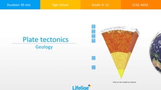
 Plate tectonics Geology Click on the model to interact
  • 2. The topic of plate tectonics is largely based on Alfred Wegner's theory of continental drift, which became accepted with the discovery of seafloor spreading in the Atlantic Ocean, and after fossil, flora, and geological studies in Africa and South America. In this lesson, students will learn about Earth’s structure, differences between various types of tectonic plate boundaries, their outcomes, and their connection to locations of volcanoes and earthquake activity. . • Describe the general distribution of fold mountains, volcanoes, and earthquakes, and explain how this distribution is related to movements at plate boundaries. • Show a basic understanding of plate tectonics, describe the global pattern of plates and their structure, and be aware of plate movements and their effects – constructive (plates moving away from each other), destructive (plates moving towards each other), and conservative (plates sliding past each other). • Demonstrate an understanding of the main features of volcanoes (and their eruptions) and earthquakes. Plate Tectonics, Lithospheric Plates, Boundary, Divergent Boundary, Convergent Boundary, Sea-floor Spreading, Continental Crust, Oceanic Crust, Continental Drift, Pangea, Volcano. Learning objectives Keywords Lesson overview
  • 3. Standards Common Core CCSS.ELA-Literacy SL.9- 10.1 Initiate and participate effectively in a range of collaborative discussions (one-on-one, in groups, and teacher-led) with diverse partners on grade 9-10 topics, texts, and issues, building on others' ideas and expressing their own clearly and persuasively. CCSS.ELA-Literacy SL.11-12.5 Make strategic use of digital media (e.g., textual, graphical, audio, visual, and interactive elements) in presentations to enhance understanding of findings, reasoning, and evidence, and to add interest. NGSS HS-ESS1-5. Evaluate evidence of the past and current movements of continental and oceanic crust and the theory of plate tectonics to explain the ages of crustal rocks. HS-ESS2-1. Develop a model to illustrate how Earth’s internal and surface processes operate at different spatial and temporal scales to form continental and ocean-floor features. MS-ESS2-3. Analyze and interpret data on the distribution of fossils and rocks, continental shapes, and seafloor structures to provide evidence of the past plate motions.
  • 4. 10 min 1. Introduction to Earth Structure Explain to your students the structure of the Earth by highlighting and speaking about different layers on the Lifeliqe model. Open the Lifeliqe app and enter “Earth” or “Structure of the Earth” into the search box. Open the model and highlight the “Earth - V cut” part and its components, including measure, and read the Introduction section: Atmosphere - the layer of gases, commonly known as air, that surrounds the planet Earth and is retained by Earth's gravity. The atmosphere protects life on Earth by absorbing ultraviolet solar radiation, warming the surface through heat retention (the greenhouse effect), and reducing temperature extremes between day and night. Crust - the outermost layer of the earth, 3–44 miles (5–70 km) thick and representing less than 1% of the earth's total volume. Upper Mantle - The upper mantle begins just beneath the crust and ends at the lower mantle. The thickness of the upper mantle is between 200 and 250 miles (320-400 km). The temperature of the mantle near the crust ranges from 900 to 1600 degrees Fahrenheit (480-870 °C). Lower Mantle - The entire mantle is about 1,800 miles (2900 km) thick, which means that the lower mantle makes up the bulk of this part of the Earth. It gets hotter at greater depths. The lower mantle near the core is as hot as 7000 degrees Fahrenheit (3870°C). Fluid Core - The outer core of the Earth is a fluid layer about 1,400 miles (2300 km) thick and composed of iron and nickel. Solid Core - The inner core is Earth's innermost part and according to seismological studies, it has been believed to be primarily a solid ball with a radius of about 1220 kilometers, or 760 miles. It is composed of an iron–nickel alloy and some light elements. The temperature at the inner core boundary is approximately 9800 degrees Fahrenheit (5400 °C). Click on the model to interact
  • 5. 15 min 2. Lithospheric plates Lithospheric plates are regions of Earth's crust and upper mantle that are fractured into plates that move across a deeper plasticine mantle. Earth's crust is fractured into 13 major and approximately 20 total lithospheric plates. Each lithospheric plate is composed of a layer of oceanic crust or continental crust on top of an outer layer of the mantle. Containing both crust and the upper region of the mantle, lithospheric plates are generally considered to be approximately 60 mi (100 km) thick. The dynamics of plate tectonics, driven by deeper thermal processes, stress and cause elastic strain on lithospheric materials. The resulting fractures of rock in the lithosphere cause a release of energy in the form of seismic waves (i.e., an earthquake). • Open the model of Earth in the Lifeliqe app, print out pictures of the surface, and distribute them among students (or just show the major boundaries on the model): Click to open in Lifeliqe
  • 6. • Let the students draw in their copies the major lithospheric plates as shown in the picture here: Map: USGS Description: Scott Nash, Plates tect2 en, marked as public domain, more details on Wikimedia Commons
  • 7. 15 min 3. Oceanic v. continental crust, plate boundaries and volcanoes There are two types of crust, oceanic and continental. Oceanic crust is generally found under the oceans and continental under land. Although plates are usually a combination of oceanic and continental crust, there are some key differences between the two types of crust: The oceanic crust is 3 mi (5 km) to 6 mi (10 km) thick, and is composed primarily of basalt, diabase, and gabbro. The age of the oldest oceanic crust today is only about 200 million years. The continental crust is typically from 20 mi (30 km) to 30 mi (50 km) thick, and is mostly composed of slightly less dense rocks than those of the oceanic crust. The present average age of Earth's continental crust has been estimated to be about 2.0 billion years. The location where two lithospheric plates meet is called a plate boundary. Plate boundaries are commonly associated with geological events such as earthquakes and the creation of topographic features such as mountains, volcanoes, mid-ocean ridges, and oceanic trenches. The majority of the world's active volcanoes occur along plate boundaries, with the Pacific Plate's Ring of Fire being the most active and widely known today. • Explore the model of Earth once more and point out the correlation between locations of active volcanoes (according the USGS) and the location of plate boundaries: USGS, Map plate tectonics world, marked as public domain, more details on Wikimedia Commons
  • 8. 20 min 4. Differences between boundaries In geological terms, there are three types of boundaries between lithospheric plates. At divergent boundaries, lithospheric plates move apart and crust is created. At convergent boundaries, lithospheric plates move together in collision zones where crust is either destroyed by subduction or uplifted to form mountain chains. Lateral movements between lithospheric plates create transform faults at the sites of plate slippage. At each of the unique lithospheric plate boundaries there are specific geophysical forces that are characteristic of the plate dynamics. At transform boundaries, there are shearing forces between the lithospheric plates. At divergent boundaries, tensional forces dominate the interaction between plates. At subduction sites, compression of lithospheric plate material dominates. • Now search for the models in the Lifeliqe app: Divergent (Constructive) Boundary, Convergent (Destructive) Boundary and Faults. • Divide the class into three groups and assign one model to each group to study. Write three main points on the board (direction and type of force, what’s happening to the crust, and the results of the activity) to guide their thinking. Let the students observe the models, use the Internet and the texts in the Introduction section, and make Notes directly in the app. • After approx. 10 minutes, let the students present their findings in groups and explain the differences in forces and results in each type of the boundary:
  • 9. Direction and type of force: - Lateral (horizontal, vertical, at angle) - Shearing force Crust is: created x destroyed x either Result: Graben or horst Strike-slip fault Earthquake Direction and type of force: - Inwards (converge) - Compressing force Crust is: created x destroyed x either Result: one side can be li ed into mountain ranges or volcanoes, the other is usually subducted (oceanic trenches) Direction and type of force: - Outwards (diverge) - Tensional force Crust is: created x destroyed x either Result: Magma can reach the surface and result in for instance seafloor ridge spreading, earthquakes, and tsunamis. Click on any model to interact
  • 10. 10 min 5. Continental drift and convection current theory "Doesn't the east coast of South America fit exactly against the west coast of Africa, as if they had once been joined? This is an idea I'll have to pursue." - Alfred Wegener to his future wife, December, 1910. 225 million years ago all the continents are believed to have been joined together in one supercontinent called Pangaea. Over millions of years, convection currents started moving the continents apart until there were two continents, Laurasia and Gondwanaland. Today the continents have moved even further apart, creating the land masses that we know today. The continents have not stopped moving, so in the future the world will look different again, for example Europe and North America are actually moving apart at up to 10cm a year, while North America and Asia are moving closer together. The tectonic plates are being moved by convection currents found within the mantle of the earth. This is a list of how convection currents work: • Magma (semi-molten rock) near the outer core is heated. • As the magma warms it expands and becomes less dense. • The less dense magma then starts to rise towards the crust. • As the magma nears the crust it begins to cool. • The cooling magma becomes denser and begins to sink. • The rising and falling magma creates circular currents with the mantle. • It is these currents that create friction with the crust above and causes it to move. Find the Rock Cycle scene in the Lifeliqe app and show the students the movements in Earth’s crust supporting the theory of convection currents - mainly Uplift, Melting of Rocks, Subduction of Tectonic Plate, and Transport and Deposition of Sedimentary Rocks: Click on the model to interact
  • 11. 15 min 6. Final exercise supporting the Continental drift theory Evidence for the movement of continents on tectonic plates is now extensive. Similar plant and animal fossils are found around the shores of different continents, suggesting that they were once joined. The fossils of Mesosaurus, a freshwater reptile rather like a small crocodile, which have been found both in Brazil and South Africa, are one example; another is the discovery of fossils of the land reptile Lystrosaurus in rocks of the same age at locations in Africa, India, and Antarctica. Another major piece of evidence for the theory of continental drift is the widespread distribution of glacial sediments in South America, Africa, Madagascar, Arabia, India, Antarctica, and Australia. • Take the printouts of the Earth with marked plate boundaries from the previous exercise and let students cut out the continents: North America, South America, Africa/Madagascar, Europe, Asia and India, Australia, and Antarctica. (Or hand out pieces prepared in advance.) • Mark and describe the fossil depositories found on the continents of Africa and Madagascar, South America, Antarctica, Australia, and the Indian peninsula, and show how they used to be connected in the past by moving the cutouts: Osvaldocangaspadilla, Snider-Pellegrini Wegener fossil map, marked as public domain, more details on Wikimedia Commons
  • 12. Further activities • Watch a video about seafloor spreading from Discovery Education bit.ly/28Ko4QV • Browse through the Paleontology section in the Lifeliqe app, find the mentioned prehistoric animals, and take a selfie with them using the AR function. • Explain plate tectonics on a piece of paper (folding v. tearing).
  • 13. 7. Wrap up of the key findings and discussion Questions for the discussion: • Do you think there are any signs of life in the mantle, outer core, or inner core layers of Earth? Explain your thoughts. • Why do you think the inner core of Earth is solid? • What is the direction of plate motion at a divergent plate boundary? How does the hot material break through the lithosphere? • What happens at a convergent plate boundary? • What types of plates can meet up at convergent boundaries? • Which plate’s crust dived under the other’s crust and why do you think that happened? • Many places around the edge of the Pacific Ocean experience volcanoes and earthquakes. • Why do you think this happens? • How does seafloor spreading fit into the idea that continents move about on Earth’s surface? 10 min
  • 14. Thanks for using Lifeliqe's lesson plan! Excite your students in learning science with 1,000+ more 3D models and lesson plans at online.lifeliqe.com