SlideShare ist ein Scribd-Unternehmen logo
1 von 18
Downloaden Sie, um offline zu lesen
San SamTrans Internship Program “GIS as a PlanningDistrict
    Mateo County Transit Tool”
         Internship Program
     “GIS as a Planning Tool”
               Summer 2009
Talking Point’s


           1.     Goals & Objective
           2.     Scope Of Work
           3.     GIS Tools / Resources
           4.     Maps Developed
           5.     Potential of GIS
Goals & Objective


    1. Improve the usability of GIS within our agency.

    2. Integrate GIS to enhance the planning decisions.

    3. Serve as a stepping stone for Advancement of GIS.
Scope of Work


         Task 1: Setup GIS Database
         1. Acquire up to date Data
         2. Create a data tracking file
         3. Consolidate and sort data
         4. Standardize layer projection for agency
Scope Of Work contin..


     Task 2: Planning Projects
     1. San Mateo County Base Map Template
     2. San Mateo County Transit Network Map
     3. Transportation Authority Measure A Investment
        Projects maps
     4. San Bruno Grade Separation Environmental Analysis
        project
Task 1


         Setup GIS Database
GIS Tools/Resources


     Software:        Data:
      Arc View 9.2    Abundance Of data
      1 License       Outdated, Multiple versions
                       No standard Projection for
                        layers
                       Inconsistent filing of data
GIS Database Advancement:


      1. Acquired up to date Data
            MTC, ABAG & CalAtlas.gov
      2. Created a data tracking file
            Excel tracking file with metadata i.e. source, date & location
            N:Planning2009 Planning InternshipGIS Data Inventory
      3. Consolidated and sort data
            Sorting & Deleting outdated duplicate data.
      4. Standardized Agency layer projection
              NAD 83 UTM Zone 10.
Task 2


         Planning Projects
(1) San Mateo County Base Map Template:


      Contains all standard layers
       needed to begin any county level
       analysis.
      Includes basic features:
            Highway signage
            Cities
            bodies of water etc.
      Consistency for agency maps
(2) San Mateo County Transit Network Map


  • County map with all modes of
  transportation offered by the district.
  i.e. SamTrans, Caltrain, Bus Shuttles
  Future Ferry terminal.
  • Enables for in-dept transportation
  network analysis.
(3) Transportation Authority Measure A Investment Projects Map


            3a. Highway Program
            3b. Caltrain Program
            3c. Grade separation Program
            3d. Dumbarton Rail Corridor Program
(3a)Transportation Authority Measure A Investments


       Measure A highway
      investment broken down by
      modes.
(3b) Caltrain Program


      Depicts Caltrain stations
     which have received
     Measure A funding for
     station improvements.
(3c) Grade Separation Program


   • Grade Separation program
   has been broken down
   between grade separation
   before TA, completed TA
   grade separations & planned
   grade separations.
(3d) Dumbarton Rail Corridor Program
(4) San Bruno Grade Separation Environmental Analysis Project


      Sufficient information could not be attained within agency,
     as well as from consultants to perform a complete analysis.
      Project shortcomings highlighted way we can improve .
Potential of GIS


         • Living Database
         • Interactive Analysis
         • Help conveys information
         • Help makes decisions

Weitere ähnliche Inhalte

Was ist angesagt?

Kansas City Parcels and their Assessed Capital Values
Kansas City Parcels and their Assessed Capital ValuesKansas City Parcels and their Assessed Capital Values
Kansas City Parcels and their Assessed Capital ValuesRyan Walsh
 
GEOcoding and Dynamic segmentation
  GEOcoding  and Dynamic segmentation  GEOcoding  and Dynamic segmentation
GEOcoding and Dynamic segmentationAbhiram Kanigolla
 
GPS to GIS Emergency Mapping
GPS to GIS Emergency MappingGPS to GIS Emergency Mapping
GPS to GIS Emergency Mappingrmikol
 
Project synopsis for East West Gas Pipeline and Effective GIS Implementation
Project synopsis for East West Gas Pipeline and Effective GIS ImplementationProject synopsis for East West Gas Pipeline and Effective GIS Implementation
Project synopsis for East West Gas Pipeline and Effective GIS ImplementationSoumik Chakraborty
 
Linear referencing 2014
Linear referencing 2014Linear referencing 2014
Linear referencing 2014Atiqa khan
 
2002 KCGIS O&M Issue Status Report #4: Status of Original GIS Capital Project...
2002 KCGIS O&M Issue Status Report #4: Status of Original GIS Capital Project...2002 KCGIS O&M Issue Status Report #4: Status of Original GIS Capital Project...
2002 KCGIS O&M Issue Status Report #4: Status of Original GIS Capital Project...Greg Babinski
 
Q-GIS : Geo-referencing and Digitization
Q-GIS : Geo-referencing and DigitizationQ-GIS : Geo-referencing and Digitization
Q-GIS : Geo-referencing and DigitizationLakshya Pandit
 
GIS Based Project Planning and Management
GIS Based Project Planning and ManagementGIS Based Project Planning and Management
GIS Based Project Planning and ManagementSaurabhChobe
 
Poster "Global Soil Information Facilities"
Poster "Global Soil Information Facilities"Poster "Global Soil Information Facilities"
Poster "Global Soil Information Facilities"Tomislav Hengl
 
Integration of GIS Based Survey procedure to update Road Network Geo-Database...
Integration of GIS Based Survey procedure to update Road Network Geo-Database...Integration of GIS Based Survey procedure to update Road Network Geo-Database...
Integration of GIS Based Survey procedure to update Road Network Geo-Database...Soumik Chakraborty
 
Fayetteville Arkansas - Neighborhood Planning Areas
Fayetteville Arkansas - Neighborhood Planning AreasFayetteville Arkansas - Neighborhood Planning Areas
Fayetteville Arkansas - Neighborhood Planning AreasThomas L Brown
 
Download-manuals-ground water-manual-gw-volume5operationmanualgiscreationofd...
 Download-manuals-ground water-manual-gw-volume5operationmanualgiscreationofd... Download-manuals-ground water-manual-gw-volume5operationmanualgiscreationofd...
Download-manuals-ground water-manual-gw-volume5operationmanualgiscreationofd...hydrologywebsite1
 
Theoretical Concepts in GIS Vanessa Quiñones Orfila PSM
Theoretical Concepts in GIS Vanessa Quiñones Orfila PSMTheoretical Concepts in GIS Vanessa Quiñones Orfila PSM
Theoretical Concepts in GIS Vanessa Quiñones Orfila PSMVanessa Quiñones
 
gis project planning and management
gis project planning and managementgis project planning and management
gis project planning and managementAbhiram Kanigolla
 
Working with Routes and Linear Referencing in ArcGIS
Working with Routes and Linear Referencing in ArcGISWorking with Routes and Linear Referencing in ArcGIS
Working with Routes and Linear Referencing in ArcGISJohn Schaeffer
 

Was ist angesagt? (19)

SHAKEEB SHAFIQ Resume
SHAKEEB SHAFIQ ResumeSHAKEEB SHAFIQ Resume
SHAKEEB SHAFIQ Resume
 
Kansas City Parcels and their Assessed Capital Values
Kansas City Parcels and their Assessed Capital ValuesKansas City Parcels and their Assessed Capital Values
Kansas City Parcels and their Assessed Capital Values
 
GEOcoding and Dynamic segmentation
  GEOcoding  and Dynamic segmentation  GEOcoding  and Dynamic segmentation
GEOcoding and Dynamic segmentation
 
GPS to GIS Emergency Mapping
GPS to GIS Emergency MappingGPS to GIS Emergency Mapping
GPS to GIS Emergency Mapping
 
Project synopsis for East West Gas Pipeline and Effective GIS Implementation
Project synopsis for East West Gas Pipeline and Effective GIS ImplementationProject synopsis for East West Gas Pipeline and Effective GIS Implementation
Project synopsis for East West Gas Pipeline and Effective GIS Implementation
 
Linear referencing 2014
Linear referencing 2014Linear referencing 2014
Linear referencing 2014
 
2002 KCGIS O&M Issue Status Report #4: Status of Original GIS Capital Project...
2002 KCGIS O&M Issue Status Report #4: Status of Original GIS Capital Project...2002 KCGIS O&M Issue Status Report #4: Status of Original GIS Capital Project...
2002 KCGIS O&M Issue Status Report #4: Status of Original GIS Capital Project...
 
Carlos M_Resume
Carlos M_ResumeCarlos M_Resume
Carlos M_Resume
 
Q-GIS : Geo-referencing and Digitization
Q-GIS : Geo-referencing and DigitizationQ-GIS : Geo-referencing and Digitization
Q-GIS : Geo-referencing and Digitization
 
GIS Based Project Planning and Management
GIS Based Project Planning and ManagementGIS Based Project Planning and Management
GIS Based Project Planning and Management
 
Poster "Global Soil Information Facilities"
Poster "Global Soil Information Facilities"Poster "Global Soil Information Facilities"
Poster "Global Soil Information Facilities"
 
DGuenaga_Report
DGuenaga_ReportDGuenaga_Report
DGuenaga_Report
 
Integration of GIS Based Survey procedure to update Road Network Geo-Database...
Integration of GIS Based Survey procedure to update Road Network Geo-Database...Integration of GIS Based Survey procedure to update Road Network Geo-Database...
Integration of GIS Based Survey procedure to update Road Network Geo-Database...
 
WVAGP/EPan Annual Meeting Course Descriptions 2011ns
WVAGP/EPan Annual Meeting Course Descriptions 2011nsWVAGP/EPan Annual Meeting Course Descriptions 2011ns
WVAGP/EPan Annual Meeting Course Descriptions 2011ns
 
Fayetteville Arkansas - Neighborhood Planning Areas
Fayetteville Arkansas - Neighborhood Planning AreasFayetteville Arkansas - Neighborhood Planning Areas
Fayetteville Arkansas - Neighborhood Planning Areas
 
Download-manuals-ground water-manual-gw-volume5operationmanualgiscreationofd...
 Download-manuals-ground water-manual-gw-volume5operationmanualgiscreationofd... Download-manuals-ground water-manual-gw-volume5operationmanualgiscreationofd...
Download-manuals-ground water-manual-gw-volume5operationmanualgiscreationofd...
 
Theoretical Concepts in GIS Vanessa Quiñones Orfila PSM
Theoretical Concepts in GIS Vanessa Quiñones Orfila PSMTheoretical Concepts in GIS Vanessa Quiñones Orfila PSM
Theoretical Concepts in GIS Vanessa Quiñones Orfila PSM
 
gis project planning and management
gis project planning and managementgis project planning and management
gis project planning and management
 
Working with Routes and Linear Referencing in ArcGIS
Working with Routes and Linear Referencing in ArcGISWorking with Routes and Linear Referencing in ArcGIS
Working with Routes and Linear Referencing in ArcGIS
 

Andere mochten auch

English Heritage - Asessing the risk of flooding with GIS
English Heritage - Asessing the risk of flooding with GISEnglish Heritage - Asessing the risk of flooding with GIS
English Heritage - Asessing the risk of flooding with GISEsri UK
 
City Owned Property GIS Presentation
City Owned Property GIS PresentationCity Owned Property GIS Presentation
City Owned Property GIS PresentationZoralys Calle, GISP
 
How to become a super realtor
How to become a super realtorHow to become a super realtor
How to become a super realtorSchoolLocatorApp
 
3D Geovisualization Flood Hazard
3D Geovisualization Flood Hazard3D Geovisualization Flood Hazard
3D Geovisualization Flood HazardAlison Chadwick
 
Carlos Feliz, E-waste
Carlos Feliz, E-wasteCarlos Feliz, E-waste
Carlos Feliz, E-wastecarlosfeliz
 
E waste presentation
E waste presentationE waste presentation
E waste presentationJoshsteffen27
 
Multi Layer GIS Platform in Digital India - Mr. Vishnu Chandra
Multi Layer GIS Platform in Digital India - Mr. Vishnu ChandraMulti Layer GIS Platform in Digital India - Mr. Vishnu Chandra
Multi Layer GIS Platform in Digital India - Mr. Vishnu ChandraNeGD Capacity Building
 
Development of a GIS based Chemistry Tool to Predict Produced Water Treatment…
Development of a GIS based Chemistry Tool to Predict Produced Water Treatment…Development of a GIS based Chemistry Tool to Predict Produced Water Treatment…
Development of a GIS based Chemistry Tool to Predict Produced Water Treatment…Ashwin Dhanasekar
 
First Aid, illustrated & simplified
First Aid, illustrated & simplified First Aid, illustrated & simplified
First Aid, illustrated & simplified Kerolus Shehata
 
Gis Applications Presentation
Gis Applications PresentationGis Applications Presentation
Gis Applications PresentationIdua Olunwa
 
Class6 Earth Rotation And Revolution
Class6 Earth Rotation And RevolutionClass6 Earth Rotation And Revolution
Class6 Earth Rotation And RevolutionPratibha Singh
 
GIS presentation
GIS presentationGIS presentation
GIS presentationarniontech
 
File three 4 am great expectations- with atf anf aef competencies
File three 4 am  great expectations- with atf anf aef competenciesFile three 4 am  great expectations- with atf anf aef competencies
File three 4 am great expectations- with atf anf aef competenciesMr Bounab Samir
 

Andere mochten auch (19)

English Heritage - Asessing the risk of flooding with GIS
English Heritage - Asessing the risk of flooding with GISEnglish Heritage - Asessing the risk of flooding with GIS
English Heritage - Asessing the risk of flooding with GIS
 
Pres gter
Pres gterPres gter
Pres gter
 
City Owned Property GIS Presentation
City Owned Property GIS PresentationCity Owned Property GIS Presentation
City Owned Property GIS Presentation
 
How to become a super realtor
How to become a super realtorHow to become a super realtor
How to become a super realtor
 
3D Geovisualization Flood Hazard
3D Geovisualization Flood Hazard3D Geovisualization Flood Hazard
3D Geovisualization Flood Hazard
 
Role of RS & GIS; gis in disaster management prepared by er. bishnu khatri
Role of RS & GIS; gis in disaster management prepared by er. bishnu khatriRole of RS & GIS; gis in disaster management prepared by er. bishnu khatri
Role of RS & GIS; gis in disaster management prepared by er. bishnu khatri
 
Gis presentation
Gis presentationGis presentation
Gis presentation
 
Carlos Feliz, E-waste
Carlos Feliz, E-wasteCarlos Feliz, E-waste
Carlos Feliz, E-waste
 
E waste presentation
E waste presentationE waste presentation
E waste presentation
 
Gishosting ForumPa2016
Gishosting ForumPa2016Gishosting ForumPa2016
Gishosting ForumPa2016
 
Multi Layer GIS Platform in Digital India - Mr. Vishnu Chandra
Multi Layer GIS Platform in Digital India - Mr. Vishnu ChandraMulti Layer GIS Platform in Digital India - Mr. Vishnu Chandra
Multi Layer GIS Platform in Digital India - Mr. Vishnu Chandra
 
Development of a GIS based Chemistry Tool to Predict Produced Water Treatment…
Development of a GIS based Chemistry Tool to Predict Produced Water Treatment…Development of a GIS based Chemistry Tool to Predict Produced Water Treatment…
Development of a GIS based Chemistry Tool to Predict Produced Water Treatment…
 
First Aid, illustrated & simplified
First Aid, illustrated & simplified First Aid, illustrated & simplified
First Aid, illustrated & simplified
 
Gis Applications Presentation
Gis Applications PresentationGis Applications Presentation
Gis Applications Presentation
 
Class6 Earth Rotation And Revolution
Class6 Earth Rotation And RevolutionClass6 Earth Rotation And Revolution
Class6 Earth Rotation And Revolution
 
My ppt on gis
My ppt on gisMy ppt on gis
My ppt on gis
 
GIS presentation
GIS presentationGIS presentation
GIS presentation
 
Chemistry project
Chemistry projectChemistry project
Chemistry project
 
File three 4 am great expectations- with atf anf aef competencies
File three 4 am  great expectations- with atf anf aef competenciesFile three 4 am  great expectations- with atf anf aef competencies
File three 4 am great expectations- with atf anf aef competencies
 

Ähnlich wie GIS_Presentation

Headings - 2008 issue 2
Headings - 2008 issue 2Headings - 2008 issue 2
Headings - 2008 issue 2Headings
 
Confident Data Integration and QC with FME
Confident Data Integration and QC with FMEConfident Data Integration and QC with FME
Confident Data Integration and QC with FMESafe Software
 
Final_Report_GRAM
Final_Report_GRAMFinal_Report_GRAM
Final_Report_GRAMSam Boesch
 
Sridhar S - Resume - Mar-2016
Sridhar S - Resume - Mar-2016Sridhar S - Resume - Mar-2016
Sridhar S - Resume - Mar-2016Sridhar S
 
Jane CHEN Work Sample
Jane CHEN Work SampleJane CHEN Work Sample
Jane CHEN Work SampleJane Chen
 
Max Bolen Resume 12202016
Max Bolen Resume 12202016Max Bolen Resume 12202016
Max Bolen Resume 12202016Max Bolen
 
16. MIS for Project Monitoring and Evaluation
16. MIS for Project Monitoring and Evaluation 16. MIS for Project Monitoring and Evaluation
16. MIS for Project Monitoring and Evaluation ifadseahub
 
Leveraging ArcGIS Platform & CityEngine for GIS based Master Plans
Leveraging ArcGIS Platform & CityEngine for GIS based Master PlansLeveraging ArcGIS Platform & CityEngine for GIS based Master Plans
Leveraging ArcGIS Platform & CityEngine for GIS based Master PlansEsri India
 
Madan Resume Updated
Madan Resume UpdatedMadan Resume Updated
Madan Resume UpdatedMadan Bachhav
 
2010 Gist
2010 Gist2010 Gist
2010 Gistfjudson
 
2010 Usdot Asset Management Presentation
2010 Usdot Asset Management Presentation2010 Usdot Asset Management Presentation
2010 Usdot Asset Management Presentationfjudson
 
Regional Bicycle and Pedestrian Planning Framework
Regional Bicycle and Pedestrian Planning FrameworkRegional Bicycle and Pedestrian Planning Framework
Regional Bicycle and Pedestrian Planning FrameworkRPO America
 
La metro measure r dashboard wp
La metro measure r dashboard wpLa metro measure r dashboard wp
La metro measure r dashboard wpp6academy
 
2015 Annual Report of The Porter County GIS Departmant
2015 Annual Report of The Porter County GIS Departmant2015 Annual Report of The Porter County GIS Departmant
2015 Annual Report of The Porter County GIS DepartmantCharles T. Miller, GISP
 

Ähnlich wie GIS_Presentation (20)

Headings - 2008 issue 2
Headings - 2008 issue 2Headings - 2008 issue 2
Headings - 2008 issue 2
 
Manoj_Jawale_CV
Manoj_Jawale_CVManoj_Jawale_CV
Manoj_Jawale_CV
 
Confident Data Integration and QC with FME
Confident Data Integration and QC with FMEConfident Data Integration and QC with FME
Confident Data Integration and QC with FME
 
Final_Report_GRAM
Final_Report_GRAMFinal_Report_GRAM
Final_Report_GRAM
 
Sridhar S - Resume - Mar-2016
Sridhar S - Resume - Mar-2016Sridhar S - Resume - Mar-2016
Sridhar S - Resume - Mar-2016
 
GIS Presentation.pptx
GIS Presentation.pptxGIS Presentation.pptx
GIS Presentation.pptx
 
Jane CHEN Work Sample
Jane CHEN Work SampleJane CHEN Work Sample
Jane CHEN Work Sample
 
Vivek Resume
Vivek Resume Vivek Resume
Vivek Resume
 
Max Bolen Resume 12202016
Max Bolen Resume 12202016Max Bolen Resume 12202016
Max Bolen Resume 12202016
 
16. MIS for Project Monitoring and Evaluation
16. MIS for Project Monitoring and Evaluation 16. MIS for Project Monitoring and Evaluation
16. MIS for Project Monitoring and Evaluation
 
Ajit Kumar
Ajit Kumar Ajit Kumar
Ajit Kumar
 
Leveraging ArcGIS Platform & CityEngine for GIS based Master Plans
Leveraging ArcGIS Platform & CityEngine for GIS based Master PlansLeveraging ArcGIS Platform & CityEngine for GIS based Master Plans
Leveraging ArcGIS Platform & CityEngine for GIS based Master Plans
 
Madan Resume Updated
Madan Resume UpdatedMadan Resume Updated
Madan Resume Updated
 
2010 Gist
2010 Gist2010 Gist
2010 Gist
 
ESRI Thursday
ESRI ThursdayESRI Thursday
ESRI Thursday
 
2010 Usdot Asset Management Presentation
2010 Usdot Asset Management Presentation2010 Usdot Asset Management Presentation
2010 Usdot Asset Management Presentation
 
Nick_Farrel_Resume
Nick_Farrel_ResumeNick_Farrel_Resume
Nick_Farrel_Resume
 
Regional Bicycle and Pedestrian Planning Framework
Regional Bicycle and Pedestrian Planning FrameworkRegional Bicycle and Pedestrian Planning Framework
Regional Bicycle and Pedestrian Planning Framework
 
La metro measure r dashboard wp
La metro measure r dashboard wpLa metro measure r dashboard wp
La metro measure r dashboard wp
 
2015 Annual Report of The Porter County GIS Departmant
2015 Annual Report of The Porter County GIS Departmant2015 Annual Report of The Porter County GIS Departmant
2015 Annual Report of The Porter County GIS Departmant
 

GIS_Presentation

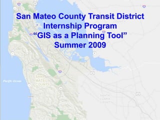
  • 1. San SamTrans Internship Program “GIS as a PlanningDistrict Mateo County Transit Tool” Internship Program “GIS as a Planning Tool” Summer 2009
  • 2. Talking Point’s 1. Goals & Objective 2. Scope Of Work 3. GIS Tools / Resources 4. Maps Developed 5. Potential of GIS
  • 3. Goals & Objective 1. Improve the usability of GIS within our agency. 2. Integrate GIS to enhance the planning decisions. 3. Serve as a stepping stone for Advancement of GIS.
  • 4. Scope of Work Task 1: Setup GIS Database 1. Acquire up to date Data 2. Create a data tracking file 3. Consolidate and sort data 4. Standardize layer projection for agency
  • 5. Scope Of Work contin.. Task 2: Planning Projects 1. San Mateo County Base Map Template 2. San Mateo County Transit Network Map 3. Transportation Authority Measure A Investment Projects maps 4. San Bruno Grade Separation Environmental Analysis project
  • 6. Task 1 Setup GIS Database
  • 7. GIS Tools/Resources Software: Data:  Arc View 9.2  Abundance Of data  1 License  Outdated, Multiple versions  No standard Projection for layers  Inconsistent filing of data
  • 8. GIS Database Advancement: 1. Acquired up to date Data  MTC, ABAG & CalAtlas.gov 2. Created a data tracking file  Excel tracking file with metadata i.e. source, date & location  N:Planning2009 Planning InternshipGIS Data Inventory 3. Consolidated and sort data  Sorting & Deleting outdated duplicate data. 4. Standardized Agency layer projection  NAD 83 UTM Zone 10.
  • 9. Task 2 Planning Projects
  • 10. (1) San Mateo County Base Map Template:  Contains all standard layers needed to begin any county level analysis.  Includes basic features:  Highway signage  Cities  bodies of water etc.  Consistency for agency maps
  • 11. (2) San Mateo County Transit Network Map • County map with all modes of transportation offered by the district. i.e. SamTrans, Caltrain, Bus Shuttles Future Ferry terminal. • Enables for in-dept transportation network analysis.
  • 12. (3) Transportation Authority Measure A Investment Projects Map 3a. Highway Program 3b. Caltrain Program 3c. Grade separation Program 3d. Dumbarton Rail Corridor Program
  • 13. (3a)Transportation Authority Measure A Investments  Measure A highway investment broken down by modes.
  • 14. (3b) Caltrain Program  Depicts Caltrain stations which have received Measure A funding for station improvements.
  • 15. (3c) Grade Separation Program • Grade Separation program has been broken down between grade separation before TA, completed TA grade separations & planned grade separations.
  • 16. (3d) Dumbarton Rail Corridor Program
  • 17. (4) San Bruno Grade Separation Environmental Analysis Project  Sufficient information could not be attained within agency, as well as from consultants to perform a complete analysis.  Project shortcomings highlighted way we can improve .
  • 18. Potential of GIS • Living Database • Interactive Analysis • Help conveys information • Help makes decisions