Hydrographic Surveying - Basic Measurements And Equipments
•Als PPTX, PDF herunterladen•
0 gefällt mir•40 views
HYDROGRAPHIC SURVEYING LECTURE 2: BASIC MEASUREMENTS AND EQUIPMENTS
Melden
Teilen
Melden
Teilen

Empfohlen
Empfohlen
Weitere ähnliche Inhalte
Mehr von Ahmed Nassar
Mehr von Ahmed Nassar (18)
Geodesy - Definition, Types, Uses and Applications
Geodesy - Definition, Types, Uses and Applications
Photogrammetry - Space Resection by Collinearity Equations
Photogrammetry - Space Resection by Collinearity Equations
Geodetic Astronomy - MOTION IN THE HEAVENS - EARTH, SUN AND STARS
Geodetic Astronomy - MOTION IN THE HEAVENS - EARTH, SUN AND STARS
PHOTOGRAMMETRY: GROUND CONTROL FOR AERIAL PHOTOGRAMMETRY نقاط الضبط الأرضي في...
PHOTOGRAMMETRY: GROUND CONTROL FOR AERIAL PHOTOGRAMMETRY نقاط الضبط الأرضي في...
(Research Project) Satellites : Applications in Topography
(Research Project) Satellites : Applications in Topography
Engineering Geology - THE ROCK CYCLE - Lecture Summary
Engineering Geology - THE ROCK CYCLE - Lecture Summary
Engineering Geology - MINERALS ( STONES – SAND) - Lecture Summary
Engineering Geology - MINERALS ( STONES – SAND) - Lecture Summary
Engineering Geology - The structure of the earth - Lecture Summary
Engineering Geology - The structure of the earth - Lecture Summary
Principles of Engineering Geology - Lecture Summary
Principles of Engineering Geology - Lecture Summary
Kürzlich hochgeladen
Model Call Girl Services in Delhi reach out to us at 🔝 9953056974🔝✔️✔️ Our agency presents a selection of young, charming call girls available for bookings at Oyo Hotels. Experience high-class escort services at pocket-friendly rates, with our female escorts exuding both beauty and a delightful personality, ready to meet your desires. Whether it's Housewives, College girls, Russian girls, Muslim girls, or any other preference, we offer a diverse range of options to cater to your tastes. We provide both in- call and out-call services for your convenience. Our in-call location in Delhi ensures cleanliness, hygiene, and 100% safety, while our out-call services offer doorstep delivery for added ease. We value your time and money, hence we kindly request pic collectors, time-passers, and bargain hunters to refrain from contacting us. Our services feature various packages at competitive rates: One shot: ₹2000/in-call, ₹5000/out-call Two shots with one girl: ₹3500 /in-call, ₱6000/out-call Body to body massage with sex: ₱3000/in-call Full night for one person: ₱7000/in-call, ₱10000/out-call Full night for more than 1 person : Contact us at 🔝 9953056974🔝. for details Operating 24/7, we serve various locations in Delhi, including Green Park, Lajpat Nagar, Saket, and Hauz Khas near metro stations. For premium call girl services in Delhi 🔝 9953056974🔝. Thank you for considering us Call Girls in South Ex (delhi) call me [🔝9953056974🔝] escort service 24X7
Call Girls in South Ex (delhi) call me [🔝9953056974🔝] escort service 24X79953056974 Low Rate Call Girls In Saket, Delhi NCR
From customer value engagements to hands-on production support, our Services span across every stage of our customers digital transformation journey, to help ensure that every customer is successful in their adoption of our solutions.
• Implementation, Upgrade, Migration, and Maintenance Services
• On-Premises and On-Cloud
• COTS Training Services; On-Site and Virtual
• Software Support Services; Legacy and 3DEXPERIENCE
• Value Engagement & Blueprinting
• Specialized Consulting and Support Services
• Customized Training Services
• Automation and Configuration Services
• Technical Resource Augmentation Services
• Project Management
• Know-how Training (mentoring) and Resource AugmentationNavigating Complexity: The Role of Trusted Partners and VIAS3D in Dassault Sy...
Navigating Complexity: The Role of Trusted Partners and VIAS3D in Dassault Sy...Arindam Chakraborty, Ph.D., P.E. (CA, TX)
Process of Integration the Laser Scan Data into FEA Model and Level 3 Fitness-for-Service Assessment of Critical Assets in Refinery & Process IndustriesFEA Based Level 3 Assessment of Deformed Tanks with Fluid Induced Loads
FEA Based Level 3 Assessment of Deformed Tanks with Fluid Induced LoadsArindam Chakraborty, Ph.D., P.E. (CA, TX)
Kürzlich hochgeladen (20)
Hazard Identification (HAZID) vs. Hazard and Operability (HAZOP): A Comparati...
Hazard Identification (HAZID) vs. Hazard and Operability (HAZOP): A Comparati...
Cara Menggugurkan Sperma Yang Masuk Rahim Biyar Tidak Hamil
Cara Menggugurkan Sperma Yang Masuk Rahim Biyar Tidak Hamil
Kuwait City MTP kit ((+919101817206)) Buy Abortion Pills Kuwait
Kuwait City MTP kit ((+919101817206)) Buy Abortion Pills Kuwait
scipt v1.pptxcxxxxxxxxxxxxxxxxxxxxxxxxxxxxxxxxxxxxxxxxxxxxxxxxxxxxxxxxxxxxxxx...
scipt v1.pptxcxxxxxxxxxxxxxxxxxxxxxxxxxxxxxxxxxxxxxxxxxxxxxxxxxxxxxxxxxxxxxxx...
Standard vs Custom Battery Packs - Decoding the Power Play
Standard vs Custom Battery Packs - Decoding the Power Play
Learn the concepts of Thermodynamics on Magic Marks
Learn the concepts of Thermodynamics on Magic Marks
Call Girls in South Ex (delhi) call me [🔝9953056974🔝] escort service 24X7
Call Girls in South Ex (delhi) call me [🔝9953056974🔝] escort service 24X7
Navigating Complexity: The Role of Trusted Partners and VIAS3D in Dassault Sy...
Navigating Complexity: The Role of Trusted Partners and VIAS3D in Dassault Sy...
DC MACHINE-Motoring and generation, Armature circuit equation
DC MACHINE-Motoring and generation, Armature circuit equation
FEA Based Level 3 Assessment of Deformed Tanks with Fluid Induced Loads
FEA Based Level 3 Assessment of Deformed Tanks with Fluid Induced Loads
Hydrographic Surveying - Basic Measurements And Equipments
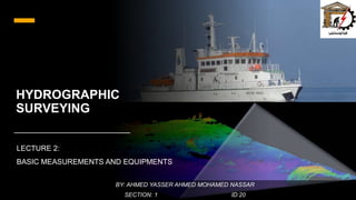
- 1. HYDROGRAPHIC SURVEYING LECTURE 2: BASIC MEASUREMENTS AND EQUIPMENTS BY: AHMED YASSER AHMED MOHAMED NASSAR SECTION: 1 ID:20
- 2. HYDROGRAPHIC SURVEYING MAJOR COMPONENTS Marine Vessel Small Scale Medium Scale Regional Scale Positioning Instrument Depth Measurement (sounding) Instrument
- 3. 1 - Marine Vessel Surveys Small Scale Medium Scale Regional Scale Vessel • Oars • Life Jackets • Gas Tanks • Extra Oil • 10 HP Engine • 25-65 ft. vessel • licensed operator • 65 ft. and larger research vessel • with competent crew and equipment Depth and Position • 50’ leadline • Range poles • Plans • Total station • Prism pole with extension rods • fathometer and transducer (for deep water) • Echo sounder • tool box • Transducers • GPS or TSI • motion reference units (MRU). • Multi-beam transducer • GPS Miscellaneous (Others) • Radio • 300 ft. tape • Navigation Chart • Staff sheets • 2 Batteries • Repair kits • Tool box • A small vessel for the near-shore shallow water survey system • Cameras for stereo imaging • Integrated multi-disciplinary data collection systems • requires accurate in-ship surveys for sensor integration, calibration, and synchronization.
- 4. Different Sizes of Vessels Small vessel Medium Vessel Large research vessel
- 5. Comparison Between Lead-line and Range Pole Ranging
- 7. 2 – Positioning Instrument • Modern methods • Land-based electronic ranging • Space-based positioning Basic positioning method is Resection. Positioning method is changing with the change in project specifications and site conditions Preferred method for positioning offshore surveys is GPS • Traditional instruments • Sextant • Transit • Stadia • EDM
- 9. 3 – Depth Sounding Instrument 1. Transducer send a sonic pulse to sea floor. 2. Sonic pulse (sound wave) propagates, hits the sea floor and starts to reflect. 3. Receiver detect the returned pulses (waves) Note that the pulse take the distance forth-and- back, so with known the time of the pulse and the sound speed we can calculate the Depth by the relation: 2 ∗ 𝐷𝑒𝑝𝑡ℎ = 𝑡𝑖𝑚𝑒 ∗ 𝑠𝑝𝑒𝑒𝑑
- 10. 3 – Depth Sounding Instrument Single beam echo-sounder Multi beam echo-sounder
- 11. THANKS