SlideShare ist ein Scribd-Unternehmen logo
1 von 72
Downloaden Sie, um offline zu lesen
ATLAS Major North-West European 
freight infrastructures 
Weastflows project - Action 1 - Deliverable 1 - June 2013
Executive summary 
1. Weastflows: partners localisation 
2. Weastflows: observers localisation 
Methodological notes 
A. To understand the atlas: cartography, map features and map scales 
B. To understand the atlas: statistic and map types 
C. To understand the atlas: the choice of cities representation for the base map 
D. To understand the european specificity: NUTS and TEN-T NETWORK 
E. To understand the atlas: interpolation methodology 
Maps and Technical notes 
 North-West Europe, contextual maps 
3. Urban geography 
4. Gross Domestic Product (GDP) per inhabitant 
5. Degree of population density 
6. Degree of surface dedicated to industry and transport 
7. Modal split of freight transport by inland waterways, rail and road in 2010 
8. Distribution of maritime transport by major type of navigation in 2010 
9. Main coastline and maritime freight traffic in 2010 by NUTS 2 
10. Total maritime freight traffic by port in 2010 
11. Container traffic by main port in 2010 
12. Maritime freight traffic by type of merchandises in 2011 
 North-West Europe, infrastructure maps 
13. Seaport and inland port 
14. Port infrastructure and TEN-T CORE Port 
15. Channel depths in seaport 
16. Road network infrastructure 
17. TEN-T road network 
18. Main freight ferry lines (RoRo) 
19. Level of navigability of inland waterways 
20. Inland waterways TEN-T network 
21. Railway nodes terminal 
22. Railway network infrastructure 
23. Level of electrification of railway network 
24. TEN-T railway network 
25. Freight airport 
26. Freight airport and TENT-T CORE airport 
27. Freight airport traffic in 2011 
28. TEN-T network 
 North-West Europe, network and intermodal platform 
projects maps 
29. Overview on main nodes projects 
30. Overview on main projects for road network 
31. Overview on main projects for inland waterways 
32. Overview on main projects for railway network 
33. Specific railway project 
 Partner areas of interest, infrastructure and network maps 
34. Areas of interest per partners 
35. Ireland: Network and intermodal platform 
36. Ireland: Network and intermodal platform projects 
37. Scotland: Network and intermodal platform 
38. Scotland: Network and intermodal platform projects 
39. Liverpool and West Coast: Network and intermodal platform 
40. Liverpool and West Coast: Network and intermodal platform projects 
41. South of England: Network and intermodal platform 
42. South of England: Network and intermodal platform projects 
43. Range Nord: Network and intermodal platform 
44. Range Nord: Network and intermodal platform projects 
45. East of France and South Germany: Network and intermodal platform 
46. East of France and South Germany: Network and intermodal platform projects 
47. Northern France: Network and intermodal platform 
48. Northern France: Network and intermodal platform projects 
49. Seine Gateway®: Network and intermodal platform 
50. Seine Gateway®: Network and intermodal platform projects 
CONTENT
The European Weastflows project (INTERREG IVB program for North-West Europe) scheduled 
to run for four years (2011 - 2014) is designed to improve freight transport and the associated 
logistics in North-West Europe and to ease the congestion in the ports on the Northern Range 
and on the traditional North-South sea routes by: 
• encouraging a modal shift from the use of road transport to more sustainable modes (rail, 
short sea and river transport); 
• promoting the flow of goods on a West-East axis. 
Jointly led by the Transport & Logistics Regional Centre for Innovation and Technology 
Transfer (CRITT) in Le Havre and the Institute for Sustainability in London, the project 
involves 22 european partners, including the Town Planning Agency of Le Havre and Seine 
Estuary Area (AURH) and thirty observers. The project covers seven countries: Germany, 
Belgium, France, Ireland, Luxembourg, the Netherlands and the United Kingdom. 
As the leader of the action «Assessment of sustainable transport capacity», AURH is 
responsible for mapping and analysing the transport infrastructures for North-West Europe, by: 
• constructing the geographic database identifying and describing the transport infrastructure; 
• analysing the organisation of the infrastructure network; 
• identifying the blocking points on existing corridors that prevent the development of freight 
transport; 
• identifying the infrastructure projects and corridors or alternative routes to be developed 
in order to improve the movement of goods on a West-East axis. 
This document is the result of close cooperation between the european partners of Weastflows 
project. It is the first deliverable of AURH. 
The atlas, presents an inventory of the existing or projected transportation infrastructures in 
North-West Europe (covering all types of infrastructure and all types of goods), thereby giving 
an initial overview of the organisation of the transport system for goods in North-West Europe. 
It provides, first of all, background maps on the scale of North-West Europe outlining the key 
demographic and economic characteristics of the region, and an initial description of the port 
flows involved. 
This contextual approach is then complemented by a selection of maps showing the 
infrastructures for each mode of transport and the associated development projects. 
Finally, the regional maps complete the atlas by focusing on the organisation of transport 
networks in the areas of interest of each partner. 
The document is closely linked to the Geographic Information System (GIS) built by the AURH 
team for the Weastflows project. The maps are based on dynamic data that will be updated 
and enriched through to the end of the project. The atlas is by nature scalable. Thanks to 
this system and the involvement of the partners, the latter will be able to share the same data 
repository, thus providing a common working basis for the entire project. 
A dynamic version of the atlas is available through the GeoWeastflows interactive mapping 
tool developed by the Henri Tudor Public Research Centre (a Weastflows partner) in 
conjunction with AURH. Initially limited to the Weastflows partnership, GeoWeastflows will 
be made available to the public in November 2013 for consultation at the following address: 
http://geo.weastflows.eu 
In addition, the atlas will provide the starting point for discussions about the creation of 
a West-East corridor for the transport of goods in Europe. AURH will publish three other 
deliverables by 2014: an analysis showing the characteristics of the transport system, an 
analysis with identification of the congestion or blocking points constituting an obstacle to the 
development of sustainable freight transport, and a forward-looking analysis of the regional 
recommendations designed to optimise the flow of goods and encourage the modal shift. 
EXECUTIVE SUMMARY
Irish Exporters Association 
^_ Partner 
1 
Atlas of major North-West European freight infrastructures - June 2013 
Institute For sustainability 
CRITT TL 
CQM 
Peterhead 
Grimsby 
LSN 
CTS 
BOM 
AURH 
VRRN 
MWRA 
IDIT 
LOOM 
Karlsruhe 
TUDOR 
BBZOB 
TTPNF 
Mobycon 
InforIT 
Kirkwall 
SEStran 
USTL-LAGIS 
Intermodality 
University Duisburg-Essen 
Portsmouth Commercial Port 
Paris 
London 
Londonderry/Derry 
Dublin 
Antwerpen Düsseldorf 
Brussel 
Köln 
Luxembourg 
Metz 
Cork 
Mainz 
Rouen 
Lille 
Nancy 
Leeds 
Larne 
Goole 
Dover 
Perth 
Liège 
Namur 
Essen 
Nantes 
Calais 
Dieppe 
Barnet 
Ipswich 
Glasgow 
Belfast 
Cardiff Bristol 
Harwich 
Croydon 
Mannheim Nürnberg 
Duisburg 
Le Havre 
Limerick 
Bradford 
Aberdeen 
Stuttgart 
Edinburgh 
Sheffield 
Waterford 
Fleetwood 
Tynemouth 
Liverpool 
Charleroi 
Hartlepool 
Birmingham 
Portsmouth 
Felixstowe 
Manchester 
Rosslare Harbour 
Port Talbot 
Saint-Nazaire 
Cherbourg-Octeville 
$ 0 25 50 100 
Km 
Weastflows: partners localisation 
Data source powered by AURH 
Boudaries ©MBR and EuroGeographics,©ESRI 
Map data ©OpenStreetMap contributors, ODbl 
®AURH -2013/02 
Legend 
Coments 
Weastflows: partners localisation 
Project partners are the organisations responsible for carrying out specific activities within the project in the manner and scope indicated in the Application Form and/or Partnership agreement. They can either be 
national, regional and local authorities including sector departments and related public agencies, transational bodies, universities, research and development agencies and non-profit organisations. They report to the 
Joint Managment Team (JMT).
Tongji University (Shanghai) 
Cobelfret/CLdN 
Atlas of major North-West European freight infrastructures - June 2013 
Essex County Council 
Weastflows: observers localisation 
Irish National Transport Authority 
Peterhead 
Shannon Airport Authority Zeebrugge Port 
Imperial College London 
Logica 
Novalog 
Dinalog 
Cluster4L 
NSL-IRISS 
Lille Port 
Rouen Port 
Mertert Port 
Wilson James 
Astrium Space 
Oostende Port 
Le Havre Port 
/Dublin Airport 
Lafarge Cement 
CFL Multimodal 
KLOK Stuttgart 
Bruxelles Port 
Rosslare Europort 
Moselle Commission 
Shannon Foynes Port 
Le Havre Development 
Logistics in Wallonia 
Ports Normands Associés 
Kimberly-Clark 
Gravesham Council 
Upper-Normandy 
Region 
Freight Quality Partnership 
Paris 
Dublin 
Antwerpen Düsseldorf 
Brussel 
Amsterdam 
Köln 
Metz 
Cork 
Gent 
Essen 
Mainz 
Brest 
Nancy 
Leeds 
Larne 
Goole 
Dover 
Perth 
Liège 
Bochum 
Manchester 
Nantes 
Calais 
Dieppe 
Galway 
Lorient 
Ipswich 
Glasgow 
Belfast 
Cardiff Bristol 
Harwich 
Grimsby 
Mannheim Nürnberg 
Duisburg 
Plymouth 
Kirkwall 
Bradford 
Aberdeen 
Den Haag 
Karlsruhe 
Edinburgh 
Sheffield 
Waterford 
Fleetwood 
Tynemouth 
Lancaster 
Liverpool 
Rotterdam 
Charleroi 
Strasbourg 
Saint-Malo 
Hartlepool 
Birmingham 
Port Talbot 
Saint-Nazaire 
Londonderry/Derry 
Cherbourg-Octeville 
^_ Observers 
Data source powered by AURH 
Boudaries ©MBR and EuroGeographics,©ESRI 
Map data ©OpenStreetMap contributors, ODbl 
®AURH -2013/02 
Km 
0 25 50 100 
^_ 
Copyright: ©2013 Esri, DeLorme, 
NAVTEQ 
2 
Legend 
Coments 
Weastflows: observers localisation 
Observers are organisations that may have an advisory capacity in the project. They are not considered as «formal» partners and should not be listed as such in the Application Form. 
Observers are selected on the basis of their ability to provide strategic guidance as and when appropriate and to promote the project through their own networks.
Methodological 
notes
To understand the atlas: cartography, map features and map scales 
A 
European scale 
This scale is used to make contextual 
maps with global european data at 
national level. 
Atlas of major North-West European freight infrastructures - June 2013 
North-West european scale 
The North-West european scale deals with the Weastflow’s project area. It is 
the reference scale for the data collection. These data are formated on the GIS 
database. 
Regional scale 
This scale is used to make maps about the different areas of interest 
for each partner. 
A map Map features 
f«eAa tumraeps oisr cah asryamctbeorliissteicds ,i mreasguelt inogf fgreoomg rtahpeh cicre raetiavleit ye, ffroerptsr eosfe cnatirntogg rsaeplehcetresd, and designed for use when spatial relationships are special relevance .» 
(Michael Wood, 1993). 
Base map elements 
A base map provides the background 
reference informations such as boundaries, 
coastline, water, on which other thematic 
information will be placed. 
North-West Europe Area 
Other european country 
Country boundary 
NUTS 2 boundary 
NUTS 3 boundary 
Coastline 
Color code 
To have a graphic consistency in the whole 
atlas, we used a color code for each type of 
infrastructure. 
Road sector 
Ferry sector 
Maritime sector 
Railway sector 
River sector 
TEN-T data 
Main Infrastructures features 
For each type of transport infrastructure, 
we choose one specific element. The nodal 
infrastructure is represented by a ponctual 
element and the network infrastructure is 
represented by a linear element. 
 Airport 
▲ Inland port 
 Seaport 
 Railway station 
Main transport network 
Other transport network 
Three scales
Type of statistic data Type of map corresponding 
Atlas of major North-West European freight infrastructures - June 2013 
B 
Graduated color maps 
These types of maps utilize a color 
progression from clear to dark in order to 
visualize easily the evolution of a relative 
statistic data in a geographic area. 
Interpolation maps 
In terms of colour progression, it is the 
same process as the graduated colour 
maps but the interpolation maps provide 
continuous data without boundary 
effect. 
Please refer to the methodological notes 
about interpolation (methodological 
notes, part E). 
Distributive maps 
Distributive maps show geographic 
information without making a hierarchy 
between the different elements. 
Graduated symbol maps 
Graduated symbol maps use a size 
variation of an object in order to 
highlight statistic raw data. 
Infrastructure maps 
Infrastructure maps provide an overview 
of different features of transport 
collected for the Weastflows project. 
To understand the atlas: statistic and map types 
Statistic and data 
cAacrctoorgdrianpgh itco rdeipffreerseennt tatytipoenss ohfa vseta ttios tbice duastead, .various Bmaasinic atyllpye, sw oef sctoautilsdt icmsa: kteh ea q duiasntitnitcattiiovne bdeattwa eaennd ttwheo qualitative data. 
Quantitative data 
Quantitative data correspond to 
numerical variable.To make a map, 
the distinction between the different 
type of quantitative data leads 
to the use of different graphical 
representations. 
We can distinguish two types of 
quantitative data: the raw data and 
the comparative data. 
Raw data 
The raw data correspond to elementary data 
which have not been processed. They are 
expressed in numbers. 
Comparative data 
The comparative data highlight a comparison 
between a specific unit and the entire group to 
which it corresponds. It is a ration like a density 
or a percentage. 
Graduated color maps 
Interpolation maps 
Gratuated symbol maps 
Qualitative data Qualitative data correspond to 
unquantificable data, like category 
and characteristic. 
Distributive maps 
Infrastructure maps 
Main map types
To understand the atlas: the choice of cities representation for the base map 
C 
Label on the map Methodology for the selection 
FNoorr tthh-eW beasste E muraopp,e w teo dderacwid eadn too vdeorv aie swe loefc tthioen uorfb tahne gmeoosgtr aimphpyo rotaf ntth icsi tiaerse ain. 
Here we have the explanation of this selection. 
Atlas of major North-West European freight infrastructures - June 2013 
I*d eAnctcifoicradtiniogn toof tehuer ovpaeriaonu sc aspcaitalel coift iethse maps, we decided to select all the european capital cities beyond the boundaries of North-West european area. 
I*d eAnctcifoicrdaitniogn too ft hoeth secr acleit ieosf the map, we decided to select all the most important cities just for North-West european area. For tthhee tehnrteiree ccoouunntrtrieys. which are split by the North-West european boundaries France, Germany and Netherland, we considered 
I*d eWneti fiscealteiocnte do f c«owunotrrlides c iwtiieths »more than one million inhabitants. 
I*d eWneti fiscealteiocnte do f c«omunatirnie sc itwieitsh» a population between 350 000 and 1 million inhabitants. 
I*d eWneti fimcaatkioen ao fr e«laptoiornt schitipie sb»etween the city and the port traffic in order to identify the main port cities. * We lack of traffic data for inland port. Consequently, we try to select the most important cities which have an inland port. 
Results and representation 
Results: 
Nuwmhboesre o f c2iti0e sa rine t«hcea pdiatatal»b;ase: 119 264 a raer e« w«moraldin c citiiteiess»»;; 69 are «port cities». 
Representation: 
The layer of city will be present on different maps as a layer of basic information. 
tChoen osenqeu heanntldy, waen dd eocni dtehde, oothne trh hea mnda pth, eto o tdhisetri ncgituieissh. the european capitals on 
tThhee s«awmoer ldg rocuitipe.s», the «main cities» and the «port cities» are put together in
To understand the european specificity: NUTS and TEN-T network 
What is a NUTS? Level of NUTS 
TUhneit sa fcorro nSytmat isNtiUcsT.S means Nomenclature of Territorial 
iTsh et oa imha voef thais snionmglee nctelartruitroer ia(el sdtaivbilsisiohne d obf y EEuurroopsetaatn) tWerirthit otrhyis inco mormdeorn tsoy sbtueimld, Ea ucroosmtamt ocna ns ctaotlilsetcict, sdyesvteelmop. and harmonize european data. 
eTuhreorpee aanre s ttahtree e(w hhiiechra rccahnic aclo nlesivdeelsre do fl eNveUl TNSU. TESa c0h) iEsa scuhb dNivUidTiSn g1 inis a snuubmdibveidre odf irnetgoi ornesg iaotn sN UaTt SN 1U TleSv e2l. lleevveell,. themselves subdivided into regions at NUTS 3 
nTeoe dcso mtpoa reb et heh ormegoigoennael osutsa tisinti cst,e rmthse NofU TsSiz er egainodn epsoppeuclaiatilolyn . baCseodn seoqnu ethnetl ya, dmthinei stNraUtivTeS undietsfi noitfio ne acihs member state and according to population thresholds. 
gTuhaer agnetoeger aap hstya boifli tyN UoTf Sst arteisgtiiocn d aetvao,l vtehse rere gisu laa rplye. riTood oFfo rc Wonesaoslitdflaotwiosn porof jetchtr,e ew ey ewaorrsk wwiitthho tuhte aNnUy TcSh a2n0g0e6. nomenclature. 
Country / NUTS 0 The basic national boundary NUTS 1 Major socio-economic regions 
BPeotpwueleant i3o nm billyio nNsU aTnSd: 7 millions 
uCnoirtrse:sponding administrative TBheelg i«ugme.w esten/régions» in «TSheco t«lalänndd, eWr»a liens ,G Neromrtahneyrn. IRreelgainodn»s aonf dE n«gGlaonvde»rn min eUnnt iOtefdfi-ce Kingdom. 
NUTS 2 rBeagsioicn arel gpioonlicsi efosr the application of 
BPeotpwueleant i8o0n0 b 0y 0N0U aTnSd: 3 millions 
uCnoirtrse:sponding administrative TBheelg i u«mp.rovincies/provinces» in TGheerm «arengy.ierungsbezirke» in TThhee ««rreéggiioonnss»» iinn IFrlraanndc.e. The «provincies» in Netherlands. 
NUTS 3 dSimaganllo rseegsions for specific 
BPeotpwueleant i5o0n 0b0y0 N aUnTdS 8:00 000 
uCnoirtrse:sponding administrative TBheelg i«uamrr.ondissements» in TGheerm «aknreyi.se/kreisfreie städte» in TThhee ««rdeégpiaorntaelm aeuntthso»r itiny rFergainocnes.» in Irland. 
What is TEN-T? The TEN-T Network 
TNheetw aocrrko.nym TEN-T means Trans-European Transport 
TAhgee ncTyr a(TnEs-NE-uTr oEpAe)a nw asT rcarenaspteodr t in N2e0t0w6o rtko imExpelecmuteivnet aEnudro pmeaanna Cgoem tmheis sTioEnN in- To rdperor gtora imm proonv eb tehhea elff fiocfie nthcey and the accessibility of european transport network. 
tEhsatta bal isshoicniagl aonn ee,f fticoi eanllto Twr aanns -eEffiucrioepnet acnir cTurlaantisopno ortf Ngoeotwdosr ka n(dT EpNe-oTp)le i sb eat wkeeey ne lmememenbtesr osft aetuerso paenadn t os terantseugrye, ibnotethrn fartoiomn aaln c oenconneoctmioinc sp, obinyt bouf ilvdiienwg missing links and removing bottlenecks. To achieve this objective the European Commission identified a strategic network that focuses investments. 
In this contexte, there is two level of network designed by TEN-T as priority axes of investments: 
-the «CORE network» is the most strategic axes and strategic nodes for improving the trans-european network. It has to be completed by 2030; 
-ntehtew o«rCk owmilpl rbeeh ecnosmivpele nteedtw boyr k2»0 c5o0m. plete the CORE Network to ensure a high level of accessibility of all european regions. The comprehensive 
Atlas of major North-West European freight infrastructures - June 2013 
D
To understand the atlas: interpolation methodology 
E 
From classical boundaries display ... to a continuous phenomena 
Classical boudaries display (here by NUTS3) Cartographic interpolation 
The interpolation: step by step 
As the map shows, the data are 
traditionally represented in the limit of 
administrative boundaries. In the case 
of density, the reference area is NUTS 
3 region. 
To make a map with interpolation, 
the first step is to report the data to 
the center point of the administrative 
surface. Here the data are reported on 
the center of each NUTS 3 region. 
Atlas of major North-West European freight infrastructures - June 2013 
North West Europe area: degree of population density 
Londonderry/Derry 
Density of population 
number of inhabitant per square kilometers 
For every cell, there is a specific calcul 
which evaluates the value of neighbour 
points based on their distance. 
This calculation takes into account the 
continuous information and the maritime 
discontinuity of the maritime area. 
From classical boundaries display ... 
... to a continuous phenomena 
One data, 
two graphic representations 
A grid is applied on the map. The 
cell resolution (1 square kilometer 
here) allows to have a finer graphic 
representation of the data. The smaller 
the grid, the better the cartographic 
results. 
Wien 
Praha 
Paris 
Zagreb 
Berlin 
Peterhead 
Grimsby 
London 
Essen 
Bremen 
Rostock 
Leipzig 
Karlsruhe 
Antwerpen Düsseldorf 
The result is the dispatching of data 
in the territory according to distance of 
each value from each other. 
Dublin 
Brussel 
Stockholm 
Kobenhavn 
Ljubljana 
Amsterdam 
Bratislava 
Luxembourg 
Kiel 
Köln 
Metz 
Lyon 
Caen 
Cork 
Gent 
Essen 
Mainz 
Rouen 
Lille 
Brest 
Nancy 
Leeds 
Larne 
Goole 
Dover 
Perth 
Liège 
Namur 
Zürich 
Bochum 
Bournemouth 
Nantes 
Calais 
Dieppe 
Barnet 
Galway 
Brugge 
Hamburg 
München 
Dresden 
Lorient 
Ipswich 
Glasgow 
Belfast 
Cardiff Bristol Harwich 
Newport 
Croydon 
Hannover 
Mannheim Nürnberg 
Duisburg 
Le Havre 
Plymouth 
Kirkwall 
Limerick 
Bradford 
Aberdeen 
Den Haag 
Oostende 
Stuttgart 
Dunkerque 
Edinburgh 
Sheffield 
Waterford 
Fleetwood 
Tynemouth 
Liverpool 
Rotterdam 
Charleroi 
Strasbourg 
Saint-Malo 
Hartlepool 
Birmingham 
Portsmouth 
Felixstowe 
Manchester 
Brunsbüttel 
Bremerhaven 
La Rochelle 
Port Talbot 
Wilhelmshaven 
Saint-Nazaire 
Rosslare Harbour 
Cherbourg-Octeville 
$ 0 50 100 200 
Km 
2 - 36 
37 - 140 
141 - 243 
244 - 485 
486 - 1 484 
1 485 - 5 000 
5 001 - 8 791 
Data source ©CorineLandCover2006; ©Eurostat 
Boudaries ©MBR and EuroGeographics,©ESRI 
Map data © OpenStreetMap contributors, ODbl 
®AURH -2013/02 
Step 1 From surface to point Step 2 The grid Step 3 The calculation Step 4 The result
Maps 
and Technical notes
North-West Europe 
 Contextual Maps
DDeennmmaarr kk 
Atlas of major North-West European freight infrastructures - June 2013 
North West Europe area: urban geography 
Newcastle upon Tyne 
Norwich 
Swansea Haarlem 
EEnn gg ll ii ss hh CChh aa nn nn ee ll 
NNoo rr tt hh SS ee aa 
AA tt ll aa nn tt ii cc OOcc ee aa nn 
FFrraann ccee 
SSwweeddeenn 
II ttaallyy 
NNoorrwwaayy 
GGeerrmmaannyy 
UUnnii tteedd KKiinnggdd oomm 
AAuuss tt rr iiaa 
II rree llaanndd 
BBeell ggiiuumm 
CCzzee cchh RReeppuubbll SSwwii tt zz eerr llaanndd 
NNeetthh eerr llaannddss 
SSll oovveennii aa 
LLuuxxeemmbboouurrgg 
LLiieecchh tteennss ttee iinn 
Köln 
Paris 
London 
Brussel 
Birmingham 
Essen 
Leeds 
Dublin 
Glasgow 
Nürnberg 
Den Haag 
Stuttgart 
Liverpool 
Amsterdam 
Frankfurt am Main 
Gent Neuss 
Mainz 
Lille 
Dijon 
Reims 
Derby 
Liège 
Kassel 
Angers 
Rennes 
Nantes 
Oxford 
Münster 
Belfast 
Bristol 
Cardiff 
Augsburg 
Mannheim 
Le Havre 
Plymouth 
Coventry 
Aberdeen 
Karlsruhe 
Charleroi 
Strasbourg 
Sunderland 
Portsmouth 
Saarbrücken 
Southampton 
Freiburg im Breisgau 
Metz 
Caen 
Cork 
Rouen 
Tours 
Brest 
Nancy 
Amiens 
Galway 
Armagh 
Dundee 
Le Mans 
Orléans 
Lincoln 
Preston 
Mulhouse 
Besançon 
Limerick 
Dunkerque 
Cambridge 
Luxembourg 
Peterborough 
Number of inhabitant by main city 
45 038 - 145 000 
145 001 - 450 000 
450 001 - 1 000 000 
over 1 million 
Data source ©UK National Statistics; ©INSEE; ©STATEC; 
©Direction Generale Institutions et Population (BE); 
©United Nations Population Division; ©Eurostat 
Boudaries ©MBR and EuroGeographics,©ESRI 
Map data ©OpenStreetMap contributors, ODbl 
®AURH -2013/02 
$ 0 50 100 200 
Km 
3 
Legend 
Coments 
North-West Europe area: urban geography 
The aim of this map is to have a first overview of 
the urban geography of North-West Europe area, 
more precise than the cities choice for the base map 
(methodological notes, part C). 
By locating the area of major or minor population, 
we can have a first idea of the most important areas 
where consumation, employment and production 
have a major or a minor importance. 
Firstly, we decided to select the cities which have a 
population over 45 000 inhabitants in order to avoid 
overloading the map. In the database we have 
retained 178 cities in North-West Europe. 
According to the distribution of the data, they are 
split into four classes.The first class represents the 
smallest cities of our area of interest in terms of 
population: from 45 000 inhabitants up to 145 000. 
There are 78 cities in this case. The second class 
groups 76 cities whose populations are split between 
145 000 and 450 000 inhabitants. There are 19 cities 
in the third class between 450 000 and 1 million 
inhabitants. 
Finally, the most important cities in this database are 
in the fourth class whose exceed 1 million inhabiants. 
There are five cities over 1 million: Birmingham, 
London, Paris, Brussel, Koln.
North West Europe area: Gross Domestic Product (GDP) per inhabitant 
Gross Domestic Product per inhabitant 
in purchasing power standard by NUTS 2 level 
4 
Atlas of major North-West European freight infrastructures - June 2013 
Antwerpen Düsseldorf 
" 
! 
! 
! 
" 
! ! 
! 
Essen 
! 
! 
! 
" 
! 
! 
! 
! 
Peterhead 
! 
Grimsby 
! 
! 
! 
! 
! 
! 
! 
! 
! 
! 
! 
! 
! 
! 
! 
Londonderry/Derry 
! 
! 
! ! 
! 
! 
! 
! 
! ! 
" 
! 
! 
! 
! 
" 
Bournemouth 
! 
! 
! 
! 
! ! 
! 
! 
! 
! 
! 
! 
! 
! ! 
! 
! 
! 
! 
! 
" 
! 
! 
! 
! 
! 
! 
! 
! 
! 
! 
! 
! 
! 
" 
! 
! 
! 
! 
! 
! 
! 
Bremen 
Karlsruhe 
! 
Rostock 
! 
! 
! 
! 
! 
! 
! 
! ! 
! 
! 
" 
" 
" 
Praha 
Paris 
Berlin 
London 
Dublin 
Brussel 
Kobenhavn 
Ljubljana 
Amsterdam 
Luxembourg 
Kiel 
Köln 
Metz 
Lyon 
Caen 
Cork 
Gent 
Essen 
Mainz 
Rouen 
Lille 
Brest 
Nancy 
Leeds 
Larne 
Goole 
Dover 
Perth 
Liège 
Namur 
Zürich 
Bochum 
Nantes 
Calais 
Dieppe 
Barnet 
Galway 
Brugge 
Hamburg 
Leipzig 
München 
Dresden 
Lorient 
Ipswich 
Glasgow 
Belfast 
Cardiff Bristol Harwich 
Newport 
Croydon 
Hannover 
Mannheim Nürnberg 
Duisburg 
Le Havre 
Plymouth 
Kirkwall 
Limerick 
Bradford 
Aberdeen 
Den Haag 
Oostende 
Stuttgart 
Dunkerque 
Edinburgh 
Sheffield 
Waterford 
Fleetwood 
Tynemouth 
Liverpool 
Rotterdam 
Charleroi 
Strasbourg 
Saint-Malo 
Hartlepool 
Birmingham 
Portsmouth 
Felixstowe 
Manchester 
Brunsbüttel 
Bremerhaven 
La Rochelle 
Port Talbot 
Wilhelmshaven 
Saint-Nazaire 
Rosslare Harbour 
Cherbourg-Octeville 
$ 0 50 100 200 
Km 
6 400 - 14 200 
14 201 - 22 000 
22 001 - 29 900 
29 901 - 44 100 
44 101 - 78 000 
Data source ©Eurostat 
Boudaries ©MBR and EuroGeographics,©ESRI 
Map data © OpenStreetMap contributors, ODbl 
®AURH -2013/02 
Legend 
Coments 
North-West Europe area: Gross Domestic Product (GDP) per inhabitant 
The gross domestic product is a general indicator to 
assess the economic activity of an area of interest. 
This indicator allows us to distinguis the dynamic 
economy of the North-West Europe area. 
Eurostat definition of Gross Domestic Product: 
«Gross domestic product (GDP) is a measure for 
the economic activity. It is defined as the value of 
all goods and services produced less the value of 
any goods or services used in their creation. The 
volume index of GDP per capita in Purchasing 
Power Standards (PPS) is expressed in relation to 
the European Union (EU-27) average set to equal 
100. If the index of a country is higher than 100, this 
country’s level of GDP per head is higher than the EU 
average and vice versa. Basic figures are expressed 
in PPS, i.e. a common currency that eliminates the 
differences in price levels between countries allowing 
meaningful volume comparisons of GDP between 
countries» (Source: data description from Eurostat).
Bremen 
Rostock 
Leipzig 
Karlsruhe 
North West Europe area: degree of population density 
Antwerpen Düsseldorf 
Atlas of major North-West European freight infrastructures - June 2013 
Praha 
Paris 
Berlin 
Peterhead 
Grimsby 
London 
Londonderry/Derry 
Dublin 
Essen 
Brussel 
Kobenhavn 
Ljubljana 
Amsterdam 
Luxembourg 
Kiel 
Köln 
Metz 
Lyon 
Caen 
Cork 
Gent 
Essen 
Mainz 
Rouen 
Lille 
Brest 
Nancy 
Leeds 
Larne 
Goole 
Dover 
Perth 
Liège 
Namur 
Zürich 
Bochum 
Bournemouth 
Nantes 
Calais 
Dieppe 
Barnet 
Galway 
Brugge 
Hamburg 
München 
Dresden 
Lorient 
Ipswich 
Glasgow 
Belfast 
Cardiff Bristol Harwich 
Newport 
Croydon 
Hannover 
Mannheim Nürnberg 
Duisburg 
Le Havre 
Plymouth 
Kirkwall 
Limerick 
Bradford 
Aberdeen 
Den Haag 
Oostende 
Stuttgart 
Dunkerque 
Edinburgh 
Sheffield 
Waterford 
Fleetwood 
Tynemouth 
Liverpool 
Rotterdam 
Charleroi 
Strasbourg 
Saint-Malo 
Hartlepool 
Birmingham 
Portsmouth 
Felixstowe 
Manchester 
Brunsbüttel 
Bremerhaven 
La Rochelle 
Port Talbot 
Wilhelmshaven 
Saint-Nazaire 
Rosslare Harbour 
Cherbourg-Octeville 
Density of population 
number of inhabitant per square kilometers 
$ 0 50 100 200 
Km 
2 - 36 
37 - 140 
141 - 243 
244 - 485 
486 - 1 484 
1 485 - 5 000 
5 001 - 8 791 
Data source ©CorineLandCover2006; ©Eurostat 
Boudaries ©MBR and EuroGeographics,©ESRI 
Map data © OpenStreetMap contributors, ODbl 
®AURH -2013/02 
5 
Legend 
Coments 
North-West Europe area: degree of population density 
Population density is a demographic indicator that 
draws the space occupation by population. With 
the help of this indicator, we can easily identify the 
concentration of population or the scatter. 
Eurostat defined population density as «the ratio 
between (total) population and surface (land) area.» 
This ratio can be calculated for any territorial unit 
for any point in time, depending on the source of 
the population data (Source: data description from 
Eurostat). Statistically, this ratio expresses the 
number of inhabitants per square kilometer. 
We used an interpolation map to express the density 
data. 
Please refer to the methodological note about 
interpolation (methodological notes, part E).
North-West Europe area: degree of surface dedicated to industry and transport 
North West Europe area: degree of surface dedicated to industry and transport 
North West area: degree of surface dedicated to industry and transport 
6 
Surface dedicated Surface dedicated to industry to transport 
Surface dedicated to industry Surface dedicated to transport 
Paris 
Madrid 
London 
Dublin 
Coments 
The two maps express a territorial density of infrastructure: transport and industry. The density is always a ratio between one element existing on the territory and the size of a territorial unit. 
The aim of these two maps is to highlight the infrastructure dedicated to transport or to industry in Europe. 
The first step to measure this information is to collect two surface indicators: the surface dedicated to infrastructure of transport and the surface dedicated to industry. We collected this data with the help of an european 
geographic database called Corine Land Cover. This database makes an inventory of land use on an european scale and produces information about artificial surfaces (urban, industrial, commercial and transport units...), 
agricultural areas, forests and wetlands. With the help of the Geographic Information System, we can mesure the area (in square meters) of each type of use listed in the database. About transport infrastructure: Corine 
Land Cover includes the road and rail networks and associated land, the port areas and the airports. About industry: Corine Land Cover includes the industrial and commercial units, and the mineral extraction sites. The 
second step to finalize the calcul of the density infrastructure indicator is to measure the ratio between the surface dedicated to transport or industry by total surface ot the territorial unit of reference (NUTS 3). 
The results gave us the area in square meters dedicated to transport infrastructure or to industry infrastructure. Finally, to make the map, we used the process of interpolation as for population density (methodological 
notes, part E). 
Atlas of major North-West European freight infrastructures - June 2013 
Oslo 
Rome 
Praha 
Wien 
Oslo 
Kobenhavn 
Berlin 
Praha 
Paris 
Madrid 
Ljubljana 
Zagreb 
Berlin 
London 
Dublin 
Brussel 
Stockholm 
Kobenhavn 
Ljubljana 
Amsterdam 
Stockholm 
Wien 
Bratislava 
Amsterdam 
Brussel 
Luxembourg 
$ 
Area dedicated to industry infrastructure 
in m² by 1 000m² 
Rome 
Rome 
Data source ©CorineLandCover2006; ©Powered by AURH 
Boudaries ©MBR and EuroGeographics,©ESRI 
Map data © OpenStreetMap contributors, ODbl 
®AURH -2013/02 
Wien 
Oslo 
Praha 
Paris 
Madrid 
Zagreb 
Berlin 
London 
Dublin 
Brussel 
Stockholm 
Kobenhavn 
Ljubljana 
Amsterdam 
Bratislava 
Luxembourg 
Bratislava 
Area dedicated to transport infrastructure 
in m² by 1 000m² 
Km 
0 50 100 200 
Rome 
Zagreb 
Luxembourg 
0 2,3 5 6,7 11,7 19,9 42,9 175 0 1 2 3 4 12 21 99 
$ 
Area dedicated to industry infrastructure 
in m² by 1 000m² 
Data source ©CorineLandCover2006; ©Powered by AURH 
Boudaries ©MBR and EuroGeographics,©ESRI 
Map data © OpenStreetMap contributors, ODbl 
®AURH -2013/02 
Wien 
Oslo 
Praha 
Paris 
Madrid 
Zagreb 
Berlin 
London 
Dublin 
Brussel 
Stockholm 
Kobenhavn 
Ljubljana 
Amsterdam 
Bratislava 
Luxembourg 
Area dedicated to transport infrastructure 
in m² by 1 000m² 
Km 
0 50 100 200 
0 2,3 5 6,7 11,7 19,9 42,9 175 0 1 2 3 4 12 21 99
7 Europe: modal split of freight transport by inland waterways, rail and road in 2010 
- Inland waterways - - Rail - - Road - 
- Inland waterways - Rail - - Road - 
82,2% 
59,1% 
74,8% 
21% 
0,1% 
59,1% 
74,8% 
21% 
0,1% 
59,1% 
74,8% 
21% 
0,1% 
Coments 
«This indicator is defined as the percentage share of each mode of transport in total inland freight transport performance. The transport modes considered are: a) road, b) rail and c) inland waterways. The measurement 
unit is tonne-kilometre, that is, one tonne transported over a distance of one kilometre. 
Inland freight transport includes road, rail and inland waterways: 
- rail and inland waterways transport are based on movements on national territory (‘territoriality principle’), regardless of the nationality of the vehicle or vessel, 
- road transport is based on all movements of vehicles registered in the reporting country.» 
(source: Metadata Eurostat) 
These data allow us to have a first overview of the modal split for each transport mode at a national scale. 
Atlas of major North-West European freight infrastructures - June 2013 
95,8% 
85% 60,7% 
75% 
64,9% 
80,6% 
90,4% 
88,7% 
79% 
56,3% 75,1% 
93,9% 
99,2% 
71,2% 
54,4% 
38,1% 
62,1% 
87% 
69,5% 
45,8% 
82,3% 
98% 
93,5% 
$ 0 100 200 
Km 
Europe: modal split of freight transport by inland waterways, rail and road in 2010 
4,2% 
13,5% 
15% 39,3% 
22,2% 
9,6% 
24,8% 
19,4% 
11,2% 
39% 
19,6% 
0,8% 
40,9% 
6,1% 
22% 
21,2% 
4,9% 
45,6% 
61,9% 
13% 
12,5% 
54,2% 
17,7% 
2% 
2,7% 
4,3% 
0,2% 
0,1% 
12,9% 
0,1% 
0,1% 
4,7% 5,3% 
7,6% 
3,2% 
33% 
18% 
0,1% 
0,1% 
0,1% 
3,9% 
Modal split of freight transport by inland waterways 
under 3,2% 
between 3,2 - 12,9% 
over 12,9% 
No data 
Modal split of freight transport by rail 
under 13,5% 
between 13,5 - 24,8% 
over 24,8% 
No data 
Modal split of freight transport by road 
under 62% 
between 62 - 82% 
over 82% 
No data 
Data source ©Eurostat 
Boundaries ©MBR and EuroGeographics,©ESRI 
Map data ©OpenStreetMap contributors, ODbl 
®AURH -2013/02 
82,2% 
95,8% 
85% 60,7% 
75% 
64,9% 
80,6% 
90,4% 
88,7% 
79% 
56,3% 75,1% 
93,9% 
99,2% 
71,2% 
54,4% 
38,1% 
62,1% 
87% 
69,5% 
45,8% 
82,3% 
98% 
93,5% 
$ 0 100 200 
Km 
Europe: modal split of freight transport by inland waterways, rail and road in 2010 
4,2% 
13,5% 
15% 39,3% 
22,2% 
9,6% 
24,8% 
19,4% 
11,2% 
39% 
19,6% 
0,8% 
40,9% 
6,1% 
22% 
21,2% 
4,9% 
45,6% 
61,9% 
13% 
12,5% 
54,2% 
17,7% 
2% 
2,7% 
4,3% 
0,2% 
0,1% 
12,9% 
0,1% 
0,1% 
4,7% 5,3% 
7,6% 
3,2% 
33% 
18% 
0,1% 
0,1% 
0,1% 
3,9% 
Modal split of freight transport by inland waterways 
under 3,2% 
between 3,2 - 12,9% 
over 12,9% 
No data 
Modal split of freight transport by rail 
under 13,5% 
between 13,5 - 24,8% 
over 24,8% 
No data 
Modal split of freight transport by road 
under 62% 
between 62 - 82% 
over 82% 
No data 
Data source ©Eurostat 
Boundaries ©MBR and EuroGeographics,©ESRI 
Map data ©OpenStreetMap contributors, ODbl 
®AURH -2013/02 
Data source ©Eurostat - Boundaries ©MBR and EuroGeographics, ©ESRI - Map data ©OpenStreetMap contributors, ODbl - ®AURH-2013/02
8 
Europe: distribution of maritime transport by major type of navigation in 2010 
- Short Sea Shipping - - Deep Sea Shipping - - Other type of shipping - 
32,3% 
71,8% 
51,2% 
61,5% 
32,3% 
71,8% 
51,2% 
61,5% 
32,3% 
71,8% 
51,2% 
61,5% 
Coments 
The share of short sea and deep sea shipping allows us to have an idea of the type of maritime transport use for freight in total sea transport. Regarding to the other type of shipping, these data seem to correspond to coastal shipping even if Eurostat 
doesn’t make any precisions. 
According to Eurostat glossary: 
«Short sea shipping, abbreviated as SSS, is the maritime transport of goods over relatively short distances, as opposed to the intercontinental cross-ocean deep sea shipping. In the context of European Union (EU) transport statistics, it is defined as 
maritime transport of goods between ports in the EU-27 (sometimes also including candidate countries and EFTA countries) on one hand, and ports situated in geographical Europe, on the Mediterranean and Black Seas on the other hand. Deep sea 
shipping refers to the maritime transport of goods on intercontinental routes, crossing oceans; as opposed to short sea shipping over relatively short distances». 
For Nort West Europe Area we can observe the importance of short sea shipping for Ireland and and for scandinavian country. France, United Kingdom, Belgium and Germany are in the middle class. Netherlands have a low share of short sea shipping 
rather than the other european country of Weastflows area. In terms of deep sea shipping, Germany, Belgium and Netherlands have a dominant position comparatively to France, Ireland and United Kingdom. 
Atlas of major North-West European freight infrastructures - June 2013 
8,6% 
8,3% 
11,1% 
3,6% 
9,8% 
1,1% 
19% 
19,5% 
14,8% 
4,9% 
2,1% 
$ 0 100 200 
Km 
Europe: distribution of maritime transport by major type of navigation in 2010 
6,1% 
29,5% 
44,8% 
8,7% 
6,8% 
39,2% 
15,8% 
18,2% 
23,4% 
23,3% 
34,5% 
12,9% 
13,7% 
16,7% 
48,4% 
42,2% 
7,3% 
27,1% 
46,3% 
5,5% 
61,9% 
46,9% 
82,8% 
57,2% 
83,4% 
83,2% 
62,9% 
61,8% 
74,7% 
53,7% 
82,2% 
80% 
63,8% 
57% 
62,8% 
76,8% 
53,7% 
Share of Short Sea Shipping in total sea transport 57,7% 
38,1% - 53,7% 
53,8% - 63,8% 
63,9% - 83,4% 
No data 
Share of Deep Sea Shipping in total sea transport 
3,6% - 13,7% 
13,8% - 29,5% 
29,6% - 48,4% 
No data 
Share of other type shipping in total sea transport 
0,1% - 8,6% 
8,7% - 22,5% 
22,6% - 58,3% 
No data 
Data source ©Eurostat 
Boundaries ©MBR and EuroGeographics,©ESRI 
Map data ©OpenStreetMap contributors, ODbL 
®AURH -2013/02 
Data source ©Eurostat - Boundaries ©MBR and EuroGeographics, ©ESRI - Map data ©OpenStreetMap contributors, ODbl - ®AURH-2013/02
9 North-West Europe area: main coastline and maritime freight traffic in 2010 by NUTS 2 
North West Europe area: main coastline and maritime freight traffic in 2010 by NUTS " 
Data source ©Eurostat; Coastline powered by AURH 
Boudaries ©MBR and EuroGeographics,©ESRI 
Map data © OpenStreetMap contributors, ODbl 
®AURH -2013/02 
Atlas of major North-West European freight infrastructures - June 2013 
" 
" 
" 
" 
" 
" 
" 
" 
" 
EEnn gg ll ii ss hh CChh aa nn nn ee ll 
NNoo rr tt hh SS ee aa 
AA tt ll aa nn tt ii cc OOcc ee aa nn 
Praha 
Paris 
Berlin 
Dublin 
Brussel 
Kobenhavn 
Luxembourg 
Total goods loaded and unloaded 
by thousand of tons 
$ 0 50 100 200 
Km 
100 000 
50 000 
10 000 
5 000 
11 00000 
Maritime Coastline 
Atlantic Coastline 
British Isles 
Range Nord 
NUTS2 
Legend 
Coments 
The aim of this map is to have a first overview of the 
maritime organization of our area of interest and to 
localize the most important maritime regions in terms 
of freight in Weastflows area. 
We distinguised three main coastlines in North West 
Europe: the North range, the British Isles coastline 
and the Atlantic coastline. 
The indicator «Total goods loaded and unloaded by 
Nuts 2 region in thousands of tons» highlights the 
importance of maritime freight transport for each 
european region. The concentration of high level of 
traffic in the North range underscore the dynamism 
of this coastline in North-West Europe followed by 
the British Isles coastline. Compared with the two 
previous coastlines, the atlantic coastline is the least 
active.
North-West Europe area: total maritime freight traffic by port in 2010 
North West Europe area: total maritime freight traffic by port in 2010 
Total maritime freight 
thousand of tons by port 
10 
Atlas of major North-West European freight infrastructures - June 2013 
Port of London 
Dover 
Rouen 
Zeebrugge 
Ghent 
Dublin 
Belfast 
Ijmuiden 
Clydeport 
Rotterdam 
Liverpool 
Felixstowe 
Thamesport 
Southampton 
Milford Haven 
Tees and Hartlepool 
Grimsby and Immingham 
Port Atlantique Nantes Saint-Nazaire 
Calais 
Amsterdam 
Terneuzen 
Dunkerque 
Antwerpen 
Port du Havre 
$ 0 50 100 200 
Km 
100 000 
50 000 
15 00 00000 
1 000 
Port with traffic under 1 000 
! Port with traffic over 10 000 
Data source ©Eurostat 
Boundaries ©MBR and EuroGeographics,©ESRI 
Map data © OpenStreetMap contributors, ODbl 
®AURH -2013/02 
Legend 
Coments 
The indicator «total maritime freight traffic» refers 
to gross weight of goods in thousand of tons for the 
main maritime ports of our area of interest (all type of 
goods considered). 
This map introduce a serie of maps more precise 
which détails by port, freight traffic by type of freight.
North West Europe area: container traffic by main port in 2010 
Atlas of major North-West European freight infrastructures - June 2013 
Rotterdam 
Zeebrugge 
Antwerpen 
Felixstowe 
Southampton 
Port du Havre 
Container Traffic 
Twenty-Foot Equivalent Unit 
10 000 000 
1 000 000 
500 000 
1100 00 00000 
Port with traffic under 10 000 TEU 
! Port with traffic over 1 million TEU 
Data Source ©ESPO; ©Department for Transport.gov.uk; 
©Le MarinBoundaries; 
©Statistisches Bundesamt, Wiesbaden 2011 
©Statistisches Landesamt Baden-Wüttemberg, Stuttgart, 2011 
©MBR and EuroGeographics,©ESRI 
Map data © OpenStreetMap contributors/ ODbl 
Ports authorities 
®AURH -2013/02 
$ 0 50 100 200 
Km 
11 
Legend 
Coments 
North-West Europe area: container traffic by main port in 2010 
To make a map with the container traffic, we have 
gathered various sources of data. 
The main source is the data provided by the European 
Sea Port Organization (ESPO). For United-Kinkdom 
ports, we used the data provided by the Department 
for Transport of UK. For France, we use the data 
provided by the specialized review called Le Marin. 
These data gave us an overview of the localization of 
main container port of North-West Europe Area. 
About the distribution of data, in this case, we can 
not provide the minimum of the data because we 
gathered on the same groups all container port who 
have a little traffic under 100 000 TEU. 
Note: data traffic for inland ports are incomplete.
12 North-West Europe area: maritime freight traffic by type of merchandises in 2011 
North West Europe area: maritime freight traffic by type of merchandises in 2011 
RoRo Traffic Other Cargo Traffic 
The traffic indicator provided by European Sea Port Organization allowed us to develop a serie of maps showing the various type of freight traffic in main North West european ports. 
The statistical section of the ESPO Annual Report has been prepared by Prof.Dr.Theo Notteboom of the University of Antwerp/Institute of Transport and Maritime Management Antwerp (ITMMA) with support from Dries 
Verbraeken and Indra Vonck. The statistics in tonnes are based on figures of Eurostat kindly made available by Mr. Vidar Lund. Eurostat data are as of 8 october 2012. 
Atlas of major North-West European freight infrastructures - June 2013 
Dover 
Calais 
Immingham 
Zeebrugge 
$ 
Merchandises by 1000 tons 
10 000 
5 000 
1 000 
Port with traffic under 1 000 
! Port with traffic over 10 000 
Data source ©ESPO 
Boundaries ©MBR and EuroGeographics,©ESRI 
Map data ©OpenStreetMap contributors, ODbl 
®AURH -2013/02 
Dunkerque 
Rotterdam 
Antwerpen 
Merchandises by 1000 tons 
10 000 
5 000 
1 000 
Port with traffic under 1 000 
! Port with traffic over 4 000 
Km 
Km 
0 50 100 200 
Dover 
Calais 
Immingham 
Zeebrugge 
$ 
Merchandises by 1000 tons 
10 000 
5 000 
1 000 
Port with traffic under 1 000 
! Port with traffic over 10 000 
Data source ©ESPO 
Boundaries ©MBR and EuroGeographics,©ESRI 
Map data ©OpenStreetMap contributors, ODbl 
®AURH -2013/02 
Dunkerque 
Rotterdam 
Antwerpen 
Merchandises by 1000 tons 
10 000 
5 000 
1 000 
Port with traffic under 1 000 
! Port with traffic over 4 000 
0 50 100 200 
Coments
North West Europe area: maritime freight traffic by type of merchandises in 2011 
Liquid Bulk Dry Bulk 
Km 
Km 
Atlas of major North-West European freight infrastructures - June 2013 
Liquid Bulk Dry Bulk 
Tees and Hartlepool 
Tees and Hartlepool 
Immingham 
Rouen 
Amsterdam 
Rotterdam 
Antwerpen 
Forh Ports 
Liverpool 
Immingham 
Southampton 
Port du Havre 
Milford Haven 
Port of London 
Port Atlantique Nantes Saint-Nazaire 
$ 
Merchandises 
by 1000 tons 
100 000 
50 000 
10 000 
1 000 
Port with traffic under 1 000 
! Port with traffic over 10 000 
Data source ©ESPO 
Boudaries ©MBR and EuroGeographics,©ESRI 
Map data ©OpenStreetMap contributors, ODbl 
®AURH -2013/02 
Rouen 
Ghent 
Immingham 
Amsterdam 
Dunkerque 
Rotterdam 
Antwerpen 
Port of London 
Merchandises 
by 1000 tons 
!( 100 000 
!( 50 000 
!( 10 000 
!( 1 000 
Port with traffic under 1 000 
! Port with traffic over 10 000 
0 50 100 200 
Rouen 
Amsterdam 
Rotterdam 
Antwerpen 
Forh Ports 
Liverpool 
Southampton 
Port du Havre 
Milford Haven 
Port of London 
Port Atlantique Nantes Saint-Nazaire 
$ 
Merchandises 
by 1000 tons 
100 000 
50 000 
10 000 
1 000 
Port with traffic under 1 000 
! Port with traffic over 10 000 
Data source ©ESPO 
Boudaries ©MBR and EuroGeographics,©ESRI 
Map data ©OpenStreetMap contributors, ODbl 
®AURH -2013/02 
Rouen 
Ghent 
Immingham 
Amsterdam 
Dunkerque 
Rotterdam 
Antwerpen 
Port of London 
Merchandises 
by 1000 tons 
!( 100 000 
!( 50 000 
!( 10 000 
!( 1 000 
Port with traffic under 1 000 
! Port with traffic over 10 000 
0 50 100 200
North-West Europe 
 Infrastructure maps
13 North-West Europe area: seaport and inland port 
North West Europe area: seaport and inland port 
Port infrastructure and 
inland waterway network 
Atlas of major North-West European freight infrastructures - June 2013 
Oss 
Ayr 
Hamm 
Cork 
Genk 
Gron 
Oban 
Bonn 
Wick 
Tyne 
Hull 
Basel 
Paris 
Krefeld 
Liège 
Kyle Harbour 
Ellen 
Wesel 
Reims 
Mainz 
Drogheda 
Truro 
Lochinver 
Perth 
Fowey 
Workington 
Barry 
Sligo 
Koeln 
Poole 
Goole 
Dover 
Larne 
Brest 
Rouen 
Ghent 
Minden 
Kampen 
Worms 
Seaham 
Mostyn 
Buckie 
Tralee 
Galway 
Dublin 
Vannes 
Fecamp 
Talbot 
Dundee 
Boston 
Harnes 
Barrow 
Ostend 
Whitby 
Mallaig 
Hengelo 
Bamberg 
Koblenz 
Wisbech 
Penrhyn 
Mistley 
Belfast 
Kinsale 
Wicklow 
Lorient 
Harwich 
Silloth 
Mertert 
Burghead 
Ullapool 
Portland 
Waalwijk 
Nürnberg 
Bideford 
Aberdeen 
Treguier 
Shoreham 
Holyhead 
Greenore 
New Ross 
Ijmuiden 
Brussels 
PAN Meuse 
Stromness 
Heilbronn 
Clydeport 
Fleetwood 
Rochester 
Stuttgart 
Andernach 
Stornoway 
Sharpness 
Lowestoft 
Inverness 
Coleraine 
Amsterdam 
Killybegs 
Granville 
Peterhead 
Fishguard 
Cairnryan 
Dordrecht 
Cherbourg 
Dunkerque 
Vlissingen 
Forh Ports 
Strasbourg 
Rocheford 
Karlsruhe 
Le Treport 
Douarnenez 
Bantry Bay 
Den Helder 
Saint-Malo 
Londonderry 
Southampton 
Saint Peter 
Porthoustock 
Mulhouse-Rhin 
Port du Havre 
Aschaffenburg 
Milford Haven 
Nancy-Frouard 
Shannon Foynes 
Béthune-Beuvry 
Caen Ouistreham 
Port de Roscoff 
Nogent-sur-Seine 
Berwick-On-Tweed 
Rosslare Europort 
Thionville-Illange 
Pagny (Technoport) 
Colmar-Neuf Brisach 
Les Sables D'Olonne 
Mâcon (Plateforme multimodale) 
Port Atlantique Nantes Saint-Nazaire 
$ Chalon-sur-Saône (Plate forme multimodale) Km 
0 50 100 200 
#* Inland port 
!( Seaport 
Navigable inland waterway network 
Data source ©2012 National Geospatial Intelligence Agency 
powered by AURH 
Boudaries ©MBR and EuroGeographics,©ESRI 
Map data © OpenStreetMap contributors, ODbl; 
© 2012 National Geospatial Intelligence Agency 
®AURH -2013/02 
Legend 
Coments 
This map offers the first overview of basic port 
infrastructure in North-West Europe Area. We can 
distinguish the maritime sea ports and the inland 
ports. 
All the name of ports are not including in the map in 
order to avoid superposition problem and unreadable 
labelling of each entity. 
Even if it’s the map of port infrastructure, to be logical 
we added on this map the inland waterway network 
in order to be coherent with the localization of inland 
ports.
North-West Europe area: port infrastructure and TEN-T CORE Port 
North West Europe area: port infrastructure and TEN-T CORE Port 
Hamm 
Karlsruhe 
Atlas of major North-West European freight infrastructures - June 2013 
Cork 
Paris 
Koeln 
Dover 
Rouen 
Ghent 
Arnhem 
Dublin 
Calais 
Ostend 
Hengelo 
Koblenz 
Cardiff 
Belfast 
Mertert 
Mannheim 
Dortmund 
Duisburg 
Brussels 
PAL Meuse 
PAN Meuse 
Clydeport 
Frankfurt 
Stuttgart 
Amsterdam 
Dunkerque 
Rotterdam 
Antwerpen 
Vlissingen 
Forh Ports 
Strasbourg 
Portsmouth 
Liverpool 
Felixstowe 
Southampton 
Mulhouse-Rhin 
Port du Havre 
Shannon Foynes 
Port of London 
PAL Canal Albert 
Tees and Hartlepool 
Bristol (Avonmouth) 
Grimsby and Immingham 
Mazerolle de Metz (Port public) 
Port Atlantique Nantes Saint-Nazaire 
$ Chalon-sur-Saône (Plate forme multimodale) Km 
0 50 100 200 
TEN-T infrastructure 
TEN-T CORE port 
Port infrastructure 
#* Inland port 
!( Seaport 
Navigable inland waterway network 
Data source ©European Commission, DG Move, TEN-T EA/ 
©2012 National Geospatial Intelligence Agency 
powered by AURH 
Boudaries ©MBR and EuroGeographics,©ESRI 
Map data © OpenStreetMap contributors, ODbl; 
© 2012 National Geospatial Intelligence Agency 
®AURH -2013/02 
14 
Legend 
Coments 
On the precedent map, we added the ports which 
are identified by Trans-European Agency as part of 
TEN-T CORE network on the one hand and on the 
other hand, the inland waterways networks which are 
identified by TEN-T as priority axes or comprehensive 
network. 
In most cases, we display on this map the name of 
TEN-T CORE ports. However, to avoid superposition 
problem, few TEN-T CORE ports lack of any name. 
Please refer to the methodological note about 
european specificity (methodological notes, part D) 
to have more details about TEN-T Network.
North-West Europe area: channel depths in seaport 
North West Europe area: channel depths in seaport 
15 
Atlas of major North-West European freight infrastructures - June 2013 
Killybegs 
Dunkerque 
Rotterdam 
Falmouth 
New Ross 
Ijmuiden 
Felixstowe 
Port du Havre 
Shannon Foynes 
Cromarty Firth 
$ 0 50 100 200 
Km 
Channel depths 
in feets and meters 
The smallest depth ports, under 35 (10,9 m) 
Beteween 36 and 50 feet (10,9 - 15 m) 
Between 51 and 65 feet (15 - 19,8 m) 
The deepest ports, over 66 feet (20 m) 
Data source © 2012 National Geospatial Intelligence Agency; 
© FleetMon.com/ © JAKOTA Cruise Systems GmbH 
Boudaries ©MBR and EuroGeographics,©ESRI 
Map data © OpenStreetMap contributors, ODbl; 
© 2012 National Geospatial Intelligence Agency 
®AURH -2013/02 
Legend 
Coments 
The main source of the data mapped here are 
provided by the World Port Index of National 
Geospatial-Intelligence Agency and FleetMon.com. 
If there is further terminal by port with different 
channel depths, we selected the most important 
channel depth and the data is given for the main port 
site. 
Informations about channel depths in the World Port 
Index are categorized 5 feet by 5 feet. We make a 
convertion to give you the information by feet and 
also by meter. 
The data on the map are categorized in four main 
classes: 
- under 36 feet (or under 10,67m), 
- between 36-50 feet (10,9m-15m), 
- between 51-65 feet (15-19,8m), 
- The deepest ports, over 66 feet (over 20m). 
To make a distinction between the deepest ports in 
North-West Europe, we just display on the map the 
name of the port which have a channel depths over 
51 feet. 
In our area of interest, we can identify three main sites 
in North West Europe with a channel depths over 66 
feets (Killybegs, Dunkerque and Rotterdam) and six 
main port with a channel depth between 51 and 65 
feet (Ijmuiden, Felixstowe, New Ross, Falmouth, Le 
Havre, Cromarty Firth).
North West Europe area: road network infrastructure 
Antwerpen Düsseldorf 
Köln 
Karlsruhe 
Atlas of major North-West European freight infrastructures - June 2013 
Paris 
Peterhead 
Grimsby 
London 
Londonderry/Derry 
Dublin 
Essen 
Brussel 
Amsterdam 
Luxembourg 
Metz 
Caen 
Cork 
Gent 
Essen 
Mainz 
Rouen 
Lille 
Brest 
Nancy 
Leeds 
Larne 
Goole 
Dover 
Perth 
Liège 
Namur 
Bochum 
Nantes 
Calais 
Dieppe 
Barnet 
Galway 
Brugge 
Lorient 
Ipswich 
Glasgow 
Belfast 
Cardiff Bristol Harwich 
Newport 
Croydon 
Mannheim Nürnberg 
Duisburg 
Le Havre 
Plymouth 
Kirkwall 
Limerick 
Bradford 
Aberdeen 
Den Haag 
Oostende 
Stuttgart 
Dunkerque 
Edinburgh 
Sheffield 
Waterford 
Fleetwood 
Tynemouth 
Liverpool 
Rotterdam 
Charleroi 
Strasbourg 
Saint-Malo 
Hartlepool 
Birmingham 
Portsmouth 
Felixstowe 
Manchester 
Bournemouth 
Port Talbot 
Saint-Nazaire 
Rosslare Harbour 
Cherbourg-Octeville 
Type of road network infrastructure 
Motorway 
Dual carriageway or freeway 
Single carriageway 
$ 0 50 100 200 
Boudaries ©MBR and EuroGeographics,©ESRI 
Map data © OpenStreetMap contributors, ODbl 
®AURH -2013/02 
Km 
16 
Legend 
Coments 
North-West Europe area: road network infrastructure 
The road elementary network is a linear spatial object 
that describes the geometry and connectivity of a 
road network between two points in the network. 
The road network was structured with the help of 
OpenStreetMap data, and a documentary work of 
the AURH team. Finally, this database has been 
completed with the help of Weastflows partners. 
To distinguish the main road infrastructures, 
the network has been classified into three main 
categories: 
- the motorway, 
- the dual carriage way or free way, 
- the single carriage way.
North West Europe area: TEN-T road network 
17 
Atlas of major North-West European freight infrastructures - June 2013 
Paris 
Peterhead 
Grimsby 
London 
Londonderry/Derry 
Dublin 
Essen 
Antwerpen Düsseldorf 
Brussel 
Amsterdam 
Köln 
Luxembourg 
Metz 
Caen 
Cork 
Gent 
Essen 
Mainz 
Rouen 
Lille 
Brest 
Nancy 
Leeds 
Larne 
Goole 
Dover 
Perth 
Liège 
Namur 
Bochum 
Nantes 
Calais 
Dieppe 
Barnet 
Galway 
Brugge 
Lorient 
Ipswich 
Glasgow 
Belfast 
Cardiff Bristol Harwich 
Newport 
Croydon 
Mannheim Nürnberg 
Duisburg 
Le Havre 
Plymouth 
Kirkwall 
Limerick 
Bradford 
Aberdeen 
Den Haag 
Oostende 
Karlsruhe 
Stuttgart 
Dunkerque 
Edinburgh 
Sheffield 
Waterford 
Fleetwood 
Tynemouth 
Liverpool 
Rotterdam 
Charleroi 
Strasbourg 
Saint-Malo 
Hartlepool 
Birmingham 
Portsmouth 
Felixstowe 
Manchester 
Bournemouth 
Port Talbot 
Saint-Nazaire 
Rosslare Harbour 
Cherbourg-Octeville 
$ 0 50 100 200 
Km 
TEN-T network 
TEN-T CORE network 
TEN-T comprehensive network 
Type of road network 
Motorway 
Dual carriageway or freeway 
Single carriageway 
Data source ©European Commission, DG Move, TEN-T EA 
Boudaries ©MBR and EuroGeographics,©ESRI 
Map data © OpenStreetMap contributors, ODbl 
®AURH -2013/02 
Legend 
Coments 
North-West Europe area: TEN-T road network 
We added on the previous map the road network 
which is identified by TEN-T Agency as CORE 
Network. 
Please refer to the methodological note about 
european specificity (methodological notes, part D) 
to have more details about TEN-T Network.
North West Europe area: main freight ferry lines (RoRo) 
Atlas of major North-West European freight infrastructures - June 2013 
Cork 
Tyne 
Hull 
Troon 
Heysham port 
Poole 
Dover 
Larne 
Dublin 
Calais 
Dieppe 
Ostend 
Cairnryan 
Douglas 
Belfast 
Harwich 
Portland Yarmouth 
Weymouth 
Aberdeen 
Ramsgate 
Newhaven 
Holyhead 
Ijmuiden 
Stromness 
Beverwijk 
Scrabster 
Cowes Iow 
Dun Laoghaire 
Rosslare Europort 
Fishguard 
Stranraer 
Cherbourg 
Dunkerque 
Rotterdam 
Zeebrugge 
Forh Ports 
Liverpool 
Saint Peter 
Saint-Malo 
Felixstowe 
Southampton 
Saint Helier 
Saint Sampson 
Port du Havre 
Inverkeithing 
Milford Haven 
Port of London 
Caen Ouistreham 
Port de Roscoff 
Tees and Hartlepool 
Plymouth Cattewater 
Grimsby and Immingham 
Newport (Isle of Wight) 
Port Atlantique Nantes Saint-Nazaire 
Frequency of ferry lines 
number of crossing by week 
1 - 3 
4 - 7 
8 - 21 
22 - 56 
57 - 385 
$ 0 25 50 100 
Km 
Port 
! Ferry Port 
TEN-T road network 
TEN-T CORE network 
TEN-T comprehensive network 
Other network 
Data source: © AFerryFreight.com; 
© DirectFerries; 
© Bureau de promotion du Shortsea Shipping; 
powered by AURH 
Boudaries ©ESRI 2010 
Map data © OpenStreetMap contributors/ ODbl 
®AURH -2013/02 
18 
Legend 
Coments 
North-West Europe area: main freight ferry lines (RoRo) 
The ferry lines correspond to a special waterway 
aimed at supporting the transport of passangers, 
vehicles or other cargo/freight across a water body, 
and which is normally used as a connection linking 
two or more nodes of a land based transport network. 
The indicator «frequency of ferry lines» presented in 
this map shows the number of crossing by week for 
RoRo trafic. 
The frequency was established with the mobilization 
of various sources: 
- some observers like ports gave us directly the 
frequency of some lines; 
- some database on internet: 
• Shortsea Promotion Center 
www.shortsea.fr/services.html 
• DFDS Seaways 
freight.dfdsseaways.com 
• Direct Ferries 
www.directferries.fr/routes.htm 
• A Ferry Fret 
www.aferryfret.fr
Navigability of inland waterways 
based on CEMT classification 
Classement CEMT V and over 
Classement CEMT III and IV 
Classement CEMT I and II 
Non navigable 
19 
Atlas of major North-West European freight infrastructures - June 2013 
Paris 
Peterhead 
Grimsby 
London 
Dublin 
Amsterdam 
Essen 
Brussel 
Luxembourg 
Köln 
Metz 
Caen 
Cork 
Essen 
Mainz 
Rouen 
Brest 
Nancy 
Leeds 
Larne 
Goole 
Dover 
Perth 
Liège 
Namur 
Nantes 
Calais 
Dieppe 
Barnet 
Galway 
Brugge 
Lorient 
Ipswich 
Glasgow 
Belfast 
Cardiff Bristol Harwich 
Newport 
Croydon 
Mannheim Nürnberg 
Le Havre 
Plymouth 
Kirkwall 
Limerick 
Bradford 
Aberdeen 
Stuttgart 
Edinburgh 
Sheffield 
Waterford 
Fleetwood 
Tynemouth 
Liverpool 
Strasbourg 
Saint-Malo 
Hartlepool 
Birmingham 
Portsmouth 
Felixstowe 
Bournemouth 
Port Talbot 
Saint-Nazaire 
Rosslare Harbour 
Frankfurt am Main 
Londonderry/Derry 
Cherbourg-Octeville 
$ 0 25 50 100 
Km 
North West Europe area: level of navigability of inland waterways 
Data source ©Voies Navigables de France 
Boudaries ©MBR and EuroGeographics,©ESRI 
Map data © OpenStreetMap contributors, ODbl 
®AURH -2013/02 
Legend 
Coments 
North-West Europe area: level of navigability of inland waterways 
The level of navigability of european waterway network 
is based on a classification established by European 
Conference of Ministers of Transport (ECMT) in 1992 
(resolution N°92/2 on new classification of inland 
waterways). The ECMT created an inland waterways 
classification of european waterways network according 
to five indicators: the tonnage (by ton), the lenght (by 
meter), the breadth (by meter), the draught (by meter) 
and the air draft. Finally, this classification determined 
the type of barge or convoy which can used the 
waterway network according to the waterway and barge 
characteristics. 
ECMT distinguised seven different classes divided 
into two main types of inland waterways. According to 
ECMT, the three first classes are waterways of regional 
importance (Class I, Class II and Class III) and the fourth 
next classes (Class IV, Va, Vb, VIa, VIb, VIc and VII) are 
waterways of international importance. 
Class I: vessels from 250 to 400 tons 
Class II: vessels from 400 to 650 tons 
Class III: vessels from 650 to 1 000 tons 
Class IV: vessels from 1 000 to 1 500 tons or convoys 
from 1 250 to 1 450 tons 
Class V: vessels from 1 500 to 3 000 tons or convoys 
from 1 600 to 6 000 tons 
Class VI: convoys from 3 200 to 18 000 tons 
Class VII: convoys from 14 500 tons to 27 000 tons 
To see in details the classification, please find the 
Resolution n°92/2 : 
www.internationaltransportforum.org/IntOrg/ecmt/ 
waterways/pdf/wat922e.pdf
Atlas of major North-West European freight infrastructures - June 2013 
Paris 
Peterhead 
Grimsby 
London 
Dublin 
Amsterdam 
Essen 
Brussel 
Luxembourg 
Köln 
Metz 
Caen 
Cork 
Essen 
Mainz 
Rouen 
Brest 
Nancy 
Leeds 
Larne 
Goole 
Dover 
Perth 
Liège 
Namur 
Nantes 
Calais 
Dieppe 
Barnet 
Galway 
Brugge 
Lorient 
Ipswich 
Glasgow 
Belfast 
Cardiff Bristol Harwich 
Newport 
Croydon 
Mannheim Nürnberg 
Le Havre 
Plymouth 
Kirkwall 
Limerick 
Bradford 
Aberdeen 
Stuttgart 
Edinburgh 
Sheffield 
Waterford 
Fleetwood 
Tynemouth 
Liverpool 
Strasbourg 
Saint-Malo 
Hartlepool 
Birmingham 
Portsmouth 
Felixstowe 
Bournemouth 
Port Talbot 
Saint-Nazaire 
Rosslare Harbour 
Frankfurt am Main 
Londonderry/Derry 
Cherbourg-Octeville 
TEN-T infrastructure 
TEN-T CORE network 
Navigability of inland waterways 
based on CEMT classification 
Classement CEMT V and over 
Classement CEMT III and IV 
Classement CEMT I and II 
Not navigable 
$ 0 25 50 100 
Km 
North West Europe area: inland waterways TEN-T network 
Data source ©European Commission, DG Move, TEN-T EA 
©Voies Navigables de France 
Boudaries ©MBR and EuroGeographics,©ESRI 
Map data © OpenStreetMap contributors, ODbl 
®AURH -2013/02 
20 
Legend 
Coments 
North-West Europe area: inland waterways TEN-T network 
On the precedent map about the level of navigability 
of inland waterway network, we added the network 
infrastructures which are identified as part of 
comprehensive network by TEN-T Agency. 
Please refer to the methodological note about 
european specificity (methodological notes, part D) 
to have more details about TEN-T Network.
21 North-West Europe area: railway nodes terminal 
Type of railway nodes terminal 
#*# Inland water port with rail and road connection 
(!! Sea port with rail and road connection 
"" Railway bi-modal platform (rail/road) 
Railway network 
Atlas of major North-West European freight infrastructures - June 2013 
Paris 
Peterhead 
Grimsby 
London 
Londonderry/Derry 
Dublin 
Essen 
Antwerpen Düsseldorf 
Brussel 
Amsterdam 
Köln 
Luxembourg 
Metz 
Caen 
Cork 
Gent 
Essen 
Mainz 
Rouen 
Lille 
Brest 
Nancy 
Leeds 
Larne 
Goole 
Dover 
Perth 
Liège 
Namur 
Bochum 
Nantes 
Calais 
Dieppe 
Barnet 
Galway 
Brugge 
Lorient 
Ipswich 
Glasgow 
Belfast 
Cardiff Bristol Harwich 
Newport 
Croydon 
Mannheim Nürnberg 
Duisburg 
Le Havre 
Plymouth 
Kirkwall 
Limerick 
Bradford 
Aberdeen 
Den Haag 
Oostende 
Karlsruhe 
Stuttgart 
Dunkerque 
Edinburgh 
Sheffield 
Waterford 
Fleetwood 
Tynemouth 
Liverpool 
Rotterdam 
Charleroi 
Strasbourg 
Saint-Malo 
Hartlepool 
Birmingham 
Portsmouth 
Felixstowe 
Manchester 
Bournemouth 
Port Talbot 
Saint-Nazaire 
Rosslare Harbour 
Cherbourg-Octeville 
$ 0 25 50 100 
Km 
North West Europe area: railway nodes terminal 
Data source © 2012 National Geospatial Intelligence Agency powered by AURH; 
©Intermodal Terminals.eu; © ViaCombi 
Boudaries ©MBR and EuroGeographics,©ESRI 
Map data © OpenStreetMap contributors, ODbl 
®AURH -2013/ 
Legend 
Coments 
We have two basic infrastructures informations on 
this map. 
The railway network is the elementary level of railway 
infrastructure in our GIS database. It corresponds to 
a linear spatial object that describes the geometry 
and connectivity of a railway network between 
two points in the network. At this level, there is no 
distinction between the current uses of the lines. 
There may have cargo, car shuttle, passangers or 
many of them in the lines which are in the database. 
The railway network was structured with the help of 
Open Street Map data and a documentary work of 
the AURH Team. 
The railway terminal node is a point spatial object 
which represents a significant point along the railway 
network. In our case, it may be a railway station or 
a railway logistic terminal. To be complete, we have 
also added on this map the inland water ports and the 
sea ports with rail and road connection. 
To localize the railway terminal, partners of the 
project gave us informations on their area of interest. 
We also use two main databases to localize railway 
intermodal terminal: Agora Intermodal Terminals in 
Europe (www.intermodalterminals.eu/database) and 
Via Combi Project (www.viacombi.eu/fr).
North West Europe area: railway network infrastructure 
Antwerpen Düsseldorf 
Köln 
Karlsruhe 
Atlas of major North-West European freight infrastructures - June 2013 
Paris 
Peterhead 
Grimsby 
London 
Londonderry/Derry 
Dublin 
Essen 
Brussel 
Amsterdam 
Luxembourg 
Metz 
Caen 
Cork 
Gent 
Essen 
Mainz 
Rouen 
Lille 
Brest 
Nancy 
Leeds 
Larne 
Goole 
Dover 
Perth 
Liège 
Namur 
Bochum 
Nantes 
Calais 
Dieppe 
Barnet 
Galway 
Brugge 
Lorient 
Ipswich 
Glasgow 
Belfast 
Cardiff Bristol Harwich 
Newport 
Croydon 
Mannheim Nürnberg 
Duisburg 
Le Havre 
Plymouth 
Kirkwall 
Limerick 
Bradford 
Aberdeen 
Den Haag 
Oostende 
Stuttgart 
Dunkerque 
Edinburgh 
Sheffield 
Waterford 
Fleetwood 
Tynemouth 
Liverpool 
Rotterdam 
Charleroi 
Strasbourg 
Saint-Malo 
Hartlepool 
Birmingham 
Portsmouth 
Felixstowe 
Manchester 
Bournemouth 
Port Talbot 
Saint-Nazaire 
Rosslare Harbour 
Cherbourg-Octeville 
$ 0 50 100 200 
Km 
Type of railway lines 
High-speed line 
Other line 
Boudaries ©MBR and EuroGeographics,©ESRI 
Map data ©OpenStreetMap contributors, ODbl 
®AURH -2013/02 
22 
Legend 
Coments 
North-West Europe area: railway network infrastructure 
We have one basic infrastructure information on this 
map to characterize the type of railway line. 
We distinguish the conventional network, called 
«other line» in the map and the high speed line. It’s 
not the most important infrastructure characteristic 
for freight transport by rail but this information help 
us to make the project map and identify the network 
used for CAREX project.
23 North-West Europe area: level of electrification of railway network 
North West Europe area: level of electrification of railway network 
Atlas of major North-West European freight infrastructures - June 2013 
Paris 
Peterhead 
Grimsby 
London 
Londonderry/Derry 
Dublin 
Essen 
Antwerpen Düsseldorf 
Brussel 
Amsterdam 
Köln 
Luxembourg 
Metz 
Caen 
Cork 
Gent 
Essen 
Mainz 
Rouen 
Lille 
Brest 
Nancy 
Leeds 
Larne 
Goole 
Dover 
Perth 
Liège 
Namur 
Bochum 
Nantes 
Calais 
Dieppe 
Barnet 
Galway 
Brugge 
Lorient 
Ipswich 
Glasgow 
Belfast 
Cardiff Bristol Harwich 
Newport 
Croydon 
Mannheim Nürnberg 
Duisburg 
Le Havre 
Plymouth 
Kirkwall 
Limerick 
Bradford 
Aberdeen 
Den Haag 
Oostende 
Karlsruhe 
Stuttgart 
Dunkerque 
Edinburgh 
Sheffield 
Waterford 
Fleetwood 
Tynemouth 
Liverpool 
Rotterdam 
Charleroi 
Strasbourg 
Saint-Malo 
Hartlepool 
Birmingham 
Portsmouth 
Felixstowe 
Manchester 
Bournemouth 
Port Talbot 
Saint-Nazaire 
Rosslare Harbour 
Cherbourg-Octeville 
$ 0 50 100 200 
Km 
Level of electrification 
of the railway network 
electrified network 
non electrified network 
Data source powered by AURH & 
© OpenStreetMap contributors, ODbl 
Boudaries ©MBR and EuroGeographics,©ESRI 
Map data © OpenStreetMap contributors, ODbl 
®AURH -2013/02 
Legend 
Coments 
The level of electrification of the railway network 
indicates whether the railway «is provided with and 
electric system to power vehicules moving along it» 
(source: Inspire). 
This characteristic of the railway network gives us an 
information about the level of modernization of the 
network infrastructure. 
Basically, this information is divided into two levels: 
- the electrified network, 
- the non electrified network. 
We can notice that the electrification of european 
railway network is not homogeneous. According to 
historical facts, like for the gauge, there are several 
standards of electrification by country.
Antwerpen Düsseldorf 
Köln 
Karlsruhe 
Atlas of major North-West European freight infrastructures - June 2013 
North West Europe area: TEN-T railway network 
Paris 
Peterhead 
Grimsby 
London 
Londonderry/Derry 
Dublin 
Essen 
Brussel 
Amsterdam 
Luxembourg 
Metz 
Caen 
Cork 
Gent 
Essen 
Mainz 
Rouen 
Lille 
Brest 
Nancy 
Leeds 
Larne 
Goole 
Dover 
Perth 
Liège 
Namur 
Bochum 
Nantes 
Calais 
Dieppe 
Barnet 
Galway 
Brugge 
Lorient 
Ipswich 
Glasgow 
Belfast 
Cardiff Bristol Harwich 
Newport 
Croydon 
Mannheim Nürnberg 
Duisburg 
Le Havre 
Plymouth 
Kirkwall 
Limerick 
Bradford 
Aberdeen 
Den Haag 
Oostende 
Stuttgart 
Dunkerque 
Edinburgh 
Sheffield 
Waterford 
Fleetwood 
Tynemouth 
Liverpool 
Rotterdam 
Charleroi 
Strasbourg 
Saint-Malo 
Hartlepool 
Birmingham 
Portsmouth 
Felixstowe 
Manchester 
Bournemouth 
Port Talbot 
Saint-Nazaire 
Rosslare Harbour 
Cherbourg-Octeville 
$ 0 50 100 200 
Km 
TEN-T Network 
TEN-T CORE network 
TEN-T comprehensive network 
Type of railway lines 
High-speed line 
Other line 
Data source ©European Commission, DG Move, TEN-T EA 
Boudaries ©MBR and EuroGeographics,©ESRI 
Map data © OpenStreetMap contributors, ODbl 
®AURH -2013/02 
24 
Legend 
Coments 
North-West Europe area: TEN-T railway network 
We added on the precedent map the railway 
network which is identified by TEN-T Agency 
as Comprehensive network or CORE network 
infrastructure. 
Please refer to the methodological note about 
european specificity (methodological notes, part D) 
to have more details about TEN-T Network.
25 North-West Europe area: freight airport 
North West Europe area: freight airport 
Atlas of major North-West European freight infrastructures - June 2013 
Glasgow 
o 
Inverness 
o 
Carliste Lake District Airport 
Blackpool International Airport 
o o 
o 
o 
o 
o 
o 
o 
o 
o 
Leeds Bradford 
o 
Koeln - Bonn 
o 
o 
o 
o 
o 
o 
o 
o 
o 
o 
o 
o 
o 
o 
o 
o 
o 
o 
o 
o 
o 
o 
Kent International Airport 
o 
o 
o 
o 
o 
o 
Doncaster Sheffield 
o 
o 
o 
o 
o 
o 
o 
o 
o 
o 
o 
o 
oo 
o 
Stornoway 
o 
o 
o 
o 
o 
o 
o 
o 
o 
o 
o 
o 
o 
o 
o 
o 
o 
o 
o 
o 
o 
o 
o 
o 
o 
o 
o 
o 
o 
o 
o 
o 
o 
o 
Lahr 
Wick 
Cork 
Hahn 
Barra 
Islay 
Weeze 
Tiree 
Dundee 
Exeter 
Dublin 
Bristol 
Newquay 
Shannon 
Norwich 
Kirkwall 
Oostende Dortmund 
Aberdeen 
Inishmore 
Dole-Jura 
Newcastle 
Edinburgh 
Prestwick 
Waterford 
Benbecula 
Connaught 
Eindhoven 
Frankfurt 
Stuttgart 
Nuernberg 
Egelsbach 
Antwerpend 
Luxembourg 
Hof-Plauen 
Dusseldorf 
Carrickfin 
Birmingham 
Campbeltown 
Southampton 
Bournemouth 
London City 
Paris-Vatry 
Londonderry 
Scilly Isles 
London-Luton 
Belfast City 
Paris - Orly 
Saarbruecken 
East Midlands 
Cardiff-Wales 
Liege Airport 
Mulhouse-Bale 
London-Gatwick 
Brest-Guipavas 
Beauvais-Tille 
Friedrichshafen 
London-Heathrow 
London-Stansted 
Lille - Lesquin 
Caen - Carpiquet 
Nantes-Atlantique 
Brussels National 
Maastricht-Aachen 
Durham Tees Valley 
Amsterdam Schiphol 
Manchester Airport 
Metz-Nancy Lorraine 
Muenster-Osnabrueck 
Strasbourg-Entzheim 
Karlsruhe/Baden-Baden 
Belfast International 
Rotterdam - The Hague 
Paderborn - Lippstadt 
Montbéliard-Courcelles 
Charleroi Bruxelles sud 
Enschede Airport Twente 
Kerry Farranfore Airport 
Paris - Charles de Gaulle 
Liverpool John Lennon Airport 
$ 0 50 100 200 
Km 
Freight airport 
o Freight airport 
Boudaries ©MBR and EuroGeographics,©ESRI 
Map data ©OpenStreetMap contributors, ODbl 
®AURH -2013/02 
Legend 
Coments 
The airport nodes correspond to the major connecting 
points to the air network. Nodes are located at the 
aerodrome reference point of an airport. 
With the help of Eurostat database about air freight 
airport (Eurostat avia_gooa), we selected the most 
important airports with freight traffic in North West 
Europe. 
This database has been completed by the information 
of Weastflows’ partners.
North West Europe area: freight airport and TEN-T CORE airport 
Dusseldorf 
Atlas of major North-West European freight infrastructures - June 2013 
Cork 
Dublin 
Glasgow Edinburgh 
Bristol 
Frankfurt 
Stuttgart 
Nuernberg 
Luxembourg 
Leeds Bradford 
Birmingham 
London-Luton 
London-Stansted 
London-Heathrow 
London City 
Brussels National 
Paris - Orly 
Koeln - Bonn 
London-Gatwick 
Lille - Lesquin 
Amsterdam Schiphol 
Manchester Airport 
Rotterdam - The Hague 
Paris - Charles de Gaulle 
Paris 
Dublin 
Amsterdam 
Metz 
Gent 
Essen 
Mainz 
Rouen 
Nancy 
Larne 
Perth 
Namur Liège 
Essen 
Calais 
Dieppe 
Galway 
Brugge 
Lorient 
Ipswich 
Cardiff Bristol 
Grimsby 
Mannheim 
Le Havre 
Plymouth 
Limerick 
Den Haag 
Karlsruhe 
Edinburgh 
Peterhead 
Waterford 
Fleetwood 
Tynemouth 
Liverpool 
Saint-Malo 
Hartlepool 
Birmingham 
Portsmouth 
Port Talbot 
Saint-Nazaire 
Rosslare Harbour 
Londonderry/Derry 
Cherbourg-Octeville 
Freight airport 
( TEN-T CORE airport 
o Freight airport 
$ 0 50 100 200 
Data source ©European Commission, DG Move, TEN-T EA 
Boudaries ©MBR and EuroGeographics,©ESRI 
Map data ©OpenStreetMap contributors, ODbl 
®AURH -2013/02 
Km 
26 
Legend 
Coments 
North-West Europe area: freight airport and TENT-T CORE airport 
We added on the precedent map the airports which 
are identified by TEN-T Agency as CORE Network. 
Please refer to the methodological note about 
european specificity (methodological notes, part D) 
to have more details about TEN-T Network.
27 North-West Europe area: freight airport traffic in 2011 
North West Europe area: freight airport traffic in 2011 
Atlas of major North-West European freight infrastructures - June 2013 
Koeln - Bonn 
Hahn 
Dublin 
Frankfurt 
Luxembourg 
East Midlands 
Amsterdam Schiphol 
Liege Airport 
London-Stansted 
London-Heathrow 
Brussels National 
Manchester Airport 
Paris - Charles de Gaulle 
$ 0 50 100 200 
Km 
Freight airpot 
traffic by tons 
o under 50 000 
o between 50 000 - 100 000 
o between 100 000 - 1 000 000 
r over 1 million 
Other airport 
Data source ©Eurostat 
Boudaries ©MBR and EuroGeographics,©ESRI 
Map data ©OpenStreetMap contributors, ODbl 
®AURH -2013/02 
Legend 
Coments 
This indicator shows the freight traffic in european 
airports by tons for freight and mail air transport. 
To bring out the more or less dynamic airports 
in terms of freight traffic, we make a distinction 
between the differents levels of freight traffic. The 
most important classes in terms of freight traffic are 
exceeding 1 million ton. There are four international 
airports in North-West Europe exceeding 1 million 
ton of freight: London-Heathrow, Paris-Charles de 
Gaulle, Amsterdam-Schiphol and Frankfurt.
- TEN-T inland waterways network - - TENT-T railway network - - TEN-T road network - 
" 
" 
" 
Data source ©European Commission,DG Move, TEN-T EA - Boundaries ©MBR and EuroGeographics, ©ESRI - Map data ©OpenStreetMap contributors, ODbl - ®AURH-2013/02 
Atlas of major North-West European freight infrastructures - June 2013 
" 
" 
" 
" 
" 
" 
" 
" 
" 
" 
" 
" 
" 
" 
" 
" 
Rome 
Oslo 
Praha 
Paris 
Madrid 
Berlin 
London 
Dublin 
Brussel 
Kobenhavn 
Ljubljana 
Amsterdam 
Luxembourg 
Inland waterways CORE network 
$ 0 50 100 200 
Km 
North West Europe area: TEN-T CORE network 
" 
" 
" 
" 
" 
" 
" 
" 
" 
" 
" 
" 
" 
" 
" 
" 
" 
" 
" 
Rome 
Oslo 
Praha 
Paris 
Madrid 
Berlin 
London 
Dublin 
Brussel 
Kobenhavn 
Ljubljana 
Amsterdam 
Luxembourg 
" 
" 
" 
" 
" 
" 
" 
" 
" 
" 
" 
" 
" 
" 
" 
" 
" 
" 
" 
Rome 
Oslo 
Praha 
Paris 
Madrid 
Berlin 
London 
Dublin 
Brussel 
Kobenhavn 
Ljubljana 
Amsterdam 
Luxembourg 
Railway CORE network Road CORE network 
Data source ©European Commission, DG Move, TEN-T EA 
Map data ©OpenStreetMap contributors/CC BY-SA 
Boundaries ©ESRI 2010/National Geographic Society 
®AURH -2013/02 
" 
" 
" 
" 
" 
" 
" 
" 
" 
" 
" 
" 
" 
" 
" 
" 
" 
" 
" 
Rome 
Oslo 
Praha 
Paris 
Madrid 
Berlin 
London 
Dublin 
Brussel 
Kobenhavn 
Ljubljana 
Amsterdam 
Luxembourg 
$ 0 50 100 200 
Km 
North West Europe area: TEN-T CORE network 
" 
" 
" 
" 
" 
" 
" 
" 
" 
" 
" 
" 
" 
" 
" 
" 
" 
" 
" 
Rome 
Oslo 
Praha 
Paris 
Madrid 
Berlin 
London 
Dublin 
Brussel 
Kobenhavn 
Ljubljana 
Amsterdam 
Luxembourg 
" 
" 
" 
" 
" 
" 
" 
" 
" 
" 
" 
" 
" 
" 
" 
" 
" 
" 
" 
Rome 
Oslo 
Praha 
Paris 
Madrid 
Berlin 
London 
Dublin 
Brussel 
Kobenhavn 
Ljubljana 
Amsterdam 
Luxembourg 
Railway CORE network Road CORE network 
Data source ©European Commission, DG Move, TEN-T EA 
Map data ©OpenStreetMap contributors/CC BY-SA 
Boundaries ©ESRI 2010/National Geographic Society 
®AURH -2013/02 
28 
Coments 
North-West Europe area: TEN-T network 
This triptyque underscores the part of the inland waterway network, the railway network and the road network which are identified as CORE TEN-T agency. 
Please refer to the methodological note about european specificity (methodological notes, part D) to have more details about TEN-T network.
North-West Europe 
 Network and intermodal platform 
projects maps
North-West Europe area: overview on main nodes projects 
North West Europe area: overview on main node project 
29 
Atlas of major North-West European freight infrastructures - June 2013 
Paris 
Peterhead 
London 
Londonderry/Derry 
Dublin 
Essen 
Brussel 
Amsterdam 
Köln 
Luxembourg 
Metz 
Caen 
Cork 
Gent 
Essen 
Mainz 
Lille 
Rosslare Harbour 
Brest 
Nancy 
Leeds 
Larne 
Goole 
Dover 
Perth 
Namur 
Bochum 
Nantes 
Calais 
Dieppe 
Barnet 
Brugge 
Lorient 
Ipswich 
Glasgow 
Belfast 
Cardiff Bristol 
Newport 
Grimsby 
Croydon 
Mannheim Nürnberg 
Duisburg 
Le Havre 
Plymouth 
Kirkwall 
Limerick 
Bradford 
Aberdeen 
Den Haag 
Oostende 
Karlsruhe 
Stuttgart 
Edinburgh 
Sheffield 
Waterford 
Fleetwood 
Tynemouth 
Liverpool 
Rotterdam 
Charleroi 
Düsseldorf 
Strasbourg 
Saint-Malo 
Hartlepool 
Birmingham 
Portsmouth 
Felixstowe 
Manchester 
Bournemouth 
Port Talbot 
Saint-Nazaire 
$ 0 50 100 200 
Km 
Type of project 
^ intermodal platform development 
V lock development 
port development 
railway development 
Networks 
Road,railway and inland waterway network 
Data source ©powered by AURH 
Boudaries ©MBR and EuroGeographics,©ESRI 
Map data ©OpenStreetMap contributors, ODbl 
®AURH -2013/02 
Legend 
Coments 
The projects mapped here focus on: 
- projects of multimodal platforms to cope with the 
increase in port traffic and to encourage modal shift 
from road to rail, 
- projects to improve capacity river system on the 
locks, 
- projects related to the improvement of port and 
rail infrastructures in order to increase the carrying 
capacity. 
It is a non-exhaustive list of proposed projects, 
ongoing or recently completed, identified from 
information available in the context of the 
implementation of the TEN-T network and national 
policies or provided by partners of Weastflows.
North-West Europe area: overview on main projects for road network 
North West Europe area: overview on main project for road network 
Antwerpen Düsseldorf 
Köln 
Karlsruhe 
Atlas of major North-West European freight infrastructures - June 2013 
Paris 
Peterhead 
Grimsby 
London 
Londonderry/Derry 
Dublin 
Essen 
Brussel 
Amsterdam 
Luxembourg 
Metz 
Caen 
Cork 
Gent 
Essen 
Mainz 
Rouen 
Lille 
Brest 
Nancy 
Leeds 
Larne 
Goole 
Dover 
Perth 
Liège 
Namur 
Bochum 
Nantes 
Calais 
Dieppe 
Barnet 
Galway 
Brugge 
Lorient 
Ipswich 
Glasgow 
Belfast 
Cardiff Bristol Harwich 
Newport 
Croydon 
Mannheim Nürnberg 
Duisburg 
Le Havre 
Plymouth 
Kirkwall 
Limerick 
Bradford 
Aberdeen 
Den Haag 
Oostende 
Stuttgart 
Dunkerque 
Edinburgh 
Sheffield 
Waterford 
Fleetwood 
Tynemouth 
Liverpool 
Rotterdam 
Charleroi 
Strasbourg 
Saint-Malo 
Hartlepool 
Birmingham 
Portsmouth 
Felixstowe 
Manchester 
Bournemouth 
Port Talbot 
Saint-Nazaire 
Rosslare Harbour 
Cherbourg-Octeville 
$ 0 50 100 200 
Km 
Type of project 
Creation of road network 
Improvement of road network 
Road network 
Motorway 
Dual carriageway or freeway 
Single carriageway 
Data source ©powered by AURH 
Boudaries ©MBR and EuroGeographics,©ESRI 
Map data ©OpenStreetMap contributors, ODbl 
®AURH -2013/02 
30 
Legend 
Coments 
The North-West Europe has a relatively well 
developed road network. Consequently, the road 
infrastructure projects are few and related only to the 
improvement of existing roads. 
It is a non-exhaustive list of proposed projects, 
ongoing or recently completed, identified from 
information available in the context of the 
implementation of the TEN-T network and national 
policies or provided by partners of Weastflows.
North-West Europe area: overview on main projects for inland waterways 
North West Europe area: overview on main project for inland waterways 
31 
Atlas of major North-West European freight infrastructures - June 2013 
Paris 
Peterhead 
Grimsby 
London 
Dublin 
Amsterdam 
Essen 
Brussel 
Luxembourg 
Köln 
Metz 
Caen 
Cork 
Essen 
Mainz 
Rouen 
Brest 
Nancy 
Leeds 
Larne 
Goole 
Dover 
Perth 
Liège 
Namur 
Nantes 
Calais 
Dieppe 
Barnet 
Galway 
Brugge 
Lorient 
Ipswich 
Glasgow 
Belfast 
Cardiff Bristol Harwich 
Newport 
Croydon 
Mannheim Nürnberg 
Le Havre 
Plymouth 
Kirkwall 
Limerick 
Bradford 
Aberdeen 
Stuttgart 
Edinburgh 
Sheffield 
Waterford 
Fleetwood 
Tynemouth 
Liverpool 
Strasbourg 
Saint-Malo 
Hartlepool 
Birmingham 
Portsmouth 
Felixstowe 
Bournemouth 
Port Talbot 
Saint-Nazaire 
Rosslare Harbour 
Frankfurt am Main 
Londonderry/Derry 
Cherbourg-Octeville 
$ 0 50 100 200 
Km 
Type of project 
Creation of inland waterways 
Improvement of inland waterways 
Inland waterway network (CEMT Class) 
CEMT Class V and over 
CEMT Class III - Class IV 
CEMT Class I - Class II 
not navigable 
Data source ©powered by AURH 
Boudaries ©MBR and EuroGeographics,©ESRI 
Map data ©OpenStreetMap contributors, ODbl 
®AURH -2013/02 
Legend 
Coments 
The inland waterways of North-West Europe 
are mainly concerned by two projects of major 
infrastructure of transport creation: the large gauge 
link Seine-Escault and Saône-Moselle to connect the 
ports of the Seine Valley and the Rhone Valley to the 
European wide-network. The projects of improvement 
of infrastructure mainly concerned the north of the 
study area and aims to increase the network capacity. 
It is a non-exhaustive list of proposed projects, 
ongoing or recently completed, identified from 
information available in the context of the 
implementation of the TEN-T network and national 
policies or provided by partners of Weastflows.
North-West Europe area: overview on main projects for railway network 
North West Europe area: overview on main project for railway network 
Antwerpen Düsseldorf 
Köln 
Karlsruhe 
Atlas of major North-West European freight infrastructures - June 2013 
Paris 
Peterhead 
Grimsby 
London 
Londonderry/Derry 
Dublin 
Essen 
Brussel 
Amsterdam 
Luxembourg 
Metz 
Caen 
Cork 
Gent 
Essen 
Mainz 
Rouen 
Lille 
Brest 
Nancy 
Leeds 
Larne 
Goole 
Dover 
Perth 
Liège 
Namur 
Bochum 
Nantes 
Calais 
Dieppe 
Barnet 
Galway 
Brugge 
Lorient 
Ipswich 
Glasgow 
Belfast 
Cardiff Bristol Harwich 
Newport 
Croydon 
Mannheim Nürnberg 
Duisburg 
Le Havre 
Plymouth 
Kirkwall 
Limerick 
Bradford 
Aberdeen 
Den Haag 
Oostende 
Stuttgart 
Dunkerque 
Edinburgh 
Sheffield 
Waterford 
Fleetwood 
Tynemouth 
Liverpool 
Rotterdam 
Charleroi 
Strasbourg 
Saint-Malo 
Hartlepool 
Birmingham 
Portsmouth 
Felixstowe 
Manchester 
Bournemouth 
Port Talbot 
Saint-Nazaire 
Rosslare Harbour 
Cherbourg-Octeville 
$ 0 50 100 200 
Km 
Type of project 
Creation of railway lines 
Improvement of railway lines 
Railway network 
Railway lines 
Data source ©powered by AURH 
Boudaries ©MBR and EuroGeographics,©ESRI 
Map data ©OpenStreetMap contributors, ODbl 
®AURH -2013/02 
32 
Legend 
Coments 
The railway network is the transport mode which is 
concerned by a lot of infrastructures projects. Only 
the projects concerned by freight transport have been 
identified on this map. 
The projects of creation of new infrastructures mainly 
involve projects of high-speed line. The projects 
of improvement of infrastructure focuses on the 
electrification of the network and the implantation 
standarts for ERTMS. 
It is a non-exhaustive list of proposed projects, 
ongoing or recently completed, identified from 
information available in the context of the 
implementation of the TEN-T network and national 
policies or provided by partners of Weastflows.
North-West Europe area: specific railway project 
North West Europe area: specific railway project 
Railway network on project 
EUROCAREX network 
33 
Atlas of major North-West European freight infrastructures - June 2013 
Paris 
Peterhead 
Grimsby 
London 
Londonderry/Derry 
Dublin 
Essen 
Antwerpen Düsseldorf 
Brussel 
Amsterdam 
Köln 
Luxembourg 
Metz 
Caen 
Cork 
Gent 
Essen 
Mainz 
Rouen 
Lille 
Brest 
Nancy 
Leeds 
Larne 
Goole 
Dover 
Perth 
Liège 
Namur 
Bochum 
Nantes 
Calais 
Dieppe 
Barnet 
Galway 
Brugge 
Lorient 
Ipswich 
Glasgow 
Belfast 
Cardiff Bristol Harwich 
Newport 
Croydon 
Mannheim Nürnberg 
Duisburg 
Le Havre 
Plymouth 
Kirkwall 
Limerick 
Bradford 
Aberdeen 
Den Haag 
Oostende 
Karlsruhe 
Stuttgart 
Dunkerque 
Edinburgh 
Sheffield 
Waterford 
Fleetwood 
Tynemouth 
Liverpool 
Rotterdam 
Charleroi 
Strasbourg 
Saint-Malo 
Hartlepool 
Birmingham 
Portsmouth 
Felixstowe 
Manchester 
Bournemouth 
Port Talbot 
Saint-Nazaire 
Rosslare Harbour 
Cherbourg-Octeville 
$ 0 50 100 200 
Km 
2015 
2018 
ERTMS network 
Corridor A 
Corridor C 
Railway network 
Railway lines 
Data source ©powered by AURH 
Boudaries ©MBR and EuroGeographics,©ESRI 
Map data ©OpenStreetMap contributors, ODbl 
®AURH -2013/02 
Legend 
Coments 
The Eurocarex network or European high-speed rail 
freight network aims to use the European high-speed 
rail network to carry airfreight pallets and containers 
over distances of between 300 and 800 kilometres, 
involving: 
- a «modal shift» from trucks and short-/mid-range 
aircraft to high-speed trains wherever appropriate, 
- airport-based air/rail terminals connected to high-speed 
rail links, 
- a service tailored to suit the logistics chains and 
transport plans of integrators, with priority given 
to Express freight in order to guarantee next-day 
delivery, followed by less urgent air cargo freight. 
ERTMS (European Rail Traffic Management System) 
is a major project to guarantee a common standard 
that enables trains to cross national borders and 
enhances safety. In this framework, european 
authorities has identified priority axes to implement 
this system. The ERTMS standards are now apply to 
any new lines construction.
Partner areas of interest 
 Infrastructure and network maps
Praha 
Bremen 
Rostock 
Leipzig 
Karlsruhe 
Antwerpen Düsseldorf 
Atlas of major North-West European freight infrastructures - June 2013 
34 North-West Europe area: areas of interest per partners 
Paris 
Berlin 
Peterhead 
Grimsby 
London 
Londonderry/Derry 
Dublin 
Essen 
Brussel 
Kobenhavn 
Ljubljana 
Amsterdam 
Luxembourg 
Kiel 
Köln 
Metz 
Lyon 
Caen 
Cork 
Gent 
Essen 
Mainz 
Rouen 
Lille 
Brest 
Nancy 
Leeds 
Larne 
Goole 
Dover 
Perth 
Liège 
Namur 
Zürich 
Bochum 
Bournemouth 
Nantes 
Calais 
Dieppe 
Barnet 
Galway 
Brugge 
Hamburg 
München 
Dresden 
Lorient 
Ipswich 
Glasgow 
Belfast 
Cardiff Bristol Harwich 
Newport 
Croydon 
Hannover 
Mannheim Nürnberg 
Duisburg 
Le Havre 
Plymouth 
Kirkwall 
Limerick 
Bradford 
Aberdeen 
Den Haag 
Oostende 
Stuttgart 
Dunkerque 
Edinburgh 
Sheffield 
Waterford 
Fleetwood 
Tynemouth 
Liverpool 
Rotterdam 
Charleroi 
Strasbourg 
Saint-Malo 
Hartlepool 
Birmingham 
Portsmouth 
Felixstowe 
Manchester 
Brunsbüttel 
Bremerhaven 
La Rochelle 
Port Talbot 
Wilhelmshaven 
Saint-Nazaire 
Rosslare Harbour 
Cherbourg-Octeville 
Ireland 
Areas of interest per partners 
Referent Partner 
Portsmouth Commercial/Intermodality 
Institute For Sustainability 
LOOM 
SEStran 
MWRA 
Irish Exporters Association 
TTPNF;USTL-LAGIS 
AURH/CRITT TL/CTS/LSN/IDIT 
BBZOB/CQM/BOM/InforIT 
TUDOR 
University Duisburg-Essen/VRRN 
Borders of partner's maps 
$ 0 25 50 100 
Km 
North West Europe area: area of interest per partners 
Data source powered by AURH 
Boudaries ©MBR and EuroGeographics,©ESRI 
Map data ©OpenStreetMap contributors, ODbl 
®AURH -2013/02 
Scotland 
Liverpool and West Coast 
South of England 
Range Nord 
East of France and South of Germany 
Northern France 
Seine Gateway® 
Legend
35 Ireland: Network and intermodal platform 
Base map 
AreaOfInterest 
Main urban area 
Legend 
City 
" Capitale 
! Main city 
Transport Node 
#* Inland water 
!( Seaport 
")" RailwayNode 
o AerodromeNode 
TEN-T CORE infrastructure 
Transport network 
Navigability of inland waterways 
CEMT Class over V 
CEMT Class III - Class IV 
CEMT Class I - Class II 
Frequency of ferry lines 
(crossing by week) 
1 - 3 
4 - 7 
8 - 21 
22 - 56 
57 - 385 
Railway network 
Railway network 
Road network 
Motorway 
Dual carriageway or freeway 
Single carriageway 
Atlas of major North-West European freight infrastructures - June 2013 
Dublin 
Islay 
Shannon 
Inishmore 
Prestwick 
Waterford 
Connaught 
Carrickfin 
Campbeltown 
Londonderry 
Belfast City 
Coleraine 
Belfast International 
Kerry Farranfore Airport 
Larne 
Galway 
Waterford 
Port Talbot 
Rosslare Harbour 
Ellen 
Troon 
Sligo 
Larne 
Tralee 
Galway 
Brodick 
Penrhyn 
Youghal 
Kinsale 
Dun Laoghaire 
Wicklow 
Rothesay 
Holyhead 
Greenore 
Drogheda 
Killybegs 
Fishguard 
Stranraer 
Cairnryan 
Caernarfon 
Ardrishaig 
Bantry Bay 
Warrenpoint 
Dundalk port 
Rosslare Europort 
Milford Haven 
Cork 
Dublin 
Glasgow 
Ayr 
Cork 
Neath 
Dublin 
Talbot 
Belfast 
Swansea 
New Ross 
Clydeport 
Waterford 
Llanddulas 
Campbeltown 
Londonderry 
Shannon Foynes 
$ 
Km 
0 5 10 20 Ireland Network and intermodal platform 
Data source powered by AURH & ©Voies Navigables de France, 
©European Commission, DG Move, TEN-T EA ; 
©OpenStreetMap contributors, ODbl, 
©2012 National Geospatial Intelligence Agency 
Boudaries ©MBR and EuroGeographics,©ESRI 
Map data ©OpenStreetMap contributors, ODbl 
®AURH -2013/02
Dublin 
Atlas of major North-West European freight infrastructures - June 2013 
36 Ireland: Network and intermodal platform projects 
Cork 
Larne 
Belfast 
Limerick 
Waterford 
Port Talbot 
Londonderry/Derry 
Rosslare Harbour 
Galway Harbour 
Type of node project 
^ intermodal platform development 
V lock development 
Legend 
port development 
railway development 
Type of network project: 
creation 
creation of inland waterways 
Creation of railway lines 
Road network creation 
Type of network project: 
improvement 
Inland waterways improvement 
Railway network improvement 
Road network improvement 
EUROCAREX project (2015) 
EUROCAREX project (2018) 
$ 
Km 
0 5 10 20 Ireland Network and intermodal platform projects 
Specific project 
Data source powered by AURH & ©Voies Navigables de France, 
©European Commission, DG Move, TEN-T EA ; 
©OpenStreetMap contributors, ODbl, 
©2012 National Geospatial Intelligence Agency 
Boudaries ©MBR and EuroGeographics,©ESRI 
Map data ©OpenStreetMap contributors, ODbl 
®AURH -2013/02
37 
Base map 
Legend 
Scotland: Network and intermodal platform 
Coleraine 
AreaOfInterest 
Main urban area 
City 
" Capitale 
! Main city 
Transport Node 
#* Inland water 
!( Seaport 
")" RailwayNode 
o AerodromeNode 
TEN-T CORE infrastructure 
Transport network 
Navigability of inland waterways 
CEMT Class over V 
CEMT Class III - Class IV 
CEMT Class I - Class II 
Frequency of ferry lines 
(crossing by week) 
1 - 3 
4 - 7 
8 - 21 
22 - 56 
57 - 385 
Railway network 
Railway network 
Road network 
Motorway 
Dual carriageway or freeway 
Single carriageway 
Atlas of major North-West European freight infrastructures - June 2013 
Islay 
Tiree 
Dundee 
Aberdeen 
Newcastle 
Prestwick 
Campbeltown 
Londonderry 
Belfast City 
Durham Tees Valley 
Belfast International 
Perth 
Carliste Lake District Airport 
Larne 
Perth 
Aberdeen 
Edinburgh 
Peterhead 
Tynemouth 
Hartlepool 
Ayr 
Oban 
Tyne 
Ellen 
Troon 
Blyth 
Larne 
Seaham 
Dundee 
Ardrishaig 
Brodick 
Whitby 
Mallaig 
Corpach 
Silloth 
Rothesay 
Montrose 
Aberdeen 
Greenore 
Peterhead 
Glensanda 
Stranraer 
Cairnryan 
Workington 
Campbeltown 
Warrenpoint 
Dundalk port 
Berwick-On-Tweed 
Glasgow 
Edinburgh 
Belfast 
Clydeport 
Forh Ports 
Sunderland 
Inverkeithing 
$ 
Tees and Hartlepool Km 
0 5 10 20 Scotland Network and intermodal platform 
Data source powered by AURH & ©Voies Navigables de France, 
©European Commission, DG Move, TEN-T EA ; 
©OpenStreetMap contributors, ODbl, 
©2012 National Geospatial Intelligence Agency 
Boudaries ©MBR and EuroGeographics,©ESRI 
Map data ©OpenStreetMap contributors, ODbl 
®AURH -2013/02
Atlas of major North-West European freight infrastructures - June 2013 
38 
Scotland: Network and intermodal platform projects 
Type of node project 
^ intermodal platform development 
V lock development 
Legend 
Larne 
Perth 
Belfast 
Aberdeen 
Edinburgh 
Peterhead 
Tynemouth 
port development 
railway development 
Type of network project: 
creation 
creation of inland waterways 
Creation of railway lines 
Road network creation 
Type of network project: 
improvement 
Inland waterways improvement 
Railway network improvement 
Road network improvement 
EUROCAREX project (2015) 
EUROCAREX project (2018) 
$ 
Hartlepool Km 
0 5 10 20 Scotland Network and intermodal platform projects 
Specific project 
Data source powered by AURH & ©Voies Navigables de France, 
©European Commission, DG Move, TEN-T EA ; 
©OpenStreetMap contributors, ODbl, 
©2012 National Geospatial Intelligence Agency 
Boudaries ©MBR and EuroGeographics,©ESRI 
Map data ©OpenStreetMap contributors, ODbl 
®AURH -2013/02
Aurh weastflows-atlas-english-sept2013

Weitere ähnliche Inhalte

Was ist angesagt?

Rail Baltica project - Lithuanian perspective
Rail Baltica project - Lithuanian perspectiveRail Baltica project - Lithuanian perspective
Rail Baltica project - Lithuanian perspectiveBusiness Finland
 
JSC, “Lithuanian railways”
JSC, “Lithuanian railways”JSC, “Lithuanian railways”
JSC, “Lithuanian railways”Business Finland
 
Challenges of Open Data in Japanese Public Transport
Challenges of Open Data in Japanese Public TransportChallenges of Open Data in Japanese Public Transport
Challenges of Open Data in Japanese Public TransportMasaki Ito
 
Lemminkäinen in the Baltics
Lemminkäinen in the BalticsLemminkäinen in the Baltics
Lemminkäinen in the BalticsBusiness Finland
 
Rail Baltica planning process
Rail Baltica planning processRail Baltica planning process
Rail Baltica planning processBusiness Finland
 
Baltic adriatique corridor k. bodewig
Baltic adriatique corridor   k. bodewigBaltic adriatique corridor   k. bodewig
Baltic adriatique corridor k. bodewigEuropean Commission
 
Corridors progrreport version1_2014
Corridors progrreport version1_2014Corridors progrreport version1_2014
Corridors progrreport version1_2014johnrubial
 
Cycle logistics baseline_study_external
Cycle logistics baseline_study_externalCycle logistics baseline_study_external
Cycle logistics baseline_study_externalcyclecities
 
Railway Forum & Conference 2017 in Prague
Railway Forum & Conference 2017 in PragueRailway Forum & Conference 2017 in Prague
Railway Forum & Conference 2017 in PragueAni Harutyunyan
 
Transport for London - GIS
Transport for London - GISTransport for London - GIS
Transport for London - GISEsri UK
 
Bulletin of the Observatory on Transport Policies and Strategies in Europe
Bulletin of the Observatory on Transport Policies and Strategies in EuropeBulletin of the Observatory on Transport Policies and Strategies in Europe
Bulletin of the Observatory on Transport Policies and Strategies in EuropeCláudio Carneiro
 
Keep it moving - construction phase transport planning
Keep it moving - construction phase  transport planningKeep it moving - construction phase  transport planning
Keep it moving - construction phase transport planningJumpingJaq
 
Pedestrian infrastructure audits for the City of Sydney’s Liveable Green Ne...
Pedestrian infrastructure audits for  the City of Sydney’s Liveable Green  Ne...Pedestrian infrastructure audits for  the City of Sydney’s Liveable Green  Ne...
Pedestrian infrastructure audits for the City of Sydney’s Liveable Green Ne...JumpingJaq
 

Was ist angesagt? (20)

Rail Baltica
Rail BalticaRail Baltica
Rail Baltica
 
Rail Baltica project - Lithuanian perspective
Rail Baltica project - Lithuanian perspectiveRail Baltica project - Lithuanian perspective
Rail Baltica project - Lithuanian perspective
 
JSC, “Lithuanian railways”
JSC, “Lithuanian railways”JSC, “Lithuanian railways”
JSC, “Lithuanian railways”
 
Challenges of Open Data in Japanese Public Transport
Challenges of Open Data in Japanese Public TransportChallenges of Open Data in Japanese Public Transport
Challenges of Open Data in Japanese Public Transport
 
Synthèse table ronde 9 mars2016 en
Synthèse table ronde 9 mars2016 enSynthèse table ronde 9 mars2016 en
Synthèse table ronde 9 mars2016 en
 
Lemminkäinen in the Baltics
Lemminkäinen in the BalticsLemminkäinen in the Baltics
Lemminkäinen in the Baltics
 
Rail Baltica planning process
Rail Baltica planning processRail Baltica planning process
Rail Baltica planning process
 
Mitnija
MitnijaMitnija
Mitnija
 
sách Thuật ngữ Logistics _ Glossary for logistic book_ có hình minh hoạ
sách Thuật ngữ Logistics _ Glossary for  logistic book_ có hình minh hoạsách Thuật ngữ Logistics _ Glossary for  logistic book_ có hình minh hoạ
sách Thuật ngữ Logistics _ Glossary for logistic book_ có hình minh hoạ
 
WSP Parsons Brinckerhoff
WSP Parsons BrinckerhoffWSP Parsons Brinckerhoff
WSP Parsons Brinckerhoff
 
Baltic adriatique corridor k. bodewig
Baltic adriatique corridor   k. bodewigBaltic adriatique corridor   k. bodewig
Baltic adriatique corridor k. bodewig
 
Corridors progrreport version1_2014
Corridors progrreport version1_2014Corridors progrreport version1_2014
Corridors progrreport version1_2014
 
Cycle logistics baseline_study_external
Cycle logistics baseline_study_externalCycle logistics baseline_study_external
Cycle logistics baseline_study_external
 
Railway Forum & Conference 2017 in Prague
Railway Forum & Conference 2017 in PragueRailway Forum & Conference 2017 in Prague
Railway Forum & Conference 2017 in Prague
 
Transport for London - GIS
Transport for London - GISTransport for London - GIS
Transport for London - GIS
 
Skonto Buve
Skonto BuveSkonto Buve
Skonto Buve
 
Bulletin of the Observatory on Transport Policies and Strategies in Europe
Bulletin of the Observatory on Transport Policies and Strategies in EuropeBulletin of the Observatory on Transport Policies and Strategies in Europe
Bulletin of the Observatory on Transport Policies and Strategies in Europe
 
Keep it moving - construction phase transport planning
Keep it moving - construction phase  transport planningKeep it moving - construction phase  transport planning
Keep it moving - construction phase transport planning
 
Stations as Places - designing & planning rail stations
Stations as Places - designing & planning rail stationsStations as Places - designing & planning rail stations
Stations as Places - designing & planning rail stations
 
Pedestrian infrastructure audits for the City of Sydney’s Liveable Green Ne...
Pedestrian infrastructure audits for  the City of Sydney’s Liveable Green  Ne...Pedestrian infrastructure audits for  the City of Sydney’s Liveable Green  Ne...
Pedestrian infrastructure audits for the City of Sydney’s Liveable Green Ne...
 

Ähnlich wie Aurh weastflows-atlas-english-sept2013

Mr. Salvatore D'Alfonso Union for Mediterranean Motorways of the Sea Initiati...
Mr. Salvatore D'Alfonso Union for Mediterranean Motorways of the Sea Initiati...Mr. Salvatore D'Alfonso Union for Mediterranean Motorways of the Sea Initiati...
Mr. Salvatore D'Alfonso Union for Mediterranean Motorways of the Sea Initiati...ASCAME
 
The European Union's Southeast Europe programme supporting …
The European Union's Southeast Europe programme supporting …The European Union's Southeast Europe programme supporting …
The European Union's Southeast Europe programme supporting …Cláudio Carneiro
 
Project overview ok
Project overview okProject overview ok
Project overview okLola Ansaldo
 
North sea baltic corridor c. trautmann
North sea baltic corridor   c. trautmannNorth sea baltic corridor   c. trautmann
North sea baltic corridor c. trautmannEuropean Commission
 
Keynote Speaker Mr. Christos Pipitsoulis
Keynote Speaker Mr. Christos PipitsoulisKeynote Speaker Mr. Christos Pipitsoulis
Keynote Speaker Mr. Christos PipitsoulisYannis Koliousis
 
Invest in Ukraine: Transport Infrastructure
Invest in Ukraine: Transport InfrastructureInvest in Ukraine: Transport Infrastructure
Invest in Ukraine: Transport InfrastructureOfficeNIC
 
Activity-Based Rail Freight Costing A Model For Calculating Transport Costs I...
Activity-Based Rail Freight Costing A Model For Calculating Transport Costs I...Activity-Based Rail Freight Costing A Model For Calculating Transport Costs I...
Activity-Based Rail Freight Costing A Model For Calculating Transport Costs I...Heather Strinden
 
ERRAC and how proposals for Horizon 2020 have been developed - Andy Doherty
ERRAC and how proposals for Horizon 2020 have been developed - Andy DohertyERRAC and how proposals for Horizon 2020 have been developed - Andy Doherty
ERRAC and how proposals for Horizon 2020 have been developed - Andy DohertyKTN
 
Portfolio Melina Christina
Portfolio Melina ChristinaPortfolio Melina Christina
Portfolio Melina ChristinaMelina CHRISTINA
 
ORIGIN DESTINATION RO-RO AND CONTAINER TRAFFIC ANALYSIS
ORIGIN DESTINATION RO-RO AND CONTAINER TRAFFIC ANALYSISORIGIN DESTINATION RO-RO AND CONTAINER TRAFFIC ANALYSIS
ORIGIN DESTINATION RO-RO AND CONTAINER TRAFFIC ANALYSISAndrea Appetecchia
 
Role and means of river transportation in Europe
Role and means of river transportation in EuropeRole and means of river transportation in Europe
Role and means of river transportation in EuropeEugene Tkachenko
 
Selection of Logistics Centre Location via ELECTRE Method A Case Study in Turkey
Selection of Logistics Centre Location via ELECTRE Method A Case Study in TurkeySelection of Logistics Centre Location via ELECTRE Method A Case Study in Turkey
Selection of Logistics Centre Location via ELECTRE Method A Case Study in TurkeyH.Tezcan Uysal
 

Ähnlich wie Aurh weastflows-atlas-english-sept2013 (20)

AURH - Analytical Atlas of freigth transport in NWE
AURH - Analytical Atlas of freigth transport in NWEAURH - Analytical Atlas of freigth transport in NWE
AURH - Analytical Atlas of freigth transport in NWE
 
Summary of the strategic initiative logistics
Summary of the strategic initiative logisticsSummary of the strategic initiative logistics
Summary of the strategic initiative logistics
 
Mr. Salvatore D'Alfonso Union for Mediterranean Motorways of the Sea Initiati...
Mr. Salvatore D'Alfonso Union for Mediterranean Motorways of the Sea Initiati...Mr. Salvatore D'Alfonso Union for Mediterranean Motorways of the Sea Initiati...
Mr. Salvatore D'Alfonso Union for Mediterranean Motorways of the Sea Initiati...
 
The European Union's Southeast Europe programme supporting …
The European Union's Southeast Europe programme supporting …The European Union's Southeast Europe programme supporting …
The European Union's Southeast Europe programme supporting …
 
Aurh-geo weastflows-Angl
Aurh-geo weastflows-AnglAurh-geo weastflows-Angl
Aurh-geo weastflows-Angl
 
Futuremed fvg region 11jul2012_a_rev3
Futuremed fvg region 11jul2012_a_rev3Futuremed fvg region 11jul2012_a_rev3
Futuremed fvg region 11jul2012_a_rev3
 
Mt2014 wider mos-svc
Mt2014 wider mos-svcMt2014 wider mos-svc
Mt2014 wider mos-svc
 
Project overview ok
Project overview okProject overview ok
Project overview ok
 
North sea baltic corridor c. trautmann
North sea baltic corridor   c. trautmannNorth sea baltic corridor   c. trautmann
North sea baltic corridor c. trautmann
 
Keynote Speaker Mr. Christos Pipitsoulis
Keynote Speaker Mr. Christos PipitsoulisKeynote Speaker Mr. Christos Pipitsoulis
Keynote Speaker Mr. Christos Pipitsoulis
 
Creating Sustainable and Efficient Transport Interchanges: Some Findings of t...
Creating Sustainable and Efficient Transport Interchanges: Some Findings of t...Creating Sustainable and Efficient Transport Interchanges: Some Findings of t...
Creating Sustainable and Efficient Transport Interchanges: Some Findings of t...
 
Invest in Ukraine: Transport Infrastructure
Invest in Ukraine: Transport InfrastructureInvest in Ukraine: Transport Infrastructure
Invest in Ukraine: Transport Infrastructure
 
Activity-Based Rail Freight Costing A Model For Calculating Transport Costs I...
Activity-Based Rail Freight Costing A Model For Calculating Transport Costs I...Activity-Based Rail Freight Costing A Model For Calculating Transport Costs I...
Activity-Based Rail Freight Costing A Model For Calculating Transport Costs I...
 
ERRAC and how proposals for Horizon 2020 have been developed - Andy Doherty
ERRAC and how proposals for Horizon 2020 have been developed - Andy DohertyERRAC and how proposals for Horizon 2020 have been developed - Andy Doherty
ERRAC and how proposals for Horizon 2020 have been developed - Andy Doherty
 
SETPOS-project-handbook.pdf
SETPOS-project-handbook.pdfSETPOS-project-handbook.pdf
SETPOS-project-handbook.pdf
 
Portfolio Melina Christina
Portfolio Melina ChristinaPortfolio Melina Christina
Portfolio Melina Christina
 
ORIGIN DESTINATION RO-RO AND CONTAINER TRAFFIC ANALYSIS
ORIGIN DESTINATION RO-RO AND CONTAINER TRAFFIC ANALYSISORIGIN DESTINATION RO-RO AND CONTAINER TRAFFIC ANALYSIS
ORIGIN DESTINATION RO-RO AND CONTAINER TRAFFIC ANALYSIS
 
Role and means of river transportation in Europe
Role and means of river transportation in EuropeRole and means of river transportation in Europe
Role and means of river transportation in Europe
 
amm-report-2015-eng
amm-report-2015-engamm-report-2015-eng
amm-report-2015-eng
 
Selection of Logistics Centre Location via ELECTRE Method A Case Study in Turkey
Selection of Logistics Centre Location via ELECTRE Method A Case Study in TurkeySelection of Logistics Centre Location via ELECTRE Method A Case Study in Turkey
Selection of Logistics Centre Location via ELECTRE Method A Case Study in Turkey
 

Mehr von AURH - Agence d'urbanisme Le Havre - Estuaire de la Seine

Mehr von AURH - Agence d'urbanisme Le Havre - Estuaire de la Seine (20)

Orientations triennales de l'AURH 2023-2025
Orientations triennales de l'AURH 2023-2025Orientations triennales de l'AURH 2023-2025
Orientations triennales de l'AURH 2023-2025
 
Programme de travail de l'AURH 2023
Programme de travail de l'AURH 2023Programme de travail de l'AURH 2023
Programme de travail de l'AURH 2023
 
La vacances des logements - Le Havre Seine Métropole
La vacances des logements - Le Havre Seine MétropoleLa vacances des logements - Le Havre Seine Métropole
La vacances des logements - Le Havre Seine Métropole
 
Les dynamiques du marché immobilier dans la Communauté urbaine Le Havre Seine...
Les dynamiques du marché immobilier dans la Communauté urbaine Le Havre Seine...Les dynamiques du marché immobilier dans la Communauté urbaine Le Havre Seine...
Les dynamiques du marché immobilier dans la Communauté urbaine Le Havre Seine...
 
La mobilité urbaine dans la Communauté urbaine Le Havre Seine Métropole
La mobilité urbaine dans la Communauté urbaine Le Havre Seine MétropoleLa mobilité urbaine dans la Communauté urbaine Le Havre Seine Métropole
La mobilité urbaine dans la Communauté urbaine Le Havre Seine Métropole
 
Rapport d'activité 2021 de l'AURH
Rapport d'activité 2021 de l'AURHRapport d'activité 2021 de l'AURH
Rapport d'activité 2021 de l'AURH
 
la pratique du vélo dans la Communauté urbaine Le Havre Seine MétropoleL
 la pratique du vélo dans la Communauté urbaine Le Havre Seine MétropoleL la pratique du vélo dans la Communauté urbaine Le Havre Seine MétropoleL
la pratique du vélo dans la Communauté urbaine Le Havre Seine MétropoleL
 
Synthèse de la 1re rencontre des tiers-lieux de l'estuaire de la Seine
Synthèse de la 1re rencontre des tiers-lieux de l'estuaire de la SeineSynthèse de la 1re rencontre des tiers-lieux de l'estuaire de la Seine
Synthèse de la 1re rencontre des tiers-lieux de l'estuaire de la Seine
 
Gambade, le carnet de découvertes gourmandes dans l’estuaire de la Seine
Gambade, le carnet de découvertes gourmandes dans l’estuaire de la SeineGambade, le carnet de découvertes gourmandes dans l’estuaire de la Seine
Gambade, le carnet de découvertes gourmandes dans l’estuaire de la Seine
 
Vieillir au sein de la Communauté urbaine Le Havre Seine Métropole
Vieillir au sein de la Communauté urbaine Le Havre Seine MétropoleVieillir au sein de la Communauté urbaine Le Havre Seine Métropole
Vieillir au sein de la Communauté urbaine Le Havre Seine Métropole
 
Programme de travail 2022 de l'AURH
Programme de travail 2022 de l'AURHProgramme de travail 2022 de l'AURH
Programme de travail 2022 de l'AURH
 
Rapport d'activité 2020 de l'AURH
Rapport d'activité 2020 de l'AURHRapport d'activité 2020 de l'AURH
Rapport d'activité 2020 de l'AURH
 
Les déplacements dans la communauté urbaine Le Havre Seine Métropole
Les déplacements dans la communauté urbaine Le Havre Seine MétropoleLes déplacements dans la communauté urbaine Le Havre Seine Métropole
Les déplacements dans la communauté urbaine Le Havre Seine Métropole
 
Programme de travail 2021
Programme de travail 2021Programme de travail 2021
Programme de travail 2021
 
Campus Le Havre - Normandie, l'émergence d'un campus métropolitain
Campus Le Havre - Normandie, l'émergence d'un campus métropolitainCampus Le Havre - Normandie, l'émergence d'un campus métropolitain
Campus Le Havre - Normandie, l'émergence d'un campus métropolitain
 
Les déplacements dans la communauté urbaine Le Havre Seine Métropole
Les déplacements dans la communauté urbaine Le Havre Seine MétropoleLes déplacements dans la communauté urbaine Le Havre Seine Métropole
Les déplacements dans la communauté urbaine Le Havre Seine Métropole
 
Foncier à vocation économique et démarche éviter-réduire-compenser
Foncier à vocation économique et démarche éviter-réduire-compenserFoncier à vocation économique et démarche éviter-réduire-compenser
Foncier à vocation économique et démarche éviter-réduire-compenser
 
Observatoire de l'immobilier d'entreprise de la communauté urbaine Le Havre S...
Observatoire de l'immobilier d'entreprise de la communauté urbaine Le Havre S...Observatoire de l'immobilier d'entreprise de la communauté urbaine Le Havre S...
Observatoire de l'immobilier d'entreprise de la communauté urbaine Le Havre S...
 
Le marché de l'ancien au Havre en 2019 - Observatoire de l'habitat
Le marché de l'ancien au Havre en 2019 - Observatoire de l'habitatLe marché de l'ancien au Havre en 2019 - Observatoire de l'habitat
Le marché de l'ancien au Havre en 2019 - Observatoire de l'habitat
 
Seine Visions 2040 - Les actes des ateliers
Seine Visions 2040 - Les actes des ateliers Seine Visions 2040 - Les actes des ateliers
Seine Visions 2040 - Les actes des ateliers
 

Kürzlich hochgeladen

Connaught Place, Delhi Call girls :8448380779 Model Escorts | 100% verified
Connaught Place, Delhi Call girls :8448380779 Model Escorts | 100% verifiedConnaught Place, Delhi Call girls :8448380779 Model Escorts | 100% verified
Connaught Place, Delhi Call girls :8448380779 Model Escorts | 100% verifiedDelhi Call girls
 
Lucknow Call Girls Service ☎ ️82500–77686 ☎️ Enjoy 24/7 Escort Service
Lucknow Call Girls Service ☎ ️82500–77686 ☎️ Enjoy 24/7 Escort ServiceLucknow Call Girls Service ☎ ️82500–77686 ☎️ Enjoy 24/7 Escort Service
Lucknow Call Girls Service ☎ ️82500–77686 ☎️ Enjoy 24/7 Escort ServiceDamini Dixit
 
Dàni Velvet Personal Brand Exploration (1).pptx
Dàni Velvet Personal Brand Exploration (1).pptxDàni Velvet Personal Brand Exploration (1).pptx
Dàni Velvet Personal Brand Exploration (1).pptxdmtillman
 
EV Electric Vehicle Startup Pitch Deck- StartupSprouts.in
EV Electric Vehicle Startup Pitch Deck- StartupSprouts.inEV Electric Vehicle Startup Pitch Deck- StartupSprouts.in
EV Electric Vehicle Startup Pitch Deck- StartupSprouts.inStartupSprouts.in
 
Bangalore Call Girls Service ☎ ️82500–77686 ☎️ Enjoy 24/7 Escort Service
Bangalore Call Girls Service ☎ ️82500–77686 ☎️ Enjoy 24/7 Escort ServiceBangalore Call Girls Service ☎ ️82500–77686 ☎️ Enjoy 24/7 Escort Service
Bangalore Call Girls Service ☎ ️82500–77686 ☎️ Enjoy 24/7 Escort ServiceDamini Dixit
 
How to structure your pitch - B4i template
How to structure your pitch - B4i templateHow to structure your pitch - B4i template
How to structure your pitch - B4i templateFerruccio Martinelli
 
JAIPUR CALL GIRLS SERVICE REAL HOT SEXY 👯 CALL GIRLS IN JAIPUR BOOK YOUR DREA...
JAIPUR CALL GIRLS SERVICE REAL HOT SEXY 👯 CALL GIRLS IN JAIPUR BOOK YOUR DREA...JAIPUR CALL GIRLS SERVICE REAL HOT SEXY 👯 CALL GIRLS IN JAIPUR BOOK YOUR DREA...
JAIPUR CALL GIRLS SERVICE REAL HOT SEXY 👯 CALL GIRLS IN JAIPUR BOOK YOUR DREA...Escorts service
 
Tirupati Call Girls Service ☎ ️82500–77686 ☎️ Enjoy 24/7 Escort Service
Tirupati Call Girls Service ☎ ️82500–77686 ☎️ Enjoy 24/7 Escort ServiceTirupati Call Girls Service ☎ ️82500–77686 ☎️ Enjoy 24/7 Escort Service
Tirupati Call Girls Service ☎ ️82500–77686 ☎️ Enjoy 24/7 Escort ServiceDamini Dixit
 
Sohna Call Girls Service ☎ ️93326-06886 ❤️‍🔥 Enjoy 24/7 Escort Service
Sohna Call Girls Service ☎ ️93326-06886 ❤️‍🔥 Enjoy 24/7 Escort ServiceSohna Call Girls Service ☎ ️93326-06886 ❤️‍🔥 Enjoy 24/7 Escort Service
Sohna Call Girls Service ☎ ️93326-06886 ❤️‍🔥 Enjoy 24/7 Escort ServiceDamini Dixit
 
Karol Bagh, Delhi Call girls :8448380779 Model Escorts | 100% verified
Karol Bagh, Delhi Call girls :8448380779 Model Escorts | 100% verifiedKarol Bagh, Delhi Call girls :8448380779 Model Escorts | 100% verified
Karol Bagh, Delhi Call girls :8448380779 Model Escorts | 100% verifiedDelhi Call girls
 
Hyderabad Call Girls Service ☎ ️82500–77686 ☎️ Enjoy 24/7 Escort Service
Hyderabad Call Girls Service ☎ ️82500–77686 ☎️ Enjoy 24/7 Escort ServiceHyderabad Call Girls Service ☎ ️82500–77686 ☎️ Enjoy 24/7 Escort Service
Hyderabad Call Girls Service ☎ ️82500–77686 ☎️ Enjoy 24/7 Escort ServiceDamini Dixit
 
Sangareddy Call Girls Service ☎ ️82500–77686 ☎️ Enjoy 24/7 Escort Service
Sangareddy Call Girls Service ☎ ️82500–77686 ☎️ Enjoy 24/7 Escort ServiceSangareddy Call Girls Service ☎ ️82500–77686 ☎️ Enjoy 24/7 Escort Service
Sangareddy Call Girls Service ☎ ️82500–77686 ☎️ Enjoy 24/7 Escort ServiceDamini Dixit
 
How Multicultural Toys Helps in Child Development.pptx
How Multicultural Toys Helps in Child Development.pptxHow Multicultural Toys Helps in Child Development.pptx
How Multicultural Toys Helps in Child Development.pptxDiversity In Toys
 
Famedesired Project portfolio1 . Fullsail
Famedesired Project portfolio1 . FullsailFamedesired Project portfolio1 . Fullsail
Famedesired Project portfolio1 . Fullsailfergusonamani
 
Dive into Angel Investing s 2024 0502.pptx
Dive into Angel Investing s 2024 0502.pptxDive into Angel Investing s 2024 0502.pptx
Dive into Angel Investing s 2024 0502.pptxElaine Werffeli
 
NEON LIGHT CITY pitch deck for the new PC game
NEON LIGHT CITY pitch deck for the new PC gameNEON LIGHT CITY pitch deck for the new PC game
NEON LIGHT CITY pitch deck for the new PC gametess51
 
Sector 18, Noida Call girls :8448380779 Model Escorts | 100% verified
Sector 18, Noida Call girls :8448380779 Model Escorts | 100% verifiedSector 18, Noida Call girls :8448380779 Model Escorts | 100% verified
Sector 18, Noida Call girls :8448380779 Model Escorts | 100% verifiedDelhi Call girls
 
Enabling Business Users to Interpret Data Through Self-Service Analytics (2).pdf
Enabling Business Users to Interpret Data Through Self-Service Analytics (2).pdfEnabling Business Users to Interpret Data Through Self-Service Analytics (2).pdf
Enabling Business Users to Interpret Data Through Self-Service Analytics (2).pdfSmartinfologiks
 
Shareholders Agreement Template for Compulsorily Convertible Debt Funding- St...
Shareholders Agreement Template for Compulsorily Convertible Debt Funding- St...Shareholders Agreement Template for Compulsorily Convertible Debt Funding- St...
Shareholders Agreement Template for Compulsorily Convertible Debt Funding- St...StartupSprouts.in
 
Jual Obat Aborsi Bojonegoro ( Asli No.1 ) 085657271886 Obat Penggugur Kandung...
Jual Obat Aborsi Bojonegoro ( Asli No.1 ) 085657271886 Obat Penggugur Kandung...Jual Obat Aborsi Bojonegoro ( Asli No.1 ) 085657271886 Obat Penggugur Kandung...
Jual Obat Aborsi Bojonegoro ( Asli No.1 ) 085657271886 Obat Penggugur Kandung...ZurliaSoop
 

Kürzlich hochgeladen (20)

Connaught Place, Delhi Call girls :8448380779 Model Escorts | 100% verified
Connaught Place, Delhi Call girls :8448380779 Model Escorts | 100% verifiedConnaught Place, Delhi Call girls :8448380779 Model Escorts | 100% verified
Connaught Place, Delhi Call girls :8448380779 Model Escorts | 100% verified
 
Lucknow Call Girls Service ☎ ️82500–77686 ☎️ Enjoy 24/7 Escort Service
Lucknow Call Girls Service ☎ ️82500–77686 ☎️ Enjoy 24/7 Escort ServiceLucknow Call Girls Service ☎ ️82500–77686 ☎️ Enjoy 24/7 Escort Service
Lucknow Call Girls Service ☎ ️82500–77686 ☎️ Enjoy 24/7 Escort Service
 
Dàni Velvet Personal Brand Exploration (1).pptx
Dàni Velvet Personal Brand Exploration (1).pptxDàni Velvet Personal Brand Exploration (1).pptx
Dàni Velvet Personal Brand Exploration (1).pptx
 
EV Electric Vehicle Startup Pitch Deck- StartupSprouts.in
EV Electric Vehicle Startup Pitch Deck- StartupSprouts.inEV Electric Vehicle Startup Pitch Deck- StartupSprouts.in
EV Electric Vehicle Startup Pitch Deck- StartupSprouts.in
 
Bangalore Call Girls Service ☎ ️82500–77686 ☎️ Enjoy 24/7 Escort Service
Bangalore Call Girls Service ☎ ️82500–77686 ☎️ Enjoy 24/7 Escort ServiceBangalore Call Girls Service ☎ ️82500–77686 ☎️ Enjoy 24/7 Escort Service
Bangalore Call Girls Service ☎ ️82500–77686 ☎️ Enjoy 24/7 Escort Service
 
How to structure your pitch - B4i template
How to structure your pitch - B4i templateHow to structure your pitch - B4i template
How to structure your pitch - B4i template
 
JAIPUR CALL GIRLS SERVICE REAL HOT SEXY 👯 CALL GIRLS IN JAIPUR BOOK YOUR DREA...
JAIPUR CALL GIRLS SERVICE REAL HOT SEXY 👯 CALL GIRLS IN JAIPUR BOOK YOUR DREA...JAIPUR CALL GIRLS SERVICE REAL HOT SEXY 👯 CALL GIRLS IN JAIPUR BOOK YOUR DREA...
JAIPUR CALL GIRLS SERVICE REAL HOT SEXY 👯 CALL GIRLS IN JAIPUR BOOK YOUR DREA...
 
Tirupati Call Girls Service ☎ ️82500–77686 ☎️ Enjoy 24/7 Escort Service
Tirupati Call Girls Service ☎ ️82500–77686 ☎️ Enjoy 24/7 Escort ServiceTirupati Call Girls Service ☎ ️82500–77686 ☎️ Enjoy 24/7 Escort Service
Tirupati Call Girls Service ☎ ️82500–77686 ☎️ Enjoy 24/7 Escort Service
 
Sohna Call Girls Service ☎ ️93326-06886 ❤️‍🔥 Enjoy 24/7 Escort Service
Sohna Call Girls Service ☎ ️93326-06886 ❤️‍🔥 Enjoy 24/7 Escort ServiceSohna Call Girls Service ☎ ️93326-06886 ❤️‍🔥 Enjoy 24/7 Escort Service
Sohna Call Girls Service ☎ ️93326-06886 ❤️‍🔥 Enjoy 24/7 Escort Service
 
Karol Bagh, Delhi Call girls :8448380779 Model Escorts | 100% verified
Karol Bagh, Delhi Call girls :8448380779 Model Escorts | 100% verifiedKarol Bagh, Delhi Call girls :8448380779 Model Escorts | 100% verified
Karol Bagh, Delhi Call girls :8448380779 Model Escorts | 100% verified
 
Hyderabad Call Girls Service ☎ ️82500–77686 ☎️ Enjoy 24/7 Escort Service
Hyderabad Call Girls Service ☎ ️82500–77686 ☎️ Enjoy 24/7 Escort ServiceHyderabad Call Girls Service ☎ ️82500–77686 ☎️ Enjoy 24/7 Escort Service
Hyderabad Call Girls Service ☎ ️82500–77686 ☎️ Enjoy 24/7 Escort Service
 
Sangareddy Call Girls Service ☎ ️82500–77686 ☎️ Enjoy 24/7 Escort Service
Sangareddy Call Girls Service ☎ ️82500–77686 ☎️ Enjoy 24/7 Escort ServiceSangareddy Call Girls Service ☎ ️82500–77686 ☎️ Enjoy 24/7 Escort Service
Sangareddy Call Girls Service ☎ ️82500–77686 ☎️ Enjoy 24/7 Escort Service
 
How Multicultural Toys Helps in Child Development.pptx
How Multicultural Toys Helps in Child Development.pptxHow Multicultural Toys Helps in Child Development.pptx
How Multicultural Toys Helps in Child Development.pptx
 
Famedesired Project portfolio1 . Fullsail
Famedesired Project portfolio1 . FullsailFamedesired Project portfolio1 . Fullsail
Famedesired Project portfolio1 . Fullsail
 
Dive into Angel Investing s 2024 0502.pptx
Dive into Angel Investing s 2024 0502.pptxDive into Angel Investing s 2024 0502.pptx
Dive into Angel Investing s 2024 0502.pptx
 
NEON LIGHT CITY pitch deck for the new PC game
NEON LIGHT CITY pitch deck for the new PC gameNEON LIGHT CITY pitch deck for the new PC game
NEON LIGHT CITY pitch deck for the new PC game
 
Sector 18, Noida Call girls :8448380779 Model Escorts | 100% verified
Sector 18, Noida Call girls :8448380779 Model Escorts | 100% verifiedSector 18, Noida Call girls :8448380779 Model Escorts | 100% verified
Sector 18, Noida Call girls :8448380779 Model Escorts | 100% verified
 
Enabling Business Users to Interpret Data Through Self-Service Analytics (2).pdf
Enabling Business Users to Interpret Data Through Self-Service Analytics (2).pdfEnabling Business Users to Interpret Data Through Self-Service Analytics (2).pdf
Enabling Business Users to Interpret Data Through Self-Service Analytics (2).pdf
 
Shareholders Agreement Template for Compulsorily Convertible Debt Funding- St...
Shareholders Agreement Template for Compulsorily Convertible Debt Funding- St...Shareholders Agreement Template for Compulsorily Convertible Debt Funding- St...
Shareholders Agreement Template for Compulsorily Convertible Debt Funding- St...
 
Jual Obat Aborsi Bojonegoro ( Asli No.1 ) 085657271886 Obat Penggugur Kandung...
Jual Obat Aborsi Bojonegoro ( Asli No.1 ) 085657271886 Obat Penggugur Kandung...Jual Obat Aborsi Bojonegoro ( Asli No.1 ) 085657271886 Obat Penggugur Kandung...
Jual Obat Aborsi Bojonegoro ( Asli No.1 ) 085657271886 Obat Penggugur Kandung...
 

Aurh weastflows-atlas-english-sept2013

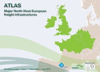
  • 1. ATLAS Major North-West European freight infrastructures Weastflows project - Action 1 - Deliverable 1 - June 2013
  • 2. Executive summary 1. Weastflows: partners localisation 2. Weastflows: observers localisation Methodological notes A. To understand the atlas: cartography, map features and map scales B. To understand the atlas: statistic and map types C. To understand the atlas: the choice of cities representation for the base map D. To understand the european specificity: NUTS and TEN-T NETWORK E. To understand the atlas: interpolation methodology Maps and Technical notes  North-West Europe, contextual maps 3. Urban geography 4. Gross Domestic Product (GDP) per inhabitant 5. Degree of population density 6. Degree of surface dedicated to industry and transport 7. Modal split of freight transport by inland waterways, rail and road in 2010 8. Distribution of maritime transport by major type of navigation in 2010 9. Main coastline and maritime freight traffic in 2010 by NUTS 2 10. Total maritime freight traffic by port in 2010 11. Container traffic by main port in 2010 12. Maritime freight traffic by type of merchandises in 2011  North-West Europe, infrastructure maps 13. Seaport and inland port 14. Port infrastructure and TEN-T CORE Port 15. Channel depths in seaport 16. Road network infrastructure 17. TEN-T road network 18. Main freight ferry lines (RoRo) 19. Level of navigability of inland waterways 20. Inland waterways TEN-T network 21. Railway nodes terminal 22. Railway network infrastructure 23. Level of electrification of railway network 24. TEN-T railway network 25. Freight airport 26. Freight airport and TENT-T CORE airport 27. Freight airport traffic in 2011 28. TEN-T network  North-West Europe, network and intermodal platform projects maps 29. Overview on main nodes projects 30. Overview on main projects for road network 31. Overview on main projects for inland waterways 32. Overview on main projects for railway network 33. Specific railway project  Partner areas of interest, infrastructure and network maps 34. Areas of interest per partners 35. Ireland: Network and intermodal platform 36. Ireland: Network and intermodal platform projects 37. Scotland: Network and intermodal platform 38. Scotland: Network and intermodal platform projects 39. Liverpool and West Coast: Network and intermodal platform 40. Liverpool and West Coast: Network and intermodal platform projects 41. South of England: Network and intermodal platform 42. South of England: Network and intermodal platform projects 43. Range Nord: Network and intermodal platform 44. Range Nord: Network and intermodal platform projects 45. East of France and South Germany: Network and intermodal platform 46. East of France and South Germany: Network and intermodal platform projects 47. Northern France: Network and intermodal platform 48. Northern France: Network and intermodal platform projects 49. Seine Gateway®: Network and intermodal platform 50. Seine Gateway®: Network and intermodal platform projects CONTENT
  • 3. The European Weastflows project (INTERREG IVB program for North-West Europe) scheduled to run for four years (2011 - 2014) is designed to improve freight transport and the associated logistics in North-West Europe and to ease the congestion in the ports on the Northern Range and on the traditional North-South sea routes by: • encouraging a modal shift from the use of road transport to more sustainable modes (rail, short sea and river transport); • promoting the flow of goods on a West-East axis. Jointly led by the Transport & Logistics Regional Centre for Innovation and Technology Transfer (CRITT) in Le Havre and the Institute for Sustainability in London, the project involves 22 european partners, including the Town Planning Agency of Le Havre and Seine Estuary Area (AURH) and thirty observers. The project covers seven countries: Germany, Belgium, France, Ireland, Luxembourg, the Netherlands and the United Kingdom. As the leader of the action «Assessment of sustainable transport capacity», AURH is responsible for mapping and analysing the transport infrastructures for North-West Europe, by: • constructing the geographic database identifying and describing the transport infrastructure; • analysing the organisation of the infrastructure network; • identifying the blocking points on existing corridors that prevent the development of freight transport; • identifying the infrastructure projects and corridors or alternative routes to be developed in order to improve the movement of goods on a West-East axis. This document is the result of close cooperation between the european partners of Weastflows project. It is the first deliverable of AURH. The atlas, presents an inventory of the existing or projected transportation infrastructures in North-West Europe (covering all types of infrastructure and all types of goods), thereby giving an initial overview of the organisation of the transport system for goods in North-West Europe. It provides, first of all, background maps on the scale of North-West Europe outlining the key demographic and economic characteristics of the region, and an initial description of the port flows involved. This contextual approach is then complemented by a selection of maps showing the infrastructures for each mode of transport and the associated development projects. Finally, the regional maps complete the atlas by focusing on the organisation of transport networks in the areas of interest of each partner. The document is closely linked to the Geographic Information System (GIS) built by the AURH team for the Weastflows project. The maps are based on dynamic data that will be updated and enriched through to the end of the project. The atlas is by nature scalable. Thanks to this system and the involvement of the partners, the latter will be able to share the same data repository, thus providing a common working basis for the entire project. A dynamic version of the atlas is available through the GeoWeastflows interactive mapping tool developed by the Henri Tudor Public Research Centre (a Weastflows partner) in conjunction with AURH. Initially limited to the Weastflows partnership, GeoWeastflows will be made available to the public in November 2013 for consultation at the following address: http://geo.weastflows.eu In addition, the atlas will provide the starting point for discussions about the creation of a West-East corridor for the transport of goods in Europe. AURH will publish three other deliverables by 2014: an analysis showing the characteristics of the transport system, an analysis with identification of the congestion or blocking points constituting an obstacle to the development of sustainable freight transport, and a forward-looking analysis of the regional recommendations designed to optimise the flow of goods and encourage the modal shift. EXECUTIVE SUMMARY
  • 4. Irish Exporters Association ^_ Partner 1 Atlas of major North-West European freight infrastructures - June 2013 Institute For sustainability CRITT TL CQM Peterhead Grimsby LSN CTS BOM AURH VRRN MWRA IDIT LOOM Karlsruhe TUDOR BBZOB TTPNF Mobycon InforIT Kirkwall SEStran USTL-LAGIS Intermodality University Duisburg-Essen Portsmouth Commercial Port Paris London Londonderry/Derry Dublin Antwerpen Düsseldorf Brussel Köln Luxembourg Metz Cork Mainz Rouen Lille Nancy Leeds Larne Goole Dover Perth Liège Namur Essen Nantes Calais Dieppe Barnet Ipswich Glasgow Belfast Cardiff Bristol Harwich Croydon Mannheim Nürnberg Duisburg Le Havre Limerick Bradford Aberdeen Stuttgart Edinburgh Sheffield Waterford Fleetwood Tynemouth Liverpool Charleroi Hartlepool Birmingham Portsmouth Felixstowe Manchester Rosslare Harbour Port Talbot Saint-Nazaire Cherbourg-Octeville $ 0 25 50 100 Km Weastflows: partners localisation Data source powered by AURH Boudaries ©MBR and EuroGeographics,©ESRI Map data ©OpenStreetMap contributors, ODbl ®AURH -2013/02 Legend Coments Weastflows: partners localisation Project partners are the organisations responsible for carrying out specific activities within the project in the manner and scope indicated in the Application Form and/or Partnership agreement. They can either be national, regional and local authorities including sector departments and related public agencies, transational bodies, universities, research and development agencies and non-profit organisations. They report to the Joint Managment Team (JMT).
  • 5. Tongji University (Shanghai) Cobelfret/CLdN Atlas of major North-West European freight infrastructures - June 2013 Essex County Council Weastflows: observers localisation Irish National Transport Authority Peterhead Shannon Airport Authority Zeebrugge Port Imperial College London Logica Novalog Dinalog Cluster4L NSL-IRISS Lille Port Rouen Port Mertert Port Wilson James Astrium Space Oostende Port Le Havre Port /Dublin Airport Lafarge Cement CFL Multimodal KLOK Stuttgart Bruxelles Port Rosslare Europort Moselle Commission Shannon Foynes Port Le Havre Development Logistics in Wallonia Ports Normands Associés Kimberly-Clark Gravesham Council Upper-Normandy Region Freight Quality Partnership Paris Dublin Antwerpen Düsseldorf Brussel Amsterdam Köln Metz Cork Gent Essen Mainz Brest Nancy Leeds Larne Goole Dover Perth Liège Bochum Manchester Nantes Calais Dieppe Galway Lorient Ipswich Glasgow Belfast Cardiff Bristol Harwich Grimsby Mannheim Nürnberg Duisburg Plymouth Kirkwall Bradford Aberdeen Den Haag Karlsruhe Edinburgh Sheffield Waterford Fleetwood Tynemouth Lancaster Liverpool Rotterdam Charleroi Strasbourg Saint-Malo Hartlepool Birmingham Port Talbot Saint-Nazaire Londonderry/Derry Cherbourg-Octeville ^_ Observers Data source powered by AURH Boudaries ©MBR and EuroGeographics,©ESRI Map data ©OpenStreetMap contributors, ODbl ®AURH -2013/02 Km 0 25 50 100 ^_ Copyright: ©2013 Esri, DeLorme, NAVTEQ 2 Legend Coments Weastflows: observers localisation Observers are organisations that may have an advisory capacity in the project. They are not considered as «formal» partners and should not be listed as such in the Application Form. Observers are selected on the basis of their ability to provide strategic guidance as and when appropriate and to promote the project through their own networks.
  • 6.
  • 8. To understand the atlas: cartography, map features and map scales A European scale This scale is used to make contextual maps with global european data at national level. Atlas of major North-West European freight infrastructures - June 2013 North-West european scale The North-West european scale deals with the Weastflow’s project area. It is the reference scale for the data collection. These data are formated on the GIS database. Regional scale This scale is used to make maps about the different areas of interest for each partner. A map Map features f«eAa tumraeps oisr cah asryamctbeorliissteicds ,i mreasguelt inogf fgreoomg rtahpeh cicre raetiavleit ye, ffroerptsr eosfe cnatirntogg rsaeplehcetresd, and designed for use when spatial relationships are special relevance .» (Michael Wood, 1993). Base map elements A base map provides the background reference informations such as boundaries, coastline, water, on which other thematic information will be placed. North-West Europe Area Other european country Country boundary NUTS 2 boundary NUTS 3 boundary Coastline Color code To have a graphic consistency in the whole atlas, we used a color code for each type of infrastructure. Road sector Ferry sector Maritime sector Railway sector River sector TEN-T data Main Infrastructures features For each type of transport infrastructure, we choose one specific element. The nodal infrastructure is represented by a ponctual element and the network infrastructure is represented by a linear element.  Airport ▲ Inland port  Seaport  Railway station Main transport network Other transport network Three scales
  • 9. Type of statistic data Type of map corresponding Atlas of major North-West European freight infrastructures - June 2013 B Graduated color maps These types of maps utilize a color progression from clear to dark in order to visualize easily the evolution of a relative statistic data in a geographic area. Interpolation maps In terms of colour progression, it is the same process as the graduated colour maps but the interpolation maps provide continuous data without boundary effect. Please refer to the methodological notes about interpolation (methodological notes, part E). Distributive maps Distributive maps show geographic information without making a hierarchy between the different elements. Graduated symbol maps Graduated symbol maps use a size variation of an object in order to highlight statistic raw data. Infrastructure maps Infrastructure maps provide an overview of different features of transport collected for the Weastflows project. To understand the atlas: statistic and map types Statistic and data cAacrctoorgdrianpgh itco rdeipffreerseennt tatytipoenss ohfa vseta ttios tbice duastead, .various Bmaasinic atyllpye, sw oef sctoautilsdt icmsa: kteh ea q duiasntitnitcattiiovne bdeattwa eaennd ttwheo qualitative data. Quantitative data Quantitative data correspond to numerical variable.To make a map, the distinction between the different type of quantitative data leads to the use of different graphical representations. We can distinguish two types of quantitative data: the raw data and the comparative data. Raw data The raw data correspond to elementary data which have not been processed. They are expressed in numbers. Comparative data The comparative data highlight a comparison between a specific unit and the entire group to which it corresponds. It is a ration like a density or a percentage. Graduated color maps Interpolation maps Gratuated symbol maps Qualitative data Qualitative data correspond to unquantificable data, like category and characteristic. Distributive maps Infrastructure maps Main map types
  • 10. To understand the atlas: the choice of cities representation for the base map C Label on the map Methodology for the selection FNoorr tthh-eW beasste E muraopp,e w teo dderacwid eadn too vdeorv aie swe loefc tthioen uorfb tahne gmeoosgtr aimphpyo rotaf ntth icsi tiaerse ain. Here we have the explanation of this selection. Atlas of major North-West European freight infrastructures - June 2013 I*d eAnctcifoicradtiniogn toof tehuer ovpaeriaonu sc aspcaitalel coift iethse maps, we decided to select all the european capital cities beyond the boundaries of North-West european area. I*d eAnctcifoicrdaitniogn too ft hoeth secr acleit ieosf the map, we decided to select all the most important cities just for North-West european area. For tthhee tehnrteiree ccoouunntrtrieys. which are split by the North-West european boundaries France, Germany and Netherland, we considered I*d eWneti fiscealteiocnte do f c«owunotrrlides c iwtiieths »more than one million inhabitants. I*d eWneti fiscealteiocnte do f c«omunatirnie sc itwieitsh» a population between 350 000 and 1 million inhabitants. I*d eWneti fimcaatkioen ao fr e«laptoiornt schitipie sb»etween the city and the port traffic in order to identify the main port cities. * We lack of traffic data for inland port. Consequently, we try to select the most important cities which have an inland port. Results and representation Results: Nuwmhboesre o f c2iti0e sa rine t«hcea pdiatatal»b;ase: 119 264 a raer e« w«moraldin c citiiteiess»»;; 69 are «port cities». Representation: The layer of city will be present on different maps as a layer of basic information. tChoen osenqeu heanntldy, waen dd eocni dtehde, oothne trh hea mnda pth, eto o tdhisetri ncgituieissh. the european capitals on tThhee s«awmoer ldg rocuitipe.s», the «main cities» and the «port cities» are put together in
  • 11. To understand the european specificity: NUTS and TEN-T network What is a NUTS? Level of NUTS TUhneit sa fcorro nSytmat isNtiUcsT.S means Nomenclature of Territorial iTsh et oa imha voef thais snionmglee nctelartruitroer ia(el sdtaivbilsisiohne d obf y EEuurroopsetaatn) tWerirthit otrhyis inco mormdeorn tsoy sbtueimld, Ea ucroosmtamt ocna ns ctaotlilsetcict, sdyesvteelmop. and harmonize european data. eTuhreorpee aanre s ttahtree e(w hhiiechra rccahnic aclo nlesivdeelsre do fl eNveUl TNSU. TESa c0h) iEsa scuhb dNivUidTiSn g1 inis a snuubmdibveidre odf irnetgoi ornesg iaotn sN UaTt SN 1U TleSv e2l. lleevveell,. themselves subdivided into regions at NUTS 3 nTeoe dcso mtpoa reb et heh ormegoigoennael osutsa tisinti cst,e rmthse NofU TsSiz er egainodn epsoppeuclaiatilolyn . baCseodn seoqnu ethnetl ya, dmthinei stNraUtivTeS undietsfi noitfio ne acihs member state and according to population thresholds. gTuhaer agnetoeger aap hstya boifli tyN UoTf Sst arteisgtiiocn d aetvao,l vtehse rere gisu laa rplye. riTood oFfo rc Wonesaoslitdflaotwiosn porof jetchtr,e ew ey ewaorrsk wwiitthho tuhte aNnUy TcSh a2n0g0e6. nomenclature. Country / NUTS 0 The basic national boundary NUTS 1 Major socio-economic regions BPeotpwueleant i3o nm billyio nNsU aTnSd: 7 millions uCnoirtrse:sponding administrative TBheelg i«ugme.w esten/régions» in «TSheco t«lalänndd, eWr»a liens ,G Neromrtahneyrn. IRreelgainodn»s aonf dE n«gGlaonvde»rn min eUnnt iOtefdfi-ce Kingdom. NUTS 2 rBeagsioicn arel gpioonlicsi efosr the application of BPeotpwueleant i8o0n0 b 0y 0N0U aTnSd: 3 millions uCnoirtrse:sponding administrative TBheelg i u«mp.rovincies/provinces» in TGheerm «arengy.ierungsbezirke» in TThhee ««rreéggiioonnss»» iinn IFrlraanndc.e. The «provincies» in Netherlands. NUTS 3 dSimaganllo rseegsions for specific BPeotpwueleant i5o0n 0b0y0 N aUnTdS 8:00 000 uCnoirtrse:sponding administrative TBheelg i«uamrr.ondissements» in TGheerm «aknreyi.se/kreisfreie städte» in TThhee ««rdeégpiaorntaelm aeuntthso»r itiny rFergainocnes.» in Irland. What is TEN-T? The TEN-T Network TNheetw aocrrko.nym TEN-T means Trans-European Transport TAhgee ncTyr a(TnEs-NE-uTr oEpAe)a nw asT rcarenaspteodr t in N2e0t0w6o rtko imExpelecmuteivnet aEnudro pmeaanna Cgoem tmheis sTioEnN in- To rdperor gtora imm proonv eb tehhea elff fiocfie nthcey and the accessibility of european transport network. tEhsatta bal isshoicniagl aonn ee,f fticoi eanllto Twr aanns -eEffiucrioepnet acnir cTurlaantisopno ortf Ngoeotwdosr ka n(dT EpNe-oTp)le i sb eat wkeeey ne lmememenbtesr osft aetuerso paenadn t os terantseugrye, ibnotethrn fartoiomn aaln c oenconneoctmioinc sp, obinyt bouf ilvdiienwg missing links and removing bottlenecks. To achieve this objective the European Commission identified a strategic network that focuses investments. In this contexte, there is two level of network designed by TEN-T as priority axes of investments: -the «CORE network» is the most strategic axes and strategic nodes for improving the trans-european network. It has to be completed by 2030; -ntehtew o«rCk owmilpl rbeeh ecnosmivpele nteedtw boyr k2»0 c5o0m. plete the CORE Network to ensure a high level of accessibility of all european regions. The comprehensive Atlas of major North-West European freight infrastructures - June 2013 D
  • 12. To understand the atlas: interpolation methodology E From classical boundaries display ... to a continuous phenomena Classical boudaries display (here by NUTS3) Cartographic interpolation The interpolation: step by step As the map shows, the data are traditionally represented in the limit of administrative boundaries. In the case of density, the reference area is NUTS 3 region. To make a map with interpolation, the first step is to report the data to the center point of the administrative surface. Here the data are reported on the center of each NUTS 3 region. Atlas of major North-West European freight infrastructures - June 2013 North West Europe area: degree of population density Londonderry/Derry Density of population number of inhabitant per square kilometers For every cell, there is a specific calcul which evaluates the value of neighbour points based on their distance. This calculation takes into account the continuous information and the maritime discontinuity of the maritime area. From classical boundaries display ... ... to a continuous phenomena One data, two graphic representations A grid is applied on the map. The cell resolution (1 square kilometer here) allows to have a finer graphic representation of the data. The smaller the grid, the better the cartographic results. Wien Praha Paris Zagreb Berlin Peterhead Grimsby London Essen Bremen Rostock Leipzig Karlsruhe Antwerpen Düsseldorf The result is the dispatching of data in the territory according to distance of each value from each other. Dublin Brussel Stockholm Kobenhavn Ljubljana Amsterdam Bratislava Luxembourg Kiel Köln Metz Lyon Caen Cork Gent Essen Mainz Rouen Lille Brest Nancy Leeds Larne Goole Dover Perth Liège Namur Zürich Bochum Bournemouth Nantes Calais Dieppe Barnet Galway Brugge Hamburg München Dresden Lorient Ipswich Glasgow Belfast Cardiff Bristol Harwich Newport Croydon Hannover Mannheim Nürnberg Duisburg Le Havre Plymouth Kirkwall Limerick Bradford Aberdeen Den Haag Oostende Stuttgart Dunkerque Edinburgh Sheffield Waterford Fleetwood Tynemouth Liverpool Rotterdam Charleroi Strasbourg Saint-Malo Hartlepool Birmingham Portsmouth Felixstowe Manchester Brunsbüttel Bremerhaven La Rochelle Port Talbot Wilhelmshaven Saint-Nazaire Rosslare Harbour Cherbourg-Octeville $ 0 50 100 200 Km 2 - 36 37 - 140 141 - 243 244 - 485 486 - 1 484 1 485 - 5 000 5 001 - 8 791 Data source ©CorineLandCover2006; ©Eurostat Boudaries ©MBR and EuroGeographics,©ESRI Map data © OpenStreetMap contributors, ODbl ®AURH -2013/02 Step 1 From surface to point Step 2 The grid Step 3 The calculation Step 4 The result
  • 14.
  • 15. North-West Europe  Contextual Maps
  • 16.
  • 17. DDeennmmaarr kk Atlas of major North-West European freight infrastructures - June 2013 North West Europe area: urban geography Newcastle upon Tyne Norwich Swansea Haarlem EEnn gg ll ii ss hh CChh aa nn nn ee ll NNoo rr tt hh SS ee aa AA tt ll aa nn tt ii cc OOcc ee aa nn FFrraann ccee SSwweeddeenn II ttaallyy NNoorrwwaayy GGeerrmmaannyy UUnnii tteedd KKiinnggdd oomm AAuuss tt rr iiaa II rree llaanndd BBeell ggiiuumm CCzzee cchh RReeppuubbll SSwwii tt zz eerr llaanndd NNeetthh eerr llaannddss SSll oovveennii aa LLuuxxeemmbboouurrgg LLiieecchh tteennss ttee iinn Köln Paris London Brussel Birmingham Essen Leeds Dublin Glasgow Nürnberg Den Haag Stuttgart Liverpool Amsterdam Frankfurt am Main Gent Neuss Mainz Lille Dijon Reims Derby Liège Kassel Angers Rennes Nantes Oxford Münster Belfast Bristol Cardiff Augsburg Mannheim Le Havre Plymouth Coventry Aberdeen Karlsruhe Charleroi Strasbourg Sunderland Portsmouth Saarbrücken Southampton Freiburg im Breisgau Metz Caen Cork Rouen Tours Brest Nancy Amiens Galway Armagh Dundee Le Mans Orléans Lincoln Preston Mulhouse Besançon Limerick Dunkerque Cambridge Luxembourg Peterborough Number of inhabitant by main city 45 038 - 145 000 145 001 - 450 000 450 001 - 1 000 000 over 1 million Data source ©UK National Statistics; ©INSEE; ©STATEC; ©Direction Generale Institutions et Population (BE); ©United Nations Population Division; ©Eurostat Boudaries ©MBR and EuroGeographics,©ESRI Map data ©OpenStreetMap contributors, ODbl ®AURH -2013/02 $ 0 50 100 200 Km 3 Legend Coments North-West Europe area: urban geography The aim of this map is to have a first overview of the urban geography of North-West Europe area, more precise than the cities choice for the base map (methodological notes, part C). By locating the area of major or minor population, we can have a first idea of the most important areas where consumation, employment and production have a major or a minor importance. Firstly, we decided to select the cities which have a population over 45 000 inhabitants in order to avoid overloading the map. In the database we have retained 178 cities in North-West Europe. According to the distribution of the data, they are split into four classes.The first class represents the smallest cities of our area of interest in terms of population: from 45 000 inhabitants up to 145 000. There are 78 cities in this case. The second class groups 76 cities whose populations are split between 145 000 and 450 000 inhabitants. There are 19 cities in the third class between 450 000 and 1 million inhabitants. Finally, the most important cities in this database are in the fourth class whose exceed 1 million inhabiants. There are five cities over 1 million: Birmingham, London, Paris, Brussel, Koln.
  • 18. North West Europe area: Gross Domestic Product (GDP) per inhabitant Gross Domestic Product per inhabitant in purchasing power standard by NUTS 2 level 4 Atlas of major North-West European freight infrastructures - June 2013 Antwerpen Düsseldorf " ! ! ! " ! ! ! Essen ! ! ! " ! ! ! ! Peterhead ! Grimsby ! ! ! ! ! ! ! ! ! ! ! ! ! ! ! Londonderry/Derry ! ! ! ! ! ! ! ! ! ! " ! ! ! ! " Bournemouth ! ! ! ! ! ! ! ! ! ! ! ! ! ! ! ! ! ! ! ! " ! ! ! ! ! ! ! ! ! ! ! ! ! " ! ! ! ! ! ! ! Bremen Karlsruhe ! Rostock ! ! ! ! ! ! ! ! ! ! ! " " " Praha Paris Berlin London Dublin Brussel Kobenhavn Ljubljana Amsterdam Luxembourg Kiel Köln Metz Lyon Caen Cork Gent Essen Mainz Rouen Lille Brest Nancy Leeds Larne Goole Dover Perth Liège Namur Zürich Bochum Nantes Calais Dieppe Barnet Galway Brugge Hamburg Leipzig München Dresden Lorient Ipswich Glasgow Belfast Cardiff Bristol Harwich Newport Croydon Hannover Mannheim Nürnberg Duisburg Le Havre Plymouth Kirkwall Limerick Bradford Aberdeen Den Haag Oostende Stuttgart Dunkerque Edinburgh Sheffield Waterford Fleetwood Tynemouth Liverpool Rotterdam Charleroi Strasbourg Saint-Malo Hartlepool Birmingham Portsmouth Felixstowe Manchester Brunsbüttel Bremerhaven La Rochelle Port Talbot Wilhelmshaven Saint-Nazaire Rosslare Harbour Cherbourg-Octeville $ 0 50 100 200 Km 6 400 - 14 200 14 201 - 22 000 22 001 - 29 900 29 901 - 44 100 44 101 - 78 000 Data source ©Eurostat Boudaries ©MBR and EuroGeographics,©ESRI Map data © OpenStreetMap contributors, ODbl ®AURH -2013/02 Legend Coments North-West Europe area: Gross Domestic Product (GDP) per inhabitant The gross domestic product is a general indicator to assess the economic activity of an area of interest. This indicator allows us to distinguis the dynamic economy of the North-West Europe area. Eurostat definition of Gross Domestic Product: «Gross domestic product (GDP) is a measure for the economic activity. It is defined as the value of all goods and services produced less the value of any goods or services used in their creation. The volume index of GDP per capita in Purchasing Power Standards (PPS) is expressed in relation to the European Union (EU-27) average set to equal 100. If the index of a country is higher than 100, this country’s level of GDP per head is higher than the EU average and vice versa. Basic figures are expressed in PPS, i.e. a common currency that eliminates the differences in price levels between countries allowing meaningful volume comparisons of GDP between countries» (Source: data description from Eurostat).
  • 19. Bremen Rostock Leipzig Karlsruhe North West Europe area: degree of population density Antwerpen Düsseldorf Atlas of major North-West European freight infrastructures - June 2013 Praha Paris Berlin Peterhead Grimsby London Londonderry/Derry Dublin Essen Brussel Kobenhavn Ljubljana Amsterdam Luxembourg Kiel Köln Metz Lyon Caen Cork Gent Essen Mainz Rouen Lille Brest Nancy Leeds Larne Goole Dover Perth Liège Namur Zürich Bochum Bournemouth Nantes Calais Dieppe Barnet Galway Brugge Hamburg München Dresden Lorient Ipswich Glasgow Belfast Cardiff Bristol Harwich Newport Croydon Hannover Mannheim Nürnberg Duisburg Le Havre Plymouth Kirkwall Limerick Bradford Aberdeen Den Haag Oostende Stuttgart Dunkerque Edinburgh Sheffield Waterford Fleetwood Tynemouth Liverpool Rotterdam Charleroi Strasbourg Saint-Malo Hartlepool Birmingham Portsmouth Felixstowe Manchester Brunsbüttel Bremerhaven La Rochelle Port Talbot Wilhelmshaven Saint-Nazaire Rosslare Harbour Cherbourg-Octeville Density of population number of inhabitant per square kilometers $ 0 50 100 200 Km 2 - 36 37 - 140 141 - 243 244 - 485 486 - 1 484 1 485 - 5 000 5 001 - 8 791 Data source ©CorineLandCover2006; ©Eurostat Boudaries ©MBR and EuroGeographics,©ESRI Map data © OpenStreetMap contributors, ODbl ®AURH -2013/02 5 Legend Coments North-West Europe area: degree of population density Population density is a demographic indicator that draws the space occupation by population. With the help of this indicator, we can easily identify the concentration of population or the scatter. Eurostat defined population density as «the ratio between (total) population and surface (land) area.» This ratio can be calculated for any territorial unit for any point in time, depending on the source of the population data (Source: data description from Eurostat). Statistically, this ratio expresses the number of inhabitants per square kilometer. We used an interpolation map to express the density data. Please refer to the methodological note about interpolation (methodological notes, part E).
  • 20. North-West Europe area: degree of surface dedicated to industry and transport North West Europe area: degree of surface dedicated to industry and transport North West area: degree of surface dedicated to industry and transport 6 Surface dedicated Surface dedicated to industry to transport Surface dedicated to industry Surface dedicated to transport Paris Madrid London Dublin Coments The two maps express a territorial density of infrastructure: transport and industry. The density is always a ratio between one element existing on the territory and the size of a territorial unit. The aim of these two maps is to highlight the infrastructure dedicated to transport or to industry in Europe. The first step to measure this information is to collect two surface indicators: the surface dedicated to infrastructure of transport and the surface dedicated to industry. We collected this data with the help of an european geographic database called Corine Land Cover. This database makes an inventory of land use on an european scale and produces information about artificial surfaces (urban, industrial, commercial and transport units...), agricultural areas, forests and wetlands. With the help of the Geographic Information System, we can mesure the area (in square meters) of each type of use listed in the database. About transport infrastructure: Corine Land Cover includes the road and rail networks and associated land, the port areas and the airports. About industry: Corine Land Cover includes the industrial and commercial units, and the mineral extraction sites. The second step to finalize the calcul of the density infrastructure indicator is to measure the ratio between the surface dedicated to transport or industry by total surface ot the territorial unit of reference (NUTS 3). The results gave us the area in square meters dedicated to transport infrastructure or to industry infrastructure. Finally, to make the map, we used the process of interpolation as for population density (methodological notes, part E). Atlas of major North-West European freight infrastructures - June 2013 Oslo Rome Praha Wien Oslo Kobenhavn Berlin Praha Paris Madrid Ljubljana Zagreb Berlin London Dublin Brussel Stockholm Kobenhavn Ljubljana Amsterdam Stockholm Wien Bratislava Amsterdam Brussel Luxembourg $ Area dedicated to industry infrastructure in m² by 1 000m² Rome Rome Data source ©CorineLandCover2006; ©Powered by AURH Boudaries ©MBR and EuroGeographics,©ESRI Map data © OpenStreetMap contributors, ODbl ®AURH -2013/02 Wien Oslo Praha Paris Madrid Zagreb Berlin London Dublin Brussel Stockholm Kobenhavn Ljubljana Amsterdam Bratislava Luxembourg Bratislava Area dedicated to transport infrastructure in m² by 1 000m² Km 0 50 100 200 Rome Zagreb Luxembourg 0 2,3 5 6,7 11,7 19,9 42,9 175 0 1 2 3 4 12 21 99 $ Area dedicated to industry infrastructure in m² by 1 000m² Data source ©CorineLandCover2006; ©Powered by AURH Boudaries ©MBR and EuroGeographics,©ESRI Map data © OpenStreetMap contributors, ODbl ®AURH -2013/02 Wien Oslo Praha Paris Madrid Zagreb Berlin London Dublin Brussel Stockholm Kobenhavn Ljubljana Amsterdam Bratislava Luxembourg Area dedicated to transport infrastructure in m² by 1 000m² Km 0 50 100 200 0 2,3 5 6,7 11,7 19,9 42,9 175 0 1 2 3 4 12 21 99
  • 21. 7 Europe: modal split of freight transport by inland waterways, rail and road in 2010 - Inland waterways - - Rail - - Road - - Inland waterways - - Rail - - Road - - Inland waterways - Rail - - Road - 82,2% 59,1% 74,8% 21% 0,1% 59,1% 74,8% 21% 0,1% 59,1% 74,8% 21% 0,1% Coments «This indicator is defined as the percentage share of each mode of transport in total inland freight transport performance. The transport modes considered are: a) road, b) rail and c) inland waterways. The measurement unit is tonne-kilometre, that is, one tonne transported over a distance of one kilometre. Inland freight transport includes road, rail and inland waterways: - rail and inland waterways transport are based on movements on national territory (‘territoriality principle’), regardless of the nationality of the vehicle or vessel, - road transport is based on all movements of vehicles registered in the reporting country.» (source: Metadata Eurostat) These data allow us to have a first overview of the modal split for each transport mode at a national scale. Atlas of major North-West European freight infrastructures - June 2013 95,8% 85% 60,7% 75% 64,9% 80,6% 90,4% 88,7% 79% 56,3% 75,1% 93,9% 99,2% 71,2% 54,4% 38,1% 62,1% 87% 69,5% 45,8% 82,3% 98% 93,5% $ 0 100 200 Km Europe: modal split of freight transport by inland waterways, rail and road in 2010 4,2% 13,5% 15% 39,3% 22,2% 9,6% 24,8% 19,4% 11,2% 39% 19,6% 0,8% 40,9% 6,1% 22% 21,2% 4,9% 45,6% 61,9% 13% 12,5% 54,2% 17,7% 2% 2,7% 4,3% 0,2% 0,1% 12,9% 0,1% 0,1% 4,7% 5,3% 7,6% 3,2% 33% 18% 0,1% 0,1% 0,1% 3,9% Modal split of freight transport by inland waterways under 3,2% between 3,2 - 12,9% over 12,9% No data Modal split of freight transport by rail under 13,5% between 13,5 - 24,8% over 24,8% No data Modal split of freight transport by road under 62% between 62 - 82% over 82% No data Data source ©Eurostat Boundaries ©MBR and EuroGeographics,©ESRI Map data ©OpenStreetMap contributors, ODbl ®AURH -2013/02 82,2% 95,8% 85% 60,7% 75% 64,9% 80,6% 90,4% 88,7% 79% 56,3% 75,1% 93,9% 99,2% 71,2% 54,4% 38,1% 62,1% 87% 69,5% 45,8% 82,3% 98% 93,5% $ 0 100 200 Km Europe: modal split of freight transport by inland waterways, rail and road in 2010 4,2% 13,5% 15% 39,3% 22,2% 9,6% 24,8% 19,4% 11,2% 39% 19,6% 0,8% 40,9% 6,1% 22% 21,2% 4,9% 45,6% 61,9% 13% 12,5% 54,2% 17,7% 2% 2,7% 4,3% 0,2% 0,1% 12,9% 0,1% 0,1% 4,7% 5,3% 7,6% 3,2% 33% 18% 0,1% 0,1% 0,1% 3,9% Modal split of freight transport by inland waterways under 3,2% between 3,2 - 12,9% over 12,9% No data Modal split of freight transport by rail under 13,5% between 13,5 - 24,8% over 24,8% No data Modal split of freight transport by road under 62% between 62 - 82% over 82% No data Data source ©Eurostat Boundaries ©MBR and EuroGeographics,©ESRI Map data ©OpenStreetMap contributors, ODbl ®AURH -2013/02 82,2% 95,8% 85% 60,7% 75% 64,9% 80,6% 90,4% 88,7% 79% 56,3% 75,1% 93,9% 99,2% 71,2% 54,4% 38,1% 62,1% 87% 69,5% 45,8% 82,3% 98% 93,5% $ 0 100 200 Km Europe: modal split of freight transport by inland waterways, rail and road in 2010 4,2% 13,5% 15% 39,3% 22,2% 9,6% 24,8% 19,4% 11,2% 39% 19,6% 0,8% 40,9% 6,1% 22% 21,2% 4,9% 45,6% 61,9% 13% 12,5% 54,2% 17,7% 2% 2,7% 4,3% 0,2% 0,1% 12,9% 0,1% 0,1% 4,7% 5,3% 7,6% 3,2% 33% 18% 0,1% 0,1% 0,1% 3,9% Modal split of freight transport by inland waterways under 3,2% between 3,2 - 12,9% over 12,9% No data Modal split of freight transport by rail under 13,5% between 13,5 - 24,8% over 24,8% No data Modal split of freight transport by road under 62% between 62 - 82% over 82% No data Data source ©Eurostat Boundaries ©MBR and EuroGeographics,©ESRI Map data ©OpenStreetMap contributors, ODbl ®AURH -2013/02 Data source ©Eurostat - Boundaries ©MBR and EuroGeographics, ©ESRI - Map data ©OpenStreetMap contributors, ODbl - ®AURH-2013/02
  • 22. 8 Europe: distribution of maritime transport by major type of navigation in 2010 - Short Sea Shipping - - Deep Sea Shipping - - Other type of shipping - - Short Sea Shipping - - Deep Sea Shipping - - Other type of shipping - - Short Sea Shipping - - Deep Sea Shipping - - Other type of shipping - 32,3% 71,8% 51,2% 61,5% 32,3% 71,8% 51,2% 61,5% 32,3% 71,8% 51,2% 61,5% Coments The share of short sea and deep sea shipping allows us to have an idea of the type of maritime transport use for freight in total sea transport. Regarding to the other type of shipping, these data seem to correspond to coastal shipping even if Eurostat doesn’t make any precisions. According to Eurostat glossary: «Short sea shipping, abbreviated as SSS, is the maritime transport of goods over relatively short distances, as opposed to the intercontinental cross-ocean deep sea shipping. In the context of European Union (EU) transport statistics, it is defined as maritime transport of goods between ports in the EU-27 (sometimes also including candidate countries and EFTA countries) on one hand, and ports situated in geographical Europe, on the Mediterranean and Black Seas on the other hand. Deep sea shipping refers to the maritime transport of goods on intercontinental routes, crossing oceans; as opposed to short sea shipping over relatively short distances». For Nort West Europe Area we can observe the importance of short sea shipping for Ireland and and for scandinavian country. France, United Kingdom, Belgium and Germany are in the middle class. Netherlands have a low share of short sea shipping rather than the other european country of Weastflows area. In terms of deep sea shipping, Germany, Belgium and Netherlands have a dominant position comparatively to France, Ireland and United Kingdom. Atlas of major North-West European freight infrastructures - June 2013 8,6% 8,3% 11,1% 3,6% 9,8% 1,1% 19% 19,5% 14,8% 4,9% 2,1% $ 0 100 200 Km Europe: distribution of maritime transport by major type of navigation in 2010 6,1% 29,5% 44,8% 8,7% 6,8% 39,2% 15,8% 18,2% 23,4% 23,3% 34,5% 12,9% 13,7% 16,7% 48,4% 42,2% 7,3% 27,1% 46,3% 5,5% 61,9% 46,9% 82,8% 57,2% 83,4% 83,2% 62,9% 61,8% 74,7% 53,7% 82,2% 80% 63,8% 57% 62,8% 76,8% 53,7% Share of Short Sea Shipping in total sea transport 57,7% 38,1% - 53,7% 53,8% - 63,8% 63,9% - 83,4% No data Share of Deep Sea Shipping in total sea transport 3,6% - 13,7% 13,8% - 29,5% 29,6% - 48,4% No data Share of other type shipping in total sea transport 0,1% - 8,6% 8,7% - 22,5% 22,6% - 58,3% No data Data source ©Eurostat Boundaries ©MBR and EuroGeographics,©ESRI Map data ©OpenStreetMap contributors, ODbL ®AURH -2013/02 8,6% 8,3% 11,1% 3,6% 9,8% 1,1% 19% 19,5% 14,8% 4,9% 2,1% $ 0 100 200 Km Europe: distribution of maritime transport by major type of navigation in 2010 6,1% 29,5% 44,8% 8,7% 6,8% 39,2% 15,8% 18,2% 23,4% 23,3% 34,5% 12,9% 13,7% 16,7% 48,4% 42,2% 7,3% 27,1% 46,3% 5,5% 61,9% 46,9% 82,8% 57,2% 83,4% 83,2% 62,9% 61,8% 74,7% 53,7% 82,2% 80% 63,8% 57% 62,8% 76,8% 53,7% Share of Short Sea Shipping in total sea transport 57,7% 38,1% - 53,7% 53,8% - 63,8% 63,9% - 83,4% No data Share of Deep Sea Shipping in total sea transport 3,6% - 13,7% 13,8% - 29,5% 29,6% - 48,4% No data Share of other type shipping in total sea transport 0,1% - 8,6% 8,7% - 22,5% 22,6% - 58,3% No data Data source ©Eurostat Boundaries ©MBR and EuroGeographics,©ESRI Map data ©OpenStreetMap contributors, ODbL ®AURH -2013/02 8,6% 8,3% 11,1% 3,6% 9,8% 1,1% 19% 19,5% 14,8% 4,9% 2,1% $ 0 100 200 Km Europe: distribution of maritime transport by major type of navigation in 2010 6,1% 29,5% 44,8% 8,7% 6,8% 39,2% 15,8% 18,2% 23,4% 23,3% 34,5% 12,9% 13,7% 16,7% 48,4% 42,2% 7,3% 27,1% 46,3% 5,5% 61,9% 46,9% 82,8% 57,2% 83,4% 83,2% 62,9% 61,8% 74,7% 53,7% 82,2% 80% 63,8% 57% 62,8% 76,8% 53,7% Share of Short Sea Shipping in total sea transport 57,7% 38,1% - 53,7% 53,8% - 63,8% 63,9% - 83,4% No data Share of Deep Sea Shipping in total sea transport 3,6% - 13,7% 13,8% - 29,5% 29,6% - 48,4% No data Share of other type shipping in total sea transport 0,1% - 8,6% 8,7% - 22,5% 22,6% - 58,3% No data Data source ©Eurostat Boundaries ©MBR and EuroGeographics,©ESRI Map data ©OpenStreetMap contributors, ODbL ®AURH -2013/02 Data source ©Eurostat - Boundaries ©MBR and EuroGeographics, ©ESRI - Map data ©OpenStreetMap contributors, ODbl - ®AURH-2013/02
  • 23. 9 North-West Europe area: main coastline and maritime freight traffic in 2010 by NUTS 2 North West Europe area: main coastline and maritime freight traffic in 2010 by NUTS " Data source ©Eurostat; Coastline powered by AURH Boudaries ©MBR and EuroGeographics,©ESRI Map data © OpenStreetMap contributors, ODbl ®AURH -2013/02 Atlas of major North-West European freight infrastructures - June 2013 " " " " " " " " " EEnn gg ll ii ss hh CChh aa nn nn ee ll NNoo rr tt hh SS ee aa AA tt ll aa nn tt ii cc OOcc ee aa nn Praha Paris Berlin Dublin Brussel Kobenhavn Luxembourg Total goods loaded and unloaded by thousand of tons $ 0 50 100 200 Km 100 000 50 000 10 000 5 000 11 00000 Maritime Coastline Atlantic Coastline British Isles Range Nord NUTS2 Legend Coments The aim of this map is to have a first overview of the maritime organization of our area of interest and to localize the most important maritime regions in terms of freight in Weastflows area. We distinguised three main coastlines in North West Europe: the North range, the British Isles coastline and the Atlantic coastline. The indicator «Total goods loaded and unloaded by Nuts 2 region in thousands of tons» highlights the importance of maritime freight transport for each european region. The concentration of high level of traffic in the North range underscore the dynamism of this coastline in North-West Europe followed by the British Isles coastline. Compared with the two previous coastlines, the atlantic coastline is the least active.
  • 24. North-West Europe area: total maritime freight traffic by port in 2010 North West Europe area: total maritime freight traffic by port in 2010 Total maritime freight thousand of tons by port 10 Atlas of major North-West European freight infrastructures - June 2013 Port of London Dover Rouen Zeebrugge Ghent Dublin Belfast Ijmuiden Clydeport Rotterdam Liverpool Felixstowe Thamesport Southampton Milford Haven Tees and Hartlepool Grimsby and Immingham Port Atlantique Nantes Saint-Nazaire Calais Amsterdam Terneuzen Dunkerque Antwerpen Port du Havre $ 0 50 100 200 Km 100 000 50 000 15 00 00000 1 000 Port with traffic under 1 000 ! Port with traffic over 10 000 Data source ©Eurostat Boundaries ©MBR and EuroGeographics,©ESRI Map data © OpenStreetMap contributors, ODbl ®AURH -2013/02 Legend Coments The indicator «total maritime freight traffic» refers to gross weight of goods in thousand of tons for the main maritime ports of our area of interest (all type of goods considered). This map introduce a serie of maps more precise which détails by port, freight traffic by type of freight.
  • 25. North West Europe area: container traffic by main port in 2010 Atlas of major North-West European freight infrastructures - June 2013 Rotterdam Zeebrugge Antwerpen Felixstowe Southampton Port du Havre Container Traffic Twenty-Foot Equivalent Unit 10 000 000 1 000 000 500 000 1100 00 00000 Port with traffic under 10 000 TEU ! Port with traffic over 1 million TEU Data Source ©ESPO; ©Department for Transport.gov.uk; ©Le MarinBoundaries; ©Statistisches Bundesamt, Wiesbaden 2011 ©Statistisches Landesamt Baden-Wüttemberg, Stuttgart, 2011 ©MBR and EuroGeographics,©ESRI Map data © OpenStreetMap contributors/ ODbl Ports authorities ®AURH -2013/02 $ 0 50 100 200 Km 11 Legend Coments North-West Europe area: container traffic by main port in 2010 To make a map with the container traffic, we have gathered various sources of data. The main source is the data provided by the European Sea Port Organization (ESPO). For United-Kinkdom ports, we used the data provided by the Department for Transport of UK. For France, we use the data provided by the specialized review called Le Marin. These data gave us an overview of the localization of main container port of North-West Europe Area. About the distribution of data, in this case, we can not provide the minimum of the data because we gathered on the same groups all container port who have a little traffic under 100 000 TEU. Note: data traffic for inland ports are incomplete.
  • 26. 12 North-West Europe area: maritime freight traffic by type of merchandises in 2011 North West Europe area: maritime freight traffic by type of merchandises in 2011 North West Europe area: maritime freight traffic by type of merchandises in 2011 RoRo Traffic Other Cargo Traffic RoRo Traffic Other Cargo Traffic The traffic indicator provided by European Sea Port Organization allowed us to develop a serie of maps showing the various type of freight traffic in main North West european ports. The statistical section of the ESPO Annual Report has been prepared by Prof.Dr.Theo Notteboom of the University of Antwerp/Institute of Transport and Maritime Management Antwerp (ITMMA) with support from Dries Verbraeken and Indra Vonck. The statistics in tonnes are based on figures of Eurostat kindly made available by Mr. Vidar Lund. Eurostat data are as of 8 october 2012. Atlas of major North-West European freight infrastructures - June 2013 Dover Calais Immingham Zeebrugge $ Merchandises by 1000 tons 10 000 5 000 1 000 Port with traffic under 1 000 ! Port with traffic over 10 000 Data source ©ESPO Boundaries ©MBR and EuroGeographics,©ESRI Map data ©OpenStreetMap contributors, ODbl ®AURH -2013/02 Dunkerque Rotterdam Antwerpen Merchandises by 1000 tons 10 000 5 000 1 000 Port with traffic under 1 000 ! Port with traffic over 4 000 Km Km 0 50 100 200 Dover Calais Immingham Zeebrugge $ Merchandises by 1000 tons 10 000 5 000 1 000 Port with traffic under 1 000 ! Port with traffic over 10 000 Data source ©ESPO Boundaries ©MBR and EuroGeographics,©ESRI Map data ©OpenStreetMap contributors, ODbl ®AURH -2013/02 Dunkerque Rotterdam Antwerpen Merchandises by 1000 tons 10 000 5 000 1 000 Port with traffic under 1 000 ! Port with traffic over 4 000 0 50 100 200 Coments
  • 27. North West Europe area: maritime freight traffic by type of merchandises in 2011 North West Europe area: maritime freight traffic by type of merchandises in 2011 Liquid Bulk Dry Bulk Km Km Atlas of major North-West European freight infrastructures - June 2013 Liquid Bulk Dry Bulk Tees and Hartlepool Tees and Hartlepool Immingham Rouen Amsterdam Rotterdam Antwerpen Forh Ports Liverpool Immingham Southampton Port du Havre Milford Haven Port of London Port Atlantique Nantes Saint-Nazaire $ Merchandises by 1000 tons 100 000 50 000 10 000 1 000 Port with traffic under 1 000 ! Port with traffic over 10 000 Data source ©ESPO Boudaries ©MBR and EuroGeographics,©ESRI Map data ©OpenStreetMap contributors, ODbl ®AURH -2013/02 Rouen Ghent Immingham Amsterdam Dunkerque Rotterdam Antwerpen Port of London Merchandises by 1000 tons !( 100 000 !( 50 000 !( 10 000 !( 1 000 Port with traffic under 1 000 ! Port with traffic over 10 000 0 50 100 200 Rouen Amsterdam Rotterdam Antwerpen Forh Ports Liverpool Southampton Port du Havre Milford Haven Port of London Port Atlantique Nantes Saint-Nazaire $ Merchandises by 1000 tons 100 000 50 000 10 000 1 000 Port with traffic under 1 000 ! Port with traffic over 10 000 Data source ©ESPO Boudaries ©MBR and EuroGeographics,©ESRI Map data ©OpenStreetMap contributors, ODbl ®AURH -2013/02 Rouen Ghent Immingham Amsterdam Dunkerque Rotterdam Antwerpen Port of London Merchandises by 1000 tons !( 100 000 !( 50 000 !( 10 000 !( 1 000 Port with traffic under 1 000 ! Port with traffic over 10 000 0 50 100 200
  • 28.
  • 29. North-West Europe  Infrastructure maps
  • 30. 13 North-West Europe area: seaport and inland port North West Europe area: seaport and inland port Port infrastructure and inland waterway network Atlas of major North-West European freight infrastructures - June 2013 Oss Ayr Hamm Cork Genk Gron Oban Bonn Wick Tyne Hull Basel Paris Krefeld Liège Kyle Harbour Ellen Wesel Reims Mainz Drogheda Truro Lochinver Perth Fowey Workington Barry Sligo Koeln Poole Goole Dover Larne Brest Rouen Ghent Minden Kampen Worms Seaham Mostyn Buckie Tralee Galway Dublin Vannes Fecamp Talbot Dundee Boston Harnes Barrow Ostend Whitby Mallaig Hengelo Bamberg Koblenz Wisbech Penrhyn Mistley Belfast Kinsale Wicklow Lorient Harwich Silloth Mertert Burghead Ullapool Portland Waalwijk Nürnberg Bideford Aberdeen Treguier Shoreham Holyhead Greenore New Ross Ijmuiden Brussels PAN Meuse Stromness Heilbronn Clydeport Fleetwood Rochester Stuttgart Andernach Stornoway Sharpness Lowestoft Inverness Coleraine Amsterdam Killybegs Granville Peterhead Fishguard Cairnryan Dordrecht Cherbourg Dunkerque Vlissingen Forh Ports Strasbourg Rocheford Karlsruhe Le Treport Douarnenez Bantry Bay Den Helder Saint-Malo Londonderry Southampton Saint Peter Porthoustock Mulhouse-Rhin Port du Havre Aschaffenburg Milford Haven Nancy-Frouard Shannon Foynes Béthune-Beuvry Caen Ouistreham Port de Roscoff Nogent-sur-Seine Berwick-On-Tweed Rosslare Europort Thionville-Illange Pagny (Technoport) Colmar-Neuf Brisach Les Sables D'Olonne Mâcon (Plateforme multimodale) Port Atlantique Nantes Saint-Nazaire $ Chalon-sur-Saône (Plate forme multimodale) Km 0 50 100 200 #* Inland port !( Seaport Navigable inland waterway network Data source ©2012 National Geospatial Intelligence Agency powered by AURH Boudaries ©MBR and EuroGeographics,©ESRI Map data © OpenStreetMap contributors, ODbl; © 2012 National Geospatial Intelligence Agency ®AURH -2013/02 Legend Coments This map offers the first overview of basic port infrastructure in North-West Europe Area. We can distinguish the maritime sea ports and the inland ports. All the name of ports are not including in the map in order to avoid superposition problem and unreadable labelling of each entity. Even if it’s the map of port infrastructure, to be logical we added on this map the inland waterway network in order to be coherent with the localization of inland ports.
  • 31. North-West Europe area: port infrastructure and TEN-T CORE Port North West Europe area: port infrastructure and TEN-T CORE Port Hamm Karlsruhe Atlas of major North-West European freight infrastructures - June 2013 Cork Paris Koeln Dover Rouen Ghent Arnhem Dublin Calais Ostend Hengelo Koblenz Cardiff Belfast Mertert Mannheim Dortmund Duisburg Brussels PAL Meuse PAN Meuse Clydeport Frankfurt Stuttgart Amsterdam Dunkerque Rotterdam Antwerpen Vlissingen Forh Ports Strasbourg Portsmouth Liverpool Felixstowe Southampton Mulhouse-Rhin Port du Havre Shannon Foynes Port of London PAL Canal Albert Tees and Hartlepool Bristol (Avonmouth) Grimsby and Immingham Mazerolle de Metz (Port public) Port Atlantique Nantes Saint-Nazaire $ Chalon-sur-Saône (Plate forme multimodale) Km 0 50 100 200 TEN-T infrastructure TEN-T CORE port Port infrastructure #* Inland port !( Seaport Navigable inland waterway network Data source ©European Commission, DG Move, TEN-T EA/ ©2012 National Geospatial Intelligence Agency powered by AURH Boudaries ©MBR and EuroGeographics,©ESRI Map data © OpenStreetMap contributors, ODbl; © 2012 National Geospatial Intelligence Agency ®AURH -2013/02 14 Legend Coments On the precedent map, we added the ports which are identified by Trans-European Agency as part of TEN-T CORE network on the one hand and on the other hand, the inland waterways networks which are identified by TEN-T as priority axes or comprehensive network. In most cases, we display on this map the name of TEN-T CORE ports. However, to avoid superposition problem, few TEN-T CORE ports lack of any name. Please refer to the methodological note about european specificity (methodological notes, part D) to have more details about TEN-T Network.
  • 32. North-West Europe area: channel depths in seaport North West Europe area: channel depths in seaport 15 Atlas of major North-West European freight infrastructures - June 2013 Killybegs Dunkerque Rotterdam Falmouth New Ross Ijmuiden Felixstowe Port du Havre Shannon Foynes Cromarty Firth $ 0 50 100 200 Km Channel depths in feets and meters The smallest depth ports, under 35 (10,9 m) Beteween 36 and 50 feet (10,9 - 15 m) Between 51 and 65 feet (15 - 19,8 m) The deepest ports, over 66 feet (20 m) Data source © 2012 National Geospatial Intelligence Agency; © FleetMon.com/ © JAKOTA Cruise Systems GmbH Boudaries ©MBR and EuroGeographics,©ESRI Map data © OpenStreetMap contributors, ODbl; © 2012 National Geospatial Intelligence Agency ®AURH -2013/02 Legend Coments The main source of the data mapped here are provided by the World Port Index of National Geospatial-Intelligence Agency and FleetMon.com. If there is further terminal by port with different channel depths, we selected the most important channel depth and the data is given for the main port site. Informations about channel depths in the World Port Index are categorized 5 feet by 5 feet. We make a convertion to give you the information by feet and also by meter. The data on the map are categorized in four main classes: - under 36 feet (or under 10,67m), - between 36-50 feet (10,9m-15m), - between 51-65 feet (15-19,8m), - The deepest ports, over 66 feet (over 20m). To make a distinction between the deepest ports in North-West Europe, we just display on the map the name of the port which have a channel depths over 51 feet. In our area of interest, we can identify three main sites in North West Europe with a channel depths over 66 feets (Killybegs, Dunkerque and Rotterdam) and six main port with a channel depth between 51 and 65 feet (Ijmuiden, Felixstowe, New Ross, Falmouth, Le Havre, Cromarty Firth).
  • 33. North West Europe area: road network infrastructure Antwerpen Düsseldorf Köln Karlsruhe Atlas of major North-West European freight infrastructures - June 2013 Paris Peterhead Grimsby London Londonderry/Derry Dublin Essen Brussel Amsterdam Luxembourg Metz Caen Cork Gent Essen Mainz Rouen Lille Brest Nancy Leeds Larne Goole Dover Perth Liège Namur Bochum Nantes Calais Dieppe Barnet Galway Brugge Lorient Ipswich Glasgow Belfast Cardiff Bristol Harwich Newport Croydon Mannheim Nürnberg Duisburg Le Havre Plymouth Kirkwall Limerick Bradford Aberdeen Den Haag Oostende Stuttgart Dunkerque Edinburgh Sheffield Waterford Fleetwood Tynemouth Liverpool Rotterdam Charleroi Strasbourg Saint-Malo Hartlepool Birmingham Portsmouth Felixstowe Manchester Bournemouth Port Talbot Saint-Nazaire Rosslare Harbour Cherbourg-Octeville Type of road network infrastructure Motorway Dual carriageway or freeway Single carriageway $ 0 50 100 200 Boudaries ©MBR and EuroGeographics,©ESRI Map data © OpenStreetMap contributors, ODbl ®AURH -2013/02 Km 16 Legend Coments North-West Europe area: road network infrastructure The road elementary network is a linear spatial object that describes the geometry and connectivity of a road network between two points in the network. The road network was structured with the help of OpenStreetMap data, and a documentary work of the AURH team. Finally, this database has been completed with the help of Weastflows partners. To distinguish the main road infrastructures, the network has been classified into three main categories: - the motorway, - the dual carriage way or free way, - the single carriage way.
  • 34. North West Europe area: TEN-T road network 17 Atlas of major North-West European freight infrastructures - June 2013 Paris Peterhead Grimsby London Londonderry/Derry Dublin Essen Antwerpen Düsseldorf Brussel Amsterdam Köln Luxembourg Metz Caen Cork Gent Essen Mainz Rouen Lille Brest Nancy Leeds Larne Goole Dover Perth Liège Namur Bochum Nantes Calais Dieppe Barnet Galway Brugge Lorient Ipswich Glasgow Belfast Cardiff Bristol Harwich Newport Croydon Mannheim Nürnberg Duisburg Le Havre Plymouth Kirkwall Limerick Bradford Aberdeen Den Haag Oostende Karlsruhe Stuttgart Dunkerque Edinburgh Sheffield Waterford Fleetwood Tynemouth Liverpool Rotterdam Charleroi Strasbourg Saint-Malo Hartlepool Birmingham Portsmouth Felixstowe Manchester Bournemouth Port Talbot Saint-Nazaire Rosslare Harbour Cherbourg-Octeville $ 0 50 100 200 Km TEN-T network TEN-T CORE network TEN-T comprehensive network Type of road network Motorway Dual carriageway or freeway Single carriageway Data source ©European Commission, DG Move, TEN-T EA Boudaries ©MBR and EuroGeographics,©ESRI Map data © OpenStreetMap contributors, ODbl ®AURH -2013/02 Legend Coments North-West Europe area: TEN-T road network We added on the previous map the road network which is identified by TEN-T Agency as CORE Network. Please refer to the methodological note about european specificity (methodological notes, part D) to have more details about TEN-T Network.
  • 35. North West Europe area: main freight ferry lines (RoRo) Atlas of major North-West European freight infrastructures - June 2013 Cork Tyne Hull Troon Heysham port Poole Dover Larne Dublin Calais Dieppe Ostend Cairnryan Douglas Belfast Harwich Portland Yarmouth Weymouth Aberdeen Ramsgate Newhaven Holyhead Ijmuiden Stromness Beverwijk Scrabster Cowes Iow Dun Laoghaire Rosslare Europort Fishguard Stranraer Cherbourg Dunkerque Rotterdam Zeebrugge Forh Ports Liverpool Saint Peter Saint-Malo Felixstowe Southampton Saint Helier Saint Sampson Port du Havre Inverkeithing Milford Haven Port of London Caen Ouistreham Port de Roscoff Tees and Hartlepool Plymouth Cattewater Grimsby and Immingham Newport (Isle of Wight) Port Atlantique Nantes Saint-Nazaire Frequency of ferry lines number of crossing by week 1 - 3 4 - 7 8 - 21 22 - 56 57 - 385 $ 0 25 50 100 Km Port ! Ferry Port TEN-T road network TEN-T CORE network TEN-T comprehensive network Other network Data source: © AFerryFreight.com; © DirectFerries; © Bureau de promotion du Shortsea Shipping; powered by AURH Boudaries ©ESRI 2010 Map data © OpenStreetMap contributors/ ODbl ®AURH -2013/02 18 Legend Coments North-West Europe area: main freight ferry lines (RoRo) The ferry lines correspond to a special waterway aimed at supporting the transport of passangers, vehicles or other cargo/freight across a water body, and which is normally used as a connection linking two or more nodes of a land based transport network. The indicator «frequency of ferry lines» presented in this map shows the number of crossing by week for RoRo trafic. The frequency was established with the mobilization of various sources: - some observers like ports gave us directly the frequency of some lines; - some database on internet: • Shortsea Promotion Center www.shortsea.fr/services.html • DFDS Seaways freight.dfdsseaways.com • Direct Ferries www.directferries.fr/routes.htm • A Ferry Fret www.aferryfret.fr
  • 36. Navigability of inland waterways based on CEMT classification Classement CEMT V and over Classement CEMT III and IV Classement CEMT I and II Non navigable 19 Atlas of major North-West European freight infrastructures - June 2013 Paris Peterhead Grimsby London Dublin Amsterdam Essen Brussel Luxembourg Köln Metz Caen Cork Essen Mainz Rouen Brest Nancy Leeds Larne Goole Dover Perth Liège Namur Nantes Calais Dieppe Barnet Galway Brugge Lorient Ipswich Glasgow Belfast Cardiff Bristol Harwich Newport Croydon Mannheim Nürnberg Le Havre Plymouth Kirkwall Limerick Bradford Aberdeen Stuttgart Edinburgh Sheffield Waterford Fleetwood Tynemouth Liverpool Strasbourg Saint-Malo Hartlepool Birmingham Portsmouth Felixstowe Bournemouth Port Talbot Saint-Nazaire Rosslare Harbour Frankfurt am Main Londonderry/Derry Cherbourg-Octeville $ 0 25 50 100 Km North West Europe area: level of navigability of inland waterways Data source ©Voies Navigables de France Boudaries ©MBR and EuroGeographics,©ESRI Map data © OpenStreetMap contributors, ODbl ®AURH -2013/02 Legend Coments North-West Europe area: level of navigability of inland waterways The level of navigability of european waterway network is based on a classification established by European Conference of Ministers of Transport (ECMT) in 1992 (resolution N°92/2 on new classification of inland waterways). The ECMT created an inland waterways classification of european waterways network according to five indicators: the tonnage (by ton), the lenght (by meter), the breadth (by meter), the draught (by meter) and the air draft. Finally, this classification determined the type of barge or convoy which can used the waterway network according to the waterway and barge characteristics. ECMT distinguised seven different classes divided into two main types of inland waterways. According to ECMT, the three first classes are waterways of regional importance (Class I, Class II and Class III) and the fourth next classes (Class IV, Va, Vb, VIa, VIb, VIc and VII) are waterways of international importance. Class I: vessels from 250 to 400 tons Class II: vessels from 400 to 650 tons Class III: vessels from 650 to 1 000 tons Class IV: vessels from 1 000 to 1 500 tons or convoys from 1 250 to 1 450 tons Class V: vessels from 1 500 to 3 000 tons or convoys from 1 600 to 6 000 tons Class VI: convoys from 3 200 to 18 000 tons Class VII: convoys from 14 500 tons to 27 000 tons To see in details the classification, please find the Resolution n°92/2 : www.internationaltransportforum.org/IntOrg/ecmt/ waterways/pdf/wat922e.pdf
  • 37. Atlas of major North-West European freight infrastructures - June 2013 Paris Peterhead Grimsby London Dublin Amsterdam Essen Brussel Luxembourg Köln Metz Caen Cork Essen Mainz Rouen Brest Nancy Leeds Larne Goole Dover Perth Liège Namur Nantes Calais Dieppe Barnet Galway Brugge Lorient Ipswich Glasgow Belfast Cardiff Bristol Harwich Newport Croydon Mannheim Nürnberg Le Havre Plymouth Kirkwall Limerick Bradford Aberdeen Stuttgart Edinburgh Sheffield Waterford Fleetwood Tynemouth Liverpool Strasbourg Saint-Malo Hartlepool Birmingham Portsmouth Felixstowe Bournemouth Port Talbot Saint-Nazaire Rosslare Harbour Frankfurt am Main Londonderry/Derry Cherbourg-Octeville TEN-T infrastructure TEN-T CORE network Navigability of inland waterways based on CEMT classification Classement CEMT V and over Classement CEMT III and IV Classement CEMT I and II Not navigable $ 0 25 50 100 Km North West Europe area: inland waterways TEN-T network Data source ©European Commission, DG Move, TEN-T EA ©Voies Navigables de France Boudaries ©MBR and EuroGeographics,©ESRI Map data © OpenStreetMap contributors, ODbl ®AURH -2013/02 20 Legend Coments North-West Europe area: inland waterways TEN-T network On the precedent map about the level of navigability of inland waterway network, we added the network infrastructures which are identified as part of comprehensive network by TEN-T Agency. Please refer to the methodological note about european specificity (methodological notes, part D) to have more details about TEN-T Network.
  • 38. 21 North-West Europe area: railway nodes terminal Type of railway nodes terminal #*# Inland water port with rail and road connection (!! Sea port with rail and road connection "" Railway bi-modal platform (rail/road) Railway network Atlas of major North-West European freight infrastructures - June 2013 Paris Peterhead Grimsby London Londonderry/Derry Dublin Essen Antwerpen Düsseldorf Brussel Amsterdam Köln Luxembourg Metz Caen Cork Gent Essen Mainz Rouen Lille Brest Nancy Leeds Larne Goole Dover Perth Liège Namur Bochum Nantes Calais Dieppe Barnet Galway Brugge Lorient Ipswich Glasgow Belfast Cardiff Bristol Harwich Newport Croydon Mannheim Nürnberg Duisburg Le Havre Plymouth Kirkwall Limerick Bradford Aberdeen Den Haag Oostende Karlsruhe Stuttgart Dunkerque Edinburgh Sheffield Waterford Fleetwood Tynemouth Liverpool Rotterdam Charleroi Strasbourg Saint-Malo Hartlepool Birmingham Portsmouth Felixstowe Manchester Bournemouth Port Talbot Saint-Nazaire Rosslare Harbour Cherbourg-Octeville $ 0 25 50 100 Km North West Europe area: railway nodes terminal Data source © 2012 National Geospatial Intelligence Agency powered by AURH; ©Intermodal Terminals.eu; © ViaCombi Boudaries ©MBR and EuroGeographics,©ESRI Map data © OpenStreetMap contributors, ODbl ®AURH -2013/ Legend Coments We have two basic infrastructures informations on this map. The railway network is the elementary level of railway infrastructure in our GIS database. It corresponds to a linear spatial object that describes the geometry and connectivity of a railway network between two points in the network. At this level, there is no distinction between the current uses of the lines. There may have cargo, car shuttle, passangers or many of them in the lines which are in the database. The railway network was structured with the help of Open Street Map data and a documentary work of the AURH Team. The railway terminal node is a point spatial object which represents a significant point along the railway network. In our case, it may be a railway station or a railway logistic terminal. To be complete, we have also added on this map the inland water ports and the sea ports with rail and road connection. To localize the railway terminal, partners of the project gave us informations on their area of interest. We also use two main databases to localize railway intermodal terminal: Agora Intermodal Terminals in Europe (www.intermodalterminals.eu/database) and Via Combi Project (www.viacombi.eu/fr).
  • 39. North West Europe area: railway network infrastructure Antwerpen Düsseldorf Köln Karlsruhe Atlas of major North-West European freight infrastructures - June 2013 Paris Peterhead Grimsby London Londonderry/Derry Dublin Essen Brussel Amsterdam Luxembourg Metz Caen Cork Gent Essen Mainz Rouen Lille Brest Nancy Leeds Larne Goole Dover Perth Liège Namur Bochum Nantes Calais Dieppe Barnet Galway Brugge Lorient Ipswich Glasgow Belfast Cardiff Bristol Harwich Newport Croydon Mannheim Nürnberg Duisburg Le Havre Plymouth Kirkwall Limerick Bradford Aberdeen Den Haag Oostende Stuttgart Dunkerque Edinburgh Sheffield Waterford Fleetwood Tynemouth Liverpool Rotterdam Charleroi Strasbourg Saint-Malo Hartlepool Birmingham Portsmouth Felixstowe Manchester Bournemouth Port Talbot Saint-Nazaire Rosslare Harbour Cherbourg-Octeville $ 0 50 100 200 Km Type of railway lines High-speed line Other line Boudaries ©MBR and EuroGeographics,©ESRI Map data ©OpenStreetMap contributors, ODbl ®AURH -2013/02 22 Legend Coments North-West Europe area: railway network infrastructure We have one basic infrastructure information on this map to characterize the type of railway line. We distinguish the conventional network, called «other line» in the map and the high speed line. It’s not the most important infrastructure characteristic for freight transport by rail but this information help us to make the project map and identify the network used for CAREX project.
  • 40. 23 North-West Europe area: level of electrification of railway network North West Europe area: level of electrification of railway network Atlas of major North-West European freight infrastructures - June 2013 Paris Peterhead Grimsby London Londonderry/Derry Dublin Essen Antwerpen Düsseldorf Brussel Amsterdam Köln Luxembourg Metz Caen Cork Gent Essen Mainz Rouen Lille Brest Nancy Leeds Larne Goole Dover Perth Liège Namur Bochum Nantes Calais Dieppe Barnet Galway Brugge Lorient Ipswich Glasgow Belfast Cardiff Bristol Harwich Newport Croydon Mannheim Nürnberg Duisburg Le Havre Plymouth Kirkwall Limerick Bradford Aberdeen Den Haag Oostende Karlsruhe Stuttgart Dunkerque Edinburgh Sheffield Waterford Fleetwood Tynemouth Liverpool Rotterdam Charleroi Strasbourg Saint-Malo Hartlepool Birmingham Portsmouth Felixstowe Manchester Bournemouth Port Talbot Saint-Nazaire Rosslare Harbour Cherbourg-Octeville $ 0 50 100 200 Km Level of electrification of the railway network electrified network non electrified network Data source powered by AURH & © OpenStreetMap contributors, ODbl Boudaries ©MBR and EuroGeographics,©ESRI Map data © OpenStreetMap contributors, ODbl ®AURH -2013/02 Legend Coments The level of electrification of the railway network indicates whether the railway «is provided with and electric system to power vehicules moving along it» (source: Inspire). This characteristic of the railway network gives us an information about the level of modernization of the network infrastructure. Basically, this information is divided into two levels: - the electrified network, - the non electrified network. We can notice that the electrification of european railway network is not homogeneous. According to historical facts, like for the gauge, there are several standards of electrification by country.
  • 41. Antwerpen Düsseldorf Köln Karlsruhe Atlas of major North-West European freight infrastructures - June 2013 North West Europe area: TEN-T railway network Paris Peterhead Grimsby London Londonderry/Derry Dublin Essen Brussel Amsterdam Luxembourg Metz Caen Cork Gent Essen Mainz Rouen Lille Brest Nancy Leeds Larne Goole Dover Perth Liège Namur Bochum Nantes Calais Dieppe Barnet Galway Brugge Lorient Ipswich Glasgow Belfast Cardiff Bristol Harwich Newport Croydon Mannheim Nürnberg Duisburg Le Havre Plymouth Kirkwall Limerick Bradford Aberdeen Den Haag Oostende Stuttgart Dunkerque Edinburgh Sheffield Waterford Fleetwood Tynemouth Liverpool Rotterdam Charleroi Strasbourg Saint-Malo Hartlepool Birmingham Portsmouth Felixstowe Manchester Bournemouth Port Talbot Saint-Nazaire Rosslare Harbour Cherbourg-Octeville $ 0 50 100 200 Km TEN-T Network TEN-T CORE network TEN-T comprehensive network Type of railway lines High-speed line Other line Data source ©European Commission, DG Move, TEN-T EA Boudaries ©MBR and EuroGeographics,©ESRI Map data © OpenStreetMap contributors, ODbl ®AURH -2013/02 24 Legend Coments North-West Europe area: TEN-T railway network We added on the precedent map the railway network which is identified by TEN-T Agency as Comprehensive network or CORE network infrastructure. Please refer to the methodological note about european specificity (methodological notes, part D) to have more details about TEN-T Network.
  • 42. 25 North-West Europe area: freight airport North West Europe area: freight airport Atlas of major North-West European freight infrastructures - June 2013 Glasgow o Inverness o Carliste Lake District Airport Blackpool International Airport o o o o o o o o o o Leeds Bradford o Koeln - Bonn o o o o o o o o o o o o o o o o o o o o o o Kent International Airport o o o o o o Doncaster Sheffield o o o o o o o o o o o o oo o Stornoway o o o o o o o o o o o o o o o o o o o o o o o o o o o o o o o o o o Lahr Wick Cork Hahn Barra Islay Weeze Tiree Dundee Exeter Dublin Bristol Newquay Shannon Norwich Kirkwall Oostende Dortmund Aberdeen Inishmore Dole-Jura Newcastle Edinburgh Prestwick Waterford Benbecula Connaught Eindhoven Frankfurt Stuttgart Nuernberg Egelsbach Antwerpend Luxembourg Hof-Plauen Dusseldorf Carrickfin Birmingham Campbeltown Southampton Bournemouth London City Paris-Vatry Londonderry Scilly Isles London-Luton Belfast City Paris - Orly Saarbruecken East Midlands Cardiff-Wales Liege Airport Mulhouse-Bale London-Gatwick Brest-Guipavas Beauvais-Tille Friedrichshafen London-Heathrow London-Stansted Lille - Lesquin Caen - Carpiquet Nantes-Atlantique Brussels National Maastricht-Aachen Durham Tees Valley Amsterdam Schiphol Manchester Airport Metz-Nancy Lorraine Muenster-Osnabrueck Strasbourg-Entzheim Karlsruhe/Baden-Baden Belfast International Rotterdam - The Hague Paderborn - Lippstadt Montbéliard-Courcelles Charleroi Bruxelles sud Enschede Airport Twente Kerry Farranfore Airport Paris - Charles de Gaulle Liverpool John Lennon Airport $ 0 50 100 200 Km Freight airport o Freight airport Boudaries ©MBR and EuroGeographics,©ESRI Map data ©OpenStreetMap contributors, ODbl ®AURH -2013/02 Legend Coments The airport nodes correspond to the major connecting points to the air network. Nodes are located at the aerodrome reference point of an airport. With the help of Eurostat database about air freight airport (Eurostat avia_gooa), we selected the most important airports with freight traffic in North West Europe. This database has been completed by the information of Weastflows’ partners.
  • 43. North West Europe area: freight airport and TEN-T CORE airport Dusseldorf Atlas of major North-West European freight infrastructures - June 2013 Cork Dublin Glasgow Edinburgh Bristol Frankfurt Stuttgart Nuernberg Luxembourg Leeds Bradford Birmingham London-Luton London-Stansted London-Heathrow London City Brussels National Paris - Orly Koeln - Bonn London-Gatwick Lille - Lesquin Amsterdam Schiphol Manchester Airport Rotterdam - The Hague Paris - Charles de Gaulle Paris Dublin Amsterdam Metz Gent Essen Mainz Rouen Nancy Larne Perth Namur Liège Essen Calais Dieppe Galway Brugge Lorient Ipswich Cardiff Bristol Grimsby Mannheim Le Havre Plymouth Limerick Den Haag Karlsruhe Edinburgh Peterhead Waterford Fleetwood Tynemouth Liverpool Saint-Malo Hartlepool Birmingham Portsmouth Port Talbot Saint-Nazaire Rosslare Harbour Londonderry/Derry Cherbourg-Octeville Freight airport ( TEN-T CORE airport o Freight airport $ 0 50 100 200 Data source ©European Commission, DG Move, TEN-T EA Boudaries ©MBR and EuroGeographics,©ESRI Map data ©OpenStreetMap contributors, ODbl ®AURH -2013/02 Km 26 Legend Coments North-West Europe area: freight airport and TENT-T CORE airport We added on the precedent map the airports which are identified by TEN-T Agency as CORE Network. Please refer to the methodological note about european specificity (methodological notes, part D) to have more details about TEN-T Network.
  • 44. 27 North-West Europe area: freight airport traffic in 2011 North West Europe area: freight airport traffic in 2011 Atlas of major North-West European freight infrastructures - June 2013 Koeln - Bonn Hahn Dublin Frankfurt Luxembourg East Midlands Amsterdam Schiphol Liege Airport London-Stansted London-Heathrow Brussels National Manchester Airport Paris - Charles de Gaulle $ 0 50 100 200 Km Freight airpot traffic by tons o under 50 000 o between 50 000 - 100 000 o between 100 000 - 1 000 000 r over 1 million Other airport Data source ©Eurostat Boudaries ©MBR and EuroGeographics,©ESRI Map data ©OpenStreetMap contributors, ODbl ®AURH -2013/02 Legend Coments This indicator shows the freight traffic in european airports by tons for freight and mail air transport. To bring out the more or less dynamic airports in terms of freight traffic, we make a distinction between the differents levels of freight traffic. The most important classes in terms of freight traffic are exceeding 1 million ton. There are four international airports in North-West Europe exceeding 1 million ton of freight: London-Heathrow, Paris-Charles de Gaulle, Amsterdam-Schiphol and Frankfurt.
  • 45. - TEN-T inland waterways network - - TENT-T railway network - - TEN-T road network - - TEN-T inland waterways network - - TENT-T railway network - - TEN-T road network - - TEN-T inland waterways network - - TENT-T railway network - - TEN-T road network - " " " Data source ©European Commission,DG Move, TEN-T EA - Boundaries ©MBR and EuroGeographics, ©ESRI - Map data ©OpenStreetMap contributors, ODbl - ®AURH-2013/02 Atlas of major North-West European freight infrastructures - June 2013 " " " " " " " " " " " " " " " " Rome Oslo Praha Paris Madrid Berlin London Dublin Brussel Kobenhavn Ljubljana Amsterdam Luxembourg Inland waterways CORE network Inland waterways CORE network Inland waterways CORE network $ 0 50 100 200 Km North West Europe area: TEN-T CORE network " " " " " " " " " " " " " " " " " " " Rome Oslo Praha Paris Madrid Berlin London Dublin Brussel Kobenhavn Ljubljana Amsterdam Luxembourg " " " " " " " " " " " " " " " " " " " Rome Oslo Praha Paris Madrid Berlin London Dublin Brussel Kobenhavn Ljubljana Amsterdam Luxembourg Railway CORE network Road CORE network Data source ©European Commission, DG Move, TEN-T EA Map data ©OpenStreetMap contributors/CC BY-SA Boundaries ©ESRI 2010/National Geographic Society ®AURH -2013/02 " " " " " " " " " " " " " " " " " " " Rome Oslo Praha Paris Madrid Berlin London Dublin Brussel Kobenhavn Ljubljana Amsterdam Luxembourg $ 0 50 100 200 Km North West Europe area: TEN-T CORE network " " " " " " " " " " " " " " " " " " " Rome Oslo Praha Paris Madrid Berlin London Dublin Brussel Kobenhavn Ljubljana Amsterdam Luxembourg " " " " " " " " " " " " " " " " " " " Rome Oslo Praha Paris Madrid Berlin London Dublin Brussel Kobenhavn Ljubljana Amsterdam Luxembourg Railway CORE network Road CORE network Data source ©European Commission, DG Move, TEN-T EA Map data ©OpenStreetMap contributors/CC BY-SA Boundaries ©ESRI 2010/National Geographic Society ®AURH -2013/02 " " " " " " " " " " " " " " " " " " " Rome Oslo Praha Paris Madrid Berlin London Dublin Brussel Kobenhavn Ljubljana Amsterdam Luxembourg $ 0 50 100 200 Km North West Europe area: TEN-T CORE network " " " " " " " " " " " " " " " " " " " Rome Oslo Praha Paris Madrid Berlin London Dublin Brussel Kobenhavn Ljubljana Amsterdam Luxembourg " " " " " " " " " " " " " " " " " " " Rome Oslo Praha Paris Madrid Berlin London Dublin Brussel Kobenhavn Ljubljana Amsterdam Luxembourg Railway CORE network Road CORE network Data source ©European Commission, DG Move, TEN-T EA Map data ©OpenStreetMap contributors/CC BY-SA Boundaries ©ESRI 2010/National Geographic Society ®AURH -2013/02 28 Coments North-West Europe area: TEN-T network This triptyque underscores the part of the inland waterway network, the railway network and the road network which are identified as CORE TEN-T agency. Please refer to the methodological note about european specificity (methodological notes, part D) to have more details about TEN-T network.
  • 46.
  • 47. North-West Europe  Network and intermodal platform projects maps
  • 48. North-West Europe area: overview on main nodes projects North West Europe area: overview on main node project 29 Atlas of major North-West European freight infrastructures - June 2013 Paris Peterhead London Londonderry/Derry Dublin Essen Brussel Amsterdam Köln Luxembourg Metz Caen Cork Gent Essen Mainz Lille Rosslare Harbour Brest Nancy Leeds Larne Goole Dover Perth Namur Bochum Nantes Calais Dieppe Barnet Brugge Lorient Ipswich Glasgow Belfast Cardiff Bristol Newport Grimsby Croydon Mannheim Nürnberg Duisburg Le Havre Plymouth Kirkwall Limerick Bradford Aberdeen Den Haag Oostende Karlsruhe Stuttgart Edinburgh Sheffield Waterford Fleetwood Tynemouth Liverpool Rotterdam Charleroi Düsseldorf Strasbourg Saint-Malo Hartlepool Birmingham Portsmouth Felixstowe Manchester Bournemouth Port Talbot Saint-Nazaire $ 0 50 100 200 Km Type of project ^ intermodal platform development V lock development port development railway development Networks Road,railway and inland waterway network Data source ©powered by AURH Boudaries ©MBR and EuroGeographics,©ESRI Map data ©OpenStreetMap contributors, ODbl ®AURH -2013/02 Legend Coments The projects mapped here focus on: - projects of multimodal platforms to cope with the increase in port traffic and to encourage modal shift from road to rail, - projects to improve capacity river system on the locks, - projects related to the improvement of port and rail infrastructures in order to increase the carrying capacity. It is a non-exhaustive list of proposed projects, ongoing or recently completed, identified from information available in the context of the implementation of the TEN-T network and national policies or provided by partners of Weastflows.
  • 49. North-West Europe area: overview on main projects for road network North West Europe area: overview on main project for road network Antwerpen Düsseldorf Köln Karlsruhe Atlas of major North-West European freight infrastructures - June 2013 Paris Peterhead Grimsby London Londonderry/Derry Dublin Essen Brussel Amsterdam Luxembourg Metz Caen Cork Gent Essen Mainz Rouen Lille Brest Nancy Leeds Larne Goole Dover Perth Liège Namur Bochum Nantes Calais Dieppe Barnet Galway Brugge Lorient Ipswich Glasgow Belfast Cardiff Bristol Harwich Newport Croydon Mannheim Nürnberg Duisburg Le Havre Plymouth Kirkwall Limerick Bradford Aberdeen Den Haag Oostende Stuttgart Dunkerque Edinburgh Sheffield Waterford Fleetwood Tynemouth Liverpool Rotterdam Charleroi Strasbourg Saint-Malo Hartlepool Birmingham Portsmouth Felixstowe Manchester Bournemouth Port Talbot Saint-Nazaire Rosslare Harbour Cherbourg-Octeville $ 0 50 100 200 Km Type of project Creation of road network Improvement of road network Road network Motorway Dual carriageway or freeway Single carriageway Data source ©powered by AURH Boudaries ©MBR and EuroGeographics,©ESRI Map data ©OpenStreetMap contributors, ODbl ®AURH -2013/02 30 Legend Coments The North-West Europe has a relatively well developed road network. Consequently, the road infrastructure projects are few and related only to the improvement of existing roads. It is a non-exhaustive list of proposed projects, ongoing or recently completed, identified from information available in the context of the implementation of the TEN-T network and national policies or provided by partners of Weastflows.
  • 50. North-West Europe area: overview on main projects for inland waterways North West Europe area: overview on main project for inland waterways 31 Atlas of major North-West European freight infrastructures - June 2013 Paris Peterhead Grimsby London Dublin Amsterdam Essen Brussel Luxembourg Köln Metz Caen Cork Essen Mainz Rouen Brest Nancy Leeds Larne Goole Dover Perth Liège Namur Nantes Calais Dieppe Barnet Galway Brugge Lorient Ipswich Glasgow Belfast Cardiff Bristol Harwich Newport Croydon Mannheim Nürnberg Le Havre Plymouth Kirkwall Limerick Bradford Aberdeen Stuttgart Edinburgh Sheffield Waterford Fleetwood Tynemouth Liverpool Strasbourg Saint-Malo Hartlepool Birmingham Portsmouth Felixstowe Bournemouth Port Talbot Saint-Nazaire Rosslare Harbour Frankfurt am Main Londonderry/Derry Cherbourg-Octeville $ 0 50 100 200 Km Type of project Creation of inland waterways Improvement of inland waterways Inland waterway network (CEMT Class) CEMT Class V and over CEMT Class III - Class IV CEMT Class I - Class II not navigable Data source ©powered by AURH Boudaries ©MBR and EuroGeographics,©ESRI Map data ©OpenStreetMap contributors, ODbl ®AURH -2013/02 Legend Coments The inland waterways of North-West Europe are mainly concerned by two projects of major infrastructure of transport creation: the large gauge link Seine-Escault and Saône-Moselle to connect the ports of the Seine Valley and the Rhone Valley to the European wide-network. The projects of improvement of infrastructure mainly concerned the north of the study area and aims to increase the network capacity. It is a non-exhaustive list of proposed projects, ongoing or recently completed, identified from information available in the context of the implementation of the TEN-T network and national policies or provided by partners of Weastflows.
  • 51. North-West Europe area: overview on main projects for railway network North West Europe area: overview on main project for railway network Antwerpen Düsseldorf Köln Karlsruhe Atlas of major North-West European freight infrastructures - June 2013 Paris Peterhead Grimsby London Londonderry/Derry Dublin Essen Brussel Amsterdam Luxembourg Metz Caen Cork Gent Essen Mainz Rouen Lille Brest Nancy Leeds Larne Goole Dover Perth Liège Namur Bochum Nantes Calais Dieppe Barnet Galway Brugge Lorient Ipswich Glasgow Belfast Cardiff Bristol Harwich Newport Croydon Mannheim Nürnberg Duisburg Le Havre Plymouth Kirkwall Limerick Bradford Aberdeen Den Haag Oostende Stuttgart Dunkerque Edinburgh Sheffield Waterford Fleetwood Tynemouth Liverpool Rotterdam Charleroi Strasbourg Saint-Malo Hartlepool Birmingham Portsmouth Felixstowe Manchester Bournemouth Port Talbot Saint-Nazaire Rosslare Harbour Cherbourg-Octeville $ 0 50 100 200 Km Type of project Creation of railway lines Improvement of railway lines Railway network Railway lines Data source ©powered by AURH Boudaries ©MBR and EuroGeographics,©ESRI Map data ©OpenStreetMap contributors, ODbl ®AURH -2013/02 32 Legend Coments The railway network is the transport mode which is concerned by a lot of infrastructures projects. Only the projects concerned by freight transport have been identified on this map. The projects of creation of new infrastructures mainly involve projects of high-speed line. The projects of improvement of infrastructure focuses on the electrification of the network and the implantation standarts for ERTMS. It is a non-exhaustive list of proposed projects, ongoing or recently completed, identified from information available in the context of the implementation of the TEN-T network and national policies or provided by partners of Weastflows.
  • 52. North-West Europe area: specific railway project North West Europe area: specific railway project Railway network on project EUROCAREX network 33 Atlas of major North-West European freight infrastructures - June 2013 Paris Peterhead Grimsby London Londonderry/Derry Dublin Essen Antwerpen Düsseldorf Brussel Amsterdam Köln Luxembourg Metz Caen Cork Gent Essen Mainz Rouen Lille Brest Nancy Leeds Larne Goole Dover Perth Liège Namur Bochum Nantes Calais Dieppe Barnet Galway Brugge Lorient Ipswich Glasgow Belfast Cardiff Bristol Harwich Newport Croydon Mannheim Nürnberg Duisburg Le Havre Plymouth Kirkwall Limerick Bradford Aberdeen Den Haag Oostende Karlsruhe Stuttgart Dunkerque Edinburgh Sheffield Waterford Fleetwood Tynemouth Liverpool Rotterdam Charleroi Strasbourg Saint-Malo Hartlepool Birmingham Portsmouth Felixstowe Manchester Bournemouth Port Talbot Saint-Nazaire Rosslare Harbour Cherbourg-Octeville $ 0 50 100 200 Km 2015 2018 ERTMS network Corridor A Corridor C Railway network Railway lines Data source ©powered by AURH Boudaries ©MBR and EuroGeographics,©ESRI Map data ©OpenStreetMap contributors, ODbl ®AURH -2013/02 Legend Coments The Eurocarex network or European high-speed rail freight network aims to use the European high-speed rail network to carry airfreight pallets and containers over distances of between 300 and 800 kilometres, involving: - a «modal shift» from trucks and short-/mid-range aircraft to high-speed trains wherever appropriate, - airport-based air/rail terminals connected to high-speed rail links, - a service tailored to suit the logistics chains and transport plans of integrators, with priority given to Express freight in order to guarantee next-day delivery, followed by less urgent air cargo freight. ERTMS (European Rail Traffic Management System) is a major project to guarantee a common standard that enables trains to cross national borders and enhances safety. In this framework, european authorities has identified priority axes to implement this system. The ERTMS standards are now apply to any new lines construction.
  • 53. Partner areas of interest  Infrastructure and network maps
  • 54.
  • 55. Praha Bremen Rostock Leipzig Karlsruhe Antwerpen Düsseldorf Atlas of major North-West European freight infrastructures - June 2013 34 North-West Europe area: areas of interest per partners Paris Berlin Peterhead Grimsby London Londonderry/Derry Dublin Essen Brussel Kobenhavn Ljubljana Amsterdam Luxembourg Kiel Köln Metz Lyon Caen Cork Gent Essen Mainz Rouen Lille Brest Nancy Leeds Larne Goole Dover Perth Liège Namur Zürich Bochum Bournemouth Nantes Calais Dieppe Barnet Galway Brugge Hamburg München Dresden Lorient Ipswich Glasgow Belfast Cardiff Bristol Harwich Newport Croydon Hannover Mannheim Nürnberg Duisburg Le Havre Plymouth Kirkwall Limerick Bradford Aberdeen Den Haag Oostende Stuttgart Dunkerque Edinburgh Sheffield Waterford Fleetwood Tynemouth Liverpool Rotterdam Charleroi Strasbourg Saint-Malo Hartlepool Birmingham Portsmouth Felixstowe Manchester Brunsbüttel Bremerhaven La Rochelle Port Talbot Wilhelmshaven Saint-Nazaire Rosslare Harbour Cherbourg-Octeville Ireland Areas of interest per partners Referent Partner Portsmouth Commercial/Intermodality Institute For Sustainability LOOM SEStran MWRA Irish Exporters Association TTPNF;USTL-LAGIS AURH/CRITT TL/CTS/LSN/IDIT BBZOB/CQM/BOM/InforIT TUDOR University Duisburg-Essen/VRRN Borders of partner's maps $ 0 25 50 100 Km North West Europe area: area of interest per partners Data source powered by AURH Boudaries ©MBR and EuroGeographics,©ESRI Map data ©OpenStreetMap contributors, ODbl ®AURH -2013/02 Scotland Liverpool and West Coast South of England Range Nord East of France and South of Germany Northern France Seine Gateway® Legend
  • 56. 35 Ireland: Network and intermodal platform Base map AreaOfInterest Main urban area Legend City " Capitale ! Main city Transport Node #* Inland water !( Seaport ")" RailwayNode o AerodromeNode TEN-T CORE infrastructure Transport network Navigability of inland waterways CEMT Class over V CEMT Class III - Class IV CEMT Class I - Class II Frequency of ferry lines (crossing by week) 1 - 3 4 - 7 8 - 21 22 - 56 57 - 385 Railway network Railway network Road network Motorway Dual carriageway or freeway Single carriageway Atlas of major North-West European freight infrastructures - June 2013 Dublin Islay Shannon Inishmore Prestwick Waterford Connaught Carrickfin Campbeltown Londonderry Belfast City Coleraine Belfast International Kerry Farranfore Airport Larne Galway Waterford Port Talbot Rosslare Harbour Ellen Troon Sligo Larne Tralee Galway Brodick Penrhyn Youghal Kinsale Dun Laoghaire Wicklow Rothesay Holyhead Greenore Drogheda Killybegs Fishguard Stranraer Cairnryan Caernarfon Ardrishaig Bantry Bay Warrenpoint Dundalk port Rosslare Europort Milford Haven Cork Dublin Glasgow Ayr Cork Neath Dublin Talbot Belfast Swansea New Ross Clydeport Waterford Llanddulas Campbeltown Londonderry Shannon Foynes $ Km 0 5 10 20 Ireland Network and intermodal platform Data source powered by AURH & ©Voies Navigables de France, ©European Commission, DG Move, TEN-T EA ; ©OpenStreetMap contributors, ODbl, ©2012 National Geospatial Intelligence Agency Boudaries ©MBR and EuroGeographics,©ESRI Map data ©OpenStreetMap contributors, ODbl ®AURH -2013/02
  • 57. Dublin Atlas of major North-West European freight infrastructures - June 2013 36 Ireland: Network and intermodal platform projects Cork Larne Belfast Limerick Waterford Port Talbot Londonderry/Derry Rosslare Harbour Galway Harbour Type of node project ^ intermodal platform development V lock development Legend port development railway development Type of network project: creation creation of inland waterways Creation of railway lines Road network creation Type of network project: improvement Inland waterways improvement Railway network improvement Road network improvement EUROCAREX project (2015) EUROCAREX project (2018) $ Km 0 5 10 20 Ireland Network and intermodal platform projects Specific project Data source powered by AURH & ©Voies Navigables de France, ©European Commission, DG Move, TEN-T EA ; ©OpenStreetMap contributors, ODbl, ©2012 National Geospatial Intelligence Agency Boudaries ©MBR and EuroGeographics,©ESRI Map data ©OpenStreetMap contributors, ODbl ®AURH -2013/02
  • 58. 37 Base map Legend Scotland: Network and intermodal platform Coleraine AreaOfInterest Main urban area City " Capitale ! Main city Transport Node #* Inland water !( Seaport ")" RailwayNode o AerodromeNode TEN-T CORE infrastructure Transport network Navigability of inland waterways CEMT Class over V CEMT Class III - Class IV CEMT Class I - Class II Frequency of ferry lines (crossing by week) 1 - 3 4 - 7 8 - 21 22 - 56 57 - 385 Railway network Railway network Road network Motorway Dual carriageway or freeway Single carriageway Atlas of major North-West European freight infrastructures - June 2013 Islay Tiree Dundee Aberdeen Newcastle Prestwick Campbeltown Londonderry Belfast City Durham Tees Valley Belfast International Perth Carliste Lake District Airport Larne Perth Aberdeen Edinburgh Peterhead Tynemouth Hartlepool Ayr Oban Tyne Ellen Troon Blyth Larne Seaham Dundee Ardrishaig Brodick Whitby Mallaig Corpach Silloth Rothesay Montrose Aberdeen Greenore Peterhead Glensanda Stranraer Cairnryan Workington Campbeltown Warrenpoint Dundalk port Berwick-On-Tweed Glasgow Edinburgh Belfast Clydeport Forh Ports Sunderland Inverkeithing $ Tees and Hartlepool Km 0 5 10 20 Scotland Network and intermodal platform Data source powered by AURH & ©Voies Navigables de France, ©European Commission, DG Move, TEN-T EA ; ©OpenStreetMap contributors, ODbl, ©2012 National Geospatial Intelligence Agency Boudaries ©MBR and EuroGeographics,©ESRI Map data ©OpenStreetMap contributors, ODbl ®AURH -2013/02
  • 59. Atlas of major North-West European freight infrastructures - June 2013 38 Scotland: Network and intermodal platform projects Type of node project ^ intermodal platform development V lock development Legend Larne Perth Belfast Aberdeen Edinburgh Peterhead Tynemouth port development railway development Type of network project: creation creation of inland waterways Creation of railway lines Road network creation Type of network project: improvement Inland waterways improvement Railway network improvement Road network improvement EUROCAREX project (2015) EUROCAREX project (2018) $ Hartlepool Km 0 5 10 20 Scotland Network and intermodal platform projects Specific project Data source powered by AURH & ©Voies Navigables de France, ©European Commission, DG Move, TEN-T EA ; ©OpenStreetMap contributors, ODbl, ©2012 National Geospatial Intelligence Agency Boudaries ©MBR and EuroGeographics,©ESRI Map data ©OpenStreetMap contributors, ODbl ®AURH -2013/02