How to Troubleshoot Apps for the Modern Connected Worker
Samoa Climate Adaptation Study
1. S A M OA CO U N T RY ST U DY i
Economics of Adaptation to Climate Change
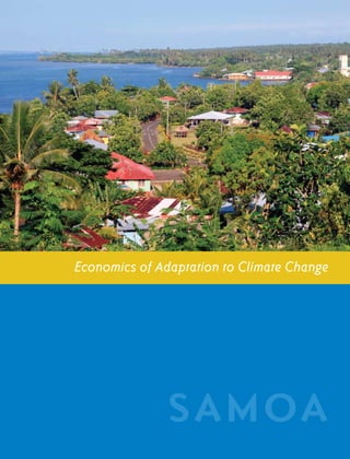
SAMOA
2. ii E C O N O M I C S O F A D A P TAT I O N T O C L I M AT E C H A N G E
EACC Publications and Reports
1. Economics of Adaptation to Climate Change: Synthesis Report
2. Economics of Adaptation to Climate Change: Social Synthesis Report
3. The Cost to Developing Countries of Adapting to Climate Change: New Methods
and Estimates
Country Case Studies:
1. Bangladesh: Economics of Adaptation to Climate Change
2. Bolivia: Adaptation to Climate Change: Vulnerability Assessment and Economic Aspects
3. Ethiopia : Economics of Adaptation to Climate Change
4. Ghana: Economics of Adaptation to Climate Change
5. Mozambique: Economics of Adaptation to Climate Change
6. Samoa: Economics of Adaptation to Climate Change
7. Vietnam: Economics of Adaptation to Climate Change
Discussion Papers:
1. Economics of Adaptation to Extreme Weather Events in Developing Countries
2. The Costs of Adapting to Climate Change for Infrastructure
3. Adaptation of Forests to Climate Change
4. Costs of Agriculture Adaptation to Climate Change
5. Cost of Adapting Fisheries to Climate Change
6. Costs of Adaptation Related to Industrial and Municipal Water Supply and
Riverine Flood Protection
7. Economics of Adaptation to Climate Change-Ecosystem Services
8. Modeling the Impact of Climate Change on Global Hydrology and Water Availability
9. Climate Change Scenarios and Climate Data
10. Economics of Coastal Zone Adaptation to Climate Change
11. Costs of Adapting to Climate Change for Human Health in Developing Countries
12. Social Dimensions of Adaptation to Climate Change in Bangladesh
13. Social Dimensions of Adaptation to Climate Change in Bolivia
14. Social Dimensions of Adaptation to Climate Change in Ethiopia
15. Social Dimensions of Adaptation to Climate Change in Ghana
16. Social Dimensions of Adaptation to Climate Change in Mozambique
17. Social Dimensions of Adaptation to Climate Change in Vietnam
18. Participatory Scenario Development Approaches for Identifying Pro-Poor Adaptation Options
19. Participatory Scenario Development Approaches for Pro-Poor Adaptation: Capacity
Development Manual
3. S A M OA CO U N T RY ST U DY i
Economics of Adaptation
to Climate Change
SAMOA
Ministry of Foreign Affairs
Government of the Netherlands
5. S A M OA CO U N T RY ST U DY iii
Contents
Acronyms vii
Acknowledgments ix
1 Overview 1
2 Vulnerability To Climate Change 5
Background 5
Projections of Climate Change—Global Scenarios 8
Sea Level Rise 9
3 Impacts Of Climate Change And Natural Hazards 11
Historical Experience 11
Modeling the Frequency of Extreme Events 12
Economic Damage Caused by Natural Disasters 13
Estimating the Costs of Adapting to Climate Change 14
The Potential Impact of Climate Change on the Agricultural Sector 16
Model of Climate-Economy Interactions 17
4 Adaptation Plans And Costs 19
Strategy for the Development of Samoa (SDS) (2008–12) 19
National Adaptation Programme of Action (NAPA) (2005) 20
Coastal Infrastructure Management (CIM) Strategy and Plans 22
Evidence of Prioritization and Sequencing—Donor Influence 23
Adaptation and Design Standards for Infrastructure 24
Coastal Protection 27
NAPA Adaptation Options 28
Agriculture 32
Adaptation Costs and Benefits 32
6. iv E C O N O M I C S O F A D A P TAT I O N T O C L I M AT E C H A N G E
5 Institutional and Social Analysis 39
Incorporation of Existing Data on Potential Risks and Hazards 39
Consistency Across and Within Sector Plans 40
Local Perspectives 40
Implementation: How Is It Working in Practice? 41
6 Lessons and Future Work 43
7 References 44
Annex 1. Storm Return Periods and Economic Damages 47
Annex 2. El Niño Events and Agricultural Production 49
7. S A M OA CO U N T RY ST U DY v
Tables
1. Projected Changes in Climate Variables by GCM and Region 8
2. Economic Damage Caused by Recent Natural Disasters in Samoa 14
3. Losses Due to Climate Change Without Adaptation 17
4. Adaptation Costs by Infrastructure Category for 10 Year Standard 26
5. Adaptation Costs as Percent of Baseline Expenditures 27
6. Adaptation Costs by Infrastructure Category for 50 Year Standard 28
7. Costs of Coastal Protection and Residual Damage from DIVA Model 29
8. Priority Adaptation Activities Based on the NAPA 30
9. Potential Adaptation Options for NAPA And CIM Plans 31
10. Dates for Implementation of NAPA Adaptation Measures by Region 32
11. The Impact of Climate Change with and without Adaptation 34
12. Total Cost of Adaptation for 10 Year Design Standards by Scenario and Decade 34
13. Total Cost of Adaptation for 50 Year Design Standards by Scenario and Decade 34
Figures
1. Main Islands in Samoa 5
2. Thirty-Year Climate Averages for Rainfall and Wind Distribution 6
3. Monthly Temperatures in Apia 1993-2008 7
4. Regions of Samoa Used in the Climate-Economy Model 7
5. Illustration of Cyclone Return Periods by Peak Wind Speed 13
6. Links Between the NAPA and the SDS with Reporting Relationships 21
7. Approval Process for Adaptation Projects 22
8. vi E C O N O M I C S O F A D A P TAT I O N T O C L I M AT E C H A N G E
9. S A M OA CO U N T RY ST U DY vii
Acronyms
ADB Asian Development Bank
CIM Coastal infrastructure management
CSIRO Commonwealth Scientific and Industrial Research Organisation
DIVA Dynamic and interactive vulnerability assessment
ENSO El Niño southern oscillation
GCM General circulation model
IFPRI International Food Policy Research Institute
MNRE Ministry of Natural Resources, Environment, and Meteorology
MWCSD Ministry of Women, Community and Social Development
NAPA National Adaptation Program of Action
NCAR National Center for Atmospheric Research
NCCCT National Climate Change Country Team
NOAA National Oceanic and Atmospheric Administration
SDS Strategy for the Development of Samoa
SLR Sea level rise
SPSLCMP South Pacific Sea Level and Climate Monitoring Project
SRES Special Report on Emissions Scenarios
Note: Unless otherwise noted, all dollars are U.S. dollars.
10. viii E C O N O M I C S O F A D A P TAT I O N T O C L I M AT E C H A N G E
11. S A M OA CO U N T RY ST U DY ix
Acknowledgments
The EACC study was conducted by a partnership coordinated production, and Hugo Mansilla pro-
consisting of the World Bank (leading its techni- vided editorial and production support.
cal aspects); the governments of The Netherlands,
The United Kingdom, and Switzerland (funding The study team would like to thank the part-
the study); and the participating case study coun- nership, which initiated, funded and actively
tries. The EACC study includes a global study and engaged with the study team through its mul-
seven country studies including the Samoa study. tiyear journey. The team is also grateful for the
active engagement throughout the study of the
The Samoa Country Study was coordinated by government of Samoa, in particular the Min-
Laurent Cretegny, Sergio Margulis, and Kiran istry of Natural Resource, Environment, and
Pandey. This report was written by Gordon Hughes Meteorology, Ministry of Finance, Ministry of
with contributions and other material provided by Agriculture and Fisheries, Ministry of Women,
Laurent Cretegny, Simon Bannock, Michele Daly, Community and Social Development, Ministry
Erwin Kalvelagen, Peter King, Thakoor Persaud, of Works, Infrastructure and Transport, Samoa
Isikuki Punivalu, Graeme Roberts,and Fernanda Water Authority, Samoa Bureau of Statistics,
Zermoglio (consultants). The peer reviewers were Samoa Tourism Authority, and the Land Trans-
Jan Bojo, Kirk Hamilton, Ian Noble, and Michael port Authority. We would also like to thank Rob-
Jacobsen. Robert Livernash provided editorial ser- ert Livernash for editorial services and Hugo
vices, Jim Cantrell contributed editorial input and Mansilla for production support.
12. x O NE
E C O N O M I C S O F A D A P TAT I O N T O C L I M AT E C H A N G E
13. S A M OA CO U N T RY ST U DY 1
Overview
Over the last two decades Samoa has suffered with the greater wind stresses and more intense
major damage from two cyclones in 1990–91, precipitation associated with worse storms.
minor damage from a third cyclone in 2004,
and an earthquake tsunami in 2009. Changes The impact of climate change on agriculture is
in the scale and impact of these types of nat- uncertain. Historical data show that variations in
ural disasters are likely to be important con- ENSO indices are correlated with variations in
sequences of climate change for the country precipitation in the following months. There is
because the increases in sea level and in aver- also a weaker correlation between El Nino events
age sea surface temperatures will increase the and declines in production of taro (the staple crop
intensity and damage from major storms. Other of Samoa) and rises in agricultural imports. If cli-
potential impacts are linked to changes in the mate change increases the magnitude and/or fre-
weather patterns associated with El Niño South- quency of strong El Niño events, this would have
ern Oscillation (ENSO) events. The primary an effect on agriculture. Still, the potential scale
concern focuses on the impact on agriculture, of the impact seems likely to be small relative to
especially in periods of lower precipitation fol- existing risks due to weather variability, disease,
lowing strong El Niño episodes. and external market conditions.
This study examines the consequences of an A macroeconomic model of the interactions
increase in average temperatures of up to 1°C between climate and the economy suggests that
by 2050 and up to 2.75°C by 2100 for the fre- the present value of the damage to the Samoan
quency and intensity of major cyclones that hit economy through 2050 due to climate change—
the islands. Estimates of the economic damage and without additional adaptation—may be
caused by storms in the past have been used to $104–$212 million; this is equivalent to 0.6–1.3
calibrate a damage function that yields an esti- percent of the present value of GDP over the
mated increase in the expected value of economic same period. The model assumes that sound
damage as the peak wind speeds for storms with development policies are adopted to minimize
return periods of 10, 50, or 100 years rise over the impact of existing weather risks and other
time. In this framework the key element of adap- natural hazards along with those from climate
tation is to ensure that buildings and other assets change. The loss of income falls on consump-
are designed to standards that enable them to cope tion rather than investment, so the reduction in
14. 2 E C O N O M I C S O F A D A P TAT I O N T O C L I M AT E C H A N G E
the present value of consumption is estimated at For agriculture the key element of an adaptation
0.9–1.9 percent. strategy is to increase expenditures on research,
development, and advisory services to mitigate the
The starting point for examining adaptation higher risks that are likely to be associated with
options is the observation that the Samoan econ- climate change. Again, this is building upon poli-
omy is resilient to storms with a return period of cies that would form part of a sound development
10 years but suffers significant damage from storms strategy. Samoan agriculture was hit hard by the
with a greater return period, i.e., storms of greater taro blight in the mid-1990s, which devastated taro
severity. This 10-year threshold is low by interna- production and eliminated taro export revenues
tional standards. The analysis suggests that raising for nearly 15 years. Vulnerability to disease, pests,
the threshold to 50 years would generate benefits and storm damage means that diversification of
that greatly outweigh the costs involved even with- both crop varieties and crops is an important ele-
out any consideration of climate change, reducing ment in any policy to limit the impact of these risks
the expected annual value of storm losses from on agricultural households. Since climate change is
5.5 percent to 0.7 percent of GDP. Implementing likely to reinforce these risks, the appropriate level
measures to ensure that buildings, infrastructure, of expenditure will be higher to reflect the greater
and similar assets are able to withstand storms with value placed upon risk reduction.
a return period of up to 50 years is a clear “no
regrets” strategy. It is justified even without climate The Government of Samoa has undertaken
change, but it will also greatly reduce the economic extensive consultations to identify community pri-
impact of climate change under the climate sce- orities for adaptation to climate change under the
narios that were examined. These actions can National Adaptation Program of Action (NAPA).
quicken the attainment of development of goals These include protection of community water sup-
including the MDGs. plies, support of agriculture and forestry sectors,
implementation of coastal infrastructure man-
The corollary of this strategy is to ensure that agement plans and integrated catchment man-
design standards are adjusted to take account of agement. This study applies a cost-benefit test to
prospective changes in the distribution of storms assess the appropriate timing of adaptation proj-
as a consequence of climate change. This leads ects identified in the National Adaptation Program
to the adoption of forward-looking design stan- of Action (NAPA). Some of these projects—e.g.,
dards rather than ones based on current climate upgrading water systems—are good development
conditions as an adaptation strategy. In practi- projects under current climate conditions. How-
cal terms this means that buildings and other ever, large investments in relocating coastal infra-
assets constructed in the near future should be structure should only be implemented if and when
designed to withstand wind speeds up to 160 the reduction in the expected value of storm dam-
kph —the projected 50-year storm in the decade age exceeds the annualized costs. If a 50-year storm
2050–59 under the Commonwealth Scientific design standard were implemented, the analysis
and Industrial Research Organisation (CSIRO) suggests that this type of adaptation may not be
scenario—rather than 148 kph (the 50–year justified before 2050 based on climate change con-
storm under current climate conditions). Strictly, siderations because the general gain from reducing
the design standards will vary for different cli- storm damage is not sufficient to warrant addi-
mate scenarios, and the additional costs of com- tional expenditures. However, these actions may
plying with the worst scenario may be viewed be justified as a measure to reduce the risks associ-
as a form of insurance against uncertainty over ated with non-climate hazards (for instance risk of
future climate outcomes. tsunamis associated with earthquakes).
15. S A M OA CO U N T RY ST U DY 3
The overall cost of adaptation is much higher change, especially with respect to activities which
under the CSIRO scenario than under the have a large overlap between development and
National Center for Atmospheric Research adaptation benefits. On the other hand, imple-
(NCAR) scenario because the former projects a menting an overall approach to adaptation based
much greater increase in the severity of flood- on an assessment of the risks associated with
ing and storms. Under the CSIRO scenario, the storms and other natural hazards is hampered
cost of adaptation would rise from $3.3 million by limitations in the collection and interpreta-
per year in 2010–19 to $10.9 million per year tion of consistent and relevant information. It
in 2040–49. The main cost arises from looking will be important to focus on strengthening the
forward to the end of the century in setting the government’s capacity to develop early warn-
design standards for buildings and infrastructure ing systems, to effectively utilize these warning
constructed in the 2030s and 2040s. systems to prepare for and prevent losses, to
develop, update and implement design stan-
The Government of Samoa, with external assis- dards, and other measures required to mitigate
tance, is implementing a program to act on the damage caused by projected changes in the
community priorities for adaptation to climate frequency and severity of storms.
16. 4 T WO
E C O N O M I C S O F A D A P TAT I O N T O C L I M AT E C H A N G E
17. S A M OA CO U N T RY ST U DY 5
Vulnerability to
Climate Change
Background is projected to increase slowly to about 210,000
by 2050. Average life expectancy at birth was 72.8
Samoa is a small island country located in the years in 2006, which is higher than the median
South-West Pacific between latitudes 13°–15°S for Pacific Island countries. About 76 percent of
and longitudes 168°–173°W. It has four main the population live on the island of Upolu. The
inhabited islands and six small uninhabited islands capital and only significant urban center is Apia in
with a total land area of 2,935 sq. km. The two North Upolu with a population of about 40,000.
main islands are Savai’i (the larger of the two but
much less densely populated) and Upolu (Figure The islands are volcanic in origin, so the topog-
1). The population is approximately 183,000 and raphy includes mountains up to 1,850 m as well
Figure 1 Main Islands in Samoa
18. 6 E C O N O M I C S O F A D A P TAT I O N T O C L I M AT E C H A N G E
Figure 2 Thirty-year Climate Averages for Rainfall and Wind Distribution
Source: MNRE, Meteorology Division - Figure 2 in Government of Samoa (2005)
as low-lying coastal areas. About 70 percent of occur in the period from December to February.
the country’s population live in the coastal zone. The islands are also affected by dry spells that
The coastal zone is vulnerable to sea level rise, coincide with the El Niño Southern Oscillation
and all areas are subject to damage caused by the (ENSO). Figure 2 shows the geographical distri-
high winds, storm surges, and torrential rainfall bution of annual precipitation and wind speeds
associated with severe tropical cyclones. It is esti- based on historic averages from 1961 to 1990,
mated that two cyclones—Ofa in 1990 and Val in while Figure 3 shows temperatures in Apia over
1991—caused damage to agriculture, infrastruc- the last two decades.
ture, and other assets valued at 2.5 to 3 times the
country’s GDP in 1990. A review of historical climate trends for Apia
suggests that the daily maximum temperature
The climate is tropical with a wet season from increased by about 0.7°C over the 20th century
November to April and a dry season from May while the daily minimum temperature increased
to October. Temperatures vary little over the by 0.2°C. Average annual precipitation decreased
year with a typical daily range of 24° to 32°C. by about 49 mm over the century. There is some
Average annual rainfall is high at 3,000 mm; evidence that the severity and/or the frequency
about two-thirds of annual rainfall falls in the of tropical cyclones have increased in the SW
wet season. Severe tropical cyclones tend to Pacific; see Chapter 1 of World Bank (2006).
19. S A M OA CO U N T RY ST U DY 7
Figure 3 Monthly Temperatures in Apia, 1993-2008
33°
32°
31°
MAXIMUM
30°
29°
28°
27°
MEAN
26°
25°
24°
MINIMUM
23°
22°
21°
20°
19°
18°
1990 1992 1994 1996 1998 2000 2002 2004 2006 2008 2010
Source: SPSLCMP data; Figure 18 in SPSLCMP (2008).
Figure 4 Regions of Samoa used in the Climate-Economy Model
CLIMATIC HAZARDS: WINDS, LIMITED OR ERRATIC RAINFALL
KEY ECONOMIC ACTIVITY: TOURISM
SAVAII NORTH
SAVAII SOUTH
KEY ECONOMIC ACTIVITY: TOURISM
KEY ECONOMIC ACTIVITY:
MAJOR ECONOMIC ZONE
ECONOMIC GROWTH: HIGH
UPOLU NORTH
UPOLU SOUTH
Source: World Bank. KEY ECONOMIC ACTIVITY: TOURISM
ECONOMIC GROWTH: MODERATE
This study has divided the country into four climate-economy model. Figure 4 illustrates the
regions: Savai’i North (SN), Savai’i South (SS), regional division and highlights the major eco-
Upolu North (UN), and Upolu South (US). This nomic characteristics of each region. Upolu
allows for regional differences in climate sce- North contains Apia and has the highest popu-
narios, economic activity, and incomes in the lation, including all of the urban population.
20. 8 E C O N O M I C S O F A D A P TAT I O N T O C L I M AT E C H A N G E
Table 1 Projected Changes in Climate Variables by GCM and Region
Baseline values for NoCC Deviations in 2050 relative to NoCC
Precipita- Precipita- Mean Precipita- Precipita- Mean
Total pre- tion tion tempera- Total pre- tion tion tempera-
Climate cipitation Dec–Feb Nov–Apr ture cipitation Dec–Feb Nov–Apr ture
model Region (mm) (mm) (mm) (°C) (mm) (mm) (mm) (°C)
NCAR Savai’i North 2,958 1,062 1,921 26.87 -17 -39 5 0.99
NCAR Savai’i South 3,002 1,107 1,971 26.86 -19 -41 3 0.99
NCAR Upolu North 3,048 1,154 2,024 26.83 -21 -42 0 0.99
NCAR Upolu South 2,929 1,090 1,942 26.67 106 -8 118 0.97
CSIRO Savai’i North 2,958 1,062 1,921 26.87 277 43 197 0.81
CSIRO Savai’i South 3,002 1,107 1,971 26.86 343 65 215 0.83
CSIRO Upolu North 3,048 1,154 2,024 26.83 344 68 218 0.83
CSIRO Upolu South 2,929 1,090 1,942 26.67 335 66 213 0.83
Source: World Bank analysis; see World Bank (2009); NoCC= no climate change
The situation is rather more complicated for
Projections of Climate precipitation. Notwithstanding its name, the
Change – Global Scenarios Global Wet scenario projects changes in total
annual precipitation by region in the range ‑21
to +106 mm by 2050 with a value of -21 mm for
Samoa is covered by four of the 0.5° grid cells for Upolu North. In contrast, the Global Dry sce-
which projections of climate variables have been nario projects changes in the range +277 to +344
downscaled from the results of the general circula- mm by 2050 with a value of +344 mm for Apia.
tion models (GCMs) used in this study. These can There are also changes in the seasonal distribu-
be mapped to the four regions shown in Figure 4 tion of rainfall. For example, total precipitation
with the largest population in the grid cell cen- for December–February—the prime period for
tered on 13.75°S, 171.75°W, which corresponds cyclones—falls by about 40 mm by 2050 in the
to Upolu North and covers Apia. The Global Wet Global Wet scenario, whereas precipitation dur-
(NCAR) and Dry (CSIRO) scenarios differ little ing the rainy season from November to April is
with respect to the increase in the annual average stable or increases slightly in Upolu South. Thus,
temperature (Table 1). The Global Wet scenario the dry season becomes drier while the transi-
projects an increase of 0.97–0.99°C by 2050 for tional months of the wet season become wetter
the four regions, while the Global Dry scenario in this scenario. The shift is not as marked for the
for 2050 projects an increase of 0.81–0.83°C by Global Dry scenario but still roughly one-half of
2050 for the four regions. Since the differences the increase in annual precipitation occurs during
between regions are much smaller than the stan- the transitional months of the wet season.
dard errors of the projections, it is reasonable
to assume a uniform increase of about 1°C for Observation and modeling suggest that higher
the Global Wet scenario and about 0.8°C for the global temperatures, including sea surface tem-
Global Dry scenario. Changes in average daily peratures, will mean that the peak wind speeds
maximum and daily minimum temperatures (not and probably precipitation and flooding associ-
shown) are almost identical to the changes in aver- ated with severe cyclones will increase. This is
age daily mean temperatures. equivalent to a shift in the tail of the distribution
21. S A M OA CO U N T RY ST U DY 9
of extreme weather events (see Annex 1). These scenario in the coastal protection component of
considerations point to a more frequent return the global study. The main scenario included in
period of cyclones with the severity of Cyclones the global estimates assumes a rise of 87 cm from
Ofa and Val, which had a devastating impact on 1990 to 2100. Other forecasts for sea level rise
Samoa in 1990–91 (see Section 3). However, since in the South Pacific are considerably more pes-
these cyclones rank second and third in the list of simistic. Evidence about changes in the height of
the most damaging cyclones in the South Pacific storm surges is even more difficult to obtain, but
region as a whole in the last 50 years, it is very dif- recent trends indicate that the difference between
ficult to quantify the potential change in exposure average sea level and the maximum value of
to extreme storm damage for different scenarios. hourly sea level measured in each year has been
increasing at about 3 cm per decade (Young 2007).
There is a separate but less well–documented
concern that the severity—and perhaps the fre- The main earthquake zone in the South Pacific
quency—of ENSO cyclical variations in weather lies about 200 km south of Samoa, with more
conditions will increase. This could mean that than 12 earthquakes of magnitude 7 or greater
the severity of ENSO dry periods may increase, since 1900. This means that the risks to coastal
especially under the Global Wet scenario for infrastructure associated with climate change
which average precipitation during the dry sea- must be assessed in a framework of vulnerability
son is expected to fall. This is discussed further to other natural shocks.
in Section 3.
Data collected by SPSLCMP show 18 separate
tsunami events over 15 years, with the largest
Sea Level Rise trough-to-peak height of 570 cm after an earth-
quake near the Kuril Islands in November 2006.
The South Pacific Sea Level and Climate Moni- The tsunami that followed the magnitude 8.1
toring Project (SPSLCMP) has collected sea level earthquake, which occurred about 190 km south
and climate data for Samoa since 1993. The most of Apia in September 2009, is reported as hav-
recent country report published in December 2008 ing a trough-to-peak height of 140 cm in Apia.
gives an average increase in sea level of 4.9 mm per The waves that struck parts of South Upolu were
year at Apia.1 If sustained over the 21st century much greater; for example, the tsunami generated
this would imply an increase of 54 cm from 1990 a trough-to-peak height of 314 cm in Pago Pago
to 2100, which is a little greater than the assump- (American Samoa), and there were reports of
tion of 40 cm used for the low sea level rise (SLR) waves of up to 450 cm in parts of Upolu.
1 Figures for another sea level gauge yield an average increase
of 2.1 mm per year over a longer period, but this estimate is
regarded as less reliable because of less precision and poorer
datum control.
22. 10 TH REE
E C O N O M I C S O F A D A P TAT I O N T O C L I M AT E C H A N G E
23. S A M OA CO U N T RY ST U DY 11
Impacts of Climate Change
and Natural Hazards
Historical Experience the Apia Observatory suggested a return period
of about 25 years with a storm surge of 1.6 m and
Over the last two decades Samoa has suffered onshore sustained wind velocity of 130 kph.
serious economic shocks caused by four major
natural disasters. The worst of these were two
severe cyclones in successive seasons—1989–90 Cyclone Val (December 1991)
and 1990–91—which caused massive damage to
infrastructure and other assets. Cyclone Val was classified as a Category 5 hur-
ricane with wind speeds up to 240 kph. It was
Cyclone Ofa (February 1990) judged to be the most destructive storm to hit the
Samoan islands in the 20th century because of
Cyclone Ofa was classified as a Category 4 hur- its intensity, irregular path, and slow speed (Fair-
ricane with wind speeds up to 215 kph. It struck bairn 1997). Damage was caused by a combina-
Samoa as the storm was strengthening and con- tion of high winds, heavy rains, and wave action.
tinued to affect Samoan waters during the worst The duration of the cyclone and the shifts in wind
phase of the storm. Extensive damage occurred direction exacerbated the destructive effects of
along the northern coasts of both Upolu and high winds, so that crops and plantations, natural
Savai’i. A review of the damage on Upolu caused vegetation, buildings, and other structures all suf-
by the storm reported seven deaths; major dam- fered extensive damage. The main effects of high
age to buildings and infrastructure caused by waves were felt on the south coasts of Upolu and
waves that inundated coastal zones and high Savai’i, an unfortunate complement to the impact
winds inland; disruption to shipping and commu- of Cyclone Ofa. The storm was reported as hav-
nications, partly caused by damage to infrastruc- ing caused 12 deaths in Samoa. It defoliated a
ture and partly as a consequence of the beaching high proportion of trees on the main islands, and
of the country’s main passenger/cargo ferry; and caused the complete loss of nearly 50 percent of
loss of reclaimed land, plus damage to agricultural coconut trees. Analysis of wind speeds and the
assets such as plantations caused by flooding and associated storm surge suggested that the storm
wind (Rearic 1990). A comparison of the severity had a return period of about 100 years, with an
of the storm with a theoretical 100–year storm by onshore sustained wind velocity of 165 kph.
24. 12 E C O N O M I C S O F A D A P TAT I O N T O C L I M AT E C H A N G E
Cyclone Heta (January 2004) systems can minimize loss of life, though they
cannot prevent widespread structural damage
Cyclone Heta passed near to or struck Samoa, with high economic costs.
American Samoa, Tonga, and Niue over a period
of about a week from January 2 to January 8,
2004. Samoa was relatively fortunate, since the Modeling the Frequency
center of the storm passed about 110 km west of of Extreme Events
the country at a point when it was still classed as
a Category 2 hurricane. Even so, sustained wind
speeds of 110 kph were reported in Apia with Statisticians and others interested in analyzing
gusts up to 145 kph. Damage on Samoa included natural hazards such as tropical storms, floods, or
the loss of or disruption to power, water, and tele- earthquakes have developed standard methods of
communications on Savai’i plus limited flooding modeling the distribution of extreme events over
in Apia. On the other hand, Alofi—Niue’s capi- a period of time. Suppose that the severity of
tal city—was devastated by the direct impact of tropical storms is measured by its peak wind speed
Cyclone Heta, which at that stage was classified measured over a period of 10 minutes and that St*
as a Category 5 hurricane. denotes the peak wind speed for the worst storm
in year t. This is closely correlated to the amount
Tsunami (September 2009) of wind damage caused by the storm and is likely
to provide a reasonable proxy for storm damage
In the early morning of September 29, 2009, an caused by rain and flooding since higher wind
earthquake of magnitude 8.1 in the Kermadec- speeds tend to be associated with more intense
Tonga Subduction Zone (part of the Pacific Ring precipitation over periods of 6 to 12 hours.
of Fire) generated a tsunami that struck the south-
ern coastal areas of Samoa about 10 minutes The probability that a storm with a wind speed
after the earthquake. It is reported that the waves greater than S will occur in year t at a particu-
caused damage up to 14 m above sea level on the lar location—prob (St* ≥ S)—is usually assumed
coast of South Upolu and traveled up to 0.7 km to follow the cumulative distribution function for
inland. Twenty coastal villages in the south and some variant of the generalized extreme value
southeast of Upolu were mostly destroyed, with (GEV) distribution (Annex 1). The return period
widespread damage to transport, power, and tele- of a cyclone with peak wind speed S is the recipro-
communications infrastructure. About 5,300 peo- cal of this probability. Carter (1990) examines the
ple were affected, with 3,000 losing their homes. return period for cyclones in the South Pacific,
the Samoa 5-degree square, and Apia.2
The reported death toll caused by the tsunami
in Samoa was 155—more than 5 times the total The “historic” curve in Figure 5 shows the esti-
number of deaths caused by cyclones from 1990 mated return periods for peak wind speeds of
to 2010. One lesson is that loss of life and eco- cyclones during the 20th century, while the
nomic damage caused by natural disasters are
not closely correlated. Geological events such as 2 Unfortunately, the expressions given in the paper for peak wind
speed, wave height, etc., as a function of the return period—
earthquakes and tsunamis, which are concen- equations (4) to (8)—are clearly wrong, though the graphs appear
trated in their impact and occur with little or no to be correct. For example, using Figure 4 the text states that the
wind speed with a 40–year return interval is 77 knots, whereas
warning, cause much heavier loss of life relative equation (4) yields a value of 438 knots (p. 15). Thus, the return
to their economic costs than weather events for periods quoted in the text have been used to derive correct values
of the Gumbel distribution parameters used for the calculation
which effective disaster planning and warning of historic return periods in Figure 5.
25. S A M OA CO U N T RY ST U DY 13
Figure 5 Illustration of Cyclone Return Periods by Peak Wind Speed
RETURN PERIOD (YEARS)
200
180
160
140
120
100
80
60
40
20
0
100 110 120 130 140 150 160 170 180 190 200 210 220
WIND SPEED (KPH)
HISTORIC CLIMATE FUTURE CLIMATE - LOW FUTURE CLIMATE - HIGH
“future” curve illustrates how the return periods infrastructure, and other assets shortly after the
might fall if it is assumed that both the location event, and (b) the present value (using a real dis-
and scale parameters of the storm distribution count rate of 5 percent) of the shortfall in GDP
increase by either 10 percent (Future climate– relative to the trend rate of economic growth
low) or 25 percent (Future climate–high) due to prior to the shortfall in economic growth.3
climate change. These increases correspond to
the range for the year 2100 discussed below. The Such figures must be treated with some caution.
changes have the effect of reducing the return It is often unclear how the value of damage to
period of a storm with a peak wind speed of 165 capital assets is obtained. The usual procedure
kph (89 knots) from 100 years to approximately is to estimate the cost of repairing or replacing
55 years for the low scenario and 26 years for the damaged assets, but this is rarely carried out on
high scenario. a like-for-like basis. Existing assets may be old
and will have been partly or fully depreciated.
They are usually less efficient or they may be less
Economic Damage Caused suitable for current requirements. Indeed, own-
by Natural Disasters ers may decide that it is not economic to replace
them. Hence, the economic value of assets that
Table 2 summarizes estimates of the economic 3 For example, over the years 1992–94 GDP fell 7–8 percent below
damage—expressed as one-off capital losses— the cyclically adjusted trend in GDP, apparently as a consequence
of the combined effects of Cyclones Ofa and Val. The shortfall
caused by the natural disasters that have affected was about 12 percent for agricultural GDP in 1994 since agricul-
Samoa over the past two decades. The estimates tural assets, particularly coconut palms, were severely affected by
Cyclone Val. However, by 1996 both total and agricultural GDP
are based upon (a) reports of damage to buildings, had recovered to match the pre-disaster trends.
26. 14 E C O N O M I C S O F A D A P TAT I O N T O C L I M AT E C H A N G E
Table 2 Economic Damage Caused by Recent Natural Disasters in Samoa
Return Asset damage Loss of GDP Total GDP Loss as
period US$ million, US$ million, US$ million, percent
Event Years 2005 prices 2005 prices 2005 prices of GDP Notes
Cyclone Ofa 25 166 15 161 113 Buildings & infrastructure
Cyclone Val 100 388 36 163 260 30% agricultural assets
Cyclone Heta 10 1 4 236 2 Limited damage
Tsunami 2009 50 54 50 277 38 Buildings, infrastructure
& tourism
Source: World Bank estimates
are damaged is likely to be significantly less than Estimating the Costs of
their replacement or even repair costs. Adapting to Climate Change
Similarly, the estimates of the loss of GDP caused
by Cyclones Ofa and Val shown in the table are The technical basis for calculating the change in
somewhat overstated, because they include the the expected value of storm damage as a conse-
impact of the taro blight, which affected crop pro- quence of a shift in the probability distribution of
duction from 1994 onward and delayed the full cyclones is set out in Annex 1. This focuses atten-
recovery from the disasters by up to two years. tion on two components of the costs of adapting
Further, the higher rate of economic growth asso- to climate change:
ciated with recovery from the damage caused
by the storms persisted after the recovery and A. The changes in design standards required to
the long-term rate of economic growth clearly ensure that new or upgraded assets can resist
increased in the late 1990s. The storms were cer- the higher wind speeds to which they are likely
tainly not a benefit in disguise, but their long-term to be exposed as a consequence of the shift in
impact has been reduced by pushing the Samoan the distribution of storms hitting Samoa. This
economy toward sectors that appear to support a approach is built into the estimates of the costs
higher long-term rate of economic growth. These of adaptation for infrastructure and related assets
considerations mean that the estimates shown in prepared for Samoa under the global analysis of
Table 2 set an upper bound on the economic losses the cost of adaptation. These global estimates
associated with storms of different return periods. include an allowance for the increased costs of
maintenance and/or accelerated replacement
Policies to minimize the economic damage caused of existing assets because they were built to
by cyclones will require the adoption of building lower design standards and are more likely to be
standards capable of withstanding much greater damaged by storms with higher wind speeds.
wind stresses or relocating infrastructure so that
it is less susceptible to damage caused by flood- B. Expenditures and investments for other mea-
ing and/or wave action. These measures will also sures to adapt to climate change that were
reduce the impact of geological events, though identified in the NAPA. These are discussed in
the attraction of coastal areas for tourism will more detail in Section 4 below.
inevitably mean that people and assets are vulner-
able to events triggered by earthquakes. There is, however, an important constraint
on any detailed examination of the impact of
27. S A M OA CO U N T RY ST U DY 15
climate change or the costs of adaptation. It is scenario for Samoa—it has been assumed that
clear that a key feature of climate change for the key parameters of the distribution increase
Samoa is the possibility that the distribution of by 4 percent to 2050 and by 10 percent to 2100.
extreme weather events—primarily cyclones but These figures fall within the range identified by
also ENSO droughts—will shift to more frequent Knutson, et al. (2010) and they correspond to
or severe cyclones hitting the islands. Unfortu- the increases in average temperatures for this
nately, the empirical evidence on how the distri- scenario combined with the middle of the range
bution might shift over time for different climate of the sensitivity of cyclone intensity to ocean
scenarios is very limited (IWTC 2006). temperatures.4 As a high estimate—linked to
the relatively wet CSIRO scenario for Samoa—
The damage caused by tropical cyclones is due it has been assumed that the key parameters of
to a combination of high winds and precipitation the distribution increase by 8 percent to 2050 and
leading to flooding. Both Emanuel (2005) and by 25 percent to 2100. These figures allow for a
Knutson, et al. (2010) emphasize the link between strong shift toward more intense cyclones and a
sea surface temperatures and cyclone intensity, greater intensity of precipitation associated with
with higher ocean temperatures being associ- such cyclones. The assumptions for the CSIRO
ated with both higher sustained wind speeds and scenario are intended to provide a worst-case
higher rainfall. Generally, changes in sea surface scenario for the change in the distribution of
temperatures follow changes in average land tem- cyclones given current knowledge.
peratures but with a considerable lag. For this
analysis there is little alternative other than to rely The analysis has also taken account of a signifi-
upon changes in average land temperatures as the cant change in the distribution of precipitation
basis for distributing changes in storm intensity over the year, especially for the CSIRO scenario.
up to 2050 and 2100. Total precipitation during the rainy season aver-
aged over the grid cells is 1,965 mm for the
In the most recent assessment of probable shifts NoCC scenario and increases to 2,175 mm for
in the intensity and frequency of cyclones as a the CSIRO scenario. This is likely to increase the
result of climate change, Knutson, et al (2010) overall probability of severe flooding during the
suggest that the overall intensity of cyclones rainy season and will require higher design stan-
may increase by 2–11 percent in the period to dards for buildings, roads, storm water drainage,
2100, with the main driver being the increase in and similar infrastructure to cope with an increase
ocean temperatures. This change may involve a in the intensity and volume of rainfall. Hence, the
decrease in the frequency of cyclones but with a calculations of the cost of adaptation include an
large margin of uncertainty (6–34 percent) off- allowance for the costs of providing greater resil-
set by an increase in the frequency of the most ience to flooding linked to precipitation in the
intense cyclones. In addition, increases on the rainy season. This is separate from and additional
order of 20 percent are likely in the intensity of to the costs associated with the increase in precip-
precipitation within 100 km of the storm for the itation intensity associated with severe cyclones.
most severe cyclones.
To capture the uncertainty about changes in both
the peak wind speeds and precipitation associated 4 The statement prepared by a WMO expert group (IWTC 2006)
states that both theory and observation support a conclusion that
with any shift in the distribution of cyclones by the intensity of tropical cyclones will increase by 3–5 percent per
intensity, a range of values has been used. As a 1°C rise in sea surface temperature. Emanuel (2005) uses a figure
of 5 percent in considering changes in his power dissipation
low estimate—linked to the relatively dry NCAR index for tropical cyclones.
28. 16 E C O N O M I C S O F A D A P TAT I O N T O C L I M AT E C H A N G E
The Potential Impact of Annex 2 provides details of a statistical analysis
of the links between ENSO events, precipitation,
Climate Change on the and agricultural production. This confirms that
Agricultural Sector strong El Niño periods lead to a reduction of about
18 percent in precipitation in the months that fol-
The agricultural sector in Samoa is a crucial source low, with little difference between the impact in
of employment—providing the main occupation the wet and dry seasons. If climate change were
for 32 percent of the workforce in the 2006 Cen- to lead to a 50 percent increase in the variation
sus—but is a much smaller contributor to GDP. between normal and extreme ENSO conditions,
Agriculture and fishing accounted for 10 percent then strong El Niño periods might be associated
of GDP at constant prices in 2008, down from 20 with a reduction of up to 27 percent in precipita-
percent in 1988, before hurricanes Ofa and Val tion. However, there is one important qualifica-
and the taro blight. Value-added in agriculture tion. The analysis also indicates that the influence
and fishing at constant prices reached a peak in of ENSO events on precipitation may have been
1996 and fell by 30 percent from 1996 to 2004. declining since 1950. If this apparent trend is real
Since 2004 agricultural output has grown but less and continues in future, the impact of climate
rapidly than the rest of the economy, so that value- change on the variability of ENSO-related pre-
added in agriculture on its own has fallen from 8.1 cipitation would be small.
percent to 6.2 percent of GDP over the five-year
period 2004–09. This share is likely to fall below 5 In any case, the relationship between ENSO-
percent in the decades up to 2050. related changes in precipitation and agricultural
production has not been large in the past. The
Research into the potential impacts of climate second part of the statistical analysis looked at the
change on crop yields and viability in Samoa and extent to which ENSO events have been associ-
other South Pacific islands is very limited. The ated with fluctuations in crop production, crop
general assessment seems to be that an increase of yields, and trade in agricultural products. Again,
1°C in average temperatures and minor changes the results confirm that there is a link primarily
in total precipitation up to 2050 will not have a driven by the impact of ENSO events on taro
large effect on yields of the main crops such as production. A typical strong El Niño event has
taro, bananas, and coconuts; see, for example, the been associated with a decline of 5–8 percent in
analysis for Vita Levu, Fiji in World Bank (2000). taro production and an increase of 3–5 percent
The changes are within the range of variation in the value of agricultural imports. The effects
observed across countries where the same or simi- might rise to a decline of 8–12 percent in taro
lar varieties are grown.5 Nonetheless, uncertainty production and a rise of 5–7 percent in agricul-
about the effects of climate change would war- tural imports if the climate change were to lead
rant expenditures on agricultural research and to a 50 percent increase in the variation between
development as an insurance policy. normal and extreme ENSO conditions.
A separate concern has been expressed about the To put these potential changes in context, the trend
prospect of more severe dry periods associated with rate of growth in agricultural imports has been 6.2
ENSO events. Again, the evidence on this issue percent per year over the last two decades, while
is limited and open to different interpretations. variations in agricultural production caused by
the cyclones in 1990–91 or the taro blight were an
5 This is documented in the relevant data sheets from FAO’s order of magnitude greater than the potential vari-
Ecocrop database, which can be accessed at: http://ecocrop.fao.
org/ecocrop/srv/en/home. ations associated with the effect of climate change
29. S A M OA CO U N T RY ST U DY 17
Table 3 Losses due to Climate Change without Adaptation
No adaptation
NCAR (1) CSIRO (2)
Present value @ 5 percent, $ million 103.9 212.4
Annualized equivalent, $ million per year 5.9 12.1
Loss/benefit as percent of baseline GDP 0.6% 1.3%
Loss/benefit as percent of baseline consumption 0.9% 1.9%
Source: World Bank estimates.
on the intensity of ENSO events. This means that (c) Growth rates for population and GDP without
a sound strategy for reducing the effects of existing climate change correspond to the baseline data
weather and agricultural risks on farmers and the used for the Global Track estimates. These
economy should be the starting point for adapt- assumptions determine the growth in capital
ing to climate change. Crop diversification, reli- stock and total factor productivity.
ance upon varieties that can cope better with dry
periods or resist wind damage, the development of (d) Gross investment is calculated assuming a stan-
alternative sources of employment and income, dard depreciation rate applied to the current
and similar measures will limit the damage caused capital stock plus net capital accumulation.
by existing risks and facilitate adaptation to climate
change. It will then be easier and less expensive (e) Total consumption is equal to total output
to implement additional measures to reduce vul- minus climate damage, adaptation costs, and
nerability to risk if concerns about changes in the gross investment. The present value in 2010 of
severity of ENSO events due to climate change are total consumption from 2010 to 2050 is used
sustained by evidence from experience over the to assess the impact of climate change and the
coming decades. effects of adaptation.
The expected value of the economic damage
Model of Climate-Economy caused by cyclones is calculated in the manner
Interactions described in Annex 1 using the shifts in the prob-
ability distribution of storms by 2050 for the
NCAR and CSIRO scenarios based on changes
A simple climate-economy model has been used to in average temperature. To maintain investment
examine the impact of climate change on economic and economic growth, the damage caused by
activity and the effects of spending on adaptation storms has the effect of reducing consumption,
measures. The key features of the model are: so that the cost of climate change for each sce-
nario is measured as the reduction in the pres-
(a) There are four regions, North and South ent value of consumption in USD at 2005 prices
Upolu/Savai’i, with populations and value- over the period 2010–50. Without any adapta-
added derived from the 2006 census. tion, Table 3 shows that the loss of consumption
is $104 million for the NCAR scenario or $212
(b) Total output in each region is calculated using million for the CSIRO scenario. The annual-
a Cobb-Douglas production function in capital ized equivalent is $5.9 million per year for the
and labor, with the capital share calibrated to NCAR scenario and $12.1 million per year for
match input shares and investment in 2006. the CSIRO scenario.
30. 18 FO UR
E C O N O M I C S O F A D A P TAT I O N T O C L I M AT E C H A N G E
31. S A M OA CO U N T RY ST U DY 19
Adaptation Plans
and Costs
Samoa has a rapidly developing and increasingly Development of Samoa (SDS) (2008–12), which
sophisticated framework of strategies, plans, and seeks to “ensure sustainable economic and social
regulations that have developed over time to meet progress.” The SDS provides a framework on
international conventions, international monitor- national priorities under key development sectors.
ing and reporting requirements, and governance The government has identified seven goals under
best practice goals. Many of the older national- this framework. Climate change is mentioned in
level strategies have been developed at different Goal 7: Environmental Sustainability and Disas-
times as a result of different drivers, but an effort ter Risk Reduction.
has been made to integrate planning in different
sectors with a broad development strategy. An insti- In the SDS under Goal 7, climate change adapta-
tutional reform in 2003, which merged 26 depart- tion is identified as a cross-cutting issue alongside
ments into 13 ministries, provided the opportunity environmental sustainability. Adaptation to climate
to review and update some of the legislation. change is linked with deforestation and cyclone fre-
quency (natural disasters). Mitigation activities are
Adaptation to climate change as a concept and also identified and linked to renewable energy pri-
priority is reflected through all government and orities. The primary focus is on the link between
planning levels, most noticeably in high-level plans climate change and disaster management, which
and strategies. Translating these general goals into reflects the critical concern that climate change will
regular corporate and departmental plans is more lead to increased frequency and intensity of storms.
difficult, though the programs and projects under Coastal communities in Samoa are already at high
way are consistent with development priorities and risk from cyclones, and their vulnerability to coastal
could be considered as adaptation activities. inundation and erosion has already been assessed.
Priority activities to address Goal 7 in the related
Strategy for the Development areas of climate change and disaster management
of Samoa (SDS) (2008–12) are to “implement the Disaster Management Act
2007 through various programs and projects aimed
at both climate mitigation (greenhouse gas reduc-
The overarching document in Samoa that guides tions) and disaster readiness.” Increasing resilience
all other development is the Strategy for the to the adverse impacts of climate change will be
32. 20 E C O N O M I C S O F A D A P TAT I O N T O C L I M AT E C H A N G E
addressed through continued work on coastal Significantly, NAPA led to:
management and adaptation programs for vulner-
able villages and other coastal locations, as well ■■ The creation of the Samoa National Climate
as activities such as promotion of energy-efficient Change Country Team (NCCCT) and NAPA
building design. Task Team, both cross-sectoral teams compris-
ing representatives from mainly government
The environment is to feature prominently as a departments but also NGOs and other interests
cross-cutting consideration in all planning activities,
including the formulation of sector plans. There ■■ The preparation of a Climate Synthesis
will be a focus on improved environmental man- Report, which assessed the current vulnerabil-
agement, compliance, and monitoring in 2008– ity and potential increase in climate hazards
2012, with the Ministry of Natural Resources, and associated risks of critical sectors
Environment and Meteorology (MNRE) the key
implementing agency (including for climate change ■■ Discussion of adaptation needs and priorities
adaptation). The Planning and Urban Manage-
ment Act 2004 aims to “implement a framework ■■ Consideration of whether and how to sepa-
for planning the use, development, management rate climate change adaptation activities from
and protection of land in Samoa in the present and other development activities.
long-term interests of all Samoans and for related
purposes.” Under the act, any development activ- The relationship of the NAPA to the SDS and
ity requires a development consent with a support- its potential for influence on the development of
ing environmental impact assessment (EIA) unless sector plans is shown in Figure 6.
a sustainable management plan or regulations pro-
vide otherwise. The capacity of the Planning and From interviews with participants and others, a
Urban Management Agency to enforce the regula- number of issues were identified:
tions and undertake or facilitate a greater level of
community consultation will need to be strength- ■■ The original Climate Risk Profile was based on
ened for this to occur. fairly limited climate data available at the time.
This has been identified as an issue and improv-
ing climate monitoring features as a priority
National Adaptation program area. An updated Climate Risk Profile
Program of Action (NAPA) has now been prepared (Young 2007).
(2005) ■■ The ranking of activities was based on a con-
sensus approach rather than a more objective
NAPA and its development were discussed in multicriteria analysis or similar method outlined
the desk-top study by Beca (2010). NAPA is the in the annotated guidelines for the preparation
key document for the identification of the most of NAPA. In part, this was a consequence of
urgent and immediate adaptation needs from the the lack of good information on both the eco-
adverse impacts of climate change. Samoa was nomics and effectiveness of adaptation options.
one of the first countries to receive funding from A consensus-based approach fitted in well with
the Global Environment Facility (GEF) to develop the cultural norms of working together. Lim-
its NAPA, which took two years of comprehensive ited understanding among the community of
information and data collection, as well as exten- climate change and of the effect of different
sive countrywide consultation. adaptation activities influenced the ranking of
33. S A M OA CO U N T RY ST U DY 21
Figure 6 Links between the NAPA and the SDS with Reporting Relationships
STRATEGY FOR
DEVELOPMENT OF SAMOA
(SDS) 2008-2012
NATIONAL ADAPTATION SECTION PLAN FOR EACH
PROGRAMME OF ACTION OF 15 SECTORS, EACH
(NAPA) 2005 PLAN BASED ON THE SDS.
CORPORATE PLAN FOR MINISTRY
EACH MINISTRY STRATEGIC ANNUAL
MAY HAVE LINKS TO MORE
MANAGEMENT PLAN
THAN ONE SECTION PLAN
SERVICE MINISTRY
CHARTERS BUDGET
CAPABILITY NATIONAL
PLANS BUDGET
Source: Beca International Consultants Ltd (2010)
alternatives. For example, construction of sea- sooner or later. Projects are designed so that
walls features as an urgent community need, they clip onto existing programs largely funded
even though other strategies emphasize the role through bilateral agreements and sector pool
of more cost-effective measures. funds. Figure 7 illustrates the approval process.
Assistance in setting priorities—stages 1 to 3—
■■ Economic assessments were limited to analyses would improve the allocation of funds.
of cost-effectiveness, feasibility, and long-term
sustainability by activity rather than overall. ■■ The significance of the energy sector has been
downplayed, possibly as a result of a lack of
■■ There was an extensive series of countrywide information but also possibly due to responsi-
workshops, but some were not particularly bility for it being in another ministry (Minis-
well-attended. try of Finance). While energy featured on the
original list of sectors, it was dropped from the
■■ The ready availability of donor funds for final ranked list. The comment was made that
adaptation projects has been a disincentive to energy priorities were being met through a dif-
develop clear priorities among potential proj- ferent strategy and as part of climate change
ects and programs. Everything gets funded mitigation programs.
34. 22 E C O N O M I C S O F A D A P TAT I O N T O C L I M AT E C H A N G E
■■ The NAPA has a high level of awareness among and awareness-raising, use and management
agencies and there is commitment to, and sup- of resources, and for undertaking intervention
port for, its implementation by MNRE. actions. The CIM Strategy set out the need for
coastal infrastructure management plans (CIM
Plans) and defined goals, objectives, policies, and
implementation methods across a broad range of
Coastal Infrastructure coastal considerations (Daly et al. 2010).
Management Strategy
The CIM plans were supported by the compila-
and Plans tion of data on the state of coastal resources based
upon (a) a survey of Samoa’s 403 km coastline;
The Samoa Coastal Infrastructure Management (b) mapping the extent and condition of natural
(CIM) Strategy (2001) provided a series of national environments (such as landforms, mangroves, and
and local priorities for coastal management. The lagoons); (c) identifying natural resources (such as
strategy developed objectives, policies, and imple- aggregate and offshore sand resources); and (d)
mentation methods for hazard and environmental mapping coastal hazards (coastal inundation and
information-gathering and monitoring, education erosion). The analysis of coastal hazards focused
Figure 7 Approval Process for Adaptation Projects
NATIONAL ADAPTATION
PROGRAMME OF
ACTION (NAPA) 2005 A S S I S TA N C E W I T H P R I O R I T I Z AT I O N R E Q U I R E D
PRIORITY PROFILES SELECTED CABINET AID
1 ADAPTATION 2 DEVELOPMENT 3 CO-ORDINATION
1. Securing community ACTIVITIES COMMITTEE COMMITTEE
APPROVED
FOR EACH (FOR APPROVAL (DETERMINE
water resource.
& SDS REVIEW) FUNDING)
PRIORITY
IF
2. Reforestation, PROFILE
rehabilitation and
community forest fire
protection.
3. Climate health
program.
INTERNAL CRITERIA
4. Climate early warning (MET BY GOVERNMENT
system. EXTERNAL
RESOURCES- EXISTING CRITERIA
PROGRAMS)
5. Agriculture & food
security/sustainability.
6. Zoning and strategic
management planning.
7. CIM plan PARALLEL
POD FINANCING FINANCING
implementation. (BILATERAL SECTOR
(INDIVIDUAL
PODS)
8. Marine and terrestrial DONORS)
concession programs.
Source: Beca International Consultants Ltd (2010)
35. S A M OA CO U N T RY ST U DY 23
on reducing tsunami risks as well as climate- ■■ Coastline monitoring at a number of points
related hazards. was established as a baseline to measure coast-
line morphology changes. There was no evi-
The project resulted in a total of 41 CIM plans dence that this monitoring was continuing.
highlighting vulnerable areas and identifying pri-
ority actions to reduce community vulnerability. Updating and implementing the CIM plans
Adaptation activities took account of community should be a priority. This would include updating
consultations and fa’a Samoa: a traditional model of the plans, prioritizing the actions, and undertak-
community decision making by consensus under ing actions of high priority.
the leadership of the matai (chief). Community
priorities were based on strong anecdotal (history
and traditional knowledge) and physical evidence Evidence of Prioritization
(such as hazard zone mapping). “Hard”, i.e. physi- and Sequencing:
cal, measures—such as coastal protection and road
Donor Influence
relocation—were subjected to an economic analy-
sis to determine their level of viability.
NAPA provided a ranked list of sectors and pre-
Implementation of the CIM plans—progressively ferred adaptation actions for each. There was no
working through the list of prioritized mitigation attempt to prioritize the actual adaptation actions
and adaptation options per village—has been themselves. Activities were grouped into pro-
identified in the NAPA as a priority. The next stage grams, some of them cross-cutting, and all have
will be to develop a prioritization tool to rank proj- been funded (or partially funded) through avail-
ects within villages and between districts. able donor funds.
The interviews highlighted the following points: Donors are engaging more in partnership with
government, whereby donor support is guided
■■ Implementation of the CIM strategy and and designed by the government. There is con-
plans is viewed, particularly by MNRE, as a siderable effort on building capacity to allow for
key element in adapting to climate change. the proper management of provided resources,
although capacity remains an issue. There are
■■ The CIM plans have been used to guide recov-
also numerous country strategies (some specific
ery in the regions of Samoa affected by the
to climate change) and donors have organized
2009 tsunami.
themselves into supporting specific sectors based
■■ The CIM plans are being referred to during on their country strategies; for example, the Euro-
the consenting process for new developments pean Union (EU) for water sector projects.
in order to ensure they are not located in pre-
viously identified hazard zones. Currently there is little incentive to prioritize or
sequence beyond the level currently afforded by
■■ Awareness of the CIM plans and the value of
the NAPA process, as most projects eventually
the outcomes of the consultation is declining
get funded through available funding mecha-
in other ministries and agencies due to staff
nisms. However, both the government and the
changes, time, and other project priorities.
donors spoken to recognize the need for better
There is a likelihood of duplication of effort in
prioritization to make the best use of the avail-
other (smaller) projects if awareness of the CIM
able funds.
plans and value of the consultation is lost.
36. 24 E C O N O M I C S O F A D A P TAT I O N T O C L I M AT E C H A N G E
Adaptation and Design ■■ Does a return period of 10 years offer the right
balance between actual costs of construction
Standards for Infrastructure and the expected damage caused by storms
now and in the future? Or, would it be bet-
As discussed in Section 3, the key component of ter for Samoa to adopt a higher value for the
adaptation to climate change is the revision of return period—say 20 or 50 years—when set-
design standards and associated planning require- ting minimum design standards?
ments to ensure that buildings and infrastructure
are capable of coping with the peak wind speeds ■■ What will be the additional costs of construct-
and precipitation associated with storms that have ing public assets—buildings and infrastruc-
a return period of X years under future climate ture—in compliance with the efficient design
conditions. The reference to X rather than some standard—that is, a return period of 10, 20 or
specific number makes the point that choosing 50 years—under the future climate scenarios?
an appropriate value of X involves an economic
tradeoff that needs detailed investigation. Build- The time and resources required to answer these
ings that will withstand storms with a higher value questions in detail are beyond the scope of this
of X—that is, higher wind speeds—cost more, case study. Nonetheless, it is possible to give an
but the expected annual value of damage will be initial assessment on the evidence that is available.
lower. Rich countries tend to use return periods Since the issue is critical for Samoa’s response to
of 50 or 100 years in setting design standards for climate change, the initial analysis should be con-
most infrastructure and buildings, but the addi- firmed and/or refined by more detailed investiga-
tional cost may not be warranted in Samoa. tion in future.
A reasonable interpretation of the damage caused Managing climate risks. A simple test can be
by cyclones that have hit Samoa in the past is that used to consider whether the current design stan-
the average design standard for the country’s dards based on a 10-year period (peak wind speed
capital stock was rather low—a return period of 108 kph) is appropriate. This is based on com-
of about 5 years—up to 1990, so that Cyclones paring the reduction in the expected annual losses
Ofa and Val caused massive damage. Following from storm damage if a higher design standard
those cyclones, the replacement assets are capable were adopted with the annualized value of the
of withstanding storms with a return period of additional investment and operating costs required
10 years—such as Cyclone Heta—with mini- to construct and maintain assets to the higher stan-
mal damage.6 Estimating the cost of adaptation dard. If new design standards were based on pro-
depends on answering two questions: tecting buildings and other assets from storms with
return periods up to 50 years (peak wind speed of
148 kph) the model indicates that the expected
6 It is important to be careful in interpreting what this means. annual value of storm losses would fall from about
Many buildings in Samoa have been built to design standards
that enable them to withstand storms with a historic return 5.5 percent of GDP to about 0.7 percent of GDP,
period of 50 or more years. However, this is not true of the
country’s entire capital stock. In practice, the design standard for
giving an expected annual benefit of 4.8 percent
some buildings and infrastructure is much lower, so that a storm of GDP or about $30 million per year in 2008.
like Cyclone Ofa with a historic return period of 25 years would
cause substantial damage if it were to occur now. What matters is In the long run, the cost of adopting such design
the minimum design standard across either all assets or the public standards, calculated using the methods described
assets that are covered by this study. Hence, the focus is on those
assets that are most vulnerable to storm damage rather than below, will be 2–3 percent of the annualized cost
those that have already been built to a standard that will enable of the capital stock, which is less than $5 million
them to cope with storms with a historic return period of 50 or
100 years. per year in 2008.
37. S A M OA CO U N T RY ST U DY 25
It is clear that moving to a design standard of 50 (a) upgrading design standards over a period of
years will generate benefits that outweigh the costs 40 years, and (b) adapting to climate change over
by a large margin. On the other hand, applying the same period. The first of these components
the same method to a move from design stan- involves an increase in the peak wind speed for
dards based on a 50-year return period to ones which buildings are designed from 108 kph to 148
based on a 100-year return period yields results kph, while the second component extends this to
that are much less clear. The additional benefits 170 kph in 2050.
would only be $3–4 million per year, while the
additional costs would be $2–3 million per year. The costs of adaptation. The infrastructure
On this basis, the analysis of the costs of adapta- analysis carried out for the global study—see
tion considers two scenarios: chapter 5 in World Bank (2009)—has been
modified to take account of the specific circum-
Scenario A: Adaptation takes place on the basis stances of Samoa, particularly in the use of (a)
of maintaining design standards at their exist- average temperature as a proxy for the shift in
ing level—for storms with a return period of 10 the probability distributions of storms under the
years—up to 2050. However, there is one fur- two climate scenarios, and (b) total precipitation
ther aspect of adaptation to reflect the impact during the rainy season as a proxy for the dam-
of climate change. Instead of being designed to age caused by flooding. The key concept is that
withstand current storms with a return period building standards are updated in discrete steps
of 10 years, which might be appropriate without to take account of expected changes in weather
climate change, it is assumed that they are con- stresses over the life of a building or other asset.
structed to withstand equivalent storms over the For each update in building standards, addi-
life of the assets; for simplicity, a period of 50 tional costs of construction and maintenance are
years ahead is used. This forward-looking basis incurred and these make up the costs of adapt-
for setting design standards confers significantly ing to climate change. For Samoa it has been
greater protection today than at the end of the assumed that building standards are updated for
life of the assets, which is appropriate since the each 10 kph increment in peak wind speeds with
destruction of an asset is much more costly when a 50-year return period. The extra costs cover
it is new than when it is near the end of its eco- both improvements in resistance to wind damage
nomic life. Under this scenario, the peak wind and protection against flood damage. For assets
speed for which buildings and other assets are in place in 2010, it has been assumed that the
designed increases gradually from 115 kph now annual cost of maintenance over the remainder
to 125 kph in 2050. of their life is increased by 50 percent of the base
cost of maintenance for each 10 kph increment
Scenario B: Adaptation is combined with the in the current 50-year wind speed. This assump-
gradual implementation of forward-looking tion is designed to reflect additional spending on
design standards based on storms with a return measures to strengthen buildings to make them
period of 50 years. Part of the gross cost of more resilient to potential storms in the imme-
adaptation that is calculated by the model arises diate future, and is based on recommendations
because of the progressive shift from a 10- year for Caribbean countries with histories of severe
basis for design standards to a 50-year basis hurricane damage.
between now and 2050. This component is esti-
mated by applying the same method of analysis to This modified approach has been used for all
the development baseline with no climate change. buildings including housing. The standard
Hence, it is possible to assess the separate costs of assumptions—reflecting changes in maximum