SlideShare ist ein Scribd-Unternehmen logo
1 von 11
Downloaden Sie, um offline zu lesen
The International Journal Of Engineering And Science (IJES)
|| Volume || 3 || Issue || 5 || Pages || 45-55 || 2014 ||
ISSN (e): 2319 – 1813 ISSN (p): 2319 – 1805
www.theijes.com The IJES Page 45
Geophysical and Hydrochemical Evaluation of Springwater
Potential and Quality within the Basement Complex Of
Southwestern Nigeria
1
Ogundana, A.K, 2
Aladejana, J.A.,
1,
Department of Geology, Afe Babalola University, Ado-Ekiti.
2,
Department of Geology, University of Ibadan.
--------------------------------------ABSTRACT-----------------------------------------
Groundwater in the basement complex terrain is known to be restricted to the weathered overburden and
fractured rocks. Consequent upon this, groundwater availability becomes a challenge in any geological
environment with low rock fracture and shallow overburden thickness. High history of borehole failure in this
area necessitates search for alternative sources of water to complement the water demand. Geophysical and
hydrochemical evaluation of spring water located on a basement complex was conducted to investigate its
potential and quality for possible development.Combination of vertical electrical sounding and profiling
methods were employed using Schlumberger and dipole dipole configurations respectively. Seven points were
sounded along two traverses and two profiles were occupied around the main spring. Four (4) water samples
were collected and analysed for physicochemical parameters. Flow rate was measured using flow-meter at six
(6) different times from which the average was determined.Four different subsurface lithologic units were
established namely; lateritic clay topsoil, clayey-sand, weathered basement and, fresh basement. The curve
types range between simple H and HA. The topsoil thickness is relatively thin along these traverses. The
average resistivity and thickness values for the topsoil are 181Ωm and 2.0m respectively, which is
predominantly lateritic clay. Clayey-sand was encountered at shallow depths of 2.0meters on the average in all
locations and the average resistivity and thickness values for the Clayey-sand are, 24Ωm and 9.0m respectively.
The overburden is assumed to include all materials above the presumably fresh basement. The depth to the
bedrock varies from 7.0 to 19.0m and the average depth to the bedrock is 13.0m. The Clayey-sand with an
average thickness of 9.0m is the aquifer which responsible for the accumulation of the water with the lateritic
clay top soil of 2.0m on an average acts as a protective layer. Shallow overburden thickness (1.0m) which
intercept with the surface is responsible for the spring water at this spot. The impermeable crystalline basement
rock underline the area prevents further percolation of the water. Hence, the accumulation and flow as spring
becomes necessary. Hydrochemical analysis of water samples from the spring and other points at the
downstream revealed that the spring water fall well within the acceptable limit of both World Health
Organisation (WHO) and Nigerian Standard for Drinking Water Quality (NSDWQ). This result also revealed
higher value of Mn and Fe as the water flows away from the spring spot indication an anthropogenic influence.
The flow rate estimated at 0.16L/Sec which is equivalent to 14,400L/day is significant if sustained throughout
the year. So far, hydrochemical results suggest the fresh spring water is of good quality; however, there is need
for the bacteriological analysis to be carried out to eliminate any doubt of probable bacteriological
contamination.
KEY WORDS: Spring Water, Evaluation, Quality, Potential and Development.
---------------------------------------------------------------------------------------------------------------------------------------
Date of Submission: 20 March 2014 Date of Publication: 25 May 2014
---------------------------------------------------------------------------------------------------------------------------------------
I. INTRODUCTION
Access to clean water is a human right and a basic requirement for economic development. The safest
kind of water supply is groundwater. Since groundwater normally has a natural protection against pollution by
the covering layers, only minor water treatment is required (Reinhard 2006). The challenges of erratic
groundwater resources are understood to be associated with any community underlying by basement complex
around the word. This is due to the crystalline nature and mineralogical complexity in the rocks associated with
this type of geological environment. Groundwater occurrence in this zone is found within the pore spaces of the
Geophysical And Hydrochemical Evaluation Of Springwater…
www.theijes.com The IJES Page 46
weathered overburden and also the fractures or other structural discontinuities such as joint or displacement
related to intrusion or tectonic activities. These units serve as the aquifer for groundwater accumulation which
largely depends on the nature/thickness of weathered overburden and structural spacing. This challenge
becomes more complicated if the rocks underlying the zones are not fractured.
Spring catchments are frequently dominated by hard rocks comprising intact rock bodies separated by
discontinuities termed fractures. Depending on the type of rock, the porosity of intact rock bodies ranges from
nearly zero to values much higher than the porosity created by fractures (Rehrl and Birk, 2010). The
permeability of intact rock bodies is often relatively low though. Thus, discontinuities provide the major flow
paths in fractured rocks. Groundwater exploration reports around Ado-Ekiti suggest low fracture in most part
of this state capital. This results in low yield in most of the boreholes own by private individual and public. In
the light of the above, it is not a gain saying to describe any area with spring water as a blessed zone. It is
therefore encouraged that this spring should be investigated and assessed for its sustainability in terms of yield,
quality and possibility to enhance its recharge rate to complement the available erratic source of water supply to
meet ever increasing water demand for various purposes.
Afe Babalola University located in Ado Ekiti is not exempted from the challenge of low groundwater
availability resulting from complex geology of this area. Hence, the Management is faced with the need to
source for alternative means to complement the existing water supply for the ever-increasing population of the
University community. Thus, the need to investigate and evaluate the springwater potential and assess the
quality of the existing spring within the campus for improved water supply. Several workers such as Dutcher
and Garret (1965), Clerk (1985), Olorunfemi and Olorunniwo (1985), Olorunfemi (1990), Olayinka and
Olorunfemi (1992)Olorunfemi and Olayinka (1992), Olorunfemi and Fasuyi (1993), Oladipo et al, (2005)
Olayinka and Weller (1993), Rehil and Birk (2010), Ojo et al, (2011), Talabi (2013) have carried research in
various aspect of groundwater exploration/investigation, evaluation and structural delineation using geophysical
methods in several location within the basement complex terrain around the world.
II. LOCATION AND GEOLOGY OF THE STUDY AREA
The study spring is located at the southwestern part of the University campus just at the back of the
power house and adjacent of the University guest house under construction. It lies at longitudes 50
18’05.78”E
and latitudes 70
36'09.59"N (Figure 1). The terrain in the study area is gently undulating, with topographic
elevation ranging from 345m to 370m above sea level. Ado Ekiti is underlain by crystalline rocks made of
Older granite, Migmatite and Charnockites which are of little or no fracture in most location with
accompanied shallow overburden.
Figure.1: Aerial Photo of the Study Location
Climate, Geology and Hydrogeology of The Area
The area is situated within the tropical rain forest region, with a climate characterized by dry and wet
seasons. Average annual rainfall in this area is 1300 mm, with average wet days of about 100. The annual
temperature varies between 180
C to 340
C. The study area lies within the basement complex of south-western
Nigeria and is older granite, Migmatite and Charnockites which are of little or no fracture in most location
with accompanied shallow overburden. The overburden is relatively shallow within the study area with
average of 13m. The groundwater is found within the overburden and fractured basement while the area is
drained by the river Ogbese which flow SW-NE direction.
Geophysical And Hydrochemical Evaluation Of Springwater…
www.theijes.com The IJES Page 47
III. METHODOLOGY, DATA ACQUISITION AND INTERPRETATION
A reconnaissance survey of study spring was carried out for site familiarization and planning.This was
followed with geophysical investigation of the spring site and environs. Geophysical methods are indirect site
investigation techniques and predominantly non-intrusive. Two methods namely; Resistivity Sounding and
Resistivity Profiling were adopted. Soil resistivity meter (PASI) was used for the geophysical tests. It is highly
reliable and reproducible.Resistivity sounding was adopted in resolving resistivity variation with depth, thus
sounding helped in delineating the various subsurface lithological units, hydrogeological significance and the
protective capacity or vulnerability of the subsurface layers to possible pollution.Resistivity profiling was
adopted in resolving horizontal resistivity variation in this study, hence profiling helped in establishing the
lateral continuity of the various subsurface lithological units.The local geology of the area was studied and the
existing hydrogeology pattern was observed. Other existing water bodies around the spring were also monitored.
Physico-chemical parameters such as pH, temperature, electrical conductivity (EC), total dissolved (TDS) solids
were determined on the field using portable multitestre meter. Water samples were taken for physiochemical
analysis. Hydrochemical studies was conducted on the water sampled from the spring and three other points
from within 200meters downstream at an average of 50m intervals were collected for both major ions and
heavy/trace metals analysis. Major cations and heavy/trace metals were analysed using Atomic Absorption
Spectrophotometer while Major anions were analysed using spectrophotometer and ion
chromatography.Hydrological approach was adopted to determine the flow rate of the spring. This was carried-
out using flow meter.
IV. RESULTS AND DISCUSSIONS
Vertical Electrical Sounding
A total of 7 VES locations across 2 traverses were spread over the study area (Figure 1). The processed
data were interpreted, resulting curve types were assessed, existing subsurface lithologic units were established,
and the geoelectric properties of the various subsurface layers were used in delineating the aquiferous units
responsible for the spring in the study area. The results are presented in the form of table (Table 1), geoelectric
curves (Figure3) and sections (Figure 4a & b).
Figure.2a and b: Picture showing Geophysical field data acquisition and Physico-chemical measurements
Four different subsurface lithologic sequences were established namely; lateritic topsoil, clayey-sand, weathered
basement and, basement. The curve types range between simple H and HA. The topsoil, clayey-sand and
weathered basement materials are characterised with relatively low resistivity values while the basement
materials are typified with high resistivity values.
A summary of the results of interpretation, on which the following findings were hinged, is shown in Table 1.
Geophysical And Hydrochemical Evaluation Of Springwater…
www.theijes.com The IJES Page 48
Figure.3: Typical Geoelectric curves from data interpretations
Table 1: Correlation Table
VES POINT 1 2 3 4 5 6 7
CURVE TYPE H HA HA HA H HA H
LITHOLOGY
TOP SOIL TOP 0 0 0 0 0 0 0
BASE 2 1 3 1 2 4 1
THICKNESS 2 1 3 1 2 4 1
Ωm 133 163 103 207 249 272 139
CLAYEYSAND TOP 2 1 3 1 2 4 1
BASE 9 8 8 7 19 11 15
THICKNESS 7 7 5 6 17 7 14
Ωm 27 36 16 23 29 10 29
WEATHERED
BASEMENT
TOP 9 8 8 - - 15
BASE - 16 - - - -
THICKNESS - 6 - - - -
Ωm 98 139 126 - - 156
BASEMENT TOP - 16 - 7 19 11 -
Ωm - 367 - 279 249 277 -
Geoelectric Units
The geoelectric sections (Figures 4) show the variations of resistivity and thickness values of layers
within the depth penetrated in the study area at the indicated VES stations. The two traverses were taken along
the N-S directions. Generally, the traverses revealed four subsurface layers: Lateritic Top-soil, Clayey- sand,
Weathered basement and the presumed Fresh basement.
Topsoil
The topsoil thickness is relatively thin along these traverses. The average resistivity and thickness
values for the topsoil are 181Ωm and 2m respectively, which indicated that the predominant composition of the
topsoil is lateritic clay.
Clayey-sand
Clayey-sand was encountered at shallow depths of 2meters on the average in all locations and the
average resistivity and thickness values for the Clayey-sand are, 24Ωm and 9m respectively.
Weathered-basement
Weathered-basement was encountered in four locations and the average resistivity value and depth to
the top of the weathered-basement are, 130Ωm and 10m respectively thus indicating that the material
composition is largely clay, sandy-clay and clayey-sand or high degree of water saturation. The thickness values
were not established in some of the locations.
Geophysical And Hydrochemical Evaluation Of Springwater…
www.theijes.com The IJES Page 49
Basement
The basement is the fresh bedrock and is the last layer. It is relatively shallow in the study area, it was
encountered in four locations and the average resistivity and depth values to the top of basement are, 293Ωm,
and 13m respectively. The resistivity values are high because of its crystalline nature.
Overburden
The overburden in assumed to include all materials above the presumably fresh basement. The depth to
the bedrock varies from 7.0 to 19.0m and the average depth to the bedrock is 13.0m (Table 1 and Figure 4).
Overburden thickness was established in four locations and the average thickness value is 13.0m. The relatively
moderate overburden thickness has potentials for groundwater saturation, however, the clayey nature and poor
permeability of the materials will pose a challenge for water abstraction.
Horizontal Profiling
Result of the profiling carried out across two traverse sections in E-W direction is presented in the
following section. The first traverse is 55meters long and is located 50meters before the spring while the second
traverse is 60meters long and is located right on the spring. Four continuous subsurface lithologic units namely;
Lateritic topsoil (blue), clayey-sand (green), weathered basement (yellowish-brown) and fresh basement
(reddish purple) were established by the two profile sections.The results are presented in form of field data
pseudosections and 2-D resistivity structures (Figure 5 & 6). The pseodosection and 2-D resistivity plot
revealed a relatively thin overburden and shallow basement at the spring spot (Station 4 on figure 5 & 6) which
invariably responsible for the discharge at that point.
Geophysical And Hydrochemical Evaluation Of Springwater…
www.theijes.com The IJES Page 50
Figure. 5a Field Data Pseudosection of Profile 1
Geophysical And Hydrochemical Evaluation Of Springwater…
www.theijes.com The IJES Page 51
Figure. 5b 2-D resistivity structures of Profile 1
Figure. 6a Field Data Pseudosection of Profile 2
Figure. 6b 2-D resistivity structures of Profile 2
Geophysical And Hydrochemical Evaluation Of Springwater…
www.theijes.com The IJES Page 52
V. RESULTS OF HYDROCHEMICAL ANALYSIS
Results of the hydrochemical analysis of the water samples are as presented in the Table 2 above.
Results of physico-chemical parameter revealed temperature ranges from 23.6 to 26.8 with average value of
25.350
C while pH, TDS and EC revealed range of 6.0-7.2, 52.5-301mg/l, and 74.5-426µS/cm with their
respective average values of 6.75, 126.05mg/l and 178.375µS/cm.Major cations Ca2+
, Mg2+
, K+
, and Na+
revealed ranges of (2.43-20.24), (2.56-13.36), (0.51-1.34) and (3.02-21.35mg/l), with respective average of 7.52,
5.72, 0.97 and 8.14mg/l. Anions HCO3 Cl-
, SO4
2-
and NO3
-
ranges from 57.6-108, 172-61, 0.79-2.52 and 25.64-
28.93mg/ with respective average of 82.8, 31.75, 1.3 and 17.14mg/l respectively Table 3. Fe and Mn range from
0-6.15 and 0.32-16.23mg/l with their respective average values of 1.62 and 4.4mg/l. Metals such as Cu, Zn, Co,
Cr, Cd, Pb and Ni all showed concentrations below the detectable limit of the analytical instrument used.
The hydrochemical results were compared with both WHO and NSDWQ standards to further establish its
quality. All the ions and metals in the fresh spring water sample fell well within the permissible limit of both
standards. Increase in groundwater composition was observed as the water flow away from the spring spot, this
could be attributed to anthropogenic influence from the surrounding.
Hydrochemical Characterisation
In a bit to further understand the hydrochemical characteristics of the study spring water Schoeller
semi-logarithmic diagram (Schoeller, 1967) was employed. This allows the major ions of many samples to be
represented on a single graph, in which samples with similar patterns can be easily discriminated. The Schoeller
diagram shows the total concentration of major ions in log-scale. Results of the Schoeller plots (Figure 7)
revealed Ca2+
as dominant cation and HCO3
-
Cl-
as dominant anions with fingerprint of Ca2+
> Na+
> Mg2+
> K+
and HCO3
-
> Cl-> NO3
-
> SO4
2-
for both anions and cations. The relative ionic composition of the studied spring
waters were plotted on a Piper Trilinear diagram as presented in Figure 6 (Piper, 1944). This diagram provides a
convenient method to classify and compare water types based on the ionic composition of different water
samples (Hem, 1985). Cation and anion concentrations for the spring waters were converted to meq/l and
plotted as percentages of their respective totals in two triangles (Figure 8). Subsequently, the cation and anion
relative percentages in each triangle were then projected into a quadrilateral polygon that describes the water
type or hydrochemical facies. The values obtained from the analyzed spring waters samples and their plot on the
Piper's diagram (Piper, 1944), revealed Ca2+
as the dominant cation while HCO3
-
is the dominant anion. In the
study area, the major spring water type is Ca-HCO3 with Ca-(Cl)-HCO3 characterised (Figure 8) based on (Back
and Hanshaw, 1965). The plausible explanation as to the evolved water type was from weathering induced
through high precipitation that characterized the study area. However, anthropogenic contributions cannot be
ruled out in view of increase in the number of tourists visiting the spring site.
Hydrological/Flow Characteristics of the Study Spring
The present flow rate was estimated at 0.16L/Sec from which the relevant calculation was done to
generate its equivalence as 14,400L/day. The average daily water requirement per person in Nigeria is 30L/Day
(UNDP 2008), hence, the spring in its present state has the capacity to meet the average daily water requirement
of about 480 people.
Table. 2: Results of the Hydrochemical Analysis
PARAMETER ABSP-1 ABSP-2 ABSP-3 ABSP-4 MIN MAX AVER STDEV WHO[2004] NSDWQ[2007]
Temp(C) 26.8 25.8 25.2 23.6 23.6 26.8 25.35 1.34 27 27
pH 6.0 6.7 7.1 7.2 6 7.2 6.75 0.54 6.5-8.5 6.5-8.5
TDS (Mg/l) 52.5 67.7 83.0 301.0 52.5 301 126.05 117.296 500 500
EC (µS/cm) 74.5 95.0 118.0 426.0 74.5 426 178.375 166.037 900-1200 1000
Mn (Mg/l) 0 0.1 0.22 6.15 0 6.15 1.6175 3.023 0.3 0.2
Fe (Mg/l) 0.32 0.81 0.53 16.23 0.32 16.23 4.4725 7.8409 0.3 0.3
Cu (Mg/l) 0 0 0 0 0 0 0 0 1 1
Zn (Mg/l) 0 0 0 0 0 0 0 0 3 3
Co (Mg/l) 0 0 0 0 0 0 0 0 0.01 0.01
Cr (Mg/l) 0 0 0 0 0 0 0 0 0.01 0.05
Cd (Mg/l) 0 0 0 0 0 0 0 0 0.01 0.03
Pb (Mg/l) 0 0 0 0 0 0 0 0 0.3 0.01
Ni (Mg/l) 0 0 0 0 0 0 0 0 0.02 0.02
Geophysical And Hydrochemical Evaluation Of Springwater…
www.theijes.com The IJES Page 53
Ca Mg Na K HCO3 Cl SO4 NO3
0.01
0.1
1
10
0.01
0.1
1
10
Concentration(Meq/L)
Parameters
SPRING
STREAM-1
STREAM-2
STREAM-3
Figure 7. Schoeller diagram of the Major oxides in the spring water.
Figure 8. Piper Trilinear diagram of the spring water.
Table 3. Results and Statistical Summary of Major Oxides of the Water Samples
Parameters Ca Mg K Na HCO3 CL SO4 NO3
Sample ID Mg/l Mg/l Mg/l Mg/l Mg/l Mg/l Mg/l Mg/l
ABSP-1 2.43 2.56 0.51 3.02 79.2 17.2 0.89 27.88
ABSP-2 3.44 3.42 0.93 4.13 86.4 24.4 1 25.64
ABSP-3 3.95 3.55 1.11 4.06 57.6 24.4 0.79 26.11
ABSP-4 20.24 13.36 1.34 21.35 108 61 2.52 28.93
MIN 2.43 2.56 0.51 3.02 57.6 17.2 0.79 25.64
MAX 20.24 13.36 1.34 21.35 108 61 2.52 28.93
AVER 7.515 5.7225 0.9725 8.14 82.8 31.75 1.3 27.14
STDEV 8.50681 5.11058 0.35103 8.82128 20.7846 19.7932 0.81784 1.53434
WHO[
2004]
75 50 10 50 100 250
250 50
NS[ 2007] 75 50 10 50
100
250
100 50
Geophysical And Hydrochemical Evaluation Of Springwater…
www.theijes.com The IJES Page 54
This figure can be improved with further enhancement of the discharge of the spring. This is contrary
to an earlier estimate quoted at 2.0L/Sec which is equivalent to 172,800L/day in the previous investigation.
However, the current estimated flow rate is significant if sustained throughout the year.
VI. CONCLUSION AND RECOMMENDATIONS
Geophysical and hydrochemical evaluation of the spring water located within the campus of Afe
Babalola University, Ado-Ekiti has been undertaken. Four subsurface layers namely; Lateritic Top-soil, Clayey-
sand, Weathered basement and the presumed Fresh basement were delineated and the aquiferous layer
responsible for the accumulation of the spring water was identified to be the Clayey-sand unit. The thin (1.0m)
lateritic overburden thickness and the shallow basement depth at the spring spot is responsible for the discharge
at this point. The lateritic clay topsoil serves as the protective unit for the aquifer against possible surface
contaminant infiltration. Hydrochemical analysis of water samples from the spring and other points at the
downstream revealed that the spring water fall well within the acceptable limit of both World Health
Organisation (WHO) and Nigerian Standard for Drinking Water Quality (NSDWQ). Hydrochemical
characterization of the water using Piper trilinear diagram suggested Ca-HCO3 water type which indicates a
product of rock-water interaction. The present flow rate was estimated at 14,400L/day and average daily water
requirement per person in Nigeria is 30L/Day (UNDP 2008), hence, the spring in its present state has the
capacity to meet the average daily water requirement of about 480 people. This figure can be improved with
further enhancement of the discharge of the spring. However, the current estimated flow rate is significant if
sustained throughout the year.
Finally, the following recommendations are made;
[1] The flow rate of the spring should be monitored during dry season.
[2] Bacteriological analysis should be carried out to eliminate any doubt of probable bacteriological
contamination.
[3] Geotechnical reinforcement of the spring discharge area should be undertaken to enhance and optimise the
discharge from the spring.
[4] Channels and Subsurface storage facility should be constructed after detail geotechnical and geophysical
investigation to evaluate the embankment requirement of the study area.
REFERENCE
[1] Pearce, A. J., Stewart M. K. and Sklash, M. D. 1998, Storm runoff generation. Water resources research. Vol. 22. No 8. P1263-
1272.
[2] Back, W. and Hanshaw, B (eds), Chemical geohydrology advances in hydroscience; (Academic Press), 1965, pp. 49-109.
[3] Birk S, Liedl R, Sauter M (2004) Identification of localized recharge and conduit flow by combined analysis of hydraulic and
physiochemical spring responses(Urenbrunne, SW-Germany). J Hydrology 286: 179-193
[4] Rehrl, C. and Birk, S. 2010, Hydrogeological Characterisation and Modelling of Spring Catchments in a Changing Environment.
Austrian Journal of Earth Sciences Volume 103 Issue 2, p106-117 Vienna.
[5] Clerk L (1985). Groundwater Abstraction from Basement Complex Areas of Africa. J. Eng. Geol., London 18: 25-34.
[6] Dutcher, L.C. and Garrett. A.A., 1963, Geologic and hydrologic features of the San Bernardino area , Califonia: U.S.Geological
survey Water-Supply Paper 1419, 114p.
[7] Grant, F. S., West, G. F, (1965). Interpretation theory in Applied Geophysics. New York, McGraw-Hill
[8] Hem, J. D, Study and interpretation of the chemical characteristics of natural water. US Geological Survey Water-supply Paper,
1985, 2254, 3rd ed., p263.
[9] Nigerian Standard for Drinking Water Quality, NSDWQ. Published by Nigerian Industrial Standard 2007, 554, 1-14.
[10] Ojo, J.S., Olorunfemi, M.O. and Falebita, D.E, An Appraisal of the Geologic Structure beneath the Ikogosi Warm Spring in South-
Western Nigeria Using Integrated Surface Geophysical Methods. Earth Sciences Research Journal. 2011, 15(1):27-34.
[11] Oladipo, A. A., Oluyemi, E. A., Tubosun, I. A., Fasisi, M. K. and Ibitoye, F. I, Chemical Examination of Ikogosi Warm Spring in
South Western Nigeria. Journal of Applied Sciences, 2005, 5 (1): 75-79
[12] Olayinka A. I. and Weller A. 1997. The inversion of geoelectrical data for hydrogeological applications in crystalline basement
areas of Nigeria. Journ. of Applied Geosciences, Vol. 37, Issue 2, June 1997, pp 103 – 105.
[13] Olayinka A. I, and Olorunfemi M. O. (1992). Determination of geoelectrical Characteristic in Okene Area and implication for
boreholes setting. J. Min. Geol., 28: 403 - 412.
[14] Olorunfemi M. O. & Olayinka A. I. (1992): Alteration of Geoelectric in Okene are and Implication for Borehole Sitting. Journal of
Mining and Geology, pp. 403-411.
[15] Olorunfemi M. O. & Oloruniwo M. A. (1985): Geoelectric Parameters and Aquifer Characteristics of Some Part of South Western
Nigeria. Journal of Mining and Geology. Part 1, pp. 99-109.
[16] Olorunfemi M. O. (1990): The Hydrogeological Implication of Topographic Variation with Overburden Thickness in Basement
Complex. Area of South Western Nigeria. Journal of Mining and Geology. Vol 26, No. 1.
[17] Olorunfemi M. O. and Fasuyi S. A. (1993). Aqufier types and geoelectric/hydrogeologic characteristics of part of central basement
terrain of Nigeria (Niger State). J. Africa Earth Sci., 16(3): 309-317.
[18] Oyawoye, M. O, 1964. The Geology of the Nigerian Basement Complex. Journ. Nigerian Min. Geol. and Metall. Soc. Vol 1. pp 108
- 117
[19] Piper, A. M, A graphic procedure in the geochemical interpretation of water analyses. Trans. Am.Geophy. Union 1944, 25: 914-
928.
Geophysical And Hydrochemical Evaluation Of Springwater…
www.theijes.com The IJES Page 55
[20] Rahaman MA (1989). Review of the basement geology of southwestern Nigeria: In Geology of Nigeria (Kogbe CA Ed.). Elizabeth
Publishing.Co. Nigeria. pp. 41-58.
[21] Rahaman, M. A. 1988. Recent advances in the study of the basement complex of Nigeria, Precambrian Geology of Nigeria, Pub. of
the Geol. Surv. Of Nigeria, Kaduna pp. 11 – 41
[22] Rahaman, M. N. 1976. Review of the basement geology of southwestern Nigeria, in geology of Nigeria, edited by C. A. Kogbe,
Elizabethan pub. Co. Lagos. pp. 41 - 58
[23] Schoeller, H, Geochemistry of groundwater. An international guide for research and practice. UNESCO, 1967, chap 15, pp 1-18.
[24] Talabi, A. O., 2013, Hydrogeochemistry and Stable Isotopes (δ18O and δ2H) Assessment of Ikogosi Spring Waters. American
Journal of Water Resources, 2013, Vol. 1, No. 3, 25-33.
[25] Tunbosun , I. A., Lancelot, J. R., Rahaman , M. A., Ocan, O. (1984) . U/Pb Pan-African ages of two charnockite-granite
associations from Southwestern Nigeria.Contr. Min. Petrol. Pp 88, 188-195.
[26] UN, 1988. Ground Water in North and West Africa. Natural Resources/Water Series No. 18,United Nations, New York
[27] US EPA (2003) National primary drinking water regulations. US EPA, Washington. DC
[28] World Health Organization (WHO), “Guidelines for Drinking Water Quality”, 2004, Vol.1: Recommendations (3rd edn). WHO,
Geneva.

Weitere ähnliche Inhalte

Was ist angesagt?

Masters presentation
Masters presentationMasters presentation
Masters presentationhazy4all
 
Geotechnical Investigation for Design and Construction of Civil Infrastructur...
Geotechnical Investigation for Design and Construction of Civil Infrastructur...Geotechnical Investigation for Design and Construction of Civil Infrastructur...
Geotechnical Investigation for Design and Construction of Civil Infrastructur...theijes
 
dam_project.pptx
dam_project.pptxdam_project.pptx
dam_project.pptxEvan Norman
 
Integrated Geophysical and Geochemical Investigations of Saline Water Intrusi...
Integrated Geophysical and Geochemical Investigations of Saline Water Intrusi...Integrated Geophysical and Geochemical Investigations of Saline Water Intrusi...
Integrated Geophysical and Geochemical Investigations of Saline Water Intrusi...David Oyeyemi
 
Environmental geology, land use & land cover, surface and subsurface water po...
Environmental geology, land use & land cover, surface and subsurface water po...Environmental geology, land use & land cover, surface and subsurface water po...
Environmental geology, land use & land cover, surface and subsurface water po...Prof. A K Baile GCOEN
 
Well Protection Program - Groundwater Modeling Presentation
Well Protection Program - Groundwater Modeling PresentationWell Protection Program - Groundwater Modeling Presentation
Well Protection Program - Groundwater Modeling PresentationHudbay Minerals Inc.
 
The International Journal of Engineering and Science (The IJES)
The International Journal of Engineering and Science (The IJES)The International Journal of Engineering and Science (The IJES)
The International Journal of Engineering and Science (The IJES)theijes
 
0509 presentation to_rwqcb
0509 presentation to_rwqcb0509 presentation to_rwqcb
0509 presentation to_rwqcbguest68898e
 
Fieldwork and research cuckmere haven
Fieldwork and research   cuckmere havenFieldwork and research   cuckmere haven
Fieldwork and research cuckmere havenMrOH
 

Was ist angesagt? (18)

Masters presentation
Masters presentationMasters presentation
Masters presentation
 
Nl 59-17-(15)d-509
Nl 59-17-(15)d-509Nl 59-17-(15)d-509
Nl 59-17-(15)d-509
 
Gp2512011210
Gp2512011210Gp2512011210
Gp2512011210
 
Rmz 59-4 3
Rmz 59-4 3Rmz 59-4 3
Rmz 59-4 3
 
Geotechnical Investigation for Design and Construction of Civil Infrastructur...
Geotechnical Investigation for Design and Construction of Civil Infrastructur...Geotechnical Investigation for Design and Construction of Civil Infrastructur...
Geotechnical Investigation for Design and Construction of Civil Infrastructur...
 
dam_project.pptx
dam_project.pptxdam_project.pptx
dam_project.pptx
 
Integrated Geophysical and Geochemical Investigations of Saline Water Intrusi...
Integrated Geophysical and Geochemical Investigations of Saline Water Intrusi...Integrated Geophysical and Geochemical Investigations of Saline Water Intrusi...
Integrated Geophysical and Geochemical Investigations of Saline Water Intrusi...
 
Gw quality management
Gw quality managementGw quality management
Gw quality management
 
C251221
C251221C251221
C251221
 
Environmental geology, land use & land cover, surface and subsurface water po...
Environmental geology, land use & land cover, surface and subsurface water po...Environmental geology, land use & land cover, surface and subsurface water po...
Environmental geology, land use & land cover, surface and subsurface water po...
 
Note 01 soil mechanics NCT
Note 01 soil mechanics NCTNote 01 soil mechanics NCT
Note 01 soil mechanics NCT
 
Well Protection Program - Groundwater Modeling Presentation
Well Protection Program - Groundwater Modeling PresentationWell Protection Program - Groundwater Modeling Presentation
Well Protection Program - Groundwater Modeling Presentation
 
Hp2002
Hp2002Hp2002
Hp2002
 
The International Journal of Engineering and Science (The IJES)
The International Journal of Engineering and Science (The IJES)The International Journal of Engineering and Science (The IJES)
The International Journal of Engineering and Science (The IJES)
 
Geotechnics
GeotechnicsGeotechnics
Geotechnics
 
0509 presentation to_rwqcb
0509 presentation to_rwqcb0509 presentation to_rwqcb
0509 presentation to_rwqcb
 
Fieldwork and research cuckmere haven
Fieldwork and research   cuckmere havenFieldwork and research   cuckmere haven
Fieldwork and research cuckmere haven
 
final report
final reportfinal report
final report
 

Andere mochten auch

Experimental assessment of bitumen coat-resistance to impact strength corrosi...
Experimental assessment of bitumen coat-resistance to impact strength corrosi...Experimental assessment of bitumen coat-resistance to impact strength corrosi...
Experimental assessment of bitumen coat-resistance to impact strength corrosi...theijes
 
D03504017024
D03504017024D03504017024
D03504017024theijes
 
Disturbance Observer And Optimal Fuzzy Controllers Used In Controlling Force ...
Disturbance Observer And Optimal Fuzzy Controllers Used In Controlling Force ...Disturbance Observer And Optimal Fuzzy Controllers Used In Controlling Force ...
Disturbance Observer And Optimal Fuzzy Controllers Used In Controlling Force ...theijes
 
Analysis of Performance of Jack Hammer to Determine the Penetration Rate on D...
Analysis of Performance of Jack Hammer to Determine the Penetration Rate on D...Analysis of Performance of Jack Hammer to Determine the Penetration Rate on D...
Analysis of Performance of Jack Hammer to Determine the Penetration Rate on D...theijes
 
The International Journal of Engineering and Science (The IJES)
The International Journal of Engineering and Science (The IJES)The International Journal of Engineering and Science (The IJES)
The International Journal of Engineering and Science (The IJES)theijes
 
Model based Spatial for Monitoring Surveillance of Fisheries to Ward Illegal ...
Model based Spatial for Monitoring Surveillance of Fisheries to Ward Illegal ...Model based Spatial for Monitoring Surveillance of Fisheries to Ward Illegal ...
Model based Spatial for Monitoring Surveillance of Fisheries to Ward Illegal ...theijes
 
B0360106010
B0360106010B0360106010
B0360106010theijes
 
E0371019024
E0371019024E0371019024
E0371019024theijes
 
The Effect of Gamma Irradiation on the Radiofrequency Dielectric Dispersion P...
The Effect of Gamma Irradiation on the Radiofrequency Dielectric Dispersion P...The Effect of Gamma Irradiation on the Radiofrequency Dielectric Dispersion P...
The Effect of Gamma Irradiation on the Radiofrequency Dielectric Dispersion P...theijes
 
Stress of Environmental Pollution on Zooplanktons and theirComparative Studi...
	Stress of Environmental Pollution on Zooplanktons and theirComparative Studi...	Stress of Environmental Pollution on Zooplanktons and theirComparative Studi...
Stress of Environmental Pollution on Zooplanktons and theirComparative Studi...theijes
 
On Communicative Competence and Students' Performance in English Language
On Communicative Competence and Students' Performance in English LanguageOn Communicative Competence and Students' Performance in English Language
On Communicative Competence and Students' Performance in English Languagetheijes
 
F03601032037
F03601032037F03601032037
F03601032037theijes
 
C03501027040
C03501027040C03501027040
C03501027040theijes
 
J0381057059
J0381057059J0381057059
J0381057059theijes
 
E03502023027
E03502023027E03502023027
E03502023027theijes
 
F0362036045
F0362036045F0362036045
F0362036045theijes
 
A03710105
A03710105A03710105
A03710105theijes
 
Measurement of Electromagnetic Waves Radiated from Base Transceiver Stations...
	Measurement of Electromagnetic Waves Radiated from Base Transceiver Stations...	Measurement of Electromagnetic Waves Radiated from Base Transceiver Stations...
Measurement of Electromagnetic Waves Radiated from Base Transceiver Stations...theijes
 
H0371041047
H0371041047H0371041047
H0371041047theijes
 

Andere mochten auch (19)

Experimental assessment of bitumen coat-resistance to impact strength corrosi...
Experimental assessment of bitumen coat-resistance to impact strength corrosi...Experimental assessment of bitumen coat-resistance to impact strength corrosi...
Experimental assessment of bitumen coat-resistance to impact strength corrosi...
 
D03504017024
D03504017024D03504017024
D03504017024
 
Disturbance Observer And Optimal Fuzzy Controllers Used In Controlling Force ...
Disturbance Observer And Optimal Fuzzy Controllers Used In Controlling Force ...Disturbance Observer And Optimal Fuzzy Controllers Used In Controlling Force ...
Disturbance Observer And Optimal Fuzzy Controllers Used In Controlling Force ...
 
Analysis of Performance of Jack Hammer to Determine the Penetration Rate on D...
Analysis of Performance of Jack Hammer to Determine the Penetration Rate on D...Analysis of Performance of Jack Hammer to Determine the Penetration Rate on D...
Analysis of Performance of Jack Hammer to Determine the Penetration Rate on D...
 
The International Journal of Engineering and Science (The IJES)
The International Journal of Engineering and Science (The IJES)The International Journal of Engineering and Science (The IJES)
The International Journal of Engineering and Science (The IJES)
 
Model based Spatial for Monitoring Surveillance of Fisheries to Ward Illegal ...
Model based Spatial for Monitoring Surveillance of Fisheries to Ward Illegal ...Model based Spatial for Monitoring Surveillance of Fisheries to Ward Illegal ...
Model based Spatial for Monitoring Surveillance of Fisheries to Ward Illegal ...
 
B0360106010
B0360106010B0360106010
B0360106010
 
E0371019024
E0371019024E0371019024
E0371019024
 
The Effect of Gamma Irradiation on the Radiofrequency Dielectric Dispersion P...
The Effect of Gamma Irradiation on the Radiofrequency Dielectric Dispersion P...The Effect of Gamma Irradiation on the Radiofrequency Dielectric Dispersion P...
The Effect of Gamma Irradiation on the Radiofrequency Dielectric Dispersion P...
 
Stress of Environmental Pollution on Zooplanktons and theirComparative Studi...
	Stress of Environmental Pollution on Zooplanktons and theirComparative Studi...	Stress of Environmental Pollution on Zooplanktons and theirComparative Studi...
Stress of Environmental Pollution on Zooplanktons and theirComparative Studi...
 
On Communicative Competence and Students' Performance in English Language
On Communicative Competence and Students' Performance in English LanguageOn Communicative Competence and Students' Performance in English Language
On Communicative Competence and Students' Performance in English Language
 
F03601032037
F03601032037F03601032037
F03601032037
 
C03501027040
C03501027040C03501027040
C03501027040
 
J0381057059
J0381057059J0381057059
J0381057059
 
E03502023027
E03502023027E03502023027
E03502023027
 
F0362036045
F0362036045F0362036045
F0362036045
 
A03710105
A03710105A03710105
A03710105
 
Measurement of Electromagnetic Waves Radiated from Base Transceiver Stations...
	Measurement of Electromagnetic Waves Radiated from Base Transceiver Stations...	Measurement of Electromagnetic Waves Radiated from Base Transceiver Stations...
Measurement of Electromagnetic Waves Radiated from Base Transceiver Stations...
 
H0371041047
H0371041047H0371041047
H0371041047
 

Ähnlich wie H03503045055

Geo Environmental Investigation of Abuad Dumpsite, Southwestern Nigeria
Geo Environmental Investigation of Abuad Dumpsite, Southwestern NigeriaGeo Environmental Investigation of Abuad Dumpsite, Southwestern Nigeria
Geo Environmental Investigation of Abuad Dumpsite, Southwestern NigeriaIJERA Editor
 
11.assessment of the vulnerability of water supply aquifers in parts of imo r...
11.assessment of the vulnerability of water supply aquifers in parts of imo r...11.assessment of the vulnerability of water supply aquifers in parts of imo r...
11.assessment of the vulnerability of water supply aquifers in parts of imo r...Alexander Decker
 
Qualitative Evaluation and Hydrogeochemical Attributes of Groundwater in Ower...
Qualitative Evaluation and Hydrogeochemical Attributes of Groundwater in Ower...Qualitative Evaluation and Hydrogeochemical Attributes of Groundwater in Ower...
Qualitative Evaluation and Hydrogeochemical Attributes of Groundwater in Ower...iosrjce
 
D0321019030
D0321019030D0321019030
D0321019030theijes
 
Research Inventy : International Journal of Engineering and Science
Research Inventy : International Journal of Engineering and ScienceResearch Inventy : International Journal of Engineering and Science
Research Inventy : International Journal of Engineering and Scienceresearchinventy
 
The International Journal of Engineering and Science (The IJES)
The International Journal of Engineering and Science (The IJES)The International Journal of Engineering and Science (The IJES)
The International Journal of Engineering and Science (The IJES)theijes
 
Geoelectrical investigation
Geoelectrical investigationGeoelectrical investigation
Geoelectrical investigationoilandgas24
 
Groundwater research and development potential in auchi polytechnic philipa i...
Groundwater research and development potential in auchi polytechnic philipa i...Groundwater research and development potential in auchi polytechnic philipa i...
Groundwater research and development potential in auchi polytechnic philipa i...Alexander Decker
 
Geophysical Investigation for Groundwater Potential in Rufus Giwa Polytechnic...
Geophysical Investigation for Groundwater Potential in Rufus Giwa Polytechnic...Geophysical Investigation for Groundwater Potential in Rufus Giwa Polytechnic...
Geophysical Investigation for Groundwater Potential in Rufus Giwa Polytechnic...theijes
 
The International Journal of Engineering and Science (The IJES)
 The International Journal of Engineering and Science (The IJES) The International Journal of Engineering and Science (The IJES)
The International Journal of Engineering and Science (The IJES)theijes
 
Integrated Geophysical Studies Over Parts of Central Cross River State for th...
Integrated Geophysical Studies Over Parts of Central Cross River State for th...Integrated Geophysical Studies Over Parts of Central Cross River State for th...
Integrated Geophysical Studies Over Parts of Central Cross River State for th...iosrjce
 
Overburden Properties of Abua in Rivers State, Nigeria, from Vertical Electri...
Overburden Properties of Abua in Rivers State, Nigeria, from Vertical Electri...Overburden Properties of Abua in Rivers State, Nigeria, from Vertical Electri...
Overburden Properties of Abua in Rivers State, Nigeria, from Vertical Electri...Associate Professor in VSB Coimbatore
 
Analysis of Microstructural Properties of Pliocene Aquifer in the Benin Forma...
Analysis of Microstructural Properties of Pliocene Aquifer in the Benin Forma...Analysis of Microstructural Properties of Pliocene Aquifer in the Benin Forma...
Analysis of Microstructural Properties of Pliocene Aquifer in the Benin Forma...IOSR Journals
 
subsurface investigation of ground water
subsurface investigation of ground watersubsurface investigation of ground water
subsurface investigation of ground waterMalimaluMalimaluVeer
 
Hydrogeological Investigation for Aquifer within Oyo Federal Constituency, So...
Hydrogeological Investigation for Aquifer within Oyo Federal Constituency, So...Hydrogeological Investigation for Aquifer within Oyo Federal Constituency, So...
Hydrogeological Investigation for Aquifer within Oyo Federal Constituency, So...ijtsrd
 
Bv31291295
Bv31291295Bv31291295
Bv31291295IJMER
 
Discovery of Perched Aquifer When Assessing Aquifer Potential along the flood...
Discovery of Perched Aquifer When Assessing Aquifer Potential along the flood...Discovery of Perched Aquifer When Assessing Aquifer Potential along the flood...
Discovery of Perched Aquifer When Assessing Aquifer Potential along the flood...theijes
 

Ähnlich wie H03503045055 (20)

Geo Environmental Investigation of Abuad Dumpsite, Southwestern Nigeria
Geo Environmental Investigation of Abuad Dumpsite, Southwestern NigeriaGeo Environmental Investigation of Abuad Dumpsite, Southwestern Nigeria
Geo Environmental Investigation of Abuad Dumpsite, Southwestern Nigeria
 
11.assessment of the vulnerability of water supply aquifers in parts of imo r...
11.assessment of the vulnerability of water supply aquifers in parts of imo r...11.assessment of the vulnerability of water supply aquifers in parts of imo r...
11.assessment of the vulnerability of water supply aquifers in parts of imo r...
 
Qualitative Evaluation and Hydrogeochemical Attributes of Groundwater in Ower...
Qualitative Evaluation and Hydrogeochemical Attributes of Groundwater in Ower...Qualitative Evaluation and Hydrogeochemical Attributes of Groundwater in Ower...
Qualitative Evaluation and Hydrogeochemical Attributes of Groundwater in Ower...
 
D0321019030
D0321019030D0321019030
D0321019030
 
Research Inventy : International Journal of Engineering and Science
Research Inventy : International Journal of Engineering and ScienceResearch Inventy : International Journal of Engineering and Science
Research Inventy : International Journal of Engineering and Science
 
The International Journal of Engineering and Science (The IJES)
The International Journal of Engineering and Science (The IJES)The International Journal of Engineering and Science (The IJES)
The International Journal of Engineering and Science (The IJES)
 
Geoelectrical investigation
Geoelectrical investigationGeoelectrical investigation
Geoelectrical investigation
 
E026021031
E026021031E026021031
E026021031
 
Groundwater research and development potential in auchi polytechnic philipa i...
Groundwater research and development potential in auchi polytechnic philipa i...Groundwater research and development potential in auchi polytechnic philipa i...
Groundwater research and development potential in auchi polytechnic philipa i...
 
Geophysical Investigation for Groundwater Potential in Rufus Giwa Polytechnic...
Geophysical Investigation for Groundwater Potential in Rufus Giwa Polytechnic...Geophysical Investigation for Groundwater Potential in Rufus Giwa Polytechnic...
Geophysical Investigation for Groundwater Potential in Rufus Giwa Polytechnic...
 
The International Journal of Engineering and Science (The IJES)
 The International Journal of Engineering and Science (The IJES) The International Journal of Engineering and Science (The IJES)
The International Journal of Engineering and Science (The IJES)
 
Integrated Geophysical Studies Over Parts of Central Cross River State for th...
Integrated Geophysical Studies Over Parts of Central Cross River State for th...Integrated Geophysical Studies Over Parts of Central Cross River State for th...
Integrated Geophysical Studies Over Parts of Central Cross River State for th...
 
Overburden Properties of Abua in Rivers State, Nigeria, from Vertical Electri...
Overburden Properties of Abua in Rivers State, Nigeria, from Vertical Electri...Overburden Properties of Abua in Rivers State, Nigeria, from Vertical Electri...
Overburden Properties of Abua in Rivers State, Nigeria, from Vertical Electri...
 
Analysis of Microstructural Properties of Pliocene Aquifer in the Benin Forma...
Analysis of Microstructural Properties of Pliocene Aquifer in the Benin Forma...Analysis of Microstructural Properties of Pliocene Aquifer in the Benin Forma...
Analysis of Microstructural Properties of Pliocene Aquifer in the Benin Forma...
 
subsurface investigation of ground water
subsurface investigation of ground watersubsurface investigation of ground water
subsurface investigation of ground water
 
Hydrogeological Investigation for Aquifer within Oyo Federal Constituency, So...
Hydrogeological Investigation for Aquifer within Oyo Federal Constituency, So...Hydrogeological Investigation for Aquifer within Oyo Federal Constituency, So...
Hydrogeological Investigation for Aquifer within Oyo Federal Constituency, So...
 
Bv31291295
Bv31291295Bv31291295
Bv31291295
 
FELIX PROJECT
FELIX PROJECTFELIX PROJECT
FELIX PROJECT
 
Discovery of Perched Aquifer When Assessing Aquifer Potential along the flood...
Discovery of Perched Aquifer When Assessing Aquifer Potential along the flood...Discovery of Perched Aquifer When Assessing Aquifer Potential along the flood...
Discovery of Perched Aquifer When Assessing Aquifer Potential along the flood...
 
Discovery of Perched Aquifer When Assessing Aquifer Potential along the flood...
Discovery of Perched Aquifer When Assessing Aquifer Potential along the flood...Discovery of Perched Aquifer When Assessing Aquifer Potential along the flood...
Discovery of Perched Aquifer When Assessing Aquifer Potential along the flood...
 

Kürzlich hochgeladen

Strategies for Unlocking Knowledge Management in Microsoft 365 in the Copilot...
Strategies for Unlocking Knowledge Management in Microsoft 365 in the Copilot...Strategies for Unlocking Knowledge Management in Microsoft 365 in the Copilot...
Strategies for Unlocking Knowledge Management in Microsoft 365 in the Copilot...Drew Madelung
 
Raspberry Pi 5: Challenges and Solutions in Bringing up an OpenGL/Vulkan Driv...
Raspberry Pi 5: Challenges and Solutions in Bringing up an OpenGL/Vulkan Driv...Raspberry Pi 5: Challenges and Solutions in Bringing up an OpenGL/Vulkan Driv...
Raspberry Pi 5: Challenges and Solutions in Bringing up an OpenGL/Vulkan Driv...Igalia
 
Exploring the Future Potential of AI-Enabled Smartphone Processors
Exploring the Future Potential of AI-Enabled Smartphone ProcessorsExploring the Future Potential of AI-Enabled Smartphone Processors
Exploring the Future Potential of AI-Enabled Smartphone Processorsdebabhi2
 
Partners Life - Insurer Innovation Award 2024
Partners Life - Insurer Innovation Award 2024Partners Life - Insurer Innovation Award 2024
Partners Life - Insurer Innovation Award 2024The Digital Insurer
 
The Role of Taxonomy and Ontology in Semantic Layers - Heather Hedden.pdf
The Role of Taxonomy and Ontology in Semantic Layers - Heather Hedden.pdfThe Role of Taxonomy and Ontology in Semantic Layers - Heather Hedden.pdf
The Role of Taxonomy and Ontology in Semantic Layers - Heather Hedden.pdfEnterprise Knowledge
 
Evaluating the top large language models.pdf
Evaluating the top large language models.pdfEvaluating the top large language models.pdf
Evaluating the top large language models.pdfChristopherTHyatt
 
Tech Trends Report 2024 Future Today Institute.pdf
Tech Trends Report 2024 Future Today Institute.pdfTech Trends Report 2024 Future Today Institute.pdf
Tech Trends Report 2024 Future Today Institute.pdfhans926745
 
presentation ICT roal in 21st century education
presentation ICT roal in 21st century educationpresentation ICT roal in 21st century education
presentation ICT roal in 21st century educationjfdjdjcjdnsjd
 
GenCyber Cyber Security Day Presentation
GenCyber Cyber Security Day PresentationGenCyber Cyber Security Day Presentation
GenCyber Cyber Security Day PresentationMichael W. Hawkins
 
Strategies for Landing an Oracle DBA Job as a Fresher
Strategies for Landing an Oracle DBA Job as a FresherStrategies for Landing an Oracle DBA Job as a Fresher
Strategies for Landing an Oracle DBA Job as a FresherRemote DBA Services
 
From Event to Action: Accelerate Your Decision Making with Real-Time Automation
From Event to Action: Accelerate Your Decision Making with Real-Time AutomationFrom Event to Action: Accelerate Your Decision Making with Real-Time Automation
From Event to Action: Accelerate Your Decision Making with Real-Time AutomationSafe Software
 
IAC 2024 - IA Fast Track to Search Focused AI Solutions
IAC 2024 - IA Fast Track to Search Focused AI SolutionsIAC 2024 - IA Fast Track to Search Focused AI Solutions
IAC 2024 - IA Fast Track to Search Focused AI SolutionsEnterprise Knowledge
 
Apidays Singapore 2024 - Building Digital Trust in a Digital Economy by Veron...
Apidays Singapore 2024 - Building Digital Trust in a Digital Economy by Veron...Apidays Singapore 2024 - Building Digital Trust in a Digital Economy by Veron...
Apidays Singapore 2024 - Building Digital Trust in a Digital Economy by Veron...apidays
 
How to convert PDF to text with Nanonets
How to convert PDF to text with NanonetsHow to convert PDF to text with Nanonets
How to convert PDF to text with Nanonetsnaman860154
 
Data Cloud, More than a CDP by Matt Robison
Data Cloud, More than a CDP by Matt RobisonData Cloud, More than a CDP by Matt Robison
Data Cloud, More than a CDP by Matt RobisonAnna Loughnan Colquhoun
 
Bajaj Allianz Life Insurance Company - Insurer Innovation Award 2024
Bajaj Allianz Life Insurance Company - Insurer Innovation Award 2024Bajaj Allianz Life Insurance Company - Insurer Innovation Award 2024
Bajaj Allianz Life Insurance Company - Insurer Innovation Award 2024The Digital Insurer
 
Presentation on how to chat with PDF using ChatGPT code interpreter
Presentation on how to chat with PDF using ChatGPT code interpreterPresentation on how to chat with PDF using ChatGPT code interpreter
Presentation on how to chat with PDF using ChatGPT code interpreternaman860154
 
04-2024-HHUG-Sales-and-Marketing-Alignment.pptx
04-2024-HHUG-Sales-and-Marketing-Alignment.pptx04-2024-HHUG-Sales-and-Marketing-Alignment.pptx
04-2024-HHUG-Sales-and-Marketing-Alignment.pptxHampshireHUG
 
Workshop - Best of Both Worlds_ Combine KG and Vector search for enhanced R...
Workshop - Best of Both Worlds_ Combine  KG and Vector search for  enhanced R...Workshop - Best of Both Worlds_ Combine  KG and Vector search for  enhanced R...
Workshop - Best of Both Worlds_ Combine KG and Vector search for enhanced R...Neo4j
 
GenAI Risks & Security Meetup 01052024.pdf
GenAI Risks & Security Meetup 01052024.pdfGenAI Risks & Security Meetup 01052024.pdf
GenAI Risks & Security Meetup 01052024.pdflior mazor
 

Kürzlich hochgeladen (20)

Strategies for Unlocking Knowledge Management in Microsoft 365 in the Copilot...
Strategies for Unlocking Knowledge Management in Microsoft 365 in the Copilot...Strategies for Unlocking Knowledge Management in Microsoft 365 in the Copilot...
Strategies for Unlocking Knowledge Management in Microsoft 365 in the Copilot...
 
Raspberry Pi 5: Challenges and Solutions in Bringing up an OpenGL/Vulkan Driv...
Raspberry Pi 5: Challenges and Solutions in Bringing up an OpenGL/Vulkan Driv...Raspberry Pi 5: Challenges and Solutions in Bringing up an OpenGL/Vulkan Driv...
Raspberry Pi 5: Challenges and Solutions in Bringing up an OpenGL/Vulkan Driv...
 
Exploring the Future Potential of AI-Enabled Smartphone Processors
Exploring the Future Potential of AI-Enabled Smartphone ProcessorsExploring the Future Potential of AI-Enabled Smartphone Processors
Exploring the Future Potential of AI-Enabled Smartphone Processors
 
Partners Life - Insurer Innovation Award 2024
Partners Life - Insurer Innovation Award 2024Partners Life - Insurer Innovation Award 2024
Partners Life - Insurer Innovation Award 2024
 
The Role of Taxonomy and Ontology in Semantic Layers - Heather Hedden.pdf
The Role of Taxonomy and Ontology in Semantic Layers - Heather Hedden.pdfThe Role of Taxonomy and Ontology in Semantic Layers - Heather Hedden.pdf
The Role of Taxonomy and Ontology in Semantic Layers - Heather Hedden.pdf
 
Evaluating the top large language models.pdf
Evaluating the top large language models.pdfEvaluating the top large language models.pdf
Evaluating the top large language models.pdf
 
Tech Trends Report 2024 Future Today Institute.pdf
Tech Trends Report 2024 Future Today Institute.pdfTech Trends Report 2024 Future Today Institute.pdf
Tech Trends Report 2024 Future Today Institute.pdf
 
presentation ICT roal in 21st century education
presentation ICT roal in 21st century educationpresentation ICT roal in 21st century education
presentation ICT roal in 21st century education
 
GenCyber Cyber Security Day Presentation
GenCyber Cyber Security Day PresentationGenCyber Cyber Security Day Presentation
GenCyber Cyber Security Day Presentation
 
Strategies for Landing an Oracle DBA Job as a Fresher
Strategies for Landing an Oracle DBA Job as a FresherStrategies for Landing an Oracle DBA Job as a Fresher
Strategies for Landing an Oracle DBA Job as a Fresher
 
From Event to Action: Accelerate Your Decision Making with Real-Time Automation
From Event to Action: Accelerate Your Decision Making with Real-Time AutomationFrom Event to Action: Accelerate Your Decision Making with Real-Time Automation
From Event to Action: Accelerate Your Decision Making with Real-Time Automation
 
IAC 2024 - IA Fast Track to Search Focused AI Solutions
IAC 2024 - IA Fast Track to Search Focused AI SolutionsIAC 2024 - IA Fast Track to Search Focused AI Solutions
IAC 2024 - IA Fast Track to Search Focused AI Solutions
 
Apidays Singapore 2024 - Building Digital Trust in a Digital Economy by Veron...
Apidays Singapore 2024 - Building Digital Trust in a Digital Economy by Veron...Apidays Singapore 2024 - Building Digital Trust in a Digital Economy by Veron...
Apidays Singapore 2024 - Building Digital Trust in a Digital Economy by Veron...
 
How to convert PDF to text with Nanonets
How to convert PDF to text with NanonetsHow to convert PDF to text with Nanonets
How to convert PDF to text with Nanonets
 
Data Cloud, More than a CDP by Matt Robison
Data Cloud, More than a CDP by Matt RobisonData Cloud, More than a CDP by Matt Robison
Data Cloud, More than a CDP by Matt Robison
 
Bajaj Allianz Life Insurance Company - Insurer Innovation Award 2024
Bajaj Allianz Life Insurance Company - Insurer Innovation Award 2024Bajaj Allianz Life Insurance Company - Insurer Innovation Award 2024
Bajaj Allianz Life Insurance Company - Insurer Innovation Award 2024
 
Presentation on how to chat with PDF using ChatGPT code interpreter
Presentation on how to chat with PDF using ChatGPT code interpreterPresentation on how to chat with PDF using ChatGPT code interpreter
Presentation on how to chat with PDF using ChatGPT code interpreter
 
04-2024-HHUG-Sales-and-Marketing-Alignment.pptx
04-2024-HHUG-Sales-and-Marketing-Alignment.pptx04-2024-HHUG-Sales-and-Marketing-Alignment.pptx
04-2024-HHUG-Sales-and-Marketing-Alignment.pptx
 
Workshop - Best of Both Worlds_ Combine KG and Vector search for enhanced R...
Workshop - Best of Both Worlds_ Combine  KG and Vector search for  enhanced R...Workshop - Best of Both Worlds_ Combine  KG and Vector search for  enhanced R...
Workshop - Best of Both Worlds_ Combine KG and Vector search for enhanced R...
 
GenAI Risks & Security Meetup 01052024.pdf
GenAI Risks & Security Meetup 01052024.pdfGenAI Risks & Security Meetup 01052024.pdf
GenAI Risks & Security Meetup 01052024.pdf
 

H03503045055

  • 1. The International Journal Of Engineering And Science (IJES) || Volume || 3 || Issue || 5 || Pages || 45-55 || 2014 || ISSN (e): 2319 – 1813 ISSN (p): 2319 – 1805 www.theijes.com The IJES Page 45 Geophysical and Hydrochemical Evaluation of Springwater Potential and Quality within the Basement Complex Of Southwestern Nigeria 1 Ogundana, A.K, 2 Aladejana, J.A., 1, Department of Geology, Afe Babalola University, Ado-Ekiti. 2, Department of Geology, University of Ibadan. --------------------------------------ABSTRACT----------------------------------------- Groundwater in the basement complex terrain is known to be restricted to the weathered overburden and fractured rocks. Consequent upon this, groundwater availability becomes a challenge in any geological environment with low rock fracture and shallow overburden thickness. High history of borehole failure in this area necessitates search for alternative sources of water to complement the water demand. Geophysical and hydrochemical evaluation of spring water located on a basement complex was conducted to investigate its potential and quality for possible development.Combination of vertical electrical sounding and profiling methods were employed using Schlumberger and dipole dipole configurations respectively. Seven points were sounded along two traverses and two profiles were occupied around the main spring. Four (4) water samples were collected and analysed for physicochemical parameters. Flow rate was measured using flow-meter at six (6) different times from which the average was determined.Four different subsurface lithologic units were established namely; lateritic clay topsoil, clayey-sand, weathered basement and, fresh basement. The curve types range between simple H and HA. The topsoil thickness is relatively thin along these traverses. The average resistivity and thickness values for the topsoil are 181Ωm and 2.0m respectively, which is predominantly lateritic clay. Clayey-sand was encountered at shallow depths of 2.0meters on the average in all locations and the average resistivity and thickness values for the Clayey-sand are, 24Ωm and 9.0m respectively. The overburden is assumed to include all materials above the presumably fresh basement. The depth to the bedrock varies from 7.0 to 19.0m and the average depth to the bedrock is 13.0m. The Clayey-sand with an average thickness of 9.0m is the aquifer which responsible for the accumulation of the water with the lateritic clay top soil of 2.0m on an average acts as a protective layer. Shallow overburden thickness (1.0m) which intercept with the surface is responsible for the spring water at this spot. The impermeable crystalline basement rock underline the area prevents further percolation of the water. Hence, the accumulation and flow as spring becomes necessary. Hydrochemical analysis of water samples from the spring and other points at the downstream revealed that the spring water fall well within the acceptable limit of both World Health Organisation (WHO) and Nigerian Standard for Drinking Water Quality (NSDWQ). This result also revealed higher value of Mn and Fe as the water flows away from the spring spot indication an anthropogenic influence. The flow rate estimated at 0.16L/Sec which is equivalent to 14,400L/day is significant if sustained throughout the year. So far, hydrochemical results suggest the fresh spring water is of good quality; however, there is need for the bacteriological analysis to be carried out to eliminate any doubt of probable bacteriological contamination. KEY WORDS: Spring Water, Evaluation, Quality, Potential and Development. --------------------------------------------------------------------------------------------------------------------------------------- Date of Submission: 20 March 2014 Date of Publication: 25 May 2014 --------------------------------------------------------------------------------------------------------------------------------------- I. INTRODUCTION Access to clean water is a human right and a basic requirement for economic development. The safest kind of water supply is groundwater. Since groundwater normally has a natural protection against pollution by the covering layers, only minor water treatment is required (Reinhard 2006). The challenges of erratic groundwater resources are understood to be associated with any community underlying by basement complex around the word. This is due to the crystalline nature and mineralogical complexity in the rocks associated with this type of geological environment. Groundwater occurrence in this zone is found within the pore spaces of the
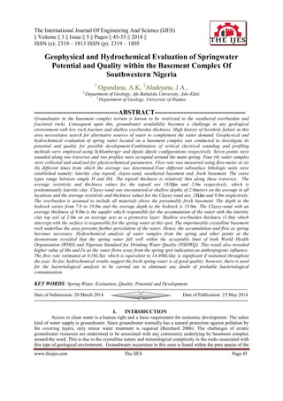
  • 2. Geophysical And Hydrochemical Evaluation Of Springwater… www.theijes.com The IJES Page 46 weathered overburden and also the fractures or other structural discontinuities such as joint or displacement related to intrusion or tectonic activities. These units serve as the aquifer for groundwater accumulation which largely depends on the nature/thickness of weathered overburden and structural spacing. This challenge becomes more complicated if the rocks underlying the zones are not fractured. Spring catchments are frequently dominated by hard rocks comprising intact rock bodies separated by discontinuities termed fractures. Depending on the type of rock, the porosity of intact rock bodies ranges from nearly zero to values much higher than the porosity created by fractures (Rehrl and Birk, 2010). The permeability of intact rock bodies is often relatively low though. Thus, discontinuities provide the major flow paths in fractured rocks. Groundwater exploration reports around Ado-Ekiti suggest low fracture in most part of this state capital. This results in low yield in most of the boreholes own by private individual and public. In the light of the above, it is not a gain saying to describe any area with spring water as a blessed zone. It is therefore encouraged that this spring should be investigated and assessed for its sustainability in terms of yield, quality and possibility to enhance its recharge rate to complement the available erratic source of water supply to meet ever increasing water demand for various purposes. Afe Babalola University located in Ado Ekiti is not exempted from the challenge of low groundwater availability resulting from complex geology of this area. Hence, the Management is faced with the need to source for alternative means to complement the existing water supply for the ever-increasing population of the University community. Thus, the need to investigate and evaluate the springwater potential and assess the quality of the existing spring within the campus for improved water supply. Several workers such as Dutcher and Garret (1965), Clerk (1985), Olorunfemi and Olorunniwo (1985), Olorunfemi (1990), Olayinka and Olorunfemi (1992)Olorunfemi and Olayinka (1992), Olorunfemi and Fasuyi (1993), Oladipo et al, (2005) Olayinka and Weller (1993), Rehil and Birk (2010), Ojo et al, (2011), Talabi (2013) have carried research in various aspect of groundwater exploration/investigation, evaluation and structural delineation using geophysical methods in several location within the basement complex terrain around the world. II. LOCATION AND GEOLOGY OF THE STUDY AREA The study spring is located at the southwestern part of the University campus just at the back of the power house and adjacent of the University guest house under construction. It lies at longitudes 50 18’05.78”E and latitudes 70 36'09.59"N (Figure 1). The terrain in the study area is gently undulating, with topographic elevation ranging from 345m to 370m above sea level. Ado Ekiti is underlain by crystalline rocks made of Older granite, Migmatite and Charnockites which are of little or no fracture in most location with accompanied shallow overburden. Figure.1: Aerial Photo of the Study Location Climate, Geology and Hydrogeology of The Area The area is situated within the tropical rain forest region, with a climate characterized by dry and wet seasons. Average annual rainfall in this area is 1300 mm, with average wet days of about 100. The annual temperature varies between 180 C to 340 C. The study area lies within the basement complex of south-western Nigeria and is older granite, Migmatite and Charnockites which are of little or no fracture in most location with accompanied shallow overburden. The overburden is relatively shallow within the study area with average of 13m. The groundwater is found within the overburden and fractured basement while the area is drained by the river Ogbese which flow SW-NE direction.
  • 3. Geophysical And Hydrochemical Evaluation Of Springwater… www.theijes.com The IJES Page 47 III. METHODOLOGY, DATA ACQUISITION AND INTERPRETATION A reconnaissance survey of study spring was carried out for site familiarization and planning.This was followed with geophysical investigation of the spring site and environs. Geophysical methods are indirect site investigation techniques and predominantly non-intrusive. Two methods namely; Resistivity Sounding and Resistivity Profiling were adopted. Soil resistivity meter (PASI) was used for the geophysical tests. It is highly reliable and reproducible.Resistivity sounding was adopted in resolving resistivity variation with depth, thus sounding helped in delineating the various subsurface lithological units, hydrogeological significance and the protective capacity or vulnerability of the subsurface layers to possible pollution.Resistivity profiling was adopted in resolving horizontal resistivity variation in this study, hence profiling helped in establishing the lateral continuity of the various subsurface lithological units.The local geology of the area was studied and the existing hydrogeology pattern was observed. Other existing water bodies around the spring were also monitored. Physico-chemical parameters such as pH, temperature, electrical conductivity (EC), total dissolved (TDS) solids were determined on the field using portable multitestre meter. Water samples were taken for physiochemical analysis. Hydrochemical studies was conducted on the water sampled from the spring and three other points from within 200meters downstream at an average of 50m intervals were collected for both major ions and heavy/trace metals analysis. Major cations and heavy/trace metals were analysed using Atomic Absorption Spectrophotometer while Major anions were analysed using spectrophotometer and ion chromatography.Hydrological approach was adopted to determine the flow rate of the spring. This was carried- out using flow meter. IV. RESULTS AND DISCUSSIONS Vertical Electrical Sounding A total of 7 VES locations across 2 traverses were spread over the study area (Figure 1). The processed data were interpreted, resulting curve types were assessed, existing subsurface lithologic units were established, and the geoelectric properties of the various subsurface layers were used in delineating the aquiferous units responsible for the spring in the study area. The results are presented in the form of table (Table 1), geoelectric curves (Figure3) and sections (Figure 4a & b). Figure.2a and b: Picture showing Geophysical field data acquisition and Physico-chemical measurements Four different subsurface lithologic sequences were established namely; lateritic topsoil, clayey-sand, weathered basement and, basement. The curve types range between simple H and HA. The topsoil, clayey-sand and weathered basement materials are characterised with relatively low resistivity values while the basement materials are typified with high resistivity values. A summary of the results of interpretation, on which the following findings were hinged, is shown in Table 1.
  • 4. Geophysical And Hydrochemical Evaluation Of Springwater… www.theijes.com The IJES Page 48 Figure.3: Typical Geoelectric curves from data interpretations Table 1: Correlation Table VES POINT 1 2 3 4 5 6 7 CURVE TYPE H HA HA HA H HA H LITHOLOGY TOP SOIL TOP 0 0 0 0 0 0 0 BASE 2 1 3 1 2 4 1 THICKNESS 2 1 3 1 2 4 1 Ωm 133 163 103 207 249 272 139 CLAYEYSAND TOP 2 1 3 1 2 4 1 BASE 9 8 8 7 19 11 15 THICKNESS 7 7 5 6 17 7 14 Ωm 27 36 16 23 29 10 29 WEATHERED BASEMENT TOP 9 8 8 - - 15 BASE - 16 - - - - THICKNESS - 6 - - - - Ωm 98 139 126 - - 156 BASEMENT TOP - 16 - 7 19 11 - Ωm - 367 - 279 249 277 - Geoelectric Units The geoelectric sections (Figures 4) show the variations of resistivity and thickness values of layers within the depth penetrated in the study area at the indicated VES stations. The two traverses were taken along the N-S directions. Generally, the traverses revealed four subsurface layers: Lateritic Top-soil, Clayey- sand, Weathered basement and the presumed Fresh basement. Topsoil The topsoil thickness is relatively thin along these traverses. The average resistivity and thickness values for the topsoil are 181Ωm and 2m respectively, which indicated that the predominant composition of the topsoil is lateritic clay. Clayey-sand Clayey-sand was encountered at shallow depths of 2meters on the average in all locations and the average resistivity and thickness values for the Clayey-sand are, 24Ωm and 9m respectively. Weathered-basement Weathered-basement was encountered in four locations and the average resistivity value and depth to the top of the weathered-basement are, 130Ωm and 10m respectively thus indicating that the material composition is largely clay, sandy-clay and clayey-sand or high degree of water saturation. The thickness values were not established in some of the locations.
  • 5. Geophysical And Hydrochemical Evaluation Of Springwater… www.theijes.com The IJES Page 49 Basement The basement is the fresh bedrock and is the last layer. It is relatively shallow in the study area, it was encountered in four locations and the average resistivity and depth values to the top of basement are, 293Ωm, and 13m respectively. The resistivity values are high because of its crystalline nature. Overburden The overburden in assumed to include all materials above the presumably fresh basement. The depth to the bedrock varies from 7.0 to 19.0m and the average depth to the bedrock is 13.0m (Table 1 and Figure 4). Overburden thickness was established in four locations and the average thickness value is 13.0m. The relatively moderate overburden thickness has potentials for groundwater saturation, however, the clayey nature and poor permeability of the materials will pose a challenge for water abstraction. Horizontal Profiling Result of the profiling carried out across two traverse sections in E-W direction is presented in the following section. The first traverse is 55meters long and is located 50meters before the spring while the second traverse is 60meters long and is located right on the spring. Four continuous subsurface lithologic units namely; Lateritic topsoil (blue), clayey-sand (green), weathered basement (yellowish-brown) and fresh basement (reddish purple) were established by the two profile sections.The results are presented in form of field data pseudosections and 2-D resistivity structures (Figure 5 & 6). The pseodosection and 2-D resistivity plot revealed a relatively thin overburden and shallow basement at the spring spot (Station 4 on figure 5 & 6) which invariably responsible for the discharge at that point.
  • 6. Geophysical And Hydrochemical Evaluation Of Springwater… www.theijes.com The IJES Page 50 Figure. 5a Field Data Pseudosection of Profile 1
  • 7. Geophysical And Hydrochemical Evaluation Of Springwater… www.theijes.com The IJES Page 51 Figure. 5b 2-D resistivity structures of Profile 1 Figure. 6a Field Data Pseudosection of Profile 2 Figure. 6b 2-D resistivity structures of Profile 2
  • 8. Geophysical And Hydrochemical Evaluation Of Springwater… www.theijes.com The IJES Page 52 V. RESULTS OF HYDROCHEMICAL ANALYSIS Results of the hydrochemical analysis of the water samples are as presented in the Table 2 above. Results of physico-chemical parameter revealed temperature ranges from 23.6 to 26.8 with average value of 25.350 C while pH, TDS and EC revealed range of 6.0-7.2, 52.5-301mg/l, and 74.5-426µS/cm with their respective average values of 6.75, 126.05mg/l and 178.375µS/cm.Major cations Ca2+ , Mg2+ , K+ , and Na+ revealed ranges of (2.43-20.24), (2.56-13.36), (0.51-1.34) and (3.02-21.35mg/l), with respective average of 7.52, 5.72, 0.97 and 8.14mg/l. Anions HCO3 Cl- , SO4 2- and NO3 - ranges from 57.6-108, 172-61, 0.79-2.52 and 25.64- 28.93mg/ with respective average of 82.8, 31.75, 1.3 and 17.14mg/l respectively Table 3. Fe and Mn range from 0-6.15 and 0.32-16.23mg/l with their respective average values of 1.62 and 4.4mg/l. Metals such as Cu, Zn, Co, Cr, Cd, Pb and Ni all showed concentrations below the detectable limit of the analytical instrument used. The hydrochemical results were compared with both WHO and NSDWQ standards to further establish its quality. All the ions and metals in the fresh spring water sample fell well within the permissible limit of both standards. Increase in groundwater composition was observed as the water flow away from the spring spot, this could be attributed to anthropogenic influence from the surrounding. Hydrochemical Characterisation In a bit to further understand the hydrochemical characteristics of the study spring water Schoeller semi-logarithmic diagram (Schoeller, 1967) was employed. This allows the major ions of many samples to be represented on a single graph, in which samples with similar patterns can be easily discriminated. The Schoeller diagram shows the total concentration of major ions in log-scale. Results of the Schoeller plots (Figure 7) revealed Ca2+ as dominant cation and HCO3 - Cl- as dominant anions with fingerprint of Ca2+ > Na+ > Mg2+ > K+ and HCO3 - > Cl-> NO3 - > SO4 2- for both anions and cations. The relative ionic composition of the studied spring waters were plotted on a Piper Trilinear diagram as presented in Figure 6 (Piper, 1944). This diagram provides a convenient method to classify and compare water types based on the ionic composition of different water samples (Hem, 1985). Cation and anion concentrations for the spring waters were converted to meq/l and plotted as percentages of their respective totals in two triangles (Figure 8). Subsequently, the cation and anion relative percentages in each triangle were then projected into a quadrilateral polygon that describes the water type or hydrochemical facies. The values obtained from the analyzed spring waters samples and their plot on the Piper's diagram (Piper, 1944), revealed Ca2+ as the dominant cation while HCO3 - is the dominant anion. In the study area, the major spring water type is Ca-HCO3 with Ca-(Cl)-HCO3 characterised (Figure 8) based on (Back and Hanshaw, 1965). The plausible explanation as to the evolved water type was from weathering induced through high precipitation that characterized the study area. However, anthropogenic contributions cannot be ruled out in view of increase in the number of tourists visiting the spring site. Hydrological/Flow Characteristics of the Study Spring The present flow rate was estimated at 0.16L/Sec from which the relevant calculation was done to generate its equivalence as 14,400L/day. The average daily water requirement per person in Nigeria is 30L/Day (UNDP 2008), hence, the spring in its present state has the capacity to meet the average daily water requirement of about 480 people. Table. 2: Results of the Hydrochemical Analysis PARAMETER ABSP-1 ABSP-2 ABSP-3 ABSP-4 MIN MAX AVER STDEV WHO[2004] NSDWQ[2007] Temp(C) 26.8 25.8 25.2 23.6 23.6 26.8 25.35 1.34 27 27 pH 6.0 6.7 7.1 7.2 6 7.2 6.75 0.54 6.5-8.5 6.5-8.5 TDS (Mg/l) 52.5 67.7 83.0 301.0 52.5 301 126.05 117.296 500 500 EC (µS/cm) 74.5 95.0 118.0 426.0 74.5 426 178.375 166.037 900-1200 1000 Mn (Mg/l) 0 0.1 0.22 6.15 0 6.15 1.6175 3.023 0.3 0.2 Fe (Mg/l) 0.32 0.81 0.53 16.23 0.32 16.23 4.4725 7.8409 0.3 0.3 Cu (Mg/l) 0 0 0 0 0 0 0 0 1 1 Zn (Mg/l) 0 0 0 0 0 0 0 0 3 3 Co (Mg/l) 0 0 0 0 0 0 0 0 0.01 0.01 Cr (Mg/l) 0 0 0 0 0 0 0 0 0.01 0.05 Cd (Mg/l) 0 0 0 0 0 0 0 0 0.01 0.03 Pb (Mg/l) 0 0 0 0 0 0 0 0 0.3 0.01 Ni (Mg/l) 0 0 0 0 0 0 0 0 0.02 0.02
  • 9. Geophysical And Hydrochemical Evaluation Of Springwater… www.theijes.com The IJES Page 53 Ca Mg Na K HCO3 Cl SO4 NO3 0.01 0.1 1 10 0.01 0.1 1 10 Concentration(Meq/L) Parameters SPRING STREAM-1 STREAM-2 STREAM-3 Figure 7. Schoeller diagram of the Major oxides in the spring water. Figure 8. Piper Trilinear diagram of the spring water. Table 3. Results and Statistical Summary of Major Oxides of the Water Samples Parameters Ca Mg K Na HCO3 CL SO4 NO3 Sample ID Mg/l Mg/l Mg/l Mg/l Mg/l Mg/l Mg/l Mg/l ABSP-1 2.43 2.56 0.51 3.02 79.2 17.2 0.89 27.88 ABSP-2 3.44 3.42 0.93 4.13 86.4 24.4 1 25.64 ABSP-3 3.95 3.55 1.11 4.06 57.6 24.4 0.79 26.11 ABSP-4 20.24 13.36 1.34 21.35 108 61 2.52 28.93 MIN 2.43 2.56 0.51 3.02 57.6 17.2 0.79 25.64 MAX 20.24 13.36 1.34 21.35 108 61 2.52 28.93 AVER 7.515 5.7225 0.9725 8.14 82.8 31.75 1.3 27.14 STDEV 8.50681 5.11058 0.35103 8.82128 20.7846 19.7932 0.81784 1.53434 WHO[ 2004] 75 50 10 50 100 250 250 50 NS[ 2007] 75 50 10 50 100 250 100 50
  • 10. Geophysical And Hydrochemical Evaluation Of Springwater… www.theijes.com The IJES Page 54 This figure can be improved with further enhancement of the discharge of the spring. This is contrary to an earlier estimate quoted at 2.0L/Sec which is equivalent to 172,800L/day in the previous investigation. However, the current estimated flow rate is significant if sustained throughout the year. VI. CONCLUSION AND RECOMMENDATIONS Geophysical and hydrochemical evaluation of the spring water located within the campus of Afe Babalola University, Ado-Ekiti has been undertaken. Four subsurface layers namely; Lateritic Top-soil, Clayey- sand, Weathered basement and the presumed Fresh basement were delineated and the aquiferous layer responsible for the accumulation of the spring water was identified to be the Clayey-sand unit. The thin (1.0m) lateritic overburden thickness and the shallow basement depth at the spring spot is responsible for the discharge at this point. The lateritic clay topsoil serves as the protective unit for the aquifer against possible surface contaminant infiltration. Hydrochemical analysis of water samples from the spring and other points at the downstream revealed that the spring water fall well within the acceptable limit of both World Health Organisation (WHO) and Nigerian Standard for Drinking Water Quality (NSDWQ). Hydrochemical characterization of the water using Piper trilinear diagram suggested Ca-HCO3 water type which indicates a product of rock-water interaction. The present flow rate was estimated at 14,400L/day and average daily water requirement per person in Nigeria is 30L/Day (UNDP 2008), hence, the spring in its present state has the capacity to meet the average daily water requirement of about 480 people. This figure can be improved with further enhancement of the discharge of the spring. However, the current estimated flow rate is significant if sustained throughout the year. Finally, the following recommendations are made; [1] The flow rate of the spring should be monitored during dry season. [2] Bacteriological analysis should be carried out to eliminate any doubt of probable bacteriological contamination. [3] Geotechnical reinforcement of the spring discharge area should be undertaken to enhance and optimise the discharge from the spring. [4] Channels and Subsurface storage facility should be constructed after detail geotechnical and geophysical investigation to evaluate the embankment requirement of the study area. REFERENCE [1] Pearce, A. J., Stewart M. K. and Sklash, M. D. 1998, Storm runoff generation. Water resources research. Vol. 22. No 8. P1263- 1272. [2] Back, W. and Hanshaw, B (eds), Chemical geohydrology advances in hydroscience; (Academic Press), 1965, pp. 49-109. [3] Birk S, Liedl R, Sauter M (2004) Identification of localized recharge and conduit flow by combined analysis of hydraulic and physiochemical spring responses(Urenbrunne, SW-Germany). J Hydrology 286: 179-193 [4] Rehrl, C. and Birk, S. 2010, Hydrogeological Characterisation and Modelling of Spring Catchments in a Changing Environment. Austrian Journal of Earth Sciences Volume 103 Issue 2, p106-117 Vienna. [5] Clerk L (1985). Groundwater Abstraction from Basement Complex Areas of Africa. J. Eng. Geol., London 18: 25-34. [6] Dutcher, L.C. and Garrett. A.A., 1963, Geologic and hydrologic features of the San Bernardino area , Califonia: U.S.Geological survey Water-Supply Paper 1419, 114p. [7] Grant, F. S., West, G. F, (1965). Interpretation theory in Applied Geophysics. New York, McGraw-Hill [8] Hem, J. D, Study and interpretation of the chemical characteristics of natural water. US Geological Survey Water-supply Paper, 1985, 2254, 3rd ed., p263. [9] Nigerian Standard for Drinking Water Quality, NSDWQ. Published by Nigerian Industrial Standard 2007, 554, 1-14. [10] Ojo, J.S., Olorunfemi, M.O. and Falebita, D.E, An Appraisal of the Geologic Structure beneath the Ikogosi Warm Spring in South- Western Nigeria Using Integrated Surface Geophysical Methods. Earth Sciences Research Journal. 2011, 15(1):27-34. [11] Oladipo, A. A., Oluyemi, E. A., Tubosun, I. A., Fasisi, M. K. and Ibitoye, F. I, Chemical Examination of Ikogosi Warm Spring in South Western Nigeria. Journal of Applied Sciences, 2005, 5 (1): 75-79 [12] Olayinka A. I. and Weller A. 1997. The inversion of geoelectrical data for hydrogeological applications in crystalline basement areas of Nigeria. Journ. of Applied Geosciences, Vol. 37, Issue 2, June 1997, pp 103 – 105. [13] Olayinka A. I, and Olorunfemi M. O. (1992). Determination of geoelectrical Characteristic in Okene Area and implication for boreholes setting. J. Min. Geol., 28: 403 - 412. [14] Olorunfemi M. O. & Olayinka A. I. (1992): Alteration of Geoelectric in Okene are and Implication for Borehole Sitting. Journal of Mining and Geology, pp. 403-411. [15] Olorunfemi M. O. & Oloruniwo M. A. (1985): Geoelectric Parameters and Aquifer Characteristics of Some Part of South Western Nigeria. Journal of Mining and Geology. Part 1, pp. 99-109. [16] Olorunfemi M. O. (1990): The Hydrogeological Implication of Topographic Variation with Overburden Thickness in Basement Complex. Area of South Western Nigeria. Journal of Mining and Geology. Vol 26, No. 1. [17] Olorunfemi M. O. and Fasuyi S. A. (1993). Aqufier types and geoelectric/hydrogeologic characteristics of part of central basement terrain of Nigeria (Niger State). J. Africa Earth Sci., 16(3): 309-317. [18] Oyawoye, M. O, 1964. The Geology of the Nigerian Basement Complex. Journ. Nigerian Min. Geol. and Metall. Soc. Vol 1. pp 108 - 117 [19] Piper, A. M, A graphic procedure in the geochemical interpretation of water analyses. Trans. Am.Geophy. Union 1944, 25: 914- 928.
  • 11. Geophysical And Hydrochemical Evaluation Of Springwater… www.theijes.com The IJES Page 55 [20] Rahaman MA (1989). Review of the basement geology of southwestern Nigeria: In Geology of Nigeria (Kogbe CA Ed.). Elizabeth Publishing.Co. Nigeria. pp. 41-58. [21] Rahaman, M. A. 1988. Recent advances in the study of the basement complex of Nigeria, Precambrian Geology of Nigeria, Pub. of the Geol. Surv. Of Nigeria, Kaduna pp. 11 – 41 [22] Rahaman, M. N. 1976. Review of the basement geology of southwestern Nigeria, in geology of Nigeria, edited by C. A. Kogbe, Elizabethan pub. Co. Lagos. pp. 41 - 58 [23] Schoeller, H, Geochemistry of groundwater. An international guide for research and practice. UNESCO, 1967, chap 15, pp 1-18. [24] Talabi, A. O., 2013, Hydrogeochemistry and Stable Isotopes (δ18O and δ2H) Assessment of Ikogosi Spring Waters. American Journal of Water Resources, 2013, Vol. 1, No. 3, 25-33. [25] Tunbosun , I. A., Lancelot, J. R., Rahaman , M. A., Ocan, O. (1984) . U/Pb Pan-African ages of two charnockite-granite associations from Southwestern Nigeria.Contr. Min. Petrol. Pp 88, 188-195. [26] UN, 1988. Ground Water in North and West Africa. Natural Resources/Water Series No. 18,United Nations, New York [27] US EPA (2003) National primary drinking water regulations. US EPA, Washington. DC [28] World Health Organization (WHO), “Guidelines for Drinking Water Quality”, 2004, Vol.1: Recommendations (3rd edn). WHO, Geneva.