SlideShare ist ein Scribd-Unternehmen logo
1 von 26
Downloaden Sie, um offline zu lesen
Martin Christen
FHNW – University of Applied Sciences and Arts Northwestern Switzerland
School of Architecture, Civil Engineering and Geomatics
Institute of Geomatics Engineering
martin.christen@fhnw.ch
@MartinChristen
Visualization of 3D City Models on Mobile
Phones using
@MartinChristen
GitHub: MartinChristen
GitLab: martin.christen
• Virtual Globe using WebGL
• Open Source Project started in
April 2011
• JavaScript Library for rapid
development of web-based
geospatial 3D applications
• Data Processing written in
C++ and Python
226 August 2016 2
OpenWebGlobe
Institute of Geomatics Engineering
26 August 2016Institute of Geomatics Engineering 3
Previous Work: OpenWebGlobe – Virtual Globe using JavaScript / WebGL
26 August 2016Institute of Geomatics Engineering 4
Motivation: 3D-Streaming in the web browser
MapData © OpenStreetMap contributors
BTh Hürbi/Daetwyler, MTh Lucas Oertli, 2013
26 August 2016Institute of Geomatics Engineering 5
Streaming Example: 3D Geometry using OSM and “BOI” (worldwide streaming)
MTh Lucas Oertli, 2013
Hello World
26 August 2016Institute of Geomatics Engineering 6
26 August 2016Institute of Geomatics Engineering 7
How does it work ?
EPSG:3857
(Visualization Pseudo Mercator)
WGS84 Ellipsoid
EPSG:4326
Proj.4 Library (pyproj): https://github.com/jswhit/pyproj
http://www.spatialreference.org
Global or local Datasets
26 August 2016Institute of Geomatics Engineering 8
Quadtree based – fully compatible with 2D Maps*
256
256
256
(Image courtesy of Microsoft, Bing Maps)
*OpenStreetMap, Google Maps, Bing Maps, Yahoo Maps, …
“zoom-levels”
26 August 2016Institute of Geomatics Engineering 9
Tile Types
2D Image Tile
RGB(A)
256x256 pixels
2D Vector Tile
Contains geometry. (if rasterized use Image Tile)
2D Elevation Tile
Contains Elevation Data
for example: 17x17 Values
26 August 2016Institute of Geomatics Engineering 10
Special Tile Types
3D Geometry Tile
A 3D Geometry Tile contains
Texture(s) & arbitrary 3D Geometry
Within it‘s tile limit
Separate Geometry for each zoom level
GDAL Library: http://www.gdal.org
26 August 2016Institute of Geomatics Engineering 11
OpenWebGlobe 2
http://www.openwebglobe.org (coming soon)
Currently in Development
A new version – completely redesigned
…with more Python! (Data processing is 98% Python code)
2
26 August 2016Institute of Geomatics Engineering 12
Why a new Version ?
• 19 zoom levels over the whole planet results in about 360 billion tiles.
• 19 zoom levels is too much for many applications
• Many “real-world” applications/projects are oriented “local”. The need for a
global 3D-scene is overkill. (1 Building, 1 city, 1 country…)
• On mobile devices rendering 3D graphics is quite power consuming
• Navigation on a 3D-Globe is difficult for many people
• People still prefer 2D-Maps (fast, quick overview, …)
• …
• ...
• ...
• ...
• ...
2
26 August 2016Institute of Geomatics Engineering 13
One new feature: Bringing together 2D Maps and 3D Globes
Another tile type!
Concept: Prerender a 3D Scene using a high quality offline 3D renderer using an
orthographic projection and create “2D” image tiles for each zoom-level
Constant, minimal bandwidth
regardless of the complexity of the
3D city model
MTh Markus Jung, 2014
(Similar approaches were already done by Döllner et al. and also go back to some concepts by Sutherland)
2
26 August 2016Institute of Geomatics Engineering 14
Display in the Webbrowser as “2D Map”
MTh Markus Jung, 2014
2
26 August 2016Institute of Geomatics Engineering 15
High Resolution Geometry doesn’t matter: Same download/render speed
MTh Markus Jung, 2014
2
26 August 2016Institute of Geomatics Engineering 16
90 CityGML files (2.72 GB)
26'474 textures (1024x1024), uncompressed size ca. 77 GB
image data (orthophoto) ca. 430 GB uncompressed
26 August 2016Institute of Geomatics Engineering 17
Another example: 3D Map using OpenStreetMap data
Source: BTh, Daniel Rettenmund 2015
26 August 2016Institute of Geomatics Engineering 18
App: make visible the invisibke (Roman city of Augusta Raurica)
26 August 2016Institute of Geomatics Engineering 19
Prerendering the Model: Color Map, Normal Map, Id-Map, Depth Map
Dynamic Lighting
Normal Map: for Object Identification:
Highlighting, special effects, …
Depth Map: for 3D Position, special effects, …
2
26 August 2016Institute of Geomatics Engineering 20
PyRT (no logo yet!)
Rendering is done using pyRT (“Pirate”)
pyRT is a new project for rendering high quality images using Ray Tracing
(pyRT). By using global illumination, the results look quite nice. It also has Jupyter
integration (render within your notebook)
The project is currently in development and open sourced later. (MTh 2016: GPU
support / OpenCL, starting in September 2016)
26 August 2016Institute of Geomatics Engineering 21
pyRT Example
from pyrt.math import *
from pyrt.geometry import Triangle
from pyrt.camera import PerspectiveCamera
from pyrt.renderer import SimpleRT
camera = PerspectiveCamera(640,480)
scene = Scene()
scene.Add(Triangle(Vec3(0, 0, 0), Vec3(0, 5, 0), Vec3(1, 5, 0)))
scene.SetCamera(camera)
engine = renderer.SimpleRT()
imgdata = engine.render(scene)
26 August 2016Institute of Geomatics Engineering 22
And “real 3d” is of course still possible in OpenWebGlobe 2
Typical Scene: From a single building to a planet…
26 August 2016Institute of Geomatics Engineering 23
Data Processing Architecture
Web Viewer
• HTML5, WebGL, JavaScript
Data Processing &
Storage/Cache
• Python (most parts)
• Some JavaScript (node.js)
• Some C++ / OpenCL
• Running on HPCC
Raw data
26 August 2016Institute of Geomatics Engineering 24
All Architecture
3DPS (3D Portrayal Service)
Based on the OGC 3DPS Candidate
2
world3d.js
Real 3D
map3d.js
3D Map
map3d.js
world3d.js
owg2.js
Building
City
Country
Planet
…
26 August 2016Institute of Geomatics Engineering 25
Docker
(Source: docker.io)
For development and deployment
(processing tools / sample webservice / …)
26 August 2016
Institute of Geomatics Engineering
26
Questions ?
Contact me at martin.christen@fhnw.ch
@MartinChristen
GitHub: MartinChristen
GitLab: martin.christen

Weitere ähnliche Inhalte

Was ist angesagt?

Let’s Power the Analytics and 3D to the Web Based Military Geo-Portal using F...
Let’s Power the Analytics and 3D to the Web Based Military Geo-Portal using F...Let’s Power the Analytics and 3D to the Web Based Military Geo-Portal using F...
Let’s Power the Analytics and 3D to the Web Based Military Geo-Portal using F...SANGHEE SHIN
 
GRASS GIS lightening talk at FOSS4G 2006
GRASS GIS lightening talk at FOSS4G 2006GRASS GIS lightening talk at FOSS4G 2006
GRASS GIS lightening talk at FOSS4G 2006Markus Neteler
 
Let's integrate CAD/BIM/GIS on the same platform: A practical approach in rea...
Let's integrate CAD/BIM/GIS on the same platform: A practical approach in rea...Let's integrate CAD/BIM/GIS on the same platform: A practical approach in rea...
Let's integrate CAD/BIM/GIS on the same platform: A practical approach in rea...SANGHEE SHIN
 
Paradigm Shift of Geospatial Information Service
Paradigm Shift of Geospatial Information ServiceParadigm Shift of Geospatial Information Service
Paradigm Shift of Geospatial Information ServiceSANGHEE SHIN
 
Hoang Nguyen and Jinjun Sun
Hoang Nguyen and Jinjun SunHoang Nguyen and Jinjun Sun
Hoang Nguyen and Jinjun Sunstephenlead
 
Using GIS to reassess urban plans based on changing industrial emissions
Using GIS to reassess urban plans based on changing industrial emissionsUsing GIS to reassess urban plans based on changing industrial emissions
Using GIS to reassess urban plans based on changing industrial emissionsniket_narang
 
최근의 공간정보 분야 동향과 시사점
최근의 공간정보 분야 동향과 시사점최근의 공간정보 분야 동향과 시사점
최근의 공간정보 분야 동향과 시사점SANGHEE SHIN
 
Auto cad map 3d 2017 product code
Auto cad map 3d 2017 product codeAuto cad map 3d 2017 product code
Auto cad map 3d 2017 product codeMathias Onosemuode
 
SFScon 21 - Silvia Franceschi Andrea Antonello - Smash a customizable cross-p...
SFScon 21 - Silvia Franceschi Andrea Antonello - Smash a customizable cross-p...SFScon 21 - Silvia Franceschi Andrea Antonello - Smash a customizable cross-p...
SFScon 21 - Silvia Franceschi Andrea Antonello - Smash a customizable cross-p...South Tyrol Free Software Conference
 
Geographic Data and Leaflet.js
Geographic Data and Leaflet.jsGeographic Data and Leaflet.js
Geographic Data and Leaflet.jsJustin Manley
 
Creating gridded cartograms: Israel and the Palestine Territories
Creating gridded cartograms: Israel and the Palestine TerritoriesCreating gridded cartograms: Israel and the Palestine Territories
Creating gridded cartograms: Israel and the Palestine TerritoriesBenjamin Hennig
 
Smooth, Interactive Rendering and On-line Modification of Large-Scale, Geospa...
Smooth, Interactive Rendering and On-line Modification of Large-Scale, Geospa...Smooth, Interactive Rendering and On-line Modification of Large-Scale, Geospa...
Smooth, Interactive Rendering and On-line Modification of Large-Scale, Geospa...Christian Kehl
 
Vincent Sarago (Mapbox) | Traitement d’imagerie satellitaires de masse en ut...
Vincent Sarago (Mapbox)  | Traitement d’imagerie satellitaires de masse en ut...Vincent Sarago (Mapbox)  | Traitement d’imagerie satellitaires de masse en ut...
Vincent Sarago (Mapbox) | Traitement d’imagerie satellitaires de masse en ut...ACSG Section Montréal
 
City of Vancouver CAD - GIS - 3D Integration A Dimension Too Far?
City of Vancouver CAD - GIS - 3D Integration A Dimension Too Far?City of Vancouver CAD - GIS - 3D Integration A Dimension Too Far?
City of Vancouver CAD - GIS - 3D Integration A Dimension Too Far?Andrew Bashfield
 
3D mapping of a quarry
3D mapping of a quarry3D mapping of a quarry
3D mapping of a quarryMatti Hytola
 
The Gorbals in Relief: Experiments in OpenStreetMap and Architectural Practic...
The Gorbals in Relief: Experiments in OpenStreetMap and Architectural Practic...The Gorbals in Relief: Experiments in OpenStreetMap and Architectural Practic...
The Gorbals in Relief: Experiments in OpenStreetMap and Architectural Practic...duncanbain
 
CARTO BUILDER: from visualization to geospatial analysis
CARTO BUILDER: from visualization to geospatial analysisCARTO BUILDER: from visualization to geospatial analysis
CARTO BUILDER: from visualization to geospatial analysisJorge Sanz
 
Mago3D: A Brand-New Live 3D Geo-Platform
Mago3D: A Brand-New Live 3D Geo-PlatformMago3D: A Brand-New Live 3D Geo-Platform
Mago3D: A Brand-New Live 3D Geo-PlatformSANGHEE SHIN
 

Was ist angesagt? (20)

Let’s Power the Analytics and 3D to the Web Based Military Geo-Portal using F...
Let’s Power the Analytics and 3D to the Web Based Military Geo-Portal using F...Let’s Power the Analytics and 3D to the Web Based Military Geo-Portal using F...
Let’s Power the Analytics and 3D to the Web Based Military Geo-Portal using F...
 
GRASS GIS lightening talk at FOSS4G 2006
GRASS GIS lightening talk at FOSS4G 2006GRASS GIS lightening talk at FOSS4G 2006
GRASS GIS lightening talk at FOSS4G 2006
 
Let's integrate CAD/BIM/GIS on the same platform: A practical approach in rea...
Let's integrate CAD/BIM/GIS on the same platform: A practical approach in rea...Let's integrate CAD/BIM/GIS on the same platform: A practical approach in rea...
Let's integrate CAD/BIM/GIS on the same platform: A practical approach in rea...
 
Paradigm Shift of Geospatial Information Service
Paradigm Shift of Geospatial Information ServiceParadigm Shift of Geospatial Information Service
Paradigm Shift of Geospatial Information Service
 
Hoang Nguyen and Jinjun Sun
Hoang Nguyen and Jinjun SunHoang Nguyen and Jinjun Sun
Hoang Nguyen and Jinjun Sun
 
GRASS GIS e Sextante
GRASS GIS e SextanteGRASS GIS e Sextante
GRASS GIS e Sextante
 
Using GIS to reassess urban plans based on changing industrial emissions
Using GIS to reassess urban plans based on changing industrial emissionsUsing GIS to reassess urban plans based on changing industrial emissions
Using GIS to reassess urban plans based on changing industrial emissions
 
최근의 공간정보 분야 동향과 시사점
최근의 공간정보 분야 동향과 시사점최근의 공간정보 분야 동향과 시사점
최근의 공간정보 분야 동향과 시사점
 
Auto cad map 3d 2017 product code
Auto cad map 3d 2017 product codeAuto cad map 3d 2017 product code
Auto cad map 3d 2017 product code
 
SFScon 21 - Silvia Franceschi Andrea Antonello - Smash a customizable cross-p...
SFScon 21 - Silvia Franceschi Andrea Antonello - Smash a customizable cross-p...SFScon 21 - Silvia Franceschi Andrea Antonello - Smash a customizable cross-p...
SFScon 21 - Silvia Franceschi Andrea Antonello - Smash a customizable cross-p...
 
Geographic Data and Leaflet.js
Geographic Data and Leaflet.jsGeographic Data and Leaflet.js
Geographic Data and Leaflet.js
 
Creating gridded cartograms: Israel and the Palestine Territories
Creating gridded cartograms: Israel and the Palestine TerritoriesCreating gridded cartograms: Israel and the Palestine Territories
Creating gridded cartograms: Israel and the Palestine Territories
 
Smooth, Interactive Rendering and On-line Modification of Large-Scale, Geospa...
Smooth, Interactive Rendering and On-line Modification of Large-Scale, Geospa...Smooth, Interactive Rendering and On-line Modification of Large-Scale, Geospa...
Smooth, Interactive Rendering and On-line Modification of Large-Scale, Geospa...
 
Vincent Sarago (Mapbox) | Traitement d’imagerie satellitaires de masse en ut...
Vincent Sarago (Mapbox)  | Traitement d’imagerie satellitaires de masse en ut...Vincent Sarago (Mapbox)  | Traitement d’imagerie satellitaires de masse en ut...
Vincent Sarago (Mapbox) | Traitement d’imagerie satellitaires de masse en ut...
 
City of Vancouver CAD - GIS - 3D Integration A Dimension Too Far?
City of Vancouver CAD - GIS - 3D Integration A Dimension Too Far?City of Vancouver CAD - GIS - 3D Integration A Dimension Too Far?
City of Vancouver CAD - GIS - 3D Integration A Dimension Too Far?
 
3D mapping of a quarry
3D mapping of a quarry3D mapping of a quarry
3D mapping of a quarry
 
Get Big Geo Data
Get Big Geo DataGet Big Geo Data
Get Big Geo Data
 
The Gorbals in Relief: Experiments in OpenStreetMap and Architectural Practic...
The Gorbals in Relief: Experiments in OpenStreetMap and Architectural Practic...The Gorbals in Relief: Experiments in OpenStreetMap and Architectural Practic...
The Gorbals in Relief: Experiments in OpenStreetMap and Architectural Practic...
 
CARTO BUILDER: from visualization to geospatial analysis
CARTO BUILDER: from visualization to geospatial analysisCARTO BUILDER: from visualization to geospatial analysis
CARTO BUILDER: from visualization to geospatial analysis
 
Mago3D: A Brand-New Live 3D Geo-Platform
Mago3D: A Brand-New Live 3D Geo-PlatformMago3D: A Brand-New Live 3D Geo-Platform
Mago3D: A Brand-New Live 3D Geo-Platform
 

Andere mochten auch

Docker for Python Development
Docker for Python DevelopmentDocker for Python Development
Docker for Python DevelopmentMartin Christen
 
Gettiing Started with IoT using Raspberry Pi and Python
Gettiing Started with IoT using Raspberry Pi and PythonGettiing Started with IoT using Raspberry Pi and Python
Gettiing Started with IoT using Raspberry Pi and PythonMartin Christen
 
Standard_Digital_Cadastral_Maps_2015_Adopted
Standard_Digital_Cadastral_Maps_2015_AdoptedStandard_Digital_Cadastral_Maps_2015_Adopted
Standard_Digital_Cadastral_Maps_2015_AdoptedMichael Prestridge
 
3D Web Services And Models For The Web: Where Do We Stand?
3D Web Services And Models For The Web: Where Do We Stand?3D Web Services And Models For The Web: Where Do We Stand?
3D Web Services And Models For The Web: Where Do We Stand?Camptocamp
 
Tips for Manipulating Data in Esri Geodatabase using FME
Tips for Manipulating Data in Esri Geodatabase using FME Tips for Manipulating Data in Esri Geodatabase using FME
Tips for Manipulating Data in Esri Geodatabase using FME Safe Software
 
Introducción a la geodatabase del SIOSE (I)
Introducción a la geodatabase del SIOSE (I)Introducción a la geodatabase del SIOSE (I)
Introducción a la geodatabase del SIOSE (I)Benito Zaragozí
 
Digital cadaster in Bulgaria. Information system of cadaster and property reg...
Digital cadaster in Bulgaria. Information system of cadaster and property reg...Digital cadaster in Bulgaria. Information system of cadaster and property reg...
Digital cadaster in Bulgaria. Information system of cadaster and property reg...Geoskills+ Project
 
Introducción a la geodatabase del SIOSE (II)
Introducción a la geodatabase del SIOSE (II)Introducción a la geodatabase del SIOSE (II)
Introducción a la geodatabase del SIOSE (II)Benito Zaragozí
 
Graduate Research Thesis Defense Presentation
Graduate Research Thesis Defense Presentation  Graduate Research Thesis Defense Presentation
Graduate Research Thesis Defense Presentation Johum Khushk
 
How to use R easily as GIS tools!
How to use R easily as GIS tools!How to use R easily as GIS tools!
How to use R easily as GIS tools!Omar F. Althuwaynee
 
Ozri 2013 Brisbane, Australia - Geodatabase Efficiencies
Ozri 2013 Brisbane, Australia - Geodatabase EfficienciesOzri 2013 Brisbane, Australia - Geodatabase Efficiencies
Ozri 2013 Brisbane, Australia - Geodatabase EfficienciesWalter Simonazzi
 
Survey camp ii
Survey camp iiSurvey camp ii
Survey camp iiDraemmraj
 
WHAT'S THERE IN GEOMATICS ENGINEERING???
WHAT'S THERE IN GEOMATICS ENGINEERING???WHAT'S THERE IN GEOMATICS ENGINEERING???
WHAT'S THERE IN GEOMATICS ENGINEERING???Nepal Flying Labs
 
How to use Logistic Regression in GIS using ArcGIS and R statistics
How to use Logistic Regression in GIS using ArcGIS and R statisticsHow to use Logistic Regression in GIS using ArcGIS and R statistics
How to use Logistic Regression in GIS using ArcGIS and R statisticsOmar F. Althuwaynee
 
Communication portfolio
Communication portfolioCommunication portfolio
Communication portfolioMicah Stump
 
Cloud computing using virtualization (Virtual Data Center)
Cloud computing using virtualization (Virtual Data Center)Cloud computing using virtualization (Virtual Data Center)
Cloud computing using virtualization (Virtual Data Center)Sarbjeet Singh
 

Andere mochten auch (20)

Docker for Python Development
Docker for Python DevelopmentDocker for Python Development
Docker for Python Development
 
Gettiing Started with IoT using Raspberry Pi and Python
Gettiing Started with IoT using Raspberry Pi and PythonGettiing Started with IoT using Raspberry Pi and Python
Gettiing Started with IoT using Raspberry Pi and Python
 
Standard_Digital_Cadastral_Maps_2015_Adopted
Standard_Digital_Cadastral_Maps_2015_AdoptedStandard_Digital_Cadastral_Maps_2015_Adopted
Standard_Digital_Cadastral_Maps_2015_Adopted
 
3D Web Services And Models For The Web: Where Do We Stand?
3D Web Services And Models For The Web: Where Do We Stand?3D Web Services And Models For The Web: Where Do We Stand?
3D Web Services And Models For The Web: Where Do We Stand?
 
Using unique and unusual archival records and data to illustrate and annotate...
Using unique and unusual archival records and data to illustrate and annotate...Using unique and unusual archival records and data to illustrate and annotate...
Using unique and unusual archival records and data to illustrate and annotate...
 
Tips for Manipulating Data in Esri Geodatabase using FME
Tips for Manipulating Data in Esri Geodatabase using FME Tips for Manipulating Data in Esri Geodatabase using FME
Tips for Manipulating Data in Esri Geodatabase using FME
 
Curso de Geodatabase
Curso de Geodatabase Curso de Geodatabase
Curso de Geodatabase
 
Introducción a la geodatabase del SIOSE (I)
Introducción a la geodatabase del SIOSE (I)Introducción a la geodatabase del SIOSE (I)
Introducción a la geodatabase del SIOSE (I)
 
Digital cadaster in Bulgaria. Information system of cadaster and property reg...
Digital cadaster in Bulgaria. Information system of cadaster and property reg...Digital cadaster in Bulgaria. Information system of cadaster and property reg...
Digital cadaster in Bulgaria. Information system of cadaster and property reg...
 
Introducción a la geodatabase del SIOSE (II)
Introducción a la geodatabase del SIOSE (II)Introducción a la geodatabase del SIOSE (II)
Introducción a la geodatabase del SIOSE (II)
 
Graduate Research Thesis Defense Presentation
Graduate Research Thesis Defense Presentation  Graduate Research Thesis Defense Presentation
Graduate Research Thesis Defense Presentation
 
How to use R easily as GIS tools!
How to use R easily as GIS tools!How to use R easily as GIS tools!
How to use R easily as GIS tools!
 
Ozri 2013 Brisbane, Australia - Geodatabase Efficiencies
Ozri 2013 Brisbane, Australia - Geodatabase EfficienciesOzri 2013 Brisbane, Australia - Geodatabase Efficiencies
Ozri 2013 Brisbane, Australia - Geodatabase Efficiencies
 
Survey camp ii
Survey camp iiSurvey camp ii
Survey camp ii
 
WHAT'S THERE IN GEOMATICS ENGINEERING???
WHAT'S THERE IN GEOMATICS ENGINEERING???WHAT'S THERE IN GEOMATICS ENGINEERING???
WHAT'S THERE IN GEOMATICS ENGINEERING???
 
How to use Logistic Regression in GIS using ArcGIS and R statistics
How to use Logistic Regression in GIS using ArcGIS and R statisticsHow to use Logistic Regression in GIS using ArcGIS and R statistics
How to use Logistic Regression in GIS using ArcGIS and R statistics
 
Communication portfolio
Communication portfolioCommunication portfolio
Communication portfolio
 
Cloud computing using virtualization (Virtual Data Center)
Cloud computing using virtualization (Virtual Data Center)Cloud computing using virtualization (Virtual Data Center)
Cloud computing using virtualization (Virtual Data Center)
 
знакомтесь!
знакомтесь!знакомтесь!
знакомтесь!
 
Sumbangan tamadun cina
Sumbangan tamadun cinaSumbangan tamadun cina
Sumbangan tamadun cina
 

Ähnlich wie Presentation final 72

High-Quality Server Side Rendering using the OGC’s 3D Portrayal Service – App...
High-Quality Server Side Rendering using the OGC’s 3D Portrayal Service – App...High-Quality Server Side Rendering using the OGC’s 3D Portrayal Service – App...
High-Quality Server Side Rendering using the OGC’s 3D Portrayal Service – App...Martin Christen
 
Embedding user generated content into oblique airborne photogrammetry based 3...
Embedding user generated content into oblique airborne photogrammetry based 3...Embedding user generated content into oblique airborne photogrammetry based 3...
Embedding user generated content into oblique airborne photogrammetry based 3...Jianming Liang
 
A Brief History of Open Geospatial
A Brief History of Open GeospatialA Brief History of Open Geospatial
A Brief History of Open GeospatialArnulf Christl
 
Urban design tools
Urban design tools  Urban design tools
Urban design tools Sakshi523259
 
Developing Spatial Applications with Google Maps and CARTO
Developing Spatial Applications with Google Maps and CARTODeveloping Spatial Applications with Google Maps and CARTO
Developing Spatial Applications with Google Maps and CARTOCARTO
 
Mago3D - An innovative AEC/GIS integration platform that can service millions...
Mago3D - An innovative AEC/GIS integration platform that can service millions...Mago3D - An innovative AEC/GIS integration platform that can service millions...
Mago3D - An innovative AEC/GIS integration platform that can service millions...SANGHEE SHIN
 
Introduction to mago3D, an Open Source Based Digital Twin Platform
Introduction to mago3D, an Open Source Based Digital Twin PlatformIntroduction to mago3D, an Open Source Based Digital Twin Platform
Introduction to mago3D, an Open Source Based Digital Twin PlatformSANGHEE SHIN
 
NASA Web World Wind: welcome to the new era of virtual globes
NASA Web World Wind: welcome to the new era of virtual globes NASA Web World Wind: welcome to the new era of virtual globes
NASA Web World Wind: welcome to the new era of virtual globes Maria Antonia Brovelli
 
Get more from your UAV Imagery
Get more from your UAV ImageryGet more from your UAV Imagery
Get more from your UAV Imagerypcigeomatics
 
Exploration and 3D GIS Software - MapInfo Professional Discover3D 2015
Exploration and 3D GIS Software - MapInfo Professional Discover3D 2015Exploration and 3D GIS Software - MapInfo Professional Discover3D 2015
Exploration and 3D GIS Software - MapInfo Professional Discover3D 2015Prakher Hajela Saxena
 
State of mago3D, An Open Source Based Digital Twin Platform
State of mago3D, An Open Source Based Digital Twin PlatformState of mago3D, An Open Source Based Digital Twin Platform
State of mago3D, An Open Source Based Digital Twin PlatformSANGHEE SHIN
 
What we've done so far with mago3D, an open source based 'Digital Twin' platf...
What we've done so far with mago3D, an open source based 'Digital Twin' platf...What we've done so far with mago3D, an open source based 'Digital Twin' platf...
What we've done so far with mago3D, an open source based 'Digital Twin' platf...SANGHEE SHIN
 
EuroPython 2019: GeoSpatial Analysis using Python and JupyterHub
EuroPython 2019: GeoSpatial Analysis using Python and JupyterHubEuroPython 2019: GeoSpatial Analysis using Python and JupyterHub
EuroPython 2019: GeoSpatial Analysis using Python and JupyterHubMartin Christen
 
BCS Workshop: Old Maps Online
BCS Workshop: Old Maps OnlineBCS Workshop: Old Maps Online
BCS Workshop: Old Maps OnlinePetr Pridal
 
TensorFlow-KR 3rd meetup - Lightning Talk for SI Analytics
TensorFlow-KR 3rd meetup - Lightning Talk for SI AnalyticsTensorFlow-KR 3rd meetup - Lightning Talk for SI Analytics
TensorFlow-KR 3rd meetup - Lightning Talk for SI AnalyticsTaegyun Jeon
 
Create Minecraft Worlds with ArcGIS and the Data Interoperability Extension
Create Minecraft Worlds with ArcGIS and the Data Interoperability ExtensionCreate Minecraft Worlds with ArcGIS and the Data Interoperability Extension
Create Minecraft Worlds with ArcGIS and the Data Interoperability ExtensionSafe Software
 
Hatii seminar 2014 - The emerging needs and the long standing issues curating...
Hatii seminar 2014 - The emerging needs and the long standing issues curating...Hatii seminar 2014 - The emerging needs and the long standing issues curating...
Hatii seminar 2014 - The emerging needs and the long standing issues curating...Ruggero Lancia
 
Enabling numerical Simulations in semantic 3D City Models using CityGML
Enabling  numerical Simulations in  semantic 3D City Models using CityGMLEnabling  numerical Simulations in  semantic 3D City Models using CityGML
Enabling numerical Simulations in semantic 3D City Models using CityGMLvirtualcitySYSTEMS GmbH
 

Ähnlich wie Presentation final 72 (20)

High-Quality Server Side Rendering using the OGC’s 3D Portrayal Service – App...
High-Quality Server Side Rendering using the OGC’s 3D Portrayal Service – App...High-Quality Server Side Rendering using the OGC’s 3D Portrayal Service – App...
High-Quality Server Side Rendering using the OGC’s 3D Portrayal Service – App...
 
Embedding user generated content into oblique airborne photogrammetry based 3...
Embedding user generated content into oblique airborne photogrammetry based 3...Embedding user generated content into oblique airborne photogrammetry based 3...
Embedding user generated content into oblique airborne photogrammetry based 3...
 
A Brief History of Open Geospatial
A Brief History of Open GeospatialA Brief History of Open Geospatial
A Brief History of Open Geospatial
 
Urban design tools
Urban design tools  Urban design tools
Urban design tools
 
Developing Spatial Applications with Google Maps and CARTO
Developing Spatial Applications with Google Maps and CARTODeveloping Spatial Applications with Google Maps and CARTO
Developing Spatial Applications with Google Maps and CARTO
 
Cv jeanlucbordessoule
Cv jeanlucbordessouleCv jeanlucbordessoule
Cv jeanlucbordessoule
 
Mago3D - An innovative AEC/GIS integration platform that can service millions...
Mago3D - An innovative AEC/GIS integration platform that can service millions...Mago3D - An innovative AEC/GIS integration platform that can service millions...
Mago3D - An innovative AEC/GIS integration platform that can service millions...
 
Entropy City
Entropy CityEntropy City
Entropy City
 
Introduction to mago3D, an Open Source Based Digital Twin Platform
Introduction to mago3D, an Open Source Based Digital Twin PlatformIntroduction to mago3D, an Open Source Based Digital Twin Platform
Introduction to mago3D, an Open Source Based Digital Twin Platform
 
NASA Web World Wind: welcome to the new era of virtual globes
NASA Web World Wind: welcome to the new era of virtual globes NASA Web World Wind: welcome to the new era of virtual globes
NASA Web World Wind: welcome to the new era of virtual globes
 
Get more from your UAV Imagery
Get more from your UAV ImageryGet more from your UAV Imagery
Get more from your UAV Imagery
 
Exploration and 3D GIS Software - MapInfo Professional Discover3D 2015
Exploration and 3D GIS Software - MapInfo Professional Discover3D 2015Exploration and 3D GIS Software - MapInfo Professional Discover3D 2015
Exploration and 3D GIS Software - MapInfo Professional Discover3D 2015
 
State of mago3D, An Open Source Based Digital Twin Platform
State of mago3D, An Open Source Based Digital Twin PlatformState of mago3D, An Open Source Based Digital Twin Platform
State of mago3D, An Open Source Based Digital Twin Platform
 
What we've done so far with mago3D, an open source based 'Digital Twin' platf...
What we've done so far with mago3D, an open source based 'Digital Twin' platf...What we've done so far with mago3D, an open source based 'Digital Twin' platf...
What we've done so far with mago3D, an open source based 'Digital Twin' platf...
 
EuroPython 2019: GeoSpatial Analysis using Python and JupyterHub
EuroPython 2019: GeoSpatial Analysis using Python and JupyterHubEuroPython 2019: GeoSpatial Analysis using Python and JupyterHub
EuroPython 2019: GeoSpatial Analysis using Python and JupyterHub
 
BCS Workshop: Old Maps Online
BCS Workshop: Old Maps OnlineBCS Workshop: Old Maps Online
BCS Workshop: Old Maps Online
 
TensorFlow-KR 3rd meetup - Lightning Talk for SI Analytics
TensorFlow-KR 3rd meetup - Lightning Talk for SI AnalyticsTensorFlow-KR 3rd meetup - Lightning Talk for SI Analytics
TensorFlow-KR 3rd meetup - Lightning Talk for SI Analytics
 
Create Minecraft Worlds with ArcGIS and the Data Interoperability Extension
Create Minecraft Worlds with ArcGIS and the Data Interoperability ExtensionCreate Minecraft Worlds with ArcGIS and the Data Interoperability Extension
Create Minecraft Worlds with ArcGIS and the Data Interoperability Extension
 
Hatii seminar 2014 - The emerging needs and the long standing issues curating...
Hatii seminar 2014 - The emerging needs and the long standing issues curating...Hatii seminar 2014 - The emerging needs and the long standing issues curating...
Hatii seminar 2014 - The emerging needs and the long standing issues curating...
 
Enabling numerical Simulations in semantic 3D City Models using CityGML
Enabling  numerical Simulations in  semantic 3D City Models using CityGMLEnabling  numerical Simulations in  semantic 3D City Models using CityGML
Enabling numerical Simulations in semantic 3D City Models using CityGML
 

Mehr von Martin Christen

Opening Session GeoPython & Python Machine Learning Conference
Opening Session GeoPython & Python Machine Learning Conference Opening Session GeoPython & Python Machine Learning Conference
Opening Session GeoPython & Python Machine Learning Conference Martin Christen
 
Lightning Talk GeoBeer #25
Lightning Talk GeoBeer #25Lightning Talk GeoBeer #25
Lightning Talk GeoBeer #25Martin Christen
 
Teaching with JupyterHub - lessons learned
Teaching with JupyterHub - lessons learnedTeaching with JupyterHub - lessons learned
Teaching with JupyterHub - lessons learnedMartin Christen
 
Mixed Reality Anwendungen mit 3D-Stadtmodellen
Mixed Reality Anwendungen mit 3D-StadtmodellenMixed Reality Anwendungen mit 3D-Stadtmodellen
Mixed Reality Anwendungen mit 3D-StadtmodellenMartin Christen
 
3D Computer Graphics with Python
3D Computer Graphics with Python3D Computer Graphics with Python
3D Computer Graphics with PythonMartin Christen
 
OpenStreetMap in 3D using Python
OpenStreetMap in 3D using PythonOpenStreetMap in 3D using Python
OpenStreetMap in 3D using PythonMartin Christen
 
3d mit Python (PythonCamp)
3d mit Python (PythonCamp)3d mit Python (PythonCamp)
3d mit Python (PythonCamp)Martin Christen
 

Mehr von Martin Christen (8)

Opening Session GeoPython & Python Machine Learning Conference
Opening Session GeoPython & Python Machine Learning Conference Opening Session GeoPython & Python Machine Learning Conference
Opening Session GeoPython & Python Machine Learning Conference
 
Lightning Talk GeoBeer #25
Lightning Talk GeoBeer #25Lightning Talk GeoBeer #25
Lightning Talk GeoBeer #25
 
Teaching with JupyterHub - lessons learned
Teaching with JupyterHub - lessons learnedTeaching with JupyterHub - lessons learned
Teaching with JupyterHub - lessons learned
 
Mixed Reality Anwendungen mit 3D-Stadtmodellen
Mixed Reality Anwendungen mit 3D-StadtmodellenMixed Reality Anwendungen mit 3D-Stadtmodellen
Mixed Reality Anwendungen mit 3D-Stadtmodellen
 
3D Computer Graphics with Python
3D Computer Graphics with Python3D Computer Graphics with Python
3D Computer Graphics with Python
 
OpenStreetMap in 3D using Python
OpenStreetMap in 3D using PythonOpenStreetMap in 3D using Python
OpenStreetMap in 3D using Python
 
3d mit Python (PythonCamp)
3d mit Python (PythonCamp)3d mit Python (PythonCamp)
3d mit Python (PythonCamp)
 
GeoBeer July 3rd, 2013
GeoBeer July 3rd, 2013GeoBeer July 3rd, 2013
GeoBeer July 3rd, 2013
 

Kürzlich hochgeladen

Nell’iperspazio con Rocket: il Framework Web di Rust!
Nell’iperspazio con Rocket: il Framework Web di Rust!Nell’iperspazio con Rocket: il Framework Web di Rust!
Nell’iperspazio con Rocket: il Framework Web di Rust!Commit University
 
My INSURER PTE LTD - Insurtech Innovation Award 2024
My INSURER PTE LTD - Insurtech Innovation Award 2024My INSURER PTE LTD - Insurtech Innovation Award 2024
My INSURER PTE LTD - Insurtech Innovation Award 2024The Digital Insurer
 
Commit 2024 - Secret Management made easy
Commit 2024 - Secret Management made easyCommit 2024 - Secret Management made easy
Commit 2024 - Secret Management made easyAlfredo García Lavilla
 
Beyond Boundaries: Leveraging No-Code Solutions for Industry Innovation
Beyond Boundaries: Leveraging No-Code Solutions for Industry InnovationBeyond Boundaries: Leveraging No-Code Solutions for Industry Innovation
Beyond Boundaries: Leveraging No-Code Solutions for Industry InnovationSafe Software
 
Human Factors of XR: Using Human Factors to Design XR Systems
Human Factors of XR: Using Human Factors to Design XR SystemsHuman Factors of XR: Using Human Factors to Design XR Systems
Human Factors of XR: Using Human Factors to Design XR SystemsMark Billinghurst
 
Tampa BSides - Chef's Tour of Microsoft Security Adoption Framework (SAF)
Tampa BSides - Chef's Tour of Microsoft Security Adoption Framework (SAF)Tampa BSides - Chef's Tour of Microsoft Security Adoption Framework (SAF)
Tampa BSides - Chef's Tour of Microsoft Security Adoption Framework (SAF)Mark Simos
 
What's New in Teams Calling, Meetings and Devices March 2024
What's New in Teams Calling, Meetings and Devices March 2024What's New in Teams Calling, Meetings and Devices March 2024
What's New in Teams Calling, Meetings and Devices March 2024Stephanie Beckett
 
New from BookNet Canada for 2024: BNC CataList - Tech Forum 2024
New from BookNet Canada for 2024: BNC CataList - Tech Forum 2024New from BookNet Canada for 2024: BNC CataList - Tech Forum 2024
New from BookNet Canada for 2024: BNC CataList - Tech Forum 2024BookNet Canada
 
Connect Wave/ connectwave Pitch Deck Presentation
Connect Wave/ connectwave Pitch Deck PresentationConnect Wave/ connectwave Pitch Deck Presentation
Connect Wave/ connectwave Pitch Deck PresentationSlibray Presentation
 
"Federated learning: out of reach no matter how close",Oleksandr Lapshyn
"Federated learning: out of reach no matter how close",Oleksandr Lapshyn"Federated learning: out of reach no matter how close",Oleksandr Lapshyn
"Federated learning: out of reach no matter how close",Oleksandr LapshynFwdays
 
Leverage Zilliz Serverless - Up to 50X Saving for Your Vector Storage Cost
Leverage Zilliz Serverless - Up to 50X Saving for Your Vector Storage CostLeverage Zilliz Serverless - Up to 50X Saving for Your Vector Storage Cost
Leverage Zilliz Serverless - Up to 50X Saving for Your Vector Storage CostZilliz
 
Training state-of-the-art general text embedding
Training state-of-the-art general text embeddingTraining state-of-the-art general text embedding
Training state-of-the-art general text embeddingZilliz
 
Artificial intelligence in cctv survelliance.pptx
Artificial intelligence in cctv survelliance.pptxArtificial intelligence in cctv survelliance.pptx
Artificial intelligence in cctv survelliance.pptxhariprasad279825
 
Dev Dives: Streamline document processing with UiPath Studio Web
Dev Dives: Streamline document processing with UiPath Studio WebDev Dives: Streamline document processing with UiPath Studio Web
Dev Dives: Streamline document processing with UiPath Studio WebUiPathCommunity
 
"Debugging python applications inside k8s environment", Andrii Soldatenko
"Debugging python applications inside k8s environment", Andrii Soldatenko"Debugging python applications inside k8s environment", Andrii Soldatenko
"Debugging python applications inside k8s environment", Andrii SoldatenkoFwdays
 
The Future of Software Development - Devin AI Innovative Approach.pdf
The Future of Software Development - Devin AI Innovative Approach.pdfThe Future of Software Development - Devin AI Innovative Approach.pdf
The Future of Software Development - Devin AI Innovative Approach.pdfSeasiaInfotech2
 
Scanning the Internet for External Cloud Exposures via SSL Certs
Scanning the Internet for External Cloud Exposures via SSL CertsScanning the Internet for External Cloud Exposures via SSL Certs
Scanning the Internet for External Cloud Exposures via SSL CertsRizwan Syed
 
Are Multi-Cloud and Serverless Good or Bad?
Are Multi-Cloud and Serverless Good or Bad?Are Multi-Cloud and Serverless Good or Bad?
Are Multi-Cloud and Serverless Good or Bad?Mattias Andersson
 
WordPress Websites for Engineers: Elevate Your Brand
WordPress Websites for Engineers: Elevate Your BrandWordPress Websites for Engineers: Elevate Your Brand
WordPress Websites for Engineers: Elevate Your Brandgvaughan
 

Kürzlich hochgeladen (20)

Nell’iperspazio con Rocket: il Framework Web di Rust!
Nell’iperspazio con Rocket: il Framework Web di Rust!Nell’iperspazio con Rocket: il Framework Web di Rust!
Nell’iperspazio con Rocket: il Framework Web di Rust!
 
My INSURER PTE LTD - Insurtech Innovation Award 2024
My INSURER PTE LTD - Insurtech Innovation Award 2024My INSURER PTE LTD - Insurtech Innovation Award 2024
My INSURER PTE LTD - Insurtech Innovation Award 2024
 
Commit 2024 - Secret Management made easy
Commit 2024 - Secret Management made easyCommit 2024 - Secret Management made easy
Commit 2024 - Secret Management made easy
 
Beyond Boundaries: Leveraging No-Code Solutions for Industry Innovation
Beyond Boundaries: Leveraging No-Code Solutions for Industry InnovationBeyond Boundaries: Leveraging No-Code Solutions for Industry Innovation
Beyond Boundaries: Leveraging No-Code Solutions for Industry Innovation
 
Human Factors of XR: Using Human Factors to Design XR Systems
Human Factors of XR: Using Human Factors to Design XR SystemsHuman Factors of XR: Using Human Factors to Design XR Systems
Human Factors of XR: Using Human Factors to Design XR Systems
 
Tampa BSides - Chef's Tour of Microsoft Security Adoption Framework (SAF)
Tampa BSides - Chef's Tour of Microsoft Security Adoption Framework (SAF)Tampa BSides - Chef's Tour of Microsoft Security Adoption Framework (SAF)
Tampa BSides - Chef's Tour of Microsoft Security Adoption Framework (SAF)
 
What's New in Teams Calling, Meetings and Devices March 2024
What's New in Teams Calling, Meetings and Devices March 2024What's New in Teams Calling, Meetings and Devices March 2024
What's New in Teams Calling, Meetings and Devices March 2024
 
New from BookNet Canada for 2024: BNC CataList - Tech Forum 2024
New from BookNet Canada for 2024: BNC CataList - Tech Forum 2024New from BookNet Canada for 2024: BNC CataList - Tech Forum 2024
New from BookNet Canada for 2024: BNC CataList - Tech Forum 2024
 
Connect Wave/ connectwave Pitch Deck Presentation
Connect Wave/ connectwave Pitch Deck PresentationConnect Wave/ connectwave Pitch Deck Presentation
Connect Wave/ connectwave Pitch Deck Presentation
 
"Federated learning: out of reach no matter how close",Oleksandr Lapshyn
"Federated learning: out of reach no matter how close",Oleksandr Lapshyn"Federated learning: out of reach no matter how close",Oleksandr Lapshyn
"Federated learning: out of reach no matter how close",Oleksandr Lapshyn
 
Leverage Zilliz Serverless - Up to 50X Saving for Your Vector Storage Cost
Leverage Zilliz Serverless - Up to 50X Saving for Your Vector Storage CostLeverage Zilliz Serverless - Up to 50X Saving for Your Vector Storage Cost
Leverage Zilliz Serverless - Up to 50X Saving for Your Vector Storage Cost
 
Training state-of-the-art general text embedding
Training state-of-the-art general text embeddingTraining state-of-the-art general text embedding
Training state-of-the-art general text embedding
 
Artificial intelligence in cctv survelliance.pptx
Artificial intelligence in cctv survelliance.pptxArtificial intelligence in cctv survelliance.pptx
Artificial intelligence in cctv survelliance.pptx
 
Dev Dives: Streamline document processing with UiPath Studio Web
Dev Dives: Streamline document processing with UiPath Studio WebDev Dives: Streamline document processing with UiPath Studio Web
Dev Dives: Streamline document processing with UiPath Studio Web
 
E-Vehicle_Hacking_by_Parul Sharma_null_owasp.pptx
E-Vehicle_Hacking_by_Parul Sharma_null_owasp.pptxE-Vehicle_Hacking_by_Parul Sharma_null_owasp.pptx
E-Vehicle_Hacking_by_Parul Sharma_null_owasp.pptx
 
"Debugging python applications inside k8s environment", Andrii Soldatenko
"Debugging python applications inside k8s environment", Andrii Soldatenko"Debugging python applications inside k8s environment", Andrii Soldatenko
"Debugging python applications inside k8s environment", Andrii Soldatenko
 
The Future of Software Development - Devin AI Innovative Approach.pdf
The Future of Software Development - Devin AI Innovative Approach.pdfThe Future of Software Development - Devin AI Innovative Approach.pdf
The Future of Software Development - Devin AI Innovative Approach.pdf
 
Scanning the Internet for External Cloud Exposures via SSL Certs
Scanning the Internet for External Cloud Exposures via SSL CertsScanning the Internet for External Cloud Exposures via SSL Certs
Scanning the Internet for External Cloud Exposures via SSL Certs
 
Are Multi-Cloud and Serverless Good or Bad?
Are Multi-Cloud and Serverless Good or Bad?Are Multi-Cloud and Serverless Good or Bad?
Are Multi-Cloud and Serverless Good or Bad?
 
WordPress Websites for Engineers: Elevate Your Brand
WordPress Websites for Engineers: Elevate Your BrandWordPress Websites for Engineers: Elevate Your Brand
WordPress Websites for Engineers: Elevate Your Brand
 

Presentation final 72

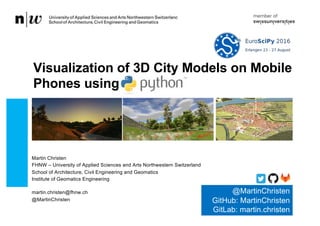
  • 1. Martin Christen FHNW – University of Applied Sciences and Arts Northwestern Switzerland School of Architecture, Civil Engineering and Geomatics Institute of Geomatics Engineering martin.christen@fhnw.ch @MartinChristen Visualization of 3D City Models on Mobile Phones using @MartinChristen GitHub: MartinChristen GitLab: martin.christen
  • 2. • Virtual Globe using WebGL • Open Source Project started in April 2011 • JavaScript Library for rapid development of web-based geospatial 3D applications • Data Processing written in C++ and Python 226 August 2016 2 OpenWebGlobe Institute of Geomatics Engineering
  • 3. 26 August 2016Institute of Geomatics Engineering 3 Previous Work: OpenWebGlobe – Virtual Globe using JavaScript / WebGL
  • 4. 26 August 2016Institute of Geomatics Engineering 4 Motivation: 3D-Streaming in the web browser MapData © OpenStreetMap contributors BTh Hürbi/Daetwyler, MTh Lucas Oertli, 2013
  • 5. 26 August 2016Institute of Geomatics Engineering 5 Streaming Example: 3D Geometry using OSM and “BOI” (worldwide streaming) MTh Lucas Oertli, 2013
  • 6. Hello World 26 August 2016Institute of Geomatics Engineering 6
  • 7. 26 August 2016Institute of Geomatics Engineering 7 How does it work ? EPSG:3857 (Visualization Pseudo Mercator) WGS84 Ellipsoid EPSG:4326 Proj.4 Library (pyproj): https://github.com/jswhit/pyproj http://www.spatialreference.org Global or local Datasets
  • 8. 26 August 2016Institute of Geomatics Engineering 8 Quadtree based – fully compatible with 2D Maps* 256 256 256 (Image courtesy of Microsoft, Bing Maps) *OpenStreetMap, Google Maps, Bing Maps, Yahoo Maps, … “zoom-levels”
  • 9. 26 August 2016Institute of Geomatics Engineering 9 Tile Types 2D Image Tile RGB(A) 256x256 pixels 2D Vector Tile Contains geometry. (if rasterized use Image Tile) 2D Elevation Tile Contains Elevation Data for example: 17x17 Values
  • 10. 26 August 2016Institute of Geomatics Engineering 10 Special Tile Types 3D Geometry Tile A 3D Geometry Tile contains Texture(s) & arbitrary 3D Geometry Within it‘s tile limit Separate Geometry for each zoom level GDAL Library: http://www.gdal.org
  • 11. 26 August 2016Institute of Geomatics Engineering 11 OpenWebGlobe 2 http://www.openwebglobe.org (coming soon) Currently in Development A new version – completely redesigned …with more Python! (Data processing is 98% Python code) 2
  • 12. 26 August 2016Institute of Geomatics Engineering 12 Why a new Version ? • 19 zoom levels over the whole planet results in about 360 billion tiles. • 19 zoom levels is too much for many applications • Many “real-world” applications/projects are oriented “local”. The need for a global 3D-scene is overkill. (1 Building, 1 city, 1 country…) • On mobile devices rendering 3D graphics is quite power consuming • Navigation on a 3D-Globe is difficult for many people • People still prefer 2D-Maps (fast, quick overview, …) • … • ... • ... • ... • ... 2
  • 13. 26 August 2016Institute of Geomatics Engineering 13 One new feature: Bringing together 2D Maps and 3D Globes Another tile type! Concept: Prerender a 3D Scene using a high quality offline 3D renderer using an orthographic projection and create “2D” image tiles for each zoom-level Constant, minimal bandwidth regardless of the complexity of the 3D city model MTh Markus Jung, 2014 (Similar approaches were already done by Döllner et al. and also go back to some concepts by Sutherland) 2
  • 14. 26 August 2016Institute of Geomatics Engineering 14 Display in the Webbrowser as “2D Map” MTh Markus Jung, 2014 2
  • 15. 26 August 2016Institute of Geomatics Engineering 15 High Resolution Geometry doesn’t matter: Same download/render speed MTh Markus Jung, 2014 2
  • 16. 26 August 2016Institute of Geomatics Engineering 16 90 CityGML files (2.72 GB) 26'474 textures (1024x1024), uncompressed size ca. 77 GB image data (orthophoto) ca. 430 GB uncompressed
  • 17. 26 August 2016Institute of Geomatics Engineering 17 Another example: 3D Map using OpenStreetMap data Source: BTh, Daniel Rettenmund 2015
  • 18. 26 August 2016Institute of Geomatics Engineering 18 App: make visible the invisibke (Roman city of Augusta Raurica)
  • 19. 26 August 2016Institute of Geomatics Engineering 19 Prerendering the Model: Color Map, Normal Map, Id-Map, Depth Map Dynamic Lighting Normal Map: for Object Identification: Highlighting, special effects, … Depth Map: for 3D Position, special effects, … 2
  • 20. 26 August 2016Institute of Geomatics Engineering 20 PyRT (no logo yet!) Rendering is done using pyRT (“Pirate”) pyRT is a new project for rendering high quality images using Ray Tracing (pyRT). By using global illumination, the results look quite nice. It also has Jupyter integration (render within your notebook) The project is currently in development and open sourced later. (MTh 2016: GPU support / OpenCL, starting in September 2016)
  • 21. 26 August 2016Institute of Geomatics Engineering 21 pyRT Example from pyrt.math import * from pyrt.geometry import Triangle from pyrt.camera import PerspectiveCamera from pyrt.renderer import SimpleRT camera = PerspectiveCamera(640,480) scene = Scene() scene.Add(Triangle(Vec3(0, 0, 0), Vec3(0, 5, 0), Vec3(1, 5, 0))) scene.SetCamera(camera) engine = renderer.SimpleRT() imgdata = engine.render(scene)
  • 22. 26 August 2016Institute of Geomatics Engineering 22 And “real 3d” is of course still possible in OpenWebGlobe 2 Typical Scene: From a single building to a planet…
  • 23. 26 August 2016Institute of Geomatics Engineering 23 Data Processing Architecture Web Viewer • HTML5, WebGL, JavaScript Data Processing & Storage/Cache • Python (most parts) • Some JavaScript (node.js) • Some C++ / OpenCL • Running on HPCC Raw data
  • 24. 26 August 2016Institute of Geomatics Engineering 24 All Architecture 3DPS (3D Portrayal Service) Based on the OGC 3DPS Candidate 2 world3d.js Real 3D map3d.js 3D Map map3d.js world3d.js owg2.js Building City Country Planet …
  • 25. 26 August 2016Institute of Geomatics Engineering 25 Docker (Source: docker.io) For development and deployment (processing tools / sample webservice / …)
  • 26. 26 August 2016 Institute of Geomatics Engineering 26 Questions ? Contact me at martin.christen@fhnw.ch @MartinChristen GitHub: MartinChristen GitLab: martin.christen