SlideShare ist ein Scribd-Unternehmen logo
1 von 52
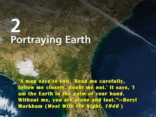
Title Page Photo "A map says to you, 'Read me carefully, follow me closely, doubt me not.' It says, 'I am the Earth in the palm of your hand. Without me, you are alone and lost.'" — Beryl Markham ( West With the Night, 1946  )
Vocabulary remote sensing  (p. 44) representative fraction  (p. 31) rhumb line  (p. 36) small-scale map  (p. 31) sonar  (p. 48) verbal scale  (p. 31) global positioning system (GPS) (p. 41) graphic scale  (p. 30) isoline  (p. 39) large-scale map  (p. 31) loxodrome  (p. 36) map  (p. 29) map projection  (p. 33) map scale  (p. 30) Mercator projection  (p. 36) multispectral scanning system (MSS)  (p. 46) aerial photograph  (p. 44) conformality (conformal projection) (p. 35) conic projection  (p. 37) cylindrical projection  (p. 35) elevation contour line  (p. 39) equal area projection  (p. 35) equivalence (equivalent projection) (p. 35) fractional scale  (p. 31) geographic information systems (GIS)  (p. 48) orthophoto map  (p. 44) photogrammetry  (p. 44) plane projection  (p. 37)  pseudocylindrical projection (elliptical projection)  (p. 38) radar  (p. 48)
The Nature of Maps ,[object Object],[object Object],[object Object],[object Object]
The Nature of Maps ,[object Object],[object Object],[object Object],http://www.zanzibarmagic.com/english2nd/maps.01.jpg
Map Scale ,[object Object],[object Object],[object Object]
Map Scale ,[object Object],[object Object],[object Object],[object Object]
Map Scale ,[object Object],[object Object]
Map Scale ,[object Object],[object Object],[object Object],[object Object],[object Object],[object Object]
Map Essentials ,[object Object],[object Object],[object Object],[object Object],[object Object],[object Object],[object Object],[object Object],[object Object],[object Object]
Map Essentials
The Role of Globes ,[object Object],[object Object],[object Object],[object Object]
Map Projections ,[object Object],[object Object]
Map Projections ,[object Object],[object Object],[object Object],A map which portrays shape accurately is called a conformal map. Conformal  maps are useful in that they help us  understand the true shape of the items  on the map. However, these maps have  many drawbacks. A conformal map  tends to get quite distorted, especially  towards the top and bottom of the map.  This creates problems with scale. The  scale may be accurate near the equator,  but the further one travels form the  equator, the less accurate the scale  becomes.
Map Projections ,[object Object],[object Object],[object Object],[object Object],[object Object],Robinson Projection
Map Projection ,[object Object],[object Object],[object Object],[object Object],[object Object]
Map Projection ,[object Object],[object Object],[object Object],[object Object]
Families of Map Projections ,[object Object],[object Object],[object Object]
Families of Map Projections ,[object Object],[object Object],[object Object],[object Object]
[object Object],[object Object],[object Object],[object Object],[object Object],-  Fig. 2-7
Families of Map Projections ,[object Object],[object Object],[object Object],[object Object],[object Object]
Families of Map Projections ,[object Object],[object Object],[object Object]
Families of Map Projections ,[object Object],[object Object],[object Object],[object Object]
[object Object],[object Object],[object Object],[object Object],- Fig. 2-9
Families of Map Projections ,[object Object],[object Object],[object Object],[object Object],[object Object]
[object Object],[object Object],[object Object]
Families of Map Projections ,[object Object],[object Object],[object Object],[object Object]
Computer Cartography ,[object Object],[object Object],[object Object],[object Object]
Isolines ,[object Object],[object Object],[object Object],[object Object]
Isolines ,[object Object],[object Object],[object Object],[object Object],[object Object],[object Object]
Isolines ,[object Object],[object Object],[object Object],[object Object],[object Object],[object Object],[object Object]
[object Object],[object Object],[object Object],[object Object],Source: U.S.G.S. Marble Colorado Topographic Quadrangle Map
[object Object],Source: U.S.G.S. Marble Colorado Topographic Quadrangle Map
The Global Positioning System ,[object Object],[object Object],[object Object],[object Object]
[object Object],[object Object],[object Object],[object Object],[object Object],[object Object],Global positioning satellites
Remote Sensing ,[object Object],[object Object],[object Object],[object Object]
Remote Sensing ,[object Object],[object Object],[object Object],[object Object],[object Object],[object Object],[object Object],http://kaznowski.blox.pl/resource/strangemaps.JPG
Remote Sensing ,[object Object],[object Object],[object Object],[object Object]
Remote Sensing ,[object Object],[object Object],[object Object],[object Object],[object Object],[object Object],[object Object]
[object Object],[object Object],Color infrared image of Mississippi River
[object Object],[object Object],[object Object]
Remote Sensing ,[object Object],[object Object],[object Object]
Remote Sensing ,[object Object],[object Object],[object Object],[object Object],[object Object],[object Object],[object Object],[object Object],[object Object]
Remote Sensing ,[object Object],[object Object],[object Object],[object Object],[object Object],[object Object]
Remote Sensing ,[object Object],[object Object],[object Object],[object Object],[object Object]
Geographic Information Systems ,[object Object],[object Object],[object Object],[object Object],[object Object],[object Object],[object Object],[object Object]
[object Object],[object Object],[object Object]
[object Object],[object Object]
The Role of the Geographer ,[object Object],[object Object],[object Object]

Weitere ähnliche Inhalte

Was ist angesagt?

Geography skills handbook1
Geography skills handbook1Geography skills handbook1
Geography skills handbook1
kjanchild
 
Chapter 6 3
Chapter 6 3Chapter 6 3
Chapter 6 3
llaub
 
gis spatial data and maps
gis spatial data and mapsgis spatial data and maps
gis spatial data and maps
Bandla Msengana
 
Reading & interpreting maps notes
Reading & interpreting maps notesReading & interpreting maps notes
Reading & interpreting maps notes
careycannon
 

Was ist angesagt? (20)

Map_Projections
Map_ProjectionsMap_Projections
Map_Projections
 
Geography skills handbook1
Geography skills handbook1Geography skills handbook1
Geography skills handbook1
 
2018 GIS in the Rockies Workshop: Coordinate Systems and Projections
2018 GIS in the Rockies Workshop: Coordinate Systems and Projections 2018 GIS in the Rockies Workshop: Coordinate Systems and Projections
2018 GIS in the Rockies Workshop: Coordinate Systems and Projections
 
GIS
GISGIS
GIS
 
Chapter 6 Section 3 (maps)
Chapter 6 Section 3 (maps)Chapter 6 Section 3 (maps)
Chapter 6 Section 3 (maps)
 
EssentialsGeographyCoakley
EssentialsGeographyCoakleyEssentialsGeographyCoakley
EssentialsGeographyCoakley
 
TYBSC IT PGIS Unit III Chapter I Spatial Referencing and Positioning
TYBSC IT PGIS Unit III Chapter I Spatial Referencing and PositioningTYBSC IT PGIS Unit III Chapter I Spatial Referencing and Positioning
TYBSC IT PGIS Unit III Chapter I Spatial Referencing and Positioning
 
Coordinate systems, datum & map projections
Coordinate systems, datum & map projectionsCoordinate systems, datum & map projections
Coordinate systems, datum & map projections
 
Ch 1 (maps & diagrams)
Ch 1 (maps & diagrams)Ch 1 (maps & diagrams)
Ch 1 (maps & diagrams)
 
2017 PLSC Track: Fundamentals of Coordinate Systems
2017 PLSC Track: Fundamentals of Coordinate Systems2017 PLSC Track: Fundamentals of Coordinate Systems
2017 PLSC Track: Fundamentals of Coordinate Systems
 
Chapter 6 3
Chapter 6 3Chapter 6 3
Chapter 6 3
 
Chapter 3 map basics
Chapter   3 map basicsChapter   3 map basics
Chapter 3 map basics
 
gis spatial data and maps
gis spatial data and mapsgis spatial data and maps
gis spatial data and maps
 
International Journal of Engineering and Science Invention (IJESI)
International Journal of Engineering and Science Invention (IJESI)International Journal of Engineering and Science Invention (IJESI)
International Journal of Engineering and Science Invention (IJESI)
 
TYBSC IT PGIS Unit V Data Visualization
TYBSC IT PGIS Unit V  Data VisualizationTYBSC IT PGIS Unit V  Data Visualization
TYBSC IT PGIS Unit V Data Visualization
 
Reading & interpreting maps notes
Reading & interpreting maps notesReading & interpreting maps notes
Reading & interpreting maps notes
 
Chapter1
Chapter1Chapter1
Chapter1
 
Understanding Coordinate Systems and Projections for ArcGIS
Understanding Coordinate Systems and Projections for ArcGISUnderstanding Coordinate Systems and Projections for ArcGIS
Understanding Coordinate Systems and Projections for ArcGIS
 
Cartographic symbology. By proj jasper
Cartographic symbology. By proj jasperCartographic symbology. By proj jasper
Cartographic symbology. By proj jasper
 
Projection 2012
Projection 2012Projection 2012
Projection 2012
 

Ähnlich wie Chapter two

Map scale and projection
Map scale and projectionMap scale and projection
Map scale and projection
lschmidt1170
 
1017 notes on maps and mapping
1017 notes on maps and mapping1017 notes on maps and mapping
1017 notes on maps and mapping
Julian Swindell
 
Maps as Models of Earth
Maps as Models of EarthMaps as Models of Earth
Maps as Models of Earth
mlong24
 

Ähnlich wie Chapter two (20)

Map projections
Map projectionsMap projections
Map projections
 
BOLTSS - Mapping Geography
BOLTSS - Mapping GeographyBOLTSS - Mapping Geography
BOLTSS - Mapping Geography
 
PROJECTIONS & COORDINATE SYSTEMS-1.pptx
PROJECTIONS & COORDINATE SYSTEMS-1.pptxPROJECTIONS & COORDINATE SYSTEMS-1.pptx
PROJECTIONS & COORDINATE SYSTEMS-1.pptx
 
Cartography Unit_ 3.pptx
Cartography Unit_ 3.pptxCartography Unit_ 3.pptx
Cartography Unit_ 3.pptx
 
Projections and coordinate system
Projections and coordinate systemProjections and coordinate system
Projections and coordinate system
 
Map scale and projection
Map scale and projectionMap scale and projection
Map scale and projection
 
Cartography
CartographyCartography
Cartography
 
1017 notes on maps and mapping
1017 notes on maps and mapping1017 notes on maps and mapping
1017 notes on maps and mapping
 
Map Projections ―concepts, classes and usage
Map Projections ―concepts, classes and usage Map Projections ―concepts, classes and usage
Map Projections ―concepts, classes and usage
 
Map reading
Map readingMap reading
Map reading
 
Map projection
Map projection Map projection
Map projection
 
Map Projection
Map ProjectionMap Projection
Map Projection
 
Basics in Cartography
Basics in Cartography Basics in Cartography
Basics in Cartography
 
Maps as Models of Earth
Maps as Models of EarthMaps as Models of Earth
Maps as Models of Earth
 
Maps as Models of Earth
Maps as Models of EarthMaps as Models of Earth
Maps as Models of Earth
 
MAP PROJECTION.pdf
MAP PROJECTION.pdfMAP PROJECTION.pdf
MAP PROJECTION.pdf
 
RebekahHannonMapSkillsTutorial
RebekahHannonMapSkillsTutorialRebekahHannonMapSkillsTutorial
RebekahHannonMapSkillsTutorial
 
CARTOGRAPHY – yesterday, today and tomorrow
CARTOGRAPHY – yesterday, today and tomorrowCARTOGRAPHY – yesterday, today and tomorrow
CARTOGRAPHY – yesterday, today and tomorrow
 
Cartography – plotting the world
Cartography – plotting the worldCartography – plotting the world
Cartography – plotting the world
 
Surveying II ajith sir class 1
Surveying II ajith sir class 1Surveying II ajith sir class 1
Surveying II ajith sir class 1
 

Mehr von lschmidt1170

Denis haley catherine douglas geneaology 1793 to 1989
Denis haley catherine douglas geneaology 1793 to 1989Denis haley catherine douglas geneaology 1793 to 1989
Denis haley catherine douglas geneaology 1793 to 1989
lschmidt1170
 

Mehr von lschmidt1170 (20)

How did the magna carta influence the united states bill of rights
How did the magna carta influence the united states bill of rightsHow did the magna carta influence the united states bill of rights
How did the magna carta influence the united states bill of rights
 
Sustainable development goals
Sustainable development goalsSustainable development goals
Sustainable development goals
 
Magna cartas lessons for the me
Magna cartas lessons for the meMagna cartas lessons for the me
Magna cartas lessons for the me
 
What is the magna carta and why there is a google doodle telegraph
What is the magna carta and why there is a google doodle    telegraphWhat is the magna carta and why there is a google doodle    telegraph
What is the magna carta and why there is a google doodle telegraph
 
Universal declaration of human rights
Universal declaration of human rightsUniversal declaration of human rights
Universal declaration of human rights
 
Magna carta and the law of nature
Magna carta and the law of natureMagna carta and the law of nature
Magna carta and the law of nature
 
King john the most evil monarch in britain's history telegraph
King john  the most evil monarch in britain's history   telegraphKing john  the most evil monarch in britain's history   telegraph
King john the most evil monarch in britain's history telegraph
 
How did the magna carta influence the united states bill of rights
How did the magna carta influence the united states bill of rightsHow did the magna carta influence the united states bill of rights
How did the magna carta influence the united states bill of rights
 
Constitution billofrightsfacts
Constitution billofrightsfactsConstitution billofrightsfacts
Constitution billofrightsfacts
 
Feudal strength! henry ii and the struggle for royal control in
Feudal strength!  henry ii and the struggle for royal control inFeudal strength!  henry ii and the struggle for royal control in
Feudal strength! henry ii and the struggle for royal control in
 
Constitution
ConstitutionConstitution
Constitution
 
Bill of rights
Bill of rightsBill of rights
Bill of rights
 
A magna carta for the earth oecd observer
A magna carta for the earth    oecd observerA magna carta for the earth    oecd observer
A magna carta for the earth oecd observer
 
Denis haley catherine douglas geneaology 1793 to 1989
Denis haley catherine douglas geneaology 1793 to 1989Denis haley catherine douglas geneaology 1793 to 1989
Denis haley catherine douglas geneaology 1793 to 1989
 
Na map 1 with terms
Na map 1 with termsNa map 1 with terms
Na map 1 with terms
 
Introfall 2016 14week
Introfall 2016 14weekIntrofall 2016 14week
Introfall 2016 14week
 
Fall 2016 syllabus geog 110 71
Fall 2016 syllabus geog 110 71Fall 2016 syllabus geog 110 71
Fall 2016 syllabus geog 110 71
 
Intro fall 2016 geog lab
Intro fall 2016 geog labIntro fall 2016 geog lab
Intro fall 2016 geog lab
 
Fall 2016 intro wed
Fall 2016 intro wedFall 2016 intro wed
Fall 2016 intro wed
 
Fall 2016 intro mon
Fall 2016 intro monFall 2016 intro mon
Fall 2016 intro mon
 

Kürzlich hochgeladen

Gardella_PRCampaignConclusion Pitch Letter
Gardella_PRCampaignConclusion Pitch LetterGardella_PRCampaignConclusion Pitch Letter
Gardella_PRCampaignConclusion Pitch Letter
MateoGardella
 
An Overview of Mutual Funds Bcom Project.pdf
An Overview of Mutual Funds Bcom Project.pdfAn Overview of Mutual Funds Bcom Project.pdf
An Overview of Mutual Funds Bcom Project.pdf
SanaAli374401
 
Russian Escort Service in Delhi 11k Hotel Foreigner Russian Call Girls in Delhi
Russian Escort Service in Delhi 11k Hotel Foreigner Russian Call Girls in DelhiRussian Escort Service in Delhi 11k Hotel Foreigner Russian Call Girls in Delhi
Russian Escort Service in Delhi 11k Hotel Foreigner Russian Call Girls in Delhi
kauryashika82
 
Activity 01 - Artificial Culture (1).pdf
Activity 01 - Artificial Culture (1).pdfActivity 01 - Artificial Culture (1).pdf
Activity 01 - Artificial Culture (1).pdf
ciinovamais
 
Gardella_Mateo_IntellectualProperty.pdf.
Gardella_Mateo_IntellectualProperty.pdf.Gardella_Mateo_IntellectualProperty.pdf.
Gardella_Mateo_IntellectualProperty.pdf.
MateoGardella
 

Kürzlich hochgeladen (20)

This PowerPoint helps students to consider the concept of infinity.
This PowerPoint helps students to consider the concept of infinity.This PowerPoint helps students to consider the concept of infinity.
This PowerPoint helps students to consider the concept of infinity.
 
How to Give a Domain for a Field in Odoo 17
How to Give a Domain for a Field in Odoo 17How to Give a Domain for a Field in Odoo 17
How to Give a Domain for a Field in Odoo 17
 
microwave assisted reaction. General introduction
microwave assisted reaction. General introductionmicrowave assisted reaction. General introduction
microwave assisted reaction. General introduction
 
Gardella_PRCampaignConclusion Pitch Letter
Gardella_PRCampaignConclusion Pitch LetterGardella_PRCampaignConclusion Pitch Letter
Gardella_PRCampaignConclusion Pitch Letter
 
psychiatric nursing HISTORY COLLECTION .docx
psychiatric  nursing HISTORY  COLLECTION  .docxpsychiatric  nursing HISTORY  COLLECTION  .docx
psychiatric nursing HISTORY COLLECTION .docx
 
Advanced Views - Calendar View in Odoo 17
Advanced Views - Calendar View in Odoo 17Advanced Views - Calendar View in Odoo 17
Advanced Views - Calendar View in Odoo 17
 
An Overview of Mutual Funds Bcom Project.pdf
An Overview of Mutual Funds Bcom Project.pdfAn Overview of Mutual Funds Bcom Project.pdf
An Overview of Mutual Funds Bcom Project.pdf
 
Application orientated numerical on hev.ppt
Application orientated numerical on hev.pptApplication orientated numerical on hev.ppt
Application orientated numerical on hev.ppt
 
Unit-IV; Professional Sales Representative (PSR).pptx
Unit-IV; Professional Sales Representative (PSR).pptxUnit-IV; Professional Sales Representative (PSR).pptx
Unit-IV; Professional Sales Representative (PSR).pptx
 
Russian Escort Service in Delhi 11k Hotel Foreigner Russian Call Girls in Delhi
Russian Escort Service in Delhi 11k Hotel Foreigner Russian Call Girls in DelhiRussian Escort Service in Delhi 11k Hotel Foreigner Russian Call Girls in Delhi
Russian Escort Service in Delhi 11k Hotel Foreigner Russian Call Girls in Delhi
 
Activity 01 - Artificial Culture (1).pdf
Activity 01 - Artificial Culture (1).pdfActivity 01 - Artificial Culture (1).pdf
Activity 01 - Artificial Culture (1).pdf
 
Nutritional Needs Presentation - HLTH 104
Nutritional Needs Presentation - HLTH 104Nutritional Needs Presentation - HLTH 104
Nutritional Needs Presentation - HLTH 104
 
Class 11th Physics NEET formula sheet pdf
Class 11th Physics NEET formula sheet pdfClass 11th Physics NEET formula sheet pdf
Class 11th Physics NEET formula sheet pdf
 
Measures of Dispersion and Variability: Range, QD, AD and SD
Measures of Dispersion and Variability: Range, QD, AD and SDMeasures of Dispersion and Variability: Range, QD, AD and SD
Measures of Dispersion and Variability: Range, QD, AD and SD
 
INDIA QUIZ 2024 RLAC DELHI UNIVERSITY.pptx
INDIA QUIZ 2024 RLAC DELHI UNIVERSITY.pptxINDIA QUIZ 2024 RLAC DELHI UNIVERSITY.pptx
INDIA QUIZ 2024 RLAC DELHI UNIVERSITY.pptx
 
Advance Mobile Application Development class 07
Advance Mobile Application Development class 07Advance Mobile Application Development class 07
Advance Mobile Application Development class 07
 
Gardella_Mateo_IntellectualProperty.pdf.
Gardella_Mateo_IntellectualProperty.pdf.Gardella_Mateo_IntellectualProperty.pdf.
Gardella_Mateo_IntellectualProperty.pdf.
 
Z Score,T Score, Percential Rank and Box Plot Graph
Z Score,T Score, Percential Rank and Box Plot GraphZ Score,T Score, Percential Rank and Box Plot Graph
Z Score,T Score, Percential Rank and Box Plot Graph
 
Accessible design: Minimum effort, maximum impact
Accessible design: Minimum effort, maximum impactAccessible design: Minimum effort, maximum impact
Accessible design: Minimum effort, maximum impact
 
Introduction to Nonprofit Accounting: The Basics
Introduction to Nonprofit Accounting: The BasicsIntroduction to Nonprofit Accounting: The Basics
Introduction to Nonprofit Accounting: The Basics
 

Chapter two

  • 1. Title Page Photo "A map says to you, 'Read me carefully, follow me closely, doubt me not.' It says, 'I am the Earth in the palm of your hand. Without me, you are alone and lost.'" — Beryl Markham ( West With the Night, 1946 )
  • 2. Vocabulary remote sensing (p. 44) representative fraction (p. 31) rhumb line (p. 36) small-scale map (p. 31) sonar (p. 48) verbal scale (p. 31) global positioning system (GPS) (p. 41) graphic scale (p. 30) isoline (p. 39) large-scale map (p. 31) loxodrome (p. 36) map (p. 29) map projection (p. 33) map scale (p. 30) Mercator projection (p. 36) multispectral scanning system (MSS) (p. 46) aerial photograph (p. 44) conformality (conformal projection) (p. 35) conic projection (p. 37) cylindrical projection (p. 35) elevation contour line (p. 39) equal area projection (p. 35) equivalence (equivalent projection) (p. 35) fractional scale (p. 31) geographic information systems (GIS) (p. 48) orthophoto map (p. 44) photogrammetry (p. 44) plane projection (p. 37) pseudocylindrical projection (elliptical projection) (p. 38) radar (p. 48)
  • 3.
  • 4.
  • 5.
  • 6.
  • 7.
  • 8.
  • 9.
  • 10.
  • 12.
  • 13.
  • 14.
  • 15.
  • 16.
  • 17.
  • 18.
  • 19.
  • 20.
  • 21.
  • 22.
  • 23.
  • 24.
  • 25.
  • 26.
  • 27.
  • 28.
  • 29.
  • 30.
  • 31.
  • 32.
  • 33.
  • 34.
  • 35.
  • 36.
  • 37.
  • 38.
  • 39.
  • 40.
  • 41.
  • 42.
  • 43.
  • 44.
  • 45.
  • 46.
  • 47.
  • 48.
  • 49.
  • 50.
  • 51.
  • 52.