SlideShare ist ein Scribd-Unternehmen logo
1 von 23
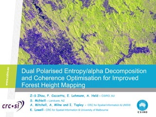
Dual Polarised Entropy/alpha Decomposition and Coherence Optimisation for Improved Forest Height Mapping Z-S Zhou, P. Caccetta, E. Lehmann, A. Held   –  CSIRO, AU S. McNeill   – Landcare, NZ A. Mitchell, A. Milne and I. Tapley  -  CRC for Spatial Information & UNSW   K. Lowell   - CRC for Spatial Information & University of Melbourne
Contents ,[object Object],[object Object],[object Object],[object Object],[object Object],[object Object]
Introduction NCAS   ( National Carbon Accounting System )   -- Land Cover Change Project ,[object Object],[object Object],[object Object],[object Object],[object Object],www.climatechange.gov.au/ncas
[object Object],[object Object],[object Object],NCAS Landcover Change Project:  Optical Time Series Data (25m) ……… . … … … 1972 2010 Mosaic ~ 400 scenes
Forest-Non-Forest : Digital Classification of Cloud Free Image at one time Epoch NCAS 2006 Image Detail 50km by 60km Classification probability (forest) Dark green High probability Light green ‘uncertain’
Classification probabilities (forest) Dark green High probability Light green ‘uncertain’ No classification in cloudy area …  Lead to use radar data instead Digital Classification of Cloudy Image NCAS 2005 Image + cloud mask (blue lines) Detail 50km by 60km
Eigenvector-Based Polarimetric Target Decomposition Eigenvectors / Eigenvalues Analysis Polarimetric Entropy Probabilities Unit Target Vector alpha (Cloude-Pottier, TGARS, 1997) Orthogonal Eigenvectors Real Eigenvalues
Entropy/alpha (H /      Space Low Entropy Medium Entropy High Entropy Surface Scattering Volume Scattering Multiple Scattering 0 0.2 0.4 0.6 0.8 1 0 10 20 30 40 50 60 70 80 90 Entropy (H) Alpha  ( a )  9 3 X-BRAGG SURFACE DIPOLE DIHEDRAL SCATTERER SURFACE ROUGHNESS PROPAGATION EFFECTS FORESTRY DBLE BOUNCE BRANCH / CROWN STRUCTURE  CLOUD OF ANISOTROPIC NEEDLES NON FEASIBLE REGION 1 4 7 2 6 5 VEGETATION 8
Dual Polarisation Radar Mode For reasons of cost, data rate and coverage in radar design, it often employs a single transmitted polarisation state and a coherent dual channel receiver to measure orthogonal components of scattered signal.  The PALSAR sensor is just such a fully coherent-on-receive mode.  Such dual polarised radars are not capable of reconstructing the complete scattering matrix [S] but instead can be used to reconstruct a 2x2 wave coherency matrix [J]. (Cloude, POLINSAR 2007)
Dual Polarised Entropy/alpha Decomposition Wave Coherency Matrix  (H Transmit, H,V Coherent Receive - PALSAR) (V Transmit, H,V Coherent Receive -) (Cloude, POLINSAR 2007)
Dual Polarised Entropy/alpha Decomposition Related to 3x3 Polarimetric Coherency Matrix [T]  (Cloude, POLINSAR 2007)
Dual Polarised Entropy/alpha Decomposition Scattering Angle and Entropy  (Cloude, POLINSAR 2007)
Dual Polarised Entropy/alpha Space ... Genuine decomposation classess to be inverstigated Entropy H  alpha (degrees)
Dual Polarised Entropy/alpha Decomposition Alpha (left) and Entropy (right) Maps of PALSAR Scene 381-6340 Acquired on 4 Oct 2008
AOI: a 10x10km Square (yellow box) alpha / Entropy / Intensity Forest/Non-forest
Partial Polarimetric Coherence Optimisation The coherence between two different polarisation channels: (Cloude & Papathanassiou, 1997) According to Reigber et al. (IGARSS 2008), HH-HV is clearly the better choice for all forested areas. where <> denotes spatial averaging,  and  contain the polarimetric information, while  contain baseline dependent polarimetric and interferometric information.  In the HH-HV pair, where  and  , total decorrelation over the forested areas is observed since the predominantly polarimetric  decorrelation between the HH-HV polarised backscattered signals is from areas dominated by volume scattering.
Polarimetric Coherence Optimisation To solve the coherence optimisation problem, we must maximise the modulus of a complex Lagrangian function L defined as The maximisation problem can be described by setting the partial derivatives to zero.  (Cloude & Papathanassiou, 1997) By solving these matrix equations, the estimates for  and  the optimal scattering mechanisms and the corresponding coherences in images i and j are obtained from the resulting eigenvalue problems
Partial Polarimetric Coherence Optimisation HV Coherence Optimised Coherence 0.9  0.1  0.5
Joint Processing of Dual Polarised Entropy/alpha Decomposition and Partial Polarimetric Coherence Optimisation  1). Generation of Entropy/alpha maps from PALSAR FBD SLC data implementing the above dual polarised Entropy/alpha decomposition algorithms; 2). Creation of the forest/non-forest discrimination map/mask using the Entropy/alpha classifier; 3). Coherence optimisation using multiple scattering mechanism approach described; 4). Non-forest region removal from the coherence map by the forest/non-forest mask derived from dual-pol Entropy/alpha maps; 5). Verification by in situ LiDAR forest canopy height data.
Optimised Coherence and LiDAR Canopy Height Map Optimised Coherence of AOI: a 10x10km Square with Non-forest Mask in White of HH-HV Pair Acquired on 19 Aug and 4 Oct 2008   LiDAR Forest Canopy Height Map of the AOI Acquired in Sept 2007: Blue – 0 meter, Green- 20 metres and Red – 40 metres. (Courtesy of Forestry Tasmania)
Optimised Coherence and LiDAR Canopy Height Map According to Le Toan (K&C 2010), the interferometric coherence ratio is sensitive to forest canopy height and the trend of coherence ratio is decreasing with a canopy height increase. That means the low coherence (red in left image) indicates a higher canopy height (red in right image).  One reason for anomaly/inconsistency in some areas could be that the ground cover changed due to the different acquisition dates of radar and LiDAR data (one year gap).
Conclusions and Future Work ,[object Object],[object Object],[object Object]
Thank you Zheng-Shu Zhou CSIRO Mathematics, Informatics and Statistics Phone: 08 9333 6189 Email: zheng-shu.zhou@csiro.au Web: www.cmis.csiro.au Contact Us Phone: 1300 363 400 or +61 3 9545 2176 Email: enquiries@csiro.au  Web: www.csiro.au

Weitere ähnliche Inhalte

Was ist angesagt?

Image interpretation keys & image resolution
Image interpretation keys & image resolutionImage interpretation keys & image resolution
Image interpretation keys & image resolutionPramoda Raj
 
Superflares in G, K and M Type Dwarfs from Kepler Observations
Superflares in G, K and M Type Dwarfs from Kepler ObservationsSuperflares in G, K and M Type Dwarfs from Kepler Observations
Superflares in G, K and M Type Dwarfs from Kepler ObservationsSimon Candelaresi
 
Heckbert p s__adaptive_radiosity_textures_for_bidirectional_r
Heckbert p s__adaptive_radiosity_textures_for_bidirectional_rHeckbert p s__adaptive_radiosity_textures_for_bidirectional_r
Heckbert p s__adaptive_radiosity_textures_for_bidirectional_rXavier Davias
 
Fractional approaches in dielectric broadband spectroscopy
Fractional approaches in dielectric broadband spectroscopyFractional approaches in dielectric broadband spectroscopy
Fractional approaches in dielectric broadband spectroscopySimon Candelaresi
 
Forest Change Detection in incomplete satellite images with deep neural networks
Forest Change Detection in incomplete satellite images with deep neural networksForest Change Detection in incomplete satellite images with deep neural networks
Forest Change Detection in incomplete satellite images with deep neural networksAatif Sohail
 
SAUSAGE MINKOWSKI SQUARE PATCH ANTENNA FOR GPS APPLICATION
SAUSAGE MINKOWSKI SQUARE PATCH ANTENNA FOR GPS APPLICATIONSAUSAGE MINKOWSKI SQUARE PATCH ANTENNA FOR GPS APPLICATION
SAUSAGE MINKOWSKI SQUARE PATCH ANTENNA FOR GPS APPLICATIONP singh
 
Land Cover and Land use Classifiction from Satellite Image Time Series Data u...
Land Cover and Land use Classifiction from Satellite Image Time Series Data u...Land Cover and Land use Classifiction from Satellite Image Time Series Data u...
Land Cover and Land use Classifiction from Satellite Image Time Series Data u...Lorena Santos
 

Was ist angesagt? (10)

Image interpretation keys & image resolution
Image interpretation keys & image resolutionImage interpretation keys & image resolution
Image interpretation keys & image resolution
 
Superflares in G, K and M Type Dwarfs from Kepler Observations
Superflares in G, K and M Type Dwarfs from Kepler ObservationsSuperflares in G, K and M Type Dwarfs from Kepler Observations
Superflares in G, K and M Type Dwarfs from Kepler Observations
 
Heckbert p s__adaptive_radiosity_textures_for_bidirectional_r
Heckbert p s__adaptive_radiosity_textures_for_bidirectional_rHeckbert p s__adaptive_radiosity_textures_for_bidirectional_r
Heckbert p s__adaptive_radiosity_textures_for_bidirectional_r
 
Fractional approaches in dielectric broadband spectroscopy
Fractional approaches in dielectric broadband spectroscopyFractional approaches in dielectric broadband spectroscopy
Fractional approaches in dielectric broadband spectroscopy
 
Force Field Transformation
Force Field TransformationForce Field Transformation
Force Field Transformation
 
Forest Change Detection in incomplete satellite images with deep neural networks
Forest Change Detection in incomplete satellite images with deep neural networksForest Change Detection in incomplete satellite images with deep neural networks
Forest Change Detection in incomplete satellite images with deep neural networks
 
SAUSAGE MINKOWSKI SQUARE PATCH ANTENNA FOR GPS APPLICATION
SAUSAGE MINKOWSKI SQUARE PATCH ANTENNA FOR GPS APPLICATIONSAUSAGE MINKOWSKI SQUARE PATCH ANTENNA FOR GPS APPLICATION
SAUSAGE MINKOWSKI SQUARE PATCH ANTENNA FOR GPS APPLICATION
 
BREWSTER_K_poster
BREWSTER_K_posterBREWSTER_K_poster
BREWSTER_K_poster
 
Poster_2
Poster_2Poster_2
Poster_2
 
Land Cover and Land use Classifiction from Satellite Image Time Series Data u...
Land Cover and Land use Classifiction from Satellite Image Time Series Data u...Land Cover and Land use Classifiction from Satellite Image Time Series Data u...
Land Cover and Land use Classifiction from Satellite Image Time Series Data u...
 

Andere mochten auch

Land cover mapping ghg
Land cover mapping  ghgLand cover mapping  ghg
Land cover mapping ghgFredrick Mokua
 
Landslides in the Hilly Regions of Bangladesh and Mitigation Measures
Landslides in the Hilly Regions of Bangladesh and Mitigation Measures Landslides in the Hilly Regions of Bangladesh and Mitigation Measures
Landslides in the Hilly Regions of Bangladesh and Mitigation Measures Anjalina Diana Podder
 
Land Use/Land Cover Mapping Of Allahabad City by Using Remote Sensing & GIS
Land Use/Land Cover Mapping Of Allahabad City by Using  Remote Sensing & GIS Land Use/Land Cover Mapping Of Allahabad City by Using  Remote Sensing & GIS
Land Use/Land Cover Mapping Of Allahabad City by Using Remote Sensing & GIS IJMER
 
Landslides and its mitigation
Landslides and its mitigationLandslides and its mitigation
Landslides and its mitigationEpapra
 
Landslides with case studies Presentation by Anand Swaroop Jaichandran
Landslides with case studies Presentation by Anand Swaroop JaichandranLandslides with case studies Presentation by Anand Swaroop Jaichandran
Landslides with case studies Presentation by Anand Swaroop JaichandranAnand Swaroop Jaichandran
 
Landslides A Major Threat
Landslides A Major ThreatLandslides A Major Threat
Landslides A Major ThreatKhanImran5975
 
Schneider - Impact of Largelandslide
Schneider - Impact of LargelandslideSchneider - Impact of Largelandslide
Schneider - Impact of Largelandslideceriuniroma
 
St.Mary`s school,teenmile,tezpur, hazard landslides class ix group 4
St.Mary`s school,teenmile,tezpur, hazard landslides class ix group 4St.Mary`s school,teenmile,tezpur, hazard landslides class ix group 4
St.Mary`s school,teenmile,tezpur, hazard landslides class ix group 4Al Muktadir Hussain
 
Lanslides tam 2013-04
Lanslides tam 2013-04Lanslides tam 2013-04
Lanslides tam 2013-04Vijay Kumar
 
Land use land cover mapping for smart village using gis
Land use land cover mapping for smart village using gisLand use land cover mapping for smart village using gis
Land use land cover mapping for smart village using gisSumit Yeole
 
LANDSLIDES
LANDSLIDESLANDSLIDES
LANDSLIDESKYI KHIN
 
Geography M2 Landslide
Geography M2 LandslideGeography M2 Landslide
Geography M2 LandslideeLearningJa
 
Use of remote sensing for land cover monitoring servir science applications
Use of remote sensing for land cover monitoring servir science applicationsUse of remote sensing for land cover monitoring servir science applications
Use of remote sensing for land cover monitoring servir science applicationsKabir Uddin
 
Land Use/Land Cover Detection
Land Use/Land Cover DetectionLand Use/Land Cover Detection
Land Use/Land Cover DetectionWansoo Im
 
Landslides and large dams
Landslides and large damsLandslides and large dams
Landslides and large damsDr_Dave
 
Urban Landuse/ Landcover change analysis using Remote Sensing and GIS
Urban Landuse/ Landcover change analysis using Remote Sensing and GISUrban Landuse/ Landcover change analysis using Remote Sensing and GIS
Urban Landuse/ Landcover change analysis using Remote Sensing and GISHarshvardhan Vashistha
 
Change detection techniques
Change detection techniquesChange detection techniques
Change detection techniquesFemi Opaleye
 
Change detection analysis in land use / land cover of Pune city using remotel...
Change detection analysis in land use / land cover of Pune city using remotel...Change detection analysis in land use / land cover of Pune city using remotel...
Change detection analysis in land use / land cover of Pune city using remotel...Nitin Mundhe
 

Andere mochten auch (20)

Land cover mapping ghg
Land cover mapping  ghgLand cover mapping  ghg
Land cover mapping ghg
 
Landslides in the Hilly Regions of Bangladesh and Mitigation Measures
Landslides in the Hilly Regions of Bangladesh and Mitigation Measures Landslides in the Hilly Regions of Bangladesh and Mitigation Measures
Landslides in the Hilly Regions of Bangladesh and Mitigation Measures
 
Land Use/Land Cover Mapping Of Allahabad City by Using Remote Sensing & GIS
Land Use/Land Cover Mapping Of Allahabad City by Using  Remote Sensing & GIS Land Use/Land Cover Mapping Of Allahabad City by Using  Remote Sensing & GIS
Land Use/Land Cover Mapping Of Allahabad City by Using Remote Sensing & GIS
 
Landslides and its mitigation
Landslides and its mitigationLandslides and its mitigation
Landslides and its mitigation
 
Landslides (José Antonio Buzón)
Landslides (José Antonio Buzón)Landslides (José Antonio Buzón)
Landslides (José Antonio Buzón)
 
Landslides with case studies Presentation by Anand Swaroop Jaichandran
Landslides with case studies Presentation by Anand Swaroop JaichandranLandslides with case studies Presentation by Anand Swaroop Jaichandran
Landslides with case studies Presentation by Anand Swaroop Jaichandran
 
Landuse Mapping
Landuse Mapping Landuse Mapping
Landuse Mapping
 
Landslides A Major Threat
Landslides A Major ThreatLandslides A Major Threat
Landslides A Major Threat
 
Schneider - Impact of Largelandslide
Schneider - Impact of LargelandslideSchneider - Impact of Largelandslide
Schneider - Impact of Largelandslide
 
St.Mary`s school,teenmile,tezpur, hazard landslides class ix group 4
St.Mary`s school,teenmile,tezpur, hazard landslides class ix group 4St.Mary`s school,teenmile,tezpur, hazard landslides class ix group 4
St.Mary`s school,teenmile,tezpur, hazard landslides class ix group 4
 
Lanslides tam 2013-04
Lanslides tam 2013-04Lanslides tam 2013-04
Lanslides tam 2013-04
 
Land use land cover mapping for smart village using gis
Land use land cover mapping for smart village using gisLand use land cover mapping for smart village using gis
Land use land cover mapping for smart village using gis
 
LANDSLIDES
LANDSLIDESLANDSLIDES
LANDSLIDES
 
Geography M2 Landslide
Geography M2 LandslideGeography M2 Landslide
Geography M2 Landslide
 
Use of remote sensing for land cover monitoring servir science applications
Use of remote sensing for land cover monitoring servir science applicationsUse of remote sensing for land cover monitoring servir science applications
Use of remote sensing for land cover monitoring servir science applications
 
Land Use/Land Cover Detection
Land Use/Land Cover DetectionLand Use/Land Cover Detection
Land Use/Land Cover Detection
 
Landslides and large dams
Landslides and large damsLandslides and large dams
Landslides and large dams
 
Urban Landuse/ Landcover change analysis using Remote Sensing and GIS
Urban Landuse/ Landcover change analysis using Remote Sensing and GISUrban Landuse/ Landcover change analysis using Remote Sensing and GIS
Urban Landuse/ Landcover change analysis using Remote Sensing and GIS
 
Change detection techniques
Change detection techniquesChange detection techniques
Change detection techniques
 
Change detection analysis in land use / land cover of Pune city using remotel...
Change detection analysis in land use / land cover of Pune city using remotel...Change detection analysis in land use / land cover of Pune city using remotel...
Change detection analysis in land use / land cover of Pune city using remotel...
 

Ähnlich wie Dual polarised entropy decomposition for forest height mapping

TU3.L09 - AN OVERVIEW OF RECENT ADVANCES IN POLARIMETRIC SAR INFORMATION EXTR...
TU3.L09 - AN OVERVIEW OF RECENT ADVANCES IN POLARIMETRIC SAR INFORMATION EXTR...TU3.L09 - AN OVERVIEW OF RECENT ADVANCES IN POLARIMETRIC SAR INFORMATION EXTR...
TU3.L09 - AN OVERVIEW OF RECENT ADVANCES IN POLARIMETRIC SAR INFORMATION EXTR...grssieee
 
Bouvet_IGARSS2011.ppt
Bouvet_IGARSS2011.pptBouvet_IGARSS2011.ppt
Bouvet_IGARSS2011.pptgrssieee
 
MONITORING FOREST MANAGEMENT ACTIVTIES USING AIRBORNE LIDAR AND ALOS PALSAR.pptx
MONITORING FOREST MANAGEMENT ACTIVTIES USING AIRBORNE LIDAR AND ALOS PALSAR.pptxMONITORING FOREST MANAGEMENT ACTIVTIES USING AIRBORNE LIDAR AND ALOS PALSAR.pptx
MONITORING FOREST MANAGEMENT ACTIVTIES USING AIRBORNE LIDAR AND ALOS PALSAR.pptxgrssieee
 
GENERATING FINE RESOLUTION LEAF AREA INDEX MAPS FOR BOREAL FORESTS OF FINLAND...
GENERATING FINE RESOLUTION LEAF AREA INDEX MAPS FOR BOREAL FORESTS OF FINLAND...GENERATING FINE RESOLUTION LEAF AREA INDEX MAPS FOR BOREAL FORESTS OF FINLAND...
GENERATING FINE RESOLUTION LEAF AREA INDEX MAPS FOR BOREAL FORESTS OF FINLAND...grssieee
 
2011_0728_IGARSS2011_Motohka.ppt
2011_0728_IGARSS2011_Motohka.ppt2011_0728_IGARSS2011_Motohka.ppt
2011_0728_IGARSS2011_Motohka.pptgrssieee
 
2011_0728_IGARSS2011_Motohka.ppt
2011_0728_IGARSS2011_Motohka.ppt2011_0728_IGARSS2011_Motohka.ppt
2011_0728_IGARSS2011_Motohka.pptgrssieee
 
IGARSS11_MW_v2.ppt
IGARSS11_MW_v2.pptIGARSS11_MW_v2.ppt
IGARSS11_MW_v2.pptgrssieee
 
IGARSS11_MW_v2.ppt
IGARSS11_MW_v2.pptIGARSS11_MW_v2.ppt
IGARSS11_MW_v2.pptgrssieee
 
ChuePoh_IGARSS2011.ppt
ChuePoh_IGARSS2011.pptChuePoh_IGARSS2011.ppt
ChuePoh_IGARSS2011.pptgrssieee
 
ChuePoh_IGARSS2011.ppt
ChuePoh_IGARSS2011.pptChuePoh_IGARSS2011.ppt
ChuePoh_IGARSS2011.pptgrssieee
 
IGARSS__RTC.pptx
IGARSS__RTC.pptxIGARSS__RTC.pptx
IGARSS__RTC.pptxgrssieee
 
POLCAL_shimada.pptx
POLCAL_shimada.pptxPOLCAL_shimada.pptx
POLCAL_shimada.pptxgrssieee
 
Eva van Gorsel_ From plant canopy to ecosystem to the globe: upscaling OzFlux...
Eva van Gorsel_ From plant canopy to ecosystem to the globe: upscaling OzFlux...Eva van Gorsel_ From plant canopy to ecosystem to the globe: upscaling OzFlux...
Eva van Gorsel_ From plant canopy to ecosystem to the globe: upscaling OzFlux...TERN Australia
 
Molinier - Feature Selection for Tree Species Identification in Very High res...
Molinier - Feature Selection for Tree Species Identification in Very High res...Molinier - Feature Selection for Tree Species Identification in Very High res...
Molinier - Feature Selection for Tree Species Identification in Very High res...grssieee
 
An Assessment of Pan-sharpening Algorithms for Mapping Mangrove Ecosystems: A...
An Assessment of Pan-sharpening Algorithms for Mapping Mangrove Ecosystems: A...An Assessment of Pan-sharpening Algorithms for Mapping Mangrove Ecosystems: A...
An Assessment of Pan-sharpening Algorithms for Mapping Mangrove Ecosystems: A...Anisa Aulia Sabilah
 
AT_MB_MM_IGARSS2011.ppt
AT_MB_MM_IGARSS2011.pptAT_MB_MM_IGARSS2011.ppt
AT_MB_MM_IGARSS2011.pptgrssieee
 
talk_igarss11_st.pptx
talk_igarss11_st.pptxtalk_igarss11_st.pptx
talk_igarss11_st.pptxgrssieee
 

Ähnlich wie Dual polarised entropy decomposition for forest height mapping (20)

TU3.L09 - AN OVERVIEW OF RECENT ADVANCES IN POLARIMETRIC SAR INFORMATION EXTR...
TU3.L09 - AN OVERVIEW OF RECENT ADVANCES IN POLARIMETRIC SAR INFORMATION EXTR...TU3.L09 - AN OVERVIEW OF RECENT ADVANCES IN POLARIMETRIC SAR INFORMATION EXTR...
TU3.L09 - AN OVERVIEW OF RECENT ADVANCES IN POLARIMETRIC SAR INFORMATION EXTR...
 
Bouvet_IGARSS2011.ppt
Bouvet_IGARSS2011.pptBouvet_IGARSS2011.ppt
Bouvet_IGARSS2011.ppt
 
MONITORING FOREST MANAGEMENT ACTIVTIES USING AIRBORNE LIDAR AND ALOS PALSAR.pptx
MONITORING FOREST MANAGEMENT ACTIVTIES USING AIRBORNE LIDAR AND ALOS PALSAR.pptxMONITORING FOREST MANAGEMENT ACTIVTIES USING AIRBORNE LIDAR AND ALOS PALSAR.pptx
MONITORING FOREST MANAGEMENT ACTIVTIES USING AIRBORNE LIDAR AND ALOS PALSAR.pptx
 
GENERATING FINE RESOLUTION LEAF AREA INDEX MAPS FOR BOREAL FORESTS OF FINLAND...
GENERATING FINE RESOLUTION LEAF AREA INDEX MAPS FOR BOREAL FORESTS OF FINLAND...GENERATING FINE RESOLUTION LEAF AREA INDEX MAPS FOR BOREAL FORESTS OF FINLAND...
GENERATING FINE RESOLUTION LEAF AREA INDEX MAPS FOR BOREAL FORESTS OF FINLAND...
 
2011_0728_IGARSS2011_Motohka.ppt
2011_0728_IGARSS2011_Motohka.ppt2011_0728_IGARSS2011_Motohka.ppt
2011_0728_IGARSS2011_Motohka.ppt
 
2011_0728_IGARSS2011_Motohka.ppt
2011_0728_IGARSS2011_Motohka.ppt2011_0728_IGARSS2011_Motohka.ppt
2011_0728_IGARSS2011_Motohka.ppt
 
IGARSS11_MW_v2.ppt
IGARSS11_MW_v2.pptIGARSS11_MW_v2.ppt
IGARSS11_MW_v2.ppt
 
IGARSS11_MW_v2.ppt
IGARSS11_MW_v2.pptIGARSS11_MW_v2.ppt
IGARSS11_MW_v2.ppt
 
arii.ppt
arii.pptarii.ppt
arii.ppt
 
ChuePoh_IGARSS2011.ppt
ChuePoh_IGARSS2011.pptChuePoh_IGARSS2011.ppt
ChuePoh_IGARSS2011.ppt
 
ChuePoh_IGARSS2011.ppt
ChuePoh_IGARSS2011.pptChuePoh_IGARSS2011.ppt
ChuePoh_IGARSS2011.ppt
 
IGARSS__RTC.pptx
IGARSS__RTC.pptxIGARSS__RTC.pptx
IGARSS__RTC.pptx
 
POLCAL_shimada.pptx
POLCAL_shimada.pptxPOLCAL_shimada.pptx
POLCAL_shimada.pptx
 
Eva van Gorsel_ From plant canopy to ecosystem to the globe: upscaling OzFlux...
Eva van Gorsel_ From plant canopy to ecosystem to the globe: upscaling OzFlux...Eva van Gorsel_ From plant canopy to ecosystem to the globe: upscaling OzFlux...
Eva van Gorsel_ From plant canopy to ecosystem to the globe: upscaling OzFlux...
 
Molinier - Feature Selection for Tree Species Identification in Very High res...
Molinier - Feature Selection for Tree Species Identification in Very High res...Molinier - Feature Selection for Tree Species Identification in Very High res...
Molinier - Feature Selection for Tree Species Identification in Very High res...
 
Exeter 2014 bbn_pdf
Exeter 2014 bbn_pdfExeter 2014 bbn_pdf
Exeter 2014 bbn_pdf
 
TREE BIOMASS ESTIMATION USING AIRBORNE LASER SCANNING
TREE BIOMASS ESTIMATION USING AIRBORNE LASER SCANNINGTREE BIOMASS ESTIMATION USING AIRBORNE LASER SCANNING
TREE BIOMASS ESTIMATION USING AIRBORNE LASER SCANNING
 
An Assessment of Pan-sharpening Algorithms for Mapping Mangrove Ecosystems: A...
An Assessment of Pan-sharpening Algorithms for Mapping Mangrove Ecosystems: A...An Assessment of Pan-sharpening Algorithms for Mapping Mangrove Ecosystems: A...
An Assessment of Pan-sharpening Algorithms for Mapping Mangrove Ecosystems: A...
 
AT_MB_MM_IGARSS2011.ppt
AT_MB_MM_IGARSS2011.pptAT_MB_MM_IGARSS2011.ppt
AT_MB_MM_IGARSS2011.ppt
 
talk_igarss11_st.pptx
talk_igarss11_st.pptxtalk_igarss11_st.pptx
talk_igarss11_st.pptx
 

Mehr von grssieee

Tangent height accuracy of Superconducting Submillimeter-Wave Limb-Emission S...
Tangent height accuracy of Superconducting Submillimeter-Wave Limb-Emission S...Tangent height accuracy of Superconducting Submillimeter-Wave Limb-Emission S...
Tangent height accuracy of Superconducting Submillimeter-Wave Limb-Emission S...grssieee
 
SEGMENTATION OF POLARIMETRIC SAR DATA WITH A MULTI-TEXTURE PRODUCT MODEL
SEGMENTATION OF POLARIMETRIC SAR DATA WITH A MULTI-TEXTURE PRODUCT MODELSEGMENTATION OF POLARIMETRIC SAR DATA WITH A MULTI-TEXTURE PRODUCT MODEL
SEGMENTATION OF POLARIMETRIC SAR DATA WITH A MULTI-TEXTURE PRODUCT MODELgrssieee
 
TWO-POINT STATISTIC OF POLARIMETRIC SAR DATA TWO-POINT STATISTIC OF POLARIMET...
TWO-POINT STATISTIC OF POLARIMETRIC SAR DATA TWO-POINT STATISTIC OF POLARIMET...TWO-POINT STATISTIC OF POLARIMETRIC SAR DATA TWO-POINT STATISTIC OF POLARIMET...
TWO-POINT STATISTIC OF POLARIMETRIC SAR DATA TWO-POINT STATISTIC OF POLARIMET...grssieee
 
THE SENTINEL-1 MISSION AND ITS APPLICATION CAPABILITIES
THE SENTINEL-1 MISSION AND ITS APPLICATION CAPABILITIESTHE SENTINEL-1 MISSION AND ITS APPLICATION CAPABILITIES
THE SENTINEL-1 MISSION AND ITS APPLICATION CAPABILITIESgrssieee
 
GMES SPACE COMPONENT:PROGRAMMATIC STATUS
GMES SPACE COMPONENT:PROGRAMMATIC STATUSGMES SPACE COMPONENT:PROGRAMMATIC STATUS
GMES SPACE COMPONENT:PROGRAMMATIC STATUSgrssieee
 
PROGRESSES OF DEVELOPMENT OF CFOSAT SCATTEROMETER
PROGRESSES OF DEVELOPMENT OF CFOSAT SCATTEROMETERPROGRESSES OF DEVELOPMENT OF CFOSAT SCATTEROMETER
PROGRESSES OF DEVELOPMENT OF CFOSAT SCATTEROMETERgrssieee
 
DEVELOPMENT OF ALGORITHMS AND PRODUCTS FOR SUPPORTING THE ITALIAN HYPERSPECTR...
DEVELOPMENT OF ALGORITHMS AND PRODUCTS FOR SUPPORTING THE ITALIAN HYPERSPECTR...DEVELOPMENT OF ALGORITHMS AND PRODUCTS FOR SUPPORTING THE ITALIAN HYPERSPECTR...
DEVELOPMENT OF ALGORITHMS AND PRODUCTS FOR SUPPORTING THE ITALIAN HYPERSPECTR...grssieee
 
EO-1/HYPERION: NEARING TWELVE YEARS OF SUCCESSFUL MISSION SCIENCE OPERATION A...
EO-1/HYPERION: NEARING TWELVE YEARS OF SUCCESSFUL MISSION SCIENCE OPERATION A...EO-1/HYPERION: NEARING TWELVE YEARS OF SUCCESSFUL MISSION SCIENCE OPERATION A...
EO-1/HYPERION: NEARING TWELVE YEARS OF SUCCESSFUL MISSION SCIENCE OPERATION A...grssieee
 
test 34mb wo animations
test  34mb wo animationstest  34mb wo animations
test 34mb wo animationsgrssieee
 
2011_Fox_Tax_Worksheets.pdf
2011_Fox_Tax_Worksheets.pdf2011_Fox_Tax_Worksheets.pdf
2011_Fox_Tax_Worksheets.pdfgrssieee
 
DLR open house
DLR open houseDLR open house
DLR open housegrssieee
 
DLR open house
DLR open houseDLR open house
DLR open housegrssieee
 
DLR open house
DLR open houseDLR open house
DLR open housegrssieee
 
Tana_IGARSS2011.ppt
Tana_IGARSS2011.pptTana_IGARSS2011.ppt
Tana_IGARSS2011.pptgrssieee
 
Solaro_IGARSS_2011.ppt
Solaro_IGARSS_2011.pptSolaro_IGARSS_2011.ppt
Solaro_IGARSS_2011.pptgrssieee
 

Mehr von grssieee (20)

Tangent height accuracy of Superconducting Submillimeter-Wave Limb-Emission S...
Tangent height accuracy of Superconducting Submillimeter-Wave Limb-Emission S...Tangent height accuracy of Superconducting Submillimeter-Wave Limb-Emission S...
Tangent height accuracy of Superconducting Submillimeter-Wave Limb-Emission S...
 
SEGMENTATION OF POLARIMETRIC SAR DATA WITH A MULTI-TEXTURE PRODUCT MODEL
SEGMENTATION OF POLARIMETRIC SAR DATA WITH A MULTI-TEXTURE PRODUCT MODELSEGMENTATION OF POLARIMETRIC SAR DATA WITH A MULTI-TEXTURE PRODUCT MODEL
SEGMENTATION OF POLARIMETRIC SAR DATA WITH A MULTI-TEXTURE PRODUCT MODEL
 
TWO-POINT STATISTIC OF POLARIMETRIC SAR DATA TWO-POINT STATISTIC OF POLARIMET...
TWO-POINT STATISTIC OF POLARIMETRIC SAR DATA TWO-POINT STATISTIC OF POLARIMET...TWO-POINT STATISTIC OF POLARIMETRIC SAR DATA TWO-POINT STATISTIC OF POLARIMET...
TWO-POINT STATISTIC OF POLARIMETRIC SAR DATA TWO-POINT STATISTIC OF POLARIMET...
 
THE SENTINEL-1 MISSION AND ITS APPLICATION CAPABILITIES
THE SENTINEL-1 MISSION AND ITS APPLICATION CAPABILITIESTHE SENTINEL-1 MISSION AND ITS APPLICATION CAPABILITIES
THE SENTINEL-1 MISSION AND ITS APPLICATION CAPABILITIES
 
GMES SPACE COMPONENT:PROGRAMMATIC STATUS
GMES SPACE COMPONENT:PROGRAMMATIC STATUSGMES SPACE COMPONENT:PROGRAMMATIC STATUS
GMES SPACE COMPONENT:PROGRAMMATIC STATUS
 
PROGRESSES OF DEVELOPMENT OF CFOSAT SCATTEROMETER
PROGRESSES OF DEVELOPMENT OF CFOSAT SCATTEROMETERPROGRESSES OF DEVELOPMENT OF CFOSAT SCATTEROMETER
PROGRESSES OF DEVELOPMENT OF CFOSAT SCATTEROMETER
 
DEVELOPMENT OF ALGORITHMS AND PRODUCTS FOR SUPPORTING THE ITALIAN HYPERSPECTR...
DEVELOPMENT OF ALGORITHMS AND PRODUCTS FOR SUPPORTING THE ITALIAN HYPERSPECTR...DEVELOPMENT OF ALGORITHMS AND PRODUCTS FOR SUPPORTING THE ITALIAN HYPERSPECTR...
DEVELOPMENT OF ALGORITHMS AND PRODUCTS FOR SUPPORTING THE ITALIAN HYPERSPECTR...
 
EO-1/HYPERION: NEARING TWELVE YEARS OF SUCCESSFUL MISSION SCIENCE OPERATION A...
EO-1/HYPERION: NEARING TWELVE YEARS OF SUCCESSFUL MISSION SCIENCE OPERATION A...EO-1/HYPERION: NEARING TWELVE YEARS OF SUCCESSFUL MISSION SCIENCE OPERATION A...
EO-1/HYPERION: NEARING TWELVE YEARS OF SUCCESSFUL MISSION SCIENCE OPERATION A...
 
EO-1/HYPERION: NEARING TWELVE YEARS OF SUCCESSFUL MISSION SCIENCE OPERATION A...
EO-1/HYPERION: NEARING TWELVE YEARS OF SUCCESSFUL MISSION SCIENCE OPERATION A...EO-1/HYPERION: NEARING TWELVE YEARS OF SUCCESSFUL MISSION SCIENCE OPERATION A...
EO-1/HYPERION: NEARING TWELVE YEARS OF SUCCESSFUL MISSION SCIENCE OPERATION A...
 
Test
TestTest
Test
 
test 34mb wo animations
test  34mb wo animationstest  34mb wo animations
test 34mb wo animations
 
Test 70MB
Test 70MBTest 70MB
Test 70MB
 
Test 70MB
Test 70MBTest 70MB
Test 70MB
 
2011_Fox_Tax_Worksheets.pdf
2011_Fox_Tax_Worksheets.pdf2011_Fox_Tax_Worksheets.pdf
2011_Fox_Tax_Worksheets.pdf
 
DLR open house
DLR open houseDLR open house
DLR open house
 
DLR open house
DLR open houseDLR open house
DLR open house
 
DLR open house
DLR open houseDLR open house
DLR open house
 
Tana_IGARSS2011.ppt
Tana_IGARSS2011.pptTana_IGARSS2011.ppt
Tana_IGARSS2011.ppt
 
Solaro_IGARSS_2011.ppt
Solaro_IGARSS_2011.pptSolaro_IGARSS_2011.ppt
Solaro_IGARSS_2011.ppt
 

Kürzlich hochgeladen

Tata AIG General Insurance Company - Insurer Innovation Award 2024
Tata AIG General Insurance Company - Insurer Innovation Award 2024Tata AIG General Insurance Company - Insurer Innovation Award 2024
Tata AIG General Insurance Company - Insurer Innovation Award 2024The Digital Insurer
 
CNv6 Instructor Chapter 6 Quality of Service
CNv6 Instructor Chapter 6 Quality of ServiceCNv6 Instructor Chapter 6 Quality of Service
CNv6 Instructor Chapter 6 Quality of Servicegiselly40
 
Salesforce Community Group Quito, Salesforce 101
Salesforce Community Group Quito, Salesforce 101Salesforce Community Group Quito, Salesforce 101
Salesforce Community Group Quito, Salesforce 101Paola De la Torre
 
Top 5 Benefits OF Using Muvi Live Paywall For Live Streams
Top 5 Benefits OF Using Muvi Live Paywall For Live StreamsTop 5 Benefits OF Using Muvi Live Paywall For Live Streams
Top 5 Benefits OF Using Muvi Live Paywall For Live StreamsRoshan Dwivedi
 
08448380779 Call Girls In Friends Colony Women Seeking Men
08448380779 Call Girls In Friends Colony Women Seeking Men08448380779 Call Girls In Friends Colony Women Seeking Men
08448380779 Call Girls In Friends Colony Women Seeking MenDelhi Call girls
 
Slack Application Development 101 Slides
Slack Application Development 101 SlidesSlack Application Development 101 Slides
Slack Application Development 101 Slidespraypatel2
 
Mastering MySQL Database Architecture: Deep Dive into MySQL Shell and MySQL R...
Mastering MySQL Database Architecture: Deep Dive into MySQL Shell and MySQL R...Mastering MySQL Database Architecture: Deep Dive into MySQL Shell and MySQL R...
Mastering MySQL Database Architecture: Deep Dive into MySQL Shell and MySQL R...Miguel Araújo
 
08448380779 Call Girls In Greater Kailash - I Women Seeking Men
08448380779 Call Girls In Greater Kailash - I Women Seeking Men08448380779 Call Girls In Greater Kailash - I Women Seeking Men
08448380779 Call Girls In Greater Kailash - I Women Seeking MenDelhi Call girls
 
Raspberry Pi 5: Challenges and Solutions in Bringing up an OpenGL/Vulkan Driv...
Raspberry Pi 5: Challenges and Solutions in Bringing up an OpenGL/Vulkan Driv...Raspberry Pi 5: Challenges and Solutions in Bringing up an OpenGL/Vulkan Driv...
Raspberry Pi 5: Challenges and Solutions in Bringing up an OpenGL/Vulkan Driv...Igalia
 
Histor y of HAM Radio presentation slide
Histor y of HAM Radio presentation slideHistor y of HAM Radio presentation slide
Histor y of HAM Radio presentation slidevu2urc
 
08448380779 Call Girls In Diplomatic Enclave Women Seeking Men
08448380779 Call Girls In Diplomatic Enclave Women Seeking Men08448380779 Call Girls In Diplomatic Enclave Women Seeking Men
08448380779 Call Girls In Diplomatic Enclave Women Seeking MenDelhi Call girls
 
Finology Group – Insurtech Innovation Award 2024
Finology Group – Insurtech Innovation Award 2024Finology Group – Insurtech Innovation Award 2024
Finology Group – Insurtech Innovation Award 2024The Digital Insurer
 
Axa Assurance Maroc - Insurer Innovation Award 2024
Axa Assurance Maroc - Insurer Innovation Award 2024Axa Assurance Maroc - Insurer Innovation Award 2024
Axa Assurance Maroc - Insurer Innovation Award 2024The Digital Insurer
 
Breaking the Kubernetes Kill Chain: Host Path Mount
Breaking the Kubernetes Kill Chain: Host Path MountBreaking the Kubernetes Kill Chain: Host Path Mount
Breaking the Kubernetes Kill Chain: Host Path MountPuma Security, LLC
 
WhatsApp 9892124323 ✓Call Girls In Kalyan ( Mumbai ) secure service
WhatsApp 9892124323 ✓Call Girls In Kalyan ( Mumbai ) secure serviceWhatsApp 9892124323 ✓Call Girls In Kalyan ( Mumbai ) secure service
WhatsApp 9892124323 ✓Call Girls In Kalyan ( Mumbai ) secure servicePooja Nehwal
 
Partners Life - Insurer Innovation Award 2024
Partners Life - Insurer Innovation Award 2024Partners Life - Insurer Innovation Award 2024
Partners Life - Insurer Innovation Award 2024The Digital Insurer
 
How to Troubleshoot Apps for the Modern Connected Worker
How to Troubleshoot Apps for the Modern Connected WorkerHow to Troubleshoot Apps for the Modern Connected Worker
How to Troubleshoot Apps for the Modern Connected WorkerThousandEyes
 
Developing An App To Navigate The Roads of Brazil
Developing An App To Navigate The Roads of BrazilDeveloping An App To Navigate The Roads of Brazil
Developing An App To Navigate The Roads of BrazilV3cube
 
Factors to Consider When Choosing Accounts Payable Services Providers.pptx
Factors to Consider When Choosing Accounts Payable Services Providers.pptxFactors to Consider When Choosing Accounts Payable Services Providers.pptx
Factors to Consider When Choosing Accounts Payable Services Providers.pptxKatpro Technologies
 
🐬 The future of MySQL is Postgres 🐘
🐬  The future of MySQL is Postgres   🐘🐬  The future of MySQL is Postgres   🐘
🐬 The future of MySQL is Postgres 🐘RTylerCroy
 

Kürzlich hochgeladen (20)

Tata AIG General Insurance Company - Insurer Innovation Award 2024
Tata AIG General Insurance Company - Insurer Innovation Award 2024Tata AIG General Insurance Company - Insurer Innovation Award 2024
Tata AIG General Insurance Company - Insurer Innovation Award 2024
 
CNv6 Instructor Chapter 6 Quality of Service
CNv6 Instructor Chapter 6 Quality of ServiceCNv6 Instructor Chapter 6 Quality of Service
CNv6 Instructor Chapter 6 Quality of Service
 
Salesforce Community Group Quito, Salesforce 101
Salesforce Community Group Quito, Salesforce 101Salesforce Community Group Quito, Salesforce 101
Salesforce Community Group Quito, Salesforce 101
 
Top 5 Benefits OF Using Muvi Live Paywall For Live Streams
Top 5 Benefits OF Using Muvi Live Paywall For Live StreamsTop 5 Benefits OF Using Muvi Live Paywall For Live Streams
Top 5 Benefits OF Using Muvi Live Paywall For Live Streams
 
08448380779 Call Girls In Friends Colony Women Seeking Men
08448380779 Call Girls In Friends Colony Women Seeking Men08448380779 Call Girls In Friends Colony Women Seeking Men
08448380779 Call Girls In Friends Colony Women Seeking Men
 
Slack Application Development 101 Slides
Slack Application Development 101 SlidesSlack Application Development 101 Slides
Slack Application Development 101 Slides
 
Mastering MySQL Database Architecture: Deep Dive into MySQL Shell and MySQL R...
Mastering MySQL Database Architecture: Deep Dive into MySQL Shell and MySQL R...Mastering MySQL Database Architecture: Deep Dive into MySQL Shell and MySQL R...
Mastering MySQL Database Architecture: Deep Dive into MySQL Shell and MySQL R...
 
08448380779 Call Girls In Greater Kailash - I Women Seeking Men
08448380779 Call Girls In Greater Kailash - I Women Seeking Men08448380779 Call Girls In Greater Kailash - I Women Seeking Men
08448380779 Call Girls In Greater Kailash - I Women Seeking Men
 
Raspberry Pi 5: Challenges and Solutions in Bringing up an OpenGL/Vulkan Driv...
Raspberry Pi 5: Challenges and Solutions in Bringing up an OpenGL/Vulkan Driv...Raspberry Pi 5: Challenges and Solutions in Bringing up an OpenGL/Vulkan Driv...
Raspberry Pi 5: Challenges and Solutions in Bringing up an OpenGL/Vulkan Driv...
 
Histor y of HAM Radio presentation slide
Histor y of HAM Radio presentation slideHistor y of HAM Radio presentation slide
Histor y of HAM Radio presentation slide
 
08448380779 Call Girls In Diplomatic Enclave Women Seeking Men
08448380779 Call Girls In Diplomatic Enclave Women Seeking Men08448380779 Call Girls In Diplomatic Enclave Women Seeking Men
08448380779 Call Girls In Diplomatic Enclave Women Seeking Men
 
Finology Group – Insurtech Innovation Award 2024
Finology Group – Insurtech Innovation Award 2024Finology Group – Insurtech Innovation Award 2024
Finology Group – Insurtech Innovation Award 2024
 
Axa Assurance Maroc - Insurer Innovation Award 2024
Axa Assurance Maroc - Insurer Innovation Award 2024Axa Assurance Maroc - Insurer Innovation Award 2024
Axa Assurance Maroc - Insurer Innovation Award 2024
 
Breaking the Kubernetes Kill Chain: Host Path Mount
Breaking the Kubernetes Kill Chain: Host Path MountBreaking the Kubernetes Kill Chain: Host Path Mount
Breaking the Kubernetes Kill Chain: Host Path Mount
 
WhatsApp 9892124323 ✓Call Girls In Kalyan ( Mumbai ) secure service
WhatsApp 9892124323 ✓Call Girls In Kalyan ( Mumbai ) secure serviceWhatsApp 9892124323 ✓Call Girls In Kalyan ( Mumbai ) secure service
WhatsApp 9892124323 ✓Call Girls In Kalyan ( Mumbai ) secure service
 
Partners Life - Insurer Innovation Award 2024
Partners Life - Insurer Innovation Award 2024Partners Life - Insurer Innovation Award 2024
Partners Life - Insurer Innovation Award 2024
 
How to Troubleshoot Apps for the Modern Connected Worker
How to Troubleshoot Apps for the Modern Connected WorkerHow to Troubleshoot Apps for the Modern Connected Worker
How to Troubleshoot Apps for the Modern Connected Worker
 
Developing An App To Navigate The Roads of Brazil
Developing An App To Navigate The Roads of BrazilDeveloping An App To Navigate The Roads of Brazil
Developing An App To Navigate The Roads of Brazil
 
Factors to Consider When Choosing Accounts Payable Services Providers.pptx
Factors to Consider When Choosing Accounts Payable Services Providers.pptxFactors to Consider When Choosing Accounts Payable Services Providers.pptx
Factors to Consider When Choosing Accounts Payable Services Providers.pptx
 
🐬 The future of MySQL is Postgres 🐘
🐬  The future of MySQL is Postgres   🐘🐬  The future of MySQL is Postgres   🐘
🐬 The future of MySQL is Postgres 🐘
 

Dual polarised entropy decomposition for forest height mapping

  • 1. Dual Polarised Entropy/alpha Decomposition and Coherence Optimisation for Improved Forest Height Mapping Z-S Zhou, P. Caccetta, E. Lehmann, A. Held – CSIRO, AU S. McNeill – Landcare, NZ A. Mitchell, A. Milne and I. Tapley - CRC for Spatial Information & UNSW K. Lowell - CRC for Spatial Information & University of Melbourne
  • 2.
  • 3.
  • 4.
  • 5. Forest-Non-Forest : Digital Classification of Cloud Free Image at one time Epoch NCAS 2006 Image Detail 50km by 60km Classification probability (forest) Dark green High probability Light green ‘uncertain’
  • 6. Classification probabilities (forest) Dark green High probability Light green ‘uncertain’ No classification in cloudy area … Lead to use radar data instead Digital Classification of Cloudy Image NCAS 2005 Image + cloud mask (blue lines) Detail 50km by 60km
  • 7. Eigenvector-Based Polarimetric Target Decomposition Eigenvectors / Eigenvalues Analysis Polarimetric Entropy Probabilities Unit Target Vector alpha (Cloude-Pottier, TGARS, 1997) Orthogonal Eigenvectors Real Eigenvalues
  • 8. Entropy/alpha (H /  Space Low Entropy Medium Entropy High Entropy Surface Scattering Volume Scattering Multiple Scattering 0 0.2 0.4 0.6 0.8 1 0 10 20 30 40 50 60 70 80 90 Entropy (H) Alpha ( a ) 9 3 X-BRAGG SURFACE DIPOLE DIHEDRAL SCATTERER SURFACE ROUGHNESS PROPAGATION EFFECTS FORESTRY DBLE BOUNCE BRANCH / CROWN STRUCTURE CLOUD OF ANISOTROPIC NEEDLES NON FEASIBLE REGION 1 4 7 2 6 5 VEGETATION 8
  • 9. Dual Polarisation Radar Mode For reasons of cost, data rate and coverage in radar design, it often employs a single transmitted polarisation state and a coherent dual channel receiver to measure orthogonal components of scattered signal. The PALSAR sensor is just such a fully coherent-on-receive mode. Such dual polarised radars are not capable of reconstructing the complete scattering matrix [S] but instead can be used to reconstruct a 2x2 wave coherency matrix [J]. (Cloude, POLINSAR 2007)
  • 10. Dual Polarised Entropy/alpha Decomposition Wave Coherency Matrix (H Transmit, H,V Coherent Receive - PALSAR) (V Transmit, H,V Coherent Receive -) (Cloude, POLINSAR 2007)
  • 11. Dual Polarised Entropy/alpha Decomposition Related to 3x3 Polarimetric Coherency Matrix [T] (Cloude, POLINSAR 2007)
  • 12. Dual Polarised Entropy/alpha Decomposition Scattering Angle and Entropy (Cloude, POLINSAR 2007)
  • 13. Dual Polarised Entropy/alpha Space ... Genuine decomposation classess to be inverstigated Entropy H alpha (degrees)
  • 14. Dual Polarised Entropy/alpha Decomposition Alpha (left) and Entropy (right) Maps of PALSAR Scene 381-6340 Acquired on 4 Oct 2008
  • 15. AOI: a 10x10km Square (yellow box) alpha / Entropy / Intensity Forest/Non-forest
  • 16. Partial Polarimetric Coherence Optimisation The coherence between two different polarisation channels: (Cloude & Papathanassiou, 1997) According to Reigber et al. (IGARSS 2008), HH-HV is clearly the better choice for all forested areas. where <> denotes spatial averaging, and contain the polarimetric information, while contain baseline dependent polarimetric and interferometric information. In the HH-HV pair, where and , total decorrelation over the forested areas is observed since the predominantly polarimetric decorrelation between the HH-HV polarised backscattered signals is from areas dominated by volume scattering.
  • 17. Polarimetric Coherence Optimisation To solve the coherence optimisation problem, we must maximise the modulus of a complex Lagrangian function L defined as The maximisation problem can be described by setting the partial derivatives to zero. (Cloude & Papathanassiou, 1997) By solving these matrix equations, the estimates for and the optimal scattering mechanisms and the corresponding coherences in images i and j are obtained from the resulting eigenvalue problems
  • 18. Partial Polarimetric Coherence Optimisation HV Coherence Optimised Coherence 0.9 0.1 0.5
  • 19. Joint Processing of Dual Polarised Entropy/alpha Decomposition and Partial Polarimetric Coherence Optimisation 1). Generation of Entropy/alpha maps from PALSAR FBD SLC data implementing the above dual polarised Entropy/alpha decomposition algorithms; 2). Creation of the forest/non-forest discrimination map/mask using the Entropy/alpha classifier; 3). Coherence optimisation using multiple scattering mechanism approach described; 4). Non-forest region removal from the coherence map by the forest/non-forest mask derived from dual-pol Entropy/alpha maps; 5). Verification by in situ LiDAR forest canopy height data.
  • 20. Optimised Coherence and LiDAR Canopy Height Map Optimised Coherence of AOI: a 10x10km Square with Non-forest Mask in White of HH-HV Pair Acquired on 19 Aug and 4 Oct 2008 LiDAR Forest Canopy Height Map of the AOI Acquired in Sept 2007: Blue – 0 meter, Green- 20 metres and Red – 40 metres. (Courtesy of Forestry Tasmania)
  • 21. Optimised Coherence and LiDAR Canopy Height Map According to Le Toan (K&C 2010), the interferometric coherence ratio is sensitive to forest canopy height and the trend of coherence ratio is decreasing with a canopy height increase. That means the low coherence (red in left image) indicates a higher canopy height (red in right image). One reason for anomaly/inconsistency in some areas could be that the ground cover changed due to the different acquisition dates of radar and LiDAR data (one year gap).
  • 22.
  • 23. Thank you Zheng-Shu Zhou CSIRO Mathematics, Informatics and Statistics Phone: 08 9333 6189 Email: zheng-shu.zhou@csiro.au Web: www.cmis.csiro.au Contact Us Phone: 1300 363 400 or +61 3 9545 2176 Email: enquiries@csiro.au Web: www.csiro.au