Drive Oregon Event: Connected Cars: The Future of Transportation
•
1 gefällt mir•797 views

Drive Oregon's September 2013 event featured Dr. Robert Bertini speaking on the the benefits of "connected car" technology. In December 2012, Governor Kitzhaber released the 10 Year Energy Plan, a bold roadmap forward aimed at reducing our state’s energy usage. Improving and expanding our state’s intelligent transportation system, which relies on “smart” or “connected” technology, was included in the plan as an integral step toward increasing the efficiency and safety of our roads. Dr. Bertini's presentation gives a great overview of what the future of Oregon's roads will probably look like!

Empfohlen
Empfohlen
Weitere ähnliche Inhalte
Was ist angesagt?
Was ist angesagt? (20)
Andere mochten auch
Andere mochten auch (20)
Ähnlich wie Drive Oregon Event: Connected Cars: The Future of Transportation
Ähnlich wie Drive Oregon Event: Connected Cars: The Future of Transportation (20)
Mehr von Forth
Mehr von Forth (20)
Kürzlich hochgeladen
Kürzlich hochgeladen (20)
Drive Oregon Event: Connected Cars: The Future of Transportation
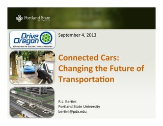
- 1. September 4, 2013 Connected Cars: Changing the Future of Transporta5on R.L. Ber3ni Portland State University ber3ni@pdx.edu
- 2. Governor’s Energy Plan 2012 § Maximize Energy Efficiency and Conserva3on § Enhance Clean Energy Infrastructure § Accelerate Market Transi3on to More Efficient, Cleaner Transporta3on System Targets ac3vi3es to accelerate the deployment of intelligent transporta3on systems and electric vehicles, including poten3al integra3on with grid moderniza3on ini3a3ves § Con3nued Investment in Compact, Mul3modal and Mixed-‐Use Communi3es § Accelerated Fleet Turnover (Residen3al and Commercial) to Alterna3ve Fuels § Implementa3on of Intelligent Transporta3on Systems § Innova3on in Financing a Clean Transporta3on System
- 4. Connected vehicles can help. They use wireless communication between vehicles and infrastructure to help prevent crashes, make travel easier, and curb pollution.
- 5. All vehicles, regardless of type, will communicate with each other using a wireless technology called Dedicated Short-Range Communications (DSRC). DSRC
- 6. Connected vehicles have the potential to address up to 81% of unimpaired crash scenarios.
- 7. Connected vehicles will provide drivers with warnings to help them avoid crashes.
- 8. Trucks, transit, and emergency vehicles are connected vehicles too.
- 9. The vehicle information communicated does not identify the driver or vehicle, and technical controls have been put in place to help prevent vehicle tracking and tampering with the system.
- 10. Imagine if the cars in front of you could send you information about dangerous road conditions ahead, such as icy roads, fog, heavy rain, and snow.
- 11. Imagine your car informing you of available parking on the next block, your cell phone telling you a cab is approaching, or your car helping you find a rideshare partner.
- 12. Consider the ways in which increased travel information can help the environment. Connected vehicles can help. http://www.youtube.com/watch?v=Zuf2VNWGMnY
- 13. Safety § 32,788 fatali3es in 2010 (-‐3% from 2009) § 1.09 fatali3es per 100 MVMT (VMT +0.7% in 2010) § 2.2 M injuries in 2009 § 5.5 M crashes in 2009 § $230 B total cost (including medical) § Leading cause of death for ages 4 to 34 Accessibility, Reliability and Mobility § 4.8B hours travel delay (34 hours/auto commuter) § $115 billion cost of urban conges3on Household Market Basket § Second biggest monthly expense, a`er housing Sustainability § 28% of GHG emissions (78% CO, 58% NOx, 36% VOCs) § 29% of energy consumed (mostly petroleum) § 70% of petroleum consump3on (60% imported) § 3.9 billion gallons of wasted fuel § Half of Americans live in areas that exceed air quality standards for at least one pollutant. U.S. Transport Sector Impacts
- 14. Evolu3on of U.S. ITS Program Congressional Legislation Dates and Mission Intermodal Surface Transportation Efficiency Act (ISTEA) 1991–1997 (extended to July 1998) § Research and Development § Operational Tests § Technical assistance including architecture and standards Transportation Equity Act for the 21st Century (TEA-21) 1998–2003 (extended to August 2005) § Policy and Institutional Challenges to Deployment § ITS Deployment Program (Congressionally designated) § Model Deployment Initiatives Safe, Accountable, Flexible, Efficient Transportation Equity Act: A Legacy for Users (SAFETEA-LU) 2005–2009 (extended to March 31, 2012) § Research § Mainstreaming ITS Moving Ahead for Progress in the 21st Century (MAP-21) 2012-2014
- 15. Intelligent Vehicle in 2013 § 2012 Ford Focus § $20,000 § EPA Ra3ng 28 mpg City/ 40 mpg Highway § Adap3ve cruise control § Forward Collision Mi3ga3on § Blind spot informa3on system § Traffic sign recogni3on § Lane keeping aid § Driver alert § Connected vehicles and infrastructure § IIHS es3mate that FCW, LDW, Side View Assist and Adap3ve Headlights could prevent/ mi3gate 33% of fatal and 20% of injury crashes § "This technology more than anything else holds great promise to protect lives and prevent injuries," NTSB Chairman Deborah Hersman
- 16. Vision for Connected Future Infrastructure Vehicles
- 17. Vision for Connected Future Infrastructure Rail Mari5me Drivers and Operators Wireless Devices Vehicles and Fleets
- 18. Solu3ons for 80% of Crashes Rear End Warning 28% Lane Departure 23% Intersection 25% Lane Change 9% Backover 2% Opposite Direction 2%
- 19. Connected Vehicles and Travelers “Here I Am” / Where’s My Bus/Carpool? la3tude, longitude, 3me, heading angle, speed, lateral accelera3on, longitudinal accelera3on, yaw rate, throlle posi3on, brake status, steering angle, headlight status, wiper status, external temperature, turn signal status, vehicle length, vehicle width, vehicle mass, bumper height
- 20. Safety Pilot
- 21. V2V Forward Collision Warning Emergency Electronic Brake Light Intersec3on Movement Assist Blind Spot Warning/Lane Change Warning Do Not Pass Warning Le` Turn Across Path/Opposite Direc3on Right Turn in Front V2I Signal Phase and Timing Curve Speed Warning Railroad Crossing Warning Pedestrian Detec3on 11 Safety Pilot Applica3ons
- 22. Device Installa3on Examples Antenna + Antenna + Driver display DAS sensors, OEM can bus DAS Antenna Inertial Mment Unit Data Acquisition System (DAS) Vehicle Awareness Device A`ermarket Safety Device A`ermarket Safety Device with Data Acquisi3on System (DAS) Data Acquisi3on from: § A`ermarket device § Radar or ranging device(s) § 4 cameras, microphone § OEM CAN bus data § Vehicle mo3on § Cell & GPS antennas
- 23. Basic Safety Message SAE J2735 Basic Safety Message Major Attributes Temporary ID Time Latitude Longitude Elevation Speed Heading Acceleration Brake System Status Vehicle Size
- 24. Poten5al End State Current State Poten5al Interim States T V I T V I T V I Data Environment Evolu3on TRAVELER VEHICLE INFRASTRUCTURE “some” “a few” “nearly zero” VEHICLE TRAVELER “nearly all” “some” “where needed” INFRASTRUCTURE
- 25. Data Environment Real-‐5me Data Capture and Management Mobility Applica5ons Transit Data Truck Data Reduce Speed 35 MPH Weather Application Transit Signal Priority Fleet Management/ Dynamic Route Guidance Mobility Program
- 26. High Priority Mobility Applica3ons ISIG ECO TSP ARTERIAL DATA ENVIRONMENTS PED SIG FSP PRE EMPT SPD HARM CACC Q WARN FREEWAY DATA ENVIRONMENTS RAMP INC ZONE RESP STG ATIS FDRG FATIS REGIONAL (INFO) DATA ENVIRONMENTS DR- OPT S PARK WX INFO [EV] DRG ICM WX - MDSS VMT CORRIDOR (CONTROL) DATA ENVIRONMENTS TCON NECT TDISP DRIDE EFP ETC EVAC TMAP PERF MEAS PERF MEAS PERF MEAS PERF MEAS PERF MEAS PERF MEAS PERF MEAS MAY DAY LEGEND DMA PROGRAM FUNDED DMA SUPPORTED(NOT FUNDED), OPENTO OTHER PROGRAMS ANDRESEARCHERS ENABLE ATIS R.E.S.C.U.M.E* *JOINTLY FUNDEDBY DMA AND PUBLICSAFETY PROGRAMS FRATIS
- 27. Dynamic Mobility Applica3ons § Enable Advanced Traveler Informa3on System (EnableATIS) § Freight Advanced Traveler Informa3on Systems (FRATIS) § Integrated Dynamic Transit Opera3ons (IDTO) § Intelligent Network Flow Op3miza3on (INFLO) § Mul3-‐Modal Intelligent Traffic Signal Systems (MMITSS) § Response, Emergency Staging and Communica3ons, Uniform Management, and Evacua3on (R.E.S.C.U.M.E.)
- 28. AERIS Program § Low Emission Zone § Eco-‐integrated Corridor Management § Eco-‐Signal Opera3ons § Eco-‐Lanes § Support Alterna3ve Fuel Vehicle Opera3ons § Eco-‐Traveler Informa3on
- 29. Test Bed Investments
- 30. Test Bed Investments OR
- 31. Policy Issues Governance Liability Sustainability Legisla3on
- 32. Policy Issues Privacy Risk Cer3fica3on Cyber/ Security Data Governance Implementa3on Liability Sustainability Deployment Approach Financing Legisla3on
- 33. Join us on September 16! More informa3on and to register: hlp://otrec.us/events/special/OTS The highlights of the 5th Annual Oregon Transporta3on Summit include: § OTREC Research Poster Exhibit (7-‐8am and during breaks) § Plenary session on MAP21 with Adie Tomer (Brookings Ins3tu3on) and Rep. Tobias Read § Keynote presenta3on by author Taras Grescoe (Straphanger) § Eight workshops on topics ranging from bike/ped safety to connected vehicles
- 34. Thank You for Your Alen3on