
Empfohlen
Empfohlen
Weitere ähnliche Inhalte
Andere mochten auch
Andere mochten auch (20)
Ähnlich wie Cn tu12 00_alt_desire_project_summary_verzandvoort
Ähnlich wie Cn tu12 00_alt_desire_project_summary_verzandvoort (11)
Mehr von Erik van den Elsen
Mehr von Erik van den Elsen (20)
Kürzlich hochgeladen
Kürzlich hochgeladen (20)
Cn tu12 00_alt_desire_project_summary_verzandvoort
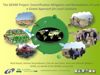
- 1. Rudi Hessel, Simone Verzandvoort, Erik van den Elsen, and Coen Ritsema (Alterra- WUR), on behalf of the DESIRE consortium The DESIRE Project: Desertification Mitigation and Remediation of Land a Global Approach for Local Solutions LANDCON1010, October 11-15, Xián, China
- 2. DESIRE Integrated Project • Co-funded by the European Commission (9 M€) in FP6 • 26 partners • Run-time 2007-2012 • Aim is to define strategies to combat desertification in collaboration with stakeholders LANDCON1010, October 11-15, Xián, China www.desire-project.eu
- 3. LANDCON1010, October 11-15, Xián, China 16 sites with different biophysical manifestations of desertification
- 4. CDE ©
- 5. Thank you for your attention! For more information, visit: www.desire-his.eu www.desire-project.eu Thanks to all colleagues having provided photos for this presentation
Hinweis der Redaktion
- The methodological framework of DESIRE consists of 4 parts. Part 1 is about the socio-economic, political and environmental context of the study sites. In this part of the work flow stakeholders are identified and their goals of sustainability, and drivers of desertificiation. Status and risk of land degradation and conservation are assessed using the WOCAT-LADA expert mapping method and an independent indicator assessment (base map of land use systems and mapping questionnaire). Red box: stakeholder analysis is used. Brown and orange box: land degradation and conservation mapping using the LADA-WOCAT-DESIRE methodology is used Orange box: statistical relationships between indicators of deseryification were used, to assess desertification risk and to analyse the effectiveness of SLM practices, to a total of 1641 observations Part 2 is about the identification of strategies to remedy desertification, to document these, and to prioritize strategies, in all steps in collaboration with stakeholders (internal and external). The L4S and WOCAT QT/QA are used here. In the prioritization phase, a multi-criteria decision support system is used. Yellow boxes: 3-part participatory framework using WOCAT, LfS , and multicriteria evaluation. In part 3 selected strategies are trialed and monitored in the field during a period 0f 2-3 years. Stakeholders are involved in the monitoring. Strategies are assessed at site level on criteria partly corresponding to those in the WOCAT QT questionnaire, using various methods (e.g. CBA). Blue box: field-based methods including scientific and stakeholder monitoring Dark blue box: PESERA and economic models (e.g. agent-based modelling, input-output modelling) Results of the local scale assessment are used as input to a coupled model framework consisting of the biophysical PESERA model and economic models (input-output, cost effectiveness, agent-based modelling). These models provide outputs at regional scales, and can be used to identify areas where different remediation strategies are most likely to be adopted by farmers and their likely biophysical impacts. The proposed grid cell size of 1 ha for the modeling work in WB5 corresponds to the field size and captures an individual farmer’s decision-making. Thus, the model essentially aggregates multiple local (adoption and biophysical) processes. Its added value consists of: i) evaluating the impacts of remediation strategies at the regional scale; and ii) evaluating the effects of policies. In part 4 of the work entails essentially the spin off of the first three parts, in that dissemination should help to get remediation strategies adopted and implemented. Dissemination will focus on target groups of land managers, national and international policy, and scientists (DESIRE being financed by DG Research). This part of part 4 is covered in DESIRE. Subsequent activities should include the monitoring of progress to goals. Based on the results of this work, remediation strategies are adjusted, or new remediation strategies may be identified and prioritised in response to changing contexts or because existing strategies are no longer needed or working. These activities should occur in follow up to the DESIRE project.