STDM Online for Land Administration
•Als ODP, PDF herunterladen•
4 gefällt mir•1,030 views

The document discusses the Global Land Tool Network's Social Tenure Domain Model (STDM) and its transition to an online platform. STDM is a land information tool that documents land tenure for formal and informal land rights. It is implemented using open-source software and aligned with the Land Administration Domain Model. Future development of STDM includes adding a file-based data store, online components, and security/privacy features to share data securely over the web. This will allow for online household surveys, mapping, reporting, and open data access to scale STDM's documentation of land rights.

Empfohlen
Empfohlen
Weitere ähnliche Inhalte
Was ist angesagt?
Was ist angesagt? (9)
Andere mochten auch
Andere mochten auch (20)
Ähnlich wie STDM Online for Land Administration
Ähnlich wie STDM Online for Land Administration (20)
Mehr von Arnulf Christl
Mehr von Arnulf Christl (20)
Kürzlich hochgeladen
Kürzlich hochgeladen (20)
STDM Online for Land Administration
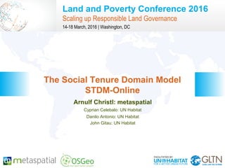
- 1. Land and Poverty Conference 2016 Scaling up Responsible Land Governance 14-18 March, 2016 | Washington, DC Arnulf Christl: metaspatial Cyprian Celebalo: UN Habitat Danilo Antonio: UN Habitat John Gitau: UN Habitat The Social Tenure Domain Model STDM-Online
- 2. GLTN BRIEFING AND PROGRAMME 2 / 17 CONTENT The Global Land Tool Network Introduction to STDM STDM-Online – Architecture – Software – Prototype and Demo Server Positive Impact of Open Source Future Development Conclusions
- 3. GLTN BRIEFING AND PROGRAMME 3 / 17 The Global Land Tool Network (GLTN) The Global Land Tool Network (GLTN) is an alliance global regional and national partners. • The main objective is to contribute to poverty alleviation through land reform, improved land management and security of tenure. • UN-Habitat through GLTN works with partners including civil society organizations, finance institutions, research and training institutions, donors and professional bodies. Most developing countries use conventional land administration systems which cover less than 30 per cent of the country, leaving up to 70 per cent of citizens looking to informal and/ or customary approaches for their tenure security.
- 4. GLTN BRIEFING AND PROGRAMME 4 / 17 STDM – The Social Tenure Domain Model The Social Tenure Domain Model (STDM) is a pro poor land information tool following GLTN's core values and principles: Pro poor; Equitable; Sustainable; Affordable; Systematically large scale /scalable; and, Gender-sensitive While taking into consideration: Good governance; Subsidiarity; and, The Continuum of Land Rights.
- 5. GLTN BRIEFING AND PROGRAMME 5 / 17 STDM – The Social Tenure Domain Model The land information tool STDM focuses on three facets: 1.STDM as a Concept 2.STDM as a Model 3.STDM as an Information Tool
- 6. GLTN BRIEFING AND PROGRAMME 6 / 17 The STDM Concept The concept of the Social Tenure Domain Model is to bridge this gap by providing a standard for representing ‘people – land’ relationships independent of the level of formality, legality and technical accuracy. Bridging the Gap: A Complimentary approach to customary and informal tenure.
- 7. GLTN BRIEFING AND PROGRAMME 7 / 17 The STDM Model STDM is a ‘specialization’ of the ISO-approved Land Administration Domain Model (LADM). LADM development took place in parallel of the STDM concept and model development. Bridging the Gap: Any form of right, responsibility or restriction in a formal system is considered as a social tenure relationship in STDM.
- 8. GLTN BRIEFING AND PROGRAMME 8 / 17 The Information Tool STDM has been implemented based on proven Open Source software maintained by a broad community, business investment and the non-profit foundational and legal body of OSGeo. Postgres PostGIS QGIS Geraldo Reports ...and many more
- 9. GLTN BRIEFING AND PROGRAMME 9 / 17 STDM Desktop STDM has been implemented based on proven Open Source software maintained by a broad community, business invest- ment and the non- profit foundational and legal body of OSGeo.
- 10. GLTN BRIEFING AND PROGRAMME 10 / 17 Future Development Future development of STDM is to add a file based option for the data store (GeoPackage) and an Online service component. The work to get there entails three main aspects: Adjust data store and data model Add security and privacy layers Add online components
- 11. GLTN BRIEFING AND PROGRAMME 11 / 17 Data and Data Model The data model has to be sturdy and simple and easy to import and export: Keep aligned with LADM Support OpenStreetMap Open Data Licenses Going Online...
- 12. GLTN BRIEFING AND PROGRAMME 12 / 17 Security and Privacy Exposing the data on the Web requires a highly secure environment, transparent policies and good governance. Secure Architecture Open Governance Transparent Terms of Service Going Online...
- 13. GLTN BRIEFING AND PROGRAMME 13 / 17 Online Architecture The code system is not changed. Con- nectivity is adapted to suit the require- ments of an Online system. Web ser- vice software and security compo- nents are added as needed.
- 14. GLTN BRIEFING AND PROGRAMME 14 / 17 Software and Standards The system is based on Open Source Software components including (besides others): Postgres / PostGIS QGIS + MapServer + OpenLayers + Apache, etc. Open Standards help to keep the infrastructure open, including (besides others) OGC SFS (Data format) ISO LADM (Data Content) OGC WMS (map content OGC GeoPackage (transport) Open, Secure and Sustainable
- 15. GLTN BRIEFING AND PROGRAMME 15 / 17 Online interfaces Use state of the art technology, minimize web traffic, support older hardware and any platform. Record Household Information Mapping components Report Generation Anonymized Open Data Server Going Online... (Prototype launch in 2016)
- 16. GLTN BRIEFING AND PROGRAMME 16 / 17 Conclusions The Open Source development model has proven to be the right choice for STDM. Standards help to build a sustainable and open system which is: Easy to Use with Powerful Functionality Extendable and Customizable Interoperable and Standardized Transparent and Secure Community Adoption is in Progress
- 17. GLTN BRIEFING AND PROGRAMME 17 / 17 The global OSGeo conference on Open Source Geospatial Software http://2016.foss4g.org
- 18. NEED TO KNOW MORE? Arnulf Christl arnulf.christl@metaspatial.net | @sevenspatial http://www.stdm.gltn.net/ http://metaspatial.net/ http://osgeo.org/