SlideShare ist ein Scribd-Unternehmen logo
1 von 20
Downloaden Sie, um offline zu lesen
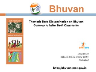
Bhuvan
  Multi Resolution
                        Thematic Data Dissemination on Bhuvan
                           Gateway to Indian Earth Observation


Societal Applications


Thematic Vectors
                                                                 Bhuvan Cell
                                              National Remote Sensing Centre
                                                                  Hyderabad


                                        http://bhuvan.nrsc.gov.in
Gateway to Indian EO Data Products & Services

                                                                    Project Specific
                                                                    “Multi theme and Multi User
                                                                              Utilities”
     Visualisation   Data Archive    Thematic Services       Geo-Processing


                                    • EO Data/ Products Exceeds 14 Terrabytes

                                    • 19000 Unique users / month

                                    • ~ 70000 EO image downloads since Sep 2011


                                                  Website of the Month – Dec’2010
NRSC Open EO Data                                    Thematic Services
                                                     “OGC Web Services (WMS, WMTS)
      Archive                                              towards interoperability”


     Released on 29 Sep 2011                        Released on 17 Dec 2011

   Cartosat-1:DEM: 1 arc Sec                     LULC – 1:50000 (2004-05)

   Oceansat-2:OCM: NDVI, VF (2011):1Km           LULC – 1:250000 (7 cycles – 2004-05 to
                                                   2010-11)
   RS-1:AWiFS Ortho
    (2008,2009,2010):56m                          Wasteland – 1: 50000 (2008-09)

   RS-1:LISS III Ortho (2008-09, 2011):24m       Urban Landuse – 1:10000 (2006-07)
                                                  Flood Hazard Layer (Assam : 1998-
                                                   2007)
                                                  Flood Annual Layer (Assam & Bihar :
                                                   1998-2010)
                   Data Downloads
 CartoDEM           20912                     Bhuvan Clip & Ship on 11 Apr 2012
 AWiFS Ortho        7339                         105 MOU signed and Data delivered
 LISS III Ortho     47222                         (world institute of sustainable energy, NIO,
 NDFI, VF           579                           Bangalore Univ, Pune Univ, National
                                                   Research centre for Agrofor etc )
    Total – 76052      (till 08 Oct’12)            475 enquiries received
Thematic Datasets

   Land use
    The way in which, and the
    purposes for which, human
    beings employ the land
    and its resources


   Land cover
    The physical state of the
    land surface
Thematic Datasets

 Urban Land Use                            Wasteland


Mapping of Thematic assets on a scale of   Mapping the wasteland extent of the
1:10,000 for the city and environs         country
Thematic Datasets

Flood Hazard                             Flood Annual Layers


Flood Hazard Zonation maps derived       Mapping and monitoring flood
from 10 yrs of flood inundation layers
Thematic Data Dissemination
   Using OGC Web services

     Web   Map Service
     Provides a simple HTTP interface for requesting geo-registered map
     images


     Web   Map Tile Service
     Extension of WMS where rendering is in the form of tiles
     Fetch the tiles asynchronously and completes the request to fill a single
     view
Software tools

    PostgreSQL                        PHP (Hypertext
    PostGIS                            Preprocessor)
    GeoServer                         JavaScript
    GeoWebCache                       Apache Webserver


Dissemination as OGC Web Services
                                    …Enabling Interoperability
System Implementation
PHP + JavaScript (Open    Apache Server (web server)
Layers API ) viewer


                                         WMS      WMTS


                                           Geo-WebCache
                         PostgreSQL
                          + PostGIS
                                              Geo Server
Results
The web-interface for this Thematic Datasets
Dissemination is available at –

http://bhuvan.nrsc.gov.in
http://bhuvan-noeda.nrsc.gov.in/theme
Accessing Thematic datasets as Web Services
Using these GetCapability URLs, users can access thematic layers and plot on any
compatible clients/Web browsers (QGIS,Gaia,OpenLayers, ArcGIS etc)

Tutorials are available at http://bhuvan-forum.nrsc.gov.in/guest/viewtopic.php?f=3&t=33
Get Data
Allows the users to place request for digital database

GDAL library is used to facilitate the user to do the clip and ship through FTP configured
using Apache FTP
Statistics tool under Bhuvan Thematic services
Statistics tab helps the user to view the statistics of the selected geography for the
specific theme in both tabular and graphic form

Open source PHP charting library is used to create Pie-charts
Analysis tool under Bhuvan Thematic services
Users can define their Area of Interest (AOI), and analyze to get the output (statistics)

PostGIS functions ‘ST_IsValid’ is used for checking the validity of AOI and ‘ST_Intersects’
is used to process the AOI
Query shell example in Bhuvan Thematic services
Create a simple query using AND, OR, NOT operators and get the spatial output

Request is processed at PostgreSQL/PostGIS and the resulting layer is dynamically
published using REST API of Geoserver
Metadata
Data about data

Based on National Spatial Data Infrastructure (NSDI)-2.0 metadata standard
Overlay of other Thematic Layers
The overlay layers include – Administrative Boundaries, Transportation layers, Water
bodies, Rediff navigation map and other themes.
Opacity vary from 0.1 to 0.9 to understand the temporal changes
Add own WMS layer using ‘Add Button’
Conclusion
   Thematic data dissemination through Bhuvan helps the users to visualize and
    consume the thematic datasets as WMS and WMTS services which
    leverages the data access across the web for further value addition.


   It facilitates the researchers, planners, administrators etc to use these vital
    information towards societal good


    Currently at an average there are around 150 unique visitors/day to
    Bhuvan-Thematic Services portal
Future Prospects

   Extension to complex query based on multiple thematic layers


   Query on the area of interest created through buffer on line, point or polygon


   Querying facility for the Bhuvan mobile version having dashboard


   Integration of more Thematic Datasets like Geomorphology, Land Degradation
Thank you…
 Questions?


  For feedback and queries write to us at
      bhuvan@nrsc.gov.in

Weitere ähnliche Inhalte

Was ist angesagt?

Introduction To and Arcaeological Apps of GIS
Introduction To and Arcaeological Apps of GIS Introduction To and Arcaeological Apps of GIS
Introduction To and Arcaeological Apps of GIS Jo Dyson
 
Archaeological Applications of Geographic Information Systems (GIS)
Archaeological Applications of Geographic Information Systems (GIS)Archaeological Applications of Geographic Information Systems (GIS)
Archaeological Applications of Geographic Information Systems (GIS)Joshua Campbell
 
Ar2419141919
Ar2419141919Ar2419141919
Ar2419141919IJMER
 
2016 GMekong Forum - Session 6 - Intro to SERVIR Mekong and dam inundation pr...
2016 GMekong Forum - Session 6 - Intro to SERVIR Mekong and dam inundation pr...2016 GMekong Forum - Session 6 - Intro to SERVIR Mekong and dam inundation pr...
2016 GMekong Forum - Session 6 - Intro to SERVIR Mekong and dam inundation pr...Water, Land and Ecosystems (WLE)
 
Archaeological Applications Of Gis
Archaeological Applications Of GisArchaeological Applications Of Gis
Archaeological Applications Of GisJo Dyson
 
Hengl & Reuter poster at Geomorphometry.org/2011
Hengl & Reuter poster at Geomorphometry.org/2011Hengl & Reuter poster at Geomorphometry.org/2011
Hengl & Reuter poster at Geomorphometry.org/2011Tomislav Hengl
 
GIS Based Semi Automated Extraction of Sites for Artificial Recharge
GIS Based Semi Automated Extraction of Sites for Artificial RechargeGIS Based Semi Automated Extraction of Sites for Artificial Recharge
GIS Based Semi Automated Extraction of Sites for Artificial Rechargeresearchinventy
 
A case study on GIS application
A case study on GIS applicationA case study on GIS application
A case study on GIS applicationAxay Sharma
 
Geographic information system and remote sensing
Geographic information system and remote sensingGeographic information system and remote sensing
Geographic information system and remote sensingDhiren Patel
 
Investigation of the Lake Victoria Region (Africa: Tanzania, Kenya and Uganda)
Investigation of the Lake Victoria Region (Africa: Tanzania, Kenya and Uganda)Investigation of the Lake Victoria Region (Africa: Tanzania, Kenya and Uganda)
Investigation of the Lake Victoria Region (Africa: Tanzania, Kenya and Uganda)Universität Salzburg
 
Geographic information system
Geographic information systemGeographic information system
Geographic information systemSumanta Das
 
Queensland’s Open Spatial Data Revolution - Steve Jacoby - IMIA Asia Pacific ...
Queensland’s Open Spatial Data Revolution - Steve Jacoby - IMIA Asia Pacific ...Queensland’s Open Spatial Data Revolution - Steve Jacoby - IMIA Asia Pacific ...
Queensland’s Open Spatial Data Revolution - Steve Jacoby - IMIA Asia Pacific ...International Map Industry Association
 
Integration of GIS Based Survey procedure to update Road Network Geo-Database...
Integration of GIS Based Survey procedure to update Road Network Geo-Database...Integration of GIS Based Survey procedure to update Road Network Geo-Database...
Integration of GIS Based Survey procedure to update Road Network Geo-Database...Soumik Chakraborty
 
GIS for Infrastructure Management
GIS for Infrastructure ManagementGIS for Infrastructure Management
GIS for Infrastructure ManagementDavid Puckett
 

Was ist angesagt? (20)

Introduction To and Arcaeological Apps of GIS
Introduction To and Arcaeological Apps of GIS Introduction To and Arcaeological Apps of GIS
Introduction To and Arcaeological Apps of GIS
 
Archaeological Applications of Geographic Information Systems (GIS)
Archaeological Applications of Geographic Information Systems (GIS)Archaeological Applications of Geographic Information Systems (GIS)
Archaeological Applications of Geographic Information Systems (GIS)
 
Ar2419141919
Ar2419141919Ar2419141919
Ar2419141919
 
2016 GMekong Forum - Session 6 - Intro to SERVIR Mekong and dam inundation pr...
2016 GMekong Forum - Session 6 - Intro to SERVIR Mekong and dam inundation pr...2016 GMekong Forum - Session 6 - Intro to SERVIR Mekong and dam inundation pr...
2016 GMekong Forum - Session 6 - Intro to SERVIR Mekong and dam inundation pr...
 
Geology Digimap
Geology DigimapGeology Digimap
Geology Digimap
 
Archaeological Applications Of Gis
Archaeological Applications Of GisArchaeological Applications Of Gis
Archaeological Applications Of Gis
 
Icelandic Bathy model
Icelandic Bathy modelIcelandic Bathy model
Icelandic Bathy model
 
What Is GIS?
What Is GIS?What Is GIS?
What Is GIS?
 
Hengl & Reuter poster at Geomorphometry.org/2011
Hengl & Reuter poster at Geomorphometry.org/2011Hengl & Reuter poster at Geomorphometry.org/2011
Hengl & Reuter poster at Geomorphometry.org/2011
 
GIS Based Semi Automated Extraction of Sites for Artificial Recharge
GIS Based Semi Automated Extraction of Sites for Artificial RechargeGIS Based Semi Automated Extraction of Sites for Artificial Recharge
GIS Based Semi Automated Extraction of Sites for Artificial Recharge
 
Ijetcas14 474
Ijetcas14 474Ijetcas14 474
Ijetcas14 474
 
Gis Application
Gis ApplicationGis Application
Gis Application
 
A case study on GIS application
A case study on GIS applicationA case study on GIS application
A case study on GIS application
 
Geographic information system and remote sensing
Geographic information system and remote sensingGeographic information system and remote sensing
Geographic information system and remote sensing
 
Investigation of the Lake Victoria Region (Africa: Tanzania, Kenya and Uganda)
Investigation of the Lake Victoria Region (Africa: Tanzania, Kenya and Uganda)Investigation of the Lake Victoria Region (Africa: Tanzania, Kenya and Uganda)
Investigation of the Lake Victoria Region (Africa: Tanzania, Kenya and Uganda)
 
Geographic information system
Geographic information systemGeographic information system
Geographic information system
 
Queensland’s Open Spatial Data Revolution - Steve Jacoby - IMIA Asia Pacific ...
Queensland’s Open Spatial Data Revolution - Steve Jacoby - IMIA Asia Pacific ...Queensland’s Open Spatial Data Revolution - Steve Jacoby - IMIA Asia Pacific ...
Queensland’s Open Spatial Data Revolution - Steve Jacoby - IMIA Asia Pacific ...
 
Integration of GIS Based Survey procedure to update Road Network Geo-Database...
Integration of GIS Based Survey procedure to update Road Network Geo-Database...Integration of GIS Based Survey procedure to update Road Network Geo-Database...
Integration of GIS Based Survey procedure to update Road Network Geo-Database...
 
IG-14-018
IG-14-018IG-14-018
IG-14-018
 
GIS for Infrastructure Management
GIS for Infrastructure ManagementGIS for Infrastructure Management
GIS for Infrastructure Management
 

Ähnlich wie Thematic Data Dissemination on bhuvan

Syntactic and semantic based approaches for Geoinformation Management - Dr. S...
Syntactic and semantic based approaches for Geoinformation Management - Dr. S...Syntactic and semantic based approaches for Geoinformation Management - Dr. S...
Syntactic and semantic based approaches for Geoinformation Management - Dr. S...NeGD Capacity Building
 
Exchange Network 2009 GeoCOI Slides Finalv2
Exchange Network 2009 GeoCOI Slides Finalv2Exchange Network 2009 GeoCOI Slides Finalv2
Exchange Network 2009 GeoCOI Slides Finalv2Carbon Project
 
Geospatial data & Web Portals for IWRM:-NRSC Perspective By Dr. J.R. Sharma
Geospatial data &  Web Portals for IWRM:-NRSC Perspective  By Dr. J.R. SharmaGeospatial data &  Web Portals for IWRM:-NRSC Perspective  By Dr. J.R. Sharma
Geospatial data & Web Portals for IWRM:-NRSC Perspective By Dr. J.R. Sharmaindiawrm
 
Open Science and GEOSS: the Cloud Sandbox enablers
Open Science and GEOSS: the Cloud Sandbox enablersOpen Science and GEOSS: the Cloud Sandbox enablers
Open Science and GEOSS: the Cloud Sandbox enablersterradue
 
Presentation
PresentationPresentation
Presentationbolu804
 
Paciello et al. - 2016 (1)
Paciello et al. - 2016 (1)Paciello et al. - 2016 (1)
Paciello et al. - 2016 (1)Giancanio Sileo
 
Distributed mixed reality for diving and
Distributed mixed reality for diving andDistributed mixed reality for diving and
Distributed mixed reality for diving andijcsa
 
MawereC- Ubuntunet paper publication 2015
MawereC- Ubuntunet paper publication 2015MawereC- Ubuntunet paper publication 2015
MawereC- Ubuntunet paper publication 2015CEPHAS MAWERE
 
20100512 Workflow Ramage
20100512 Workflow Ramage20100512 Workflow Ramage
20100512 Workflow RamageSteven Ramage
 
Dublinked tech workshop_15_dec2011
Dublinked tech workshop_15_dec2011Dublinked tech workshop_15_dec2011
Dublinked tech workshop_15_dec2011Dublinked .
 
110105 htap pilot_aqco_p_esip_dc
110105 htap pilot_aqco_p_esip_dc110105 htap pilot_aqco_p_esip_dc
110105 htap pilot_aqco_p_esip_dcRudolf Husar
 
Alberts ppt gi2011_imcs_habitats_pilot_dd_andas_final
Alberts ppt gi2011_imcs_habitats_pilot_dd_andas_finalAlberts ppt gi2011_imcs_habitats_pilot_dd_andas_final
Alberts ppt gi2011_imcs_habitats_pilot_dd_andas_finalIGN Vorstand
 
Egu2013 final
Egu2013 finalEgu2013 final
Egu2013 finalsirf13
 
Field Data Collecting, Processing and Sharing: Using web Service Technologies
Field Data Collecting, Processing and Sharing: Using web Service TechnologiesField Data Collecting, Processing and Sharing: Using web Service Technologies
Field Data Collecting, Processing and Sharing: Using web Service TechnologiesNiroshan Sanjaya
 

Ähnlich wie Thematic Data Dissemination on bhuvan (20)

Syntactic and semantic based approaches for Geoinformation Management - Dr. S...
Syntactic and semantic based approaches for Geoinformation Management - Dr. S...Syntactic and semantic based approaches for Geoinformation Management - Dr. S...
Syntactic and semantic based approaches for Geoinformation Management - Dr. S...
 
Exchange Network 2009 GeoCOI Slides Finalv2
Exchange Network 2009 GeoCOI Slides Finalv2Exchange Network 2009 GeoCOI Slides Finalv2
Exchange Network 2009 GeoCOI Slides Finalv2
 
Earth Science Data and Information System (ESDIS) Project Update
Earth Science Data and Information System (ESDIS) Project UpdateEarth Science Data and Information System (ESDIS) Project Update
Earth Science Data and Information System (ESDIS) Project Update
 
Geospatial data & Web Portals for IWRM:-NRSC Perspective By Dr. J.R. Sharma
Geospatial data &  Web Portals for IWRM:-NRSC Perspective  By Dr. J.R. SharmaGeospatial data &  Web Portals for IWRM:-NRSC Perspective  By Dr. J.R. Sharma
Geospatial data & Web Portals for IWRM:-NRSC Perspective By Dr. J.R. Sharma
 
Open Science and GEOSS: the Cloud Sandbox enablers
Open Science and GEOSS: the Cloud Sandbox enablersOpen Science and GEOSS: the Cloud Sandbox enablers
Open Science and GEOSS: the Cloud Sandbox enablers
 
EOSC-hub & Geohazards TEP
EOSC-hub & Geohazards TEPEOSC-hub & Geohazards TEP
EOSC-hub & Geohazards TEP
 
Presentation
PresentationPresentation
Presentation
 
Paciello et al. - 2016 (1)
Paciello et al. - 2016 (1)Paciello et al. - 2016 (1)
Paciello et al. - 2016 (1)
 
geo.admin.ch eurogi award presentation
geo.admin.ch eurogi award presentationgeo.admin.ch eurogi award presentation
geo.admin.ch eurogi award presentation
 
Ijetr042136
Ijetr042136Ijetr042136
Ijetr042136
 
Semantic Sensor Web
Semantic Sensor WebSemantic Sensor Web
Semantic Sensor Web
 
Distributed mixed reality for diving and
Distributed mixed reality for diving andDistributed mixed reality for diving and
Distributed mixed reality for diving and
 
MawereC- Ubuntunet paper publication 2015
MawereC- Ubuntunet paper publication 2015MawereC- Ubuntunet paper publication 2015
MawereC- Ubuntunet paper publication 2015
 
20100512 Workflow Ramage
20100512 Workflow Ramage20100512 Workflow Ramage
20100512 Workflow Ramage
 
Dublinked tech workshop_15_dec2011
Dublinked tech workshop_15_dec2011Dublinked tech workshop_15_dec2011
Dublinked tech workshop_15_dec2011
 
110105 htap pilot_aqco_p_esip_dc
110105 htap pilot_aqco_p_esip_dc110105 htap pilot_aqco_p_esip_dc
110105 htap pilot_aqco_p_esip_dc
 
Alberts ppt gi2011_imcs_habitats_pilot_dd_andas_final
Alberts ppt gi2011_imcs_habitats_pilot_dd_andas_finalAlberts ppt gi2011_imcs_habitats_pilot_dd_andas_final
Alberts ppt gi2011_imcs_habitats_pilot_dd_andas_final
 
HoLIS GIS Update
HoLIS GIS UpdateHoLIS GIS Update
HoLIS GIS Update
 
Egu2013 final
Egu2013 finalEgu2013 final
Egu2013 final
 
Field Data Collecting, Processing and Sharing: Using web Service Technologies
Field Data Collecting, Processing and Sharing: Using web Service TechnologiesField Data Collecting, Processing and Sharing: Using web Service Technologies
Field Data Collecting, Processing and Sharing: Using web Service Technologies
 

Kürzlich hochgeladen

Concurrency Control in Database Management system
Concurrency Control in Database Management systemConcurrency Control in Database Management system
Concurrency Control in Database Management systemChristalin Nelson
 
Barangay Council for the Protection of Children (BCPC) Orientation.pptx
Barangay Council for the Protection of Children (BCPC) Orientation.pptxBarangay Council for the Protection of Children (BCPC) Orientation.pptx
Barangay Council for the Protection of Children (BCPC) Orientation.pptxCarlos105
 
Keynote by Prof. Wurzer at Nordex about IP-design
Keynote by Prof. Wurzer at Nordex about IP-designKeynote by Prof. Wurzer at Nordex about IP-design
Keynote by Prof. Wurzer at Nordex about IP-designMIPLM
 
Visit to a blind student's school🧑‍🦯🧑‍🦯(community medicine)
Visit to a blind student's school🧑‍🦯🧑‍🦯(community medicine)Visit to a blind student's school🧑‍🦯🧑‍🦯(community medicine)
Visit to a blind student's school🧑‍🦯🧑‍🦯(community medicine)lakshayb543
 
FILIPINO PSYCHology sikolohiyang pilipino
FILIPINO PSYCHology sikolohiyang pilipinoFILIPINO PSYCHology sikolohiyang pilipino
FILIPINO PSYCHology sikolohiyang pilipinojohnmickonozaleda
 
Global Lehigh Strategic Initiatives (without descriptions)
Global Lehigh Strategic Initiatives (without descriptions)Global Lehigh Strategic Initiatives (without descriptions)
Global Lehigh Strategic Initiatives (without descriptions)cama23
 
AUDIENCE THEORY -CULTIVATION THEORY - GERBNER.pptx
AUDIENCE THEORY -CULTIVATION THEORY -  GERBNER.pptxAUDIENCE THEORY -CULTIVATION THEORY -  GERBNER.pptx
AUDIENCE THEORY -CULTIVATION THEORY - GERBNER.pptxiammrhaywood
 
ENGLISH 7_Q4_LESSON 2_ Employing a Variety of Strategies for Effective Interp...
ENGLISH 7_Q4_LESSON 2_ Employing a Variety of Strategies for Effective Interp...ENGLISH 7_Q4_LESSON 2_ Employing a Variety of Strategies for Effective Interp...
ENGLISH 7_Q4_LESSON 2_ Employing a Variety of Strategies for Effective Interp...JhezDiaz1
 
AMERICAN LANGUAGE HUB_Level2_Student'sBook_Answerkey.pdf
AMERICAN LANGUAGE HUB_Level2_Student'sBook_Answerkey.pdfAMERICAN LANGUAGE HUB_Level2_Student'sBook_Answerkey.pdf
AMERICAN LANGUAGE HUB_Level2_Student'sBook_Answerkey.pdfphamnguyenenglishnb
 
4.16.24 21st Century Movements for Black Lives.pptx
4.16.24 21st Century Movements for Black Lives.pptx4.16.24 21st Century Movements for Black Lives.pptx
4.16.24 21st Century Movements for Black Lives.pptxmary850239
 
Grade 9 Quarter 4 Dll Grade 9 Quarter 4 DLL.pdf
Grade 9 Quarter 4 Dll Grade 9 Quarter 4 DLL.pdfGrade 9 Quarter 4 Dll Grade 9 Quarter 4 DLL.pdf
Grade 9 Quarter 4 Dll Grade 9 Quarter 4 DLL.pdfJemuel Francisco
 
ANG SEKTOR NG agrikultura.pptx QUARTER 4
ANG SEKTOR NG agrikultura.pptx QUARTER 4ANG SEKTOR NG agrikultura.pptx QUARTER 4
ANG SEKTOR NG agrikultura.pptx QUARTER 4MiaBumagat1
 
THEORIES OF ORGANIZATION-PUBLIC ADMINISTRATION
THEORIES OF ORGANIZATION-PUBLIC ADMINISTRATIONTHEORIES OF ORGANIZATION-PUBLIC ADMINISTRATION
THEORIES OF ORGANIZATION-PUBLIC ADMINISTRATIONHumphrey A Beña
 
INTRODUCTION TO CATHOLIC CHRISTOLOGY.pptx
INTRODUCTION TO CATHOLIC CHRISTOLOGY.pptxINTRODUCTION TO CATHOLIC CHRISTOLOGY.pptx
INTRODUCTION TO CATHOLIC CHRISTOLOGY.pptxHumphrey A Beña
 
Culture Uniformity or Diversity IN SOCIOLOGY.pptx
Culture Uniformity or Diversity IN SOCIOLOGY.pptxCulture Uniformity or Diversity IN SOCIOLOGY.pptx
Culture Uniformity or Diversity IN SOCIOLOGY.pptxPoojaSen20
 
Karra SKD Conference Presentation Revised.pptx
Karra SKD Conference Presentation Revised.pptxKarra SKD Conference Presentation Revised.pptx
Karra SKD Conference Presentation Revised.pptxAshokKarra1
 

Kürzlich hochgeladen (20)

Model Call Girl in Tilak Nagar Delhi reach out to us at 🔝9953056974🔝
Model Call Girl in Tilak Nagar Delhi reach out to us at 🔝9953056974🔝Model Call Girl in Tilak Nagar Delhi reach out to us at 🔝9953056974🔝
Model Call Girl in Tilak Nagar Delhi reach out to us at 🔝9953056974🔝
 
Concurrency Control in Database Management system
Concurrency Control in Database Management systemConcurrency Control in Database Management system
Concurrency Control in Database Management system
 
Barangay Council for the Protection of Children (BCPC) Orientation.pptx
Barangay Council for the Protection of Children (BCPC) Orientation.pptxBarangay Council for the Protection of Children (BCPC) Orientation.pptx
Barangay Council for the Protection of Children (BCPC) Orientation.pptx
 
Keynote by Prof. Wurzer at Nordex about IP-design
Keynote by Prof. Wurzer at Nordex about IP-designKeynote by Prof. Wurzer at Nordex about IP-design
Keynote by Prof. Wurzer at Nordex about IP-design
 
FINALS_OF_LEFT_ON_C'N_EL_DORADO_2024.pptx
FINALS_OF_LEFT_ON_C'N_EL_DORADO_2024.pptxFINALS_OF_LEFT_ON_C'N_EL_DORADO_2024.pptx
FINALS_OF_LEFT_ON_C'N_EL_DORADO_2024.pptx
 
Visit to a blind student's school🧑‍🦯🧑‍🦯(community medicine)
Visit to a blind student's school🧑‍🦯🧑‍🦯(community medicine)Visit to a blind student's school🧑‍🦯🧑‍🦯(community medicine)
Visit to a blind student's school🧑‍🦯🧑‍🦯(community medicine)
 
YOUVE_GOT_EMAIL_PRELIMS_EL_DORADO_2024.pptx
YOUVE_GOT_EMAIL_PRELIMS_EL_DORADO_2024.pptxYOUVE_GOT_EMAIL_PRELIMS_EL_DORADO_2024.pptx
YOUVE_GOT_EMAIL_PRELIMS_EL_DORADO_2024.pptx
 
Raw materials used in Herbal Cosmetics.pptx
Raw materials used in Herbal Cosmetics.pptxRaw materials used in Herbal Cosmetics.pptx
Raw materials used in Herbal Cosmetics.pptx
 
FILIPINO PSYCHology sikolohiyang pilipino
FILIPINO PSYCHology sikolohiyang pilipinoFILIPINO PSYCHology sikolohiyang pilipino
FILIPINO PSYCHology sikolohiyang pilipino
 
Global Lehigh Strategic Initiatives (without descriptions)
Global Lehigh Strategic Initiatives (without descriptions)Global Lehigh Strategic Initiatives (without descriptions)
Global Lehigh Strategic Initiatives (without descriptions)
 
AUDIENCE THEORY -CULTIVATION THEORY - GERBNER.pptx
AUDIENCE THEORY -CULTIVATION THEORY -  GERBNER.pptxAUDIENCE THEORY -CULTIVATION THEORY -  GERBNER.pptx
AUDIENCE THEORY -CULTIVATION THEORY - GERBNER.pptx
 
ENGLISH 7_Q4_LESSON 2_ Employing a Variety of Strategies for Effective Interp...
ENGLISH 7_Q4_LESSON 2_ Employing a Variety of Strategies for Effective Interp...ENGLISH 7_Q4_LESSON 2_ Employing a Variety of Strategies for Effective Interp...
ENGLISH 7_Q4_LESSON 2_ Employing a Variety of Strategies for Effective Interp...
 
AMERICAN LANGUAGE HUB_Level2_Student'sBook_Answerkey.pdf
AMERICAN LANGUAGE HUB_Level2_Student'sBook_Answerkey.pdfAMERICAN LANGUAGE HUB_Level2_Student'sBook_Answerkey.pdf
AMERICAN LANGUAGE HUB_Level2_Student'sBook_Answerkey.pdf
 
4.16.24 21st Century Movements for Black Lives.pptx
4.16.24 21st Century Movements for Black Lives.pptx4.16.24 21st Century Movements for Black Lives.pptx
4.16.24 21st Century Movements for Black Lives.pptx
 
Grade 9 Quarter 4 Dll Grade 9 Quarter 4 DLL.pdf
Grade 9 Quarter 4 Dll Grade 9 Quarter 4 DLL.pdfGrade 9 Quarter 4 Dll Grade 9 Quarter 4 DLL.pdf
Grade 9 Quarter 4 Dll Grade 9 Quarter 4 DLL.pdf
 
ANG SEKTOR NG agrikultura.pptx QUARTER 4
ANG SEKTOR NG agrikultura.pptx QUARTER 4ANG SEKTOR NG agrikultura.pptx QUARTER 4
ANG SEKTOR NG agrikultura.pptx QUARTER 4
 
THEORIES OF ORGANIZATION-PUBLIC ADMINISTRATION
THEORIES OF ORGANIZATION-PUBLIC ADMINISTRATIONTHEORIES OF ORGANIZATION-PUBLIC ADMINISTRATION
THEORIES OF ORGANIZATION-PUBLIC ADMINISTRATION
 
INTRODUCTION TO CATHOLIC CHRISTOLOGY.pptx
INTRODUCTION TO CATHOLIC CHRISTOLOGY.pptxINTRODUCTION TO CATHOLIC CHRISTOLOGY.pptx
INTRODUCTION TO CATHOLIC CHRISTOLOGY.pptx
 
Culture Uniformity or Diversity IN SOCIOLOGY.pptx
Culture Uniformity or Diversity IN SOCIOLOGY.pptxCulture Uniformity or Diversity IN SOCIOLOGY.pptx
Culture Uniformity or Diversity IN SOCIOLOGY.pptx
 
Karra SKD Conference Presentation Revised.pptx
Karra SKD Conference Presentation Revised.pptxKarra SKD Conference Presentation Revised.pptx
Karra SKD Conference Presentation Revised.pptx
 

Thematic Data Dissemination on bhuvan

  • 1. Bhuvan Multi Resolution Thematic Data Dissemination on Bhuvan Gateway to Indian Earth Observation Societal Applications Thematic Vectors Bhuvan Cell National Remote Sensing Centre Hyderabad http://bhuvan.nrsc.gov.in
  • 2. Gateway to Indian EO Data Products & Services Project Specific “Multi theme and Multi User Utilities” Visualisation Data Archive Thematic Services Geo-Processing • EO Data/ Products Exceeds 14 Terrabytes • 19000 Unique users / month • ~ 70000 EO image downloads since Sep 2011 Website of the Month – Dec’2010
  • 3. NRSC Open EO Data Thematic Services “OGC Web Services (WMS, WMTS) Archive towards interoperability” Released on 29 Sep 2011 Released on 17 Dec 2011  Cartosat-1:DEM: 1 arc Sec  LULC – 1:50000 (2004-05)  Oceansat-2:OCM: NDVI, VF (2011):1Km  LULC – 1:250000 (7 cycles – 2004-05 to 2010-11)  RS-1:AWiFS Ortho (2008,2009,2010):56m  Wasteland – 1: 50000 (2008-09)  RS-1:LISS III Ortho (2008-09, 2011):24m  Urban Landuse – 1:10000 (2006-07)  Flood Hazard Layer (Assam : 1998- 2007)  Flood Annual Layer (Assam & Bihar : 1998-2010) Data Downloads  CartoDEM 20912  Bhuvan Clip & Ship on 11 Apr 2012  AWiFS Ortho 7339  105 MOU signed and Data delivered  LISS III Ortho 47222 (world institute of sustainable energy, NIO,  NDFI, VF 579 Bangalore Univ, Pune Univ, National Research centre for Agrofor etc ) Total – 76052 (till 08 Oct’12) 475 enquiries received
  • 4. Thematic Datasets  Land use The way in which, and the purposes for which, human beings employ the land and its resources  Land cover The physical state of the land surface
  • 5. Thematic Datasets Urban Land Use Wasteland Mapping of Thematic assets on a scale of Mapping the wasteland extent of the 1:10,000 for the city and environs country
  • 6. Thematic Datasets Flood Hazard Flood Annual Layers Flood Hazard Zonation maps derived Mapping and monitoring flood from 10 yrs of flood inundation layers
  • 7. Thematic Data Dissemination  Using OGC Web services  Web Map Service Provides a simple HTTP interface for requesting geo-registered map images  Web Map Tile Service Extension of WMS where rendering is in the form of tiles Fetch the tiles asynchronously and completes the request to fill a single view
  • 8. Software tools  PostgreSQL  PHP (Hypertext  PostGIS Preprocessor)  GeoServer  JavaScript  GeoWebCache  Apache Webserver Dissemination as OGC Web Services …Enabling Interoperability
  • 9. System Implementation PHP + JavaScript (Open Apache Server (web server) Layers API ) viewer WMS WMTS Geo-WebCache PostgreSQL + PostGIS Geo Server
  • 10. Results The web-interface for this Thematic Datasets Dissemination is available at – http://bhuvan.nrsc.gov.in http://bhuvan-noeda.nrsc.gov.in/theme
  • 11. Accessing Thematic datasets as Web Services Using these GetCapability URLs, users can access thematic layers and plot on any compatible clients/Web browsers (QGIS,Gaia,OpenLayers, ArcGIS etc) Tutorials are available at http://bhuvan-forum.nrsc.gov.in/guest/viewtopic.php?f=3&t=33
  • 12. Get Data Allows the users to place request for digital database GDAL library is used to facilitate the user to do the clip and ship through FTP configured using Apache FTP
  • 13. Statistics tool under Bhuvan Thematic services Statistics tab helps the user to view the statistics of the selected geography for the specific theme in both tabular and graphic form Open source PHP charting library is used to create Pie-charts
  • 14. Analysis tool under Bhuvan Thematic services Users can define their Area of Interest (AOI), and analyze to get the output (statistics) PostGIS functions ‘ST_IsValid’ is used for checking the validity of AOI and ‘ST_Intersects’ is used to process the AOI
  • 15. Query shell example in Bhuvan Thematic services Create a simple query using AND, OR, NOT operators and get the spatial output Request is processed at PostgreSQL/PostGIS and the resulting layer is dynamically published using REST API of Geoserver
  • 16. Metadata Data about data Based on National Spatial Data Infrastructure (NSDI)-2.0 metadata standard
  • 17. Overlay of other Thematic Layers The overlay layers include – Administrative Boundaries, Transportation layers, Water bodies, Rediff navigation map and other themes. Opacity vary from 0.1 to 0.9 to understand the temporal changes Add own WMS layer using ‘Add Button’
  • 18. Conclusion  Thematic data dissemination through Bhuvan helps the users to visualize and consume the thematic datasets as WMS and WMTS services which leverages the data access across the web for further value addition.  It facilitates the researchers, planners, administrators etc to use these vital information towards societal good Currently at an average there are around 150 unique visitors/day to Bhuvan-Thematic Services portal
  • 19. Future Prospects  Extension to complex query based on multiple thematic layers  Query on the area of interest created through buffer on line, point or polygon  Querying facility for the Bhuvan mobile version having dashboard  Integration of more Thematic Datasets like Geomorphology, Land Degradation
  • 20. Thank you… Questions? For feedback and queries write to us at bhuvan@nrsc.gov.in