Draft Southeast Florida Prosperity Plan Scenario Review
•
1 gefällt mir•524 views

The document is a draft scenario review for a regional prosperity plan in Southeast Florida. It describes four scenarios for the year 2060 that were created to analyze different approaches to regional growth, transportation, environmental protection, social issues, and economic development. The scenarios include: 1) Trend/Business as Usual, 2) Exurban Expansion, 3) Strategic Interventions, and 4) Next Gen Region. The Strategic Interventions scenario focuses on transit-oriented development around existing and planned rail lines and stations to accommodate future population growth through increased density and walkable communities near transit.

Empfohlen
Weitere ähnliche Inhalte
Was ist angesagt?
Was ist angesagt? (20)
Andere mochten auch
Andere mochten auch (20)
Ähnlich wie Draft Southeast Florida Prosperity Plan Scenario Review
Ähnlich wie Draft Southeast Florida Prosperity Plan Scenario Review (20)
Mehr von Roar Media
Mehr von Roar Media (20)
Kürzlich hochgeladen
Kürzlich hochgeladen (20)
Draft Southeast Florida Prosperity Plan Scenario Review
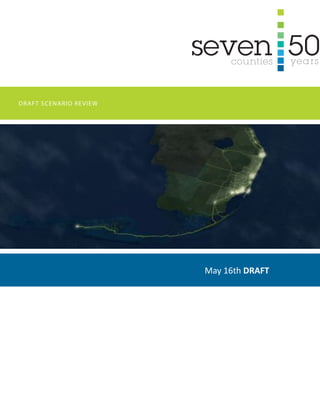
- 1. DRAFT SCENARIO REVIEW May 16th DRAFT
- 3. Seven50: Se Florida ProSPerity Plan Preface Purpose: This draft report concerns the contract entitled, “Southeast Florida’s Regional Vision and Blueprint for Economic Prosperity (Sustainable Communities Initiative) – Master Contract” approved by the South Florida Regional Planning Council on November 7, 2011. Introduction: Four scenarios for the year 2060 were created: key indicators.
- 4. Seven50: Se Florida ProSPerity Plan Table of Contents 3.5 Scenario Mapping 3.47 Existing Conditions Analysis Maps
- 5. Seven50: Se Florida ProSPerity Plan Scenario Mapping
- 6. Seven50: Se Florida ProSPerity Plan
- 7. Seven50: Se Florida ProSPerity Plan Trend “Business as Usual” Scenarios: A Narrative of Trend “Business as Usual” and Plan 1 “Exurban Expansion” The Southeast Florida Region continues on its current trend, with no major changes in regional growth, transportation, environmental, social, and economic policies. New development is pushed to the edges of metropolitan areas, causing widespread loss of farmland and environmentally sensitive lands, especially in the northern counties. Development is mostly automobile-dependent, resulting in further strains on the suburban road networks roadways and a growing population. Development pressures at the edges create renewed pressure for urban development boundaries in Miami- Meanwhile, demographic changes demand more pedestrian-friendly urban environments, yet constrained supplies of walkable development cause prices in these places to continue to rise, putting it out of reach of large portions of the population. Energy and transportation costs also continue to rise putting a strain on household budgets, especially throughout the automobile-dependent suburban stretches of the along transit corridors can barely keep up with demand from a growing population. Because of the limited amount of transit-served areas, development at these locations often takes the form of high-rise condominium buildings without many middle densities to make the transition Sea-level rise gradually affects more and more of the region, causing widespread flooding in low-lying areas. Although many areas are unable in storm-water infrastructure to protect key areas from at least some of the effects of sea-level rise. Current everglades restoration projects
- 8. Seven50: Se Florida ProSPerity Plan Trend “Business as Usual” LEGEND Highway Major Arterial Rail Transit Stop Walkable Areas Urbanized Area Preserved Natural Areas Parks Farmland Restored Everglades Flow Airport or Port Areas Threatened by 2’ Sea Level Rise Areas Threatened by 2’ Sea Level Rise (Assuming 3’ High Tide)
- 9. Seven50: Se Florida ProSPerity Plan Major Transit Oriented Development Sites Sites with heavy rail passenger stations with long distance service (like All Aboard Florida) or regional commuter lines (like Tri-Rail) and corresponding walkable urban development at densities which support the transit investment. Trend “Business as Usual” Key to the Atlas Protected Lands Agricultural Lands 2’ Sea Level Rise (Assuming 3’ high tide) Sites that face inundation with a 2’ sea To avoid indundation adaptation mechanisms (drainage, pumping, levee systems, beach replenishment, etc.) may be necessary. Movement of Water in Everglades Arrows show a simplification of water movement within the Everglades System, 2’ Sea Level Rise (Not tidally adjusted) Sites that face inundation with a 2’ sea indundation adaptation mechanisms (drainage, pumping, levee systems, beach replenishment, etc.) may be necessary.
- 10. Seven50: Se Florida ProSPerity Plan Walkable Areas and TOD Sites The atlas shows a close-up of the preliminary scenario model created by framework for the region that is multi-modal and walkable. Magenta Areas on the Map Magenta areas include Major Transit Oriented Development Sites, Minor Transit Oriented Development Sites, and Walkable Corridors. Magenta areas indicate improved walkability and bikeability in order to capitalize on the investment made in transit and/or thoroughfare improvements. Walkable/ bikeable improvements include items such as greater sidewalk/bike route connectivity, more continuous street tree shade canopy, and increased crossing ease at intersections. Where needed, improvements should include adjustments to land development regulations to permit and promote pedestrian-friendly development including: buildings forming a well-shaped public street space, doors and windows facing the street, minimization of blank walls and back-of house service areas facing the street, and less obtrusive parking generally placed to the rear and sides of buildings. These areas may also warrant adjustments to land development regulations to permit Magenta Around Major Transit Oriented Development Sites Magenta to indicate improved walkability and bikeability is configured in walkability and bikeability with: greatest focus on improvements within ¼ mile radius, intermediate focus on improvements within ½ mile radius, and moderate focus on improvements within a 1-mile radius. The larger emphasis on walkability around heavy rail transit stations is commensurate with the increased capital investment in these transportation facilities.
- 11. Seven50: Se Florida ProSPerity Plan 18,000’ 36,000’ 54,000’ 72,000’0 Indian River County St. Lucie County Martin County Palm Beach County LEGEND Highway Major Arterial Rail Transit Stop Walkable Areas Urbanized Area Preserved Natural Areas Parks Farmland Restored Everglades Flow Airport or Port Areas Threatened by 2’ Sea Level Rise Areas Threatened by 2’ Sea Level Rise (Assuming 3’ High Tide)
- 12. Seven50: Se Florida ProSPerity Plan 18,000’ 36,000’ 54,000’ 72,000’0 Palm Beach County Broward County LEGEND Highway Major Arterial Rail Transit Stop Walkable Areas Urbanized Area Preserved Natural Areas Parks Farmland Restored Everglades Flow Airport or Port Areas Threatened by 2’ Sea Level Rise Areas Threatened by 2’ Sea Level Rise (Assuming 3’ High Tide)
- 13. Seven50: Se Florida ProSPerity Plan 18,000’ 36,000’ 54,000’ 72,000’0 Miami-Dade County LEGEND Highway Major Arterial Rail Transit Stop Walkable Areas Urbanized Area Preserved Natural Areas Parks Farmland Restored Everglades Flow Airport or Port Areas Threatened by 2’ Sea Level Rise Areas Threatened by 2’ Sea Level Rise (Assuming 3’ High Tide)
- 14. Seven50: Se Florida ProSPerity Plan 18,000’ 36,000’ 54,000’ 72,000’0 Monroe County LEGEND Highway Major Arterial Rail Transit Stop Walkable Areas Urbanized Area Preserved Natural Areas Parks Farmland Restored Everglades Flow Airport or Port Areas Threatened by 2’ Sea Level Rise Areas Threatened by 2’ Sea Level Rise (Assuming 3’ High Tide)
- 15. Seven50: Se Florida ProSPerity Plan 18,000’ 36,000’ 54,000’ 72,000’0 Monroe County LEGEND Highway Major Arterial Rail Transit Stop Walkable Areas Urbanized Area Preserved Natural Areas Parks Farmland Restored Everglades Flow Airport or Port Areas Threatened by 2’ Sea Level Rise Areas Threatened by 2’ Sea Level Rise (Assuming 3’ High Tide)
- 16. Seven50: Se Florida ProSPerity Plan
- 17. Seven50: Se Florida ProSPerity Plan Plan 1 “Exurban Expansion” Scenarios: A Narrative of Trend “Business as Usual” and Plan 1 “Exurban Expansion” The Southeast Florida Region continues on its current trend, with no major changes in regional growth, transportation, environmental, social, and economic policies. New development is pushed to the edges of metropolitan areas, causing widespread loss of farmland and environmentally sensitive lands, especially in the northern counties. Development is mostly automobile-dependent, resulting in further strains on the suburban road networks roadways and a growing population. Development pressures at the edges create renewed pressure for urban development boundaries in Miami- Meanwhile, demographic changes demand more pedestrian-friendly urban environments, yet constrained supplies of walkable development cause prices in these places to continue to rise, putting it out of reach of large portions of the population. Energy and transportation costs also continue to rise putting a strain on household budgets, especially throughout the automobile-dependent suburban stretches of the along transit corridors can barely keep up with demand from a growing population. Because of the limited amount of transit-served areas, development at these locations often takes the form of high-rise condominium buildings without many middle densities to make the transition Sea-level rise gradually affects more and more of the region, causing widespread flooding in low-lying areas. Although many areas are unable in storm-water infrastructure to protect key areas from at least some of the effects of sea-level rise. Current everglades restoration projects
- 18. Seven50: Se Florida ProSPerity Plan Plan 1 “Exurban Expansion” LEGEND Highway Major Arterial Rail Transit Stop Walkable Areas Urbanized Area Preserved Natural Areas Parks Farmland Restored Everglades Flow Airport or Port Areas Threatened by 2’ Sea Level Rise Areas Threatened by 2’ Sea Level Rise (Assuming 3’ High Tide)
- 19. Seven50: Se Florida ProSPerity Plan Major Transit Oriented Development Sites Sites with heavy rail passenger stations with long distance service (like All Aboard Florida) or regional commuter lines (like Tri-Rail) and corresponding walkable urban development at densities which support the transit investment. Plan 1 “Exurban Expansion” Key to the Atlas Protected Lands Agricultural Lands 2’ Sea Level Rise (Assuming 3’ high tide) Sites that face inundation with a 2’ sea To avoid indundation adaptation mechanisms (drainage, pumping, levee systems, beach replenishment, etc.) may be necessary. Movement of Water in Everglades Arrows show a simplification of water movement within the Everglades System, 2’ Sea Level Rise (Not tidally adjusted) Sites that face inundation with a 2’ sea indundation adaptation mechanisms (drainage, pumping, levee systems, beach replenishment, etc.) may be necessary.
- 20. Seven50: Se Florida ProSPerity Plan Walkable Areas and TOD Sites The atlas shows a close-up of the preliminary scenario model created by framework for the region that is multi-modal and walkable. Magenta Areas on the Map Magenta areas include Major Transit Oriented Development Sites, Minor Transit Oriented Development Sites, and Walkable Corridors. Magenta areas indicate improved walkability and bikeability in order to capitalize on the investment made in transit and/or thoroughfare improvements. Walkable/ bikeable improvements include items such as greater sidewalk/bike route connectivity, more continuous street tree shade canopy, and increased crossing ease at intersections. Where needed, improvements should include adjustments to land development regulations to permit and promote pedestrian-friendly development including: buildings forming a well-shaped public street space, doors and windows facing the street, minimization of blank walls and back-of house service areas facing the street, and less obtrusive parking generally placed to the rear and sides of buildings. These areas may also warrant adjustments to land development regulations to permit Magenta Around Major Transit Oriented Development Sites Magenta to indicate improved walkability and bikeability is configured in walkability and bikeability with: greatest focus on improvements within ¼ mile radius, intermediate focus on improvements within ½ mile radius, and moderate focus on improvements within a 1-mile radius. The larger emphasis on walkability around heavy rail transit stations is commensurate with the increased capital investment in these transportation facilities.
- 21. Seven50: Se Florida ProSPerity Plan 18,000’ 36,000’ 54,000’ 72,000’0 Indian River County St. Lucie County Martin County Palm Beach County LEGEND Highway Major Arterial Rail Transit Stop Walkable Areas Urbanized Area Preserved Natural Areas Parks Farmland Restored Everglades Flow Airport or Port Areas Threatened by 2’ Sea Level Rise Areas Threatened by 2’ Sea Level Rise (Assuming 3’ High Tide)
- 22. Seven50: Se Florida ProSPerity Plan 18,000’ 36,000’ 54,000’ 72,000’0 Palm Beach County Broward County LEGEND Highway Major Arterial Rail Transit Stop Walkable Areas Urbanized Area Preserved Natural Areas Parks Farmland Restored Everglades Flow Airport or Port Areas Threatened by 2’ Sea Level Rise Areas Threatened by 2’ Sea Level Rise (Assuming 3’ High Tide)
- 23. Seven50: Se Florida ProSPerity Plan 18,000’ 36,000’ 54,000’ 72,000’0 Miami-Dade County LEGEND Highway Major Arterial Rail Transit Stop Walkable Areas Urbanized Area Preserved Natural Areas Parks Farmland Restored Everglades Flow Airport or Port Areas Threatened by 2’ Sea Level Rise Areas Threatened by 2’ Sea Level Rise (Assuming 3’ High Tide)
- 24. Seven50: Se Florida ProSPerity Plan 18,000’ 36,000’ 54,000’ 72,000’0 Monroe County LEGEND Highway Major Arterial Rail Transit Stop Walkable Areas Urbanized Area Preserved Natural Areas Parks Farmland Restored Everglades Flow Airport or Port Areas Threatened by 2’ Sea Level Rise Areas Threatened by 2’ Sea Level Rise (Assuming 3’ High Tide)
- 25. Seven50: Se Florida ProSPerity Plan 18,000’ 36,000’ 54,000’ 72,000’0 Monroe County LEGEND Highway Major Arterial Rail Transit Stop Walkable Areas Urbanized Area Preserved Natural Areas Parks Farmland Restored Everglades Flow Airport or Port Areas Threatened by 2’ Sea Level Rise Areas Threatened by 2’ Sea Level Rise (Assuming 3’ High Tide)
- 26. Seven50: Se Florida ProSPerity Plan
- 27. Seven50: Se Florida ProSPerity Plan Plan 2 “Strategic Interventions” Scenarios: Transit Oriented Development as a Factor in Population Shifts in Plan 2 “Strategic Interventions” and 3 “Next Gen Region” only two ways to accommodate population growth in the seven-county region. One is to increase density through infill development and opportunities for the latter are very limited going forward, especially in the southern counties. The different scenarios demonstrate different ways of accommodating future growth by encouraging infill development within walkable areas. of these investments are already starting to take place along Miami’s Metrorail line, and can be seen in places like South Miami, Brickell and Downtown Kendall. A great deal of future growth can take place within already established growth areas such as these. With enough investment and retrofit of streets into comfortable public spaces, all these areas have the potential to mature into lively urban neighborhoods. planned FEC passenger rail stations. These are the first priority areas for investment in walkability. The FEC rail line originally developed by Henry Flagler, historically carried passenger traffic along the Florida coast, creating many of Florida’s original historic settlements. Reviving passenger rail service along this line thus restores connections to these historic communities that were severed decades ago when passenger service was discontinued. Investments in walkability in these areas involve reinvestment and infill development, as can already be observed in places like Delray Beach and West Palm Beach. comprehensive approach increases the amount of area devoted to walkable, transit-oriented development. Wider investment allows for middle- range densities that are currently missing in the South Florida real-estate markets. Middle densities include a diversity of housing types such as creating large concentrations of any one type of housing. A diversity of housing also allows a variety of people in different stages of their lives to live harmoniously together, generating a more stable, active community. region’s premier bus-rapid transit service. Nodes of investment in walkable development should be created along every major stop along this line. As these areas mature further investments in transit can be made, prioritizing station areas for walkable development. Scenario 1 and Broward Counties. Brining a consistent level of transit to these areas, combined with the systematic redesign of streets to encourage surrounding neighborhoods. development. Through a serious commitment to transit, these corridors can connect to the regional economic and transportation centers. Through careful investment and redevelopment, a series of walkable, livable neighborhoods can emerge, creating important corridors of economic prosperity in the region. of growing importance as cities mature. In recent years health problems such as obesity, heart disease, high blood pressure, and the maladies associated with social alienation have become a normal response to a built-environment that does not allow walking or facilitate human interaction. Encouraging walkability helps create healthy life styles. Building complete places that enable neighbors to know each other will help create and retain close-knit communities. The young and the elderly, especially, have been left behind by urban forms that necessitate driving long distances. A wide investment in walkable places brings more of the activities of daily living within walking distance and a framework of transportation alternatives including distance; buildings fronting streets; narrow streets; streets with managed speeds; sidewalks; and on-street parking. Vehicular speed plays a critical role in the walkability of an area due to its relationship with pedestrian fatalities. In a crash with a vehicle transit that links together walkable areas to create a healthy region in which one can move around without needing a car.
- 28. Seven50: Se Florida ProSPerity Plan Plan 2 “Strategic Interventions” LEGEND Highway Major Arterial Rail Transit Stop Walkable Areas Urbanized Area Preserved Natural Areas Parks Farmland Restored Everglades Flow Airport or Port Areas Threatened by 2’ Sea Level Rise Areas Threatened by 2’ Sea Level Rise (Assuming 3’ High Tide)
- 29. Seven50: Se Florida ProSPerity Plan Major Transit Oriented Development Sites Sites with heavy rail passenger stations with long distance service (like All Aboard Florida) or regional commuter lines (like Tri-Rail) and corresponding walkable urban development at densities which support the transit investment. Minor Transit Oriented Development Sites Sites with urban circulators like streetcars, electric trolleys, and Bus Rapid Transit and corresponding walkable urban development at densities which support the transit investment. Walkable Corridors Corridors for retrofit for greater walkability: sidewalks, street trees, cycle facilities, and urban format buildings. Plan 2 “Strategic Interventions” Key to the Atlas Protected Lands Agricultural Lands 2’ Sea Level Rise (Assuming 3’ high tide) Sites that face inundation with a 2’ sea To avoid indundation adaptation mechanisms (drainage, pumping, levee systems, beach replenishment, etc.) may be necessary. Movement of Water in Everglades Arrows show a simplification of water movement within the Everglades System, 2’ Sea Level Rise (Not tidally adjusted) Sites that face inundation with a 2’ sea indundation adaptation mechanisms (drainage, pumping, levee systems, beach replenishment, etc.) may be necessary.
- 30. Seven50: Se Florida ProSPerity Plan Walkable Areas and TOD Sites The atlas shows a close-up of the preliminary scenario model created by framework for the region that is multi-modal and walkable. Magenta Areas on the Map Magenta areas include Major Transit Oriented Development Sites, Minor Transit Oriented Development Sites, and Walkable Corridors. Magenta areas indicate improved walkability and bikeability in order to capitalize on the investment made in transit and/or thoroughfare improvements. Walkable/ bikeable improvements include items such as greater sidewalk/bike route connectivity, more continuous street tree shade canopy, and increased crossing ease at intersections. Where needed, improvements should include adjustments to land development regulations to permit and promote pedestrian-friendly development including: buildings forming a well-shaped public street space, doors and windows facing the street, minimization of blank walls and back-of house service areas facing the street, and less obtrusive parking generally placed to the rear and sides of buildings. These areas may also warrant adjustments to land development regulations to permit Magenta Around Major Transit Oriented Development Sites Magenta to indicate improved walkability and bikeability is configured in walkability and bikeability with: greatest focus on improvements within ¼ mile radius, intermediate focus on improvements within ½ mile radius, and moderate focus on improvements within a 1-mile radius. The larger emphasis on walkability around heavy rail transit stations is commensurate with the increased capital investment in these transportation facilities. Minor Transit Oriented Development Sites Magenta to indicate improved walkability and bikeability is configured in 2-tiered circles around urban circulators such as streetcar/bus rapid transit stations to indicate the improved walkability and bikeability with: greatest focus on improvements within ¼ mile radius, and moderate focus on improvements within a ½ mile radius. Along Primary North-South and East-West Thoroughfares Magenta to indicate improved walkability and bikeability is configured in a side. Many of these corridors are currently served with conventional bus transit and therefore could potentially be good candidate locations for an will help to absorb development pressure over time in a logical pattern and will thereby help to preserve the character of the primarily residential neighborhoods bounded by the corridors while also providing services within walkable and bikeable distance of these neighborhoods.
- 31. Seven50: Se Florida ProSPerity Plan 18,000’ 36,000’ 54,000’ 72,000’0 Indian River County St. Lucie County Martin County Palm Beach County LEGEND Highway Major Arterial Rail Transit Stop Walkable Areas Urbanized Area Preserved Natural Areas Parks Farmland Restored Everglades Flow Airport or Port Areas Threatened by 2’ Sea Level Rise Areas Threatened by 2’ Sea Level Rise (Assuming 3’ High Tide)
- 32. Seven50: Se Florida ProSPerity Plan 18,000’ 36,000’ 54,000’ 72,000’0 Palm Beach County Broward County LEGEND Highway Major Arterial Rail Transit Stop Walkable Areas Urbanized Area Preserved Natural Areas Parks Farmland Restored Everglades Flow Airport or Port Areas Threatened by 2’ Sea Level Rise Areas Threatened by 2’ Sea Level Rise (Assuming 3’ High Tide)
- 33. Seven50: Se Florida ProSPerity Plan 18,000’ 36,000’ 54,000’ 72,000’0 Miami-Dade County LEGEND Highway Major Arterial Rail Transit Stop Walkable Areas Urbanized Area Preserved Natural Areas Parks Farmland Restored Everglades Flow Airport or Port Areas Threatened by 2’ Sea Level Rise Areas Threatened by 2’ Sea Level Rise (Assuming 3’ High Tide)
- 34. Seven50: Se Florida ProSPerity Plan 18,000’ 36,000’ 54,000’ 72,000’0 Monroe County LEGEND Highway Major Arterial Rail Transit Stop Walkable Areas Urbanized Area Preserved Natural Areas Parks Farmland Restored Everglades Flow Airport or Port Areas Threatened by 2’ Sea Level Rise Areas Threatened by 2’ Sea Level Rise (Assuming 3’ High Tide)
- 35. Seven50: Se Florida ProSPerity Plan 18,000’ 36,000’ 54,000’ 72,000’0 Monroe County LEGEND Highway Major Arterial Rail Transit Stop Walkable Areas Urbanized Area Preserved Natural Areas Parks Farmland Restored Everglades Flow Airport or Port Areas Threatened by 2’ Sea Level Rise Areas Threatened by 2’ Sea Level Rise (Assuming 3’ High Tide)
- 36. Seven50: Se Florida ProSPerity Plan
- 37. Seven50: Se Florida ProSPerity Plan Plan 3 “Next Gen Region” Scenarios: Transit Oriented Development as a Factor in Population Shifts in Plan 2 “Strategic Interventions” and 3 “Next Gen Region” only two ways to accommodate population growth in the seven-county region. One is to increase density through infill development and opportunities for the latter are very limited going forward, especially in the southern counties. The different scenarios demonstrate different ways of accommodating future growth by encouraging infill development within walkable areas. of these investments are already starting to take place along Miami’s Metrorail line, and can be seen in places like South Miami, Brickell and Downtown Kendall. A great deal of future growth can take place within already established growth areas such as these. With enough investment and retrofit of streets into comfortable public spaces, all these areas have the potential to mature into lively urban neighborhoods. planned FEC passenger rail stations. These are the first priority areas for investment in walkability. The FEC rail line originally developed by Henry Flagler, historically carried passenger traffic along the Florida coast, creating many of Florida’s original historic settlements. Reviving passenger rail service along this line thus restores connections to these historic communities that were severed decades ago when passenger service was discontinued. Investments in walkability in these areas involve reinvestment and infill development, as can already be observed in places like Delray Beach and West Palm Beach. comprehensive approach increases the amount of area devoted to walkable, transit-oriented development. Wider investment allows for middle- range densities that are currently missing in the South Florida real-estate markets. Middle densities include a diversity of housing types such as creating large concentrations of any one type of housing. A diversity of housing also allows a variety of people in different stages of their lives to live harmoniously together, generating a more stable, active community. region’s premier bus-rapid transit service. Nodes of investment in walkable development should be created along every major stop along this line. As these areas mature further investments in transit can be made, prioritizing station areas for walkable development. Scenario 1 and Broward Counties. Brining a consistent level of transit to these areas, combined with the systematic redesign of streets to encourage surrounding neighborhoods. development. Through a serious commitment to transit, these corridors can connect to the regional economic and transportation centers. Through careful investment and redevelopment, a series of walkable, livable neighborhoods can emerge, creating important corridors of economic prosperity in the region. of growing importance as cities mature. In recent years health problems such as obesity, heart disease, high blood pressure, and the maladies associated with social alienation have become a normal response to a built-environment that does not allow walking or facilitate human interaction. Encouraging walkability helps create healthy life styles. Building complete places that enable neighbors to know each other will help create and retain close-knit communities. The young and the elderly, especially, have been left behind by urban forms that necessitate driving long distances. A wide investment in walkable places brings more of the activities of daily living within walking distance and a framework of transportation alternatives including distance; buildings fronting streets; narrow streets; streets with managed speeds; sidewalks; and on-street parking. Vehicular speed plays a critical role in the walkability of an area due to its relationship with pedestrian fatalities. In a crash with a vehicle transit that links together walkable areas to create a healthy region in which one can move around without needing a car.
- 38. Seven50: Se Florida ProSPerity Plan Plan 3 “Next Gen Region” LEGEND Highway Major Arterial Rail Transit Stop Walkable Areas Urbanized Area Preserved Natural Areas Parks Farmland Restored Everglades Flow Airport or Port Areas Threatened by 2’ Sea Level Rise Areas Threatened by 2’ Sea Level Rise (Assuming 3’ High Tide)
- 39. Seven50: Se Florida ProSPerity Plan Major Transit Oriented Development Sites Sites with heavy rail passenger stations with long distance service (like All Aboard Florida) or regional commuter lines (like Tri-Rail) and corresponding walkable urban development at densities which support the transit investment. Minor Transit Oriented Development Sites Sites with urban circulators like streetcars, electric trolleys, and Bus Rapid Transit and corresponding walkable urban development at densities which support the transit investment. Walkable Corridors Corridors for retrofit for greater walkability: sidewalks, street trees, cycle facilities, and urban format buildings. Plan 3 “Next Gen Region” Key to the Atlas Protected Lands Agricultural Lands 2’ Sea Level Rise (Assuming 3’ high tide) Sites that face inundation with a 2’ sea To avoid indundation adaptation mechanisms (drainage, pumping, levee systems, beach replenishment, etc.) may be necessary. Movement of Water in Everglades Arrows show a simplification of water movement within the Everglades System, 2’ Sea Level Rise (Not tidally adjusted) Sites that face inundation with a 2’ sea indundation adaptation mechanisms (drainage, pumping, levee systems, beach replenishment, etc.) may be necessary.
- 40. Seven50: Se Florida ProSPerity Plan Walkable Areas and TOD Sites The atlas shows a close-up of the preliminary scenario model created by framework for the region that is multi-modal and walkable. Magenta Areas on the Map Magenta areas include Major Transit Oriented Development Sites, Minor Transit Oriented Development Sites, and Walkable Corridors. Magenta areas indicate improved walkability and bikeability in order to capitalize on the investment made in transit and/or thoroughfare improvements. Walkable/ bikeable improvements include items such as greater sidewalk/bike route connectivity, more continuous street tree shade canopy, and increased crossing ease at intersections. Where needed, improvements should include adjustments to land development regulations to permit and promote pedestrian-friendly development including: buildings forming a well-shaped public street space, doors and windows facing the street, minimization of blank walls and back-of house service areas facing the street, and less obtrusive parking generally placed to the rear and sides of buildings. These areas may also warrant adjustments to land development regulations to permit Magenta Around Major Transit Oriented Development Sites Magenta to indicate improved walkability and bikeability is configured in walkability and bikeability with: greatest focus on improvements within ¼ mile radius, intermediate focus on improvements within ½ mile radius, and moderate focus on improvements within a 1-mile radius. The larger emphasis on walkability around heavy rail transit stations is commensurate with the increased capital investment in these transportation facilities. Minor Transit Oriented Development Sites Magenta to indicate improved walkability and bikeability is configured in 2-tiered circles around urban circulators such as streetcar/bus rapid transit stations to indicate the improved walkability and bikeability with: greatest focus on improvements within ¼ mile radius, and moderate focus on improvements within a ½ mile radius. Along Primary North-South and East-West Thoroughfares Magenta to indicate improved walkability and bikeability is configured in a side. Many of these corridors are currently served with conventional bus transit and therefore could potentially be good candidate locations for an will help to absorb development pressure over time in a logical pattern and will thereby help to preserve the character of the primarily residential neighborhoods bounded by the corridors while also providing services within walkable and bikeable distance of these neighborhoods.
- 41. Seven50: Se Florida ProSPerity Plan 18,000’ 36,000’ 54,000’ 72,000’0 Indian River County St. Lucie County Martin County Palm Beach County LEGEND Highway Major Arterial Rail Transit Stop Walkable Areas Urbanized Area Preserved Natural Areas Parks Farmland Restored Everglades Flow Airport or Port Areas Threatened by 2’ Sea Level Rise Areas Threatened by 2’ Sea Level Rise (Assuming 3’ High Tide)
- 42. Seven50: Se Florida ProSPerity Plan 18,000’ 36,000’ 54,000’ 72,000’0 Palm Beach County Broward County LEGEND Highway Major Arterial Rail Transit Stop Walkable Areas Urbanized Area Preserved Natural Areas Parks Farmland Restored Everglades Flow Airport or Port Areas Threatened by 2’ Sea Level Rise Areas Threatened by 2’ Sea Level Rise (Assuming 3’ High Tide)
- 43. Seven50: Se Florida ProSPerity Plan 18,000’ 36,000’ 54,000’ 72,000’0 Miami-Dade County LEGEND Highway Major Arterial Rail Transit Stop Walkable Areas Urbanized Area Preserved Natural Areas Parks Farmland Restored Everglades Flow Airport or Port Areas Threatened by 2’ Sea Level Rise Areas Threatened by 2’ Sea Level Rise (Assuming 3’ High Tide)
- 44. Seven50: Se Florida ProSPerity Plan 18,000’ 36,000’ 54,000’ 72,000’0 Monroe County LEGEND Highway Major Arterial Rail Transit Stop Walkable Areas Urbanized Area Preserved Natural Areas Parks Farmland Restored Everglades Flow Airport or Port Areas Threatened by 2’ Sea Level Rise Areas Threatened by 2’ Sea Level Rise (Assuming 3’ High Tide)
- 45. Seven50: Se Florida ProSPerity Plan 18,000’ 36,000’ 54,000’ 72,000’0 Monroe County LEGEND Highway Major Arterial Rail Transit Stop Walkable Areas Urbanized Area Preserved Natural Areas Parks Farmland Restored Everglades Flow Airport or Port Areas Threatened by 2’ Sea Level Rise Areas Threatened by 2’ Sea Level Rise (Assuming 3’ High Tide)
- 46. Seven50: Se Florida ProSPerity Plan
- 47. Seven50: Se Florida ProSPerity Plan Existing Conditions Analysis Maps
- 48. Seven50: Se Florida ProSPerity Plan
- 49. Seven50: Se Florida ProSPerity Plan Intersection Density Map
- 50. Seven50: Se Florida ProSPerity Plan Intersection Density Map Intersections The color represents different levels of intersection densities based on the intersection numbers. 1/4 Mile Grid grid. NUMBERS OF INTERSECTIONS 0-5 6-10 11-25 26-35 36-50 51-100
- 51. Seven50: Se Florida ProSPerity Plan 18,000’ 36,000’ 54,000’ 72,000’0 NUMBERS OF INTERSECTIONS 0-5 6-10 11-25 26-35 36-50 51-100 Indian River County St. Lucie County Martin County Palm Beach County
- 52. Seven50: Se Florida ProSPerity Plan 18,000’ 36,000’ 54,000’ 72,000’0 Palm Beach County Broward County NUMBERS OF INTERSECTIONS 0-5 6-10 11-25 26-35 36-50 51-100
- 53. Seven50: Se Florida ProSPerity Plan 18,000’ 36,000’ 54,000’ 72,000’0 Miami-Dade County NUMBERS OF INTERSECTIONS 0-5 6-10 11-25 26-35 36-50 51-100
- 54. Seven50: Se Florida ProSPerity Plan 18,000’ 36,000’ 54,000’ 72,000’0 Monroe County NUMBERS OF INTERSECTIONS 0-5 6-10 11-25 26-35 36-50 51-100
- 55. Seven50: Se Florida ProSPerity Plan 18,000’ 36,000’ 54,000’ 72,000’0 Monroe County NUMBERS OF INTERSECTIONS 0 1 2-5 6-15 15-25 25-30
- 56. Seven50: Se Florida ProSPerity Plan
- 57. Seven50: Se Florida ProSPerity Plan Existing Walkability Map
- 58. Seven50: Se Florida ProSPerity Plan Existing Walkability Map Walkability The color represents different levels of walkabilities. WALKABILITY LEVEL Car-Dependent Rarely Walkable Walkable Walkers’ Paradise
- 59. Seven50: Se Florida ProSPerity Plan 18,000’ 36,000’ 54,000’ 72,000’0 Indian River County St. Lucie County Martin County Palm Beach County WALKABILITY LEVEL Car-Dependent Rarely Walkable Walkable Walkers’ Paradise
- 60. Seven50: Se Florida ProSPerity Plan 18,000’ 36,000’ 54,000’ 72,000’0 Palm Beach County Broward County WALKABILITY LEVEL Car-Dependent Rarely Walkable Walkable Walkers’ Paradise
- 61. Seven50: Se Florida ProSPerity Plan 18,000’ 36,000’ 54,000’ 72,000’0 Miami-Dade County WALKABILITY LEVEL Car-Dependent Rarely Walkable Walkable Walkers’ Paradise
- 62. Seven50: Se Florida ProSPerity Plan 18,000’ 36,000’ 54,000’ 72,000’0 Monroe County WALKABILITY LEVEL Car-Dependent Rarely Walkable Walkable Walkers’ Paradise
- 63. Seven50: Se Florida ProSPerity Plan 18,000’ 36,000’ 54,000’ 72,000’0 Monroe County WALKABILITY LEVEL Car-Dependent Rarely Walkable Walkable Walkers’ Paradise
- 64. Seven50: Se Florida ProSPerity Plan
- 65. Seven50: Se Florida ProSPerity Plan Plan 2 “Strategic Interventions” Walkability Map
- 66. Seven50: Se Florida ProSPerity Plan Plan 2 “Strategic Interventions” Walkability Map Walkability The color represents different levels of walkabilities. WALKABILITY LEVEL Car-Dependent Rarely Walkable Walkable Walkers’ Paradise
- 67. Seven50: Se Florida ProSPerity Plan 18,000’ 36,000’ 54,000’ 72,000’0 Indian River County St. Lucie County Martin County Palm Beach County WALKABILITY LEVEL Car-Dependent Rarely Walkable Walkable Walkers’ Paradise
- 68. Seven50: Se Florida ProSPerity Plan 18,000’ 36,000’ 54,000’ 72,000’0 Palm Beach County Broward County WALKABILITY LEVEL Car-Dependent Rarely Walkable Walkable Walkers’ Paradise
- 69. Seven50: Se Florida ProSPerity Plan 18,000’ 36,000’ 54,000’ 72,000’0 Miami-Dade County WALKABILITY LEVEL Car-Dependent Rarely Walkable Walkable Walkers’ Paradise
- 70. Seven50: Se Florida ProSPerity Plan 18,000’ 36,000’ 54,000’ 72,000’0 Monroe County WALKABILITY LEVEL Car-Dependent Rarely Walkable Walkable Walkers’ Paradise
- 71. Seven50: Se Florida ProSPerity Plan 18,000’ 36,000’ 54,000’ 72,000’0 Monroe County WALKABILITY LEVEL Car-Dependent Rarely Walkable Walkable Walkers’ Paradise
- 72. Seven50: Se Florida ProSPerity Plan
- 73. Seven50: Se Florida ProSPerity Plan Plan 3 “Next Gen Region” Walkability Map
- 74. Seven50: Se Florida ProSPerity Plan Plan 3 “Next Gen Region” Walkability Map Walkability The color represents different levels of walkabilities. WALKABILITY LEVEL Car-Dependent Rarely Walkable Walkable Walkers’ Paradise
- 75. Seven50: Se Florida ProSPerity Plan 18,000’ 36,000’ 54,000’ 72,000’0 Indian River County St. Lucie County Martin County Palm Beach County WALKABILITY LEVEL Car-Dependent Rarely Walkable Walkable Walkers’ Paradise
- 76. Seven50: Se Florida ProSPerity Plan 18,000’ 36,000’ 54,000’ 72,000’0 Palm Beach County Broward County WALKABILITY LEVEL Car-Dependent Rarely Walkable Walkable Walkers’ Paradise
- 77. Seven50: Se Florida ProSPerity Plan 18,000’ 36,000’ 54,000’ 72,000’0 Miami-Dade County WALKABILITY LEVEL Car-Dependent Rarely Walkable Walkable Walkers’ Paradise
- 78. Seven50: Se Florida ProSPerity Plan 18,000’ 36,000’ 54,000’ 72,000’0 Monroe County WALKABILITY LEVEL Car-Dependent Rarely Walkable Walkable Walkers’ Paradise
- 79. Seven50: Se Florida ProSPerity Plan 18,000’ 36,000’ 54,000’ 72,000’0 Monroe County WALKABILITY LEVEL Car-Dependent Rarely Walkable Walkable Walkers’ Paradise
- 80. Seven50: Se Florida ProSPerity Plan
- 81. Seven50: Se Florida ProSPerity Plan Land Use Map
- 82. Seven50: Se Florida ProSPerity Plan Existing Land Use LEGEND Residential - Single Family Institutional/Public Vacant Industrial Commercial Mixed Use Residential - Multi-Family Agriculture Recreation Facilities Parks/Open Space Water/Wetlands
- 83. Seven50: Se Florida ProSPerity Plan 18,000’ 36,000’ 54,000’ 72,000’0 Indian River County St. Lucie County Martin County Palm Beach County LEGEND Residential - Single Family Institutional/Public Vacant Industrial Commercial Mixed Use Residential - Multi-Family Agriculture Recreation Facilities Parks/Open Space Water/Wetlands
- 84. Seven50: Se Florida ProSPerity Plan 18,000’ 36,000’ 54,000’ 72,000’0 Palm Beach County Broward County LEGEND Residential - Single Family Institutional/Public Vacant Industrial Commercial Mixed Use Residential - Multi-Family Agriculture Recreation Facilities Parks/Open Space Water/Wetlands
- 85. Seven50: Se Florida ProSPerity Plan 18,000’ 36,000’ 54,000’ 72,000’0 Miami-Dade County LEGEND Residential - Single Family Institutional/Public Vacant Industrial Commercial Mixed Use Residential - Multi-Family Agriculture Recreation Facilities Parks/Open Space Water/Wetlands
- 86. Seven50: Se Florida ProSPerity Plan 18,000’ 36,000’ 54,000’ 72,000’0 Monroe County LEGEND Residential - Single Family Institutional/Public Vacant Industrial Commercial Mixed Use Residential - Multi-Family Agriculture Recreation Facilities Parks/Open Space Water/Wetlands
- 87. Seven50: Se Florida ProSPerity Plan 18,000’ 36,000’ 54,000’ 72,000’0 Monroe County LEGEND Residential - Single Family Institutional/Public Vacant Industrial Commercial Mixed Use Residential - Multi-Family Agriculture Recreation Facilities Parks/Open Space Water/Wetlands
- 88. Seven50: Se Florida ProSPerity Plan
- 89. Seven50: Se Florida ProSPerity Plan Agriculture Lands Map
- 90. Seven50: Se Florida ProSPerity Plan Agriculture Lands LEGEND Agriculture Land
- 91. Seven50: Se Florida ProSPerity Plan 18,000’ 36,000’ 54,000’ 72,000’0 Indian River County St. Lucie County Martin County Palm Beach CountyLEGEND Agriculture Land
- 92. Seven50: Se Florida ProSPerity Plan 18,000’ 36,000’ 54,000’ 72,000’0 Palm Beach County Broward County LEGEND Agriculture Land
- 93. Seven50: Se Florida ProSPerity Plan 18,000’ 36,000’ 54,000’ 72,000’0 Miami-Dade County LEGEND Agriculture Land
- 94. Seven50: Se Florida ProSPerity Plan 18,000’ 36,000’ 54,000’ 72,000’0 Monroe County LEGEND Agriculture Land
- 95. Seven50: Se Florida ProSPerity Plan 18,000’ 36,000’ 54,000’ 72,000’0 Monroe County LEGEND Agriculture Land
- 96. Seven50: Se Florida ProSPerity Plan
- 97. Seven50: Se Florida ProSPerity Plan Natural and Recreational Resources Map
- 98. Seven50: Se Florida ProSPerity Plan LEGEND Parks Golf Courses Water Wetland or Marsh Trails (Paddle Trails, Bike Trails, Hiking Trails, etc.) Natural and Recreational Resources
- 99. Seven50: Se Florida ProSPerity Plan 18,000’ 36,000’ 54,000’ 72,000’0 Indian River County St. Lucie County Martin County Palm Beach County LEGEND Parks Golf Courses Water Wetland or Marsh Trails (Paddle Trails, Bike Trails, Hiking Trails, etc.)
- 100. Seven50: Se Florida ProSPerity Plan 18,000’ 36,000’ 54,000’ 72,000’0 Palm Beach County Broward County LEGEND Parks Golf Courses Water Wetland or Marsh Trails (Paddle Trails, Bike Trails, Hiking Trails, etc.)
- 101. Seven50: Se Florida ProSPerity Plan 18,000’ 36,000’ 54,000’ 72,000’0 Miami-Dade County LEGEND Parks Golf Courses Water Wetland or Marsh Trails (Paddle Trails, Bike Trails, Hiking Trails, etc.)
- 102. Seven50: Se Florida ProSPerity Plan 18,000’ 36,000’ 54,000’ 72,000’0 Monroe County LEGEND Parks Golf Courses Water Wetland or Marsh Trails (Paddle Trails, Bike Trails, Hiking Trails, etc.)
- 103. Seven50: Se Florida ProSPerity Plan 18,000’ 36,000’ 54,000’ 72,000’0 Monroe County LEGEND Parks Golf Courses Water Wetland or Marsh Trails (Paddle Trails, Bike Trails, Hiking Trails, etc.)
- 104. Seven50: Se Florida ProSPerity Plan
- 105. Seven50: Se Florida ProSPerity Plan Areas Threatened by 2’ Sea Level Rise Map
- 106. Seven50: Se Florida ProSPerity Plan Areas Threatened by 2’ Sea Level Rise LEGEND Areas Threatened by 2’ Sea Level Rise Areas Threatened by 2’ Sea Level Rise (Assuming 3’ High Tide)
- 107. Seven50: Se Florida ProSPerity Plan 18,000’ 36,000’ 54,000’ 72,000’0 Indian River County St. Lucie County Martin County Palm Beach County LEGEND Areas Threatened by 2’ Sea Level Rise Areas Threatened by 2’ Sea Level Rise (Assuming 3’ High Tide)
- 108. Seven50: Se Florida ProSPerity Plan 18,000’ 36,000’ 54,000’ 72,000’0 Palm Beach County Broward County LEGEND Areas Threatened by 2’ Sea Level Rise Areas Threatened by 2’ Sea Level Rise (Assuming 3’ High Tide)
- 109. Seven50: Se Florida ProSPerity Plan 18,000’ 36,000’ 54,000’ 72,000’0 Miami-Dade County LEGEND Areas Threatened by 2’ Sea Level Rise Areas Threatened by 2’ Sea Level Rise (Assuming 3’ High Tide)
- 110. Seven50: Se Florida ProSPerity Plan 18,000’ 36,000’ 54,000’ 72,000’0 Monroe County LEGEND Areas Threatened by 2’ Sea Level Rise Areas Threatened by 2’ Sea Level Rise (Assuming 3’ High Tide)
- 111. Seven50: Se Florida ProSPerity Plan 18,000’ 36,000’ 54,000’ 72,000’0 Monroe County LEGEND Areas Threatened by 2’ Sea Level Rise Areas Threatened by 2’ Sea Level Rise (Assuming 3’ High Tide)
- 112. Seven50: Se Florida ProSPerity Plan
- 113. Seven50: Se Florida ProSPerity Plan Transit Network Map
- 114. Seven50: Se Florida ProSPerity Plan Transit Network Map LEGEND Airports Aviation Facilities Rail Transit Stop Bus Routes
- 115. Seven50: Se Florida ProSPerity Plan 18,000’ 36,000’ 54,000’ 72,000’0 Indian River County St. Lucie County Martin County Palm Beach County LEGEND Airports Aviation Facilities Rail Transit Stop Bus Routes
- 116. Seven50: Se Florida ProSPerity Plan 18,000’ 36,000’ 54,000’ 72,000’0 Palm Beach County Broward County LEGEND Airports Aviation Facilities Rail Transit Stop Bus Routes
- 117. Seven50: Se Florida ProSPerity Plan 18,000’ 36,000’ 54,000’ 72,000’0 Miami-Dade County LEGEND Airports Aviation Facilities Rail Transit Stop Bus Routes
- 118. Seven50: Se Florida ProSPerity Plan 18,000’ 36,000’ 54,000’ 72,000’0 Monroe County LEGEND Airports Aviation Facilities Rail Transit Stop Bus Routes
- 119. Seven50: Se Florida ProSPerity Plan 18,000’ 36,000’ 54,000’ 72,000’0 Monroe County LEGEND Airports Aviation Facilities Rail Transit Stop Bus Routes