SlideShare ist ein Scribd-Unternehmen logo
1 von 2
Downloaden Sie, um offline zu lesen
ArcGIS
®
GeoEvent Extension
for Server
Monitor All Your Assets in Real Time
ArcGIS®
GeoEvent Extension for Server allows you to connect with virtually any type of streaming data and automatically
alert personnel when specified conditions occur—all in real time. GeoEvent Extension changes your everyday geographic
information system (GIS) applications into frontline decision applications, helping you respond faster and with remarkable
accuracy whenever and wherever change happens.
Monitor Events
Keep track of your most valuable assets on land, at sea, and
in the air and have key personnel be automatically alerted
immediately when conditions meet specified criteria.
Process and Filter Real-Time Data
Multiple streams of data flow continuously through
GeoEvent Extension, using filters and processing steps
that you define, allowing you to detect and focus on the
most important events, locations, and thresholds for your
operations.
Connect to Any Sensor
GeoEvent Extension includes connectors for common
sensors including in-vehicle GPS receivers, mobile devices,
and social media providers. Additional connectors can
be found online, allowing you to enable your GeoEvent
Extension to handle new types of sensors.
Key Benefits
GeoEvent Extension lets you incorporate real-time
information streams with existing GIS data and ArcGIS
applications.
• Connect sensors to features hosted on ArcGIS
SM
Online or
ArcGIS for Server so they represent the most up-to-date
information happening in the real world.
• Filter streams using spatial and/or attribute conditions to
view only the most important features.
• Enrich incoming event information with additional fields
joined in from a feature service.
• Use existing features as the basis for detecting geofence
events. You can even create geofences on the fly without
interrupting the stream.
• View the latest feature status using any ArcGIS viewer,
such as Operations Dashboard for ArcGIS.
• Store historical events using feature services.
Add Real-Time GIS to Applications
GeoEvent Extension can be integrated with critical
decision-support tools and applications:
• Asset monitoring for fleet management, public transit,
railway, aviation, and maritime applications
• Route monitoring for facilities management,
transportation, and utilities
• Tactical monitoring for homeland security, law
enforcement, and military applications
• Environmental monitoring for resource management and
health and safety oversight
• Social media monitoring for sales and marketing and
business applications
Create Custom Connectors
Developers can create new connectors using the GeoEvent
Software Development Kit (SDK).
Deployment on Premises or in the Cloud
GeoEvent Extension can be deployed on your local
infrastructure, in a virtualized environment, or in the cloud.
System Requirements
GeoEvent Extension requires ArcGIS for Server—Standard
or Advanced.
ArcGIS for Server supports the following operating systems:
• Microsoft Windows Server
• Red Hat Enterprise Linux AS/ES
• SUSE Linux Enterprise Server
• Ubuntu (when deployed on Amazon Web Services)
Your starting point is
esri.com/GeoEvent
Copyright © 2013 Esri. All rights reserved. Esri, the Esri globe logo, ArcGIS, and esri.com are trademarks, service marks, or registered
marks of Esri in the United States, the European Community, or certain other jurisdictions. Other companies and products or services
mentioned herein may be trademarks, service marks, or registered marks of their respective mark owners.
142959
ESRI2M8/14kp-ca

Weitere ähnliche Inhalte

Was ist angesagt?

Our vision: The 3D Shared Earth Model - Oil and Gas seminar October 10th
Our vision: The 3D Shared Earth Model - Oil and Gas seminar October 10thOur vision: The 3D Shared Earth Model - Oil and Gas seminar October 10th
Our vision: The 3D Shared Earth Model - Oil and Gas seminar October 10th
Geodata AS
 
Geocap Water Column and Seafloor for ArcGIS - Oil and Gas seminar October 10th
Geocap Water Column and Seafloor for ArcGIS - Oil and Gas seminar October 10th Geocap Water Column and Seafloor for ArcGIS - Oil and Gas seminar October 10th
Geocap Water Column and Seafloor for ArcGIS - Oil and Gas seminar October 10th
Geodata AS
 

Was ist angesagt? (19)

All Edits State Zero Solution Profile
All Edits State Zero Solution ProfileAll Edits State Zero Solution Profile
All Edits State Zero Solution Profile
 
Experimental design approach for optimal selection and placement of rain sensors
Experimental design approach for optimal selection and placement of rain sensorsExperimental design approach for optimal selection and placement of rain sensors
Experimental design approach for optimal selection and placement of rain sensors
 
Rule-Driven, Fully-Configurable Asset Tracking with GIS
Rule-Driven, Fully-Configurable Asset Tracking with GISRule-Driven, Fully-Configurable Asset Tracking with GIS
Rule-Driven, Fully-Configurable Asset Tracking with GIS
 
How FME Gave Me 250 Hours in 2017
How FME Gave Me 250 Hours in 2017How FME Gave Me 250 Hours in 2017
How FME Gave Me 250 Hours in 2017
 
Imagin presentation
Imagin presentationImagin presentation
Imagin presentation
 
Azure Event Grid: Glue for the Internet
Azure Event Grid: Glue for the InternetAzure Event Grid: Glue for the Internet
Azure Event Grid: Glue for the Internet
 
Our vision: The 3D Shared Earth Model - Oil and Gas seminar October 10th
Our vision: The 3D Shared Earth Model - Oil and Gas seminar October 10thOur vision: The 3D Shared Earth Model - Oil and Gas seminar October 10th
Our vision: The 3D Shared Earth Model - Oil and Gas seminar October 10th
 
Overview of Blue Medora - New Relic Plugin for HP Rack Servers
Overview of Blue Medora - New Relic Plugin for HP Rack ServersOverview of Blue Medora - New Relic Plugin for HP Rack Servers
Overview of Blue Medora - New Relic Plugin for HP Rack Servers
 
Connecting through the OMS
Connecting through the OMSConnecting through the OMS
Connecting through the OMS
 
Integrating Sanitary Televising Data with Utility GIS Data
Integrating Sanitary Televising Data with Utility GIS DataIntegrating Sanitary Televising Data with Utility GIS Data
Integrating Sanitary Televising Data with Utility GIS Data
 
Overview of Blue Medora - New Relic Plugin for HP Blade Servers
Overview of Blue Medora - New Relic Plugin for HP Blade ServersOverview of Blue Medora - New Relic Plugin for HP Blade Servers
Overview of Blue Medora - New Relic Plugin for HP Blade Servers
 
MineExcellence Digital mine mine safety and e-compliance v1.0
MineExcellence Digital mine  mine safety and e-compliance v1.0MineExcellence Digital mine  mine safety and e-compliance v1.0
MineExcellence Digital mine mine safety and e-compliance v1.0
 
Esri presentation 07-08-2013
Esri presentation 07-08-2013Esri presentation 07-08-2013
Esri presentation 07-08-2013
 
Geocap Water Column and Seafloor for ArcGIS - Oil and Gas seminar October 10th
Geocap Water Column and Seafloor for ArcGIS - Oil and Gas seminar October 10th Geocap Water Column and Seafloor for ArcGIS - Oil and Gas seminar October 10th
Geocap Water Column and Seafloor for ArcGIS - Oil and Gas seminar October 10th
 
ArcGIS Mobile 10 Gas Leak Detection Application by Grontmij and Esri NL
ArcGIS Mobile 10 Gas Leak Detection Application by Grontmij and Esri NLArcGIS Mobile 10 Gas Leak Detection Application by Grontmij and Esri NL
ArcGIS Mobile 10 Gas Leak Detection Application by Grontmij and Esri NL
 
Presentation may30th
Presentation may30thPresentation may30th
Presentation may30th
 
GIS Applications for Tornado Damage Visualization
GIS Applications for Tornado Damage VisualizationGIS Applications for Tornado Damage Visualization
GIS Applications for Tornado Damage Visualization
 
2018 GIS in Business: Trials and Tribulations of Switching to esri's Mobile Apps
2018 GIS in Business: Trials and Tribulations of Switching to esri's Mobile Apps2018 GIS in Business: Trials and Tribulations of Switching to esri's Mobile Apps
2018 GIS in Business: Trials and Tribulations of Switching to esri's Mobile Apps
 
Big data, Cloud, and the NOAA CRADA at The Climate Corporation
Big data, Cloud, and the NOAA CRADA at The Climate CorporationBig data, Cloud, and the NOAA CRADA at The Climate Corporation
Big data, Cloud, and the NOAA CRADA at The Climate Corporation
 

Andere mochten auch

CASO CLINICO audiologia otoneurologia
CASO CLINICO audiologia otoneurologiaCASO CLINICO audiologia otoneurologia
CASO CLINICO audiologia otoneurologia
Marcial Hayakawa
 
Final Ppt Of Mar Bus 201
Final Ppt Of Mar Bus 201Final Ppt Of Mar Bus 201
Final Ppt Of Mar Bus 201
mar_09
 
ETOGAS company presentation Dr. Karl Maria Grünauer
ETOGAS company presentation Dr. Karl Maria GrünauerETOGAS company presentation Dr. Karl Maria Grünauer
ETOGAS company presentation Dr. Karl Maria Grünauer
Dr. Karl Maria Grünauer
 

Andere mochten auch (20)

Arriesgarse
ArriesgarseArriesgarse
Arriesgarse
 
Cinematequio
CinematequioCinematequio
Cinematequio
 
Primera unidad de matemáticas quinto nivel 2015
Primera unidad de matemáticas quinto nivel 2015Primera unidad de matemáticas quinto nivel 2015
Primera unidad de matemáticas quinto nivel 2015
 
Putting Social Intelligence To Work (from #SMWLA)
Putting Social Intelligence To Work (from #SMWLA)Putting Social Intelligence To Work (from #SMWLA)
Putting Social Intelligence To Work (from #SMWLA)
 
Estadísticas Digitales Guatemala 2015
Estadísticas Digitales Guatemala 2015Estadísticas Digitales Guatemala 2015
Estadísticas Digitales Guatemala 2015
 
Taller Collage Cultura Abierta
Taller Collage Cultura AbiertaTaller Collage Cultura Abierta
Taller Collage Cultura Abierta
 
Pvc compounding ingredients, The essential Ingredients
Pvc compounding ingredients, The essential IngredientsPvc compounding ingredients, The essential Ingredients
Pvc compounding ingredients, The essential Ingredients
 
CASO CLINICO audiologia otoneurologia
CASO CLINICO audiologia otoneurologiaCASO CLINICO audiologia otoneurologia
CASO CLINICO audiologia otoneurologia
 
Passing the PMP Exam: From Distress to Success
Passing the PMP Exam: From Distress to SuccessPassing the PMP Exam: From Distress to Success
Passing the PMP Exam: From Distress to Success
 
Berroeta, ismael. 2016. somos sufridos. por qué consultamos el tarot. estudio...
Berroeta, ismael. 2016. somos sufridos. por qué consultamos el tarot. estudio...Berroeta, ismael. 2016. somos sufridos. por qué consultamos el tarot. estudio...
Berroeta, ismael. 2016. somos sufridos. por qué consultamos el tarot. estudio...
 
Clase de Pseudo Elementos en Escuela.it
Clase de Pseudo Elementos en Escuela.itClase de Pseudo Elementos en Escuela.it
Clase de Pseudo Elementos en Escuela.it
 
E-ihracat,Yurtdışına İhracat
E-ihracat,Yurtdışına İhracatE-ihracat,Yurtdışına İhracat
E-ihracat,Yurtdışına İhracat
 
Final Ppt Of Mar Bus 201
Final Ppt Of Mar Bus 201Final Ppt Of Mar Bus 201
Final Ppt Of Mar Bus 201
 
ETOGAS company presentation Dr. Karl Maria Grünauer
ETOGAS company presentation Dr. Karl Maria GrünauerETOGAS company presentation Dr. Karl Maria Grünauer
ETOGAS company presentation Dr. Karl Maria Grünauer
 
Outplacement. Elementos de un plan de marketing efectivo
Outplacement. Elementos de un plan de marketing efectivoOutplacement. Elementos de un plan de marketing efectivo
Outplacement. Elementos de un plan de marketing efectivo
 
Rajoy
RajoyRajoy
Rajoy
 
tekom regional: Technische Dokumentation auf mobilen Endgeräten
tekom regional: Technische Dokumentation auf mobilen Endgerätentekom regional: Technische Dokumentation auf mobilen Endgeräten
tekom regional: Technische Dokumentation auf mobilen Endgeräten
 
Proyecto Final ( E - FARMA )
Proyecto Final ( E - FARMA ) Proyecto Final ( E - FARMA )
Proyecto Final ( E - FARMA )
 
Dossier de presse August & Debouzy
Dossier de presse August & DebouzyDossier de presse August & Debouzy
Dossier de presse August & Debouzy
 
Segman
SegmanSegman
Segman
 

Ähnlich wie ArcGIS GeoEvent Extension for Server

Putting Asset Management Tools on the web and mobile devices with Cartegraph ...
Putting Asset Management Tools on the web and mobile devices with Cartegraph ...Putting Asset Management Tools on the web and mobile devices with Cartegraph ...
Putting Asset Management Tools on the web and mobile devices with Cartegraph ...
GeCo in the Rockies
 
North South GIS India
North South GIS India North South GIS India
North South GIS India
Teja Rani
 
Precision Viticulture R&D by Charlotte Wyatt
Precision Viticulture R&D by Charlotte WyattPrecision Viticulture R&D by Charlotte Wyatt
Precision Viticulture R&D by Charlotte Wyatt
COGS Presentations
 

Ähnlich wie ArcGIS GeoEvent Extension for Server (20)

Putting Asset Management Tools on the web and mobile devices with Cartegraph ...
Putting Asset Management Tools on the web and mobile devices with Cartegraph ...Putting Asset Management Tools on the web and mobile devices with Cartegraph ...
Putting Asset Management Tools on the web and mobile devices with Cartegraph ...
 
North South GIS India
North South GIS India North South GIS India
North South GIS India
 
THE OGC STANDARDS AND GEO-PLATFORM BASED WEB APPLICATION FOR SEISMIC EVENTS M...
THE OGC STANDARDS AND GEO-PLATFORM BASED WEB APPLICATION FOR SEISMIC EVENTS M...THE OGC STANDARDS AND GEO-PLATFORM BASED WEB APPLICATION FOR SEISMIC EVENTS M...
THE OGC STANDARDS AND GEO-PLATFORM BASED WEB APPLICATION FOR SEISMIC EVENTS M...
 
GI2013 ppt buono_seismic_geo_sdi
GI2013 ppt buono_seismic_geo_sdiGI2013 ppt buono_seismic_geo_sdi
GI2013 ppt buono_seismic_geo_sdi
 
Precision Viticulture R&D by Charlotte Wyatt
Precision Viticulture R&D by Charlotte WyattPrecision Viticulture R&D by Charlotte Wyatt
Precision Viticulture R&D by Charlotte Wyatt
 
Geocortex technology update
Geocortex technology update  Geocortex technology update
Geocortex technology update
 
Geospatial Product Watch 2015
Geospatial Product Watch 2015Geospatial Product Watch 2015
Geospatial Product Watch 2015
 
Future forward
Future forward Future forward
Future forward
 
Rhodium overview op
Rhodium overview opRhodium overview op
Rhodium overview op
 
Welcome to International Journal of Engineering Research and Development (IJERD)
Welcome to International Journal of Engineering Research and Development (IJERD)Welcome to International Journal of Engineering Research and Development (IJERD)
Welcome to International Journal of Engineering Research and Development (IJERD)
 
TAIS - Technology Components
TAIS - Technology ComponentsTAIS - Technology Components
TAIS - Technology Components
 
Dasbox
DasboxDasbox
Dasbox
 
2020-07-07 Stargate RTK for service information
2020-07-07 Stargate RTK for service information2020-07-07 Stargate RTK for service information
2020-07-07 Stargate RTK for service information
 
Introduction to FIWARE Open Ecosystem
Introduction to FIWARE Open EcosystemIntroduction to FIWARE Open Ecosystem
Introduction to FIWARE Open Ecosystem
 
Azure Monitoring Overview
Azure Monitoring OverviewAzure Monitoring Overview
Azure Monitoring Overview
 
3D Modeling by GIS
3D Modeling by GIS3D Modeling by GIS
3D Modeling by GIS
 
Presentaion final
Presentaion finalPresentaion final
Presentaion final
 
Brochure - What is VTScada Software?
Brochure - What is VTScada Software?Brochure - What is VTScada Software?
Brochure - What is VTScada Software?
 
INOVA GIS Platform
INOVA GIS PlatformINOVA GIS Platform
INOVA GIS Platform
 
What's New in the ArcGIS Platform - Smart Education - Higher - AC18
What's New in the ArcGIS Platform - Smart Education - Higher - AC18What's New in the ArcGIS Platform - Smart Education - Higher - AC18
What's New in the ArcGIS Platform - Smart Education - Higher - AC18
 

Mehr von Esri

Aena Aeropuerto Adolfo Suárez-Barajas crea potentes aplicaciones para sus cli...
Aena Aeropuerto Adolfo Suárez-Barajas crea potentes aplicaciones para sus cli...Aena Aeropuerto Adolfo Suárez-Barajas crea potentes aplicaciones para sus cli...
Aena Aeropuerto Adolfo Suárez-Barajas crea potentes aplicaciones para sus cli...
Esri
 

Mehr von Esri (20)

INIA- CISA: Análisis de las amenazas en la fauna silvestre
INIA- CISA: Análisis de las amenazas en la fauna silvestreINIA- CISA: Análisis de las amenazas en la fauna silvestre
INIA- CISA: Análisis de las amenazas en la fauna silvestre
 
Aena Aeropuerto Adolfo Suárez-Barajas crea potentes aplicaciones para sus cli...
Aena Aeropuerto Adolfo Suárez-Barajas crea potentes aplicaciones para sus cli...Aena Aeropuerto Adolfo Suárez-Barajas crea potentes aplicaciones para sus cli...
Aena Aeropuerto Adolfo Suárez-Barajas crea potentes aplicaciones para sus cli...
 
Plataforma Smart City de Móstoles
Plataforma Smart City de MóstolesPlataforma Smart City de Móstoles
Plataforma Smart City de Móstoles
 
ArcGIS Online para Organizaciones
ArcGIS Online para OrganizacionesArcGIS Online para Organizaciones
ArcGIS Online para Organizaciones
 
Molina de Segura se convierte en una smart city
Molina de Segura se convierte en una smart cityMolina de Segura se convierte en una smart city
Molina de Segura se convierte en una smart city
 
Portal for ArcGIS
Portal for ArcGISPortal for ArcGIS
Portal for ArcGIS
 
GIS-Based Web Services Provide Rapid Analysis and Dissemination of Maritime Data
GIS-Based Web Services Provide Rapid Analysis and Dissemination of Maritime DataGIS-Based Web Services Provide Rapid Analysis and Dissemination of Maritime Data
GIS-Based Web Services Provide Rapid Analysis and Dissemination of Maritime Data
 
An Effective Tool for Drinking Water Protection
An Effective Tool for Drinking Water ProtectionAn Effective Tool for Drinking Water Protection
An Effective Tool for Drinking Water Protection
 
GeoCollector for ArcPad
GeoCollector for ArcPadGeoCollector for ArcPad
GeoCollector for ArcPad
 
GeoCollector for ArcGIS for Windows Mobile
GeoCollector for ArcGIS for Windows MobileGeoCollector for ArcGIS for Windows Mobile
GeoCollector for ArcGIS for Windows Mobile
 
Data Appliance for ArcGIS
Data Appliance for ArcGISData Appliance for ArcGIS
Data Appliance for ArcGIS
 
Esri and BlackBridge
Esri and BlackBridgeEsri and BlackBridge
Esri and BlackBridge
 
GeoPlanner for ArcGIS
GeoPlanner for ArcGISGeoPlanner for ArcGIS
GeoPlanner for ArcGIS
 
Esri and AccuWeather
Esri and AccuWeatherEsri and AccuWeather
Esri and AccuWeather
 
Esri and Airbus Defense & Space
Esri and Airbus Defense & SpaceEsri and Airbus Defense & Space
Esri and Airbus Defense & Space
 
Esri US Data Fact Sheet
Esri US Data Fact SheetEsri US Data Fact Sheet
Esri US Data Fact Sheet
 
ArcGIS for Server on Microsoft Azure Jumpstart
ArcGIS for Server on Microsoft Azure JumpstartArcGIS for Server on Microsoft Azure Jumpstart
ArcGIS for Server on Microsoft Azure Jumpstart
 
ArcGIS for the Military--Maritime Operations
ArcGIS for the Military--Maritime OperationsArcGIS for the Military--Maritime Operations
ArcGIS for the Military--Maritime Operations
 
Esri Geoportal Server
Esri Geoportal ServerEsri Geoportal Server
Esri Geoportal Server
 
The NATO Core Geographic Services System
The NATO Core Geographic Services SystemThe NATO Core Geographic Services System
The NATO Core Geographic Services System
 

Kürzlich hochgeladen

EIS-Webinar-Prompt-Knowledge-Eng-2024-04-08.pptx
EIS-Webinar-Prompt-Knowledge-Eng-2024-04-08.pptxEIS-Webinar-Prompt-Knowledge-Eng-2024-04-08.pptx
EIS-Webinar-Prompt-Knowledge-Eng-2024-04-08.pptx
Earley Information Science
 
Histor y of HAM Radio presentation slide
Histor y of HAM Radio presentation slideHistor y of HAM Radio presentation slide
Histor y of HAM Radio presentation slide
vu2urc
 
CNv6 Instructor Chapter 6 Quality of Service
CNv6 Instructor Chapter 6 Quality of ServiceCNv6 Instructor Chapter 6 Quality of Service
CNv6 Instructor Chapter 6 Quality of Service
giselly40
 
Artificial Intelligence: Facts and Myths
Artificial Intelligence: Facts and MythsArtificial Intelligence: Facts and Myths
Artificial Intelligence: Facts and Myths
Joaquim Jorge
 

Kürzlich hochgeladen (20)

What Are The Drone Anti-jamming Systems Technology?
What Are The Drone Anti-jamming Systems Technology?What Are The Drone Anti-jamming Systems Technology?
What Are The Drone Anti-jamming Systems Technology?
 
The Codex of Business Writing Software for Real-World Solutions 2.pptx
The Codex of Business Writing Software for Real-World Solutions 2.pptxThe Codex of Business Writing Software for Real-World Solutions 2.pptx
The Codex of Business Writing Software for Real-World Solutions 2.pptx
 
Strategies for Unlocking Knowledge Management in Microsoft 365 in the Copilot...
Strategies for Unlocking Knowledge Management in Microsoft 365 in the Copilot...Strategies for Unlocking Knowledge Management in Microsoft 365 in the Copilot...
Strategies for Unlocking Knowledge Management in Microsoft 365 in the Copilot...
 
EIS-Webinar-Prompt-Knowledge-Eng-2024-04-08.pptx
EIS-Webinar-Prompt-Knowledge-Eng-2024-04-08.pptxEIS-Webinar-Prompt-Knowledge-Eng-2024-04-08.pptx
EIS-Webinar-Prompt-Knowledge-Eng-2024-04-08.pptx
 
From Event to Action: Accelerate Your Decision Making with Real-Time Automation
From Event to Action: Accelerate Your Decision Making with Real-Time AutomationFrom Event to Action: Accelerate Your Decision Making with Real-Time Automation
From Event to Action: Accelerate Your Decision Making with Real-Time Automation
 
A Domino Admins Adventures (Engage 2024)
A Domino Admins Adventures (Engage 2024)A Domino Admins Adventures (Engage 2024)
A Domino Admins Adventures (Engage 2024)
 
TrustArc Webinar - Stay Ahead of US State Data Privacy Law Developments
TrustArc Webinar - Stay Ahead of US State Data Privacy Law DevelopmentsTrustArc Webinar - Stay Ahead of US State Data Privacy Law Developments
TrustArc Webinar - Stay Ahead of US State Data Privacy Law Developments
 
Histor y of HAM Radio presentation slide
Histor y of HAM Radio presentation slideHistor y of HAM Radio presentation slide
Histor y of HAM Radio presentation slide
 
CNv6 Instructor Chapter 6 Quality of Service
CNv6 Instructor Chapter 6 Quality of ServiceCNv6 Instructor Chapter 6 Quality of Service
CNv6 Instructor Chapter 6 Quality of Service
 
Understanding Discord NSFW Servers A Guide for Responsible Users.pdf
Understanding Discord NSFW Servers A Guide for Responsible Users.pdfUnderstanding Discord NSFW Servers A Guide for Responsible Users.pdf
Understanding Discord NSFW Servers A Guide for Responsible Users.pdf
 
Boost Fertility New Invention Ups Success Rates.pdf
Boost Fertility New Invention Ups Success Rates.pdfBoost Fertility New Invention Ups Success Rates.pdf
Boost Fertility New Invention Ups Success Rates.pdf
 
Tata AIG General Insurance Company - Insurer Innovation Award 2024
Tata AIG General Insurance Company - Insurer Innovation Award 2024Tata AIG General Insurance Company - Insurer Innovation Award 2024
Tata AIG General Insurance Company - Insurer Innovation Award 2024
 
Artificial Intelligence: Facts and Myths
Artificial Intelligence: Facts and MythsArtificial Intelligence: Facts and Myths
Artificial Intelligence: Facts and Myths
 
Finology Group – Insurtech Innovation Award 2024
Finology Group – Insurtech Innovation Award 2024Finology Group – Insurtech Innovation Award 2024
Finology Group – Insurtech Innovation Award 2024
 
Bajaj Allianz Life Insurance Company - Insurer Innovation Award 2024
Bajaj Allianz Life Insurance Company - Insurer Innovation Award 2024Bajaj Allianz Life Insurance Company - Insurer Innovation Award 2024
Bajaj Allianz Life Insurance Company - Insurer Innovation Award 2024
 
Slack Application Development 101 Slides
Slack Application Development 101 SlidesSlack Application Development 101 Slides
Slack Application Development 101 Slides
 
The 7 Things I Know About Cyber Security After 25 Years | April 2024
The 7 Things I Know About Cyber Security After 25 Years | April 2024The 7 Things I Know About Cyber Security After 25 Years | April 2024
The 7 Things I Know About Cyber Security After 25 Years | April 2024
 
Powerful Google developer tools for immediate impact! (2023-24 C)
Powerful Google developer tools for immediate impact! (2023-24 C)Powerful Google developer tools for immediate impact! (2023-24 C)
Powerful Google developer tools for immediate impact! (2023-24 C)
 
08448380779 Call Girls In Diplomatic Enclave Women Seeking Men
08448380779 Call Girls In Diplomatic Enclave Women Seeking Men08448380779 Call Girls In Diplomatic Enclave Women Seeking Men
08448380779 Call Girls In Diplomatic Enclave Women Seeking Men
 
Driving Behavioral Change for Information Management through Data-Driven Gree...
Driving Behavioral Change for Information Management through Data-Driven Gree...Driving Behavioral Change for Information Management through Data-Driven Gree...
Driving Behavioral Change for Information Management through Data-Driven Gree...
 

ArcGIS GeoEvent Extension for Server

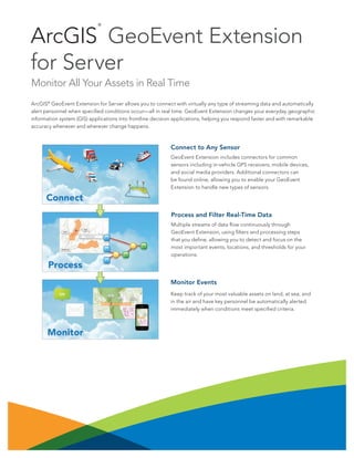
  • 1. ArcGIS ® GeoEvent Extension for Server Monitor All Your Assets in Real Time ArcGIS® GeoEvent Extension for Server allows you to connect with virtually any type of streaming data and automatically alert personnel when specified conditions occur—all in real time. GeoEvent Extension changes your everyday geographic information system (GIS) applications into frontline decision applications, helping you respond faster and with remarkable accuracy whenever and wherever change happens. Monitor Events Keep track of your most valuable assets on land, at sea, and in the air and have key personnel be automatically alerted immediately when conditions meet specified criteria. Process and Filter Real-Time Data Multiple streams of data flow continuously through GeoEvent Extension, using filters and processing steps that you define, allowing you to detect and focus on the most important events, locations, and thresholds for your operations. Connect to Any Sensor GeoEvent Extension includes connectors for common sensors including in-vehicle GPS receivers, mobile devices, and social media providers. Additional connectors can be found online, allowing you to enable your GeoEvent Extension to handle new types of sensors.
  • 2. Key Benefits GeoEvent Extension lets you incorporate real-time information streams with existing GIS data and ArcGIS applications. • Connect sensors to features hosted on ArcGIS SM Online or ArcGIS for Server so they represent the most up-to-date information happening in the real world. • Filter streams using spatial and/or attribute conditions to view only the most important features. • Enrich incoming event information with additional fields joined in from a feature service. • Use existing features as the basis for detecting geofence events. You can even create geofences on the fly without interrupting the stream. • View the latest feature status using any ArcGIS viewer, such as Operations Dashboard for ArcGIS. • Store historical events using feature services. Add Real-Time GIS to Applications GeoEvent Extension can be integrated with critical decision-support tools and applications: • Asset monitoring for fleet management, public transit, railway, aviation, and maritime applications • Route monitoring for facilities management, transportation, and utilities • Tactical monitoring for homeland security, law enforcement, and military applications • Environmental monitoring for resource management and health and safety oversight • Social media monitoring for sales and marketing and business applications Create Custom Connectors Developers can create new connectors using the GeoEvent Software Development Kit (SDK). Deployment on Premises or in the Cloud GeoEvent Extension can be deployed on your local infrastructure, in a virtualized environment, or in the cloud. System Requirements GeoEvent Extension requires ArcGIS for Server—Standard or Advanced. ArcGIS for Server supports the following operating systems: • Microsoft Windows Server • Red Hat Enterprise Linux AS/ES • SUSE Linux Enterprise Server • Ubuntu (when deployed on Amazon Web Services) Your starting point is esri.com/GeoEvent Copyright © 2013 Esri. All rights reserved. Esri, the Esri globe logo, ArcGIS, and esri.com are trademarks, service marks, or registered marks of Esri in the United States, the European Community, or certain other jurisdictions. Other companies and products or services mentioned herein may be trademarks, service marks, or registered marks of their respective mark owners. 142959 ESRI2M8/14kp-ca