SlideShare ist ein Scribd-Unternehmen logo
1 von 9
Downloaden Sie, um offline zu lesen
Re.Sun™ -Validation White Paper, March 2013
page: 1/9
Introduction
Understanding the solar resources in areas where local measurements are scarce or unavailable
is nowadays possible with state-of-the-art mesoscale numerical weather models and public high
quality global weather databases.
Since 2009, MEGAJOULE INOVAÇÃO has
developed and tested an internal methodology
using mesoscale modelling to feed a process
of coupling using broadband Clear Sky models
(ESRA, Ineichen, REST2) and solar radiation
decomposition techniques allowing the
assessment of Solar resources worldwide with
more detail than usual approaches: Re.Sun™.
The Re.Sun™ approach was developed internally and counts with the cooperation of the Physics
research department of Aveiro University for validation and optimization of the mesoscale
parameterisations.
Re.Sun™ - Approach
Re.SunTM
is a code based on coupling techniques developed to ingest results from WRF–Weather
Research and Forecasting mesoscale numerical model. The WRF model is presently used by
numerous institutions across the world, and its versatility permits its use in a variety of
applications. It consists of a series of modules, which allow the simulation of atmospheric
conditions at a large (meso) scale (>1km), as well as assimilation of observed data, through the
solution of several equations that describe the dynamics of the physical phenomena. WRF was
developed by the U.S. National Center for Atmospheric Research (NCAR) as an evolution of the
original MM5. It incorporates the latest scientific developments from the leading research
SSoollaarr MMooddeelllliinngg bbaasseedd oonn CCoouupplliinngg TTeecchhnniiqquueess wwiitthh MMeessoossccaallee SSiimmuullaattiioonnss
Re.Sun™ -Validation White Paper, March 2013
page: 2/9
:: Re.Sun.cfg ::
> n WRF mesh points to incluide (points to interp)
> Transport Radiation model(Global or Indivudual
components of Radiation
> WRF Mesh aod/TL2 Interpolation
> Clear Sky model (ESRA; Ineichen; REST2)
> Decomposition model (20 in total ::DIRINT, BRL,
Skartveit & Olseth, Maxwell, Reindl and others)
:: WRF runs to Re.Sun
=>data inputs :: FNL ; CLC Land Use and SRTM for
topography)
=>set up highlights
(2/3 levels nesting ; 2-ways feedback; same radt for all
nests; RRTM to LW& Dudhia to SW model)
=>output modified (wrfout * tuned, only variables to
use in coupling process; 10 min or others time steps)
WRF runs wr fout_ReSun_d0X_YY-MM-DD_00_00_00.nc
> Tur bidity, Aer osols, Ozone and Nitr ogen
Diox ide Sour ces
:: SODA (Solar Radiation Data)
:: Aer onet (Aer osol Robotic Networ k)
:: MACC Re-analysis (Monitor ing atmospher ic
composition & climate, ECMWF)
:: OMI V2.1 (Nitr ogen Diox ide, NASA/Goddar d
Space Flight Center )
Horizon code
>Topogr aphy gr id
> number of sector s
Hor izon data (*netcdf or
*.hdf5)
centers, and is the result of decades of research. Over the last years, MJ INOVAÇÃO has “tuned”
the WRF configuration for best results in solar assessment.
Precursor mesoscale simulations are performed using WRF to solve all meteorological
interactions, rendering available fields like Short Wave Radiation, Temperature, Vapour Mixe
Ratio and Surface Pressure for posterior use by Re.SunTM
.
Re.SunTM
applies Clear Sky simulations which include current information about aerosols and
atmospheric gases (Ozone and Nitrogen Dioxide, in case of the REST2 model), pressure
correction and orographic horizon effects. From these runs correction factors are estimated,
which are interpolated to the interest points to correcting the local Clear Sky simulations. The
correction factors can be estimated in terms of Solar Global index (Global RadiationWRF / Global
RadiationClear Sky) or Solar Direct and Diffuse indexes, making use, in this case, of a decomposition
model.
A flowchart of the process is presented in the figure below.
The global weather databases for WRF simulations currently available at MJ INOVAÇÃO are: FNL
(Final) Operational Global Analysis from NCEP, ERA-Interim from ECMWF or Reanalysis I and II
from NCEP/NCAR. The domain configuration and model parameterizations are studied for a set
of cases but they can change according to site features.
All WRF simulations make use of SRTM (Shuttle Radar Topography Mission) topography
information. Simulations in the European context use Terrain Cover data from the Corine Land
Cover 2006 programme, outside Europe, terrain cover data from the Global Land Cover
Characteristics Database (USGS, National Center for Earth Resources Observation and Science –
EROS, Joint Research Centre of the European Commission) is used.
Re.Sun™ -Validation White Paper, March 2013
page: 3/9
The aerosols or the TL2 (Linke Turbidity for an air mass equal to 2) can be derived from the
SODA (Solar Radiation Data) programme or from MACC Re-analysis (Monitoring Atmospheric
Composition & Climate) project (ECMWF). MEGAJOULE INOVAÇÃO has processed the two
databases and has created its own database. The SODA project has monthly Worldwide Linke
Turbidity Information already available, which is a result of assembling estimates of TL gathering
different background layers, METEOTEST (Redmund et al. 2003). The MACC Re-analysis project
does not contain TL2 information, but this can be estimated using the aerosols information for
different wavelengths and water column data. To obtain TL2 from MACC information we have
used two formulations: Redmund et al. 2003 and a multivariate fit calculated from beam
irradiance with Solis model and the Kasten pyrheliometric formula (1996).
Depending on the Clear Sky model used, we have different information to characterize the
atmosphere purity. In case of the ESRA model the equations make use of TL2. Simplified version
of Solis model (Ineichen model), use as input the aerosol optical depth information for a
wavelength of 700nm (AOD700).
Independently of the source of the aerosols or TL2, the data are used with a daily frequency.
The monthly values of SODA are interpolated linearly from monthly to daily values and the MACC
average daily values come from the insolation period with three hours of sampling.
Regarding the atmospheric gases, ozone data is obtained from MACC and Nitrogen Dioxide values
from OMI V2.1 programme (NASA/Goddard Space Flight Center).
The REST2 (Reference Evaluation of Solar Transmittance, 2 bands) model is currently in
implementation and its performance will be tested and results published in further editions of
Re.SunTM
White Paper. In a few words, the REST2 is a high performance model to predict
cloudless-sky broadband irradiance, illuminance and photosynthetically active radiation (PAR)
from atmospheric data (Christian A. Gueymard, 2007). REST2 was developed to precisely
account the effect of aerosols, using for that two bands separated at 700nm where band 1
covers the UV and visible ranges (290nm to 700nm) and band 2 covers the near-infrared range
(700nm to 4000nm).
The Re.SunTM
software thus provides a package of data that includes Solar Radiation (Global,
Direct Diffuse on horizontal/tilted plane and Beam) and Meteorological (Temperature, Relative
Humidity at 2m and Wind Speed/Direction at 10m) variables at site/project scale.
Re.Sun™ -Validation White Paper, March 2013
page: 4/9
Diffuse / Global Radiation ratio, (kd),
Complex/Coastal site, Corvo, 06
October 2011, Re.SunTM
Why no Pre-Calculated Solar Data ?
Mesoscale weather numerical modelling is a
complex science and in constant development.
Calculation domain and several model
parameterizations depend on the effects of
prevailing climate and local topography features.
The WRF model is also in continuous development
and constantly tested.
By not making use of pre-calculated solar maps or
series MEGAJOULE INOVAÇÃO ensures that our
Clients get the best modelling options available
for each case and at any given time.
Typical application from Re.Sun™
Typically, Re.SunTM
is best suited for:
• Country, Regional or Urban prospection of Solar Resource;
• Complex terrains (high altitudes and varied soil occupations), sites where the
atmospheric conditions are changing constantly;
• Urban environments where the shadow effects of buildings, aerosols and micro-climates
are features which affect the Solar Resource.
The approach proposed by MEGAJOULE INOVAÇÃO was conceived to gather and model the main
drivers which affect the Solar Resource modelling, performing a more realistic assessment than
usual techniques based on interpolations.
Traditional products are:
• Solar Resource Mapping at Country, Regional or Urban scale (flexible output data – GIS,
Google Earth, etc…);
• Solar Data Series TMY (Typical Meteorological Year) for annual energy estimates;
• Long Term reference solar data (for Long Term extrapolation of local measurements).
The main outputs are:
Global1
, Direct1
, Diffuse (Horizontal1
), Beam2
Radiation, Temperature, Relative Humidity at 2m
and Wind3
speed/direction at 10 m.
1,2,3 - The estimates in tilted planes, Solar Beam Radiation and Wind Speed/Direction are provided at an additional cost.
Re.Sun™ -Validation White Paper, March 2013
page: 5/9
Validation of Simulated Solar Data Series
During 2012 MJ completed its first validation programme for Re.Sun™, the solar coupling code
with mesoscale numerical model WRF, using Global Solar data from 9 locations.
This validation was based in WRF meshes of 5x5 km and 1x1 km
resolution, depending on site complexity. The weather input used
was the NCEP FNL (Final) Operation Global Analysis data set.
The simulated data was compared against local measurements for
9 complex sites, due to their challenging orogrophic and/or
atmospheric conditions, located in Portugal. One in continental
Portugal, in urban context, one in the Azores archipelago in Corvo
Island under the influence of the well-known Azores anticyclone
weather pattern. The remaining sites, 7, are located in Madeira
Island.
The climate throughout the year in Madeira is also directly
influenced by the Azores anticyclone weather pattern. Due the
privileged geographical location and east to west orientation the
island can be split in two climatic regions, the south, warm
subtropical, and the north, humid temperate. The two climatic
regions combine to produce an exceptionally mild climate, with an
overall average temperature of 22°C in the summer and 16°C in
the winter, along with a moderate level of humidity. The island
has many micro climates due to its extreme complex orography.
The local measurements in Corvo and Sintra were
carried out by MEGAJOULE and all measurements
in Madeira were courtesy of LREC (LaboratĂłrio
Regional de Engenharia Civil).
The test sites vary from flat to very complex,
coastal (< 10 km to shoreline) to inland and also
urban to rural environment. This set of tests contains all the main drivers in the context of solar
modelling. In the urban environment aerosols play an important role on the attenuation of
radiation, and the shadowing effects from neighbour buildings are crucial. The orographic
complexity is also present which normally leads to added shadowing effects, always considered
in Re.SunTM
simulations, as well as contributions from fog and cloud formation due to increased
humidity on the slopes not exposed to direct radiation.
Sintra
Corvo
Re.Sun™ -Validation White Paper, March 2013
page: 6/9
Example of mean Daily values of Global
Radiation Complex/Coastal site, Corvo
October 2011, Re.SunTM
(Orange),
Measured (Green)
Example of 10 minutes correlation of
Global Radiation Complex/Coastal site,
Corvo October 2011, Re.SunTM
Example of Cumulative Density Function
(CDF) of Global Radiation, sampling 10
minutes, Complex/Coastal site, Corvo,
October 2011, Re.SunTM
(Orange),
Measured (Green)
Results showed (table 1) a relative RMS error (Root Mean Square) of 4.00 % and a relative MB
error (Mean Bias) of 0.64 %.
The cumulative distribution of results (table 2) showed that for 80 % of cases, average Annual
Global Solar Radiation (in horizontal plane) was below 4.14 % and below 2.77 % for 50 % of
cases.
5 10 15 20 25 30
0
50
100
150
200
250
Day
Irradiance[W/m
2
]
Modelled
Measured
0 100 200 300 400 500 600 700 800
0
100
200
300
400
500
600
700
800
Measured [W/m2
]
Modelled[W/m
2
]
0 100 200 300 400 500 600 700 800
0
0.1
0.2
0.3
0.4
0.5
0.6
0.7
0.8
0.9
1
Irradiance [W/m2
]
CDF
Modelled
Measured
Day
06
Day
17
Re.Sun™ -Validation White Paper, March 2013
page: 7/9
(Mapping of Mean Daily Global Radiation
based on time step of 10 minutes, 06
October 2011, Re.SunTM
(Mapping of Mean Daily Global Radiation
based on time step of 10 minutes, 17
October 2011, Re.SunTM
Table 1
Global statistics for Annual Average Solar Global Radiation comparison
rMB (%) rRMS(%) rSTD(%)
0.64 4.00 4.19
Table 2
Maximum relative Mean Absolute BIAS (rMAB) for different frequency levels
Frequency [%] Maximum rMAB (%)
50% 2.77
80% 4.14
90% 5.94
Re.Sun™ -Validation White Paper, March 2013
page: 8/9
Conclusions
The statistics above show the usefulness of Re.Sun™ code for: solar applications in Thermal
and Photovoltaic, solar series for energy building simulations and analysis of solar potential
at urban scale.
An 80 % probability was found that real average Annual Global Solar Radiation (in horizontal
plane) will be within an interval +/- 4.14 % of the simulated value and within +/-2.77 % for a
probability of 50%.
The complexity of the sites involved in the validation process included the main drivers in the
solar modelling context, rendering the worldwide application of this methodology more reliable.
Further releases of this White Paper will integrate: i) a new validation set based on WRF weather
dataset input ERA-Interim; ii) validation results of one year of energy production simulated
against real energy production for a PV central of 1MWp; iii) validation of Global, Beam and
Diffuse Radiation using stations from the SURFRAD network.
Further Info.:
www.megajoule.pt
www.facebook.com/MEGAJOULE
www.youtube.com/MEGAJOULEConsultants
www.linkedin.com/MEGAJOULE
www.twitter.com/MEGAJOULE
megajoule.inov@megajoule.pt
Re.Sun™ -Validation White Paper, March 2013
page: 9/9
Annex - List of sample sites
ID Complexity
Elevation
[m]
Data
Period
Data Recovery Rate
[%]
Sampling rMB R
1 Complex / Coastal / Rural 390 Oc11 - Sp12 78% 10min 1.7% 0.94
2 Complex / Coastal /Rural 675 Ja11-Dc11 98% 1hour -0.1% 0.95
3 Complex / Inland / Rural 1622 Ja11-Dc11 100% 1hour -3.0% 0.99
4 Complex / Inland / Rural 1017 Ja11-Dc11 99% 1hour -2.3% 0.97
5 Complex / Coastal / Rural 1020 Ja11-Dc11 90% 1hour 9.0% 0.98
6 Complex / Inland / Urban 260 Ja11-Dc11 100% 1hour -5.2% 0.94
7 Complex / Inland / Rural 1215 Ja11-Dc11 94% 1hour 2.8% 0.98
8 Complex / Inland / Rural 874 Ja11-Dc11 92% 1hour -0.5% 0.95
9 Flat / Inland / Urban 188 Ja11-Dc11 100% 1hour 3.4% 0.99

Weitere ähnliche Inhalte

Was ist angesagt?

Karakterisasi Letusan Merapi menggunakan Data SAR (Synthetic Aperture Radar)
Karakterisasi Letusan Merapi menggunakan Data SAR (Synthetic Aperture Radar)Karakterisasi Letusan Merapi menggunakan Data SAR (Synthetic Aperture Radar)
Karakterisasi Letusan Merapi menggunakan Data SAR (Synthetic Aperture Radar)Achmad Darul
 
MPE data validation
MPE data validationMPE data validation
MPE data validationhojjatseyyedi
 
IGARSS11_HongboSu_ver3.ppt
IGARSS11_HongboSu_ver3.pptIGARSS11_HongboSu_ver3.ppt
IGARSS11_HongboSu_ver3.pptgrssieee
 
Time integration of evapotranspiration using a two source surface energy bala...
Time integration of evapotranspiration using a two source surface energy bala...Time integration of evapotranspiration using a two source surface energy bala...
Time integration of evapotranspiration using a two source surface energy bala...Ramesh Dhungel
 
SPIE_Newsroom_Dubovik_et_al_2014
SPIE_Newsroom_Dubovik_et_al_2014SPIE_Newsroom_Dubovik_et_al_2014
SPIE_Newsroom_Dubovik_et_al_2014Oleg Dubovik
 
Coulter_JPL_Poster_Final
Coulter_JPL_Poster_FinalCoulter_JPL_Poster_Final
Coulter_JPL_Poster_FinalDave Coulter
 
Estimation of global solar radiation by using machine learning methods
Estimation of global solar radiation by using machine learning methodsEstimation of global solar radiation by using machine learning methods
Estimation of global solar radiation by using machine learning methodsmehmet şahin
 
HYPERSPECTRAL RS IN MINERAL MAPPING
HYPERSPECTRAL RS IN MINERAL MAPPINGHYPERSPECTRAL RS IN MINERAL MAPPING
HYPERSPECTRAL RS IN MINERAL MAPPINGAbhiram Kanigolla
 
Irsolav Methodology 2013
Irsolav Methodology 2013Irsolav Methodology 2013
Irsolav Methodology 2013IrSOLaV Pomares
 
Geothermal exploration using remote sensing techniques
Geothermal exploration using remote sensing techniquesGeothermal exploration using remote sensing techniques
Geothermal exploration using remote sensing techniquesSepideh Abadpour
 
meteodynWT meso coupling downscaling regional planing
meteodynWT meso coupling downscaling regional planingmeteodynWT meso coupling downscaling regional planing
meteodynWT meso coupling downscaling regional planingJean-Claude Meteodyn
 
TU2.L10 - NEXT-GENERATION GLOBAL PRECIPITATION PRODUCTS AND THEIR APPLICATIONS
TU2.L10 - NEXT-GENERATION GLOBAL PRECIPITATION PRODUCTS AND THEIR APPLICATIONSTU2.L10 - NEXT-GENERATION GLOBAL PRECIPITATION PRODUCTS AND THEIR APPLICATIONS
TU2.L10 - NEXT-GENERATION GLOBAL PRECIPITATION PRODUCTS AND THEIR APPLICATIONSgrssieee
 

Was ist angesagt? (14)

Karakterisasi Letusan Merapi menggunakan Data SAR (Synthetic Aperture Radar)
Karakterisasi Letusan Merapi menggunakan Data SAR (Synthetic Aperture Radar)Karakterisasi Letusan Merapi menggunakan Data SAR (Synthetic Aperture Radar)
Karakterisasi Letusan Merapi menggunakan Data SAR (Synthetic Aperture Radar)
 
MPE data validation
MPE data validationMPE data validation
MPE data validation
 
IGARSS11_HongboSu_ver3.ppt
IGARSS11_HongboSu_ver3.pptIGARSS11_HongboSu_ver3.ppt
IGARSS11_HongboSu_ver3.ppt
 
Time integration of evapotranspiration using a two source surface energy bala...
Time integration of evapotranspiration using a two source surface energy bala...Time integration of evapotranspiration using a two source surface energy bala...
Time integration of evapotranspiration using a two source surface energy bala...
 
CLIM: Transition Workshop - Optimization Methods in Remote Sensing - Jessica...
CLIM: Transition Workshop - Optimization Methods in Remote Sensing  - Jessica...CLIM: Transition Workshop - Optimization Methods in Remote Sensing  - Jessica...
CLIM: Transition Workshop - Optimization Methods in Remote Sensing - Jessica...
 
SPIE_Newsroom_Dubovik_et_al_2014
SPIE_Newsroom_Dubovik_et_al_2014SPIE_Newsroom_Dubovik_et_al_2014
SPIE_Newsroom_Dubovik_et_al_2014
 
Coulter_JPL_Poster_Final
Coulter_JPL_Poster_FinalCoulter_JPL_Poster_Final
Coulter_JPL_Poster_Final
 
Estimation of global solar radiation by using machine learning methods
Estimation of global solar radiation by using machine learning methodsEstimation of global solar radiation by using machine learning methods
Estimation of global solar radiation by using machine learning methods
 
Climate Modelling for Ireland -Dr Ray McGrath, Met Eireann
Climate Modelling for Ireland -Dr Ray McGrath, Met EireannClimate Modelling for Ireland -Dr Ray McGrath, Met Eireann
Climate Modelling for Ireland -Dr Ray McGrath, Met Eireann
 
HYPERSPECTRAL RS IN MINERAL MAPPING
HYPERSPECTRAL RS IN MINERAL MAPPINGHYPERSPECTRAL RS IN MINERAL MAPPING
HYPERSPECTRAL RS IN MINERAL MAPPING
 
Irsolav Methodology 2013
Irsolav Methodology 2013Irsolav Methodology 2013
Irsolav Methodology 2013
 
Geothermal exploration using remote sensing techniques
Geothermal exploration using remote sensing techniquesGeothermal exploration using remote sensing techniques
Geothermal exploration using remote sensing techniques
 
meteodynWT meso coupling downscaling regional planing
meteodynWT meso coupling downscaling regional planingmeteodynWT meso coupling downscaling regional planing
meteodynWT meso coupling downscaling regional planing
 
TU2.L10 - NEXT-GENERATION GLOBAL PRECIPITATION PRODUCTS AND THEIR APPLICATIONS
TU2.L10 - NEXT-GENERATION GLOBAL PRECIPITATION PRODUCTS AND THEIR APPLICATIONSTU2.L10 - NEXT-GENERATION GLOBAL PRECIPITATION PRODUCTS AND THEIR APPLICATIONS
TU2.L10 - NEXT-GENERATION GLOBAL PRECIPITATION PRODUCTS AND THEIR APPLICATIONS
 

Andere mochten auch

Uncertainty for solar products assessment and benchmarking
Uncertainty for solar products assessment and benchmarkingUncertainty for solar products assessment and benchmarking
Uncertainty for solar products assessment and benchmarkingIrSOLaV Pomares
 
Annual Energy Production Estimates Validation of Wind Farms (March 2012)
Annual Energy Production Estimates Validation of Wind Farms (March 2012)Annual Energy Production Estimates Validation of Wind Farms (March 2012)
Annual Energy Production Estimates Validation of Wind Farms (March 2012)Carlos Pinto
 
Solar Resource Assessment, Dealing with the uncertainty
Solar Resource Assessment, Dealing with the uncertaintySolar Resource Assessment, Dealing with the uncertainty
Solar Resource Assessment, Dealing with the uncertaintyCarlos Pinto
 
WindSight Validation (March 2011)
WindSight Validation (March 2011)WindSight Validation (March 2011)
WindSight Validation (March 2011)Carlos Pinto
 
Data requirements
Data requirementsData requirements
Data requirementsRCREEE
 

Andere mochten auch (8)

Uncertainty for solar products assessment and benchmarking
Uncertainty for solar products assessment and benchmarkingUncertainty for solar products assessment and benchmarking
Uncertainty for solar products assessment and benchmarking
 
Annual Energy Production Estimates Validation of Wind Farms (March 2012)
Annual Energy Production Estimates Validation of Wind Farms (March 2012)Annual Energy Production Estimates Validation of Wind Farms (March 2012)
Annual Energy Production Estimates Validation of Wind Farms (March 2012)
 
Solar Resource Assessment, Dealing with the uncertainty
Solar Resource Assessment, Dealing with the uncertaintySolar Resource Assessment, Dealing with the uncertainty
Solar Resource Assessment, Dealing with the uncertainty
 
WindSight Validation (March 2011)
WindSight Validation (March 2011)WindSight Validation (March 2011)
WindSight Validation (March 2011)
 
Data requirements
Data requirementsData requirements
Data requirements
 
Dissecting the Differences Between Pyranometer and Reference Cell Irradiance ...
Dissecting the Differences Between Pyranometer and Reference Cell Irradiance ...Dissecting the Differences Between Pyranometer and Reference Cell Irradiance ...
Dissecting the Differences Between Pyranometer and Reference Cell Irradiance ...
 
Uncertainty of the Solargis solar radiation database
Uncertainty of the Solargis solar radiation databaseUncertainty of the Solargis solar radiation database
Uncertainty of the Solargis solar radiation database
 
Exploring Sources of Uncertainties in Solar Resource Measurements
Exploring Sources of Uncertainties in Solar Resource MeasurementsExploring Sources of Uncertainties in Solar Resource Measurements
Exploring Sources of Uncertainties in Solar Resource Measurements
 

Ähnlich wie RE.SUN Validation (March 2013)

Use of mesoscale modeling to increase the reliability of wind resource assess...
Use of mesoscale modeling to increase the reliability of wind resource assess...Use of mesoscale modeling to increase the reliability of wind resource assess...
Use of mesoscale modeling to increase the reliability of wind resource assess...Jean-Claude Meteodyn
 
Longwave radiation
Longwave radiationLongwave radiation
Longwave radiationRiccardo Rigon
 
2 ShengleiZhang_IGARSS2011_MO3.T04.2.ppt
2 ShengleiZhang_IGARSS2011_MO3.T04.2.ppt2 ShengleiZhang_IGARSS2011_MO3.T04.2.ppt
2 ShengleiZhang_IGARSS2011_MO3.T04.2.pptgrssieee
 
2 ShengleiZhang_IGARSS2011_MO3.T04.2.ppt
2 ShengleiZhang_IGARSS2011_MO3.T04.2.ppt2 ShengleiZhang_IGARSS2011_MO3.T04.2.ppt
2 ShengleiZhang_IGARSS2011_MO3.T04.2.pptgrssieee
 
2 ShengleiZhang_IGARSS2011_MO3.T04.2.ppt
2 ShengleiZhang_IGARSS2011_MO3.T04.2.ppt2 ShengleiZhang_IGARSS2011_MO3.T04.2.ppt
2 ShengleiZhang_IGARSS2011_MO3.T04.2.pptgrssieee
 
2 ShengleiZhang_IGARSS2011_MO3.T04.2.ppt
2 ShengleiZhang_IGARSS2011_MO3.T04.2.ppt2 ShengleiZhang_IGARSS2011_MO3.T04.2.ppt
2 ShengleiZhang_IGARSS2011_MO3.T04.2.pptgrssieee
 
2 ShengleiZhang_IGARSS2011_MO3.T04.2.ppt
2 ShengleiZhang_IGARSS2011_MO3.T04.2.ppt2 ShengleiZhang_IGARSS2011_MO3.T04.2.ppt
2 ShengleiZhang_IGARSS2011_MO3.T04.2.pptgrssieee
 
2 ShengleiZhang_IGARSS2011_MO3.T04.2.ppt
2 ShengleiZhang_IGARSS2011_MO3.T04.2.ppt2 ShengleiZhang_IGARSS2011_MO3.T04.2.ppt
2 ShengleiZhang_IGARSS2011_MO3.T04.2.pptgrssieee
 
2 ShengleiZhang_IGARSS2011_MO3.T04.2.ppt
2 ShengleiZhang_IGARSS2011_MO3.T04.2.ppt2 ShengleiZhang_IGARSS2011_MO3.T04.2.ppt
2 ShengleiZhang_IGARSS2011_MO3.T04.2.pptgrssieee
 
Estimation of diffuse solar radiation in the south of cameroon
Estimation of diffuse solar radiation in the south of cameroonEstimation of diffuse solar radiation in the south of cameroon
Estimation of diffuse solar radiation in the south of cameroonAlexander Decker
 
NPOESSPreparatoryProjectValidationPlansfortheOzoneMappingandProfilerSuite.ppt
NPOESSPreparatoryProjectValidationPlansfortheOzoneMappingandProfilerSuite.pptNPOESSPreparatoryProjectValidationPlansfortheOzoneMappingandProfilerSuite.ppt
NPOESSPreparatoryProjectValidationPlansfortheOzoneMappingandProfilerSuite.pptgrssieee
 
Wandera_et_al_HESS_2017
Wandera_et_al_HESS_2017Wandera_et_al_HESS_2017
Wandera_et_al_HESS_2017Kaniska Mallick
 
Forecasting long term global solar radiation with an ann algorithm
Forecasting long term global solar radiation with an ann algorithmForecasting long term global solar radiation with an ann algorithm
Forecasting long term global solar radiation with an ann algorithmmehmet şahin
 
AUTOMATIC IDENTIFICATION OF CLOUD COVER REGIONS USING SURF
AUTOMATIC IDENTIFICATION OF CLOUD COVER REGIONS USING SURF AUTOMATIC IDENTIFICATION OF CLOUD COVER REGIONS USING SURF
AUTOMATIC IDENTIFICATION OF CLOUD COVER REGIONS USING SURF ijcseit
 
CIRED Paper 1414 - Evaluation of the level of prediction errors
CIRED Paper 1414 - Evaluation of the level of prediction errorsCIRED Paper 1414 - Evaluation of the level of prediction errors
CIRED Paper 1414 - Evaluation of the level of prediction errorsLoĂŻc LE GARS
 
A Land Data Assimilation System Utilizing Low Frequency Passive Microwave Rem...
A Land Data Assimilation System Utilizing Low Frequency Passive Microwave Rem...A Land Data Assimilation System Utilizing Low Frequency Passive Microwave Rem...
A Land Data Assimilation System Utilizing Low Frequency Passive Microwave Rem...drboon
 
Future guidelines on solar forecasting the research view - David Pozo (Univer...
Future guidelines on solar forecasting the research view - David Pozo (Univer...Future guidelines on solar forecasting the research view - David Pozo (Univer...
Future guidelines on solar forecasting the research view - David Pozo (Univer...IrSOLaV Pomares
 
Narayan Shrestha [ACCURACY OF X-BAND LOCAL AREA WEATHER RADAR (LAWR) OF LEUVE...
Narayan Shrestha [ACCURACY OF X-BAND LOCAL AREA WEATHER RADAR (LAWR) OF LEUVE...Narayan Shrestha [ACCURACY OF X-BAND LOCAL AREA WEATHER RADAR (LAWR) OF LEUVE...
Narayan Shrestha [ACCURACY OF X-BAND LOCAL AREA WEATHER RADAR (LAWR) OF LEUVE...Narayan Shrestha
 

Ähnlich wie RE.SUN Validation (March 2013) (20)

Ijciet 10 01_152
Ijciet 10 01_152Ijciet 10 01_152
Ijciet 10 01_152
 
Use of mesoscale modeling to increase the reliability of wind resource assess...
Use of mesoscale modeling to increase the reliability of wind resource assess...Use of mesoscale modeling to increase the reliability of wind resource assess...
Use of mesoscale modeling to increase the reliability of wind resource assess...
 
Longwave radiation
Longwave radiationLongwave radiation
Longwave radiation
 
2 ShengleiZhang_IGARSS2011_MO3.T04.2.ppt
2 ShengleiZhang_IGARSS2011_MO3.T04.2.ppt2 ShengleiZhang_IGARSS2011_MO3.T04.2.ppt
2 ShengleiZhang_IGARSS2011_MO3.T04.2.ppt
 
2 ShengleiZhang_IGARSS2011_MO3.T04.2.ppt
2 ShengleiZhang_IGARSS2011_MO3.T04.2.ppt2 ShengleiZhang_IGARSS2011_MO3.T04.2.ppt
2 ShengleiZhang_IGARSS2011_MO3.T04.2.ppt
 
2 ShengleiZhang_IGARSS2011_MO3.T04.2.ppt
2 ShengleiZhang_IGARSS2011_MO3.T04.2.ppt2 ShengleiZhang_IGARSS2011_MO3.T04.2.ppt
2 ShengleiZhang_IGARSS2011_MO3.T04.2.ppt
 
2 ShengleiZhang_IGARSS2011_MO3.T04.2.ppt
2 ShengleiZhang_IGARSS2011_MO3.T04.2.ppt2 ShengleiZhang_IGARSS2011_MO3.T04.2.ppt
2 ShengleiZhang_IGARSS2011_MO3.T04.2.ppt
 
2 ShengleiZhang_IGARSS2011_MO3.T04.2.ppt
2 ShengleiZhang_IGARSS2011_MO3.T04.2.ppt2 ShengleiZhang_IGARSS2011_MO3.T04.2.ppt
2 ShengleiZhang_IGARSS2011_MO3.T04.2.ppt
 
2 ShengleiZhang_IGARSS2011_MO3.T04.2.ppt
2 ShengleiZhang_IGARSS2011_MO3.T04.2.ppt2 ShengleiZhang_IGARSS2011_MO3.T04.2.ppt
2 ShengleiZhang_IGARSS2011_MO3.T04.2.ppt
 
2 ShengleiZhang_IGARSS2011_MO3.T04.2.ppt
2 ShengleiZhang_IGARSS2011_MO3.T04.2.ppt2 ShengleiZhang_IGARSS2011_MO3.T04.2.ppt
2 ShengleiZhang_IGARSS2011_MO3.T04.2.ppt
 
Estimation of diffuse solar radiation in the south of cameroon
Estimation of diffuse solar radiation in the south of cameroonEstimation of diffuse solar radiation in the south of cameroon
Estimation of diffuse solar radiation in the south of cameroon
 
NPOESSPreparatoryProjectValidationPlansfortheOzoneMappingandProfilerSuite.ppt
NPOESSPreparatoryProjectValidationPlansfortheOzoneMappingandProfilerSuite.pptNPOESSPreparatoryProjectValidationPlansfortheOzoneMappingandProfilerSuite.ppt
NPOESSPreparatoryProjectValidationPlansfortheOzoneMappingandProfilerSuite.ppt
 
Wandera_et_al_HESS_2017
Wandera_et_al_HESS_2017Wandera_et_al_HESS_2017
Wandera_et_al_HESS_2017
 
Forecasting long term global solar radiation with an ann algorithm
Forecasting long term global solar radiation with an ann algorithmForecasting long term global solar radiation with an ann algorithm
Forecasting long term global solar radiation with an ann algorithm
 
AUTOMATIC IDENTIFICATION OF CLOUD COVER REGIONS USING SURF
AUTOMATIC IDENTIFICATION OF CLOUD COVER REGIONS USING SURF AUTOMATIC IDENTIFICATION OF CLOUD COVER REGIONS USING SURF
AUTOMATIC IDENTIFICATION OF CLOUD COVER REGIONS USING SURF
 
CIRED Paper 1414 - Evaluation of the level of prediction errors
CIRED Paper 1414 - Evaluation of the level of prediction errorsCIRED Paper 1414 - Evaluation of the level of prediction errors
CIRED Paper 1414 - Evaluation of the level of prediction errors
 
Irsolav catalogue
Irsolav catalogueIrsolav catalogue
Irsolav catalogue
 
A Land Data Assimilation System Utilizing Low Frequency Passive Microwave Rem...
A Land Data Assimilation System Utilizing Low Frequency Passive Microwave Rem...A Land Data Assimilation System Utilizing Low Frequency Passive Microwave Rem...
A Land Data Assimilation System Utilizing Low Frequency Passive Microwave Rem...
 
Future guidelines on solar forecasting the research view - David Pozo (Univer...
Future guidelines on solar forecasting the research view - David Pozo (Univer...Future guidelines on solar forecasting the research view - David Pozo (Univer...
Future guidelines on solar forecasting the research view - David Pozo (Univer...
 
Narayan Shrestha [ACCURACY OF X-BAND LOCAL AREA WEATHER RADAR (LAWR) OF LEUVE...
Narayan Shrestha [ACCURACY OF X-BAND LOCAL AREA WEATHER RADAR (LAWR) OF LEUVE...Narayan Shrestha [ACCURACY OF X-BAND LOCAL AREA WEATHER RADAR (LAWR) OF LEUVE...
Narayan Shrestha [ACCURACY OF X-BAND LOCAL AREA WEATHER RADAR (LAWR) OF LEUVE...
 

KĂźrzlich hochgeladen

🐬 The future of MySQL is Postgres 🐘
🐬  The future of MySQL is Postgres   🐘🐬  The future of MySQL is Postgres   🐘
🐬 The future of MySQL is Postgres 🐘RTylerCroy
 
Artificial Intelligence Chap.5 : Uncertainty
Artificial Intelligence Chap.5 : UncertaintyArtificial Intelligence Chap.5 : Uncertainty
Artificial Intelligence Chap.5 : UncertaintyKhushali Kathiriya
 
Workshop - Best of Both Worlds_ Combine KG and Vector search for enhanced R...
Workshop - Best of Both Worlds_ Combine  KG and Vector search for  enhanced R...Workshop - Best of Both Worlds_ Combine  KG and Vector search for  enhanced R...
Workshop - Best of Both Worlds_ Combine KG and Vector search for enhanced R...Neo4j
 
Top 10 Most Downloaded Games on Play Store in 2024
Top 10 Most Downloaded Games on Play Store in 2024Top 10 Most Downloaded Games on Play Store in 2024
Top 10 Most Downloaded Games on Play Store in 2024SynarionITSolutions
 
Powerful Google developer tools for immediate impact! (2023-24 C)
Powerful Google developer tools for immediate impact! (2023-24 C)Powerful Google developer tools for immediate impact! (2023-24 C)
Powerful Google developer tools for immediate impact! (2023-24 C)wesley chun
 
Top 5 Benefits OF Using Muvi Live Paywall For Live Streams
Top 5 Benefits OF Using Muvi Live Paywall For Live StreamsTop 5 Benefits OF Using Muvi Live Paywall For Live Streams
Top 5 Benefits OF Using Muvi Live Paywall For Live StreamsRoshan Dwivedi
 
Understanding Discord NSFW Servers A Guide for Responsible Users.pdf
Understanding Discord NSFW Servers A Guide for Responsible Users.pdfUnderstanding Discord NSFW Servers A Guide for Responsible Users.pdf
Understanding Discord NSFW Servers A Guide for Responsible Users.pdfUK Journal
 
From Event to Action: Accelerate Your Decision Making with Real-Time Automation
From Event to Action: Accelerate Your Decision Making with Real-Time AutomationFrom Event to Action: Accelerate Your Decision Making with Real-Time Automation
From Event to Action: Accelerate Your Decision Making with Real-Time AutomationSafe Software
 
Exploring the Future Potential of AI-Enabled Smartphone Processors
Exploring the Future Potential of AI-Enabled Smartphone ProcessorsExploring the Future Potential of AI-Enabled Smartphone Processors
Exploring the Future Potential of AI-Enabled Smartphone Processorsdebabhi2
 
Manulife - Insurer Innovation Award 2024
Manulife - Insurer Innovation Award 2024Manulife - Insurer Innovation Award 2024
Manulife - Insurer Innovation Award 2024The Digital Insurer
 
GenAI Risks & Security Meetup 01052024.pdf
GenAI Risks & Security Meetup 01052024.pdfGenAI Risks & Security Meetup 01052024.pdf
GenAI Risks & Security Meetup 01052024.pdflior mazor
 
Artificial Intelligence: Facts and Myths
Artificial Intelligence: Facts and MythsArtificial Intelligence: Facts and Myths
Artificial Intelligence: Facts and MythsJoaquim Jorge
 
TrustArc Webinar - Stay Ahead of US State Data Privacy Law Developments
TrustArc Webinar - Stay Ahead of US State Data Privacy Law DevelopmentsTrustArc Webinar - Stay Ahead of US State Data Privacy Law Developments
TrustArc Webinar - Stay Ahead of US State Data Privacy Law DevelopmentsTrustArc
 
Connector Corner: Accelerate revenue generation using UiPath API-centric busi...
Connector Corner: Accelerate revenue generation using UiPath API-centric busi...Connector Corner: Accelerate revenue generation using UiPath API-centric busi...
Connector Corner: Accelerate revenue generation using UiPath API-centric busi...DianaGray10
 
presentation ICT roal in 21st century education
presentation ICT roal in 21st century educationpresentation ICT roal in 21st century education
presentation ICT roal in 21st century educationjfdjdjcjdnsjd
 
TrustArc Webinar - Unlock the Power of AI-Driven Data Discovery
TrustArc Webinar - Unlock the Power of AI-Driven Data DiscoveryTrustArc Webinar - Unlock the Power of AI-Driven Data Discovery
TrustArc Webinar - Unlock the Power of AI-Driven Data DiscoveryTrustArc
 
Why Teams call analytics are critical to your entire business
Why Teams call analytics are critical to your entire businessWhy Teams call analytics are critical to your entire business
Why Teams call analytics are critical to your entire businesspanagenda
 
Mastering MySQL Database Architecture: Deep Dive into MySQL Shell and MySQL R...
Mastering MySQL Database Architecture: Deep Dive into MySQL Shell and MySQL R...Mastering MySQL Database Architecture: Deep Dive into MySQL Shell and MySQL R...
Mastering MySQL Database Architecture: Deep Dive into MySQL Shell and MySQL R...Miguel AraĂşjo
 
2024: Domino Containers - The Next Step. News from the Domino Container commu...
2024: Domino Containers - The Next Step. News from the Domino Container commu...2024: Domino Containers - The Next Step. News from the Domino Container commu...
2024: Domino Containers - The Next Step. News from the Domino Container commu...Martijn de Jong
 

KĂźrzlich hochgeladen (20)

🐬 The future of MySQL is Postgres 🐘
🐬  The future of MySQL is Postgres   🐘🐬  The future of MySQL is Postgres   🐘
🐬 The future of MySQL is Postgres 🐘
 
Artificial Intelligence Chap.5 : Uncertainty
Artificial Intelligence Chap.5 : UncertaintyArtificial Intelligence Chap.5 : Uncertainty
Artificial Intelligence Chap.5 : Uncertainty
 
Workshop - Best of Both Worlds_ Combine KG and Vector search for enhanced R...
Workshop - Best of Both Worlds_ Combine  KG and Vector search for  enhanced R...Workshop - Best of Both Worlds_ Combine  KG and Vector search for  enhanced R...
Workshop - Best of Both Worlds_ Combine KG and Vector search for enhanced R...
 
Top 10 Most Downloaded Games on Play Store in 2024
Top 10 Most Downloaded Games on Play Store in 2024Top 10 Most Downloaded Games on Play Store in 2024
Top 10 Most Downloaded Games on Play Store in 2024
 
Powerful Google developer tools for immediate impact! (2023-24 C)
Powerful Google developer tools for immediate impact! (2023-24 C)Powerful Google developer tools for immediate impact! (2023-24 C)
Powerful Google developer tools for immediate impact! (2023-24 C)
 
Top 5 Benefits OF Using Muvi Live Paywall For Live Streams
Top 5 Benefits OF Using Muvi Live Paywall For Live StreamsTop 5 Benefits OF Using Muvi Live Paywall For Live Streams
Top 5 Benefits OF Using Muvi Live Paywall For Live Streams
 
Understanding Discord NSFW Servers A Guide for Responsible Users.pdf
Understanding Discord NSFW Servers A Guide for Responsible Users.pdfUnderstanding Discord NSFW Servers A Guide for Responsible Users.pdf
Understanding Discord NSFW Servers A Guide for Responsible Users.pdf
 
From Event to Action: Accelerate Your Decision Making with Real-Time Automation
From Event to Action: Accelerate Your Decision Making with Real-Time AutomationFrom Event to Action: Accelerate Your Decision Making with Real-Time Automation
From Event to Action: Accelerate Your Decision Making with Real-Time Automation
 
Exploring the Future Potential of AI-Enabled Smartphone Processors
Exploring the Future Potential of AI-Enabled Smartphone ProcessorsExploring the Future Potential of AI-Enabled Smartphone Processors
Exploring the Future Potential of AI-Enabled Smartphone Processors
 
Manulife - Insurer Innovation Award 2024
Manulife - Insurer Innovation Award 2024Manulife - Insurer Innovation Award 2024
Manulife - Insurer Innovation Award 2024
 
GenAI Risks & Security Meetup 01052024.pdf
GenAI Risks & Security Meetup 01052024.pdfGenAI Risks & Security Meetup 01052024.pdf
GenAI Risks & Security Meetup 01052024.pdf
 
Artificial Intelligence: Facts and Myths
Artificial Intelligence: Facts and MythsArtificial Intelligence: Facts and Myths
Artificial Intelligence: Facts and Myths
 
TrustArc Webinar - Stay Ahead of US State Data Privacy Law Developments
TrustArc Webinar - Stay Ahead of US State Data Privacy Law DevelopmentsTrustArc Webinar - Stay Ahead of US State Data Privacy Law Developments
TrustArc Webinar - Stay Ahead of US State Data Privacy Law Developments
 
Connector Corner: Accelerate revenue generation using UiPath API-centric busi...
Connector Corner: Accelerate revenue generation using UiPath API-centric busi...Connector Corner: Accelerate revenue generation using UiPath API-centric busi...
Connector Corner: Accelerate revenue generation using UiPath API-centric busi...
 
presentation ICT roal in 21st century education
presentation ICT roal in 21st century educationpresentation ICT roal in 21st century education
presentation ICT roal in 21st century education
 
TrustArc Webinar - Unlock the Power of AI-Driven Data Discovery
TrustArc Webinar - Unlock the Power of AI-Driven Data DiscoveryTrustArc Webinar - Unlock the Power of AI-Driven Data Discovery
TrustArc Webinar - Unlock the Power of AI-Driven Data Discovery
 
+971581248768>> SAFE AND ORIGINAL ABORTION PILLS FOR SALE IN DUBAI AND ABUDHA...
+971581248768>> SAFE AND ORIGINAL ABORTION PILLS FOR SALE IN DUBAI AND ABUDHA...+971581248768>> SAFE AND ORIGINAL ABORTION PILLS FOR SALE IN DUBAI AND ABUDHA...
+971581248768>> SAFE AND ORIGINAL ABORTION PILLS FOR SALE IN DUBAI AND ABUDHA...
 
Why Teams call analytics are critical to your entire business
Why Teams call analytics are critical to your entire businessWhy Teams call analytics are critical to your entire business
Why Teams call analytics are critical to your entire business
 
Mastering MySQL Database Architecture: Deep Dive into MySQL Shell and MySQL R...
Mastering MySQL Database Architecture: Deep Dive into MySQL Shell and MySQL R...Mastering MySQL Database Architecture: Deep Dive into MySQL Shell and MySQL R...
Mastering MySQL Database Architecture: Deep Dive into MySQL Shell and MySQL R...
 
2024: Domino Containers - The Next Step. News from the Domino Container commu...
2024: Domino Containers - The Next Step. News from the Domino Container commu...2024: Domino Containers - The Next Step. News from the Domino Container commu...
2024: Domino Containers - The Next Step. News from the Domino Container commu...
 

RE.SUN Validation (March 2013)

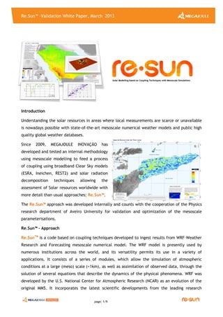
  • 1. Re.Sun™ -Validation White Paper, March 2013 page: 1/9 Introduction Understanding the solar resources in areas where local measurements are scarce or unavailable is nowadays possible with state-of-the-art mesoscale numerical weather models and public high quality global weather databases. Since 2009, MEGAJOULE INOVAÇÃO has developed and tested an internal methodology using mesoscale modelling to feed a process of coupling using broadband Clear Sky models (ESRA, Ineichen, REST2) and solar radiation decomposition techniques allowing the assessment of Solar resources worldwide with more detail than usual approaches: Re.Sun™. The Re.Sun™ approach was developed internally and counts with the cooperation of the Physics research department of Aveiro University for validation and optimization of the mesoscale parameterisations. Re.Sun™ - Approach Re.SunTM is a code based on coupling techniques developed to ingest results from WRF–Weather Research and Forecasting mesoscale numerical model. The WRF model is presently used by numerous institutions across the world, and its versatility permits its use in a variety of applications. It consists of a series of modules, which allow the simulation of atmospheric conditions at a large (meso) scale (>1km), as well as assimilation of observed data, through the solution of several equations that describe the dynamics of the physical phenomena. WRF was developed by the U.S. National Center for Atmospheric Research (NCAR) as an evolution of the original MM5. It incorporates the latest scientific developments from the leading research SSoollaarr MMooddeelllliinngg bbaasseedd oonn CCoouupplliinngg TTeecchhnniiqquueess wwiitthh MMeessoossccaallee SSiimmuullaattiioonnss
  • 2. Re.Sun™ -Validation White Paper, March 2013 page: 2/9 :: Re.Sun.cfg :: > n WRF mesh points to incluide (points to interp) > Transport Radiation model(Global or Indivudual components of Radiation > WRF Mesh aod/TL2 Interpolation > Clear Sky model (ESRA; Ineichen; REST2) > Decomposition model (20 in total ::DIRINT, BRL, Skartveit & Olseth, Maxwell, Reindl and others) :: WRF runs to Re.Sun =>data inputs :: FNL ; CLC Land Use and SRTM for topography) =>set up highlights (2/3 levels nesting ; 2-ways feedback; same radt for all nests; RRTM to LW& Dudhia to SW model) =>output modified (wrfout * tuned, only variables to use in coupling process; 10 min or others time steps) WRF runs wr fout_ReSun_d0X_YY-MM-DD_00_00_00.nc > Tur bidity, Aer osols, Ozone and Nitr ogen Diox ide Sour ces :: SODA (Solar Radiation Data) :: Aer onet (Aer osol Robotic Networ k) :: MACC Re-analysis (Monitor ing atmospher ic composition & climate, ECMWF) :: OMI V2.1 (Nitr ogen Diox ide, NASA/Goddar d Space Flight Center ) Horizon code >Topogr aphy gr id > number of sector s Hor izon data (*netcdf or *.hdf5) centers, and is the result of decades of research. Over the last years, MJ INOVAÇÃO has “tuned” the WRF configuration for best results in solar assessment. Precursor mesoscale simulations are performed using WRF to solve all meteorological interactions, rendering available fields like Short Wave Radiation, Temperature, Vapour Mixe Ratio and Surface Pressure for posterior use by Re.SunTM . Re.SunTM applies Clear Sky simulations which include current information about aerosols and atmospheric gases (Ozone and Nitrogen Dioxide, in case of the REST2 model), pressure correction and orographic horizon effects. From these runs correction factors are estimated, which are interpolated to the interest points to correcting the local Clear Sky simulations. The correction factors can be estimated in terms of Solar Global index (Global RadiationWRF / Global RadiationClear Sky) or Solar Direct and Diffuse indexes, making use, in this case, of a decomposition model. A flowchart of the process is presented in the figure below. The global weather databases for WRF simulations currently available at MJ INOVAÇÃO are: FNL (Final) Operational Global Analysis from NCEP, ERA-Interim from ECMWF or Reanalysis I and II from NCEP/NCAR. The domain configuration and model parameterizations are studied for a set of cases but they can change according to site features. All WRF simulations make use of SRTM (Shuttle Radar Topography Mission) topography information. Simulations in the European context use Terrain Cover data from the Corine Land Cover 2006 programme, outside Europe, terrain cover data from the Global Land Cover Characteristics Database (USGS, National Center for Earth Resources Observation and Science – EROS, Joint Research Centre of the European Commission) is used.
  • 3. Re.Sun™ -Validation White Paper, March 2013 page: 3/9 The aerosols or the TL2 (Linke Turbidity for an air mass equal to 2) can be derived from the SODA (Solar Radiation Data) programme or from MACC Re-analysis (Monitoring Atmospheric Composition & Climate) project (ECMWF). MEGAJOULE INOVAÇÃO has processed the two databases and has created its own database. The SODA project has monthly Worldwide Linke Turbidity Information already available, which is a result of assembling estimates of TL gathering different background layers, METEOTEST (Redmund et al. 2003). The MACC Re-analysis project does not contain TL2 information, but this can be estimated using the aerosols information for different wavelengths and water column data. To obtain TL2 from MACC information we have used two formulations: Redmund et al. 2003 and a multivariate fit calculated from beam irradiance with Solis model and the Kasten pyrheliometric formula (1996). Depending on the Clear Sky model used, we have different information to characterize the atmosphere purity. In case of the ESRA model the equations make use of TL2. Simplified version of Solis model (Ineichen model), use as input the aerosol optical depth information for a wavelength of 700nm (AOD700). Independently of the source of the aerosols or TL2, the data are used with a daily frequency. The monthly values of SODA are interpolated linearly from monthly to daily values and the MACC average daily values come from the insolation period with three hours of sampling. Regarding the atmospheric gases, ozone data is obtained from MACC and Nitrogen Dioxide values from OMI V2.1 programme (NASA/Goddard Space Flight Center). The REST2 (Reference Evaluation of Solar Transmittance, 2 bands) model is currently in implementation and its performance will be tested and results published in further editions of Re.SunTM White Paper. In a few words, the REST2 is a high performance model to predict cloudless-sky broadband irradiance, illuminance and photosynthetically active radiation (PAR) from atmospheric data (Christian A. Gueymard, 2007). REST2 was developed to precisely account the effect of aerosols, using for that two bands separated at 700nm where band 1 covers the UV and visible ranges (290nm to 700nm) and band 2 covers the near-infrared range (700nm to 4000nm). The Re.SunTM software thus provides a package of data that includes Solar Radiation (Global, Direct Diffuse on horizontal/tilted plane and Beam) and Meteorological (Temperature, Relative Humidity at 2m and Wind Speed/Direction at 10m) variables at site/project scale.
  • 4. Re.Sun™ -Validation White Paper, March 2013 page: 4/9 Diffuse / Global Radiation ratio, (kd), Complex/Coastal site, Corvo, 06 October 2011, Re.SunTM Why no Pre-Calculated Solar Data ? Mesoscale weather numerical modelling is a complex science and in constant development. Calculation domain and several model parameterizations depend on the effects of prevailing climate and local topography features. The WRF model is also in continuous development and constantly tested. By not making use of pre-calculated solar maps or series MEGAJOULE INOVAÇÃO ensures that our Clients get the best modelling options available for each case and at any given time. Typical application from Re.Sun™ Typically, Re.SunTM is best suited for: • Country, Regional or Urban prospection of Solar Resource; • Complex terrains (high altitudes and varied soil occupations), sites where the atmospheric conditions are changing constantly; • Urban environments where the shadow effects of buildings, aerosols and micro-climates are features which affect the Solar Resource. The approach proposed by MEGAJOULE INOVAÇÃO was conceived to gather and model the main drivers which affect the Solar Resource modelling, performing a more realistic assessment than usual techniques based on interpolations. Traditional products are: • Solar Resource Mapping at Country, Regional or Urban scale (flexible output data – GIS, Google Earth, etc…); • Solar Data Series TMY (Typical Meteorological Year) for annual energy estimates; • Long Term reference solar data (for Long Term extrapolation of local measurements). The main outputs are: Global1 , Direct1 , Diffuse (Horizontal1 ), Beam2 Radiation, Temperature, Relative Humidity at 2m and Wind3 speed/direction at 10 m. 1,2,3 - The estimates in tilted planes, Solar Beam Radiation and Wind Speed/Direction are provided at an additional cost.
  • 5. Re.Sun™ -Validation White Paper, March 2013 page: 5/9 Validation of Simulated Solar Data Series During 2012 MJ completed its first validation programme for Re.Sun™, the solar coupling code with mesoscale numerical model WRF, using Global Solar data from 9 locations. This validation was based in WRF meshes of 5x5 km and 1x1 km resolution, depending on site complexity. The weather input used was the NCEP FNL (Final) Operation Global Analysis data set. The simulated data was compared against local measurements for 9 complex sites, due to their challenging orogrophic and/or atmospheric conditions, located in Portugal. One in continental Portugal, in urban context, one in the Azores archipelago in Corvo Island under the influence of the well-known Azores anticyclone weather pattern. The remaining sites, 7, are located in Madeira Island. The climate throughout the year in Madeira is also directly influenced by the Azores anticyclone weather pattern. Due the privileged geographical location and east to west orientation the island can be split in two climatic regions, the south, warm subtropical, and the north, humid temperate. The two climatic regions combine to produce an exceptionally mild climate, with an overall average temperature of 22°C in the summer and 16°C in the winter, along with a moderate level of humidity. The island has many micro climates due to its extreme complex orography. The local measurements in Corvo and Sintra were carried out by MEGAJOULE and all measurements in Madeira were courtesy of LREC (LaboratĂłrio Regional de Engenharia Civil). The test sites vary from flat to very complex, coastal (< 10 km to shoreline) to inland and also urban to rural environment. This set of tests contains all the main drivers in the context of solar modelling. In the urban environment aerosols play an important role on the attenuation of radiation, and the shadowing effects from neighbour buildings are crucial. The orographic complexity is also present which normally leads to added shadowing effects, always considered in Re.SunTM simulations, as well as contributions from fog and cloud formation due to increased humidity on the slopes not exposed to direct radiation. Sintra Corvo
  • 6. Re.Sun™ -Validation White Paper, March 2013 page: 6/9 Example of mean Daily values of Global Radiation Complex/Coastal site, Corvo October 2011, Re.SunTM (Orange), Measured (Green) Example of 10 minutes correlation of Global Radiation Complex/Coastal site, Corvo October 2011, Re.SunTM Example of Cumulative Density Function (CDF) of Global Radiation, sampling 10 minutes, Complex/Coastal site, Corvo, October 2011, Re.SunTM (Orange), Measured (Green) Results showed (table 1) a relative RMS error (Root Mean Square) of 4.00 % and a relative MB error (Mean Bias) of 0.64 %. The cumulative distribution of results (table 2) showed that for 80 % of cases, average Annual Global Solar Radiation (in horizontal plane) was below 4.14 % and below 2.77 % for 50 % of cases. 5 10 15 20 25 30 0 50 100 150 200 250 Day Irradiance[W/m 2 ] Modelled Measured 0 100 200 300 400 500 600 700 800 0 100 200 300 400 500 600 700 800 Measured [W/m2 ] Modelled[W/m 2 ] 0 100 200 300 400 500 600 700 800 0 0.1 0.2 0.3 0.4 0.5 0.6 0.7 0.8 0.9 1 Irradiance [W/m2 ] CDF Modelled Measured Day 06 Day 17
  • 7. Re.Sun™ -Validation White Paper, March 2013 page: 7/9 (Mapping of Mean Daily Global Radiation based on time step of 10 minutes, 06 October 2011, Re.SunTM (Mapping of Mean Daily Global Radiation based on time step of 10 minutes, 17 October 2011, Re.SunTM Table 1 Global statistics for Annual Average Solar Global Radiation comparison rMB (%) rRMS(%) rSTD(%) 0.64 4.00 4.19 Table 2 Maximum relative Mean Absolute BIAS (rMAB) for different frequency levels Frequency [%] Maximum rMAB (%) 50% 2.77 80% 4.14 90% 5.94
  • 8. Re.Sun™ -Validation White Paper, March 2013 page: 8/9 Conclusions The statistics above show the usefulness of Re.Sun™ code for: solar applications in Thermal and Photovoltaic, solar series for energy building simulations and analysis of solar potential at urban scale. An 80 % probability was found that real average Annual Global Solar Radiation (in horizontal plane) will be within an interval +/- 4.14 % of the simulated value and within +/-2.77 % for a probability of 50%. The complexity of the sites involved in the validation process included the main drivers in the solar modelling context, rendering the worldwide application of this methodology more reliable. Further releases of this White Paper will integrate: i) a new validation set based on WRF weather dataset input ERA-Interim; ii) validation results of one year of energy production simulated against real energy production for a PV central of 1MWp; iii) validation of Global, Beam and Diffuse Radiation using stations from the SURFRAD network. Further Info.: www.megajoule.pt www.facebook.com/MEGAJOULE www.youtube.com/MEGAJOULEConsultants www.linkedin.com/MEGAJOULE www.twitter.com/MEGAJOULE megajoule.inov@megajoule.pt
  • 9. Re.Sun™ -Validation White Paper, March 2013 page: 9/9 Annex - List of sample sites ID Complexity Elevation [m] Data Period Data Recovery Rate [%] Sampling rMB R 1 Complex / Coastal / Rural 390 Oc11 - Sp12 78% 10min 1.7% 0.94 2 Complex / Coastal /Rural 675 Ja11-Dc11 98% 1hour -0.1% 0.95 3 Complex / Inland / Rural 1622 Ja11-Dc11 100% 1hour -3.0% 0.99 4 Complex / Inland / Rural 1017 Ja11-Dc11 99% 1hour -2.3% 0.97 5 Complex / Coastal / Rural 1020 Ja11-Dc11 90% 1hour 9.0% 0.98 6 Complex / Inland / Urban 260 Ja11-Dc11 100% 1hour -5.2% 0.94 7 Complex / Inland / Rural 1215 Ja11-Dc11 94% 1hour 2.8% 0.98 8 Complex / Inland / Rural 874 Ja11-Dc11 92% 1hour -0.5% 0.95 9 Flat / Inland / Urban 188 Ja11-Dc11 100% 1hour 3.4% 0.99