
Recommended
More Related Content
What's hot
What's hot (20)
Viewers also liked
Viewers also liked (20)
Similar to Upgrading Shamozai to Dadahara Road
Similar to Upgrading Shamozai to Dadahara Road (20)
More from zubeditufail
More from zubeditufail (20)
Recently uploaded
Recently uploaded (20)
Upgrading Shamozai to Dadahara Road
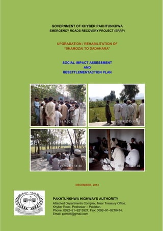
- 1. GOVERNMENT OF KHYBER PAKHTUNKHWA EMERGENCY ROADS RECOVERY PROJECT (ERRP) UPGRADATION / REHABILITATION OF “SHAMOZAI TO DADAHARA” SOCIAL IMPACT ASSESSMENT AND RESETTLEMENTACTION PLAN DECEMBER, 2013 PAKHTUNKHWA HIGHWAYS AUTHORITY Attached Departments Complex, Near Treasury Office, Khyber Road, Peshawar – Pakistan. Phone: 0092–91–9213927, Fax: 0092–91–9210434, Email: pdmdtf@gmail.com
- 2. (ii) TABLE OF CONTENTS LIST OF ACRONYMS.............................................................................................................. VII EXECUTIVE SUMMARY ............................................................................................................9 CHAPTER – 1 : INTRODUCTION.............................................................................................15 1.1. General ...................................................................................................................15 1.2. Project Location and Description .............................................................................15 1.3. RAP Related Procedures and Conditionalities.........................................................16 1.4. Screening Level Social and Resettlement Impact Assessment................................16 1.5. Need for SIA Study and RAP...................................................................................17 1.6. Objectives of the Social Assessment and Resettlement Plan ..................................17 1.7. Existing Road Conditions.........................................................................................17 1.8. Proposed Road Improvements under the Project ....................................................17 1.9. Availability of Row (Land) ........................................................................................18 CHAPTER – 2 : LEGAL AND POLICY FRAMEWORK..............................................................20 2.1. General ...................................................................................................................20 2.2. The World Bank Policy on Involuntary Resettlement Operational Policy - 4.12........20 2.2.1. Loss of Immoveable Assets and Infrastructure.............................................21 2.2.2. Access to Information Policy of World Bank .................................................21 2.3. Environmental and Social Screening and Assessment Framework (ESSAF)...........21 2.4. Resettlement Policy Framework and Entitlement Matrix ..........................................21 2.4.1. Basic Principles for Resettlement Plan Preparation .....................................22 2.4.2. Compensation Eligibility...............................................................................22 2.4.3. Compensation Entitlements .........................................................................23 2.4.3.1. Entitlement Provisions ...................................................................23 2.4.3.2. Owners of Micro Business Structures............................................23 2.4.3.3. Owners of Houses.........................................................................23 2.4.3.4. Crop Losses to Encroachers of Agricultural Land within the RoW..24 2.4.3.5. Wood Trees...................................................................................24 2.4.4. Entitlement Matrix ........................................................................................24 2.4.5. Interaction with Different Departments / Agencies........................................25 CHAPTER – 3 : APPROACH AND METHODOLOGY...............................................................27 3.1. General ...................................................................................................................27 3.2. Identification of PAPs ..............................................................................................27 3.3. Collection of Information from Secondary Sources ..................................................27 3.4. Collection of Primary Data.......................................................................................27 3.4.1. Village Profile Survey...................................................................................27 3.4.2. Census of Project Affected Persons (PAPs) Encroachers............................28 3.4.3. Cut–Off Date................................................................................................28 3.4.4. Socioeconomic Baseline Survey ..................................................................28 3.4.5. Processing and Analysis of Data..................................................................29 CHAPTER – 4 : SUMMARY OF PROJECT IMPACTS..............................................................30 4.1. General ...................................................................................................................30 4.2. Identification of Project Affected Persons ................................................................30 4.3. Loss of Cropped Area..............................................................................................30 4.4. Removal of Trees ....................................................................................................31 4.5. Loss of Structures....................................................................................................31 4.6. Impact on Income / Livelihood .................................................................................31
- 3. (iii) 4.7. No Relocation Due to Impact on Structures.............................................................31 4.8. Indigenous People...................................................................................................31 4.9. Archeological, Historical and Religious Sites ...........................................................31 4.10. Public Utilities within RoW .......................................................................................32 4.11. Occupations, Income Status and Vulnerability of the Affected Households..............32 CHAPTER – 5 : ANALYSIS OF ALTERNATIVES .....................................................................33 5.1. General ...................................................................................................................33 5.2. No–Project Option ...................................................................................................33 5.3. Alternative Transport Options ..................................................................................33 5.4. Design Alternatives..................................................................................................34 5.4.1. Change No of Sections Onwards to Route Alternatives ...............................34 5.4.2. Alignment Alternatives .................................................................................34 5.4.3. Alternatives for Public Amenities..................................................................34 5.4.4. Alternative Option for Minimizing the Resettlement Impacts.........................34 5.5. Conclusions.............................................................................................................35 CHAPTER – 6 : INFORMATION DISSEMINATION, CONSULTATION, PARTICIPATION AND DISCLOSURE...........................................................................................36 6.1. General ...................................................................................................................36 6.2. Identification of Stakeholders...................................................................................36 6.3. Dissemination of Information and Consultations with PAPs .....................................36 6.4. Outcome of Stakeholders Consultation....................................................................38 6.4.1. Social and Resettlement Related Concerns Raised By the PAPs ................38 6.4.2. Other General Concerns raised by PAPs.....................................................40 6.4.3. Addressal of Stakeholders Concerns ...........................................................40 6.4.4. Consultation with Local Women...................................................................41 6.4.5. Consultation with Local Community Organizations.......................................41 6.5. Consultation Strategy during Implementation Stage ................................................42 6.6. Formation of Project Affected Person Committees ..................................................42 6.7. Disclosure, Already Done, and Procedures for Future Disclosure............................42 CHAPTER – 7 : PROJECT IMPACTS, SOCIAL RISKS AND MITIGATION MEASURES .........44 7.1. General ...................................................................................................................44 7.2. Delineation of Project Corridor of Impact .................................................................44 7.3. Summary of Project Impacts....................................................................................45 7.4. Criteria for Impact Scaling .......................................................................................45 7.5. Overall Assessment of Potential Socioeconomic Impacts........................................46 CHAPTER – 8 : SOCIOECONOMIC ASSESSMENT OF PROJECT AREA AND PAPS ...........47 8.1. General ...................................................................................................................47 8.2. Description of the Project Area ................................................................................47 8.2.1. Administrative and Socio–Political Setup .....................................................47 8.2.2. Ethnic Clans.................................................................................................48 8.2.3. Religion........................................................................................................48 8.2.4. Language.....................................................................................................48 8.2.5. Family Life ...................................................................................................48 8.2.6. Joint Families...............................................................................................48 8.2.7. Shared Families...........................................................................................48 8.2.8. Marriages.....................................................................................................49 8.2.9. Social Organization......................................................................................49 8.2.10. Conflicts Resolution Mechanism and Laws ..................................................49 8.3. Economic Base and Development Opportunities in Swat District.............................50
- 4. (iv) 8.3.1. Economic Base............................................................................................50 8.3.2. Industries .....................................................................................................50 8.3.3. Irrigation.......................................................................................................50 8.3.4. Mining Resources ........................................................................................50 8.3.5. Land Use and Agriculture.............................................................................50 8.3.6. Forestry........................................................................................................51 8.3.7. Trade and Trade Centers.............................................................................51 8.3.8. Education.....................................................................................................51 8.3.9. Electricity and Telephone Facilities ..............................................................52 8.3.10. Transportation and Accessibility...................................................................52 8.3.11. Fuel and Energy...........................................................................................52 8.4. Characteristics of the Project Corridor .....................................................................52 8.4.1. Description of the Project Corridor ...............................................................52 8.4.2. Agriculture....................................................................................................53 8.4.3. Per Acre Income from Crops........................................................................53 8.4.4. Settlement Pattern along the Road ..............................................................54 8.4.5. Population....................................................................................................54 8.4.6. Housing Characteristics ...............................................................................54 8.4.7. Education Facilities ......................................................................................54 8.4.8. Health Facilities............................................................................................54 8.4.9. Industry and Trade.......................................................................................55 8.5. Socioeconomic Profile of the Population along the Project Corridor.........................55 8.5.1. Population and Family Size..........................................................................55 8.5.2. Education Level ...........................................................................................55 8.5.3. Major Occupations of Respondents .............................................................55 8.5.4. Annual Income of the Respondents .............................................................56 8.5.5. Annual Expenditure......................................................................................56 8.5.6. Available Social Amenities in the Project Corridor........................................56 8.5.7. Possession of Household Items...................................................................57 8.5.8. Stakeholders‟ Perceptions about the Project................................................58 8.5.9. Gender in Development ...............................................................................58 8.5.10. Women Role in Socio–Economic Activities ..................................................58 8.5.11. Conflict Resolution Mechanism in the Project Area ......................................59 8.5.12. Community Organizations in the Project Corridor.........................................59 CHAPTER – 9 : RESETTLEMENT PLAN DISCLOSURE AND IMPLEMENTATION PLAN ......60 9.1. Process of RAP Implementation..............................................................................60 9.2. Disclosure of RAP ...................................................................................................60 9.3. Advance Actions for RAP Implementation ...............................................................61 9.4. Training in RAP Implementation ..............................................................................61 9.5. Process of RAP Implementation..............................................................................62 9.6. Procedures to be followed for Disbursement of Payments.......................................62 9.7. RAP Implementation Schedule................................................................................64 9.8. Basis of Resettlement Costs and Unit Rates for Compensation...............................65 9.8.1. Unit Rate for Residential and Business Structures.......................................65 9.8.2. Unit Rate for Wood Trees ............................................................................66 9.8.3. Cost of Relocation of Public Utilities.............................................................66 9.8.4. Compensatory Plantation in Lieu of Loss of Forest Department Wood Trees ...........................................................................................................66 9.8.5. Additional Assistance for Vulnerable Households ........................................67 9.9. Relocation Strategy .................................................................................................67
- 5. (v) 9.10. Severe (Irreversible) Impacts...................................................................................67 9.11. Resettlement Budget ..................................................Error! Bookmark not defined. 9.12. Contract Document Clauses for Social Mitigation ....................................................68 CHAPTER – 10 : INSTITUTIONAL ARRANGEMENTS, CAPACITY BUILDING FOR RAP IMPLEMENTATION AND GRIEVANCE REDRESSAL MECHANISM................70 10.1. Institutional Arrangements.......................................................................................70 10.1.1. Project Management Unit (PMU) .................................................................70 10.1.2. Field Implementation Unit (FIU) ...................................................................70 10.1.3. Affected Person‟s Committees (APCs).........................................................70 10.2. Capacity Building and Training ................................................................................71 10.3. Grievance Redressal Mechanism............................................................................72 10.3.1. Grievance Redressal Committee (GRC) ......................................................73 10.3.2. Complaints Management Register (CMR)....................................................73 10.3.3. Conflict Resolution Procedure......................................................................74 CHAPTER – 11 : MONITORING AND EVALUATION...............................................................75 11.1. General ...................................................................................................................75 11.2. Internal Monitoring...................................................................................................75 11.3. Monitoring Role and Responsibilities.......................................................................76 11.4. M & E Arrangements ...............................................................................................76 11.5. External Monitoring/Third Party Validation...............................................................77 LIST OF ANNEXURES.............................................................................................................78 ANNEXURE Annexure–1: Cross Section of Existing Road Annexure–2: Cross Section of Proposed Road Annexure–3: Transfer of Road to PKHA – Notification Annexure–4: Environmental and Social Screening and Assessment Framework (ESSAF) Annexure–5: Questionnaire for Village Profile Survey Annexure–6: Questionnaire for Census Survey Annexure–7: Questionnaire for Socio–economic Survey Annexure–8: Details of Loss of Cropped Area Annexure–9: Details about Removal of Trees Annexure–10: Details about Affected Structures Annexure–11: Linear Plan for Affected Structures Annexure–12: Details of Public Consultation Annexure–13: Project Affected Person Committee for Shamozai Annexure–14: Project Affected Person Committee for Dadahara Annexure–15: Information Pamphlet in English Annexure–16: Unit Rates for Structure‟s Valuation, Crops, Trees and Public Utilities Annexure–17: Detail of Compensation for Affected Structures Annexure–18: TORs for SIA&RAP Preparation Annexure 19: TORs for Third Party Validation Annexure 20: TORs for Monitoring Consultant Annexure 21: Pictorial View of Project Impacts and Public Consultation
- 6. (vi) TABLES Table – 2.1: Entitlement Matrix Table - 5.1: Comparison between the Initial and Final Design Impacts Table – 6.1: Summary of Public Consultations Table – 6.2: Concerned raised by the PAPs and their rederssal Table – 6.3: Detail of Community Organizations in the Project Area Table – 7.1: Affected Households / Persons by Category of Impact Table – 7.2: Social Impact Scaling Table – 7.3: Potential Social Issues and their Impacts Table – 8.1: Land Utilization Statistics of District Swat, 2007–2008 Table – 8.2: Literacy Ratios for Swat, by Rural / Urban and Sex Table – 8.3: Main Features along the Alignment Table – 8.4: Land Use Statistics of Barikot Tehsil Table – 8.5: Average Household Expenditure Table – 8.6: Possession of Household Items Table – 8.7: Women Role in Socio–economic Activities Table – 9.1: Timeline for Approval and Implementation of RAP Table – 9.2: Structures Types and their Unit Rates Table – 9.3: Resettlement and Rehabilitation Budget Table – 10.1: Training Program for Capacity Building Table – 10.2: Conflict Resolution Process at Project Level FIGURES Figure – 1.1: Project Area Location Figure – 1.2: Project Location Map Figure – 8.1: Institutional Arrangements for RAP Implementation
- 7. (vii) LIST OF ACRONYMS AD Assistant Director ACE Associate Consulting Engineers AHH Affected House Holds APs Affected Persons BOQ Bill of Quantities BP Bank Policy CBOs Community Based Organizations CO Community Organization COI Corridor of Impact DCO District Coordination Officer DD Deputy Director EM Entitlement Matrix EDO Executive Development Officer ESSAF Environmental and Social Screening and Assessment Framework ERRP Emergency l Roads Recovery Project GoKP Government of Khyber Pakhtunkhwa GoP Government of Pakistan GRM Grievance Redress Mechanism GRC Grievance Redress Committee MDTF Multi Donor Trust Fund M&E Monitoring and Evaluation NGOs Non–Government Organizations OP Operational Policy / Policies OPL Official Poverty Line PAC Project Affected Persons Committee PAPs Project Affected Persons PD Project Director P&D Planning and Development PKHA Pakhtunkhwa Highways Authority PKR Pak Rupee RAP Resettlement Action Plan ROW Right of Way SIA Social Impact Assessment SCR Social Complaint Register SOP Standard Operating Procedures TMP Traffic Management Plan U / C Union Council WB World Bank WSD Works & Services Department
- 8. (viii) DEFINITIONS Project Affected Persons: are those who are physically affected (relocation, loss of residential land, or loss of shelter) and/or economically affected (loss of land, assets, access to assets, income sources, or means of livelihoods) as a result of (i) involuntary acquisition of land, or (ii) involuntary restrictions on land use or on access to legally designated parks and protected areas. Compensation: means payment in cash or kind for an asset to be acquired or affected by a project at replacement cost at current market value. Cut-off-date: the date after which people will not be considered eligible for compensation i.e. they are not included in the list of PAPs as defined by the Census. The cut-off date is the last date of the census survey/completion of census survey. Encroachers: People who extend their occupation beyond the lands they legally own. Entitlements: means the range of measures comprising cash or kind compensation, relocation cost, income rehabilitation assistance, transfer assistance, income substitution, and relocation which are due to /business restoration which are due to Affected Households, depending on the type and degree nature of their losses, to restore their social and economic base. Inventory of Losses: means pre-appraisal inventory of assets as a preliminary record of affected/lost assets. Land Acquisition: means the process whereby a person is compelled by a public agency to alienate all or part of the land s/he owns or possesses, to the ownership and possession of that agency, for public purposes, in return for fair compensation. Non titled: means those who have no recognizable rights or claims to the land that they are occupying and includes people using private or state land without permission, permit or grant i.e. those people without legal title to land and/or structures occupied or used by them. Such people cannot be denied compensation as per World Bank Safeguard clauses. Poor: means those falling below the official national poverty line (equivalent to 2,350 calories per day) of Rs. 848.79 per person per month (2004). Replacement Cost: market value (ii) transaction costs (iii) interest accrued (iv) transitional and restoration costs and (v) other applicable payments if any. Where market conditions are absent or in a formative stage, the borrower/client will consult with the affected persons and host populations to obtain adequate information about recent land transactions, land value by types, land titles, land use, cropping patterns and crop production, availability of land in the project area and region and other related information. The borrower/client will also collect baseline data on housing, house types, and construction materials. Qualified and experienced experts will undertake the valuation of acquired assets in applying method of valuation, depreciation of structures and assets should not be taken into account. Share Cropper: means the same as tenant cultivator or tenant farmer, and is a person who cultivates land they do not own for an agreed proportion of the crop or harvest. Significant Impact: means 200 people or more will experience major impacts, which are defined as; (i) being physically affected by losing their housing, or (ii) losing ten per cent or more of their productive assets (income generating). Vulnerable: means any people who might suffer disproportionately or face the risk of being marginalized from the effects of resettlement and includes; (i) female-headed households with dependents; (ii) disabled household heads; (iii) poor households (within the meaning given previously); (iv) landless; (v) elderly households with no means of support; (vi) households without security of tenure; (vii) ethnic minorities; and (viii) marginal farmers (with landholdings of five acres or less).
- 9. 9 EXECUTIVE SUMMARY ES–1 Introduction 1. This report consists of Social Impact Assessment and Resettlement Action Plan of Khyber Pakhtunkhwa-Emergency RoadsRecovery Project (ERRP) “Shamozai–Dadahara, S-3B provincial highway road”. This project would help respond to the post-conflict situation by carrying out emergency rebuilding of priority road infrastructure damaged during the conflict in the Province of Khyber-Pakhtunkhwa (KP). The proposed project focuses on early recovery priorities agreed between the Government of Khyber Pakhtunkhwa (GoKP) and the World Bank to be funded under Multi Donor Trust Fund (MDTF), the World Bank is the (administrator of MDTF). The Project Development Objective (PDO) is to enable the population along the Project corridor to benefit from year round improved access and mobility through reconstruction of priority damaged roads and bridges in the conflict hit areas. The expected outcome is improved traffic flow resulting in reduced vehicle operating costs and travel time for beneficiaries using the road. The project will be implemented by the Pakhtunkhwa Highways Authority (PkHA), an autonomous provincial roads organization of the GoKP. The cost of resettlement under this project will be funded by MDTF. ES–2 Project Description 2. The project is located in the province of Khyber Pakhtunkhwa, Tehsil Shamozai, District Swat on right bank of River Swat. The existing road traverses through small towns and cultivated lands on the right bank of River Swat. The project road feeds numerous settlements / villages of varying size namely Shamozai, Tang Shamozai, Malik Abad, Dedawar, Khaliq Abad, Nagoha, Hamidabad (Parai) and Dadahara. 3. ERRP is a twenty months project starting from November, 2013 and will be physically closed in June 2015, but the RAP will be implemented within a period of one month starting from November 2013 and ending December 2013.The project has two components, first relates to Infrastructure Rebuilding and second to Project Management. The SIA / RAP relates to Component-1 of the project. ES–3 Analysis of Alternative Design Options 4. After making analysis of the alternatives,PkHA reviewed its strategy to avoid and minimize resettlement impacts.At sections, where there are no resettlement issues, mostly in rural areas, the full RoW width (15 m) will be considered for road improvement works.While at build-up semi-urban areas (Parai, Dedawar and Khaliq Abad) where RoW encroached by people, the road improvement works will be confined to the CoI (7.3 m) instead of taking full width of RoW. ES–4 Objective of The Social Impact Assessment And Resettlement Action Plan 5. The objective of the Social Impact Assessment (SIA) is to identify Project Affected Persons (PAPs), assess the types and extent of losses and consultations with PAPs on the ways to compensate them. SIA provides a detailed inventory survey of project impacts, a census survey of 100 % Project Affected Persons and a socio- economic survey of 50% of the
- 10. 10 Affected Households (AHHs).The primary objective of the RAP is to provide necessary details for compensation, resettlement and rehabilitation by identifying i) the extent of losses; ii) the policy framework for compensation payments, income restoration, relocation and rehabilitation; (iii) mechanisms for timely disclosure of information to the affected person and other stakeholder (iv) institutional framework for participation and implementation; (v) grievance redressal mechanism and (vi) responsibilities for internal and external monitoring of implementation process (vii) estimated resettlement budget and implementation schedule. ES–5 Approach and Methodology 6. SIA study of the project has been made in a systematic manner. Besides collecting information from secondary sources, and project related literature, the surveys were conducted to collect field data by using pre-structured data collection forms. A Village Profile Survey conducted in 8 villages along the Corridor of Impact, which aimed at collecting information on socioeconomic settings of all the villages from Shamozai to Dadahara. To assess the project impacts, a complete 100 percent census of PAPs and their assets was carried out. A sample Socio-economic Survey was carried out of 50% affected households in order to develop a socioeconomic baseline. The cut–off date to determine the eligibility and entitlements for compensation under the project was announced as September 25, 2013, the completion date of PAPs Inventory Survey. People moving into the RoW after this date will not be considered as entitled to any compensation. ES–6 Summary of Project Impacts 7. According to final inventory survey of project affected assets, conducted from 13-25 September 2013, the project will partially impact 10 structures (06 houses, 02 shops and 02 boundary walls of houses), 731 non-fruit wood trees scattered along the road and crops on 36 kanals of land encroached by farmers, varying from 40 to 1000 feet. None of the APs need relocation of houses or shops. The impact on public utilities will involve relocation of 116 electricity poles and 41 telephone poles. Nosquatters or vendors will be affected. There will be no impact on cultural heritage and no indigenous people residing in the settlements along the road. The Project will also include relocation of 7 kacha water channels. Total number of Project Affected Persons is 172 (02 PAPs of structures, 08 PAPs of houses, 61 farmers of crops,among them are 7sharecroppers (of the cultivators who own land adjacent to ROW of the road and also encroached/use PkHA land for cultivation, they engage sharecroppers for the whole land under cultivation including encroached land), and rest of them will be affected from loss of trees). Affected households (AHHs) come to 84 (among them 2 have shared/joint ownership of structures and 24 have shared/joint ownership of crops and trees. 6 HHs have multiple impacts on structures, crops and trees and 16 HHs have multiple impacts on crops and trees, But none of them will significantly or severely impacted due to loss of assets or income. The impact on income / livelihood due to damages to 2 business structures (small shops) and encroached cropping area and trees will have minor impacts on the household income. These small shops do not have any employees.No vulnerable PAPs identified such as elderly, women headed household, orphans, disabled etc. Detail of project impacts is given in Chapter 4. ES–7 Consultations, Participation and Disclosure 8. Consultation process was carried out by identifying the project stakeholders; in compliance of the requirements of World Bank on public consultation and Access to Information
- 11. 11 by holding scoping sessions with the PAPs and local communities, 133 maleand 18 female from project affected households participated in these sessions. Wayside consultations were also held with general highway users, including transport passengers, vehicle drivers, roadside shopkeepers, and passersby. After detailed consultations with PAPs, two Affected Persons Committees (APCs) were formed on the basis of geographical locations of PAPs. Consultations revealed that the project is socially acceptable by the PAPs and general public. They welcomed the project and assured their full cooperation for smooth implementation of the project works in coordination with PkHA.It was agreed thatPkHA will issue one month advance notice before making damages to the structures and compensation will also be paid one month in advance to complete restoration of structures.As a result of consultations with PAPs and other stakeholders, the social risks were also identified such as increased risk of accidents caused by partial closure of road during construction. It is learned from the Phase-I experience that APs do not open bank accounts for small amounts of compensation payments. In this phase, a provision was made to pay Rs-5000/ and less compensation amounts in cash by following the SOPs developed by Planning and Development Department of KPK Government for MDTF projects. A detailed description of risks and their mitigation is given in Chapter - 8. ES–8 Legal and Policy Framework 9. This document has been prepared by following the World Bank Involuntary Resettlement Policy (OP/BP 4.12) and OP Access to Information, and the broader principles defined in Environmental and Social Screening and Assessment Framework (ESSAF). The ESSAF has been prepared in accordance with the OP 8.0 for emergency operations, to address negative environmental and/or social impacts associated with the projects under MDTF. Since this project (ERRP) is financed under MDTF, ESSAF is applicable to this project also. The ESSAF has been shared with the PkHA and it was disclosed locally by PkHA on May 17, 2011 at the website of Communication and Works (C&W) Department. A project Policy on entitlement and compensation has been developed to compensate all damages to the structures,trees and crops on current market rates at replacement cost, The detail of compensation entitlements is given in Chapter – 2 but a summary is given in Entitlement Matrix (EM) in Table S–2 below, Table S–2: Entitlement Matrix Type of Loss Eligibility Compensation Entitlements Loss of Housing, Business and Irrigation Structures within ROW of PkHA Loss of housing/ business on encroached land All PAPs, who have encroached PkHA ROW,will receive compensation for the loss of damage to structures at market based replacement cost, to restore remaining structure, as per 2013 Composite Schedule Rates of GoKP, but are not eligible for compensation against loss of land within the ROW.Salvage material will be the property of APs. Water Channels will be restored under civil works contract. Wood Trees Cultivators of Trees All PAPs who have used PkHAROW for tree plantation, will be given cash compensation @ Rs.2,000/– per tree, at average market rate, fixed on the basis of discussions with the Forest Department officials and cultivators of trees.Cut off trees will be the property of APs.
- 12. 12 Type of Loss Eligibility Compensation Entitlements Public Utilities: Electricity and Telephone Poles Peshawer Electric Supply Corporation (PESCO) and Pakistan Telecommunic ation Ltd.(PtCL) respectively Relocation of electricity and telephone Poles as per rates given by the PESCO and PTCL. Crop Cultivators of crops All PAPs, who have encroached PkHA ROW for agriculture, will be given one-time cash compensation for the loss of crops at current market rates equal to annual gross harvest, based on per acre yields data of Shamozai Tehsil, taken from Agriculture Department for the cropping year 2012-13 Loss of Livelihood Micro Business Operators Micro Business operators will receive transitional Livelihood allowance equal to the inflation adjustedOPL 1 to meet living expenses for business interruption, for a period of 2 months @ Rs. 23,902/– per month (23,902*2 = Rs.47, 804/– in total). Temporary Shifting Micro business operators Microbusiness operators will receive Rs. 10,000/- (one time cost) as shifting allowance totransporttheir business goods during the period of reconstruction. The amount has been determined on the basis of discussions with the mini trucks/ tractor trolley operators in the area. Temporary Acquisition of private land Owners of land Contractor(s) will pay rent against temporary acquisition of privateland, if require for sub-camp, plants or other construction activities. Unanticipated adverse impacts PkHA will deal with any unanticipated adverse impacts of the project during project implementation in the letter and spirit of the principles laid down in ESSAF and OP 4.12 of the World Bank 10. In addition to the Bank‟s internal procedures for safeguard documents disclosure, by following the Access to Information Policy, the final SIA and RAP document will be disclosed by PkHA on its website after finalization. It will be shared with stakeholders including government line agencies (involved in resettlement), local Community Organizations (COs) and Project Affected Persons (PAPs) through their committees and location specific meetings. The PkHAwill translate final SIA/RAP document into Urdu and share a copy of it with Affected Persons Committees, COs, relevantgovernment agencies, civil works contractor(s), construction supervision consultants and other stakeholders. A summary of RAP in the form of an Information Brochure in Urdu will be shared with each Affected Household (AHH) through registered mail. ES–9 Socio-Economic Assessment of Project Area and PAPs 1. The OPL of Rs. 879 per capita / month were announced by the government in 2004–2005 (Pakistan Economic Survey, 2005–06, Table 41). The latest estimate of inflation–adjusted poverty line per capita per month comes to Rs. 1734.52 in 2011. By taking the av. household size as 6.89 persons, the amount comes to Rs. 11,951/-.
- 13. 13 11. Socioeconomic assessment of the project area revealed Islam is the religion of 99.9 percent and Pashto is the main language. Urdu and English are commonly understood by most of people. People live in joint or shared families. Most of the project area is rural except Shamozai, Nagoha and Parai towns which can be considered as semi–urban. Overall literacy rate of the sample population is 55 percent in which 71 percent among male population and 37 percent among female.Major professions of the affected households are farming, business and services, skilled and unskilled labor and foreign remittances. The average household is comprised of 7.5 members and average monthly income per sample household is Rs. 25,423/= whereas average monthly expenditure per household are Rs. 20,090/ –, which amounts to 76 percent of the total income. Survey has revealed that routine life of most of women revolves around home and children. They have not equal rights in legacy and greater say in community life matters. Women of the area do not have access to secondary education due to lack of girl‟s high schools, they also face difficulties due to lack of maternity hospitals. The project road will facilitate women access to these facilities. Institutional Arrangements: 12. PkHA had established aProject Management Unit (PMU) for Phase-I of the project headed by the Project Director with other essential staff and assisted by a Field Implementation Unit (FIU). Project Director is overall responsible for the implementation of RAP while FIUwill be responsible for implementation of RAP in the field. FIU is headed by Deputy Director (North) who will be supported by the Resettlement Specialist of Supervision Consultants. PkHA will create permanent cell to handle environment and social issues in PkHAfor mainstream operations. In the Phase-I, the PkHA planned to designate Assistant Director as Resettlement Officer, but it is learned that PkHA engineering staff do not have time to perform such activities mainly due to their other field bases engagements and lack of capacity. Although in Phase-1 project staff got trainings in social safeguards, however still PkHA, technical staff, supervision consultants and contractor staff need refresher training particularly the newly involved staff of PkHA, to effectively implement RAP and address any otheror unforeseen social issues. ES–10 Grievance Redressal Mechanism 13. A Grievance Redressal Mechanism (GRM) has been developed to provide a public forum to the aggrieved persons to raise their objections and register complaints and to address them adequately. The main objective of the GRM is to investigate charges of irregularities and complaints received from PAPs/general public and provide an early, transparent and fair resolution. Under the GRM, a Grievance Redressal Committee (GRC) will be formulated at the project site which will look into all the grievance cases and redress them on timely and efficient manner. GRC will be headed by the Project Director, but at the field level, the Deputy Director North of PKHA will be responsible to manage GRC. The GRC will have representationof technical staff of PkHA,Resident Engineer of Supervision Consultants, focal points of contractors for resettlement/social issues, 4 representatives from Affected Persons Committees (two from each APC), and Resettlement Specialist of Supervision Consultants. The Bank will be kept informed by reporting summary of complaints and their redressal in the monthly progress reports. The detailed GRM has been given in Chapter – 10.
- 14. 14 ES–11 Implementation Schedule and Budget 14. Implementation of the RAP will be completed in a month starting from November 2013 and ending in December 2013. Detailed Implementation Schedule is given in Table – 9.1 of Chapter – 9. The cost of RAP implementation is included in the overall budget of the Component-1 of the project and will be financed through the project grant under MDTF. The total estimated cost of the Resettlement Plan is calculated as Rs. 6.384 Million / US$ 0.0638 Million. ES–12 Monitoring and Evaluation 15. Internal and external monitoring arrangements have been devised for the RAP implementation monitoring. The key objective is to ensure its effective and efficient implementation. Project Director will be overall responsible for Monitoring and Evaluation, but Deputy Director-North will be responsible to monitor RAP implementation in the field and reporting to the Project Director. The Project Director will Integrate monitoring reports in the main Monthly reports of the project. The Resettlement Specialist of Supervision Consultant will carry out a final evaluation at the end of the Project. In addition, for external monitoring, PkHA will engage an independent agency (an NGO, an academic institute or an individual consultant) to conduct 3rd party validation of RAP implementation.
- 15. 15 CHAPTER – 1 : INTRODUCTION 1.1. General 1. This report presents the Social Impact Assessment and Resettlement Plan of Emergency Roads Recovery Project (ERRP) “Shamozai - Dadahara” funded under Multi Donor Trust Fund, administer by the World Bank. The proposed Project is a Provincial Highway S-3B which is on the right bank of the Swat River. This project would help respond to the post-conflict situation by carrying out emergency rebuilding of priority road infrastructure damaged during the conflict in the Province of Khyber-Pakhtunkhwa (KP). The project focuses on early recovery priorities agreed between the Government of Khyber Pakhtunkhwa (GoKP) authorities and the World Bank being the administrator of the Multi Donor Trust Fund (MDTF). Given the deep crisis situation, exacerbated by the 2010 devastating floods, the main focus of the first set of priorities is restoration/improvement of pedestrian and vehicular access to some of the KP‟s poorest neighborhoods in the Swat Valley. The Project Development Objective (PDO) is to enable the population along the Project corridor to benefit from year round improved access and mobility through reconstruction of priority damaged roads and bridges in the conflict hit areas. The anticipated results will support Governmental efforts to help maintain minimal economic activity and improve social and political stability in the province. The project will be implemented by the Frontier Highways Authority (PkHA), an autonomous provincial roads organization of the GoKP. The expected outcome is improved traffic flow resulting in reduced vehicle operating costs and travel time for beneficiaries using the road. 2. This RAP has been prepared by the Pakhtunkhwa Highway Authority (PkHA) based on consolidation of census survey of 100% losses of Project Affected Persons‟ (PAPs) assets, socio-economic survey of 50% affected households (AHHs), socio-economic profiling of every settlement lying on the road and on-going consultations through meetings, interviews, focus group discussions with the AFs/PAPs and other stakeholders, in accordance with the World Bank Policy 4.12 on Involuntary Resettlement. The RAP has been developed in close coordination and consultation with PkHA. This RAP is reviewed and fully endorsed by the PkHA through its Project Management Unit (PMU).The PMU has already been established for the project, headed by the Project Director (PD). The PD/PMU reports to the Managing Director of PkHA, the overall responsibility of RAP implementation lies with the Project Director. 1.2. Project Location and Description 3. The proposed road under this project is located in the Kabbal tehsil of Swat district of Khyber Pakhtunkhwa province, on right bank of River Swat (Location Map attached as Figure – 1.1 and 1.2). The existing road traverses through small towns and cultivated lands on the right bank of River Swat. The project road feeds numerous settlements / villages of varying sizes namely Shamozai, Tang Shamozai, Malika Abad, Dedawar, Khaliq Abad, Nagoha, Hamidabad and Dadahara. 4. It is a twenty months project starting from November 2013 and will be physically closed on June 2015, but RAP will be implemented in a period of one month starting from November 2013. Since the project construction will be contracted out through variation order to the Phase-I contractor, hence the commencement of civil works is expected in December 2013. The project
- 16. 16 has two components, the first relates to Infrastructure Rebuilding and the second is support to Project Management Unit (PMU). The Component-1 consists of civil works along the provincial highway S-3B (Shamozai - Dadahara) comprising: (a) Reconstruction and widening of about 14.1 Km of highway: (b) associated relocation of utilities, land acquisition (land acquisition is not needed as per final design of the road) and resettlement. The Component-2 includes support for Contract Administration & Construction Supervision Consultant Services; (a) Environmental &Social Safeguard Consultant Services; and (b) Other Project Management Activities through the financing of incremental operating costs. 1.3. RAP Related Procedures and Conditionalities 5. The World Bank Policy on Involuntary Resettlement requires a Resettlement Action Plan to be prepared to identify and compensate all losses caused by the project; as a result a RAP has been prepared for this project. The evacuation of RoW and initiation of civil works on the road sites will be contingent to fulfill the following conditions: (a) Approval of this RAP by the World Bank and its disclosure to the public that contains officially approved unit rates for structures; crops and wood trees; income restoration and rehabilitation program; and (b) Commencement of civil works on the resettlement sites is conditional on full payment of compensation including livelihood and rehabilitation assistance. 1.4. Screening Level Social and Resettlement Impact Assessment 6. A preliminary Due Diligence study was conducted by PKHA to assess the project impacts. According to the studya total of 180 persons were to be affected. The potential adverse impacts included acquisition of about 15 kanals of (mostly productive) land in rural areas to improve road curves and loss of about 2,883 trees. In urban areas the project could have affected 16 permanent structures of micro businesses / shops and 10 boundary walls. But PkHA reviewed its strategy keeping in view the objectives of the World Bank Policy on Involuntary Resettlement to avoid land acquisition and limit the dislocation. The PkHA adopted the following approach in the design of project road. (a) At sections, where there are no resettlement issues, the full RoW width (15 m) will be considered for road improvement works. (b) At build-up areas where RoW has been encroached by the people, the road improvement works will be confined to the COI instead of taking full width of RoW. It will be ensured that required COI (7.3 m) is available at the build-up areas to make the road improvements as per design. According to the final inventory survey of project affected assets, now the project will impact 10 structures including 02 micro businesses, 06 residential units and 2 boundary walls of houses. All will have minor impacts on structures and need no relocation, as ample land space is available for restoration of structures with a loss of narrow strip of encroached land. The project will need up-rooting of privately owned 731 wood trees, scattered along the road,
- 17. 17 removal of these trees will have minor impact on the source of income of the owners. The impact on public utilities will involve relocation of 116 electricity poles and 41 telephone poles. No squatters or vendors will be affected. There will be no impact on cultural heritage and no indigenous people residing in the settlements along the road. The Project will also include relocation of 7 kacha water channels. 1.5. Need for SIA Study and RAP 7. Following the requirements of Environmental and Social Screening and Assessment Framework (ESSAF), a Social Impact Assessment (SIA) study was undertaken and a Resettlement Action Plan (RAP) has been prepared. After the screening level social and resettlement impacts assessment, it was necessary to collect the information on social and resettlement impacts of the Project from the real field conditions according to the final detailed design of the project; and assess and estimate in advance, the social consequences to be emerged with the implementation of the project. 1.6. Objectives of the Social Assessment and Resettlement Plan 8. The objective of the Social Impact Assessment (SIA) is to identify Project Affected Persons, to be affected due to the road improvement works, assess the types and extent of losses/impacts, consultations and ways to compensate them and to ensure that PAPs are not adversely affected by the project or left in worse conditions. SIA provides a detailed inventory survey of project impacts, a census survey of Project Affected Persons and a social economic survey of affected households. 9. The primary objective of the RAP is to provide necessary details for compensation, resettlement and rehabilitation by identifying (i) the extent of losses; (ii) the policy framework for compensation payments, income restoration and rehabilitation; (iii) mechanisms for timely disclosure of information to the affected person and other stakeholder (iv) institutional framework for participation and implementation; (v) grievance redressal mechanism and (vi) responsibilities for monitoring the implementation process (vii) resettlement budget and implementation schedule 1.7. Existing Road Conditions 10. The existing road is narrow and in poor condition especially in urban areas. The Right of way (ROW) is 15 m as per “RewajNama” (the road by–laws during the regime of ex–ruler of Swat valley). Major distress includes raveling, cracking and patching. Presently, this 14.1 Km section carries a little passenger and freight traffic. 1.8. Proposed Road Improvements under the Project 11. The new road has been designed as 02–lane single carriage way having a black topped width of 7.31 m with 02 m paved shoulder on each side. In build-up areas, pacca covered drains with top width of 1.22 m and 0.50 m elevated, above finished road level, will be provided. These
- 18. 18 covered drains will also be used as footpaths. The typical cross section of the existing and the proposed road is provided as Annexure–1 and 2. 1.9. Availability of Row (Land) 12. The road from Shamozai – Dadahara(a part of PHS–03 Chakdarra - Madyan Road), was previously a District road, later on converted to a provincial highway and transferred to the Pakhtunkhwa Highway Authority (PkHA) vide. Secretary to Govt. C&W Department: Peshawar Notification No.SOG / W&S / Notification / 2006 dated 02.12.2006 in accordance to Frontier Highways Authority ordinance. Copy attached as Annexure–3. The commencement of civil works is conditional on disclosure of approved SIA and RAP to the potential affected persons, their communities and other stakeholders, and full payment of compensation to PAPs including livelihood restoration and rehabilitation assistance. Figure –1.1: Geographical Map of Project
- 19. 19 Figure – 1.2: Project Location Map
- 20. 20 CHAPTER – 2 : LEGAL AND POLICY FRAMEWORK 2.1. General 1. According to the project design, the existing available RoW is sufficient enough to accommodate the road improvement works. Therefore, no privately owned land will be acquired for the project so the Land Acquisition Act 1894 of Pakistan will not apply. The project is being funded by the MDTF administered by the World Bank. The Bank‟s social safeguard Policy seek to avoid or minimize and mitigate adverse social impacts; and social costs to the affected people or vulnerable groups, as a result of implementation of the project which has been applied and discussed in this Chapter. 2.2. The World Bank Policy on Involuntary Resettlement Operational Policy - 4.12 2. The World Bank‟s Operational Policy-4.12 deal with the issues and concerns relating to involuntary resettlement due to the development projects and provides principles and guidelines to mitigate the adverse impacts on the local community, particularly their relocation/displacement. The Bank‟s experience indicates that involuntary resettlement under development projects, if unmitigated, often gives rise to severe economic, social, and environmental risks: production systems are dismantled; people face impoverishment when their productive assets or income sources are lost; people are relocated to environments where their productive skills may be less applicable and the competition for resources greater; community institutions and social networks are weakened; kin groups are dispersed; and cultural identity, traditional authority, and the potential for mutual help are diminished or lost. This policy includes safeguards to address and mitigate these impoverishment risks.2 As such this policy provides basis for the development / preparation of Resettlement Policy Framework and Resettlement Plan. 3. The main objectives of Bank‟s safeguard policies can be described as under: (a) Reduce and manage adverse risks of the development projects (b) Identify opportunities for promoting social benefits (c) Provide a process for full disclosure and meaningful stakeholders consultation (d) Ensure that social risks are systematically addressed, evaluated, and incorporated at various stages of the project, such as decision–making, design, construction and operations. 4. The triggers of the Bank‟s policy, in case of ERRP“ Shamozai – Dadahara Road” financed under WB administered MDTF, are described as follows : (a) Loss of Income Sources or Livelihood: The final Census Survey of the project impacts revealed that the project will impact 2 micro businesses/shops structures and crops on 36 Kanals of encroached land will be affected. 2. Excerpts from WB OP 4.12, WB Operational Manual, December 2001.
- 21. 21 2.2.1. Loss of Immoveable Assets and Infrastructure The project will affect 10 structures of various types including 02 shops, 06 residential houses and 02 boundary walls of residential houses. All these assets are located in semi-urban areas. In addition to this 731 wood trees will be affected, all located along the road in the rural stretches. Besides private structures, the project will disrupt public utilities including 116 electricity poles owned by Peshawar Electric Supply Corporation (PESCO), 41 telephone poles owned by Pakistan Tele-Communication Ltd (PTCL). 2.2.2. Access to Information Policy of World Bank 5. The Access to Information Policy of the World Bank requires that the project related information / documents should be made public. The policy has laid down procedures for disclosing the documents relating to SIA study and RAP of the project to the various tiers of the stakeholders and general public. The project information will be disclosed and shared with the people at the time of the Public Hearing to be arranged by Provincial EPA. The SIA / RAP document will also be disclosed to the public and PAPs as per the Bank policy, after its clearancefrom the Bank. 2.3. Environmental and Social Screening and Assessment Framework (ESSAF) 6. To provide a mechanism to carry out appropriate assessment of environment and social impacts and implement necessary safeguard measures under the emergency operations of MDTF such as this project, the World Bank has prepared the Environmental and Social Screening and Assessment Framework (ESSAF). Recognizing the urgent need for assistance and emergency nature of potential operations to be financed under the MDTF, the ESSAF provides an approach, tailored to this emergency situation in line with OP 8.00 for the emergency operations, to manage the potential environmental and social impacts of the projects and activities. It provides guidelines to the implementing agencies in: (i) carrying out appropriate assessment of environmental and social impacts; (ii)planning and implementing necessary environmental and social mitigation measures for these projects during the implementation phase, in compliance with relevant World Bank safeguard policies and the national regulatory requirements of Pakistan. Since the ERRP is being proposed under MDTF, the ESSAF is applicable to this project also. The key aspects of the Framework are Impact screening, assessment and mitigation planning, consultations, planning, review and approval, disclosure, capacity building and monitoring implementation of safeguard instruments, a copy of ESSAF is given as Annexure-4. 2.4. Resettlement Policy Framework and Entitlement Matrix 7. This Resettlement Action Plan (RAP) has been prepared to compensate the Project Affected Persons as a result of improvement / rehabilitation of “Shamozai - Dadahara Road” of ERRP with a total length of 14.1 km. The existing road centerline has been maintained in the detailed design to minimize resettlement.
- 22. 22 2.4.1. Basic Principles for Resettlement Plan Preparation 8. Taking into account the requirements of the ESSAF guidelines and the OP4.12, the following basic principles are devised for the preparation of RAP. (a) The negative impacts on PAPs would be avoided or minimized as much as possible; (b) Where the negative impacts are unavoidable, the project–affected persons will be assisted in improving or regaining their standard of living. Vulnerable groups will be identified and assisted to improve their standard of living; (c) The PkHA will make cash compensation to the PAPs for their affected structures and assets falling within the RoW. (d) The PkHA will ensure that as far as possible the vulnerable PAPs will receive some financial relief from the project. This will include one–time lump sum assistance equal to one month‟s inflation adjusted OPL, in addition to other admissible compensation / allowances. (e) The owners of affected structures, in addition to cash compensation for the structure on replacement cost, will be allowed to salvage their building material. This applies to the owners including absentee owners of all categories of immovable structures. (f) Rehabilitation assistance i.e., compensation for lost business and workdays (including employees) due to relocation and disruption of business enterprise will be paid. (g) Before taking possession of the acquired land and properties, compensation assistance will be made in accordance with the Bank policy. (h) Appropriate grievance redress mechanism will be established at the project level to ensure speedy resolution of disputes/disagreements. 2.4.2. Compensation Eligibility 9. PAPs are identified as persons whose structures/assets and livelihood is directly affected by the project due to road improvement works. The eligible PAPs for compensation or at least rehabilitation provisions under the Project would be: (a) All PAPs identified along the project corridor are losing a small part of their micro business structures/shops, residential houses, boundary walls of residential houses, trees and encroached cropped area. The all identified PAPs are encroaches on the government owned RoW. (b) Tenants whether registered or not; and (c) PAPs losing business, income and sources of livelihood.
- 23. 23 10. Compensation eligibility is attached with the cut–off date that has been announced as 25.09.2013 (refer Chapters 3). 2.4.3. Compensation Entitlements 2.4.3.1. Entitlement Provisions For PAPs losing structures, assets, income; and entitled for rehabilitation subsidies, will include residential and commercial structures losses, crops and trees losses and allowance for temporary business disruption; based on tax declarations and / or lump sums, in case of non– availability of such documentation, in accordance with the inflation adjusted official Poverty Line3 (OPL). Project impacts have been divided into minor, significant and severe categories keeping in view the extent of impact on the affected assets/income. The minor impact is that where the impact on an asset or income is less than 10 %. The significant impact category denotes the impact as more than 10% but less than 25% and severe impact is where a structure/asset/income is impacted by more than 25%. The project will cause minor impacts on structures and income of PAPs. 2.4.3.2. Micro Business Operators 11. The Micro business operators are entitled for the following compensation. (a) Full compensation for the total covered area of the affected shop at replacement cost basis. (b) Livelihood Allowance for the period of business interruption to meet living expenses equal to 02 months of inflation adjusted OPL, (c) One time Shifting Allowance @ Rs. 10,000/- on lump sum basis, as determined on the basis of discussions with the mini trucks/ tractor trolley operators in the area. (a) Additional allowance in case of vulnerable. 2.4.3.3. Loss of Houses/Structures (a) The PAPs who have encroached PKHA ROW will receive compensation for the loss of damage to structures at market cost to restore remaining structure. Project–related Employment: (for unskilled and semi–skilled tasks during construction): Members of AHHs will be given priority for project–related employment opportunities as drivers, carpenters, masons, clearing and digging work, and if possible, as clerks or basic administration support staff. To this end, the PkHA will require to add in the contractor‟s contract to give preference to AHHs in recruiting personnel for their activities. 3. The OPL of Rs. 879 per capita / month were announced by the government in 2004–2005 (Pakistan Economic Survey, 2005–06, Table 41). The latest estimate of inflation–adjusted poverty line per capita per month comes to Rs. 1734.52 in 2011. By taking the av. household size as 6.89 persons, the amount comes to Rs. 11,951/-.
- 24. 24 2.4.3.4. Crop Losses to Encroachers of Agricultural Land within the RoW 12. The encroacher farmers will be provided with one time paid cash compensation at current market rates equal to annual gross harvest, for loss of source of income. 2.4.3.5. Wood Trees 13. No fruit trees will be affected. Only wood trees will need removal from the RoW. The cultivators of trees will be paid cash compensation at market rate, based on type and age of the affected trees. 2.4.4. Entitlement Matrix 14. Based on the above discussed eligibility criteria and compensation entitlements and keeping in view the nature of losses and implementation issues of the proposed project, the following Entitlement Matrix (EM) has been prepared for the project to follow: Table – 2.1: Entitlement Matrix Type of Loss Eligibility Compensation Entitlements Loss of Housing, Business and Irrigation Structures within ROW of PkHA Loss of housing/ business on encroached land All PAPs, who have encroached PkHA ROW,will receive compensation for the loss of damage to structures at market based replacement cost, to restore remaining structure, as per 2013 Composite Schedule Rates of GoKP, but are not eligible for compensation against loss of land within the ROW.Salvage material will be the property of APs. Water Channels will be restored under civil works contract. Wood Trees Cultivators of Trees All PAPs who have used PkHAROW for tree plantation, will be given cash compensation @ Rs.2,000/– per tree, at average market rate, fixed on the basis of discussions with the Forest Department officials and cultivators of trees.Cut off trees will be the property of APs. Public Utilities: Electricity and Telephone Poles Peshawer Electric Supply Corporation (PESCO) and Pakistan Telecommunic ation Ltd.(PtCL) respectively Relocation of electricity and telephone Poles as per rates given by the PESCO and PTCL. Crop Cultivators of crops All PAPs, who have encroached PkHA ROW for agriculture, will be given one-time cash compensation for the loss of crops at current market rates equal to annual gross harvest, based on per acre yields data of Shamozai Tehsil, taken from Agriculture Department for the cropping year 2012-13
- 25. 25 Type of Loss Eligibility Compensation Entitlements Loss of Livelihood Micro Business Operators Micro Business operators will receive transitional Livelihood allowance equal to the inflation adjustedOPL 4 to meet living expenses for business interruption, for a period of 2 months @ Rs. 23,902/– per month (23,902*2 = Rs.47, 804/– in total). Temporary Shifting Micro business operators Microbusiness operators will receive Rs. 10,000/- (one time cost) as shifting allowance totransporttheir business goods during the period of reconstruction. The amount has been determined on the basis of discussions with the mini trucks/ tractor trolley operators in the area. Temporary Acquisition of private land Owners of land Contractor(s) will pay rent against temporary acquisition of privateland, if require for sub-camp, plants or other construction activities. Unanticipated adverse impacts PkHA will deal with any unanticipated adverse impacts of the project during project implementation in the letter and spirit of the principles laid down in ESSAF and OP 4.12 of the World Bank 2.4.5. Interaction with Different Departments / Agencies 15. The PkHA is responsible for implementation of RAP and ensuring that the project iscompliant with the social concerns of road construction and operations, and all pre– construction requisites. This will require interaction with the line departments, the nature of the relationship between the PkHA and the line departments is given as follows. (a) Provincial Revenue Department Although there is no acquisition of privately owned land involved in the project, but as per national law, matters relating to land use and ownership are managed by the Revenue Departments of provincial governments. In case of Shamozai–DadaharaRoad of ERRP, the entire 50 feet wide RoW is owned by the PKHA as per the revenue record At the time of RoW clearance from the encroachments, after compensation payments to encroachers, the PkHA will maintain a close liaison with the local revenue offices to avoid any misunderstanding / issue between the PkHA and PAPs on land ownership related matters. (b) Local Government & Local Administration The PkHA and its contractor must ensure that the project meets the criteria of the Government of KPK for the establishment of construction camps and plants, use of water resources and the safe disposal of wastewater. These matters lie in the jurisdiction of Local Governments. Therefore, the contractor should liaise closely with the concerned body. The PkHA will coordinate and monitor the resolution of social issues. 4. The OPL of Rs. 879 per capita / month were announced by the government in 2004–2005 (Pakistan Economic Survey, 2005–06, Table 41). The latest estimate of inflation–adjusted poverty line per capita per month comes to Rs. 1734.52 in 2011. By taking the av. household size as 6.89 persons, the amount comes to Rs. 11,951/-.
- 26. 26 The PKHA will also liaise with local government / administration on matters related to the recruitment of local labor, their wage rates, removal of encroachments or sources of congestion, traffic controls, etc. In specific cases, the PKHA will make an agreement with the local government, or other service provider concerned on the removal of encroachments after making full compensation as defined in EM. (c) Coordination with the Other Concerned Departments The implementation of the project will require tree cutting, relocation of electricity and telephone poles from the RoW. Tree cutting and compensatory tree plantation activities will be carried out by the Forest Department and PkHA will have to make it sure that these activities are carried out well in time by the concerned departments, to avoid any delay in project works. All this will require an efficient interaction between the PkHA and other concerned departments.
- 27. 27 CHAPTER – 3 : APPROACH AND METHODOLOGY 3.1. General 1. The construction of project road will have minor impacts on social conditions of a limited number of people. In this situation, the need for correct approach for data collection on the socioeconomic impacts and the project affected persons (PAPs) becomes important. This is a 15 m wide Right of Way (ROW), 7.5 m from the center line on each side of the road, within which there will be direct impact on the physical and social environment, like removal of trees, relocation of public utilities, impact on structures such as micro business shops and housing infrastructure. Linear maps of the project design with marked resettlement impacts are given in Annexure-11 of this document. Based on the delineation of the project corridor as indicated by the PkHA and the expected project interventions, the following modus operandi was adopted for the conduct of different surveys and collection of information. 3.2. Identification of PAPs 2. Any person, whose asset / infrastructure, source of income is likely to be affected by the project operations, is termed as a Project Affected Person (PAP). The PAPs in case of “Shamozai - Dadahara Road” of ERRP are all encroachers. They include mainly the owners of the residential and commercial structures, land and tree cultivators located within Col / ROW. Project affected persons have been classified into the following categories. Shop owners – business operators Owners of residential houses Owners of residential boundary walls Land cultivators Tree owners 3.3. Collection of Information from Secondary Sources 3. These included the information collected from various documents / publications of the line departments such as KPK Planning and Development Department, Forest Department, Agriculture Department, Revenue Department, and Works and Services Department. Besides, data/ information from the District Census Report of Swat also extracted. 3.4. Collection of Primary Data 4. The primary data mainly emerged from the field surveys. The following surveys were conducted to collect the data from the field. 3.4.1. Village Profile Survey 5. A Village Profile Survey conducted in Shamozai, Tang Shamozai, Malika Abad, Dedawar, Khaliq Abad, Nagoha, ParaiHamidabad and Dadahara. All these villages are located
- 28. 28 along the corridor of the 14.1Km length of the road from Shamozai to Dadahara. A pre– structured Performa shown as Annexure-5 was used to collect the information. 3.4.2. Census of Project Affected Persons (PAPs) Encroachers 6. The existing ROW of the selected 14.1 Km section is sufficient to accommodate the road extension / improvement works. However, the people have encroached few structures within the RoW by making encroachments in the government/PkHA land/RoW. These include shops, houses, mosques, graveyards etc. The COI has been kept to 7.5 meters in built up area to avoid damages to the mosque and graveyard. People also cultivate crops within the RoW. To assess the project impacts, a complete census (on 100% basis) was carried out of owners of assets within the RoW. The purpose of census was to register and document the number and status of people likely to be affected as a result of project and therefore, entitled to compensation. The following data / information were collected. (i) Number of people settled within the COI (ii) Nature of business / occupation (iii) Type and extent of structures / assets to be affected (iv) Ownership documentation (v) Annual income of the owner of the affected structure / asset (from the affected asset and from other sources) (vi) Income of the other family members (vii) Vulnerable groups (viii) Alternative options for resettlement (ix) Type of standing crops, trees and their value (x) Replacement costs of structures / assets (xi) Identification of loss of income source 7. The Census Survey was conducted by using a structured questionnaire shown as Annexure-6. Besides, information from the PAPs through focused group discussions and individual interviews was also gathered. 3.4.3. Cut–Off Date 8. The cut–off date to determine the eligibility and entitlements for compensation under the project was taken as September 25, 2013, the date of the completion of Census Survey. People moving into the RoW after this date were not and will not be considered eligible for or entitled to any compensation. 3.4.4. Socioeconomic Baseline Survey 9. A sample survey was carried out in order to develop a socioeconomic baseline of the general population along the ROW of the project road. For this purpose, the total number of PAPs was taken as universe of the study. The size of study sample was determined as 50% of this universe, on random basis. The purpose was to make the findings of the socio–economic
- 29. 29 survey more representative of the conditions prevailed in the project area. By adopting this methodology, a sample of 45 respondent households was selected. A pre–structured questionnaire, shown as Annexure-7, was used for data collection. The survey focused on the following features of the sample population. (i) Demographic characteristics (ii) Education and literacy rates (iii) Nature of business / occupation (iv) Income and Expenditure Pattern (v) Housing characteristics and amenities (vi) Ownership of Household Items (vii) Women participation in decision making (viii) Conflict Resolution Mechanism (ix) Livestock Ownership 3.4.5. Processing and Analysis of Data 10. Database were developed using the MS excel. Before data entry, the filled–in proformas were thoroughly checked for any omission. The data were processed and analyzed to work out various indicators relating to socioeconomic and censes characteristics of the PAPs. The computerized database, of all the surveys including household wise baseline information, will be kept by the PkHA record, in the form of hardcopies of the survey forms and computerized database to be used in the implementation of the RAP, for the internal and external monitoring (Third Party Validation) and evaluation.
- 30. 30 CHAPTER – 4 : SUMMARY OF PROJECT IMPACTS 4.1. General 1. Any person, whose asset / infrastructure, source of income or access to resources is likely to be affected by the project operations, is an Affected Person. These include mainly the encroachers of land and assets located within the RoW. Impacts have been categorized into minor, significant and severe based on the extent of impact on the affected asset and income. The minor impact is that where the impact on an asset is less than or up to 10%, the significant impact category denotes the impact as more than 10% but less than 25% and severe impact is where a structure / asset / income is impacted by more than 25%. The minor and significant impacts are reversible after rehabilitating the affected part/ applying the mitigation measure while severe impacts are irreversible. A detailed Census Survey, as explained in Chapter – 3, was carried out to record the names of persons, details and extent of their affected income, assets, crops and trees falling in the Row of the Project. The cut–off date of this survey was announced as September 25, 2013, which is the completion date of Census Survey. 4.2. Identification of Project Affected Persons 2. According to revenue record; the PkHA owns 50 feet wide RoW of this road, 25 feet both sides from centre line of existing road. There is sufficient space to accommodate the proposed road development works; hence no land acquisition is involved. The survey has indicated that over time, the people have encroached the RoW by extending their business and residential structures in the RoW, and farmers for cropping and wood trees. It is also used by government department for installation of public utilities such as electricity and telephone poles. Total number of Project Affected Persons is 172 (02 PAPs of structures, 08 PAPs of houses, 61 farmers of crops, among them 7 are sharecroppers(of the cultivators who own land adjacent to ROW of the road and also encroached/use PkHA land for cultivation, they engage sharecroppers for the whole land under cultivation including encroached land) and rest of them will be affected from loss of trees). Affected households (AHHs) come to 84 (among them 2 have shared/joint ownership of structures and 24 have shared/joint ownership of crops and trees. 6 HHs have multiple impacts on structures, crops and trees and 16 HHs have multiple impacts on crops and trees, But none of them will significantly or severely impacted due to loss of assets or income. The major professions of affected households are farming, business and services, skilled and unskilled labor and foreign remittances. The impact on income / livelihood due to damages to the business structures, loss of cropping area and wood trees will have minor impacts on the household income. Both of the affected micro business shops are under minor impacts. All the 06 affected houses and 02 boundary walls come under the minor category of impacts. 4.3. Loss of Cropped Area The survey has revealed that 61 farmers will be losing their source of income as a result of loss of cropping area encroached by them. On this land, wheat, maize, rice and tomato are
- 31. 31 grown in the winter and in the summer season, respectively. The impact of loss of cropped area on the individual farmers is minor. Total affected cropping area comes to 36 Kanals in total. 4.4. Removal of Trees 3. The project will need up-rooting of privately owned 731 wood trees. These are scattered in a 14.1 Km. length of the road. These include kikar (acacia), eucalyptus, shahtoot (mulberry) and poplar. Loss of trees will have minor impact on the source of livelihood of the owners. All the affected trees are mostly at the pole stage with average age ranging between 8–13 years. No fruit trees are grown within the RoW. 4.5. Loss of Structures 4. It has been observed that major socio–economic activity is concentrated in the big semi- urban settlements like Shamozai and Parai along the road where people have encroached the PkHA‟s / government land. In line with the World Bank Involuntary Resettlement Policy objectives, the PkHA has adopted a strategy to squeeze the project works at the built-up areas within the COI instead of taking the full RoW. The purpose is to minimize the resettlement impacts of the project to the possible extent. According to the final inventory survey of project affected assets, the project will partially impact 10 structures. These include 2 shops, 04 building of houses and two boundary walls of houses. However, these structures have ample land space for rebuilding and will not require relocation. 4.6. Impact on Income / Livelihood 5. The project will have minor impact on the source of livelihood of 2 micro business shops at semi-urban areas of ParaiHamidabad. They will be provided livelihood allowance for the business interruption period. 4.7. No Relocation Due to Impact on Structures 6. The structures will be partially damaged and will not require relocation as the owners of these structures own sufficient adjacent land to rebuild their structures. For this purpose, they will be provided compensation against the affected structures at replacement cost. 4.8. Indigenous People 7. No indigenous people residing in the project area. 4.9. Archaeological, Historical and Religious Sites 8. No archaeological and historical sites will be affected in the proposed project corridor of impact.
- 32. 32 4.10. Public Utilities within RoW 9. No public infrastructure i.e. schools, hospitals, offices, etc. fall within RoW. However, 116 electricity poles and 41 telephone poles fall within the COI and will be relocated by their respective Department Peshawar Electric Supply Corporation (PESCO) and Pakistan Tele- Communication Private Ltd. (PTCL) respectively, budgetary provisions for this relocation activity have been made in the Project costs. 4.11. Occupations, Income Status and Vulnerability of the Affected Households 10. . The survey has revealed that agriculture is the major occupation of AHHs. However, 30% of the AHHs substantiate their livelihood by working in some other occupation along with practicing agriculture. The number of AHHs dependent on single source of earning comes to 57%. 11. The income status of PAPs was compared with official poverty line (OPL). The OPL of Rs. 879/- per capita / month were estimated by the government in 2004–2005 (Pakistan Economic Survey, 2005–06, Table 41). The latest estimate of inflation–adjusted poverty line per capita per month comes to Rs. 1734.52 in 2013. The analysis indicates that all categories of the PAPs are earning higher than the OPL. It is hoped that the project activities in the area will help in generating enhanced employment opportunities, particularly for the un–skilled workers in its construction stage and increased business opportunities during its construction stage. On its completion, more working opportunities will be generated through increased socio–economic activity in the area. No vulnerable PAPs were found in the survey such as elderly, orphans, women headed households and disabled.
- 33. 33 CHAPTER – 5 : ANALYSIS OF ALTERNATIVES 5.1. General 1. The analysis of alternatives in respect of ERRP “Shamozai – Dadahara Road” improvement works provides a rationale for the project. In this context, an overview of the alternatives that have been considered in respect of transportation means, route alignment, and design parameters has been made. The following options are considered in the analysis. No Project Option Alternative Transport Option Alternative Highway Option Alternative Design Options: 5.2. No–Project Option 2. The PHS–03 (Shamozai - Dadahara) road is an important link on the right bank of Swat River between the conflict hit areas with the cities of Mangora and Saidu Sharif. Under the present conditions the road is badly damaged due to conflict, and rehabilitation and restoration activities in these areas mainly depend on the efficient means of communications. Provision of an improved road is necessary for rehabilitation / development operations. There are many other factors that will justify for the improvement of this road. The rapid rise in the demand for land transport in Swat Valley both for passengers and freight as a result of increased socioeconomic activities necessitates the improvement of road links. The project road is the only link for the remotest areas on the right bank of river Swat with Mangora, the main town in the district Swat and Saidu Sharif, the district headquarters of Swat. The width of existing road is about 4.5 m to 6.5 m and traveling on this road is very difficult due to speed restrictions under present conditions. No quick rescue operations are available. During public consultations, communities residing along the road highly appreciated the road improvement / rehabilitation project and requested to complete its rehabilitation and improvement as soon as possible. In the light of this, the no–project option is not desirable as it would impede national economic growth, contribute to socioeconomic degradation of the area and lead to deteriorating road safety conditions. 5.3. Alternative Transport Options 3. In Swat Valley, roads are the only mode of transportation. Due to very rugged and high mountainous topography of the area with narrow valleys, development of railway tracks is very difficult and uneconomical. So there is no railway system exists in Swat. The nearest air links are Peshawar and Islamabad, which are at about 4–6 hours‟ drive from the project area. Similarly, although river Swat runs along the entire project route, but narrow width of the river at places, steep slopes and consequently high velocity of flows, rocky outcrops in the river bed hinder the development of navigational facilities.
- 34. 34 4. In the light of above discussions in respect of other means of transportation like railway, air and navigation, the only economically feasible and preferable investment potential remains the improvement of existing roads network. 5.4. Design Alternatives 5. Design–related alternatives considered include the route, alignment, cross–section, and public amenities. These are discussed below : 5.4.1. Change No of Sections Onwards to Route Alternatives 6. The existing project route has its importance not only from socioeconomic point of view for the people residing in the remotest areas of the Swat Valley but also strategically for the reason that it provides a link with district headquarters on the right bank of Swat River. As mentioned above, demarcating an alternative route would require vast amounts of land acquisition, disruption of rural communities and presently established natural and agro– ecosystems resulting in further environmental and social degradation. 5.4.2. Alignment Alternatives 7. The horizontal and vertical alignment of the road will be improved as part of the rehabilitation and widening works. The objectives will be to improve sight distance, eliminate sharp corners, and reduce steep grades, thereby improving road safety and transport efficiency. The road improvements will minimize the adverse effects on existing properties. 5.4.3. Alternatives for Public Amenities 8. Public transport amenities, such as crossing ramps, passenger sheds and signboards have been incorporated in the design where required especially near main settlements. 5.4.4. Alternative Option for Minimizing the Resettlement Impacts 9. To identify the impacts of the proposed improvement works on the people and their assets, an initial Due Diligence Study was carried out by PkHA taking into consideration the full RoW width. During this study, it was assessed that private land of 15 kanals needed in rural areas, to improve the curves of the road, and a number of structures (16 shops, 10 houses, 01 mosque, 10 boundary walls of micro businesses / residential houses and 01 graveyard) were coming under the project impacts at built–up areas. 10. A due consideration was given to the identified resettlement impacts and measures were considered to avoid and minimize these impacts without compromising on the objectives of the project and width of the road. Accordingly, in order to avoid acquisition of private land in rural areas for improvement of the road curves and to minimize the disruption to structures and resettlement issues, the PkHA decided to squeeze the project works to the available COI of 7.5 m at built up areas. As a result of this strategy, the resettlement impacts have been reduced considerably and now the number of affected structures comes to 10, according to the final
- 35. 35 Census Survey conducted from September 13 to 25, 2013. The acquisition of private land avoided and many shops, houses, boundary walls, mosques and graves have been saved. The comparison between the impacts of initial design and final design is given in Table 5.1 below: Table - 5.1: Comparison between the Initial and Final Design Impacts Sr.no. Affected Entities Due Diligence Detail Assessment 1 Number of affected houses 10 6 1.1) pucca, partial 2 0 1.2) semi pucca, partial 3 1 1.3) mud, partial 5 5 2 Number of affected persons 180 172 3 Loss of orchards Nil Nil 4 Loss of water courses Nil 07 5 Loss of trees 2883 731 6 Relocation of business / income generating activities Nil Nil 7 9.1) Loss of Structures / Shops 16 2 9.2) pucca , partially affected 12 2 9.3) semi pucca, fully damaged 04 0 8 Loss of Structures / Boundary Walls 10 2 10.1) pucca, fully damaged 6 0 10.2) semi, fully damaged 2 0 10.3) mud, fully damaged 2 2 9 Loss of Community Structure (partially) 1 0 10 Loss of forest land Nil Nil 11 Damage or disturbance to Government: installations Nil Nil 12 Damage or Disturbance to utilities 84 157 i) HT Electric poles/cables 31 0 ii) LT Electric poles/cables 37 116 iii) Telephone poles/cables 16 41 13 Loss of grazing & fishing activities Nil Nil 14 Loss of crops 40 Kanal 36 Kanal (Maize, Rice, Tomato and wheat in second season 5.5. Conclusions 11. In the light of above discussions in respect of other means of transportation like railway, air and navigation, it is concluded that improvement / rehabilitation of the existing road rout is the only viable option from socioeconomic considerations. The works will be accommodated within the available COI at built up areas. At locations where the minimum requisite road width is not available, the structures will be removed to clear the COI. By adopting this approach, the resettlement impacts are minimized as per World Bank Involuntary Resettlement Policy 4.12.
- 36. 36 CHAPTER – 6 : INFORMATION DISSEMINATION, CONSULTATION, PARTICIPATION AND DISCLOSURE 6.1. General 1. The overall purpose of consultation process is to disseminate project information and to incorporate PAPs' views into the RAP preparation and implementation. The specific aims of conducting the public consultations are to: improve project design to avoid or minimize social and resettlement issues in compliance of ESSAF guidelines and provisions of the Bank Operational Policy 4.12 on involuntary resettlement; seek PAPs' views about the project; obtain information about the need and priorities of PAPs; Ensure effective participation of PAPs and obtain co–operation in activities required for RAP planning and implementation; facilitate development of appropriate and acceptable entitlement options; inform PAPs about the RAP implementation process and the Bank requirements; discuss opportunities for participation in the project in accordance with the Bank requirements; and Ensure transparency in all activities related to social mitigation and resettlement matters. 2. Consultation process was carried out in accordance with the requirements of the World Bank on public consultation during the survey in September, 2013 which requires that affected people should be fully informed and closely consulted on social / resettlement impacts of the proposed project. So, consultation with stakeholders is the starting point and continuous process for all activities concerning the conduct of social impact / resettlement assessment. 6.2. Identification of Stakeholders 3. The primary project stakeholders identified are PAPs, who reside or own businesses or cultivate land within the RoW of Shamozai - Dadahara Road that include owners of micro business structures, owners of the residential houses, and farmers that grow crops and/or trees on the ROW. Other stakeholders included the business community along the project corridor, road users, COs, students, general public and different government departments (local government, Revenue, Forest, Works and Services and Agriculture). All these stakeholders have different types of stakes according to their professions and involvements in various aspects of the project. All the stakeholders contacted and given an opportunity to share their views and concerns regarding the design and implementation of the project including RAP planning and implementation. The detail of methods used and activities conducted for consultation and their outcome is given below: 6.3. Dissemination of Information and Consultations with PAPs 4. The consultation process was carried out by holding scoping sessions with local communities. Wayside consultations were held with general highway users; including transport
- 37. 37 passengers, vehicle drivers, roadside shopkeepers, and passersby (Details of Public Consultations is placed at Annexure 12). During these consultations PAPs were informed about the plans for the improvement / rehabilitation of Shamozai – Dadahara Road under ERRP. The participants were told about the project and its salient features by the PKHA staff and consultants. The following aspects were focused during the consultation process. Project introduction, discussion on design options and seek suggestions / recommendations Structures losses and their compensation Livelihood restoration and rehabilitation support for affected livelihood Assistance for rehabilitation Mutual consensus on acceptable compensations for each category of loss 5. Table – 6.1 provides a summary of the meetings held with respect to date, venue and stakeholder participation. Table – 6.1: Summary of Public Consultations DATE VENUE CHAINAGE PURPOSE TARGET GROUP NO. OF PARTICIPANTS MEN WOMEN 16th Sep, 2013 Shamozai 9+000 Introduction of Project, The World Bank policy on resettlement of PAPs, PkHA‟s strategy on road improvement, compensation to affected crop area PAPs, Community Organization and general people 13 0 17th Sep, 2013 Trang Shamozai 11+500 Introduction of Project, The Bank policy on resettlement of PAPs, PkHA‟s strategy on road improvement, compensation to affected crop area PAPs, Community Organizations and general people 7 2 18th Sep, 2013 Malikabad 12+725 Introduction of Project, the Bank policy on resettlement of PAPs, PkHA‟s strategy on road improvement, compensation to affected crop area PAPs, and general people 10 3 19th Sep, 2013 Dedawar 14+150 Introduction of Project, the Bank policy on resettlement and compensation to PAPs, PkHA‟s strategy on road improvement, compensation rates to the affected structures. PAPs, and general people 32 4 20th Sep, 2013 Khaliqabad And Zarhela shamozai 15+800 Introduction of Project, the Bankpolicy on resettlement and compensation to PAPs, PKHA‟s strategy on road improvement, compensation rates to the affected structures. PAPs, Community Organization and general people 32 6 21st Sep, 2013 Nagoha 17+600 Introduction of Project, the Bank policy on resettlement and compensation to PAPs, PkHA‟s strategy on road improvement, compensation rates to the affected structures. PAPs, Community Organization and general people 13 3
- 38. 38 DATE VENUE CHAINAGE PURPOSE TARGET GROUP NO. OF PARTICIPANTS MEN WOMEN 22nd Sep, 2013 Hamidabad/ Parai 19+900 Policy about compensation. Discussions CBOs PAPs, Community Organization and general people 15 – 23rd Sep, 2013 Dadahara 24+760 Policy about crops and tree compensation PAPs, Community Organization and general people 11 – TOTAL 133 18 6.4. Outcome of Stakeholders Consultation 6. Generally, people were found to be aware of the need to rehabilitate / upgrade this Provincial Highway, and expressed their support for the PKHA. The proposed improvement of the additional carriageway was welcomed by the people since it will reduce traffic congestion and other road hazards near settlements along the project corridor. Local communities demanded that they should be a part of a continuous consultation process with other stakeholders at different stages of the project including the design, construction, and operation periods. The concerns are raised by the stakeholders / communities are described as follows. The participants were appraised about the PkHA policy for the improvement of this road. They were told that PkHA owns 50 feet wide Row, 25 feet on each side from the center line of existing road. The PKHA will utilize full RoW of the road at sections where road passes through rural areas. However, at semi-urban areas like Shamozai and Parai, the road improvement works will adjust within the available width of the road. At such locations, the availability of minimum required width of 7.5 m will be ensured and any structure falling within this requirement will be demolished and the owner of the structure will be compensated according to the extent of damage to the structure at current 2013-14 rates. They were appraised that the project is being financed through funding from the World Bank and it is the policy of the Bank to pay compensation to every affected person before the start of project works. The participants welcomed the PkHA‟s and road improvement efforts and the World Bank policy of compensation. 6.4.1. Social and Resettlement Related Concerns Raised By the PAPs 7. The major concerns raised during the consultations are(i) adequacy and timely payment of compensation,(ii) employment opportunity for local population during construction activities, safe and free mobility of locals especially women and children as well as safety measures to be taken during construction activities. The PAPs concerns and suggestions have been incorporated in the RAP and will be implemented as an integral part of the project activities as per agreements in these sessions and meetings, and the provisions of the ESSAF and the WB Policy 4.12 on Involuntary Resettlement. 8. Responses of local communities / PAPs regarding project perception and resettlement related matters and action undertaken in the RAP summarized in the Table – 6.2 below: