Potential of AI (Generative AI) in Business: Learnings and Insights
Alaska Amchitka Island LTS Highlights
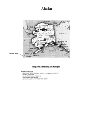
1. Alaska
Amchitka Island
Long-Term Stewardship Site Highlights
Amchitka Island (page 3)
Major Activities- soil and groundwater monitoring; enforcing access restrictions for
subsurface contamination
Site Size- 30,000 hectares (74,000 acres)
Start/End Years- 2004/in perpetuity
Estimated Average Annual Cost FY 2004-2006- $23,000
2. Table of Contents
Table of Contents
Amchitka Island ......................................................................... 3
Alaska
3. Amchitka Island
AMCHITKA ISLAND
1.0
SITE SUMMARY
1.1
Site Description and Mission
Amchitka Island is in the western Aleutian Islands
chain and is about 2,156 kilometers (1,340 miles)
southwest of Anchorage, Alaska. The site was first
used by the U.S. Government in 1943, when American
troops landed on the island to establish an airfield to
prevent the enemy forces from gaining strategic control
of the islands during World War II. Anti-personnel
devices such as steel spikes still remain scattered across
the island and continue to pose a hazard for onsite
workers.
LONG-TERM STEWARDSHIP HIGHLIGHTS
Major Long-Term Stewardship Activities- soil and
groundwater monitoring; enforcing access restrictions
for subsurface contamination
Total Site Area- 30,000 hectares (74,000 acres)
Estimated Volume of Residual Contaminants -
unknown
Long-Term Stewardship Start-End Years- 2004-in
perpetuity
Average Annual Long-Term Stewardship Cost FY
2004-2006- $23,000
Landlord -U.S. Department oflnterior
The U.S. Atomic Energy Commission (later known as
the U.S. Department of Energy) conducted three subsurface nuclear detonations on Amchitka Island in
October 1965, October 1969, and November 1971. The first of the three underground tests, known as Long Shot,
was a nuclear detection research experiment detonated at a depth of700 meters (2,300 feet), with a yield of about
80 kilotons. The second detonation, referred to as Milrow, was a high-yield seismic calibration test detonated
at a depth of 1,220 meters (4,000 feet), with a yield of about one megaton. The third and final detonation, known
as Cannikin, was a test of a proposed warhead. Cannikin was detonated at a depth of about 1,790 meters (5,875
feet), with a yield of almost five megatons. In addition to the three test locations, DOE is responsible for three
other areas where emplacement holes were drilled but never used for testing.
DOE's mission at Amchitka Island is to complete remediation of surface contamination and continue the longterm stewardship of residual subsurface contamination. Amchitka Island is currently part of the Alaska Maritime
National Wildlife Refuge and is managed by the U.S. Fish and Wildlife Service (USFWS). The USFWS will
continue to manage the site for the foreseeable future. DOE's expected end-state for Amchitka Island will allow
for future surface use at the site, with restrictions placed on intrusion into any capped soil areas. DOE will
restrict access to the test cavities, subsurface, and groundwater indefinitely.
1.2
Site Cleanup and Accomplishments
Drilling of the emplacement holes and post-test sampling resulted in surface contamination that consists of
approximately 30 contaminated areas, including six emplacement holes, one adjacent drill back hole, multiple
monitoring wells, multiple mud pits, landfills, and shaker pad areas. The potential constituents of concern for
surface soils and surface waters are total petroleum hydrocarbons from diesel fuel, volatile organic compounds,
lead, chromium, and tritium. A corrective action plan for the surface contamination is currently being developed
and corrective actions are scheduled to begin in 2001. A joint DOE, USFWS, and State of Alaska examination
of the area is currently scheduled for June 2000.
Based on site characterization, the DOE, USFWS, and State will make a decision for each area of contamination,
whether corrective action is warranted or if no surface remediation is necessary. Based on these decisions, each
area of surface contamination on the Island will either be "clean closed" or closed in place, although most are
expected to be closed in place. Closure in place will entail leaving the drilling muds in their present location,
draining water collected in basins above the mud pits, placing an engineered cover over the drilling muds, and
Alaska
3
4. Amchitka Island
DOE maintains the project-specific records at the
Nevada Operations Office in Las Vegas, Nevada.
These records include a compilation of work plans, data
reports, numerical models, numerical model results,
monitoring results, health assessments, risk
assessments, Letters of Accomplishment, Closure
Reports, comments and information submitted by the
public, relevant State agreements, and other writings
pursuant to the negotiated corrective action process.
Records are retained according to DOE records
retention procedures. Upon the completion of the
project, all project files will be transferred to controlled
storage at the Nevada Operations Office in Las Vegas,
Nevada, and other entities, as required by agreements
with the State of Alaska.
2.2
Specific Long-Term Stewardship Activities
Soil
STAKEHOLDER INVOLVEMENT
Public participation for the Amchitka Island
environmental restoration project is being implemented
in accordance with the State of Alaska regulations and
agreements reached with the USFWS and the
Aleutian/Pribilof Islands Association (which
represents the native population). At the initiation of
project work, DOE identified the relevant state
regulators, federal agencies, tribal governments,
interest groups, and stakeholders expected to have an
interest in the project and the site. Issues of interest
and concern and key decision points were identified
with stakeholders to determine the means by which
public involvement will occur. DOE conducts
frequent project status meetings/conference calls;
informational and technical briefings in accordance
with the project schedule; public meetings at
designated key decision points in the schedule; and
additional technical meetings on an as-needed basis.
Other opportunities for involvement might include
public hearings, town hall meetings, public workshops,
informational and technical briefings, and document
reviews.
If contaminated surface areas are closed in place with
engineered caps, institutional controls to restrict access
to the residual contamination may be required. The
specific long-term stewardship activities for the surface
areas will be detailed in the site closure report, but will include visual inspections, cap maintenance, information
management, and environmental monitoring activities.
Groundwater
A monument has been placed at the site to mark the locations of the test. DOE will maintain institutional controls
over the subsurface to prevent access to the test cavities, groundwater, and associated subsurface contamination
in perpetuity. The institutional controls will include a restriction on well drilling on the site. DOE will work
with the USFWS to ensure that all restrictions are incorporated into the USFWS management plan for the island.
Due to the geographic isolation of the site and the cost associated with visiting the site, DOE assumes that longterm stewardship and monitoring activities will be conducted every five years. Monitoring wells are estimated
to require repair or replacement every 25 years. At the end of the post-closure groundwater monitoring period
in 2104, the monitoring wells will be plugged and abandoned in place in accordance with state regulations.
2.3
Regulatory Regime
In accordance with applicable regulatory drivers listed below, DOE is responsible for identifying the nature and
extent of contamination, determining potential risk to the public and the environment, and performing the
necessary corrective actions in compliance with guidelines and requirements under federal regulatory drivers,
as well as the state-specific regulatory drivers associated with the site location.
Resource Conservation and Recoverv Act CRCRA): RCRA was the first comprehensive federal effort to deal
with solid and hazardous waste and regulates the generation, transportation, treatment, storage, and disposal of
hazardous waste. At Amchitka Island, RCRA is enforced to protect human health and the environment; conserve
energy and natural resources; reduce the amount of generated waste; and ensure that wastes are managed in an
environmentally sound manner.
Alaska
5
5. Amchitka Island
The long-term stewardship cost estimates for Amchitka Island are approximately $70,000 every fifth year through
2009. These costs include a visual site inspection, soil and groundwater sampling, and monitoring activities
conducted every five years. In addition, each five-year cost increment from FY 2011 to FY 2070 includes
$145,000 for data and sample analysis in the year following the collection of soil and groundwater samples. DOE
projects that the total post-FY 2070 (FY 2071-2104) costs will be approximately $1.4 million dollars.
4.0
FUTURE USES
DOE anticipates that the USFWS will continue to manage the island 30,000 hectares (74,000 acres) as a wildlife
refuge. Access to the test cavities, subsurface, and groundwater will continue to be restticted in perpetuity.
For additional information about the Amchitka Island site, please contact:
Ms. Monica Sanchez
U.S. Department of Energy, Nevada Operations Office
Environmental Restoration Division
232 Energy Way
North Las Vegas, NV 89030-4199
Phone:702-295-l862
sanchezm@nv.doe.gov
Alaska
Ms. Claire Caldes
U.S. Fish and Wildlife Service
Alaska Maritime National Wildlife Refuge
2355 Kachemak Bay Drive
Homer, AK 99603
Phone: 907-235-6546
claire_caldes @fws.gov
7