Which Way Is Up?
•
0 gefällt mir•358 views

Issues of user orientation in schematic maps - by Dr David Forrest, Glasgow University

Empfohlen
Empfohlen
Weitere ähnliche Inhalte
Mehr von British Cartographic Society
Mehr von British Cartographic Society (20)
Kürzlich hochgeladen
Kürzlich hochgeladen (20)
Which Way Is Up?
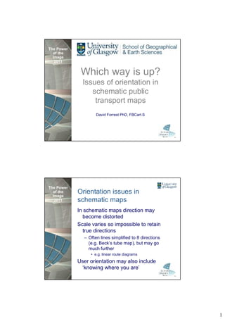
- 1. The Power of the Image 2011 Which way is up? Issues of orientation in schematic public transport maps David Forrest PhD, FBCart.S The Power of the Image Orientation issues in 2011 schematic maps In schematic maps direction may become distorted Scale varies so impossible to retain true directions – Often lines simplified to 8 directions (e.g. Beck’s tube map), but may go much further • e.g. linear route diagrams User orientation may also include ‘knowing where you are’ 1
- 2. The Power of the Image Partick station, Eastbound 2011 platform Train direction ^ N <W E> S The Power of the Image Westbound platform 2011 Train direction ^ N <E W> S 2
- 3. The Power of the Image Westbound platform - issues 2011 Will user appreciate orientation change At junctions, lines diverge to wrong side of forward direction Does not match map shown on train / timetable The Power of the Image 2011 3
- 4. The Power of the Image On a train … 2011 … should the destination on a ‘strip map’ always be towards the front of the train? The Power of the Paris Metro – line 1 Image 2011 4
- 5. The Power of the Paris RER – Line B Image 2011 The Power of the On a train should the destination Image on the ‘map’ always be towards the 2011 front of the train? Assumes trains always run in same orientation – Single line with no loops – Couldn’t work on Piccadilly Line Only works for single line ‘map’, not network map If both shown may not match – Confusion of users? 5
- 6. The Power of the Image Stop specific bus maps 2011 (SSBM) Maps designed for a particular stop – Only shows forward portion of routes calling at the bus stop – Display panels often of limited size with tall, narrow shape preferred Is forward direction up or down? How important is geographic reality? The Power of the Image 2011 Existing SSBM Designs Dundee All services shown Reads upwards Schematic design Some geographic truth Services truncated 6
- 7. The Power of the Image 2011 Existing SSBM Designs London All services shown Reads downwards Highly distorted schematic design Little geographic truth – shared parts of routes indicated The Power of the Existing Image 2011 SSBM Designs Edinburgh Lothian Buses services only – May be others Reads upwards Highly schematic design Little geographic truth Will user realise parts of routes are the same? 7
- 8. The Power of the Geography vs topology Image 2011 How do landmarks fit into a schematic map? – Eg river Thames provides geographic context for London Underground map How important are geographic landmarks to user orientation/positioning? – How do you get know you are reaching your destination? • Easy with metro/rail map, less so with bus map What geographical relationships should be retained? Circuit routing network must avoid obstacles. Is there a similarity with geographic features/landmarks? – May need to avoid some (eg crossing river) or be in close proximity to others The Power of the River Thames issue - 2009 Image 2011 8
- 9. The Power of the Image Metro maps including a major river 2011 New York Kiev Paris Lyon Barcelona (coast and river) Newcastle Boston Philadelphia Budapest Prague Hamburg Rome Montreal Rotterdam Munich Sao Paulo San Francisco Vienna St Petersburg Cairo Washington Santiago Amsterdam Warsaw Bucharest Cologne/Bonn Copenhagen Frankfurt New Delhi The Power of the Interchange maps/diagrams Image 2011 What happens when I get off the train? – Where do I find another train/bus/taxi? – Need simple diagrammatic map – How do we design a map of a potentially complex area that can easily be remembered? • May be struggling with luggage, etc – Also needs to tie in with signage 9
- 10. The Power of the Maps with varying detail Image 2011 User of public transport requires varying levels of detail at different stages of the journey Journey planning – what goes where? At start, need to find appropriate service During travel need to know when reaching destination – Don’t need much off-route information • Key landmarks useful for confirmation Need detail at interchange points The Power of the Map with varying detail: Image 2011 Spider map 10
- 11. The Power of the Image Research goal 2011 How to create a schematic map that is somehow globally ‘correct’ and preserves local detail (at decision points), but in an overall simplified and schematised form that easy to understand and retain at a glance – Unachievable dream!!!??? Lots of interesting discussion at Dagstuhl Seminar, Nov 2010 (Thanks to Jason Dykes for organisation) The Power of the 5 issues / challenges Image 2011 How to evaluate schematic map alternatives Error correction / location confirmation (disambiguate) – Requirements for landmarks in schematic maps Learnable, faster (at a glance graphic) – Especially at decision points Smooth transformation between different views – Between true geographic & schematic • Work by Jo Wood, City University – Between levels of schematisation Automated production of maps with varying levels of detail for different points of journey • Work by William Mackaness, Edinburgh U 11
- 12. The Power of the Image 2011 ICA Commission on Use & User Issues User Issues in Geospatial Public Transport Information Pre-conference workshop, ICC 2011, Paris July 1st & 2nd 2011 Paper & poster presentations; Hands on assessment of public transport information; Public transport map exhibition www.univie.ac.at/icacomuse www.icc2011.fr Information from david.forrest@glasgow.ac.uk 12