Tim Stonor_How should Norfolk grow?
•Als PPTX, PDF herunterladen•
0 gefällt mir•1,298 views

Presentation at the "How should Norfolk grow?" seminar organised by Richard Bacon MP and held in Norwich on 20th November 2015.

Empfohlen
Weitere ähnliche Inhalte
Ähnlich wie Tim Stonor_How should Norfolk grow?
Ähnlich wie Tim Stonor_How should Norfolk grow? (20)
Mehr von Tim Stonor
Mehr von Tim Stonor (11)
Kürzlich hochgeladen
Kürzlich hochgeladen (20)
Tim Stonor_How should Norfolk grow?
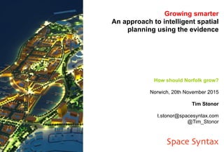
- 1. Growing smarter An approach to intelligent spatial planning using the evidence How should Norfolk grow? Norwich, 20th November 2015 Tim Stonor t.stonor@spacesyntax.com @Tim_Stonor Space Syntax
- 7. Underpinning policy with evidence Short-term 50 yearsThe right science for emergencies Current issues: Well-being, health, security & resilience e.g. Ebola e.g. Cybersecurity e.g. Future of Cities Medium-term Long-term Knowledge translated to economic advantage Advocacy and leadership for science Government’s Chief Scientific Adviser
- 9. Disconnected Layout Spatial Accessibility Score = 35 Connected layout Spatial Accessibility Score = 75 Disconnected Layout Connected Layout Difference IRR 15% 18% 3% NPV USD 1.1 billion USD 1.6 billion USD 0.5 billion Real estate value analysis
- 10. Suppressed movement economy. Enhanced movement economy. Main street, mixing global & local movement. Fast highways, separating global & local movement. Urban challenge #1 Fast highways replacing main streets
- 15. Modelling the Spatial Layout Attraction
- 16. New Extension Area (NEA) CBD area 2,000 3,000 750 2,500 1,500 1,000 500 250 2,000 750 2,500 1,500 1,000 500 250 0 to to to to to to to to Unimproved Capital Value (UCV) $ per m² above3,000 to Existing land value The Land value Model predicts a total land value for the CBD and the New Extension Area of more than 3.7 billion Australian dollars. Forecasting land value
- 18. The Integrated Transport Network model examines the employment impacts of rail infrastructure improvement 18 “Peak Ring North” scenario “Peak Ring South” scenario Note: model incorporates planned improvements under HS2/HS3 Model links rail and road infrastructure to capture integrated commuting time
Hinweis der Redaktion
- Good morning. I would like to start this presentation with a simple definition of planning. To me, planning is a matter of what goes where and how it connects together. So let me take those two components - the what and the how - with a couple of brief references to history.
- But first let’s start with "why". Why do we have cities, or towns, or villages? First, because they are places to bring goods into - to sell. And second, they are places of social exchange. They always have been and they always will be. So, in planning future places, we need to have this front and foremost in our minds: planning is about creating places that maximises opportunities to interact and exchange: to provide high levels of access between where people live and where they might work or take leisure.
- Here is a first lesson from history: at a very local level, the Romans knew all about this. The merchants lived immediately behind the shops: commuting four or five toga'd steps from where they lived to where they worked.
- A second lesson: the shops were arranged next door to each other, in lines, on the main streets, just like Harlesden: concentrating the land use to make it easier for shoppers to walk around as many of them as possible. And locating these shops on the main streets where people would mostly likely be in the first place. Lesson: streets matter.
- Next principle: streets connect as grids so that it is easy to move around them. It is hard to get lost in a grid.
- Next principle: city regions. Creating a hierarchy of interconnected places.
- Cities - and city regions - matter to the UK government for a number of reasons. First because of the pace of change occurring in UK cities in recent history and the change that is anticipated to occur in coming years. Second, because cities are places where policies land and where they either thrive or fail. And third because recent history in planning has sadly been one as much of failure as it has been of success: failed inner-city housing estates; underperforming low-density new towns - with the rare exception of the success of Milton Keynes. Traffic congestion, air-pollution and environmental degradation. Cities pose risks when they are planned badly. And perhaps most physically, we no longer seem to build streets. Instead we build highways between housing estates - and within the housing estates the houses are located higgledy piggledy. And this is where the science comes in. The government's Chief Scientific Advisor, Sir Mark Walport, is leading a project to look at the future of the UK cities over the next 25 to 50 years. I am a member of the group of eight advisors which is helping him and his colleagues prepare a report - in fact a series of reports which we have been publishing over the last two years - and will lead to a major final publication in the near future. Among our concerns has been a lack of scientific rigour in the planning of future places. We have also identified relatively low levels of spatial literacy amongst policymakers at a national and local level. It seems many of the lessons of the Romans have been forgotten: how to mix uses, and create street-based places that work as parts of systems of cities. But we have also identified the need to think boldly and often radically – to be imaginative. This has come as something of a challenge to people that we have met and as an amazing opportunity to many others. We have convened meetings where we have brought urban policy makers together in rooms not to dissimilar to this - to think not just about the next 5 to 10 years but about the next 25 to 50. This is taking people out of their typical mindsets and allowed them the freedom to be imaginative. At the same time, we have identified the need to bring professional disciplines together and for government departments, both national and local, to work with each other. On the face of it this may sound simple and obvious – to integrate transport planning and town planning with economic planning. In practice, as many of you know, this is harder to make happen. What has worked extremely well is when people have been able to meet not just once but regular and, when they do, to first identify a vision for the future: to describe or draw scenarios that they would like to achieve. Then to design the policies that will enable such a vision. And, at the same time, to create scenarios they would not like the future to look like so that policies that might produce these negative outcomes can be avoided. A key, largely missing, next step is to run analytics to forecast the impacts of proposed changes. Now, fortunately, this is my business: my company, Space Syntax, forecasts the effects of new land uses, and new road and rail connections, on human behaviour patterns and then on the social and economic outcomes of those behaviours: the effects on land values, social interaction, crime risk and health outcomes. We use computer models to do so. These have been developed over many years now and at the heart of them are spatial inputs: land use locations and road/rail connections. We have identified the science behind the everyday commonsense activities of real people. [Sadly, common sense that has largely been forgotten in modern town planning.]
- Here is a model of the UK system of cities where the colours, from hot to cold, indicate the density of the street network. What we have found is that the pattern of connectivity correlates with movement patterns inside as well as between urban settlements, with employment density numbers and crime patterns. What we found is that the spatial layout itself influences a very large part of these outcomes.
- This image shows two different versions of a masterplan for the same site: the only difference between the masterplans comes down to the location and number of street connections, yet if we look at the relationship between connectivity and lifetime land value, we can identify half a billion US dollars difference in the lifetime value of these masterplans. These are the kinds of values that are being made or lost when decisions on connectivity are being taken.
- And it is not just about the connections themselves– it is also the character and quality of connections: how buildings along those connections either face towards your face away from them; whether there is a high quality landscape; cycle routes and pedestrian crossings. Compare the Champs Élysées in Paris, where citywide land values are the highest on the main boulevards, with the road to Medina in Jeddah, where they are the lowest.
- Using these modelling techniques in practice it has been possible, as here in Darwin, Australia, to work with the Lord Mayr and her team of advisors, to create a plan that doubles the size of the city centre in a way that will create new, street-based urbanism with enhanced land values.
- Working with the Government Office for Science, Space Syntax has looked speculatively at new rail scenarios for the UK. In each case, we have been measuring how different connections create different levels of access to opportunities. On this side of a basis, policy can be formed. How do we create the right connections to build a Northern Powerhouse, or an Eastern Powerhouse? Or both? Which connections might come first? These are questions that can be addressed through modelling.
- In preparation for today’s event, I looked with my Space Syntax colleagues at Office for National Statistics projections of housing growth and employment growth across the UK. If we look at the East of England region, we see housing growth in large numbers being projected for Norwich and Ipswich - the green dots. At the same time we see employment numbers growing significantly in Peterborough and Cambridge - the red dots. Now I look at these and think you can either try to buck the trend and change the forecast numbers or you can try to work with them. If so, what could that mean?
- I think it could mean providing connections - better connections - between where people will live in the future and where they will work. It could mean Norfolk and Ipswich focusing housing growth westwards, in two “beams” of development that focus on Peterborough and Cambridge.
- That would then mean looking at road and rail between the spaces.
- Our initial analysis of the region - from a position that is so far largely ignorant of the detail of what has been going on in this region in recent years (so please forgive me) - is that the rail line between Norwich and Cambridge is a hugely underused resource. From what we have learnt, this connection - and perhaps others - has significant potential to grow. But when we then went looking for proposals to locate new housing and new jobs along the Norwich-Cambridge line, we could not find it - at least not in the numbers that the potential would suggest.
- What we might instead expect to find is the redevelopment of the agricultural stops along the line into new villages or small towns, combining housing and shopping as well as local working; allowing people to take the train into Cambridge to work during the week and into Norwich to take leisure at the weekend. This is one idea that I would like to explore with you today and clearly it is not the only idea. I look forward to hearing other ideas, especially those that focus on the creation of effective places for human transaction. And, if I may suggest one further step, it will be to consider these ideas regularly into the future: to think boldly and to work together; to evolve a plan for the future of Norfolk as part of a system of cities, towns and villages across the East of England, grow sustainably by better connecting both within itself as well as with its regional setting. Thank you.