SlideShare a Scribd company logo
1 of 12
Download to read offline
1 — The Freshwater Trust Uplift Report 2013
Uplift Report 2013
2 — The Freshwater Trust Uplift Report 2013
Using LiDAR data
and GIS technology
to determine a site’s
potential ecological uplift,
prior to committing
significant resources to
a restoration project,
allows us to best focus and
prioritize our restoration
assets in order to achieve
the most ecological gain
on the ground.
Table of Contents
Shade-a-lator......................................................................................................................................................................4
Nutrient Tracking Tool.......................................................................................................................................................5
Water Temperature Tracking Tool ....................................................................................................................................6
Stream Function Assessment Methodology................................................................................................................... 7
Salmon Calculator.............................................................................................................................................................8
Case Study: Rudio Creek ..................................................................................................................................................9
Uplift from 2013 Projects ...............................................................................................................................................10
Using recently developed — and in some cases, still
developing — tools for calculating the ecological
uplift of restoration projects, we are advancing a new
framework for communicating the value of our work.
Using this new framework, we quantified most of
our work in 2012 with regard to ecological uplift
and issued our first Uplift Report. In 2013 we
quantified new projects with the calculators, and
evaluated a new method to determine river health.
The process of calculating the uplift benefit of our
actions helps hone our organization’s focus on
delivering the best ecosystem outcomes for our
invested dollars and provides collaboration with
the restoration community to evaluate and test
chosen quantification tools. We understand that
for these uplift measurements to be used on a
S
ince the passage of the Endangered Species
and Clean Water Acts, there have been
many successful river restoration projects
along with great leaps in the engineering
and design of river restoration solutions ­— all driving
toward improving water quality and aquatic habitat.
Over the last decade, the restoration community has
been working to develop and implement methods
for economically and physically quantifying the
effects of long-term restoration actions within a more
accountable framework.
The Freshwater Trust has traditionally evaluated
and reported on projects in terms of dollars spent,
trees planted, gallons of water restored instream
or acres of floodplain reconnected. In 2012, our
approach evolved to measuring ecological benefit.
Quantifying Ecological Uplift: Why it is Important
Front Cover Images
Clockwise From Top Left:
Skyris Imaging;
Sean O’Connor,
Freesolo Collective;
NarrativeLab Communications;
Hanmi Meyer;
Sean O’Connor
Back Cover Images
Clockwise From Top Left:
Levi Schmidt;
Sean O’Connor;
Levi Schmidt
John Doe Sand & Gravel
Company
Owner: 	 John Doe
ADDRESS:	 1234 A Street
Acres:	 1.12
KCAL:	10,600,000
KCAL/ACRE:	 9,500,000
John Doe Sand & Gravel
Company
Key: Uplift Potential
	 High
	 Medium
	 Low
3 — The Freshwater Trust Uplift Report 2013
Why quantify?: The application of new tools and methods to
accurately quantify the ecological benefits of conservation actions
provides numerous benefits to practitioners, landowners, regulators,
conservation grant makers and policy makers charged with
managing our natural resources and environment.
Grants and other investments can be targeted based on modeled
ecological benefits (outcome-based) – potentially a more precise
method than the traditional evaluation of proposed actions
(process-based).
Landowners, particularly farmers, ranchers and foresters, can
better determine current (pre-project) conditions and accurately
track uplift (post-project) from conservation on their lands.
Practitioners can improve project design and associated
monitoring efforts.
Regulators could better track performance towards water quality
or species targets within a watershed, by accumulating quantified
results from projects over time.
Lawmakers and other policy leaders could use quantified
results from projects on the ground to better guide public
investment in conservation.
national scale to predict the effects of our actions
on true river restoration, we require the buy-in and
support of the regulatory, restoration and regulated
communities. Sometimes this involves automation
of the calculations we use regularly for efficiencies of
scale, and sometimes this involves evaluation of new
methods of measuring impact in a holistic manner.
What do we mean by ecological uplift? Simply put,
“uplift”refers to the environmental gain of a project
— the quantifiable environmental benefit of the
restoration actions we take. For example, consider
planting trees next to a stream. In the past, we have
focused on restoration inputs —trees planted or
habitat structures created. But not all parts of a
stream are created equal in the amount of ecosystem
services they provide. Using new tools and science,
we now employ an outcome-based process for our
actions (focusing on where the planting of trees has
the most benefit and the value of this benefit). For
example, we can now model the solar radiation that
will be blocked by mature trees, preventing river
waters from heating up to the detriment of cold
water species like salmon and steelhead.
Quantifying the benefits of restoration projects
in this way can provide a more robust picture
of a project’s ecological value. In fact, we are
now doing these calculations on projects before
implementation to determine potential ecological
uplift prior to committing significant resources
to a project. We do this to ensure we implement
restoration actions that achieve the most benefit for
the freshwater ecosystem.
Skyris Imaging
Sean O’Connor, Freesolo Collective
Acknowledgements
The Freshwater Trust would like to thank the following partners who developed the
tools & calculators to measure the ecological uplift in this report.
Counting on the Environment
ESA Vigil-Agrimis, Inc.
National Fish & Wildlife
Foundation
Oregon Department of
Environmental Quality
Oregon Department of
Transportation
Oregon State University
Parametrix, Inc.
Skidmore Restoration
Consulting, LLC
Texas Institute for Applied
Environmental Research
United States Department
of Agriculture
Watercourse Engineering, Inc.
Willamette Partnership
The Freshwater Trust is a non-profit
organization with a mission to preserve and
restore freshwater ecosystems.
With nearly 30 years of on-the-ground experience,
we continue to look for innovative ways to fix
imperiled rivers and streams. With the latest
tools and methods, we can attain efficiencies
that facilitate real environmental gains with less
cost, in less time.
4 — The Freshwater Trust Uplift Report 2013
Field staff maintain
a freshly planted riparian
site in the Rogue Basin of
southern Oregon.
Shade-a-lator
Quantifying solar load avoided through riparian restoration
MODEL INPUTS
Upstream & downstream
boundaries of the
stream reach
Stream aspect (azimuth)
Wetted width of the
stream
Bank slope
Distribution of existing
riparian trees & plants
Modeling time period,
including the time of
year the model is run &
the number of days the
model is run
Surrounding topography
R
iparian shade provided by streamside
vegetation blocks the sun’s rays from
reaching the surface of the water, reducing
the amount of thermal energy entering
the river. In effect, this shade prevents the water
from heating up. Anadromous fish, such as salmon
and steelhead, are extremely sensitive to water
temperature; therefore, healthy riparian buffers help
ensure healthy fish habitat.
Shade-a-lator is a module of Heat Source, a stream
assessment tool used by Oregon Department of
Environmental Quality (ODEQ). It was developed in
1996 at Oregon State University in the Departments
of Bioresource Engineering and Civil Engineering.
ODEQ currently maintains the Heat Source
methodology and software development.
Using pre-project data (see sidebar for model
inputs), Shade-a-lator calculates the current load
of solar radiation reaching the surface of a stream.
Once vegetation is planted, Shade-a-lator predicts
the new load of solar radiation reaching the stream
based on the new vegetation’s shading capacity at
maturity. The difference between pre-
project and post-project solar loading
represents a project’s uplift in terms of
solar radiation avoided by streamside
riparian vegetation. Shade-a-lator
expresses this uplift in energy units of
kilocalories per day. Once we have this
calculation, we can determine which
restoration sites will most benefit from
riparian restoration.
Shade-a-lator has been in use and
ongoing development for more than a
decade. With The Freshwater Trust’s
projects, its refinement will continue.
Projections
based
on tree
maturity
BEFORE Restoration AFTER Restoration
HOW IT WORKS: Calculating Uplift for Solar Load Avoided
Uplift = Change in kilocalories per day (a measurement of energy)
Solar Load Avoided
Tool used Shade-a-lator
Units of measure kilocalories per day (kcals/day)
Before (pre-project) 10,000,000
After (post-project) 4,500,000
UPLIFT 5,500,000 kcals/day
Sample restoration
actions
• Plant streamside vegetation
Solar Load 		 Solar Load Avoided
Don Jacobson
5 — The Freshwater Trust Uplift Report 2013
of conservation actions — from riparian actions like
fence building to exclude livestock, to changed farm
practices like improving irrigation methods.
Sean O’Connor, Freesolo Collective
major water quality concern across the
United States is the abundance of nutrients
such as nitrogen and phosphorus in our
freshwater systems. Too much nitrogen
and phosphorus promotes excessive plant and
algae growth, choking out other aquatic species.
Large sediment loads that carry these nutrients
can also harm aquatic systems. They can settle
into streambeds and fill in the spaces between the
rocks and gravel — spaces that are essential for
salmonid spawning.
Nationwide, runoff from farming and ranching
operations contribute large loads of nitrogen and
phosphorus. The Freshwater Trust is working to
measure the benefit of conservation actions that
limit these inputs while maintaining productive
agricultural lands.
The Nutrient Tracking Tool (NTT) is a sophisticated
modeling tool that allows the user to create a
detailed scenario of on-field agricultural practices
(see sidebar for model inputs). NTT models the
agricultural practices and then estimates the annual
nutrient and sediment loads that occur as a result
of these actions. NTT can model a wide assortment
Nutrient Tracking Tool (NTT)
Quantifying reduced nitrogen, phosphorus and sediments from riparian
improvements and changes to agricultural practices
MODEL INPUTS
Crop type & livestock type
Crop rotations
Fertilizer application rates
Irrigation practices
Livestock access to
streams
Pesticide application rates
Tillage practices
Field size & slope
Geographic location
Local weather data
Soil type
Soil phosphorus
concentration
BEFORE Restoration AFTER Restoration
HOW IT WORKS: Calculating Uplift for Decreased Nutrient & Sediment Loads
Uplift = Change in pounds per year of phosphorus, nitrogen and/or sediment load
BEFORE Restoration AFTER Restoration
Agricultural runoff
drains into stream
Vegetation
filters runoff
Nutrient & Sediment Reduction
Tool used Nutrient Tracking Tool (NTT)
Units of measure Pounds per year (lbs/year)
Phosphorus Nitrogen Sediments
Before (pre-project) 10 100 2,000
After (post-project) 5 25 100
UPLIFT 5 lbs/year 75 1,900
Sample conservation
actions
• Plant streamside vegetation
• Implement cover crops
• Livestock exclusion
NTT calculates uplift in terms of nitrogen, phosphorus
and sediment load reductions by comparing pre-
project conditions of a field to modeled conditions after
restoration or changed farm practices.The difference
represents the uplift from conservation actions. Once
we have this calculation, we can assess the impact of
site-level restoration as a component of a basin-scale
water quality problem.
NTT was designed and developed by the United
States Department of Agriculture (USDA) Natural
Resources Conservation Service, the USDA
Agricultural Research Service and Texas Institute for
Applied Environmental Research. 
The Freshwater Trust
uses elevation data and
geoprocessing to delineate
micro-drainage areas of
riparian planting sites, as
shown in this image.
Key:
	 Riparian
	 Planting Area
	 Drainage Basins
	 Project Area 		
	 Drainage Basins
Flow Accumulation:
	 High
	Low
6 — The Freshwater Trust Uplift Report 2013
Field staff take
a flow measurement
to help determine the
temperature benefit for
restored flow.
ncreasing river flow can buffer water
temperature and increase velocity through
a stream reach. Higher velocity can limit the
water’s exposure to local solar impact, keeping
the water from warming. Additional temperature
benefits can be achieved if the increased flow is
cooler than the water in the existing stream reach.
The Water Temperature Transaction Tool (W3T)
uses river and landscape characteristics to estimate
hourly solar radiation and overall heat loss or
gain from a water body. W3T also incorporates
temperature and flow inputs provided by tributaries
MODEL INPUTS
River length, width &
depth
Stream bed roughness
Topographical &
vegetation features:
surrounding zones of
vegetation that provide
shade & inhibit solar
radiation
Inflow water
temperatures
Flow volumes
Atmospheric heat
exchange, air-water
interface & bed-water
interface
Tributary inputs
River velocity
Water Temperature Transaction Tool (W3T)
Quantifying decreased water temperature through flow restoration
Terry Stroh
and meteorological information. From these inputs,
W3T calculates temperature changes in a river reach.
W3T is based on a steady flow approach requiring
pre-project data (see sidebar for model inputs). W3T
models water temperature based on energy transfer
to and from the water across the air-water interface
and bed-water interface. W3T also accounts for
transport of heat energy in the downstream direction.
Water temperature reduction from increased flow can
be determined by subtracting pre-project conditions
from modeled conditions after flow has been
restored. The difference in water temperature
represents the temperature improvement
(uplift) from restoring flow to that reach. Once
the temperature impacts of flow are quantified,
flow restoration can be used as a tool to directly
address and account for water temperature
as a limiting factor that affects the survival of
threatened and endangered fish species.
National Fish and Wildlife Foundation
contracted with Watercourse Engineering to
develop the W3T model, with funding from
USDA Natural Resources Conservation Service.
HOW IT WORKS: Calculating Uplift for Decreased Water Temperature
Water Temperature Decreased (Daily Max)
Tool used
Water Temperature
Transaction Tool (W3T)
Units of measure
Cubic feet per
second (cfs)
Degrees
Celsius (o
C)
Before (baseline) 1 20
After (post-project) 2 18
UPLIFT 1 cfs 2 o
C
Sample restoration
actions
• Introduce cooler water
• Increase stream velocity
• Deepen channel
BEFORE
Restoration
AFTER
Restoration
Uplift = Change in cubic feet per second/degrees Celsius
1,000 feet stream reach
2 cfs
(cubic feet per second)
18o
C
(stream temperature)
1,000 feet stream reach
1 cfs
(cubic feet per second)
20o
C
(stream temperature)
–1 cfs
–2 cfs
7 — The Freshwater Trust Uplift Report 2013
after restoration actions,
users are able to quantify
uplift from restoration
actions. Once we have this
calculation, we can track
the progress of our habitat
restoration projects against
restoration goals, over time.
The Stream Function
Assessment Methodology
is being developed for Oregon by ESAVigil-Agrimis
and Skidmore Restoration Consulting, LLC with
funding from US Environmental Protection Agency.
The tool is designed for use in Oregon’s stream
compensatory mitigation program being developed
by Oregon Department of State Lands, US Army
Corps of Engineers, US Environmental Protection
Agency and Willamette Partnership.
The Stream Function Assessment Methodology
is undergoing beta testing, including extensive
field testing throughout Oregon in 2014. While
the tool is still under development, early adoption
enables The Freshwater Trust to calculate the 2013
level of function for our stream restoration sites.
T
he Stream Function Assessment
Methodology was designed as a rapid
assessment that evaluates stream
functions and values. Stream functions
are the processes that create and support healthy
stream ecosystems; functions include flow
variation, sediment mobility and nutrient cycling.
The Stream Function Assessment Methodology
defines stream values as the ecological and
societal benefits that the stream functions provide.
The Excel-based calculator generates scores for
hydrologic, geomorphic, biologic and water quality
(chemical, nutrient and thermal) functions as well
as the importance of each of those functions.
Inputs for the tool are collected both in the field and
using online resources (see sidebar for model inputs).
The methodology considers stream and riparian
area characteristics along with the ecological and
societal benefits of that stream in generating the
functional assessment.The output of the tool is a
score between 0% and 100%, rating the function and
the value of the stream.This score is multiplied by the
linear feet of stream affected to generate functioning
linear feet of stream. By calculating the difference
between functioning linear feet of stream before and
A Chinook helicopter
places large wood
instream to build large
wood habitat structure,
a restoration action that
supports healthy habitat
for wild fish and other
aquatic species.
Sean O’Connor,
Freesolo Collective
Stream Function Assessment Methodology
Quantifying improvements in stream function through instream and riparian restoration
MODEL INPUTS
Aquatic species structure
and composition
Distribution of ESA-listed
fish species
Distribution of rare
species
Riparian structure and
composition
Flow characteristics and
depth
Floodplain connectivity
Water quality information
Sediment characteristics
and mobility
Stream order, gradient
and permeability
Geomorphic stability
Presence of off-channel
habitat
Aquatic features such as
riffles, runs and pools
Presence of rare plants
and animals
Proximity to intact
ecosystems
Presence of irrigation
withdrawals
HOW IT WORKS: Calculating Uplift for Increased Stream Function
BEFORE
Restoration
AFTER
Restoration
Uplift = Change in functional linear feet of stream
Scott Wright
Increased Stream Function
Tool used
Stream Functional
Assessment Methodology
Units of measure Functional linear feet (FLF) of stream
Before (pre-project) 100
After (post-project) 400
UPLIFT 300 FLF
Sample restoration
actions
• Large wood habitat placement
• Plant streamside vegetation
• Create off-channel habitat
Stream function disrupted
Stream function restored
8 — The Freshwater Trust Uplift Report 2013
T
he Salmon Calculator is designed to
quantify ecological changes that directly
impact salmon habitat through modeling,
on average, how well a given stream reach
supports salmon. Based on the inputs of physical
characteristics of the stream and terrestrial
areas (see sidebar for model inputs), the Salmon
Calculator measures the ecological functions of
a stream with regard to its ability to create and
maintain salmon habitat. The Salmon Calculator
then consolidates those ecological functions into
one salmon habitat score. The score is a percentage
of functional habitat per linear foot of stream, which
is recorded as weighted linear feet. Once we have
this calculation, we can
understand the impact
of our projects on the
habitat needs of listed
salmonids.
The Salmon
Calculator was
developed as part
of Counting on the
Environment, a USDA
Natural Resources
Field staff
collect hydrologic,
geomorphologic,
biological and water
quality data on Rudio
Creek for stream habitat
assessments.
Sean O’Connor,
Freesolo Collective
Salmon Calculator
Quantifying increased salmon habitat through stream restoration
Conservation Service grant project managed by
Willamette Partnership. The development of the
Salmon Calculator began as part of the Oregon
Department of Transportation bridges project and
was further refined by Parametrix, Inc.
The Salmon Calculator has been valuable in
helping us improve our understanding of how
instream actions affect species health, but a more
robust stream assessment tool is being developed
that will further improve our ability to estimate
stream function for salmon. (See Stream Function
Assessment Methodology, previous page.) To
enable ongoing evaluation of the uplift of our prior
actions, however, we continue to use the Salmon
Calculator into 2013.As demonstrated by the shift
from the Salmon Calculator to the Stream Function
Assessment, the restoration community is still
determining the best measure of stream ecosystem
health for salmon. In Oregon right now, three
standards of measurement are used: NOAA’s Habitat
Equivalency Analysis, the Columbia River Basin
Federal Caucus’Survival Benefit Unit and the Stream
Function Assessment. In 2014,The Trust is engaging
with this community to evaluate and adopt the most
practical measure of stream health for salmon.
MODEL INPUTS
Distribution & abundance
of aquatic & riparian
native & nonnative
vegetation
Stream width & depth
Substrate characteristics
Flow & depth
characteristics
Aquatic features such as
log jams, pools, riffles,
glides, alcoves, gravel
bars & cascades
Floodplain connectivity
Barriers to fish movement
Land use
Floodplain slope, width
& soil type
Amount of large wood
Historical frequency &
duration of flooding
HOW IT WORKS: Calculating Uplift for Increased Salmon Habitat
Increased Salmon Habitat
Tool used Salmon Calculator
Units of measure
Weighted linear feet (WLF)
of salmon habitat
Before (pre-project) 100
After (post-project) 400
UPLIFT 300 WLF
Sample restoration
actions
• Construct large wood
habitat structures
• Plant streamside vegetation
• Reconnect floodplains
• Increase pools & riffles
BEFORE
Restoration
AFTER
Restoration
Uplift = Change in weighted linear feet of salmon habitat
functional habitat
150+ 50= 400 WLF (40%) of50+ 150+
functional habitat
50+25+ 25= 100 WLF (10%) of
1,000 feet stream reach
Mary Edwards Photography
9 — The Freshwater Trust Uplift Report 2013
1
2
The newly re-
meandered channel of
Rudio Creek in central
Oregon restores this
stream to its historical
floodplain.
Returning a Stream to its Natural State: Historic land use practices
moved Rudio Creek to the edge of its floodplain to facilitate agriculture.The
shorter, straightened channel increased stream energy which disconnected the
channel from its floodplain, increased substrate size and reduced the number and
complexity of pools. Returning Rudio Creek to its 1946 historical alignment will, over
time, restore self sustaining habitat conditions that benefit salmon and steelhead.
fish during high winter flows or cold water refugia
during warm summer periods.These features were
designed to emulate the beaver dam ponds that were
historically present at the project area. 2013 activities
consisted of constructing four off-channel ponds
with associated side channel complexes.
Increase instream flow. The Freshwater Trust
entered an agreement with the landowners on Rudio
Creek that requires their diversions from Rudio
Creek to stop when flows at the mouth drop below 2
cubic feet per second or on July 1, whichever occurs
first. This contractual obligation protects late-
summer flows to the mouth of Rudio Creek, which
historically ran dry.
n 2012,The Freshwater Trust reconstructed
the historic channel of Rudio Creek to
restore its natural flow and habitat. In 2013,
The Freshwater Trust implemented several
additional restoration elements complementary to
the major restoration activities completed in 2012.
These elements are designed to ensure the site
continues on its restoration trajectory and increases
habitat for juvenile spring Chinook and summer
steelhead. 2013 work included construction of
off-channel ponds with side channel connections
to Rudio Creek, and livestock exclusion fencing and
hardwood plantings to promote riparian recovery.
Promote riparian vegetation via hardwood
planting and livestock exclusion fencing. Riparian
vegetation is intended to provide channel stability,
shade, cover and dam building material for beaver.
2013 activities consisted of planting native, rooted
cottonwoods along the banks of Rudio Creek.
Construct side channels and ponds. Side
channels and ponds provide a diversity of habitats
for juvenile spring Chinook salmon and summer
steelhead.These floodplain habitats often derive a
major portion of their flow from either groundwater
or seepage from the adjacent stream. Side channel
and pond features can provide velocity refugia for
Case Study: Rudio Creek
Sean O’Connor, Freesolo Collective
3
1946
1965
1984
2001
Base Image 1946 Aerial Photo, Prepared by River Design Group
Upliftfrom2013Projects
SolarLoad
Avoided
Phosphorus
Reduced
Nitrogen
Reduced
Sediments
Reduced
Increased
StreamFunction
WaterTemperature
Decreased
(DailyMax)
Increased
SalmonHabitat
ToolusedShade-a-latorNutrientTrackingTool(NTT)
StreamFunction
Assessment
Methodology
WaterTemperature
TransactionTool
(W3T)
SalmonCalculator
Unitsofmeasure
Kilocaloriesperday
(kcals/day)
Poundsperyear
(lbs/year)
Poundsperyear
(lbs/year)
Poundsperyear
(lbs/year)
Functionallinear
feet(FLF)
DegreesCelsius
(°C)
Weightedlinearfeet
(WLF)
Before(pre-project)16,748,2600.06.65762,1491,489
After(post-project)7,040,4690.05.42042,3761,511
Uplift9,707,7910.01.237222722
RestorationActions7,599feetofstreamprotected,70.2acresofriparianareaprotected,500nativetreesinstalled,17,164squarefeetofoffchannelhabitatcreated
Before(pre-project)77,626,4670.00.41
After(post-project)36,187,7300.00.30
Uplift41,438,737*0.0*0.1*1*
RestorationActions4,525nativetreesandshrubsinstalled
Before(pre-project)3,120,6055.044.54,918
After(post-project)667,9874.330.53,130
Uplift2,452,6180.714.01,788
RestorationActions3,600nativetreesandshrubsinstalled
Before(pre-project)63,885,35169.4447.634,300
After(post-project)45,356,10066.3418.233,544
Uplift18,529,2513.129.4756
RestorationActions8,450nativetreesandshrubsinstalled
Before(pre-project)15,477,5630.31.4163
After(post-project)6,550,6940.00.875
Uplift8,926,8690.30.688
RestorationActions5,600nativetreesandshrubsinstalled
Before(pre-project)50,074,31027.2136.141,231
After(post-project)8,264,7102.815.01,114
Uplift41,809,60024.4121.140,117
RestorationActions5,441nativetreesandshrubsinstalled
Before(pre-project)33,093,2471.812.62,717
After(post-project)9,521,1471.48.81,468
Uplift23,572,1000.43.81,249
RestorationActions2,880nativetreesandshrubsinstalled
Before(pre-project)66,637,2932.312.32,152
After(post-project)9,715,3681.98.61,344
Uplift56,921,9250.43.7808
RestorationActions3,360nativetreesandshrubsinstalled
10 — The Freshwater Trust Uplift Report 2013
Inadditiontotheprojects
listedinthisUpliftReport,
TheFreshwaterTrustalso
protected15.62billiongallons
(113milliongallonsofwaterper
day)instreamacrossthestate.
RogueRiver
Mile128
Phase2
RogueBasin
RudioRanch
JohnDayBasin
MillRaceRiver
Mile2
WillametteBasin
Lewis&Clark
RiverMile9
NorthCoastBasin
MiddleFork
JohnDayRiver
Mile50
JohnDayBasin
Applegate
RiverMile28.5
RogueBasin
Applegate
RiverMile29.5
RogueBasin
Applegate
RiverMile30
RogueBasin
11 — The Freshwater Trust Uplift Report 2013
Before(pre-project)0.00.0960
After(post-project)0.00.0540
Uplift0.00.0420
RestorationActions8,448feetofstreamprotected,150.5acresofriparianareaprotected
Before(pre-project)15.192.314,84221.6
After(post-project)5.717.16,73421.5
Uplift9.475.28,1080.1
RestorationActions0.52cfsrestoredinstream(10%oftotalflow)
Before(pre-project)11.439.510,78619.8
After(post-project)0.46.179819.7
Uplift11.033.49,9880.1
RestorationActions0.80cfsrestoredinstream(31%oftotalflow)
Before(pre-project)1,288
After(post-project)2,000
Uplift712
RestorationActions629feetofsidechannelhabitatrestored,5largewoodhabitatstructures,2,746feetofstreamrestored
Before(pre-project)1,130
After(post-project)5,192
Uplift4,062
RestorationActions5,067feetofsidechannelhabitatrestored,16largewoodhabitatstructures,2,640feetofstreamrestored
Before(pre-project)600
After(post-project)1,548
Uplift948
RestorationActions1,005feetofsidechannelhabitatrestored,3largewoodhabitatstructures,763feetofstreamrestored
Before(pre-project)901
After(post-project)1,486
Uplift585
RestorationActions631feetofsidechannelhabitatrestored,1largewoodhabitatstructure,1,404feetofstreamrestored
Before(pre-project)28.8
After(post-project)26.9
Uplift1.9
RestorationActions1.39cfsrestoredinstream(85%oftotalflow)
QuantifiedUpliftfor2013Projects203,358,891kcals/day49.7lbs/year282.5lbs/year63,695lbs/year6,534FLF2.1°C22WLF
QuantifiedUpliftfor2012Projects80,422,822kcals/day5.5lbs/year82.6lbs/year1,579lbs/yearn/a**1.0°C7,170WLF
CumulativeQuantifiedUplift
(2012+2013)
283,781,713kcals/day
(solarloadavoided)
55.2lbs/year
(reducedphosphorus)
365.1lbs/year
(reducednitrogen)
65,274lbs/year
(reducedsediments)
6,534FLF
(increased
streamfunction)
3.1°C
(reducedmaxdaily
watertemperature)
7,192WLF
(increased
salmonhabitat)
*ThesenumbersarefromthePhase2plantingofRogueRiver.The2013plantingaugmentedtheplantingin2012.
**TheStreamFunctionalAssessmentMethodologywasnotavailablein2012.
NOTESTOTABLE
The Freshwater Trust Uplift Report 2013 — 11
MiddleFork
JohnDayRiver
Reach1
JohnDayBasin
Catherine
Creek
GrandeRondeBasin
Fifteenmile
Creek
HoodBasin
SalmonRiver
Mile0.91–1.43
SandyBasin
StillCreek
Reach1
(PumpkinPatch)
SandyBasin
StillCreek
Reach2
(Straights)
SandyBasin
StillCreek
Reach3
(Compression)
SandyBasin
RudioCreek
JohnDayBasin
NON-PROFIT
ORGANIZATION
U.S. POSTAGE
PAID
PORTLAND, OR
PERMIT No. 4313
65 SWYamhill Street, Suite 200
Portland, OR 97204
ADDRESS SERVICE REQUESTED

More Related Content

What's hot

Creating Successful Wetlands
Creating Successful WetlandsCreating Successful Wetlands
Creating Successful WetlandsYnes Arocho
 
Gray vs. Green: The Role of Watershed-scale Green Infrastructure Systems for ...
Gray vs. Green: The Role of Watershed-scale Green Infrastructure Systems for ...Gray vs. Green: The Role of Watershed-scale Green Infrastructure Systems for ...
Gray vs. Green: The Role of Watershed-scale Green Infrastructure Systems for ...Mcrpc Staff
 
A Systematic, Multi-Criteria Decision Support Framework for Sustainable Drain...
A Systematic, Multi-Criteria Decision Support Framework for Sustainable Drain...A Systematic, Multi-Criteria Decision Support Framework for Sustainable Drain...
A Systematic, Multi-Criteria Decision Support Framework for Sustainable Drain...Jo-fai Chow
 
Stream buffer 20131108
Stream buffer 20131108Stream buffer 20131108
Stream buffer 20131108Mcrpc Staff
 
Dr Jeff Connor at the Landscape Science Cluster Seminar, May 2009
Dr Jeff Connor at the Landscape Science Cluster Seminar, May 2009Dr Jeff Connor at the Landscape Science Cluster Seminar, May 2009
Dr Jeff Connor at the Landscape Science Cluster Seminar, May 2009pdalby
 
Rainwater_Filtration_Spring_Final_Report_2.0
Rainwater_Filtration_Spring_Final_Report_2.0Rainwater_Filtration_Spring_Final_Report_2.0
Rainwater_Filtration_Spring_Final_Report_2.0Derek Munsch
 
Canada; Rainwater Collection System: A Feasibility Study for Dalhousie Univ...
Canada;  Rainwater Collection System:  A Feasibility Study for Dalhousie Univ...Canada;  Rainwater Collection System:  A Feasibility Study for Dalhousie Univ...
Canada; Rainwater Collection System: A Feasibility Study for Dalhousie Univ...D5Z
 
Nature Nights: A Low-to-No Snow Future
Nature Nights: A Low-to-No Snow FutureNature Nights: A Low-to-No Snow Future
Nature Nights: A Low-to-No Snow FutureDesLandTrust
 
rain gardens & Permeable Pavements
rain gardens & Permeable Pavementsrain gardens & Permeable Pavements
rain gardens & Permeable Pavementsdhilgers
 
Benefits of Manure Digesters
Benefits of Manure DigestersBenefits of Manure Digesters
Benefits of Manure Digesterslakeimprovement
 
The Critical Link Between Aquifer Exemptions and teh Sustainability of Water ...
The Critical Link Between Aquifer Exemptions and teh Sustainability of Water ...The Critical Link Between Aquifer Exemptions and teh Sustainability of Water ...
The Critical Link Between Aquifer Exemptions and teh Sustainability of Water ...Dan Arthur
 
Review the effectiveness of constructed wetlands for the treatment of either ...
Review the effectiveness of constructed wetlands for the treatment of either ...Review the effectiveness of constructed wetlands for the treatment of either ...
Review the effectiveness of constructed wetlands for the treatment of either ...www.StudentsAssignmentHelp.com
 
T4: GROUNDWATER MANAGEMENT AND WATER GOVERNANCE THE EGYPTIAN EXPERIENCE
T4: GROUNDWATER MANAGEMENT AND WATER GOVERNANCETHE EGYPTIAN EXPERIENCET4: GROUNDWATER MANAGEMENT AND WATER GOVERNANCETHE EGYPTIAN EXPERIENCE
T4: GROUNDWATER MANAGEMENT AND WATER GOVERNANCE THE EGYPTIAN EXPERIENCEFAO
 
Rainwater Harvesting System Planning - Texas A&M University
Rainwater Harvesting System Planning - Texas A&M UniversityRainwater Harvesting System Planning - Texas A&M University
Rainwater Harvesting System Planning - Texas A&M UniversityK9T
 
Texas; Rainwater Harvesting Systems For Residential And Commercial Systems
Texas;  Rainwater Harvesting Systems For Residential And Commercial SystemsTexas;  Rainwater Harvesting Systems For Residential And Commercial Systems
Texas; Rainwater Harvesting Systems For Residential And Commercial SystemsD2Z
 
2017 Open Space Conference - Ellie Cohen - Accelerating Nature-based Solution...
2017 Open Space Conference - Ellie Cohen - Accelerating Nature-based Solution...2017 Open Space Conference - Ellie Cohen - Accelerating Nature-based Solution...
2017 Open Space Conference - Ellie Cohen - Accelerating Nature-based Solution...OpenSpaceCouncil
 

What's hot (20)

Creating Successful Wetlands
Creating Successful WetlandsCreating Successful Wetlands
Creating Successful Wetlands
 
Gray vs. Green: The Role of Watershed-scale Green Infrastructure Systems for ...
Gray vs. Green: The Role of Watershed-scale Green Infrastructure Systems for ...Gray vs. Green: The Role of Watershed-scale Green Infrastructure Systems for ...
Gray vs. Green: The Role of Watershed-scale Green Infrastructure Systems for ...
 
A Systematic, Multi-Criteria Decision Support Framework for Sustainable Drain...
A Systematic, Multi-Criteria Decision Support Framework for Sustainable Drain...A Systematic, Multi-Criteria Decision Support Framework for Sustainable Drain...
A Systematic, Multi-Criteria Decision Support Framework for Sustainable Drain...
 
Houston Engineering - Private Public Partnerships
Houston Engineering - Private Public PartnershipsHouston Engineering - Private Public Partnerships
Houston Engineering - Private Public Partnerships
 
Stream buffer 20131108
Stream buffer 20131108Stream buffer 20131108
Stream buffer 20131108
 
Considering Climate Change in Land Stewardship
Considering Climate Change in Land StewardshipConsidering Climate Change in Land Stewardship
Considering Climate Change in Land Stewardship
 
Dr Jeff Connor at the Landscape Science Cluster Seminar, May 2009
Dr Jeff Connor at the Landscape Science Cluster Seminar, May 2009Dr Jeff Connor at the Landscape Science Cluster Seminar, May 2009
Dr Jeff Connor at the Landscape Science Cluster Seminar, May 2009
 
Rainwater_Filtration_Spring_Final_Report_2.0
Rainwater_Filtration_Spring_Final_Report_2.0Rainwater_Filtration_Spring_Final_Report_2.0
Rainwater_Filtration_Spring_Final_Report_2.0
 
Canada; Rainwater Collection System: A Feasibility Study for Dalhousie Univ...
Canada;  Rainwater Collection System:  A Feasibility Study for Dalhousie Univ...Canada;  Rainwater Collection System:  A Feasibility Study for Dalhousie Univ...
Canada; Rainwater Collection System: A Feasibility Study for Dalhousie Univ...
 
Nature Nights: A Low-to-No Snow Future
Nature Nights: A Low-to-No Snow FutureNature Nights: A Low-to-No Snow Future
Nature Nights: A Low-to-No Snow Future
 
rain gardens & Permeable Pavements
rain gardens & Permeable Pavementsrain gardens & Permeable Pavements
rain gardens & Permeable Pavements
 
Benefits of Manure Digesters
Benefits of Manure DigestersBenefits of Manure Digesters
Benefits of Manure Digesters
 
The Critical Link Between Aquifer Exemptions and teh Sustainability of Water ...
The Critical Link Between Aquifer Exemptions and teh Sustainability of Water ...The Critical Link Between Aquifer Exemptions and teh Sustainability of Water ...
The Critical Link Between Aquifer Exemptions and teh Sustainability of Water ...
 
NZC - Morgan
NZC - MorganNZC - Morgan
NZC - Morgan
 
Review the effectiveness of constructed wetlands for the treatment of either ...
Review the effectiveness of constructed wetlands for the treatment of either ...Review the effectiveness of constructed wetlands for the treatment of either ...
Review the effectiveness of constructed wetlands for the treatment of either ...
 
T4: GROUNDWATER MANAGEMENT AND WATER GOVERNANCE THE EGYPTIAN EXPERIENCE
T4: GROUNDWATER MANAGEMENT AND WATER GOVERNANCETHE EGYPTIAN EXPERIENCET4: GROUNDWATER MANAGEMENT AND WATER GOVERNANCETHE EGYPTIAN EXPERIENCE
T4: GROUNDWATER MANAGEMENT AND WATER GOVERNANCE THE EGYPTIAN EXPERIENCE
 
ENV 101 Ch15 lecture ppt_a
ENV 101 Ch15 lecture ppt_aENV 101 Ch15 lecture ppt_a
ENV 101 Ch15 lecture ppt_a
 
Rainwater Harvesting System Planning - Texas A&M University
Rainwater Harvesting System Planning - Texas A&M UniversityRainwater Harvesting System Planning - Texas A&M University
Rainwater Harvesting System Planning - Texas A&M University
 
Texas; Rainwater Harvesting Systems For Residential And Commercial Systems
Texas;  Rainwater Harvesting Systems For Residential And Commercial SystemsTexas;  Rainwater Harvesting Systems For Residential And Commercial Systems
Texas; Rainwater Harvesting Systems For Residential And Commercial Systems
 
2017 Open Space Conference - Ellie Cohen - Accelerating Nature-based Solution...
2017 Open Space Conference - Ellie Cohen - Accelerating Nature-based Solution...2017 Open Space Conference - Ellie Cohen - Accelerating Nature-based Solution...
2017 Open Space Conference - Ellie Cohen - Accelerating Nature-based Solution...
 

Similar to 2013 Uplift Report: Quantifying Ecological Uplift

2012 Uplift Report: Quantifying Ecological Benefit
2012 Uplift Report: Quantifying Ecological Benefit2012 Uplift Report: Quantifying Ecological Benefit
2012 Uplift Report: Quantifying Ecological BenefitThe Freshwater Trust
 
Environmental Services for the Great Lakes SOQ 033016
Environmental Services for the Great Lakes SOQ 033016Environmental Services for the Great Lakes SOQ 033016
Environmental Services for the Great Lakes SOQ 033016Mike Lancioni
 
AAEE E3Competition-Winners-2002
AAEE E3Competition-Winners-2002AAEE E3Competition-Winners-2002
AAEE E3Competition-Winners-2002Dennis Palalay
 
Port lavaca desalination study
Port lavaca desalination studyPort lavaca desalination study
Port lavaca desalination studyJeffrey Pickett
 
GreenWater Stakeholders Package
GreenWater Stakeholders PackageGreenWater Stakeholders Package
GreenWater Stakeholders PackageJeff Lemon
 
Ethical Corp Report Summary Water Footprinting
Ethical Corp Report Summary   Water FootprintingEthical Corp Report Summary   Water Footprinting
Ethical Corp Report Summary Water FootprintingEthical Corporation
 
Cc natural capital accounting wp_aw2_digital
Cc natural capital accounting wp_aw2_digitalCc natural capital accounting wp_aw2_digital
Cc natural capital accounting wp_aw2_digitalThe Coca-Cola Company
 
FY 2013 R&D REPORT January 6 2014 - National Oceanic and Atmospheric Administ...
FY 2013 R&D REPORT January 6 2014 - National Oceanic and Atmospheric Administ...FY 2013 R&D REPORT January 6 2014 - National Oceanic and Atmospheric Administ...
FY 2013 R&D REPORT January 6 2014 - National Oceanic and Atmospheric Administ...Lyle Birkey
 
Oracular PD
Oracular PDOracular PD
Oracular PDOracle15
 
Trees: Climate-Smart Infrastructure for Cities and Towns
Trees: Climate-Smart Infrastructure for Cities and TownsTrees: Climate-Smart Infrastructure for Cities and Towns
Trees: Climate-Smart Infrastructure for Cities and TownsArbor Day Foundation
 
7970 Science of sustainability
7970 Science of sustainability7970 Science of sustainability
7970 Science of sustainabilitySonja Morgan
 
9463_Arcadis Water Print as spreads
9463_Arcadis Water Print as spreads9463_Arcadis Water Print as spreads
9463_Arcadis Water Print as spreadsKevin Fitzpatrick
 
Xeriscape North Carolina
Xeriscape North CarolinaXeriscape North Carolina
Xeriscape North CarolinaSimm846q
 
SC-1119 Sustainable Brochure8.5X11_web
SC-1119 Sustainable Brochure8.5X11_webSC-1119 Sustainable Brochure8.5X11_web
SC-1119 Sustainable Brochure8.5X11_webSpacesaver
 

Similar to 2013 Uplift Report: Quantifying Ecological Uplift (20)

2012 Uplift Report: Quantifying Ecological Benefit
2012 Uplift Report: Quantifying Ecological Benefit2012 Uplift Report: Quantifying Ecological Benefit
2012 Uplift Report: Quantifying Ecological Benefit
 
Environmental Services for the Great Lakes SOQ 033016
Environmental Services for the Great Lakes SOQ 033016Environmental Services for the Great Lakes SOQ 033016
Environmental Services for the Great Lakes SOQ 033016
 
AAEE E3Competition-Winners-2002
AAEE E3Competition-Winners-2002AAEE E3Competition-Winners-2002
AAEE E3Competition-Winners-2002
 
B R O C H U R E Saudi Arabia
B R O C H U R E    Saudi ArabiaB R O C H U R E    Saudi Arabia
B R O C H U R E Saudi Arabia
 
Port lavaca desalination study
Port lavaca desalination studyPort lavaca desalination study
Port lavaca desalination study
 
GreenWater Stakeholders Package
GreenWater Stakeholders PackageGreenWater Stakeholders Package
GreenWater Stakeholders Package
 
Ethical Corp Report Summary Water Footprinting
Ethical Corp Report Summary   Water FootprintingEthical Corp Report Summary   Water Footprinting
Ethical Corp Report Summary Water Footprinting
 
modelos_sitterson.PDF
modelos_sitterson.PDFmodelos_sitterson.PDF
modelos_sitterson.PDF
 
Cc natural capital accounting wp_aw2_digital
Cc natural capital accounting wp_aw2_digitalCc natural capital accounting wp_aw2_digital
Cc natural capital accounting wp_aw2_digital
 
B R O C H U R E Morocco
B R O C H U R E    MoroccoB R O C H U R E    Morocco
B R O C H U R E Morocco
 
FY 2013 R&D REPORT January 6 2014 - National Oceanic and Atmospheric Administ...
FY 2013 R&D REPORT January 6 2014 - National Oceanic and Atmospheric Administ...FY 2013 R&D REPORT January 6 2014 - National Oceanic and Atmospheric Administ...
FY 2013 R&D REPORT January 6 2014 - National Oceanic and Atmospheric Administ...
 
Essay On Water Supply System
Essay On Water Supply SystemEssay On Water Supply System
Essay On Water Supply System
 
Oracular PD
Oracular PDOracular PD
Oracular PD
 
Catching the Rain - A Great Lakes Resource Guide
Catching the Rain - A Great Lakes Resource GuideCatching the Rain - A Great Lakes Resource Guide
Catching the Rain - A Great Lakes Resource Guide
 
Trees: Climate-Smart Infrastructure for Cities and Towns
Trees: Climate-Smart Infrastructure for Cities and TownsTrees: Climate-Smart Infrastructure for Cities and Towns
Trees: Climate-Smart Infrastructure for Cities and Towns
 
7970 Science of sustainability
7970 Science of sustainability7970 Science of sustainability
7970 Science of sustainability
 
9463_Arcadis Water Print as spreads
9463_Arcadis Water Print as spreads9463_Arcadis Water Print as spreads
9463_Arcadis Water Print as spreads
 
Xeriscape North Carolina
Xeriscape North CarolinaXeriscape North Carolina
Xeriscape North Carolina
 
SPR Slides - LCA - 5.14.2014
SPR Slides - LCA - 5.14.2014SPR Slides - LCA - 5.14.2014
SPR Slides - LCA - 5.14.2014
 
SC-1119 Sustainable Brochure8.5X11_web
SC-1119 Sustainable Brochure8.5X11_webSC-1119 Sustainable Brochure8.5X11_web
SC-1119 Sustainable Brochure8.5X11_web
 

Recently uploaded

Planning and Designing Green buildings-.issues, options and strategies
Planning and Designing Green buildings-.issues, options and strategiesPlanning and Designing Green buildings-.issues, options and strategies
Planning and Designing Green buildings-.issues, options and strategiesJIT KUMAR GUPTA
 
CCXG global forum, April 2024, Luca Lo Re
CCXG global forum, April 2024,  Luca Lo ReCCXG global forum, April 2024,  Luca Lo Re
CCXG global forum, April 2024, Luca Lo ReOECD Environment
 
Uae-NO1 Black Magic Specialist Expert In Bahawalpur, Sargodha, Sialkot, Sheik...
Uae-NO1 Black Magic Specialist Expert In Bahawalpur, Sargodha, Sialkot, Sheik...Uae-NO1 Black Magic Specialist Expert In Bahawalpur, Sargodha, Sialkot, Sheik...
Uae-NO1 Black Magic Specialist Expert In Bahawalpur, Sargodha, Sialkot, Sheik...Amil baba
 
CCXG global forum, April 2024, Adriana Bonilla
CCXG global forum, April 2024,  Adriana BonillaCCXG global forum, April 2024,  Adriana Bonilla
CCXG global forum, April 2024, Adriana BonillaOECD Environment
 
Slide deck for the IPCC Briefing to Latvian Parliamentarians
Slide deck for the IPCC Briefing to Latvian ParliamentariansSlide deck for the IPCC Briefing to Latvian Parliamentarians
Slide deck for the IPCC Briefing to Latvian Parliamentariansipcc-media
 
CCXG global forum, April 2024, Alban Kitous
CCXG global forum, April 2024,  Alban KitousCCXG global forum, April 2024,  Alban Kitous
CCXG global forum, April 2024, Alban KitousOECD Environment
 
CCXG global forum, April 2024, Marcia Rocha
CCXG global forum, April 2024,  Marcia RochaCCXG global forum, April 2024,  Marcia Rocha
CCXG global forum, April 2024, Marcia RochaOECD Environment
 
CCXG global forum, April 2024, Brian Motherway and Paolo Frankl
CCXG global forum, April 2024,  Brian Motherway and Paolo FranklCCXG global forum, April 2024,  Brian Motherway and Paolo Frankl
CCXG global forum, April 2024, Brian Motherway and Paolo FranklOECD Environment
 
CCXG global forum, April 2024, Davi Bonavides
CCXG global forum, April 2024,  Davi BonavidesCCXG global forum, April 2024,  Davi Bonavides
CCXG global forum, April 2024, Davi BonavidesOECD Environment
 
CCXG global forum, April 2024, Julio Cordano
CCXG global forum, April 2024,  Julio CordanoCCXG global forum, April 2024,  Julio Cordano
CCXG global forum, April 2024, Julio CordanoOECD Environment
 
CCXG global forum, April 2024, Thomas Spencer
CCXG global forum, April 2024,  Thomas SpencerCCXG global forum, April 2024,  Thomas Spencer
CCXG global forum, April 2024, Thomas SpencerOECD Environment
 
CCXG global forum, April 2024, Delio Rincon
CCXG global forum, April 2024,  Delio RinconCCXG global forum, April 2024,  Delio Rincon
CCXG global forum, April 2024, Delio RinconOECD Environment
 
7. PD 705 & RELEVANT FORESTRY LAWS PHILIPPINES
7. PD 705 & RELEVANT FORESTRY LAWS PHILIPPINES7. PD 705 & RELEVANT FORESTRY LAWS PHILIPPINES
7. PD 705 & RELEVANT FORESTRY LAWS PHILIPPINESMarlonJayBayag
 
CCXG global forum, April 2024, Niklas Höhne
CCXG global forum, April 2024,  Niklas HöhneCCXG global forum, April 2024,  Niklas Höhne
CCXG global forum, April 2024, Niklas HöhneOECD Environment
 
Get inspired by SYMBA Project: promoting Industrial Symbiosis
Get inspired by SYMBA Project: promoting Industrial SymbiosisGet inspired by SYMBA Project: promoting Industrial Symbiosis
Get inspired by SYMBA Project: promoting Industrial Symbiosissymbaprojecteu
 
XO2 high quality carbon offsets and Bamboo as a Climate Solution
XO2 high quality carbon offsets and Bamboo as a Climate SolutionXO2 high quality carbon offsets and Bamboo as a Climate Solution
XO2 high quality carbon offsets and Bamboo as a Climate SolutionAlexanderPlace
 
CCXG global forum, April 2024, XU Huaqing
CCXG global forum, April 2024,  XU HuaqingCCXG global forum, April 2024,  XU Huaqing
CCXG global forum, April 2024, XU HuaqingOECD Environment
 
CCXG global forum, April 2024, Nino Tkhilava
CCXG global forum, April 2024,  Nino TkhilavaCCXG global forum, April 2024,  Nino Tkhilava
CCXG global forum, April 2024, Nino TkhilavaOECD Environment
 
Science, Technology and Nation Building.pptx
Science, Technology and Nation Building.pptxScience, Technology and Nation Building.pptx
Science, Technology and Nation Building.pptxgrandmarshall132
 

Recently uploaded (20)

Planning and Designing Green buildings-.issues, options and strategies
Planning and Designing Green buildings-.issues, options and strategiesPlanning and Designing Green buildings-.issues, options and strategies
Planning and Designing Green buildings-.issues, options and strategies
 
CCXG global forum, April 2024, Luca Lo Re
CCXG global forum, April 2024,  Luca Lo ReCCXG global forum, April 2024,  Luca Lo Re
CCXG global forum, April 2024, Luca Lo Re
 
Uae-NO1 Black Magic Specialist Expert In Bahawalpur, Sargodha, Sialkot, Sheik...
Uae-NO1 Black Magic Specialist Expert In Bahawalpur, Sargodha, Sialkot, Sheik...Uae-NO1 Black Magic Specialist Expert In Bahawalpur, Sargodha, Sialkot, Sheik...
Uae-NO1 Black Magic Specialist Expert In Bahawalpur, Sargodha, Sialkot, Sheik...
 
CCXG global forum, April 2024, Adriana Bonilla
CCXG global forum, April 2024,  Adriana BonillaCCXG global forum, April 2024,  Adriana Bonilla
CCXG global forum, April 2024, Adriana Bonilla
 
Slide deck for the IPCC Briefing to Latvian Parliamentarians
Slide deck for the IPCC Briefing to Latvian ParliamentariansSlide deck for the IPCC Briefing to Latvian Parliamentarians
Slide deck for the IPCC Briefing to Latvian Parliamentarians
 
CCXG global forum, April 2024, Alban Kitous
CCXG global forum, April 2024,  Alban KitousCCXG global forum, April 2024,  Alban Kitous
CCXG global forum, April 2024, Alban Kitous
 
Health Facility Electrification: State of Play
Health Facility Electrification: State of PlayHealth Facility Electrification: State of Play
Health Facility Electrification: State of Play
 
CCXG global forum, April 2024, Marcia Rocha
CCXG global forum, April 2024,  Marcia RochaCCXG global forum, April 2024,  Marcia Rocha
CCXG global forum, April 2024, Marcia Rocha
 
CCXG global forum, April 2024, Brian Motherway and Paolo Frankl
CCXG global forum, April 2024,  Brian Motherway and Paolo FranklCCXG global forum, April 2024,  Brian Motherway and Paolo Frankl
CCXG global forum, April 2024, Brian Motherway and Paolo Frankl
 
CCXG global forum, April 2024, Davi Bonavides
CCXG global forum, April 2024,  Davi BonavidesCCXG global forum, April 2024,  Davi Bonavides
CCXG global forum, April 2024, Davi Bonavides
 
CCXG global forum, April 2024, Julio Cordano
CCXG global forum, April 2024,  Julio CordanoCCXG global forum, April 2024,  Julio Cordano
CCXG global forum, April 2024, Julio Cordano
 
CCXG global forum, April 2024, Thomas Spencer
CCXG global forum, April 2024,  Thomas SpencerCCXG global forum, April 2024,  Thomas Spencer
CCXG global forum, April 2024, Thomas Spencer
 
CCXG global forum, April 2024, Delio Rincon
CCXG global forum, April 2024,  Delio RinconCCXG global forum, April 2024,  Delio Rincon
CCXG global forum, April 2024, Delio Rincon
 
7. PD 705 & RELEVANT FORESTRY LAWS PHILIPPINES
7. PD 705 & RELEVANT FORESTRY LAWS PHILIPPINES7. PD 705 & RELEVANT FORESTRY LAWS PHILIPPINES
7. PD 705 & RELEVANT FORESTRY LAWS PHILIPPINES
 
CCXG global forum, April 2024, Niklas Höhne
CCXG global forum, April 2024,  Niklas HöhneCCXG global forum, April 2024,  Niklas Höhne
CCXG global forum, April 2024, Niklas Höhne
 
Get inspired by SYMBA Project: promoting Industrial Symbiosis
Get inspired by SYMBA Project: promoting Industrial SymbiosisGet inspired by SYMBA Project: promoting Industrial Symbiosis
Get inspired by SYMBA Project: promoting Industrial Symbiosis
 
XO2 high quality carbon offsets and Bamboo as a Climate Solution
XO2 high quality carbon offsets and Bamboo as a Climate SolutionXO2 high quality carbon offsets and Bamboo as a Climate Solution
XO2 high quality carbon offsets and Bamboo as a Climate Solution
 
CCXG global forum, April 2024, XU Huaqing
CCXG global forum, April 2024,  XU HuaqingCCXG global forum, April 2024,  XU Huaqing
CCXG global forum, April 2024, XU Huaqing
 
CCXG global forum, April 2024, Nino Tkhilava
CCXG global forum, April 2024,  Nino TkhilavaCCXG global forum, April 2024,  Nino Tkhilava
CCXG global forum, April 2024, Nino Tkhilava
 
Science, Technology and Nation Building.pptx
Science, Technology and Nation Building.pptxScience, Technology and Nation Building.pptx
Science, Technology and Nation Building.pptx
 

2013 Uplift Report: Quantifying Ecological Uplift

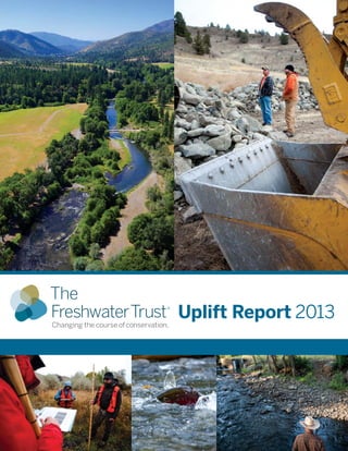
  • 1. 1 — The Freshwater Trust Uplift Report 2013 Uplift Report 2013
  • 2. 2 — The Freshwater Trust Uplift Report 2013 Using LiDAR data and GIS technology to determine a site’s potential ecological uplift, prior to committing significant resources to a restoration project, allows us to best focus and prioritize our restoration assets in order to achieve the most ecological gain on the ground. Table of Contents Shade-a-lator......................................................................................................................................................................4 Nutrient Tracking Tool.......................................................................................................................................................5 Water Temperature Tracking Tool ....................................................................................................................................6 Stream Function Assessment Methodology................................................................................................................... 7 Salmon Calculator.............................................................................................................................................................8 Case Study: Rudio Creek ..................................................................................................................................................9 Uplift from 2013 Projects ...............................................................................................................................................10 Using recently developed — and in some cases, still developing — tools for calculating the ecological uplift of restoration projects, we are advancing a new framework for communicating the value of our work. Using this new framework, we quantified most of our work in 2012 with regard to ecological uplift and issued our first Uplift Report. In 2013 we quantified new projects with the calculators, and evaluated a new method to determine river health. The process of calculating the uplift benefit of our actions helps hone our organization’s focus on delivering the best ecosystem outcomes for our invested dollars and provides collaboration with the restoration community to evaluate and test chosen quantification tools. We understand that for these uplift measurements to be used on a S ince the passage of the Endangered Species and Clean Water Acts, there have been many successful river restoration projects along with great leaps in the engineering and design of river restoration solutions ­— all driving toward improving water quality and aquatic habitat. Over the last decade, the restoration community has been working to develop and implement methods for economically and physically quantifying the effects of long-term restoration actions within a more accountable framework. The Freshwater Trust has traditionally evaluated and reported on projects in terms of dollars spent, trees planted, gallons of water restored instream or acres of floodplain reconnected. In 2012, our approach evolved to measuring ecological benefit. Quantifying Ecological Uplift: Why it is Important Front Cover Images Clockwise From Top Left: Skyris Imaging; Sean O’Connor, Freesolo Collective; NarrativeLab Communications; Hanmi Meyer; Sean O’Connor Back Cover Images Clockwise From Top Left: Levi Schmidt; Sean O’Connor; Levi Schmidt John Doe Sand & Gravel Company Owner: John Doe ADDRESS: 1234 A Street Acres: 1.12 KCAL: 10,600,000 KCAL/ACRE: 9,500,000 John Doe Sand & Gravel Company Key: Uplift Potential High Medium Low
  • 3. 3 — The Freshwater Trust Uplift Report 2013 Why quantify?: The application of new tools and methods to accurately quantify the ecological benefits of conservation actions provides numerous benefits to practitioners, landowners, regulators, conservation grant makers and policy makers charged with managing our natural resources and environment. Grants and other investments can be targeted based on modeled ecological benefits (outcome-based) – potentially a more precise method than the traditional evaluation of proposed actions (process-based). Landowners, particularly farmers, ranchers and foresters, can better determine current (pre-project) conditions and accurately track uplift (post-project) from conservation on their lands. Practitioners can improve project design and associated monitoring efforts. Regulators could better track performance towards water quality or species targets within a watershed, by accumulating quantified results from projects over time. Lawmakers and other policy leaders could use quantified results from projects on the ground to better guide public investment in conservation. national scale to predict the effects of our actions on true river restoration, we require the buy-in and support of the regulatory, restoration and regulated communities. Sometimes this involves automation of the calculations we use regularly for efficiencies of scale, and sometimes this involves evaluation of new methods of measuring impact in a holistic manner. What do we mean by ecological uplift? Simply put, “uplift”refers to the environmental gain of a project — the quantifiable environmental benefit of the restoration actions we take. For example, consider planting trees next to a stream. In the past, we have focused on restoration inputs —trees planted or habitat structures created. But not all parts of a stream are created equal in the amount of ecosystem services they provide. Using new tools and science, we now employ an outcome-based process for our actions (focusing on where the planting of trees has the most benefit and the value of this benefit). For example, we can now model the solar radiation that will be blocked by mature trees, preventing river waters from heating up to the detriment of cold water species like salmon and steelhead. Quantifying the benefits of restoration projects in this way can provide a more robust picture of a project’s ecological value. In fact, we are now doing these calculations on projects before implementation to determine potential ecological uplift prior to committing significant resources to a project. We do this to ensure we implement restoration actions that achieve the most benefit for the freshwater ecosystem. Skyris Imaging Sean O’Connor, Freesolo Collective Acknowledgements The Freshwater Trust would like to thank the following partners who developed the tools & calculators to measure the ecological uplift in this report. Counting on the Environment ESA Vigil-Agrimis, Inc. National Fish & Wildlife Foundation Oregon Department of Environmental Quality Oregon Department of Transportation Oregon State University Parametrix, Inc. Skidmore Restoration Consulting, LLC Texas Institute for Applied Environmental Research United States Department of Agriculture Watercourse Engineering, Inc. Willamette Partnership The Freshwater Trust is a non-profit organization with a mission to preserve and restore freshwater ecosystems. With nearly 30 years of on-the-ground experience, we continue to look for innovative ways to fix imperiled rivers and streams. With the latest tools and methods, we can attain efficiencies that facilitate real environmental gains with less cost, in less time.
  • 4. 4 — The Freshwater Trust Uplift Report 2013 Field staff maintain a freshly planted riparian site in the Rogue Basin of southern Oregon. Shade-a-lator Quantifying solar load avoided through riparian restoration MODEL INPUTS Upstream & downstream boundaries of the stream reach Stream aspect (azimuth) Wetted width of the stream Bank slope Distribution of existing riparian trees & plants Modeling time period, including the time of year the model is run & the number of days the model is run Surrounding topography R iparian shade provided by streamside vegetation blocks the sun’s rays from reaching the surface of the water, reducing the amount of thermal energy entering the river. In effect, this shade prevents the water from heating up. Anadromous fish, such as salmon and steelhead, are extremely sensitive to water temperature; therefore, healthy riparian buffers help ensure healthy fish habitat. Shade-a-lator is a module of Heat Source, a stream assessment tool used by Oregon Department of Environmental Quality (ODEQ). It was developed in 1996 at Oregon State University in the Departments of Bioresource Engineering and Civil Engineering. ODEQ currently maintains the Heat Source methodology and software development. Using pre-project data (see sidebar for model inputs), Shade-a-lator calculates the current load of solar radiation reaching the surface of a stream. Once vegetation is planted, Shade-a-lator predicts the new load of solar radiation reaching the stream based on the new vegetation’s shading capacity at maturity. The difference between pre- project and post-project solar loading represents a project’s uplift in terms of solar radiation avoided by streamside riparian vegetation. Shade-a-lator expresses this uplift in energy units of kilocalories per day. Once we have this calculation, we can determine which restoration sites will most benefit from riparian restoration. Shade-a-lator has been in use and ongoing development for more than a decade. With The Freshwater Trust’s projects, its refinement will continue. Projections based on tree maturity BEFORE Restoration AFTER Restoration HOW IT WORKS: Calculating Uplift for Solar Load Avoided Uplift = Change in kilocalories per day (a measurement of energy) Solar Load Avoided Tool used Shade-a-lator Units of measure kilocalories per day (kcals/day) Before (pre-project) 10,000,000 After (post-project) 4,500,000 UPLIFT 5,500,000 kcals/day Sample restoration actions • Plant streamside vegetation Solar Load Solar Load Avoided Don Jacobson
  • 5. 5 — The Freshwater Trust Uplift Report 2013 of conservation actions — from riparian actions like fence building to exclude livestock, to changed farm practices like improving irrigation methods. Sean O’Connor, Freesolo Collective major water quality concern across the United States is the abundance of nutrients such as nitrogen and phosphorus in our freshwater systems. Too much nitrogen and phosphorus promotes excessive plant and algae growth, choking out other aquatic species. Large sediment loads that carry these nutrients can also harm aquatic systems. They can settle into streambeds and fill in the spaces between the rocks and gravel — spaces that are essential for salmonid spawning. Nationwide, runoff from farming and ranching operations contribute large loads of nitrogen and phosphorus. The Freshwater Trust is working to measure the benefit of conservation actions that limit these inputs while maintaining productive agricultural lands. The Nutrient Tracking Tool (NTT) is a sophisticated modeling tool that allows the user to create a detailed scenario of on-field agricultural practices (see sidebar for model inputs). NTT models the agricultural practices and then estimates the annual nutrient and sediment loads that occur as a result of these actions. NTT can model a wide assortment Nutrient Tracking Tool (NTT) Quantifying reduced nitrogen, phosphorus and sediments from riparian improvements and changes to agricultural practices MODEL INPUTS Crop type & livestock type Crop rotations Fertilizer application rates Irrigation practices Livestock access to streams Pesticide application rates Tillage practices Field size & slope Geographic location Local weather data Soil type Soil phosphorus concentration BEFORE Restoration AFTER Restoration HOW IT WORKS: Calculating Uplift for Decreased Nutrient & Sediment Loads Uplift = Change in pounds per year of phosphorus, nitrogen and/or sediment load BEFORE Restoration AFTER Restoration Agricultural runoff drains into stream Vegetation filters runoff Nutrient & Sediment Reduction Tool used Nutrient Tracking Tool (NTT) Units of measure Pounds per year (lbs/year) Phosphorus Nitrogen Sediments Before (pre-project) 10 100 2,000 After (post-project) 5 25 100 UPLIFT 5 lbs/year 75 1,900 Sample conservation actions • Plant streamside vegetation • Implement cover crops • Livestock exclusion NTT calculates uplift in terms of nitrogen, phosphorus and sediment load reductions by comparing pre- project conditions of a field to modeled conditions after restoration or changed farm practices.The difference represents the uplift from conservation actions. Once we have this calculation, we can assess the impact of site-level restoration as a component of a basin-scale water quality problem. NTT was designed and developed by the United States Department of Agriculture (USDA) Natural Resources Conservation Service, the USDA Agricultural Research Service and Texas Institute for Applied Environmental Research.  The Freshwater Trust uses elevation data and geoprocessing to delineate micro-drainage areas of riparian planting sites, as shown in this image. Key: Riparian Planting Area Drainage Basins Project Area Drainage Basins Flow Accumulation: High Low
  • 6. 6 — The Freshwater Trust Uplift Report 2013 Field staff take a flow measurement to help determine the temperature benefit for restored flow. ncreasing river flow can buffer water temperature and increase velocity through a stream reach. Higher velocity can limit the water’s exposure to local solar impact, keeping the water from warming. Additional temperature benefits can be achieved if the increased flow is cooler than the water in the existing stream reach. The Water Temperature Transaction Tool (W3T) uses river and landscape characteristics to estimate hourly solar radiation and overall heat loss or gain from a water body. W3T also incorporates temperature and flow inputs provided by tributaries MODEL INPUTS River length, width & depth Stream bed roughness Topographical & vegetation features: surrounding zones of vegetation that provide shade & inhibit solar radiation Inflow water temperatures Flow volumes Atmospheric heat exchange, air-water interface & bed-water interface Tributary inputs River velocity Water Temperature Transaction Tool (W3T) Quantifying decreased water temperature through flow restoration Terry Stroh and meteorological information. From these inputs, W3T calculates temperature changes in a river reach. W3T is based on a steady flow approach requiring pre-project data (see sidebar for model inputs). W3T models water temperature based on energy transfer to and from the water across the air-water interface and bed-water interface. W3T also accounts for transport of heat energy in the downstream direction. Water temperature reduction from increased flow can be determined by subtracting pre-project conditions from modeled conditions after flow has been restored. The difference in water temperature represents the temperature improvement (uplift) from restoring flow to that reach. Once the temperature impacts of flow are quantified, flow restoration can be used as a tool to directly address and account for water temperature as a limiting factor that affects the survival of threatened and endangered fish species. National Fish and Wildlife Foundation contracted with Watercourse Engineering to develop the W3T model, with funding from USDA Natural Resources Conservation Service. HOW IT WORKS: Calculating Uplift for Decreased Water Temperature Water Temperature Decreased (Daily Max) Tool used Water Temperature Transaction Tool (W3T) Units of measure Cubic feet per second (cfs) Degrees Celsius (o C) Before (baseline) 1 20 After (post-project) 2 18 UPLIFT 1 cfs 2 o C Sample restoration actions • Introduce cooler water • Increase stream velocity • Deepen channel BEFORE Restoration AFTER Restoration Uplift = Change in cubic feet per second/degrees Celsius 1,000 feet stream reach 2 cfs (cubic feet per second) 18o C (stream temperature) 1,000 feet stream reach 1 cfs (cubic feet per second) 20o C (stream temperature) –1 cfs –2 cfs
  • 7. 7 — The Freshwater Trust Uplift Report 2013 after restoration actions, users are able to quantify uplift from restoration actions. Once we have this calculation, we can track the progress of our habitat restoration projects against restoration goals, over time. The Stream Function Assessment Methodology is being developed for Oregon by ESAVigil-Agrimis and Skidmore Restoration Consulting, LLC with funding from US Environmental Protection Agency. The tool is designed for use in Oregon’s stream compensatory mitigation program being developed by Oregon Department of State Lands, US Army Corps of Engineers, US Environmental Protection Agency and Willamette Partnership. The Stream Function Assessment Methodology is undergoing beta testing, including extensive field testing throughout Oregon in 2014. While the tool is still under development, early adoption enables The Freshwater Trust to calculate the 2013 level of function for our stream restoration sites. T he Stream Function Assessment Methodology was designed as a rapid assessment that evaluates stream functions and values. Stream functions are the processes that create and support healthy stream ecosystems; functions include flow variation, sediment mobility and nutrient cycling. The Stream Function Assessment Methodology defines stream values as the ecological and societal benefits that the stream functions provide. The Excel-based calculator generates scores for hydrologic, geomorphic, biologic and water quality (chemical, nutrient and thermal) functions as well as the importance of each of those functions. Inputs for the tool are collected both in the field and using online resources (see sidebar for model inputs). The methodology considers stream and riparian area characteristics along with the ecological and societal benefits of that stream in generating the functional assessment.The output of the tool is a score between 0% and 100%, rating the function and the value of the stream.This score is multiplied by the linear feet of stream affected to generate functioning linear feet of stream. By calculating the difference between functioning linear feet of stream before and A Chinook helicopter places large wood instream to build large wood habitat structure, a restoration action that supports healthy habitat for wild fish and other aquatic species. Sean O’Connor, Freesolo Collective Stream Function Assessment Methodology Quantifying improvements in stream function through instream and riparian restoration MODEL INPUTS Aquatic species structure and composition Distribution of ESA-listed fish species Distribution of rare species Riparian structure and composition Flow characteristics and depth Floodplain connectivity Water quality information Sediment characteristics and mobility Stream order, gradient and permeability Geomorphic stability Presence of off-channel habitat Aquatic features such as riffles, runs and pools Presence of rare plants and animals Proximity to intact ecosystems Presence of irrigation withdrawals HOW IT WORKS: Calculating Uplift for Increased Stream Function BEFORE Restoration AFTER Restoration Uplift = Change in functional linear feet of stream Scott Wright Increased Stream Function Tool used Stream Functional Assessment Methodology Units of measure Functional linear feet (FLF) of stream Before (pre-project) 100 After (post-project) 400 UPLIFT 300 FLF Sample restoration actions • Large wood habitat placement • Plant streamside vegetation • Create off-channel habitat Stream function disrupted Stream function restored
  • 8. 8 — The Freshwater Trust Uplift Report 2013 T he Salmon Calculator is designed to quantify ecological changes that directly impact salmon habitat through modeling, on average, how well a given stream reach supports salmon. Based on the inputs of physical characteristics of the stream and terrestrial areas (see sidebar for model inputs), the Salmon Calculator measures the ecological functions of a stream with regard to its ability to create and maintain salmon habitat. The Salmon Calculator then consolidates those ecological functions into one salmon habitat score. The score is a percentage of functional habitat per linear foot of stream, which is recorded as weighted linear feet. Once we have this calculation, we can understand the impact of our projects on the habitat needs of listed salmonids. The Salmon Calculator was developed as part of Counting on the Environment, a USDA Natural Resources Field staff collect hydrologic, geomorphologic, biological and water quality data on Rudio Creek for stream habitat assessments. Sean O’Connor, Freesolo Collective Salmon Calculator Quantifying increased salmon habitat through stream restoration Conservation Service grant project managed by Willamette Partnership. The development of the Salmon Calculator began as part of the Oregon Department of Transportation bridges project and was further refined by Parametrix, Inc. The Salmon Calculator has been valuable in helping us improve our understanding of how instream actions affect species health, but a more robust stream assessment tool is being developed that will further improve our ability to estimate stream function for salmon. (See Stream Function Assessment Methodology, previous page.) To enable ongoing evaluation of the uplift of our prior actions, however, we continue to use the Salmon Calculator into 2013.As demonstrated by the shift from the Salmon Calculator to the Stream Function Assessment, the restoration community is still determining the best measure of stream ecosystem health for salmon. In Oregon right now, three standards of measurement are used: NOAA’s Habitat Equivalency Analysis, the Columbia River Basin Federal Caucus’Survival Benefit Unit and the Stream Function Assessment. In 2014,The Trust is engaging with this community to evaluate and adopt the most practical measure of stream health for salmon. MODEL INPUTS Distribution & abundance of aquatic & riparian native & nonnative vegetation Stream width & depth Substrate characteristics Flow & depth characteristics Aquatic features such as log jams, pools, riffles, glides, alcoves, gravel bars & cascades Floodplain connectivity Barriers to fish movement Land use Floodplain slope, width & soil type Amount of large wood Historical frequency & duration of flooding HOW IT WORKS: Calculating Uplift for Increased Salmon Habitat Increased Salmon Habitat Tool used Salmon Calculator Units of measure Weighted linear feet (WLF) of salmon habitat Before (pre-project) 100 After (post-project) 400 UPLIFT 300 WLF Sample restoration actions • Construct large wood habitat structures • Plant streamside vegetation • Reconnect floodplains • Increase pools & riffles BEFORE Restoration AFTER Restoration Uplift = Change in weighted linear feet of salmon habitat functional habitat 150+ 50= 400 WLF (40%) of50+ 150+ functional habitat 50+25+ 25= 100 WLF (10%) of 1,000 feet stream reach 1,000 feet stream reach Mary Edwards Photography
  • 9. 9 — The Freshwater Trust Uplift Report 2013 1 2 The newly re- meandered channel of Rudio Creek in central Oregon restores this stream to its historical floodplain. Returning a Stream to its Natural State: Historic land use practices moved Rudio Creek to the edge of its floodplain to facilitate agriculture.The shorter, straightened channel increased stream energy which disconnected the channel from its floodplain, increased substrate size and reduced the number and complexity of pools. Returning Rudio Creek to its 1946 historical alignment will, over time, restore self sustaining habitat conditions that benefit salmon and steelhead. fish during high winter flows or cold water refugia during warm summer periods.These features were designed to emulate the beaver dam ponds that were historically present at the project area. 2013 activities consisted of constructing four off-channel ponds with associated side channel complexes. Increase instream flow. The Freshwater Trust entered an agreement with the landowners on Rudio Creek that requires their diversions from Rudio Creek to stop when flows at the mouth drop below 2 cubic feet per second or on July 1, whichever occurs first. This contractual obligation protects late- summer flows to the mouth of Rudio Creek, which historically ran dry. n 2012,The Freshwater Trust reconstructed the historic channel of Rudio Creek to restore its natural flow and habitat. In 2013, The Freshwater Trust implemented several additional restoration elements complementary to the major restoration activities completed in 2012. These elements are designed to ensure the site continues on its restoration trajectory and increases habitat for juvenile spring Chinook and summer steelhead. 2013 work included construction of off-channel ponds with side channel connections to Rudio Creek, and livestock exclusion fencing and hardwood plantings to promote riparian recovery. Promote riparian vegetation via hardwood planting and livestock exclusion fencing. Riparian vegetation is intended to provide channel stability, shade, cover and dam building material for beaver. 2013 activities consisted of planting native, rooted cottonwoods along the banks of Rudio Creek. Construct side channels and ponds. Side channels and ponds provide a diversity of habitats for juvenile spring Chinook salmon and summer steelhead.These floodplain habitats often derive a major portion of their flow from either groundwater or seepage from the adjacent stream. Side channel and pond features can provide velocity refugia for Case Study: Rudio Creek Sean O’Connor, Freesolo Collective 3 1946 1965 1984 2001 Base Image 1946 Aerial Photo, Prepared by River Design Group
  • 10. Upliftfrom2013Projects SolarLoad Avoided Phosphorus Reduced Nitrogen Reduced Sediments Reduced Increased StreamFunction WaterTemperature Decreased (DailyMax) Increased SalmonHabitat ToolusedShade-a-latorNutrientTrackingTool(NTT) StreamFunction Assessment Methodology WaterTemperature TransactionTool (W3T) SalmonCalculator Unitsofmeasure Kilocaloriesperday (kcals/day) Poundsperyear (lbs/year) Poundsperyear (lbs/year) Poundsperyear (lbs/year) Functionallinear feet(FLF) DegreesCelsius (°C) Weightedlinearfeet (WLF) Before(pre-project)16,748,2600.06.65762,1491,489 After(post-project)7,040,4690.05.42042,3761,511 Uplift9,707,7910.01.237222722 RestorationActions7,599feetofstreamprotected,70.2acresofriparianareaprotected,500nativetreesinstalled,17,164squarefeetofoffchannelhabitatcreated Before(pre-project)77,626,4670.00.41 After(post-project)36,187,7300.00.30 Uplift41,438,737*0.0*0.1*1* RestorationActions4,525nativetreesandshrubsinstalled Before(pre-project)3,120,6055.044.54,918 After(post-project)667,9874.330.53,130 Uplift2,452,6180.714.01,788 RestorationActions3,600nativetreesandshrubsinstalled Before(pre-project)63,885,35169.4447.634,300 After(post-project)45,356,10066.3418.233,544 Uplift18,529,2513.129.4756 RestorationActions8,450nativetreesandshrubsinstalled Before(pre-project)15,477,5630.31.4163 After(post-project)6,550,6940.00.875 Uplift8,926,8690.30.688 RestorationActions5,600nativetreesandshrubsinstalled Before(pre-project)50,074,31027.2136.141,231 After(post-project)8,264,7102.815.01,114 Uplift41,809,60024.4121.140,117 RestorationActions5,441nativetreesandshrubsinstalled Before(pre-project)33,093,2471.812.62,717 After(post-project)9,521,1471.48.81,468 Uplift23,572,1000.43.81,249 RestorationActions2,880nativetreesandshrubsinstalled Before(pre-project)66,637,2932.312.32,152 After(post-project)9,715,3681.98.61,344 Uplift56,921,9250.43.7808 RestorationActions3,360nativetreesandshrubsinstalled 10 — The Freshwater Trust Uplift Report 2013 Inadditiontotheprojects listedinthisUpliftReport, TheFreshwaterTrustalso protected15.62billiongallons (113milliongallonsofwaterper day)instreamacrossthestate. RogueRiver Mile128 Phase2 RogueBasin RudioRanch JohnDayBasin MillRaceRiver Mile2 WillametteBasin Lewis&Clark RiverMile9 NorthCoastBasin MiddleFork JohnDayRiver Mile50 JohnDayBasin Applegate RiverMile28.5 RogueBasin Applegate RiverMile29.5 RogueBasin Applegate RiverMile30 RogueBasin
  • 11. 11 — The Freshwater Trust Uplift Report 2013 Before(pre-project)0.00.0960 After(post-project)0.00.0540 Uplift0.00.0420 RestorationActions8,448feetofstreamprotected,150.5acresofriparianareaprotected Before(pre-project)15.192.314,84221.6 After(post-project)5.717.16,73421.5 Uplift9.475.28,1080.1 RestorationActions0.52cfsrestoredinstream(10%oftotalflow) Before(pre-project)11.439.510,78619.8 After(post-project)0.46.179819.7 Uplift11.033.49,9880.1 RestorationActions0.80cfsrestoredinstream(31%oftotalflow) Before(pre-project)1,288 After(post-project)2,000 Uplift712 RestorationActions629feetofsidechannelhabitatrestored,5largewoodhabitatstructures,2,746feetofstreamrestored Before(pre-project)1,130 After(post-project)5,192 Uplift4,062 RestorationActions5,067feetofsidechannelhabitatrestored,16largewoodhabitatstructures,2,640feetofstreamrestored Before(pre-project)600 After(post-project)1,548 Uplift948 RestorationActions1,005feetofsidechannelhabitatrestored,3largewoodhabitatstructures,763feetofstreamrestored Before(pre-project)901 After(post-project)1,486 Uplift585 RestorationActions631feetofsidechannelhabitatrestored,1largewoodhabitatstructure,1,404feetofstreamrestored Before(pre-project)28.8 After(post-project)26.9 Uplift1.9 RestorationActions1.39cfsrestoredinstream(85%oftotalflow) QuantifiedUpliftfor2013Projects203,358,891kcals/day49.7lbs/year282.5lbs/year63,695lbs/year6,534FLF2.1°C22WLF QuantifiedUpliftfor2012Projects80,422,822kcals/day5.5lbs/year82.6lbs/year1,579lbs/yearn/a**1.0°C7,170WLF CumulativeQuantifiedUplift (2012+2013) 283,781,713kcals/day (solarloadavoided) 55.2lbs/year (reducedphosphorus) 365.1lbs/year (reducednitrogen) 65,274lbs/year (reducedsediments) 6,534FLF (increased streamfunction) 3.1°C (reducedmaxdaily watertemperature) 7,192WLF (increased salmonhabitat) *ThesenumbersarefromthePhase2plantingofRogueRiver.The2013plantingaugmentedtheplantingin2012. **TheStreamFunctionalAssessmentMethodologywasnotavailablein2012. NOTESTOTABLE The Freshwater Trust Uplift Report 2013 — 11 MiddleFork JohnDayRiver Reach1 JohnDayBasin Catherine Creek GrandeRondeBasin Fifteenmile Creek HoodBasin SalmonRiver Mile0.91–1.43 SandyBasin StillCreek Reach1 (PumpkinPatch) SandyBasin StillCreek Reach2 (Straights) SandyBasin StillCreek Reach3 (Compression) SandyBasin RudioCreek JohnDayBasin
  • 12. NON-PROFIT ORGANIZATION U.S. POSTAGE PAID PORTLAND, OR PERMIT No. 4313 65 SWYamhill Street, Suite 200 Portland, OR 97204 ADDRESS SERVICE REQUESTED