
Empfohlen
Empfohlen
Weitere ähnliche Inhalte
Was ist angesagt?
Was ist angesagt? (20)
Ähnlich wie Bradsby: Matagorda Bay System: Challenges and Threats
Ähnlich wie Bradsby: Matagorda Bay System: Challenges and Threats (20)
Mehr von Texas Living Waters Project
Mehr von Texas Living Waters Project (20)
Kürzlich hochgeladen
Kürzlich hochgeladen (20)
Bradsby: Matagorda Bay System: Challenges and Threats
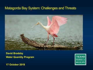
- 1. Matagorda Bay System: Challenges and Threats David Bradsby Water Quantity Program 17 October 2018
- 3. Credit: NOAA and USFWS ALCOA (Point Comfort)/Lavaca Bay Superfund Site https://www.cerc.usgs.gov/orda_docs/CaseDetails?ID=932
- 4. ALCOA (Point Comfort)/Lavaca Bay Superfund Site
- 5. From 2018 Lavaca Basin Highlights Clean Rivers Program Report - LNRA
- 6. From 2018 Lavaca Basin Highlights Clean Rivers Program Report - LNRA
- 9. Lake Texana
- 10. Lavaca Navidad River Authority Off-Channel Reservoir
- 11. Lavaca Navidad River Authority Off-Channel Reservoir
- 12. Lavaca Navidad River Authority Off-Channel Reservoir
- 21. HB 51 Oyster Shell Planting Galveston Bay From Texas Living Waters Project Noble Point Reef, Lavaca Bay • Cumulative oyster shell planting has reached 3,323 cubic yards.
- 23. The EFIT Objective: Develop an easy to use publicly available geospatial web application that identifies priority streamflow protection and restoration opportunity areas
- 25. Water Quality
Hinweis der Redaktion
- Good morning, I am David Bradsby, the leader of the Water Quantity Program and I am going to talk to you a little today about the Matagorda Bay system …I am in the unenviable position of being with a panel of experts and an audience that know more about the subject than I do. But when has that ever stopped me?
- So, I’ll originally I was going to talk about the good news and the bad news. But the deeper I dug, the more depressed I got, and the more bad news there seemed to. So I’ll be David Downer and let Leslie talk about the fun stuff.
- But I can tell you a little about the ALCOA Superfund site. Located near the City of Point Comfort, the area includes the 3,500-acre Alcoa Point Comfort Operations (PCO) Plant, the 420-acre Dredge Island, portions of Lavaca Bay, Cox Bay, Cox Creek, Cox Cove, Cox Lake and western Matagorda Bay. The PCO Plant was established as an aluminum smelter in 1948. Alcoa, a now-idled aluminum refinery, used to discharge tons of mercury into that water, leading to the Superfund designation. More than two decades later, residents’ memories have faded, but the latest EPA report shows the danger remains: The average mercury concentration in red drum there is twice what state health officials consider safe to eat over a sustained period. There is a fish consumption advisory for certain species in a part of the bay because of legacy mercury contamination from an industrial source.
- But I can tell you a little about the ALCOA Superfund site. Located near the City of Point Comfort, the area includes the 3,500-acre Alcoa Point Comfort Operations (PCO) Plant, the 420-acre Dredge Island, portions of Lavaca Bay, Cox Bay, Cox Creek, Cox Cove, Cox Lake and western Matagorda Bay. The PCO Plant was established as an aluminum smelter in 1948. Alcoa, a now-idled aluminum refinery, used to discharge tons of mercury into that water, leading to the Superfund designation. More than two decades later, residents’ memories have faded, but the latest EPA report shows the danger remains: The average mercury concentration in red drum there is twice what state health officials consider safe to eat over a sustained period.
- So you got a superfund site…what else? Well, the 2018 Lavaca Basin Clean Rivers program reports that there are a few water quality concerns and a problem with the invasive aquatic plant, Giant Salvinia. Rocky Creek in Lavaca County is on the 303d list for impaired waters due to exceeding the state’s contact recreation criteria because of high bacterial counts (think E Coli). The source of the counts is primarily rural in origin - feral hogs, dogs, septic systems – and is being addressed through a Recreational Use Attainability Analysis. For the Lavaca River, a Watershed Protection Plan was developed to identify best management practices for reducing high bacteria levels.
- And Tres Palacios Creek also made the naughty list for high bacterial levels and low dissolved oxygen concentrations. Again, a watershed protection plan has been prepared to identify best management practices for addressing the water quality concerns. Water Quality TCEQ has designated Lavaca Bay (TCEQ Water Quality segment 2453) and its secondary bays with high to exceptional aquatic life use (TCEQ 2010). TCEQ’s review of water quality monitoring data for Lavaca Bay, its secondary bays, and tributaries over the period from December 1, 2001 through November 30, 2008 was assessed. In general, water quality and nutrients did not exceed levels of concern. In portions of the bay, there were occasional chlorophyll a concentrations above the assessment criterion, and in Garcitas Creek tidal and the Lavaca Ship Channel, dissolved oxygen levels were sometimes lower than the criterion. There is a fish consumption advisory for certain species in a part of the bay because of legacy mercury contamination from an industrial source. At times bacterial levels are above concentrations considered safe for harvest and consumption of oysters.
- Now I want to shift gears and talk about water quantity. This area is included in two regional water planning areas Region P and Region K. Region P is small and primarily agricultural in nature. Geographic extent includes . The regional planning groups project and develop water sully strategies for the next 50 years. For Region P, the population and water demand forecast for the next 50 years is fairly flat. However, there are other areas of the state with an eye on water from this region – water supplied by the Lavaca Navidad River Authority.
- Included in the Region P plan is a water supply strategy to develop an off channel reservoir to store water previously authorized as part of the Lake Texana 1 and 2 water right permits. A permit actually exists to allow LNRA to build a new on-channel reservoir on the Lavaca River.
- The footprint of the reservoir is here… Now, instead of constructing a new on-channel reservoir, the Region P plan proposes a smaller off-channel reservoir that would store water diverted from either Lake Texana or run of river when available.
- And there are these notes in the plan about environmental implications…
- And here are the fwi targets for Lavaca Bay…
- Region K includes the lower Colorado River basin and the demands of Austin. You can see that the demands increase substantially in the coming years. And when more water is used, water to Matagorda Bay is reduced. This where Myron, Jennifer, and others, including TPWD is so important in trying to preserve water for instream and freshwater inflow needs.
- Jennifer and I were at a meeting earlier in the week, a Water Strategies meeting for Region K, and here is the print out that we received on potential strategies to address water needs in the lower Colorado Basin. Here are some proposed by LCRA - you will notice several new reservoirs. Now, a lot of the water for these reservoirs is from existing water rights. But the cumulative effects of all of theses strategies could be significant. Ok, one more…
- There is also a proposal to supplement environmental flows with groundwater from the coastal counties. We have several concerns about this proposal and its effectiveness. More to come on this one…
- Finally, we have the looming threat of climate change. What does it mean for Texas? Although there are a lot of uncertainties, more than likely fewer but more intense rain events, warmer temperatures, more intense droughts, higher evaporation…and I suspect a re-jiggering of some biological and physical responses – spawning seasons, bay health, salinity.
- And if that wasn’t enough…
- Cheers!
- So I won’t get to tell you about Powderhorn Ranch, an over 17 000 acre property that was acquired by a multi partner coalition to preserve a large tract of coastal prairie. The property was purchased through the combined efforts of the Texas Parks and Wildlife Foundation, the National Fish and Wildlife Foundation, The Conservation Fund, The Nature Conservancy, and the Texas Parks and Wildlife Department. It represents a good example of public and private entities working together to achieve conservation goals.
- I also won’t tell you about the work of Leslie and others to build and replace oyster reefs along the Texas coast using cast off oyster shells and engaging the efforts of commercial operations joined with public entities. Leslie can tell that story far better than I can – she’s lived it!
- And hopefully we are all talking about EFIT and environmental flow strategies next year at this time. Stay tuned!
- EFIT objective is to develop an easy to use web application that identifies priority streamflow protection and restoration opportunity areas The EFIT process can be mapped to elements of the Strategic Habitat Conservation Design Framework - biological planning, conservation design, and conservation delivery