
Empfohlen
Empfohlen
Weitere ähnliche Inhalte
Was ist angesagt?
Was ist angesagt? (20)
Andere mochten auch
Andere mochten auch (16)
Ähnlich wie PE etraining mtg
Ähnlich wie PE etraining mtg (20)
Mehr von Steven McDaniel
Mehr von Steven McDaniel (10)
Kürzlich hochgeladen
Kürzlich hochgeladen (20)
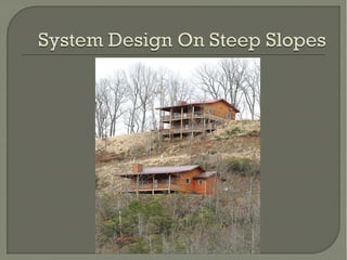
PE etraining mtg
- 3. One of the 6 factors (Rule 420-3-1-.71) Certain limits for OSS on steeper slopes There are 4 soil related factors And 2 site related factors All are to be evaluated on each site
- 4. What is the slope? % Slope = (Rise ÷ Run) x 100 Rise 40 ft Run 100 ft % Slope = (40/100) x 100 = 40%
- 5. • Requires Engineer Design • Start with Table 4 in Rules • Rules require Deeper trenches More space between trenches More cover over trenches
- 6. Minimum Minimum Trench Cover Depth** Percent Slope 26-30 31-40 Trench Spacing (Side Wall to Side Wall)* 6 feet 7 feet 28” 33” 16” 21”
- 7. Table 4 Slope Spacing of Trenches Based on Width of Trench and Slope * The distances between trenches are measured between adjacent sidewalls. ** If the minimum trench depth is measured on the downhill side of the trench, the minimum cover as listed in the table should be assured.
- 8. Some general guidelines are: • Make a detailed evaluation of the site to determine options Generally, the larger the lot, the more options The steeper the slope, the more difficult to overcome • Select the best location and landform • Keep it as simple as possible • Use a pump (effluent) if needed • Renew your liability insurance Then: • If it doesn’t pass the “feel good” test; walk away
- 9. • Gravity • Erosion • Soil Stability • Variable Soil Depth • Shallow Rock • Surface Water • Spring Activity
- 10. Certain Landforms • Headslopes • Toeslopes • Depressions • (These are all concave shapes) • Also: • Drains • Rock Outcrops • Complex Slopes
- 12. Focus On The Better Landforms Where Waters Diverge • Convex Ridges, Sideslopes
- 14. Requires deep soils Must meet setbacks • Uphill • Downhill • Over Rock
- 16. .67(2)c Requires geologist’s report & PSC map (subject to LHD)
- 18. .67(2)f Does not allow downhill pushover fill for EDF for >25% slope
- 20. The amount of wastewater that can be applied each day over an indefinite period of time to a square foot of soil such that the effluent is absorbed and properly treated.
- 22. If Benching is proposed • Setbacks may be difficult to meet • 25’ setback from uphill cut unless pretreatment • 25’ setback from downhill slope over 40% Consider Drip technology
- 23. Try to read and interpret • Landforms • Soils • Water movement & concentration Use these to best advantage – avoid bad locations Design for the long term Call in other professionals if needed
- 25. Permeability Depth To ASHES (ave seasonal high extended saturation) Depth To Rock and Other Restrictions Slope and Landform Limitations Flooding Frequency Hydric Soils
- 26. ABILITY OF SOIL TO ALLOW WATER TO PASS THRU IT Permeability is affected by anything that affects PORES (pathways for water to travel) Texture Structure Consistence Bulk Density Clay Mineralogy Dissimilar Layers
- 28. From Surface To Gray Colors Chroma 2 or less 2% or more of the volume 6” or more thick
- 29. >2% 6” Thick
- 32. HARD VS. SOFT ROCK
- 33. THEY SAID DIDN’T FLOOD WATER FRONT LOTS FOR SALE
- 34. SOUTH AL HYDRIC SOIL NORTH AL HYDRIC SOIL
- 35. If perc test are used check results against what the soil says Some signs are obvious Some are more subtle
- 36. A 10 min/Inch perc rate during the dry season in a sticky, plastic clay in an area dominated by cedars and red buds is a... Non-Representative Perc Result.
- 37. A 10 Min/Inch Perc Rate In A Soil With A Sandy Loam Texture But Has A High Bulk Density Layer at ~ 24” (Fragipan) Is Also NonRepresentative
- 38. A 10 min/inch perc rate at 12” in this sandy topsoil is likely System may actually be underdesigned for the long term Because of the clay texture just below.
- 39. Consider all 6 factors or limitations Interpret the soil and site characteristics Compare test results w/ what’s present If questions arise – ask for assistance If we can a avoid a problem down the road - we all win
- 41. Filling a drainage channel for an EDF is not recommended Most undisturbed natural soils are stable • They can be trusted to stay in place and retain their integrity Fill requires time to develop stability • Or use stabilizing practices Establish vegetation Retaining walls Extended shoulders (aprons)
- 43. Table 15 SYSTEM LIMITATION ENGINEERED CONVENTIONAL SLIGHT MODERATE SEVERE EXTREME AT Required 1. Percolation (Min/In) (1) 5-30 31-90 91-120 1-<5 121-240 >240 1a MVS (2) from Redox(3) 24 18 18 36 18 12 1b MVS from Hard Rock 18 18 18 18 12 1c MVS from Other R/L (4) 12 12 12 12 6 Min trench depth for above 12” below NGS Natural Ground Surface (3) 1-<5<1 24 w/AT May vary but either 6” above or below(not exactly at) the fill/soil interface 2% Slope (%) 0-15 16-25 26-40 >40 (7) 3. Flooding Frequency Chance/Year None Rare <5% Occasional 5-50% Frequent (7) >50% 4. Landform (Slope Position) Summit Shoulder Back & Other Linear or Convex Lower Back Foot & Other Slightly Concave Toe Head Depression & Other Concave Swamp, Wetlands, Floodplain Drain, Gully, Mine Spoil, Hydric Soil Area (7)
- 44. Conv Conv Perc Rate 5-60 MVS /2 Hard Rock Soft Rock Other Eng Eng 61-90 91120 120240 24” 18” 18” 18” 18” 18” 18” 18” >240 1-<5 w/AT 1-<5 12” 36” 24” 12” 24” 12” 12” 12” 12” 6” 24” 12” 12” 12” 12” 6” 24” 7-15 16-25 26-40 Slope 0-6 Conv Eng* > 40