SlideShare a Scribd company logo
1 of 20
Download to read offline
SDC V&A Programme                                                   Situational Analysis Stage I Report

CHAPTER 1

                            INTRODUCTION

Mahabubnagar District (Map 1 and Map2) in
Andhra Pradesh State is selected for the
programme on “Vulnerability Assessment
and Enhancing Adaptive Capacity to Climate
Change in Semi-Arid Areas of India” also
called “SDC V&A Programme”.


Mahabubnagar District is semi-arid, drought
prone and one of the most backward
Districts in Andhra Pradesh State. Duration
                                                  Map 1 Location of Mahabubnagar District in
of the programme is 4 years (2005 to              Andhra Pradesh
2009).


Program Objective: The core objectives of this program is to secure the
livelihoods of rural poor and vulnerable communities by building and enhancing
their adaptive capacity to better cope with adverse impacts of climate change and
improve their disaster preparedness.


Expected Outcomes:
•   To enhance the adaptive capacity of the local communities
•   To improve the delivery systems, especially the extension services

•   To promote multi-level policy dialogues and general awareness to climate
    related impacts.


1. OBJECTIVES OF THE SITUATIONAL ANALYSIS STAGE – 1


         a. Reconnaissance of Mahabubnagar District for identification of potential
            areas and prioritization for the SDC V&A Programme.
         b. Collection of secondary information for Situational Analysis – Natural
            Resources     (Agriculture,   Water   and    Energy),      Socio        Economic,
            Institutions, etc.
         c. Identification of NGOs and their area of operation in the District.
         d. Planning for the Situational Analysis Stage 2


                                                                                                  1
AFPRO
SDC V&A Programme                                                  Situational Analysis Stage I Report

2. METHODOLOGY


   1. Reconnaissance field visit
   2. Interaction and discussions with various officials in the District
        •   Chief Executive Officer (CEO)
        •   Chief Planning Officer (CPO)
        •   Project Director, District Water Management Agency (DWMA)
        •   Deputy Director, Ground Water Department,
        •   Officers at Agriculture Department
        •   Faculty at the RARS, Palem
        •   Mandal level officials, MDO, MRO, Statistical officers, Agriculture officers,
            etc of the potential Mandals.
        •   Village level secretaries
   3. Interaction and discussion with community members in the villages visited
   4. Secondary data collection and analysis
   5. Referring the programme document and in consultation with International
        Consortium and National Consortium members.


        Map 2 Mahabubnagar District with Mandals


                                                                                                 2
AFPRO
SDC V&A Programme                                                                   Situational Analysis Stage I Report

CHAPTER 2

                               DISTRICT PROFILE
Mahabubnagar is the largest District in Telangana Region and Second Largest in
Andhra Pradesh State. This District consists of 1553 Revenue Villages, 1347 Gram
Panchayats, 64 Mandals1 and 5 Revenue Divisions. Mahabubnagar District has 13
Assembly Constituencies and 2 Parliamentary Constituencies.


It is located in the semiarid region of India with recurring meteorological drought
(because of erratic and scanty rainfall) and worsened by overexploitation of
meager groundwater resources. This is a backward District with diverse socio-
economic problems like lowest literacy rate, migrations, extreme poverty, etc.


1. LOCATION AND TOPOGRAPHY
The District is located in the Central Part of Peninsular India. It is bounded by
Ranga Reddy and Nalgonda Districts in the North, Nalgonda and Guntur Districts in
the East, Kurnool District in the South. Raichur and Gulbarga Districts of Karnataka
State in the West. In the South Eastern Parts of the District there are hill ranges
extending from North to South, the Hills are mostly Flat Topped.                              The District is
located between 16 Degree and 17 Degree N latitudes and 77 Degree and 79
Degree E longitudes (see Map 3).


2. LAND USE PATTERN
Total Geographical area of the District is 18.48 Lakhs Hectares and the land
utilization of this District, as per Agriculture Census 2000-2001, is as follows:


Table 1 Land use particulars

S.No.       Type                                                 ( Area in Ha.)       % age
1           Forest Area                                          263560               14.2617
2           Barren and uncultivable lands                        93798                5.075578
3           Permanent pastures and grazing lands                 25447                1.376983
4           Land put for non-agricultural use                    78600                4.253187
5           Cultivable waste                                     111426               6.029461
6           Other fallow lands                                   158657               8.585215
7           Current fallows                                      467442               25.29412
8           Total Normal Area of all crops                       649066               35.12212
            Total Geographical Area of the District              1848026              100


1
    Administrative unit in each district, consisting of an average of 20 to 30 villages
                                                                                                                  3
AFPRO
SDC V&A Programme                                               Situational Analysis Stage I Report


 Map 3 Mahabubnagar District location w.r.t. other Districts


3. CLIMATE


The climate of the District is generally hot. The District summer period is from
March to May. The daily Temperature during the period ranges from 16.9 deg.
Centigrade to 41.5 deg. Centigrade, the minimum temperature during the winter
season i.e. November to January ranges between 16.9 deg. Centigrade to 19.1
deg. Centigrade.


The rainfall in the District is scanty and the South West Monsoon is erratic. Most of
the Rainfall is received during the South West Monsoon. The normal annual rainfall
of the District is 604.56 mm. Out of this, the South West monsoon accounts for
71% i.e. 489.0 mm and the balance is covered from North East monsoon. (see
graph 1)


                                                                                              4
AFPRO
SDC V&A Programme                                                                                                                                    Situational Analysis Stage I Report

                                                         GRAPHICAL REPRESENTATION OF RAINFALL DATA FROM 1980-81 TO 2002-2003

                1000.0

                 900.0

                 800.0

                 700.0
NORMAL IN M.M


                 600.0

                 500.0

                 400.0

                 300.0

                 200.0

                 100.0

                   0.0
                         1980-   1981-   1982-   1983-   1984-   1985-   1986-   1987- 1988 - 1989 - 1990 - 1991 - 1992 - 1993 - 1994 - 1995 - 1996 - 1997 - 1998 - 1999 - 2000 - 2001-   2002-
                          81      82      83      84      85      86      87      88     89     90     91     92    93      94     95     96     97     98     99    2000 2001 2002       2003
                                                                                                             YEARS


            Graph 1 Rainfall Pattern – Mahabubnagar District


Photo 1 This farmer of Kosgi Mandal said that he had seen good rains about 14 years back when all the
tanks in his village got filled up, since then he is facing drought


4. GEOLOGICAL RESOURCES


The Dharwars are exposed in parts of Gadwal and Makthal Taluka in the form of
narrow bands. They consists of hornblends, schist’s, Traversed by quartz veins.
Almost all parts of the District is comprised of the Granites, except some parts in
Kodangal Taluka in the North and the Purana sedimentaries in Krishna Basin in the
South. The Granites are broadly divided into the Pink and Gray series. There are

                                                                                                                                                                                              5
AFPRO
SDC V&A Programme                                                             Situational Analysis Stage I Report

numerous pegmatite’s and quartz veins intrusive into these granites. The Deccan
Traps occur in small patches i.e., the Northern Portions of Kodangal Taluka, where
in some places the trap has been lateritised.


5. SOILS


The Soils of the District can be classified into three broad groups i.e., Red Soil,
Black Cotton and Chalka Soil or mixed Soils. Major soil group in the district is Red
Sandy Soils.


 Type of soil                                         % age
 A) Loamy Sand Soils (Dubba)                          13%
 B) Red Sandy Soils (Chalka)                          67%
 C) Black Soils                                       20%


About 70% of the total area is under mixed soils, which do not have water-
retaining capacity. The Chalka soils are predominate in the Talukas of Shadnagar,
Mahabubnagar, Jadcherla, Kalwakurthy and Kollapur. The Dubba Soils are in the
Talukas of Achampet and Gadwal while the Black Cotton Soils, which constitute
20% of the District, are in the Talukas of Alampur and Kodangal.


Photo 2 Patch of rich black cotton soils ~3 feet thick found at Reddy Guda Village, Midjil Mandal

                                                                                                            6
AFPRO
SDC V&A Programme                                               Situational Analysis Stage I Report

6. AGRICULTURE


The dry crops are predominant in the District as the Irrigated area is only 15% of
the net area sown. Net area sown: 8.767 Lakhs Hect. and Gross area sown: 9.767
Lakhs Hect. The percentage of areas sown under different crops is a follows:

Table 2 Cropping pattern
Crop           Percentage      Crop         Percentage   Crop               Percentage
1. Paddy       10 %            2. Millets   28 %         5. Others          9%
3. Pulses      11 %            4. Oil       42 %
                               Seeds


Table 3 Major types of crops
Major Food Crops:              Major Oil seeds Crops     Major Pulses Crops

Jowar                          Castor                    Red Gram

Paddy                          Groundnut                 Green Gram

Bajra / sajja / pearl millet   Sun Flower                Horse Gram

Ragi / Finger millet


The net sown area is not more than 50% of the total geographical area. The
district has been declared as one of the 12 drought prone districts of Andhra
Pradesh. Major livelihood in the district includes agriculture and animal husbandry.
About 1.75 Lakhs small farmers and 2.94 marginal farmers are dependent on wage
employment. About 3.20 Lakhs agricultural laborers who are below poverty line are
also dependent on agricultural wage employment.


                                                                                              7
AFPRO
SDC V&A Programme                                                           Situational Analysis Stage I Report


Photo 3 A farmer of Reddy Guda Village, Midjil Mandal is preparing the land for sowing


7. LIVESTOCK


Mahabubnagar has large numbers of small ruminants and cattle. The dependency
on small ruminants like sheep and goat is very high. For many farmers, livestock is
an important asset to sell off to cope with drought; therefore, it is an important
resource against vulnerability.


Due to failure of monsoons in the initial stages, fodder shortage is noticed. The
green fodder position in the district has become critical and the grazing facilities
have almost dwindled. Fodder requirement in the District upto June 2005 is 9.47
lakhs MT. The people are found buying fodder in large quantities to meet the
requirement and shepherds are migrating with their sheep to other places.


Table 4 Livestock Numbers
Livestock                                          Numbers
Total White & Black cattle population              27.40 Lakhs
Sheep                                              11.98 Lakhs
Goats                                              3.85 Lakhs
Total livestock                                    19.10 Lakhs cow units

                                                                                                          8
AFPRO
SDC V&A Programme                                                         Situational Analysis Stage I Report


Photo 4 This shepherd from Wanaparthy area is migrating with his sheep towards northwestern part of
the District as it has rained there - photo was taken near Mahabubnagar town.


8. WATER


One of the important agencies in the district is District Water Management
Agency(DWMA) started in 1995. Each watershed project covers about 500 hectares
and there are 942 such projects sanctioned in the district. Presently the new
watersheds are being carried following Hariyali Guidelines – Involvement of
Grampanchayat, Village Organisation and the Watershed Committee, the action
planning and monitoring is participatory. The status of watershed projects is as
such:


Table 5 Scheme wise watersheds
S.No       Scheme                 Sanctioned             completed              ongoing
1          EAS                    212                    212
2          DPAP                   463                    132                    331
3          Hariyali               48                                            48
4          APRLP                  100                                           100
5          RIDF - VI              119                                           119
           Total                  942                    344                    598

                                                                                                        9
AFPRO
SDC V&A Programme                                     Situational Analysis Stage I Report


Table 6 Water Resources

Surface water
Tanks - 6192 nos covering 76513 hect.
Major Projects:
Priyadarshini Jurala Irrigation Project (40200 ac.)
Rajolibanda Diversion Scheme (35000 ac.)
Koilsagar project (4726 ac.)
Proposed:
Nettampadu Lift Irrigation Scheme (2,00,000 ac.)
Kalwakurthy lift irrigation Scheme (2,50,000 ac.)
Bhima Lift Irrigation Scheme (2,03,000 ac.)


Tube wells - 108200 nos covering 109711 hect.
District average dept of groundwater table: 17.16 M


        Map 4 Watersheds Distribution


                                                                                   10
AFPRO
SDC V&A Programme                                                          Situational Analysis Stage I Report


Photo 5 An open dry well as found in Karukonda Village, Nawabpet Village, the ground water table has
gone down drastically in most parts of Mahabubnagar District.


9. ENERGY


DWMA and DFO social forestry are the important agencies in the district
responsible for promoting Bio-fuel plantations (Jatropha). This is the national policy
adopted for alternative sources of energy and at the same time helping the
farmers. Total Jatropha seed allotted to the district is 1.5 MT. Presently the total
saplings available are 10 Lakhs with DWMA alone. Number of farmers identified are
2,548 nos for planting in 5,897 acres.


10. FORESTS
Forests occupy an area of 2.67 Lakhs Hectares and constitute about 14% of the
total Geographic area of the District. Most of the Forests are concentrated in the
South Eastern parts of the District covering mainly Achampet, Kollapur with small
areas in Wanaparthy, Mahabubnagar and Makthal Talukas. The bulk of the Forests
in the District is comprised of deciduous. The important species of these are Teak,
Maddi, Ippa etc., The availability of Bamboo in the District is formal. The important
sources of Revenue from Forest are mainly from Beedi Leaves, Timber, Bamboos,
Seethaphal and Gum etc.,


                                                                                                        11
AFPRO
SDC V&A Programme                                                   Situational Analysis Stage I Report

The Wild Life is abundant in the interior and inaccessible plateau regions of
Amarabad. Among the wild animals, the Panther, the Tiger, wild Dogs, hyenas,
Bear are common and of the herbivorous animals spotted deer, Nilgai, Sambar,
Black-Buck, Chinkara, Wild Bear, several kinds of birds, Peacocks, Water Birds,
Cobras and Vipers are also common in these forests.


11. DEMOGRAPHIC PARTICULARS


The District has a population of 35,13,934 of which 17.81 Lakhs are males and
17.28 Lakhs are females. About 69% of the total population lives in rural areas. It
has been estimated that 48% of the people live below poverty line. The Urban
areas of the District is only 156.86 kms, and distributed among 4 towns and 7
major Gram Panchayats in the District. Mahabubnagar town, which is the District
Headquarters, is largest Urban unit in the District, with a population of 1,39,662.


12. SOCIO-ECONOMIC CONDITIONS


The district ranks lowest among the literates in the State accounting for only
38.6% of the literacy level. A very disturbing demographic feature of the district is
that a high percentage of population migrate to nearby urban centers in search of
livelihood. This is because of continuous recurrence of drought conditions and lack
of employment opportunities. The worst affected are the children and the aged
because of this phenomena., the agricultural laborers are having no work in many
areas.   To arrest   migration   it   is   necessary   to provide    wage       employment
opportunities especially of unskilled nature


It is also interesting to note that the worker participation rate among females (i.e.
total female workers to female population) is as high as 45%, which is second
largest in Andhra Pradesh. Most of the female workers are agricultural laborers.
Statistics over a period also suggest that the proportion of agricultural laborers is
increasing over the proportion of cultivators.


                                                                                                 12
AFPRO
SDC V&A Programme                                                 Situational Analysis Stage I Report


Photo 6 These women have migrated to Mahabubnagar town for work


13. GROUPS / SOCIAL NETWORKS


A pioneering developmental initiative was take-up in the district in promoting Self-
help groups (SHGs) and also forming mutually aided cooperatives societies at
Mandal level in 1980s under the auspices of UNDP which eventually led to a mass
movement of organizing women self help groups around thrift, credit and livelihood
programmes. Subsequently almost all Mandals and the habitations are covered,
with the efforts of DRDA, DPIP, NGOs and other line department programmes in
the District.
•    No. of Self-Help Groups            28870
•    Total members covered No.          4.33 Lakhs


14. ONGOING PROGRAMMES / ACTIVITIES


Recognizing the level of backwardness in the district a number of developmental
schemes have been introduced in the district by national and international
agencies. Important of them are World Bank supported District Poverty Initiative
Programme (DPIP), DFID supported Andhra Pradesh Rural Livelihoods Programme,
Dutch supported Biotech Programme, Netherlands Govt. Supported APWELL project
etc., A number of government and non-governmental institutions are actively
engaged in the district in promoting peoples participation in a number of
developmental programmes.

                                                                                               13
AFPRO
SDC V&A Programme                                                     Situational Analysis Stage I Report


In addition to internationally funded programmes, there are a number of schemes
supported by Government of Andhra Pradesh and Government of India in the areas
of watershed developments, minor and major irrigation, social afforestation,
diversification of agriculture, livestock development, drinking water and sanitation
improvement, primary health, and education etc.             In other words, institutional
structure is in place to optimize the benefits of any innovative programme.


As per Government instructions, all works are going on in the district i.e.
Employment Assurance Scheme (EAS), Jawahar Grameena Swarojgar Yojana
(JGSY), DPAP watersheds, Joint Forest Management or VSS, MPLADS, NABARD
works, ZP general funds, PR Roads & Building sector, PR (RWS) sector, Minor
Irrigation, R & B, Housing etc., This district is also selected for National Food For
Work Programme (NFFWP), assuring 100 days of employment opportunity for all
wage seekers in an year. They are paid in food grains (80%) and partly in
cash(20).


15. FORMAL INSTITUTIONS AT VILLAGE LEVEL
• NRM                                         •   SC Corporation
• District Water Management Agency(DWMA)      •   ST Welfare/Tribal Welfare
• Rural Infrastructure Development            •   BC Welfare / BC Corporation
  Fund(RIDF)                                  •   Social Welfare
• NAWAPRA / Watershed Development by          •   Tribal welfare
  Agriculture Department                      •   Youth welfare
• Ground Water Department                     •   ICDS / Child Development Programme
• JFM / CFM programmes by Forest              •   Anganwadi / Women and Children Welfare
  Department                                  •   Infrastructure
• Agriculture Department / Rythu Mitra or     •   Housing Department
  groups
• Horticulture Dept                           •   Services
• Comprehensive Land Development              •   Civil supplies / Public Distribution sys
  Programme / Indira Prabha                   •   Rural water supply (Panchayat Raj dept.)
• Animal Husbandry                            •   Electricity
• Fisheries                                   •   Road Transport Corporation
• Irrigation Dept (Minor / Medium / Major)    •   Telecommunications / BSNL
                                              •   Marketing
• Social
• Dist. Rural Dev. Agency (DRDA) / District   •   Artisans / Industries / enterprise
  Poverty Initiatives Programme (DPIP) /      •   Industries Department
  Indira Kranthi Patham                       •   Handlooms and Textiles
• DPEP / Education                            •   Various schemes for Artisans
• Medical and Health
                                              • Other Programmes
                                              • Andhra Pradesh Rural Livelihoods
                                                Programme (APRLP)


                                                                                                   14
AFPRO
SDC V&A Programme                                                           Situational Analysis Stage I Report

CHAPTER 3

            PRIORITIZATION OF MANDALS
Considering the size of the district, it will not be possible to cover the entire
district. For the implementation of the programme, only few villages will be
identified. A list of the potential Mandals2 / sites are selected tentatively based on a
set of criteria, and which include the following:


1. CRITERIA FOR SELECTION OF POTENTIAL MANDALS


    2. Located in drought prone and semi-arid areas
    3. The need for intervention and the conditions for successful implementation.
    4. The response of the local communities in successful implementation
    5. Social networks / groups representing women, farmers, water users, etc.,
        are formed and active.
    6. Presence of a number of developmental programmes
    7. Major irrigation programmes are not being envisaged in these Mandals3
    8. Opinion of the district level officials
    9. Local institutional arrangements including the presence of active NGOs etc.
    10. Infrastructure existing
    11. Accessibility


2. PRIORITISATION OF POTENTIAL MANDALS


The potential Mandals were prioritized using the Secondary data (See Annexure -
1, 2 and 4) and also keeping in view the nature of the programme i.e., This is a 4
years programme - very short duration (need to select an appropriate area and
should be able to achieve results). Based on existing insights and experiences
specific sites in the District are being selected. The criteria to identify and select
includes 1. Manifestation of climate hazards vis-Ă -vis Water, Agriculture and
Energy (biomass-livestock, etc) 2. The social organisation at village level 3.
Presence of local partners.


For prioritizing the Mandals, 0 to 3 scores were given classifying the Mandals into 4
classes for which the following parameters were considered (See Annexure 3).


2
  All the potential Mandals have been visited by Dr. N. Sai Bhaskar Reddy, Lead Consultant along with
1. Mr. K. Siva Prasad and Dr. V. K. Reddy (24-25 May 2005), 2. Ms. Sulabha Mahajan (6th TO 8th June
2005), 3. Dr. V. K. Reddy 18th June 2005
3
  Except that some parts of Kalwakurthy and Nagarkurnool would be benefited if proposed Kalwakurthy
Lift Irrigation scheme is completed.
                                                                                                         15
AFPRO
SDC V&A Programme                                            Situational Analysis Stage I Report

Agriculture
   •    % Net area sown to total cultivable area
   •    % total cropped area to Geographical area
   •    Food crops
   •    Small farmers(<1.23 hect)
   •    Marginal farmers(1.24 to 2.46 hect)
Water
   •    Rainfall
   •    Tube wells net irrigated
Energy (Biomass – Livestock)
   •    Cattle
   •    Buffalo
   •    Sheep
   •    Livestock
   •    % of Pastures
Literacy
   •    % of Literacy total
Access to loans – Service of financial institutions
   •    Average Loan amount per person availing
Physical Access
   •    Access (from highways and District head quarters)
NGOs
   •    NGOs access (Based on the discussions with secondary stakeholders)


                                                                                          16
AFPRO
SDC V&A Programme                                                       Situational Analysis Stage I Report


Table 7 Prioritization of potential Mandals

Rank                   Mandal                 Rank                 Mandal
1        Farooknagar                          7       Amangal
2        Kondurg                              8       Wanaparthy
3        Balanagar                            8       Nagarkurnool
4        Midjil                               8       Kalwakurthy
5        Nawabpet                             9       Jadcherla
5        Kodangal                             10      Boothpur
6        Bijinapally                          11      Kosgi
6        Bomaraspet                           12      Ghanapur


Map 5 NGOs working on NRM based programmes and their spatial distribution


                                                                                                     17
AFPRO
SDC V&A Programme                                           Situational Analysis Stage I Report


Map 6 Potential Mandals identified in Mahabubnagar District


                                                                                           18
  AFPRO
SDC V&A Programme                                                            Situational Analysis Stage I Report

3. SELECTION OF PROJECT VILLAGES


There are three models emerging they are:
Model 1: Selection of a cluster of villages in only one Mandal.
Model 2: Selection of two Mandals and few villages in each Mandal.
Model 3: Selection of few villages in one Mandal and Satellite villages (only one
village each from 2 or 3 other Mandals)


Table 8 Emerging models for selection of villages
                Advantages                                  Disadvantages
Model 1         Area of operation, Delivery                 If the officials change or non-
                systems, capacity building,                 cooperative, People are not
                Knowledge Dissemination-                    adaptive, case studies / learnings
                Automatic Weather Station                   would be few.
                (AWS), Knowledge Centers
Model 2         Comparative advantage, risk of              Access, delivery systems, capacity
                failure would be less.                      building
Model 3         Results would be better and                 Cost of capacity building at
                chance for comparison more, case            secondary level would be more,
                studies would be more                       more efforts for better delivery
                                                            systems at higher level.


Further discussions are needed on these emerging models or there could be some
other practical model4.


4
    Suggestions needed from International and National consortium members.
                                                                                                          19
AFPRO
SDC V&A Programme                                                             Situational Analysis Stage I Report

CHAPTER 4

                               WAY FORWARD
Situational analysis stage – I has provided insights into emerging challenges for
selection of project villages in Mahabubnagar District for the SDC V&A Programme.
It also forms the basis for planning and completion of the following tasks
immediately:
1. Finalization of Mandal/s5, identification of the programme villages and planning
    for participatory situational analysis.
2. Collection of any other appropriate secondary data
3. Study of existing NGOs and selection for local facilitation
4. Identification of the status and gaps in the implementation of various NRM
    programmes, and thereby identifying the capacity building needs6.
5. Identifying the scope for convergence of various programs at District, Mandal
    and Village level.
6. Identification of members for formation of District level and village level
    committees.


5
  This would be based on the inputs from Capacity Building Workshop at Hyderabad - 28th to 30th June
2005.
6
  Along with MANAGE

Report by: Dr. N. Sai Bhaskar Reddy, Lead Consultant, AFPRO, Hyderabad, AP.
                                                                                                           20
AFPRO

More Related Content

Similar to Vulnerability and Adaptation to climate change situational analysis

Robust Strategies of GIS and Geospatial Data mining techniques for drinking g...
Robust Strategies of GIS and Geospatial Data mining techniques for drinking g...Robust Strategies of GIS and Geospatial Data mining techniques for drinking g...
Robust Strategies of GIS and Geospatial Data mining techniques for drinking g...IJERA Editor
 
SITE SUITABILITY ANALYSIS FOR HORTICULTURE PLANTATION ON CULTURABLE WASTELAND...
SITE SUITABILITY ANALYSIS FOR HORTICULTURE PLANTATION ON CULTURABLE WASTELAND...SITE SUITABILITY ANALYSIS FOR HORTICULTURE PLANTATION ON CULTURABLE WASTELAND...
SITE SUITABILITY ANALYSIS FOR HORTICULTURE PLANTATION ON CULTURABLE WASTELAND...IRJET Journal
 
M.Tech Final Seminar
M.Tech Final SeminarM.Tech Final Seminar
M.Tech Final Seminarsantoshborate2
 
Vernacular architecture of Nalwar Yadgir district
Vernacular architecture of Nalwar Yadgir districtVernacular architecture of Nalwar Yadgir district
Vernacular architecture of Nalwar Yadgir districtTanzil Faraz
 
Rajeshwari Urban Environment, RS and GIS
Rajeshwari  Urban Environment, RS and GISRajeshwari  Urban Environment, RS and GIS
Rajeshwari Urban Environment, RS and GISrajeshwariku
 
Critical analysis of sedimentation assessment of reservoirs of nagpur region ...
Critical analysis of sedimentation assessment of reservoirs of nagpur region ...Critical analysis of sedimentation assessment of reservoirs of nagpur region ...
Critical analysis of sedimentation assessment of reservoirs of nagpur region ...IAEME Publication
 
Aan with gis in rasuwa
Aan with gis in rasuwaAan with gis in rasuwa
Aan with gis in rasuwaDPNet
 
Cropping Pattern and Agricultural Productivity of Pindar Basin, Garhwal Himalaya
Cropping Pattern and Agricultural Productivity of Pindar Basin, Garhwal HimalayaCropping Pattern and Agricultural Productivity of Pindar Basin, Garhwal Himalaya
Cropping Pattern and Agricultural Productivity of Pindar Basin, Garhwal HimalayaIRJET Journal
 
Application of Remote Sensing Techniques for Change Detection in Land Use/ La...
Application of Remote Sensing Techniques for Change Detection in Land Use/ La...Application of Remote Sensing Techniques for Change Detection in Land Use/ La...
Application of Remote Sensing Techniques for Change Detection in Land Use/ La...iosrjce
 
Inland waters rra report on nam mae hkok watershed eastern shan state burma m...
Inland waters rra report on nam mae hkok watershed eastern shan state burma m...Inland waters rra report on nam mae hkok watershed eastern shan state burma m...
Inland waters rra report on nam mae hkok watershed eastern shan state burma m...Thura Han Htoon Awng
 
Environmental resources and prospective agriculture in madhesh region
Environmental resources and prospective agriculture in madhesh region Environmental resources and prospective agriculture in madhesh region
Environmental resources and prospective agriculture in madhesh region Sujit Thakur
 
Forecasting of drought at taluka levels in gulbarga district of karnataka, (i...
Forecasting of drought at taluka levels in gulbarga district of karnataka, (i...Forecasting of drought at taluka levels in gulbarga district of karnataka, (i...
Forecasting of drought at taluka levels in gulbarga district of karnataka, (i...eSAT Publishing House
 
LAND USE LAND COVER FEATURES IN AND AROUND SURYAPET TOWN FOR URBAN PLANNING
LAND USE LANDCOVER FEATURES IN AND AROUND SURYAPET TOWN FOR URBAN PLANNINGLAND USE LANDCOVER FEATURES IN AND AROUND SURYAPET TOWN FOR URBAN PLANNING
LAND USE LAND COVER FEATURES IN AND AROUND SURYAPET TOWN FOR URBAN PLANNINGKam Raju
 
SITE SUITABILITY ANALYSIS OF TOMATO CROP IN SONBHADRA DISTRICT USING REMOTE S...
SITE SUITABILITY ANALYSIS OF TOMATO CROP IN SONBHADRA DISTRICT USING REMOTE S...SITE SUITABILITY ANALYSIS OF TOMATO CROP IN SONBHADRA DISTRICT USING REMOTE S...
SITE SUITABILITY ANALYSIS OF TOMATO CROP IN SONBHADRA DISTRICT USING REMOTE S...IRJET Journal
 

Similar to Vulnerability and Adaptation to climate change situational analysis (20)

IFPRI-TAAS-ICAR- Land Degradation in India - Nature, Extent and Severity-S K ...
IFPRI-TAAS-ICAR- Land Degradation in India - Nature, Extent and Severity-S K ...IFPRI-TAAS-ICAR- Land Degradation in India - Nature, Extent and Severity-S K ...
IFPRI-TAAS-ICAR- Land Degradation in India - Nature, Extent and Severity-S K ...
 
Robust Strategies of GIS and Geospatial Data mining techniques for drinking g...
Robust Strategies of GIS and Geospatial Data mining techniques for drinking g...Robust Strategies of GIS and Geospatial Data mining techniques for drinking g...
Robust Strategies of GIS and Geospatial Data mining techniques for drinking g...
 
SITE SUITABILITY ANALYSIS FOR HORTICULTURE PLANTATION ON CULTURABLE WASTELAND...
SITE SUITABILITY ANALYSIS FOR HORTICULTURE PLANTATION ON CULTURABLE WASTELAND...SITE SUITABILITY ANALYSIS FOR HORTICULTURE PLANTATION ON CULTURABLE WASTELAND...
SITE SUITABILITY ANALYSIS FOR HORTICULTURE PLANTATION ON CULTURABLE WASTELAND...
 
Situational Analysis Srirangapur
Situational Analysis SrirangapurSituational Analysis Srirangapur
Situational Analysis Srirangapur
 
M.Tech Final Seminar
M.Tech Final SeminarM.Tech Final Seminar
M.Tech Final Seminar
 
15. balak ram and chauhan
15. balak ram and chauhan15. balak ram and chauhan
15. balak ram and chauhan
 
39 41
39 4139 41
39 41
 
Vernacular architecture of Nalwar Yadgir district
Vernacular architecture of Nalwar Yadgir districtVernacular architecture of Nalwar Yadgir district
Vernacular architecture of Nalwar Yadgir district
 
Rajeshwari Urban Environment, RS and GIS
Rajeshwari  Urban Environment, RS and GISRajeshwari  Urban Environment, RS and GIS
Rajeshwari Urban Environment, RS and GIS
 
Critical analysis of sedimentation assessment of reservoirs of nagpur region ...
Critical analysis of sedimentation assessment of reservoirs of nagpur region ...Critical analysis of sedimentation assessment of reservoirs of nagpur region ...
Critical analysis of sedimentation assessment of reservoirs of nagpur region ...
 
Wet lands day
Wet lands dayWet lands day
Wet lands day
 
Aan with gis in rasuwa
Aan with gis in rasuwaAan with gis in rasuwa
Aan with gis in rasuwa
 
Cropping Pattern and Agricultural Productivity of Pindar Basin, Garhwal Himalaya
Cropping Pattern and Agricultural Productivity of Pindar Basin, Garhwal HimalayaCropping Pattern and Agricultural Productivity of Pindar Basin, Garhwal Himalaya
Cropping Pattern and Agricultural Productivity of Pindar Basin, Garhwal Himalaya
 
Application of Remote Sensing Techniques for Change Detection in Land Use/ La...
Application of Remote Sensing Techniques for Change Detection in Land Use/ La...Application of Remote Sensing Techniques for Change Detection in Land Use/ La...
Application of Remote Sensing Techniques for Change Detection in Land Use/ La...
 
Inland waters rra report on nam mae hkok watershed eastern shan state burma m...
Inland waters rra report on nam mae hkok watershed eastern shan state burma m...Inland waters rra report on nam mae hkok watershed eastern shan state burma m...
Inland waters rra report on nam mae hkok watershed eastern shan state burma m...
 
Report
ReportReport
Report
 
Environmental resources and prospective agriculture in madhesh region
Environmental resources and prospective agriculture in madhesh region Environmental resources and prospective agriculture in madhesh region
Environmental resources and prospective agriculture in madhesh region
 
Forecasting of drought at taluka levels in gulbarga district of karnataka, (i...
Forecasting of drought at taluka levels in gulbarga district of karnataka, (i...Forecasting of drought at taluka levels in gulbarga district of karnataka, (i...
Forecasting of drought at taluka levels in gulbarga district of karnataka, (i...
 
LAND USE LAND COVER FEATURES IN AND AROUND SURYAPET TOWN FOR URBAN PLANNING
LAND USE LANDCOVER FEATURES IN AND AROUND SURYAPET TOWN FOR URBAN PLANNINGLAND USE LANDCOVER FEATURES IN AND AROUND SURYAPET TOWN FOR URBAN PLANNING
LAND USE LAND COVER FEATURES IN AND AROUND SURYAPET TOWN FOR URBAN PLANNING
 
SITE SUITABILITY ANALYSIS OF TOMATO CROP IN SONBHADRA DISTRICT USING REMOTE S...
SITE SUITABILITY ANALYSIS OF TOMATO CROP IN SONBHADRA DISTRICT USING REMOTE S...SITE SUITABILITY ANALYSIS OF TOMATO CROP IN SONBHADRA DISTRICT USING REMOTE S...
SITE SUITABILITY ANALYSIS OF TOMATO CROP IN SONBHADRA DISTRICT USING REMOTE S...
 

More from Sai Bhaskar Reddy Nakka

School Earth Clubs Structure and Functions.pptx
School Earth Clubs Structure and Functions.pptxSchool Earth Clubs Structure and Functions.pptx
School Earth Clubs Structure and Functions.pptxSai Bhaskar Reddy Nakka
 
FIELD LEVEL TESTING OF BIOCHAR.pptx
FIELD LEVEL TESTING OF BIOCHAR.pptxFIELD LEVEL TESTING OF BIOCHAR.pptx
FIELD LEVEL TESTING OF BIOCHAR.pptxSai Bhaskar Reddy Nakka
 
GLOBAL WARMING AND ITS EFFECTS Climate Change Workshop for Journalists
GLOBAL WARMING AND ITS EFFECTS Climate Change Workshop for JournalistsGLOBAL WARMING AND ITS EFFECTS Climate Change Workshop for Journalists
GLOBAL WARMING AND ITS EFFECTS Climate Change Workshop for JournalistsSai Bhaskar Reddy Nakka
 
Recycling Plastics and Global Environmental Challenges.pptx
Recycling Plastics and Global Environmental Challenges.pptxRecycling Plastics and Global Environmental Challenges.pptx
Recycling Plastics and Global Environmental Challenges.pptxSai Bhaskar Reddy Nakka
 
Climate Change and Global Warming.pptx
Climate Change and Global Warming.pptxClimate Change and Global Warming.pptx
Climate Change and Global Warming.pptxSai Bhaskar Reddy Nakka
 
Floods in Telangana Climate Change and Disasters July 2022.pptx
Floods in Telangana Climate Change and Disasters July 2022.pptxFloods in Telangana Climate Change and Disasters July 2022.pptx
Floods in Telangana Climate Change and Disasters July 2022.pptxSai Bhaskar Reddy Nakka
 
The Earth Centers Alliance Workshop.pptx
The Earth Centers Alliance Workshop.pptxThe Earth Centers Alliance Workshop.pptx
The Earth Centers Alliance Workshop.pptxSai Bhaskar Reddy Nakka
 
Earth Research Centers for Earth Leaders.pptx
Earth Research Centers for Earth Leaders.pptxEarth Research Centers for Earth Leaders.pptx
Earth Research Centers for Earth Leaders.pptxSai Bhaskar Reddy Nakka
 
Ipcc cop 26 climate change and environment sai bhaskar
Ipcc cop 26 climate change and environment sai bhaskarIpcc cop 26 climate change and environment sai bhaskar
Ipcc cop 26 climate change and environment sai bhaskarSai Bhaskar Reddy Nakka
 
Books of Dr Sai Bhaskar Reddy Nakka
Books of Dr Sai Bhaskar Reddy NakkaBooks of Dr Sai Bhaskar Reddy Nakka
Books of Dr Sai Bhaskar Reddy NakkaSai Bhaskar Reddy Nakka
 
Integrity in Agriculture Seeds Crop Marketing
Integrity in Agriculture Seeds Crop MarketingIntegrity in Agriculture Seeds Crop Marketing
Integrity in Agriculture Seeds Crop MarketingSai Bhaskar Reddy Nakka
 
Critical Infrastructure Systems Resilient Interventions and Strategy
Critical Infrastructure Systems Resilient Interventions and StrategyCritical Infrastructure Systems Resilient Interventions and Strategy
Critical Infrastructure Systems Resilient Interventions and StrategySai Bhaskar Reddy Nakka
 
Importance of sustainable scientific harvesting practices of Minor Forest Pro...
Importance of sustainable scientific harvesting practices of Minor Forest Pro...Importance of sustainable scientific harvesting practices of Minor Forest Pro...
Importance of sustainable scientific harvesting practices of Minor Forest Pro...Sai Bhaskar Reddy Nakka
 
Environment and climate change fes
Environment and climate change fesEnvironment and climate change fes
Environment and climate change fesSai Bhaskar Reddy Nakka
 

More from Sai Bhaskar Reddy Nakka (20)

School Earth Clubs Structure and Functions.pptx
School Earth Clubs Structure and Functions.pptxSchool Earth Clubs Structure and Functions.pptx
School Earth Clubs Structure and Functions.pptx
 
FIELD LEVEL TESTING OF BIOCHAR.pptx
FIELD LEVEL TESTING OF BIOCHAR.pptxFIELD LEVEL TESTING OF BIOCHAR.pptx
FIELD LEVEL TESTING OF BIOCHAR.pptx
 
GLOBAL WARMING AND ITS EFFECTS Climate Change Workshop for Journalists
GLOBAL WARMING AND ITS EFFECTS Climate Change Workshop for JournalistsGLOBAL WARMING AND ITS EFFECTS Climate Change Workshop for Journalists
GLOBAL WARMING AND ITS EFFECTS Climate Change Workshop for Journalists
 
Recycling Plastics and Global Environmental Challenges.pptx
Recycling Plastics and Global Environmental Challenges.pptxRecycling Plastics and Global Environmental Challenges.pptx
Recycling Plastics and Global Environmental Challenges.pptx
 
Earth Day 2023.pptx
Earth Day 2023.pptxEarth Day 2023.pptx
Earth Day 2023.pptx
 
Climate Change and Global Warming.pptx
Climate Change and Global Warming.pptxClimate Change and Global Warming.pptx
Climate Change and Global Warming.pptx
 
Floods in Telangana Climate Change and Disasters July 2022.pptx
Floods in Telangana Climate Change and Disasters July 2022.pptxFloods in Telangana Climate Change and Disasters July 2022.pptx
Floods in Telangana Climate Change and Disasters July 2022.pptx
 
The Earth Centers Alliance Workshop.pptx
The Earth Centers Alliance Workshop.pptxThe Earth Centers Alliance Workshop.pptx
The Earth Centers Alliance Workshop.pptx
 
Earth Research Centers for Earth Leaders.pptx
Earth Research Centers for Earth Leaders.pptxEarth Research Centers for Earth Leaders.pptx
Earth Research Centers for Earth Leaders.pptx
 
Earth Leader Awards
Earth Leader AwardsEarth Leader Awards
Earth Leader Awards
 
Ipcc cop 26 climate change and environment sai bhaskar
Ipcc cop 26 climate change and environment sai bhaskarIpcc cop 26 climate change and environment sai bhaskar
Ipcc cop 26 climate change and environment sai bhaskar
 
Books of Dr Sai Bhaskar Reddy Nakka
Books of Dr Sai Bhaskar Reddy NakkaBooks of Dr Sai Bhaskar Reddy Nakka
Books of Dr Sai Bhaskar Reddy Nakka
 
AR6 climate change 2021 Overview
AR6 climate change 2021 OverviewAR6 climate change 2021 Overview
AR6 climate change 2021 Overview
 
Integrity in Agriculture Seeds Crop Marketing
Integrity in Agriculture Seeds Crop MarketingIntegrity in Agriculture Seeds Crop Marketing
Integrity in Agriculture Seeds Crop Marketing
 
Critical Infrastructure Systems Resilient Interventions and Strategy
Critical Infrastructure Systems Resilient Interventions and StrategyCritical Infrastructure Systems Resilient Interventions and Strategy
Critical Infrastructure Systems Resilient Interventions and Strategy
 
Importance of sustainable scientific harvesting practices of Minor Forest Pro...
Importance of sustainable scientific harvesting practices of Minor Forest Pro...Importance of sustainable scientific harvesting practices of Minor Forest Pro...
Importance of sustainable scientific harvesting practices of Minor Forest Pro...
 
Way of life
Way of lifeWay of life
Way of life
 
Adoption of children to learning
Adoption of children to learningAdoption of children to learning
Adoption of children to learning
 
Eastern Ghats Environment Outlook
Eastern Ghats Environment OutlookEastern Ghats Environment Outlook
Eastern Ghats Environment Outlook
 
Environment and climate change fes
Environment and climate change fesEnvironment and climate change fes
Environment and climate change fes
 

Recently uploaded

Science 7 Quarter 4 Module 2: Natural Resources.pptx
Science 7 Quarter 4 Module 2: Natural Resources.pptxScience 7 Quarter 4 Module 2: Natural Resources.pptx
Science 7 Quarter 4 Module 2: Natural Resources.pptxMaryGraceBautista27
 
call girls in Kamla Market (DELHI) 🔝 >༒9953330565🔝 genuine Escort Service 🔝✔️✔️
call girls in Kamla Market (DELHI) 🔝 >༒9953330565🔝 genuine Escort Service 🔝✔️✔️call girls in Kamla Market (DELHI) 🔝 >༒9953330565🔝 genuine Escort Service 🔝✔️✔️
call girls in Kamla Market (DELHI) 🔝 >༒9953330565🔝 genuine Escort Service 🔝✔️✔️9953056974 Low Rate Call Girls In Saket, Delhi NCR
 
MULTIDISCIPLINRY NATURE OF THE ENVIRONMENTAL STUDIES.pptx
MULTIDISCIPLINRY NATURE OF THE ENVIRONMENTAL STUDIES.pptxMULTIDISCIPLINRY NATURE OF THE ENVIRONMENTAL STUDIES.pptx
MULTIDISCIPLINRY NATURE OF THE ENVIRONMENTAL STUDIES.pptxAnupkumar Sharma
 
ECONOMIC CONTEXT - PAPER 1 Q3: NEWSPAPERS.pptx
ECONOMIC CONTEXT - PAPER 1 Q3: NEWSPAPERS.pptxECONOMIC CONTEXT - PAPER 1 Q3: NEWSPAPERS.pptx
ECONOMIC CONTEXT - PAPER 1 Q3: NEWSPAPERS.pptxiammrhaywood
 
ECONOMIC CONTEXT - LONG FORM TV DRAMA - PPT
ECONOMIC CONTEXT - LONG FORM TV DRAMA - PPTECONOMIC CONTEXT - LONG FORM TV DRAMA - PPT
ECONOMIC CONTEXT - LONG FORM TV DRAMA - PPTiammrhaywood
 
Field Attribute Index Feature in Odoo 17
Field Attribute Index Feature in Odoo 17Field Attribute Index Feature in Odoo 17
Field Attribute Index Feature in Odoo 17Celine George
 
Proudly South Africa powerpoint Thorisha.pptx
Proudly South Africa powerpoint Thorisha.pptxProudly South Africa powerpoint Thorisha.pptx
Proudly South Africa powerpoint Thorisha.pptxthorishapillay1
 
Computed Fields and api Depends in the Odoo 17
Computed Fields and api Depends in the Odoo 17Computed Fields and api Depends in the Odoo 17
Computed Fields and api Depends in the Odoo 17Celine George
 
Judging the Relevance and worth of ideas part 2.pptx
Judging the Relevance  and worth of ideas part 2.pptxJudging the Relevance  and worth of ideas part 2.pptx
Judging the Relevance and worth of ideas part 2.pptxSherlyMaeNeri
 
ISYU TUNGKOL SA SEKSWLADIDA (ISSUE ABOUT SEXUALITY
ISYU TUNGKOL SA SEKSWLADIDA (ISSUE ABOUT SEXUALITYISYU TUNGKOL SA SEKSWLADIDA (ISSUE ABOUT SEXUALITY
ISYU TUNGKOL SA SEKSWLADIDA (ISSUE ABOUT SEXUALITYKayeClaireEstoconing
 
Incoming and Outgoing Shipments in 3 STEPS Using Odoo 17
Incoming and Outgoing Shipments in 3 STEPS Using Odoo 17Incoming and Outgoing Shipments in 3 STEPS Using Odoo 17
Incoming and Outgoing Shipments in 3 STEPS Using Odoo 17Celine George
 
ACC 2024 Chronicles. Cardiology. Exam.pdf
ACC 2024 Chronicles. Cardiology. Exam.pdfACC 2024 Chronicles. Cardiology. Exam.pdf
ACC 2024 Chronicles. Cardiology. Exam.pdfSpandanaRallapalli
 
THEORIES OF ORGANIZATION-PUBLIC ADMINISTRATION
THEORIES OF ORGANIZATION-PUBLIC ADMINISTRATIONTHEORIES OF ORGANIZATION-PUBLIC ADMINISTRATION
THEORIES OF ORGANIZATION-PUBLIC ADMINISTRATIONHumphrey A Beña
 
INTRODUCTION TO CATHOLIC CHRISTOLOGY.pptx
INTRODUCTION TO CATHOLIC CHRISTOLOGY.pptxINTRODUCTION TO CATHOLIC CHRISTOLOGY.pptx
INTRODUCTION TO CATHOLIC CHRISTOLOGY.pptxHumphrey A Beña
 
How to do quick user assign in kanban in Odoo 17 ERP
How to do quick user assign in kanban in Odoo 17 ERPHow to do quick user assign in kanban in Odoo 17 ERP
How to do quick user assign in kanban in Odoo 17 ERPCeline George
 
ENGLISH 7_Q4_LESSON 2_ Employing a Variety of Strategies for Effective Interp...
ENGLISH 7_Q4_LESSON 2_ Employing a Variety of Strategies for Effective Interp...ENGLISH 7_Q4_LESSON 2_ Employing a Variety of Strategies for Effective Interp...
ENGLISH 7_Q4_LESSON 2_ Employing a Variety of Strategies for Effective Interp...JhezDiaz1
 
ANG SEKTOR NG agrikultura.pptx QUARTER 4
ANG SEKTOR NG agrikultura.pptx QUARTER 4ANG SEKTOR NG agrikultura.pptx QUARTER 4
ANG SEKTOR NG agrikultura.pptx QUARTER 4MiaBumagat1
 

Recently uploaded (20)

Science 7 Quarter 4 Module 2: Natural Resources.pptx
Science 7 Quarter 4 Module 2: Natural Resources.pptxScience 7 Quarter 4 Module 2: Natural Resources.pptx
Science 7 Quarter 4 Module 2: Natural Resources.pptx
 
call girls in Kamla Market (DELHI) 🔝 >༒9953330565🔝 genuine Escort Service 🔝✔️✔️
call girls in Kamla Market (DELHI) 🔝 >༒9953330565🔝 genuine Escort Service 🔝✔️✔️call girls in Kamla Market (DELHI) 🔝 >༒9953330565🔝 genuine Escort Service 🔝✔️✔️
call girls in Kamla Market (DELHI) 🔝 >༒9953330565🔝 genuine Escort Service 🔝✔️✔️
 
MULTIDISCIPLINRY NATURE OF THE ENVIRONMENTAL STUDIES.pptx
MULTIDISCIPLINRY NATURE OF THE ENVIRONMENTAL STUDIES.pptxMULTIDISCIPLINRY NATURE OF THE ENVIRONMENTAL STUDIES.pptx
MULTIDISCIPLINRY NATURE OF THE ENVIRONMENTAL STUDIES.pptx
 
YOUVE_GOT_EMAIL_PRELIMS_EL_DORADO_2024.pptx
YOUVE_GOT_EMAIL_PRELIMS_EL_DORADO_2024.pptxYOUVE_GOT_EMAIL_PRELIMS_EL_DORADO_2024.pptx
YOUVE_GOT_EMAIL_PRELIMS_EL_DORADO_2024.pptx
 
ECONOMIC CONTEXT - PAPER 1 Q3: NEWSPAPERS.pptx
ECONOMIC CONTEXT - PAPER 1 Q3: NEWSPAPERS.pptxECONOMIC CONTEXT - PAPER 1 Q3: NEWSPAPERS.pptx
ECONOMIC CONTEXT - PAPER 1 Q3: NEWSPAPERS.pptx
 
ECONOMIC CONTEXT - LONG FORM TV DRAMA - PPT
ECONOMIC CONTEXT - LONG FORM TV DRAMA - PPTECONOMIC CONTEXT - LONG FORM TV DRAMA - PPT
ECONOMIC CONTEXT - LONG FORM TV DRAMA - PPT
 
Field Attribute Index Feature in Odoo 17
Field Attribute Index Feature in Odoo 17Field Attribute Index Feature in Odoo 17
Field Attribute Index Feature in Odoo 17
 
FINALS_OF_LEFT_ON_C'N_EL_DORADO_2024.pptx
FINALS_OF_LEFT_ON_C'N_EL_DORADO_2024.pptxFINALS_OF_LEFT_ON_C'N_EL_DORADO_2024.pptx
FINALS_OF_LEFT_ON_C'N_EL_DORADO_2024.pptx
 
Proudly South Africa powerpoint Thorisha.pptx
Proudly South Africa powerpoint Thorisha.pptxProudly South Africa powerpoint Thorisha.pptx
Proudly South Africa powerpoint Thorisha.pptx
 
Computed Fields and api Depends in the Odoo 17
Computed Fields and api Depends in the Odoo 17Computed Fields and api Depends in the Odoo 17
Computed Fields and api Depends in the Odoo 17
 
Judging the Relevance and worth of ideas part 2.pptx
Judging the Relevance  and worth of ideas part 2.pptxJudging the Relevance  and worth of ideas part 2.pptx
Judging the Relevance and worth of ideas part 2.pptx
 
ISYU TUNGKOL SA SEKSWLADIDA (ISSUE ABOUT SEXUALITY
ISYU TUNGKOL SA SEKSWLADIDA (ISSUE ABOUT SEXUALITYISYU TUNGKOL SA SEKSWLADIDA (ISSUE ABOUT SEXUALITY
ISYU TUNGKOL SA SEKSWLADIDA (ISSUE ABOUT SEXUALITY
 
Incoming and Outgoing Shipments in 3 STEPS Using Odoo 17
Incoming and Outgoing Shipments in 3 STEPS Using Odoo 17Incoming and Outgoing Shipments in 3 STEPS Using Odoo 17
Incoming and Outgoing Shipments in 3 STEPS Using Odoo 17
 
ACC 2024 Chronicles. Cardiology. Exam.pdf
ACC 2024 Chronicles. Cardiology. Exam.pdfACC 2024 Chronicles. Cardiology. Exam.pdf
ACC 2024 Chronicles. Cardiology. Exam.pdf
 
THEORIES OF ORGANIZATION-PUBLIC ADMINISTRATION
THEORIES OF ORGANIZATION-PUBLIC ADMINISTRATIONTHEORIES OF ORGANIZATION-PUBLIC ADMINISTRATION
THEORIES OF ORGANIZATION-PUBLIC ADMINISTRATION
 
INTRODUCTION TO CATHOLIC CHRISTOLOGY.pptx
INTRODUCTION TO CATHOLIC CHRISTOLOGY.pptxINTRODUCTION TO CATHOLIC CHRISTOLOGY.pptx
INTRODUCTION TO CATHOLIC CHRISTOLOGY.pptx
 
YOUVE GOT EMAIL_FINALS_EL_DORADO_2024.pptx
YOUVE GOT EMAIL_FINALS_EL_DORADO_2024.pptxYOUVE GOT EMAIL_FINALS_EL_DORADO_2024.pptx
YOUVE GOT EMAIL_FINALS_EL_DORADO_2024.pptx
 
How to do quick user assign in kanban in Odoo 17 ERP
How to do quick user assign in kanban in Odoo 17 ERPHow to do quick user assign in kanban in Odoo 17 ERP
How to do quick user assign in kanban in Odoo 17 ERP
 
ENGLISH 7_Q4_LESSON 2_ Employing a Variety of Strategies for Effective Interp...
ENGLISH 7_Q4_LESSON 2_ Employing a Variety of Strategies for Effective Interp...ENGLISH 7_Q4_LESSON 2_ Employing a Variety of Strategies for Effective Interp...
ENGLISH 7_Q4_LESSON 2_ Employing a Variety of Strategies for Effective Interp...
 
ANG SEKTOR NG agrikultura.pptx QUARTER 4
ANG SEKTOR NG agrikultura.pptx QUARTER 4ANG SEKTOR NG agrikultura.pptx QUARTER 4
ANG SEKTOR NG agrikultura.pptx QUARTER 4
 

Vulnerability and Adaptation to climate change situational analysis

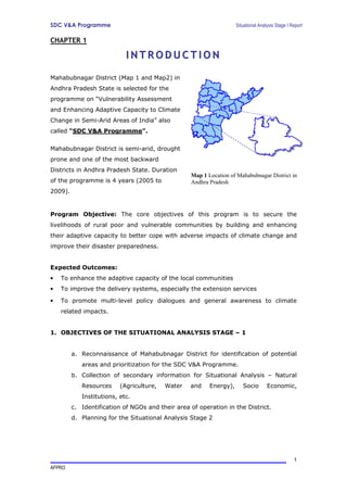
  • 1. SDC V&A Programme Situational Analysis Stage I Report CHAPTER 1 INTRODUCTION Mahabubnagar District (Map 1 and Map2) in Andhra Pradesh State is selected for the programme on “Vulnerability Assessment and Enhancing Adaptive Capacity to Climate Change in Semi-Arid Areas of India” also called “SDC V&A Programme”. Mahabubnagar District is semi-arid, drought prone and one of the most backward Districts in Andhra Pradesh State. Duration Map 1 Location of Mahabubnagar District in of the programme is 4 years (2005 to Andhra Pradesh 2009). Program Objective: The core objectives of this program is to secure the livelihoods of rural poor and vulnerable communities by building and enhancing their adaptive capacity to better cope with adverse impacts of climate change and improve their disaster preparedness. Expected Outcomes: • To enhance the adaptive capacity of the local communities • To improve the delivery systems, especially the extension services • To promote multi-level policy dialogues and general awareness to climate related impacts. 1. OBJECTIVES OF THE SITUATIONAL ANALYSIS STAGE – 1 a. Reconnaissance of Mahabubnagar District for identification of potential areas and prioritization for the SDC V&A Programme. b. Collection of secondary information for Situational Analysis – Natural Resources (Agriculture, Water and Energy), Socio Economic, Institutions, etc. c. Identification of NGOs and their area of operation in the District. d. Planning for the Situational Analysis Stage 2 1 AFPRO
  • 2. SDC V&A Programme Situational Analysis Stage I Report 2. METHODOLOGY 1. Reconnaissance field visit 2. Interaction and discussions with various officials in the District • Chief Executive Officer (CEO) • Chief Planning Officer (CPO) • Project Director, District Water Management Agency (DWMA) • Deputy Director, Ground Water Department, • Officers at Agriculture Department • Faculty at the RARS, Palem • Mandal level officials, MDO, MRO, Statistical officers, Agriculture officers, etc of the potential Mandals. • Village level secretaries 3. Interaction and discussion with community members in the villages visited 4. Secondary data collection and analysis 5. Referring the programme document and in consultation with International Consortium and National Consortium members. Map 2 Mahabubnagar District with Mandals 2 AFPRO
  • 3. SDC V&A Programme Situational Analysis Stage I Report CHAPTER 2 DISTRICT PROFILE Mahabubnagar is the largest District in Telangana Region and Second Largest in Andhra Pradesh State. This District consists of 1553 Revenue Villages, 1347 Gram Panchayats, 64 Mandals1 and 5 Revenue Divisions. Mahabubnagar District has 13 Assembly Constituencies and 2 Parliamentary Constituencies. It is located in the semiarid region of India with recurring meteorological drought (because of erratic and scanty rainfall) and worsened by overexploitation of meager groundwater resources. This is a backward District with diverse socio- economic problems like lowest literacy rate, migrations, extreme poverty, etc. 1. LOCATION AND TOPOGRAPHY The District is located in the Central Part of Peninsular India. It is bounded by Ranga Reddy and Nalgonda Districts in the North, Nalgonda and Guntur Districts in the East, Kurnool District in the South. Raichur and Gulbarga Districts of Karnataka State in the West. In the South Eastern Parts of the District there are hill ranges extending from North to South, the Hills are mostly Flat Topped. The District is located between 16 Degree and 17 Degree N latitudes and 77 Degree and 79 Degree E longitudes (see Map 3). 2. LAND USE PATTERN Total Geographical area of the District is 18.48 Lakhs Hectares and the land utilization of this District, as per Agriculture Census 2000-2001, is as follows: Table 1 Land use particulars S.No. Type ( Area in Ha.) % age 1 Forest Area 263560 14.2617 2 Barren and uncultivable lands 93798 5.075578 3 Permanent pastures and grazing lands 25447 1.376983 4 Land put for non-agricultural use 78600 4.253187 5 Cultivable waste 111426 6.029461 6 Other fallow lands 158657 8.585215 7 Current fallows 467442 25.29412 8 Total Normal Area of all crops 649066 35.12212 Total Geographical Area of the District 1848026 100 1 Administrative unit in each district, consisting of an average of 20 to 30 villages 3 AFPRO
  • 4. SDC V&A Programme Situational Analysis Stage I Report Map 3 Mahabubnagar District location w.r.t. other Districts 3. CLIMATE The climate of the District is generally hot. The District summer period is from March to May. The daily Temperature during the period ranges from 16.9 deg. Centigrade to 41.5 deg. Centigrade, the minimum temperature during the winter season i.e. November to January ranges between 16.9 deg. Centigrade to 19.1 deg. Centigrade. The rainfall in the District is scanty and the South West Monsoon is erratic. Most of the Rainfall is received during the South West Monsoon. The normal annual rainfall of the District is 604.56 mm. Out of this, the South West monsoon accounts for 71% i.e. 489.0 mm and the balance is covered from North East monsoon. (see graph 1) 4 AFPRO
  • 5. SDC V&A Programme Situational Analysis Stage I Report GRAPHICAL REPRESENTATION OF RAINFALL DATA FROM 1980-81 TO 2002-2003 1000.0 900.0 800.0 700.0 NORMAL IN M.M 600.0 500.0 400.0 300.0 200.0 100.0 0.0 1980- 1981- 1982- 1983- 1984- 1985- 1986- 1987- 1988 - 1989 - 1990 - 1991 - 1992 - 1993 - 1994 - 1995 - 1996 - 1997 - 1998 - 1999 - 2000 - 2001- 2002- 81 82 83 84 85 86 87 88 89 90 91 92 93 94 95 96 97 98 99 2000 2001 2002 2003 YEARS Graph 1 Rainfall Pattern – Mahabubnagar District Photo 1 This farmer of Kosgi Mandal said that he had seen good rains about 14 years back when all the tanks in his village got filled up, since then he is facing drought 4. GEOLOGICAL RESOURCES The Dharwars are exposed in parts of Gadwal and Makthal Taluka in the form of narrow bands. They consists of hornblends, schist’s, Traversed by quartz veins. Almost all parts of the District is comprised of the Granites, except some parts in Kodangal Taluka in the North and the Purana sedimentaries in Krishna Basin in the South. The Granites are broadly divided into the Pink and Gray series. There are 5 AFPRO
  • 6. SDC V&A Programme Situational Analysis Stage I Report numerous pegmatite’s and quartz veins intrusive into these granites. The Deccan Traps occur in small patches i.e., the Northern Portions of Kodangal Taluka, where in some places the trap has been lateritised. 5. SOILS The Soils of the District can be classified into three broad groups i.e., Red Soil, Black Cotton and Chalka Soil or mixed Soils. Major soil group in the district is Red Sandy Soils. Type of soil % age A) Loamy Sand Soils (Dubba) 13% B) Red Sandy Soils (Chalka) 67% C) Black Soils 20% About 70% of the total area is under mixed soils, which do not have water- retaining capacity. The Chalka soils are predominate in the Talukas of Shadnagar, Mahabubnagar, Jadcherla, Kalwakurthy and Kollapur. The Dubba Soils are in the Talukas of Achampet and Gadwal while the Black Cotton Soils, which constitute 20% of the District, are in the Talukas of Alampur and Kodangal. Photo 2 Patch of rich black cotton soils ~3 feet thick found at Reddy Guda Village, Midjil Mandal 6 AFPRO
  • 7. SDC V&A Programme Situational Analysis Stage I Report 6. AGRICULTURE The dry crops are predominant in the District as the Irrigated area is only 15% of the net area sown. Net area sown: 8.767 Lakhs Hect. and Gross area sown: 9.767 Lakhs Hect. The percentage of areas sown under different crops is a follows: Table 2 Cropping pattern Crop Percentage Crop Percentage Crop Percentage 1. Paddy 10 % 2. Millets 28 % 5. Others 9% 3. Pulses 11 % 4. Oil 42 % Seeds Table 3 Major types of crops Major Food Crops: Major Oil seeds Crops Major Pulses Crops Jowar Castor Red Gram Paddy Groundnut Green Gram Bajra / sajja / pearl millet Sun Flower Horse Gram Ragi / Finger millet The net sown area is not more than 50% of the total geographical area. The district has been declared as one of the 12 drought prone districts of Andhra Pradesh. Major livelihood in the district includes agriculture and animal husbandry. About 1.75 Lakhs small farmers and 2.94 marginal farmers are dependent on wage employment. About 3.20 Lakhs agricultural laborers who are below poverty line are also dependent on agricultural wage employment. 7 AFPRO
  • 8. SDC V&A Programme Situational Analysis Stage I Report Photo 3 A farmer of Reddy Guda Village, Midjil Mandal is preparing the land for sowing 7. LIVESTOCK Mahabubnagar has large numbers of small ruminants and cattle. The dependency on small ruminants like sheep and goat is very high. For many farmers, livestock is an important asset to sell off to cope with drought; therefore, it is an important resource against vulnerability. Due to failure of monsoons in the initial stages, fodder shortage is noticed. The green fodder position in the district has become critical and the grazing facilities have almost dwindled. Fodder requirement in the District upto June 2005 is 9.47 lakhs MT. The people are found buying fodder in large quantities to meet the requirement and shepherds are migrating with their sheep to other places. Table 4 Livestock Numbers Livestock Numbers Total White & Black cattle population 27.40 Lakhs Sheep 11.98 Lakhs Goats 3.85 Lakhs Total livestock 19.10 Lakhs cow units 8 AFPRO
  • 9. SDC V&A Programme Situational Analysis Stage I Report Photo 4 This shepherd from Wanaparthy area is migrating with his sheep towards northwestern part of the District as it has rained there - photo was taken near Mahabubnagar town. 8. WATER One of the important agencies in the district is District Water Management Agency(DWMA) started in 1995. Each watershed project covers about 500 hectares and there are 942 such projects sanctioned in the district. Presently the new watersheds are being carried following Hariyali Guidelines – Involvement of Grampanchayat, Village Organisation and the Watershed Committee, the action planning and monitoring is participatory. The status of watershed projects is as such: Table 5 Scheme wise watersheds S.No Scheme Sanctioned completed ongoing 1 EAS 212 212 2 DPAP 463 132 331 3 Hariyali 48 48 4 APRLP 100 100 5 RIDF - VI 119 119 Total 942 344 598 9 AFPRO
  • 10. SDC V&A Programme Situational Analysis Stage I Report Table 6 Water Resources Surface water Tanks - 6192 nos covering 76513 hect. Major Projects: Priyadarshini Jurala Irrigation Project (40200 ac.) Rajolibanda Diversion Scheme (35000 ac.) Koilsagar project (4726 ac.) Proposed: Nettampadu Lift Irrigation Scheme (2,00,000 ac.) Kalwakurthy lift irrigation Scheme (2,50,000 ac.) Bhima Lift Irrigation Scheme (2,03,000 ac.) Tube wells - 108200 nos covering 109711 hect. District average dept of groundwater table: 17.16 M Map 4 Watersheds Distribution 10 AFPRO
  • 11. SDC V&A Programme Situational Analysis Stage I Report Photo 5 An open dry well as found in Karukonda Village, Nawabpet Village, the ground water table has gone down drastically in most parts of Mahabubnagar District. 9. ENERGY DWMA and DFO social forestry are the important agencies in the district responsible for promoting Bio-fuel plantations (Jatropha). This is the national policy adopted for alternative sources of energy and at the same time helping the farmers. Total Jatropha seed allotted to the district is 1.5 MT. Presently the total saplings available are 10 Lakhs with DWMA alone. Number of farmers identified are 2,548 nos for planting in 5,897 acres. 10. FORESTS Forests occupy an area of 2.67 Lakhs Hectares and constitute about 14% of the total Geographic area of the District. Most of the Forests are concentrated in the South Eastern parts of the District covering mainly Achampet, Kollapur with small areas in Wanaparthy, Mahabubnagar and Makthal Talukas. The bulk of the Forests in the District is comprised of deciduous. The important species of these are Teak, Maddi, Ippa etc., The availability of Bamboo in the District is formal. The important sources of Revenue from Forest are mainly from Beedi Leaves, Timber, Bamboos, Seethaphal and Gum etc., 11 AFPRO
  • 12. SDC V&A Programme Situational Analysis Stage I Report The Wild Life is abundant in the interior and inaccessible plateau regions of Amarabad. Among the wild animals, the Panther, the Tiger, wild Dogs, hyenas, Bear are common and of the herbivorous animals spotted deer, Nilgai, Sambar, Black-Buck, Chinkara, Wild Bear, several kinds of birds, Peacocks, Water Birds, Cobras and Vipers are also common in these forests. 11. DEMOGRAPHIC PARTICULARS The District has a population of 35,13,934 of which 17.81 Lakhs are males and 17.28 Lakhs are females. About 69% of the total population lives in rural areas. It has been estimated that 48% of the people live below poverty line. The Urban areas of the District is only 156.86 kms, and distributed among 4 towns and 7 major Gram Panchayats in the District. Mahabubnagar town, which is the District Headquarters, is largest Urban unit in the District, with a population of 1,39,662. 12. SOCIO-ECONOMIC CONDITIONS The district ranks lowest among the literates in the State accounting for only 38.6% of the literacy level. A very disturbing demographic feature of the district is that a high percentage of population migrate to nearby urban centers in search of livelihood. This is because of continuous recurrence of drought conditions and lack of employment opportunities. The worst affected are the children and the aged because of this phenomena., the agricultural laborers are having no work in many areas. To arrest migration it is necessary to provide wage employment opportunities especially of unskilled nature It is also interesting to note that the worker participation rate among females (i.e. total female workers to female population) is as high as 45%, which is second largest in Andhra Pradesh. Most of the female workers are agricultural laborers. Statistics over a period also suggest that the proportion of agricultural laborers is increasing over the proportion of cultivators. 12 AFPRO
  • 13. SDC V&A Programme Situational Analysis Stage I Report Photo 6 These women have migrated to Mahabubnagar town for work 13. GROUPS / SOCIAL NETWORKS A pioneering developmental initiative was take-up in the district in promoting Self- help groups (SHGs) and also forming mutually aided cooperatives societies at Mandal level in 1980s under the auspices of UNDP which eventually led to a mass movement of organizing women self help groups around thrift, credit and livelihood programmes. Subsequently almost all Mandals and the habitations are covered, with the efforts of DRDA, DPIP, NGOs and other line department programmes in the District. • No. of Self-Help Groups 28870 • Total members covered No. 4.33 Lakhs 14. ONGOING PROGRAMMES / ACTIVITIES Recognizing the level of backwardness in the district a number of developmental schemes have been introduced in the district by national and international agencies. Important of them are World Bank supported District Poverty Initiative Programme (DPIP), DFID supported Andhra Pradesh Rural Livelihoods Programme, Dutch supported Biotech Programme, Netherlands Govt. Supported APWELL project etc., A number of government and non-governmental institutions are actively engaged in the district in promoting peoples participation in a number of developmental programmes. 13 AFPRO
  • 14. SDC V&A Programme Situational Analysis Stage I Report In addition to internationally funded programmes, there are a number of schemes supported by Government of Andhra Pradesh and Government of India in the areas of watershed developments, minor and major irrigation, social afforestation, diversification of agriculture, livestock development, drinking water and sanitation improvement, primary health, and education etc. In other words, institutional structure is in place to optimize the benefits of any innovative programme. As per Government instructions, all works are going on in the district i.e. Employment Assurance Scheme (EAS), Jawahar Grameena Swarojgar Yojana (JGSY), DPAP watersheds, Joint Forest Management or VSS, MPLADS, NABARD works, ZP general funds, PR Roads & Building sector, PR (RWS) sector, Minor Irrigation, R & B, Housing etc., This district is also selected for National Food For Work Programme (NFFWP), assuring 100 days of employment opportunity for all wage seekers in an year. They are paid in food grains (80%) and partly in cash(20). 15. FORMAL INSTITUTIONS AT VILLAGE LEVEL • NRM • SC Corporation • District Water Management Agency(DWMA) • ST Welfare/Tribal Welfare • Rural Infrastructure Development • BC Welfare / BC Corporation Fund(RIDF) • Social Welfare • NAWAPRA / Watershed Development by • Tribal welfare Agriculture Department • Youth welfare • Ground Water Department • ICDS / Child Development Programme • JFM / CFM programmes by Forest • Anganwadi / Women and Children Welfare Department • Infrastructure • Agriculture Department / Rythu Mitra or • Housing Department groups • Horticulture Dept • Services • Comprehensive Land Development • Civil supplies / Public Distribution sys Programme / Indira Prabha • Rural water supply (Panchayat Raj dept.) • Animal Husbandry • Electricity • Fisheries • Road Transport Corporation • Irrigation Dept (Minor / Medium / Major) • Telecommunications / BSNL • Marketing • Social • Dist. Rural Dev. Agency (DRDA) / District • Artisans / Industries / enterprise Poverty Initiatives Programme (DPIP) / • Industries Department Indira Kranthi Patham • Handlooms and Textiles • DPEP / Education • Various schemes for Artisans • Medical and Health • Other Programmes • Andhra Pradesh Rural Livelihoods Programme (APRLP) 14 AFPRO
  • 15. SDC V&A Programme Situational Analysis Stage I Report CHAPTER 3 PRIORITIZATION OF MANDALS Considering the size of the district, it will not be possible to cover the entire district. For the implementation of the programme, only few villages will be identified. A list of the potential Mandals2 / sites are selected tentatively based on a set of criteria, and which include the following: 1. CRITERIA FOR SELECTION OF POTENTIAL MANDALS 2. Located in drought prone and semi-arid areas 3. The need for intervention and the conditions for successful implementation. 4. The response of the local communities in successful implementation 5. Social networks / groups representing women, farmers, water users, etc., are formed and active. 6. Presence of a number of developmental programmes 7. Major irrigation programmes are not being envisaged in these Mandals3 8. Opinion of the district level officials 9. Local institutional arrangements including the presence of active NGOs etc. 10. Infrastructure existing 11. Accessibility 2. PRIORITISATION OF POTENTIAL MANDALS The potential Mandals were prioritized using the Secondary data (See Annexure - 1, 2 and 4) and also keeping in view the nature of the programme i.e., This is a 4 years programme - very short duration (need to select an appropriate area and should be able to achieve results). Based on existing insights and experiences specific sites in the District are being selected. The criteria to identify and select includes 1. Manifestation of climate hazards vis-Ă -vis Water, Agriculture and Energy (biomass-livestock, etc) 2. The social organisation at village level 3. Presence of local partners. For prioritizing the Mandals, 0 to 3 scores were given classifying the Mandals into 4 classes for which the following parameters were considered (See Annexure 3). 2 All the potential Mandals have been visited by Dr. N. Sai Bhaskar Reddy, Lead Consultant along with 1. Mr. K. Siva Prasad and Dr. V. K. Reddy (24-25 May 2005), 2. Ms. Sulabha Mahajan (6th TO 8th June 2005), 3. Dr. V. K. Reddy 18th June 2005 3 Except that some parts of Kalwakurthy and Nagarkurnool would be benefited if proposed Kalwakurthy Lift Irrigation scheme is completed. 15 AFPRO
  • 16. SDC V&A Programme Situational Analysis Stage I Report Agriculture • % Net area sown to total cultivable area • % total cropped area to Geographical area • Food crops • Small farmers(<1.23 hect) • Marginal farmers(1.24 to 2.46 hect) Water • Rainfall • Tube wells net irrigated Energy (Biomass – Livestock) • Cattle • Buffalo • Sheep • Livestock • % of Pastures Literacy • % of Literacy total Access to loans – Service of financial institutions • Average Loan amount per person availing Physical Access • Access (from highways and District head quarters) NGOs • NGOs access (Based on the discussions with secondary stakeholders) 16 AFPRO
  • 17. SDC V&A Programme Situational Analysis Stage I Report Table 7 Prioritization of potential Mandals Rank Mandal Rank Mandal 1 Farooknagar 7 Amangal 2 Kondurg 8 Wanaparthy 3 Balanagar 8 Nagarkurnool 4 Midjil 8 Kalwakurthy 5 Nawabpet 9 Jadcherla 5 Kodangal 10 Boothpur 6 Bijinapally 11 Kosgi 6 Bomaraspet 12 Ghanapur Map 5 NGOs working on NRM based programmes and their spatial distribution 17 AFPRO
  • 18. SDC V&A Programme Situational Analysis Stage I Report Map 6 Potential Mandals identified in Mahabubnagar District 18 AFPRO
  • 19. SDC V&A Programme Situational Analysis Stage I Report 3. SELECTION OF PROJECT VILLAGES There are three models emerging they are: Model 1: Selection of a cluster of villages in only one Mandal. Model 2: Selection of two Mandals and few villages in each Mandal. Model 3: Selection of few villages in one Mandal and Satellite villages (only one village each from 2 or 3 other Mandals) Table 8 Emerging models for selection of villages Advantages Disadvantages Model 1 Area of operation, Delivery If the officials change or non- systems, capacity building, cooperative, People are not Knowledge Dissemination- adaptive, case studies / learnings Automatic Weather Station would be few. (AWS), Knowledge Centers Model 2 Comparative advantage, risk of Access, delivery systems, capacity failure would be less. building Model 3 Results would be better and Cost of capacity building at chance for comparison more, case secondary level would be more, studies would be more more efforts for better delivery systems at higher level. Further discussions are needed on these emerging models or there could be some other practical model4. 4 Suggestions needed from International and National consortium members. 19 AFPRO
  • 20. SDC V&A Programme Situational Analysis Stage I Report CHAPTER 4 WAY FORWARD Situational analysis stage – I has provided insights into emerging challenges for selection of project villages in Mahabubnagar District for the SDC V&A Programme. It also forms the basis for planning and completion of the following tasks immediately: 1. Finalization of Mandal/s5, identification of the programme villages and planning for participatory situational analysis. 2. Collection of any other appropriate secondary data 3. Study of existing NGOs and selection for local facilitation 4. Identification of the status and gaps in the implementation of various NRM programmes, and thereby identifying the capacity building needs6. 5. Identifying the scope for convergence of various programs at District, Mandal and Village level. 6. Identification of members for formation of District level and village level committees. 5 This would be based on the inputs from Capacity Building Workshop at Hyderabad - 28th to 30th June 2005. 6 Along with MANAGE Report by: Dr. N. Sai Bhaskar Reddy, Lead Consultant, AFPRO, Hyderabad, AP. 20 AFPRO